A
INTRODUCTION
Background: Ahmad Shah DURRANI unified the Pashtun tribes and founded Afghanistan in 1747. The country served as a buffer between the British and Russian Empires until it won independence from notional British control in 1919. A brief experiment in increased democracy ended in a 1973 coup and a 1978 communist countercoup. The Soviet Union invaded in 1979 to support the tottering Afghan communist regime, touching off a long and destructive war. The USSR withdrew in 1989 under relentless pressure by internationally supported anti-communist mujahidin rebels. A series of subsequent civil wars saw Kabul finally fall in 1996 to the Taliban, a hardline Pakistani-sponsored movement that emerged in 1994 to end the country’s civil war and anarchy. Following the 11 September 2001 terrorist attacks, a US, Allied, and anti-Taliban Northern Alliance military action toppled the Taliban for sheltering Usama BIN LADIN.
A UN-sponsored Bonn Conference in 2001 established a process for political reconstruction that included the adoption of a new constitution, a presidential election in 2004, and National Assembly elections in 2005. In December 2004, Hamid KARZAI became the first democratically elected president of Afghanistan and was reelected in August 2009. The Taliban conducted an insurgency for two decades against the Afghan Government and international forces from the United States and other countries. In February 2020, the US and the Taliban signed an agreement that led to the withdrawal from Afghanistan of international forces in exchange for commitments on counterterrorism and other assurances. The Taliban seized control of Afghanistan on 15 August 2021.
GEOGRAPHY
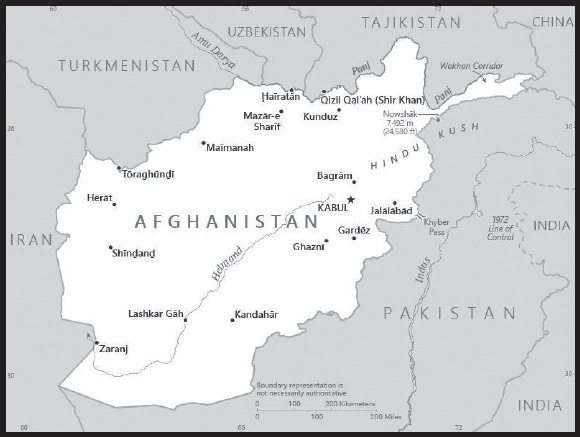
Location: Southern Asia, north and west of Pakistan, east of Iran
Geographic coordinates: 33 00 N, 65 00 E
Map references: Asia
Area: total: 652,230 sq km
land: 652,230 sq km
water: 0 sq km
comparison ranking: total 43
Area - comparative: almost six times the size of Virginia; slightly smaller than Texas
Land boundaries: total: 5,987 km
border countries (6): China 91 km; Iran 921 km; Pakistan 2,670 km; Tajikistan 1,357 km; Turkmenistan 804 km; Uzbekistan 144 km
Coastline: 0 km (landlocked)
Maritime claims: none (landlocked)
Climate: arid to semiarid; cold winters and hot summers
Terrain: mostly rugged mountains; plains in north and southwest
Elevation: highest point: Noshak 7,492 m
lowest point: Amu Darya 258 m
mean elevation: 1,884 m
Natural resources: natural gas, petroleum, coal, copper, chromite, talc, barites, sulfur, lead, zinc, iron ore, salt, precious and semiprecious stones, arable land
Land use: agricultural land: 58.1% (2018 est.)
arable land: 11.8% (2018)
permanent crops: 0.3% (2018)
permanent pasture: 46% (2018)
forest: 1.8% (2018 est.)
other: 40.1% (2018)
Irrigated land: 24,930 sq km (2020)
Major lakes (area sq km): salt water lake(s): Ab-e Istadah-ye Muqur (endorheic basin) - 520 sq km
Major rivers (by length in km): Amu Darya (shared with Tajikistan [s], Turkmenistan, and Uzbekistan [m]) - 2,620 km; Helmand river source (shared with Iran) - 1,130 km
note – [s] after country name indicates river source; [m] after country name indicates river mouth
Major watersheds (area sq km):
Indian Ocean drainage: Indus (1,081,718 sq km)
Internal (endorheic basin) drainage: Amu Darya (534,739 sq km); Tarim Basin (1,152,448 sq km)
Population distribution: populations tend to cluster in the foothills and periphery of the rugged Hindu Kush range; smaller groups are found in many of the country’s interior valleys; in general, the east is more densely settled, while the south is sparsely populated
Natural hazards: damaging earthquakes occur in Hindu Kush mountains; flooding; droughts
Geography - note: landlocked; the Hindu Kush mountains that run northeast to southwest divide the northern provinces from the rest of the country; the highest peaks are in the northern Vakhan (Wakhan Corridor)
PEOPLE AND SOCIETY
Population: 39,232,003 (2023 est.)
comparison ranking: 37
Nationality: noun: Afghan(s)
adjective: Afghan
Ethnic groups: Current, reliable statistical data on ethnicity in Afghanistan are not available; Afghanistan’s 2004 Constitution cited Pashtun, Tajik, Hazara, Uzbek, Turkman, Baluch, Pachaie, Nuristani, Aymaq, Arab, Qirghiz, Qizilbash, Gujur, and Brahwui ethnicities; Afghanistan has dozens of other small ethnic groups
Languages: Afghan Persian or Dari (official, lingua franca) 77%, Pashto (official) 48%, Uzbeki 11%, English 6%, Turkmani 3%, Urdu 3%, Pachaie 1%, Nuristani 1%, Arabic 1%, Balochi 1%, other <1% (2020 est.)
major-language sample(s):
 (Dari)
 (Pashto)
note 1: percentages sum to more than 100% because many people are multilingual
note 2: Uzbeki, Turkmani, Pachaie, Nuristani, Balochi, and Pamiri are the third official languages in areas where the majority speaks them
Religions: Muslim 99.7% (Sunni 84.7 - 89.7%, Shia 10 - 15%), other <0.3% (2009 est.)
Age structure: 0-14 years: 39.8% (male 7,926,748/female 7,686,979)
15-64 years: 57.35% (male 11,413,654/female 11,084,665)
65 years and over: 2.85% (2023 est.) (male 515,147/female 604,810)
Dependency ratios: total dependency ratio: 84.6
youth dependency ratio: 80.2
elderly dependency ratio: 4.8
potential support ratio: 22.5 (2021 est.)
Median age: total: 19.5 years (2020)
male: 19.4 years
female: 19.5 years
comparison ranking: total 201
Population growth rate: 2.26% (2023 est.)
comparison ranking: 32
Birth rate: 34.79 births/1,000 population (2023 est.)
comparison ranking: 16
Death rate: 12.08 deaths/1,000 population (2023 est.)
comparison ranking: 13
Net migration rate: -0.1 migrant(s)/1,000 population (2023 est.)
comparison ranking: 103
Population distribution: populations tend to cluster in the foothills and periphery of the rugged Hindu Kush range; smaller groups are found in many of the country’s interior valleys; in general, the east is more densely settled, while the south is sparsely populated
Urbanization: urban population: 26.9% of total population (2023)
rate of urbanization: 3.34% annual rate of change (2020-25 est.)
Major urban areas - population: 4.589 million KABUL (capital) (2023)
Sex ratio: at birth: 1.05 male(s)/female
0-14 years: 1.03 male(s)/female
15-64 years: 1.03 male(s)/female
65 years and over: 0.85 male(s)/female
total population: 1.02 male(s)/female (2023 est.)
Mother’s mean age at first birth: 19.9 years (2015 est.)
note: data represents median age at first birth among women 25-49
Maternal mortality ratio: 620 deaths/100,000 live births (2020 est.)
comparison ranking: 8
Infant mortality rate: total: 103.06 deaths/1,000 live births (2023 est.)
male: 111.47 deaths/1,000 live births
female: 94.24 deaths/1,000 live births
comparison ranking: total 1
Life expectancy at birth: total population: 54.05 years (2023 est.)
male: 52.47 years
female: 55.71 years
comparison ranking: total population 227
Total fertility rate: 4.53 children born/woman (2023 est.)
comparison ranking: 17
Gross reproduction rate: 2.21 (2023 est.)
Contraceptive prevalence rate: 18.9% (2018)
note: percent of women aged 12-49
Drinking water source: improved: urban: 100% of population
rural: 68.3% of population
total: 76.5% of population 70.2%
unimproved: urban: 0% of population
rural: 31.7% of population
total: 23.5% of population (2020 est.)
Current health expenditure: 15.5% of GDP (2020)
Physicians density: 0.25 physicians/1,000 population (2020)
Hospital bed density: 0.4 beds/1,000 population (2017)
Sanitation facility access: improved: urban: 88.2% of population
rural: 52% of population
total: 61.4% of population
unimproved: urban: 11.8% of population
rural: 48% of population
total: 38.6% of population (2020 est.)
Major infectious diseases: degree of risk: intermediate (2023)
food or waterborne diseases: bacterial diarrhea, hepatitis A, and typhoid fever
vectorborne diseases: Crimea-Congo hemorrhagic fever, malaria
note: Afghanistan is one of two countries with endemic wild polio virus (the other is Pakistan) and considered high risk for international spread of the disease; before any international travel, anyone unvaccinated, incompletely vaccinated, or with an unknown polio vaccination status should complete the routine polio vaccine series; before travel to any high-risk destination, the US Centers for Disease Control and Prevention (CDC) recommends that adults who previously completed the full, routine polio vaccine series receive a single, lifetime booster dose of polio vaccine
Obesity - adult prevalence rate: 5.5% (2016)
comparison ranking: 177
Alcohol consumption per capita: total: 0.01 liters of pure alcohol (2019 est.)
beer: 0 liters of pure alcohol (2019 est.)
wine: 0 liters of pure alcohol (2019 est.)
spirits: 0.01 liters of pure alcohol (2019 est.)
other alcohols: 0 liters of pure alcohol (2019 est.)
comparison ranking: total 183
Tobacco use: total: 23.3% (2020 est.)
male: 39.4% (2020 est.)
female: 7.2% (2020 est.)
comparison ranking: total 62
Children under the age of 5 years underweight: 19.1% (2018)
comparison ranking: 19
Currently married women (ages 15-49): 70.3% (2023 est.)
Child marriage: women married by age 15: 4.2%
women married by age 18: 28.3% (2017 est.)
Education expenditures: 2.9% of GDP (2020 est.)
comparison ranking: 162
Literacy: definition: age 15 and over can read and write
total population: 37.3%
male: 52.1%
female: 22.6% (2021)
School life expectancy (primary to tertiary education): total: 10 years
male: 13 years
female: 8 years (2018)
Youth unemployment rate (ages 15-24): total: 20.2% (2021 est.)
male: 18.6%
female: 26.4%
comparison ranking: total 81
ENVIRONMENT
Environment - current issues: limited natural freshwater resources; inadequate supplies of potable water; soil degradation; overgrazing; deforestation (much of the remaining forests are being cut down for fuel and building materials); desertification; air and water pollution in overcrowded urban areas
Environment - international agreements: party to: Biodiversity, Climate Change, Climate Change-Kyoto Protocol, Climate Change-Paris Agreement, Comprehensive Nuclear Test Ban, Desertification, Endangered Species, Environmental Modification, Hazardous Wastes, Marine Dumping-London Convention, Nuclear Test Ban, Ozone Layer Protection
signed, but not ratified: Law of the Sea, Marine Life Conservation
Climate: arid to semiarid; cold winters and hot summers
Land use: agricultural land: 58.1% (2018 est.)
arable land: 11.8% (2018)
permanent crops: 0.3% (2018)
permanent pasture: 46% (2018)
forest: 1.8% (2018 est.)
other: 40.1% (2018)
Urbanization: urban population: 26.9% of total population (2023)
rate of urbanization: 3.34% annual rate of change (2020-25 est.)
Food insecurity: severe localized food insecurity: due to civil conflict, population displacement, and economic slowdown - between November 2021 and March 2022, during the winter lean season, the food insecurity situation was expected to deteriorate and the number of people in “Crisis” or above was likely to increase to 22.8 million, about 35% more than during the same season in 2020/21; following the developments of August 2021 in the country, the international aid flows, an important element of public spending, were halted; the food security situation and agricultural livelihoods in the country is likely to significantly deteriorate in the coming months due to cumulative and cascading impact of multiple shocks, including weather, conflict, economic crisis and the lingering effects of the COVID-19 pandemic (2022)
Revenue from forest resources: 0.2% of GDP (2018 est.)
comparison ranking: 94
Revenue from coal: 0.45% of GDP (2018 est.)
comparison ranking: 12
Air pollutants: particulate matter emissions: 62.49 micrograms per cubic meter (2019 est.)
carbon dioxide emissions: 8.67 megatons (2016 est.)
methane emissions: 90.98 megatons (2020 est.)
Waste and recycling: municipal solid waste generated annually: 5,628,525 tons (2016 est.)
Major lakes (area sq km): salt water lake(s): Ab-e Istadah-ye Muqur (endorheic basin) - 520 sq km
Major rivers (by length in km): Amu Darya (shared with Tajikistan [s], Turkmenistan, and Uzbekistan [m]) - 2,620 km; Helmand river source (shared with Iran) - 1,130 km
note – [s] after country name indicates river source; [m] after country name indicates river mouth
Major watersheds (area sq km):
Indian Ocean drainage: Indus (1,081,718 sq km)
Internal (endorheic basin) drainage: Amu Darya (534,739 sq km); Tarim Basin (1,152,448 sq km)
Total water withdrawal: municipal: 200 million cubic meters (2020 est.)
industrial: 170 million cubic meters (2020 est.)
agricultural: 20 billion cubic meters (2020 est.)
Total renewable water resources: 65.33 billion cubic meters (2020 est.)
GOVERNMENT
Country name: conventional long form: formerly Islamic Republic of Afghanistan
conventional short form: Afghanistan
local long form: formerly Jamhuri-ye Islami-ye Afghanistan
local short form: Afghanistan
former: Islamic Republic of Afghanistan
etymology: the name “Afghan” originally referred to the Pashtun people (today it is understood to include all the country’s ethnic groups), while the suffix “-stan” means “place of” or “country”; so Afghanistan literally means the “Land of the Afghans”
Government type: theocratic; the United States does not recognize the Taliban Government
Capital: name: Kabul
geographic coordinates: 34 31 N, 69 11 E
time difference: UTC+4.5 (9.5 hours ahead of Washington, DC, during Standard Time)
daylight saving time: does not observe daylight savings time
etymology: named for the Kabul River, but the river’s name is of unknown origin
Administrative divisions: 34 provinces (welayat, singular - welayat); Badakhshan, Badghis, Baghlan, Balkh, Bamyan, Daykundi, Farah, Faryab, Ghazni, Ghor, Helmand, Herat, Jowzjan, Kabul, Kandahar, Kapisa, Khost, Kunar, Kunduz, Laghman, Logar, Nangarhar, Nimroz, Nuristan, Paktika, Paktiya, Panjshir, Parwan, Samangan, Sar-e Pul, Takhar, Uruzgan, Wardak, Zabul
Independence: 19 August 1919 (from UK control over Afghan foreign affairs)
National holiday: previous: Independence Day, 19 August (1919); under the Taliban Government, 15 August (2022) is declared a national holiday, marking the anniversary of the victory of the Afghan jihad
Constitution: history: several previous; latest ratified in 2004, suspended by the Taliban after taking over the country in 2021
Legal system: the Taliban is implementing its own interpretation of Islamic law, which partially based on the Hanifi school of Islamic jurisprudence; before the Taliban takeover, Afghanistan had a mixed legal system of civil, customary, and Islamic law (2021)
International law organization participation: has not submitted an ICJ jurisdiction declaration; formerly accepted ICCt jurisdiction
Citizenship: citizenship by birth: no
citizenship by descent only: at least one parent must have been born in - and continuously lived in - Afghanistan
dual citizenship recognized: no
residency requirement for naturalization: 5 years
Suffrage: 18 years of age; universal
Executive branch: chief of state: Overall Taliban Leader HAYBATULLAH Akhundzada serves as the head of the Taliban government as Amir-ul Momineen
note – on 7 September 2021, the Taliban announced Mohammad HASSAN Akhund as the “acting prime minister” of the “caretaker government”; as of November 2021, the group had announced three acting “deputy prime ministers” - Abdul Ghani BERADER, Abdul Salam HANAFI, and Abdul KABIR
head of government: Overall Taliban Leader HAYBATULLAH Akhundzada serves as the head of the Taliban government as Amir-ul Momineen
cabinet: includes the acting prime minister, acting deputy prime ministers, and 26 ministries
elections/appointments: the 2004 Afghan constitution directed that the president should be elected by majority popular vote for a 5-year term (eligible for a second term); election last held on 28 September 2019
Legislative branch: description: the Taliban Government has not announced the formation of a legislative branch; before the 2021 Taliban takeover, Afghanistan had a bicameral National Assembly that consisted of the House of Elders and House of the People
Judicial branch: highest court(s): the Taliban Government has a Supreme Court: number of judges and organizational structure NA; note - before 15 August 2021, Afghanistan had a Supreme Court (consisting of a supreme court chief and 8 justices organized into criminal, public security, civil, and commercial divisions)
judge selection and term of office: the Taliban Supreme Court judge selection and term of office NA; note - before 15 August 2021, the Supreme Court chief and justices were appointed by the president with the approval of the Wolesi Jirga; court chief and justices served single 10-year terms
subordinate courts: the Taliban Government has many provincial-level courts, religious courts, and specialty courts note - before 15 August 2021, consisted of Appeals Courts; Primary Courts; and Special Courts for issues including narcotics, security, property, family, and juveniles
Political parties and leaders: the Taliban Government enforces an authoritarian state and has banned other political parties; note - before 15 August 2021, the Ministry of Justice had licensed 72 political parties as of April 2019
International organization participation: member of the following organizations but cannot participate because the international community does not recognize the Taliban Government: ADB, CICA, CP, ECO, EITI (candidate country), FAO, G-77, IAEA, IBRD, ICAO, ICC (NGOs), ICCt, ICRM, IDA, IDB, IFAD, IFC, IFRCS, ILO, IMF, Interpol, IOC, IOM, IPU, ISO (correspondent), ITSO, ITU, ITUC (NGOs), MIGA, NAM, OIC, OPCW, OSCE (partner), SAARC, SACEP, SCO (dialogue member), UN, UNAMA, UNCTAD, UNESCO, UNHCR, UNIDO, UNWTO, UPU, WCO, WFTU (NGOs), WHO, WIPO, WMO, WTO
Diplomatic representation in the US: chief of mission: none; note - the Afghan Embassy closed in March 2022
Diplomatic representation from the US: chief of mission: the United States does not maintain a presence in Afghanistan and bases the Department of State’s Afghanistan Affairs Unit in Doha, Qatar; note - the US Embassy in Kabul closed in August 2021
embassy: Embassy Kabul, operations have been suspended; Department of State’s Afghanistan Affairs Unit operates from Doha, Qatar.
Flag description: three equal vertical bands of black (hoist side), red, and green, with the national emblem in white centered on the red band and slightly overlapping the other 2 bands; the center of the emblem features a mosque with pulpit and flags on either side, below the mosque are Eastern Arabic numerals for the solar year 1298 (1919 in the Gregorian calendar, the year of Afghan independence from the UK); this central image is circled by a border consisting of sheaves of wheat on the left and right, in the upper-center is an Arabic inscription of the Shahada (Muslim creed) below which are rays of the rising sun over the Takbir (Arabic expression meaning “God is great”), and at bottom center is a scroll bearing the name Afghanistan; black signifies the past, red is for the blood shed for independence, and green can represent either hope for the future, agricultural prosperity, or Islam
note 1: the United States has not recognized the Taliban or any other entity as the government of Afghanistan and, accordingly, continues to display the flag of Afghanistan as set forth in the country’s constitution of 2004
note 2: Afghanistan had more changes to its national flag in the 20th century - 19 by one count - than any other country; the colors black, red, and green appeared on most of them
National symbol(s): lion; national colors: red, green, black
National anthem: name: “Milli Surood” (National Anthem)
lyrics/music: Abdul Bari JAHANI/Babrak WASA
note: adopted 2006
National heritage: total World Heritage Sites: 2 (both cultural)
selected World Heritage Site locales: Minaret of Jam; Buddhas of Bamyan
note: the monumental 6th- and 7th-century statues were destroyed by the Taliban in 2001
ECONOMY
Economic overview: extremely low-income South Asian economy; import drops, currency depreciation, disappearing central bank reserves, and increasing inflation after Taliban takeover; increasing Chinese trade; hit hard by COVID; ongoing sanctions
Real GDP (purchasing power parity): $60.803 billion (2021 est.)
$76.711 billion (2020 est.)
$78.558 billion (2019 est.)
note: data are in 2017 dollars
comparison ranking: 105
Real GDP growth rate: -20.74% (2021 est.)
-2.35% (2020 est.)
3.91% (2019 est.)
comparison ranking: 224
Real GDP per capita: $1,500 (2021 est.)
$2,000 (2020 est.)
$2,100 (2019 est.)
note: data are in 2017 dollars
comparison ranking: 219
GDP (official exchange rate): $20.24 billion (2017 est.)
Inflation rate (consumer prices): 2.3% (2019 est.)
0.63% (2018 est.)
4.98% (2017 est.)
comparison ranking: 144
GDP - composition, by sector of origin: agriculture: 23% (2016 est.)
industry: 21.1% (2016 est.)
services: 55.9% (2016 est.)
note: data exclude opium production
comparison rankings: services 152; industry 137; agriculture 36
GDP - composition, by end use: household consumption: 81.6% (2016 est.)
government consumption: 12% (2016 est.)
investment in fixed capital: 17.2% (2016 est.)
investment in inventories: 30% (2016 est.)
exports of goods and services: 6.7% (2016 est.)
imports of goods and services: -47.6% (2016 est.)
Agricultural products: wheat, milk, grapes, vegetables, potatoes, watermelons, melons, rice, onions, apples
Industries: small-scale production of bricks, textiles, soap, furniture, shoes, fertilizer, apparel, food products, non-alcoholic beverages, mineral water, cement; handwoven carpets; natural gas, coal, copper
Industrial production growth rate: -14.19% (2021 est.)
comparison ranking: 203
Labor force: 9.39 million (2021 est.)
comparison ranking: 56
Labor force - by occupation: agriculture: 44.3%
industry: 18.1%
services: 37.6% (2017 est.)
Unemployment rate: 13.28% (2021 est.)
11.71% (2020 est.)
11.22% (2019 est.)
comparison ranking: 47
Youth unemployment rate (ages 15-24): total: 20.2% (2021 est.)
male: 18.6%
female: 26.4%
comparison ranking: total 81
Population below poverty line: 54.5% (2016 est.)
Gini Index coefficient - distribution of family income: 29.4 (2008)
comparison ranking: 153
Household income or consumption by percentage share: lowest 10%: 3.8%
highest 10%: 24% (2008)
Budget: revenues: $5.093 billion (2019 est.)
expenditures: $5.293 billion (2019 est.)
Budget surplus (+) or deficit (-): -15.1% (of GDP) (2017 est.)
comparison ranking: 217
Public debt: 7% of GDP (2017 est.)
7.8% of GDP (2016 est.)
comparison ranking: 201
Taxes and other revenues: 9.9% (of GDP) (2017 est.)
comparison ranking: 193
Fiscal year: 21 March - 20 March
Current account balance: -$3.137 billion (2020 est.)
-$3.792 billion (2019 est.)
-$3.897 billion (2018 est.)
comparison ranking: 174
Exports: $1.476 billion (2020 est.)
$1.516 billion (2019 est.)
$1.609 billion (2018 est.)
note: Data are in current year dollars and do not include illicit exports or re-exports.
comparison ranking: 167
Exports - partners: United Arab Emirates 45%, Pakistan 24%, India 22%, China 1% (2019)
Exports - commodities: gold, figs, grapes, cotton, fruits and nuts, coal (2021)
note: Afghan opium production remains a significant illicit trade export
Imports: $6.983 billion (2020 est.) note: data are in current year dollars
$7.371 billion (2019 est.) note: data are in current year dollars
$7.988 billion (2018 est.) note: data are in current year dollars
comparison ranking: 128
Imports - partners: United Arab Emirates 23%, Pakistan 17%, India 13%, Uzbekistan 7%, China 9% (2021)
Imports - commodities: wheat flours, broadcasting equipment, refined petroleum, rolled tobacco, aircraft parts, synthetic fabrics (2019)
Reserves of foreign exchange and gold: $9.749 billion (31 December 2020 est.)
$8.498 billion (31 December 2019 est.)
$8.207 billion (31 December 2018 est.)
comparison ranking: 80
Debt - external: $284 million (FY10/11)
comparison ranking: 185
Exchange rates: afghanis (AFA) per US dollar -
Exchange rates: 76.814 (2020 est.)
77.738 (2019 est.)
72.083 (2018 est.)
68.027 (2017 est.)
67.866 (2016 est.)
ENERGY
Electricity access: electrification - total population: 97.7% (2021)
electrification - urban areas: 99.5% (2021)
electrification - rural areas: 97% (2021)
Electricity: installed generating capacity: 776,000 kW (2020 est.)
consumption: 5.913 billion kWh (2019 est.)
exports: 0 kWh (2019 est.)
imports: 4.912 billion kWh (2019 est.)
transmission/distribution losses: 61.6 million kWh (2019 est.)
comparison rankings: installed generating capacity 140; transmission/distribution losses 168; imports 40; exports 131; consumption 119
Electricity generation sources: fossil fuels: 15.9% of total installed capacity (2020 est.)
nuclear: 0% of total installed capacity (2020 est.)
solar: 5.1% of total installed capacity (2020 est.)
wind: 0% of total installed capacity (2020 est.)
hydroelectricity: 79.1% of total installed capacity (2020 est.)
tide and wave: 0% of total installed capacity (2020 est.)
geothermal: 0% of total installed capacity (2020 est.)
biomass and waste: 0% of total installed capacity (2020 est.)
Coal: production: 2.096 million metric tons (2020 est.)
consumption: 2.096 million metric tons (2020 est.)
exports: 0 metric tons (2020 est.)
imports: 0 metric tons (2020 est.)
proven reserves: 66 million metric tons (2019 est.)
Petroleum: total petroleum production: 0 bbl/day (2021 est.)
refined petroleum consumption: 24,300 bbl/day (2019 est.)
crude oil and lease condensate exports: 0 bbl/day (2018 est.)
crude oil and lease condensate imports: 0 bbl/day (2018 est.)
crude oil estimated reserves: 0 barrels (2021 est.)
Refined petroleum products - production: 0 bbl/day (2015 est.)
comparison ranking: 130
Refined petroleum products - exports: 0 bbl/day (2015 est.)
comparison ranking: 197
Refined petroleum products - imports: 34,210 bbl/day (2015 est.)
comparison ranking: 97
Natural gas: production: 80.193 million cubic meters (2020 est.)
consumption: 80.193 million cubic meters (2020 est.)
exports: 0 cubic meters (2021 est.)
imports: 0 cubic meters (2021 est.)
proven reserves: 49.554 billion cubic meters (2021 est.)
Carbon dioxide emissions: 7.893 million metric tonnes of CO2 (2019 est.)
from coal and metallurgical coke: 4.158 million metric tonnes of CO2 (2019 est.)
from petroleum and other liquids: 3.468 million metric tonnes of CO2 (2019 est.)
from consumed natural gas: 267,000 metric tonnes of CO2 (2019 est.)
comparison ranking: total emissions 117
Energy consumption per capita: 3.227 million Btu/person (2019 est.)
comparison ranking: 180
COMMUNICATIONS
Telephones - fixed lines: total subscriptions: 150,000 (2021 est.)
subscriptions per 100 inhabitants: (2021 est.) less than 1
comparison ranking: total subscriptions 126
Telephones - mobile cellular: total subscriptions: 23 million (2021 est.)
subscriptions per 100 inhabitants: 57 (2021 est.)
comparison ranking: total subscriptions 54
Telecommunication systems: general assessment: Afghanistan’s telecom sector is facing challenges providing adequate coverage to all of the population; prior to the Taliban regaining power, the World Bank and other donors supported the development of a nationwide fiber backbone and there is terrestrial cable connectivity to five neighboring countries; work on the ‘Wakhan Corridor Fiber Optic Survey Project’ to connect to China has faced obstacles because of Afghanistan’s economic issues. (2021)
domestic: before the Taliban takeover in August 2021, less than 1 per 100 for fixed-line teledensity; 57 per 100 for mobile-cellular subscriptions (2021)
international: country code - 93; multiple VSAT’s provide international and domestic voice and data connectivity (2019)
Broadcast media: under the Taliban government, independent media outlets have decreased in number and are probably self-censoring criticism of the Taliban and the Ministry of Information and Culture monitors all mass media in Afghanistan; television and radio are key media platforms; only about a fifth of Afghans use the internet, mostly through smartphones (2023)
Internet country code: .af
Internet users: total: 7.02 million (2020 est.)
percent of population: 18% (2020 est.)
comparison ranking: total 79
Broadband - fixed subscriptions: total: 26,570 (2020 est.)
subscriptions per 100 inhabitants: 0.1 (2020 est.)
comparison ranking: total 157
TRANSPORTATION
National air transport system: number of registered air carriers: 3 (2020)
inventory of registered aircraft operated by air carriers: 13
annual passenger traffic on registered air carriers: 1,722,612 (2018)
annual freight traffic on registered air carriers: 29.56 million (2018) mt-km
Civil aircraft registration country code prefix: YA
Airports: 46 (2021)
comparison ranking: total 94
Airports - with paved runways: 29
note: paved runways have a concrete or asphalt surface but not all have facilities for refueling, maintenance, or air traffic control; the length of a runway required for aircraft to safely operate depends on a number of factors including the type of aircraft, the takeoff weight (including passengers, cargo, and fuel), engine types, flap settings, landing speed, elevation of the airport, and average maximum daily air temperature; paved runways can reach a length of 5,000 m (16,000 ft.), but the “typical” length of a commercial airline runway is between 2,500-4,000 m (8,000-13,000 ft.)
Airports - with unpaved runways: 17
note: unpaved runways have a surface composition such as grass or packed earth and are most suited to the operation of light aircraft; unpaved runways are usually short, often less than 1,000 m (3,280 ft.) in length; airports with unpaved runways often lack facilities for refueling, maintenance, or air traffic control
Heliports: 1 (2021)
Pipelines: 466 km gas (2013)
Roadways: total: 34,903 km (2017)
paved: 17,903 km (2017)
unpaved: 17,000 km (2017)
comparison ranking: total 92
Waterways: 1,200 km (2011) (chiefly Amu Darya, which handles vessels up to 500 DWT)
comparison ranking: 64
Ports and terminals: river port(s): Hairatan, Qizil Qal’ah (Amu Darya)
MILITARY AND SECURITY
Military and security forces: the Taliban has established a de facto ministry of defense and a national army (aka Army of the Islamic Emirate of Afghanistan, Islamic Emirate Army, or Afghan Army); it has also formed a ministry of interior with a subordinate police force (2023)
Military expenditures: 3.3% of GDP (2019)
3.2% of GDP (2018)
3.3% of GDP (2017)
3.1% of GDP (2016)
2.9% of GDP (2015)
comparison ranking: 24
Military and security service personnel strengths: announced that approximately 130,000 personnel had been recruited for a new “National Army”; also announced that over 50,000 personnel had been trained for the police force under the ministry of interior (2022)
note: as of 2022, there were also up to 10,000 foreign fighters in Afghanistan, most of whom were aligned with the Taliban
Military equipment inventories and acquisitions: the Taliban military/security forces are armed largely with US-provided equipment captured from the Afghan National Defense and Security Forces when the central government in Kabul collapsed in 2021 (2023)
Military service age and obligation: not available
note: the Taliban dismissed nearly all women from the former Afghan Government security forces, except those serving in detention facilities and assisting with body searches
Military - note: the Taliban’s primary security threats include ISIS-Khorasan and anti-Taliban resistance elements known as the National Resistance Front and Afghanistan Freedom Front (2023)
TERRORISM
Terrorist group(s): Terrorist group(s): Haqqani Taliban Network; Harakat ul-Mujahidin; Harakat ul-Jihad-i-Islami; Islamic Jihad Union; Islamic Movement of Uzbekistan; Islamic State of Iraq and ash-Sham-Khorasan Province (ISIS-K); Islamic Revolutionary Guard Corps (IRGC)/Qods Force; Jaish-e-Mohammed; Jaysh al Adl (Jundallah); Lashkar i Jhangvi; Lashkar-e Tayyiba; al-Qa’ida; al-Qa’ida in the Indian Subcontinent (AQIS); Tehrik-e-Taliban Pakistan (TTP)
note 1: as of mid-2022, TTP was reportedly the largest component of foreign terrorist fighters in Afghanistan, with an estimated 3-4,000 armed fighters operating primarily along the Afghanistan-Pakistan border
note 2: details about the history, aims, leadership, organization, areas of operation, tactics, targets, weapons, size, and sources of support of the group(s) appear(s) in Appendix T
TRANSNATIONAL ISSUES
Disputes - international: Afghanistan-China: none identified
Afghanistan-Iran: Afghan and Iranian commissioners have discussed boundary monument densification and resurvey; Iran protests Afghanistan’s restricting flow of dammed Helmand River tributaries during drought
Afghanistan-Pakistan: Pakistan has built fences in some portions of its border with Afghanistan which remains open in some areas to terrorist and other illegal activities; their alignments may not always be in conformance with the Durand Line and original surveyed definitions of the boundary; Pakistan demarcates the Durand Line differently from Afghanistan, and thus portions of the Pakistani fence may lie within what Afghanistan (and most of the international community, including the US) would consider Afghan territory; successive governments in Afghanistan, including the Taliban, have not accepted the 1947 demarcation line
Afghanistan-Tajikistan: none identified
Afghanistan-Turkmenistan: none identified
Afghanistan-Uzbekistan: none identified; boundary follows Amu Darya River as delimited in the Afghan-Soviet treaties and not by the river’s current course; the boundary was delimited and possibly demarcated during Soviet times (pre-1991); no current negotiations between Afghanistan and Uzbekistan to redelimit the boundary have been identified
Russia remains concerned about the smuggling of poppy derivatives from Afghanistan through Central Asian countries
Refugees and internally displaced persons: refugees (country of origin): 59,486 (Pakistan) (mid-year 2022)
IDPs: 4.394 million (mostly Pashtuns and Kuchis displaced in the south and west due to natural disasters and political instability) (2022)
Trafficking in persons: tier rating: Tier 3 - Afghanistan does not fully meet the minimum standards for the elimination of trafficking and is not making significant efforts to do so; therefore, Afghanistan remains on Tier 3; substantial personnel turnover and closing of some ministries after the August 15, 2021 Taliban takeover hindered Afghanistan’s ability to maintain consistent anti-trafficking efforts; although the pre-August 15 government took some training and awareness steps to address trafficking, it employed or recruited child soldiers and sexual slaves in government compounds; after August 15, the Taliban continued recruiting or employing child soldiers and did not investigate, prosecute, or convict any traffickers; the Taliban shut down shelters for victims, did not identify or protect victims, and did not make any efforts to prevent trafficking; Taliban undermining the rights of women, minorities, and other vulnerable populations, further exacerbated vulnerabilities to trafficking (2022)
trafficking profile: human traffickers exploit domestic and foreign victims in Afghanistan and exploit Afghan victims abroad; internal trafficking is more prevalent than transnational trafficking; since the Taliban takeover, vulnerabilities to exploitation have intensified; traffickers exploit men, women, and a large number of children domestically; victims are subjected to forced labor in agriculture, brick kilns, carpet weaving, domestic servitude, commercial sex, begging, poppy cultivation and harvesting, salt mining, transnational drug smuggling, and truck driving; the Taliban and non-state armed groups, such as the Islamic State in Khorasan Province (ISIS-K), continue to unlawfully recruit and use child soldiers; sexual exploitation of boys remains pervasive nationwide, and traffickers subject some boys to sexual exploitation abroad; after the Taliban takeover, restrictions on the movement of women and girls, and severely diminished access to employment and education, increased their vulnerability to trafficking; LGBTQI+ individuals are among the most vulnerable groups in Afghanistan under the Taliban (2022)
note: The United States has not recognized the Taliban or another entity as the government of Afghanistan. On August 15, 2021, the Taliban culminated its takeover of Kabul, and on September 7, 2021, the Taliban announced a so-called interim government. As of December 2021, the Taliban had not outlined steps or a timeline to establish a new permanent government. All references to “the pre-August 15 government” refer to the Islamic Republic of Afghanistan. References to the Taliban reflect events both prior to and after August 15.
Illicit drugs: the world’s largest supplier of opiates, but it is not a major supplier to the United States; 233,000 hectares (ha) of opium poppy cultivated in Afghanistan in 2022; opium from poppies used to produce morphine and heroin; also produces large quantities of methamphetamine, cannabis, and cannabis products such as hashish; one of the world’s largest populations suffering from substance abuse; major source of precursor or essential chemicals used in the production of illicit narcotics. (2022)
INTRODUCTION
Background: By terms of the 1960 Treaty of Establishment that created the independent Republic of Cyprus, the UK retained full sovereignty and jurisdiction over two areas of almost 254 square kilometers - Akrotiri and Dhekelia. The southernmost and smaller of the two is the Akrotiri Sovereign Base Area, which is also referred to as the Western Sovereign Base Area.
GEOGRAPHY
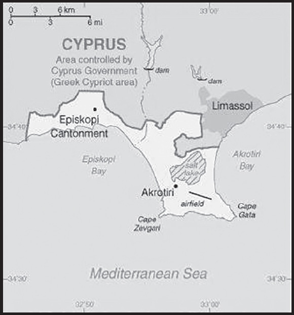
Location: Eastern Mediterranean, peninsula on the southwest coast of Cyprus
Geographic coordinates: 34 37 N, 32 58 E
Map references: Middle East
Area: total: 123 sq km
note: includes a salt lake and wetlands
comparison ranking: total 223
Area - comparative: about 0.7 times the size of Washington, DC
Land boundaries: total: 48 km
border countries (1): Cyprus 48 km
Coastline: 56.3 km
Climate: temperate; Mediterranean with hot, dry summers and cool winters
Geography - note: British extraterritorial rights also extended to several small off-post sites scattered across Cyprus; of the Sovereign Base Area (SBA) land, 60% is privately owned and farmed, 20% is owned by the Ministry of Defense, and 20% is SBA Crown land
PEOPLE AND SOCIETY
Population: (2020) approximately 18,195 on the Sovereign Base Areas of Akrotiri and Dhekelia including 11,000 Cypriots and 7,195 Service and UK-based contract personnel and dependents
Languages: English, Greek
major-language sample(s): Το Παγκόσμιο Βιβλίο Δεδομένων, η απαραίτητη πηγή βασικών πληροφοριών. (Greek)
ENVIRONMENT
Environment - current issues: hunting around the salt lake; note - breeding place for loggerhead and green turtles; only remaining colony of griffon vultures is on the base
Climate: temperate; Mediterranean with hot, dry summers and cool winters
GOVERNMENT
Country name: conventional long form: none
conventional short form: Akrotiri
etymology: named for the village that lies within the Western Sovereign Base Area on Cyprus
Dependency status: a special form of UK overseas territory; administered by an administrator who is also the Commander, British Forces Cyprus
Capital: name: Episkopi Cantonment (base administrative center for Akrotiri and Dhekelia)
geographic coordinates: 34 40 N, 32 51 E
time difference: UTC+2 (7 hours ahead of Washington, DC, during Standard Time)
daylight saving time: +1hr, begins last Sunday in March; ends last Sunday in October
etymology: “Episkopi” means “episcopal” in Greek and stems from the fact that the site previously served as the bishop’s seat of an Orthodox diocese
Constitution: history: presented 3 August 1960, effective 16 August 1960 (The Sovereign Base Areas of Akrotiri and Dhekelia Order in Council 1960 serves as a basic legal document)
amendments: amended 1966
Legal system: laws applicable to the Cypriot population are, as far as possible, the same as the laws of the Republic of Cyprus; note - the Sovereign Base Area Administration has its own court system to deal with civil and criminal matters
Executive branch: chief of state: King CHARLES III (since 8 September 2022)
head of government: Administrator Air Vice-Marshal Peter J.M. SQUIRES (since 1 September 2022); note - administrator reports to the British Ministry of Defense and is also Commander, British Forces Cyprus (BFC); the chief officer, an appointed civilian, is responsible for the day-to-day running of the civil government of the Sovereign Base Areas
elections/appointments: the monarchy is hereditary; administrator appointed by the monarch on the advice of the Ministry of Defense
Judicial branch: highest court(s): Senior Judges’ Court (consists of several visiting judges from England and Wales)
judge selection and term of office: see entry for United Kingdom
subordinate courts: Resident Judges’ Court; Courts Martial
Diplomatic representation in the US: none (overseas territory of the UK)
Diplomatic representation from the US: embassy: none (overseas territory of the UK)
Flag description: the flag of the UK is used
National anthem: note: as a UK area of special sovereignty, “God Save the King” is official (see United Kingdom)
ECONOMY
Exchange rates: note: uses the euro
COMMUNICATIONS
Broadcast media: British Forces Broadcast Service (BFBS) provides multi-channel satellite TV service as well as BFBS radio broadcasts to the Akrotiri Sovereign Base Area
TRANSPORTATION
Airports: 1 (2021)
comparison ranking: total 224
Airports - with paved runways: note: paved runways have a concrete or asphalt surface but not all have facilities for refueling, maintenance, or air traffic control; the length of a runway required for aircraft to safely operate depends on a number of factors including the type of aircraft, the takeoff weight (including passengers, cargo, and fuel), engine types, flap settings, landing speed, elevation of the airport, and average maximum daily air temperature; paved runways can reach a length of 5,000 m (16,000 ft.), but the “typical” length of a commercial airline runway is between 2,500-4,000 m (8,000-13,000 ft.)
MILITARY AND SECURITY
Military - note: defense is the responsibility of the UK; Akrotiri (aka the Western Sovereign Base Area) has a full Royal Air Force base, headquarters for British Forces Cyprus, and the Episkopi Cantonment
INTRODUCTION
Background: Albania declared its independence from the Ottoman Empire in 1912, but was conquered by Italy in 1939 and occupied by Germany in 1943. Communist partisans took over the country in 1944. Albania allied itself first with the USSR (until 1960), and then with China (to 1978). In the early 1990s, Albania ended 46 years of isolated communist rule and established a multiparty democracy. The transition has proven challenging as successive governments have tried to deal with high unemployment, widespread corruption, dilapidated infrastructure, powerful organized crime networks, and combative political opponents.
Albania has made progress in its democratic development since it first held multiparty elections in 1991, but deficiencies remain. Most of Albania’s post-communist elections were marred by claims of electoral fraud; however, international observers judged elections to be largely free and fair since the restoration of political stability following the collapse of pyramid schemes in 1997. Albania joined NATO in April 2009 and in June 2014 became an EU candidate. In April 2017, Albania received a European Commission recommendation to open EU accession negotiations following the passage of historic EU-mandated justice reforms in 2016. Albania - along with North Macedonia - opened EU accession talks in 2022. Although Albania’s economy continues to grow, it has slowed, and the country is still one of the poorest in Europe. A large informal economy and a weak energy and transportation infrastructure remain obstacles.
GEOGRAPHY
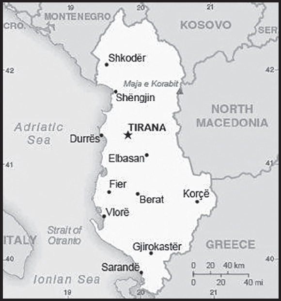
Location: Southeastern Europe, bordering the Adriatic Sea and Ionian Sea, between Greece to the south and Montenegro and Kosovo to the north
Geographic coordinates: 41 00 N, 20 00 E
Map references: Europe
Area: total: 28,748 sq km
land: 27,398 sq km
water: 1,350 sq km
comparison ranking: total 144
Area - comparative: slightly smaller than Maryland
Land boundaries: total: 691 km
border countries (4): Greece 212 km; Kosovo 112 km; Macedonia 181 km; Montenegro 186 km
Coastline: 362 km
Maritime claims: territorial sea: 12 nm
continental shelf: 200-m depth or to the depth of exploitation
Climate: mild temperate; cool, cloudy, wet winters; hot, clear, dry summers; interior is cooler and wetter
Terrain: mostly mountains and hills; small plains along coast
Elevation: highest point: Maja e Korabit (Golem Korab) 2,764 m
lowest point: Adriatic Sea 0 m
mean elevation: 708 m
Natural resources: petroleum, natural gas, coal, bauxite, chromite, copper, iron ore, nickel, salt, timber, hydropower, arable land
Land use: agricultural land: 42.8% (2018 est.)
arable land: 22.3% (2018 est.)
permanent crops: 3% (2018 est.)
permanent pasture: 17.4% (2018 est.)
forest: 28.8% (2018 est.)
other: 28.2% (2018 est.)
Irrigated land: 1,820 sq km (2020)
Major lakes (area sq km): fresh water lake(s): Lake Scutari (shared with Montenegro) - 400 sq km note - largest lake in the Balkans
Major watersheds (area sq km):
Atlantic Ocean drainage: (Black Sea) Danube (795,656 sq km)
Population distribution: a fairly even distribution, with somewhat higher concentrations of people in the western and central parts of the country
Natural hazards: destructive earthquakes; tsunamis occur along southwestern coast; floods; drought
Geography - note: strategic location along Strait of Otranto (links Adriatic Sea to Ionian Sea and Mediterranean Sea)
PEOPLE AND SOCIETY
Population: 3,101,621 (2023 est.)
comparison ranking: 137
Nationality: noun: Albanian(s)
adjective: Albanian
Ethnic groups: Albanian 82.6%, Greek 0.9%, other 1% (including Vlach, Romani, Macedonian, Montenegrin, and Egyptian), unspecified 15.5% (2011 est.)
note: data represent population by ethnic and cultural affiliation
Languages: Albanian 98.8% (official - derived from Tosk dialect), Greek 0.5%, other 0.6% (including Macedonian, Romani, Vlach, Turkish, Italian, and Serbo-Croatian), unspecified 0.1% (2011 est.)
major-language sample(s): Libri i fakteve boterore, burimi i pazevendesueshem per informacione elementare (Albanian)
Religions: Muslim 56.7%, Roman Catholic 10%, Orthodox 6.8%, atheist 2.5%, Bektashi (a Sufi order) 2.1%, other 5.7%, unspecified 16.2% (2011 est.)
note: all mosques and churches were closed in 1967 and religious observances prohibited; in November 1990, Albania began allowing private religious practice
Age structure: 0-14 years: 17.9% (male 290,624/female 264,536)
15-64 years: 67.53% (male 1,030,436/female 1,064,217)
65 years and over: 14.57% (2023 est.) (male 207,960/female 243,848)
Dependency ratios: total dependency ratio: 48.2
youth dependency ratio: 24.1
elderly dependency ratio: 24.1
potential support ratio: 4.2 (2021 est.)
Median age: total: 34.3 years (2020)
male: 32.9 years
female: 35.7 years
comparison ranking: total 91
Population growth rate: 0.19% (2023 est.)
comparison ranking: 179
Birth rate: 12.48 births/1,000 population (2023 est.)
comparison ranking: 143
Death rate: 7.36 deaths/1,000 population (2023 est.)
comparison ranking: 107
Net migration rate: -3.22 migrant(s)/1,000 population (2023 est.)
comparison ranking: 185
Population distribution: a fairly even distribution, with somewhat higher concentrations of people in the western and central parts of the country
Urbanization: urban population: 64.6% of total population (2023)
rate of urbanization: 1.29% annual rate of change (2020-25 est.)
Major urban areas - population: 520,000 TIRANA (capital) (2023)
Sex ratio: at birth: 1.07 male(s)/female
0-14 years: 1.1 male(s)/female
15-64 years: 0.97 male(s)/female
65 years and over: 0.85 male(s)/female
total population: 0.97 male(s)/female (2023 est.)
Mother’s mean age at first birth: 26.6 years (2020 est.)
Maternal mortality ratio: 8 deaths/100,000 live births (2020 est.)
comparison ranking: 151
Infant mortality rate: total: 10.54 deaths/1,000 live births (2023 est.)
male: 11.56 deaths/1,000 live births
female: 9.46 deaths/1,000 live births
comparison ranking: total 132
Life expectancy at birth: total population: 79.7 years (2023 est.)
male: 77.04 years
female: 82.55 years
comparison ranking: total population 61
Total fertility rate: 1.55 children born/woman (2023 est.)
comparison ranking: 195
Gross reproduction rate: 0.75 (2023 est.)
Contraceptive prevalence rate: 46% (2017/18)
Drinking water source: improved: urban: 97.3% of population
rural: 96.4% of population
total: 97% of population
unimproved: urban: 2.7% of population
rural: 3.6% of population
total: 3% of population (2020 est.)
Current health expenditure: 6.7% of GDP (2018)
Physicians density: 1.88 physicians/1,000 population (2020)
Hospital bed density: 2.9 beds/1,000 population (2013)
Sanitation facility access: improved: urban: 99.8% of population
rural: 100% of population
total: 99.9% of population
unimproved: urban: 0.2% of population
rural: 0.5% of population
total: 0.1% of population (2020 est.)
Obesity - adult prevalence rate: 21.7% (2016)
comparison ranking: 86
Alcohol consumption per capita: total: 4.4 liters of pure alcohol (2019 est.)
beer: 1.75 liters of pure alcohol (2019 est.)
wine: 1.15 liters of pure alcohol (2019 est.)
spirits: 1.43 liters of pure alcohol (2019 est.)
other alcohols: 0.08 liters of pure alcohol (2019 est.)
comparison ranking: total 90
Tobacco use: total: 22.4% (2020 est.)
male: 38.8% (2020 est.)
female: 6% (2020 est.)
comparison ranking: total 69
Children under the age of 5 years underweight: 1.5% (2017/18)
comparison ranking: 114
Currently married women (ages 15-49): 67.2% (2023 est.)
Child marriage: women married by age 15: 1.4%
women married by age 18: 11.8%
men married by age 18: 1.2% (2018 est.)
Education expenditures: 3.1% of GDP (2020 est.)
comparison ranking: 154
Literacy: definition: age 15 and over can read and write
total population: 98.4%
male: 98.7%
female: 98.2% (2021)
School life expectancy (primary to tertiary education): total: 14 years
male: 13 years
female: 15 years (2020)
Youth unemployment rate (ages 15-24): total: 27.8% (2021 est.)
male: 28%
female: 27.6%
comparison ranking: total 47
ENVIRONMENT
Environment - current issues: deforestation; soil erosion; water pollution from industrial and domestic effluents; air pollution from industrial and power plants; loss of biodiversity due to lack of resources for sound environmental management
Environment - international agreements: party to: Air Pollution, Air Pollution-Nitrogen Oxides, Air Pollution-Sulphur 85, Biodiversity, Climate Change, Climate Change-Kyoto Protocol, Climate Change-Paris Agreement, Comprehensive Nuclear Test Ban, Desertification, Endangered Species, Hazardous Wastes, Law of the Sea, Ozone Layer Protection, Ship Pollution, Tropical Timber 2006, Wetlands
signed, but not ratified: none of the selected agreements
Climate: mild temperate; cool, cloudy, wet winters; hot, clear, dry summers; interior is cooler and wetter
Land use: agricultural land: 42.8% (2018 est.)
arable land: 22.3% (2018 est.)
permanent crops: 3% (2018 est.)
permanent pasture: 17.4% (2018 est.)
forest: 28.8% (2018 est.)
other: 28.2% (2018 est.)
Urbanization: urban population: 64.6% of total population (2023)
rate of urbanization: 1.29% annual rate of change (2020-25 est.)
Revenue from forest resources: 0.18% of GDP (2018 est.)
comparison ranking: 95
Revenue from coal: 0.03% of GDP (2018 est.)
comparison ranking: 40
Air pollutants: particulate matter emissions: 16.28 micrograms per cubic meter (2019 est.)
carbon dioxide emissions: 4.54 megatons (2016 est.)
methane emissions: 2.55 megatons (2020 est.)
Waste and recycling: municipal solid waste generated annually: 1,142,964 tons (2015 est.)
Major lakes (area sq km): fresh water lake(s): Lake Scutari (shared with Montenegro) - 400 sq km
note - largest lake in the Balkans
Major watersheds (area sq km): Atlantic Ocean drainage: (Black Sea) Danube (795,656 sq km)
Total water withdrawal: municipal: 230 million cubic meters (2020 est.)
industrial: 20 million cubic meters (2020 est.)
agricultural: 550 million cubic meters (2020 est.)
Total renewable water resources: 30.2 billion cubic meters (2020 est.)
GOVERNMENT
Country name: conventional long form: Republic of Albania
conventional short form: Albania
local long form: Republika e Shqiperise
local short form: Shqiperia
former: People’s Socialist Republic of Albania
etymology: the English-language country name seems to be derived from the ancient Illyrian tribe of the Albani; the native name “Shqiperia” is derived from the Albanian word “Shqiponje” (“Eagle”) and is popularly interpreted to mean “Land of the Eagles”
Government type: parliamentary republic
Capital: name: Tirana (Tirane)
geographic coordinates: 41 19 N, 19 49 E
time difference: UTC+1 (6 hours ahead of Washington, DC, during Standard Time)
daylight saving time: +1hr, begins last Sunday in March; ends last Sunday in October
etymology: the name Tirana first appears in a 1418 Venetian document; the origin of the name is unclear, but may derive from Tirkan Fortress, whose ruins survive on the slopes of Dajti mountain and which overlooks the city
Administrative divisions: 12 counties (qarqe, singular - qark); Berat, Diber, Durres, Elbasan, Fier, Gjirokaster, Korce, Kukes, Lezhe, Shkoder, Tirane (Tirana), Vlore
Independence: 28 November 1912 (from the Ottoman Empire)
National holiday: Independence Day, 28 November (1912), also known as Flag Day
Constitution: history: several previous; latest approved by the Assembly 21 October 1998, adopted by referendum 22 November 1998, promulgated 28 November 1998
amendments: proposed by at least one-fifth of the Assembly membership; passage requires at least a two-thirds majority vote by the Assembly; referendum required only if approved by two-thirds of the Assembly; amendments approved by referendum effective upon declaration by the president of the republic; amended several times, last in 2020
Legal system: civil law system except in the northern rural areas where customary law known as the “Code of Leke” is still present
International law organization participation: has not submitted an ICJ jurisdiction declaration; accepts ICCt jurisdiction
Citizenship: citizenship by birth: no
citizenship by descent only: at least one parent must be a citizen of Albania
dual citizenship recognized: yes
residency requirement for naturalization: 5 years
Suffrage: 18 years of age; universal
Executive branch: chief of state: President of the Republic Bajram BEGAJ (since 24 July 2022)
head of government: Prime Minister Edi RAMA (since 10 September 2013); Deputy Prime Minister Arben AHMETAJ (since 18 September 2021)
cabinet: Council of Ministers proposed by the prime minister, nominated by the president, and approved by the Assembly
elections/appointments: president indirectly elected by the Assembly for a 5-year term (eligible for a second term); a candidate needs three-fifths majority vote of the Assembly in 1 of 3 rounds or a simple majority in 2 additional rounds to become president; election last held in 4 rounds on 16, 23, and 30 May and 4 June 2022 (next election to be held in 2027); prime minister appointed by the president on the proposal of the majority party or coalition of parties in the Assembly
election results: 2022: Bajram BEGAJ elected president in the fourth round; Assembly vote - 78-4, opposition parties boycotted
2017: Ilir META elected president in the fourth round; Assembly vote - 87-2
Legislative branch: description: unicameral Assembly or Kuvendi (140 seats; members directly elected in multi-seat constituencies by open party -list proportional representation vote using the D’Hondt method; members serve 4-year terms)
elections: last held on 25 April 2021 (next to be held in 2025)
election results: percent of vote by party/coalition - PS 48.7%, PD-Alliance for Change 39.4%, LSI 6.8%, PSD 2.3%, other 2.8%; seats by party/coalition - PS 74, PD-Alliance for Change 59, LSI 4, PSD 3; composition as of August 2023 - men 90, women 50, percent of women 35.7%
Judicial branch: highest court(s): Supreme Court (consists of 19 judges, including the chief justice); Constitutional Court (consists of 9 judges, including the chairman)
judge selection and term of office: Supreme Court judges appointed by the High Judicial Council with the consent of the president to serve single 9-year terms; Supreme Court chairman is elected for a single 3-year term by the court members; appointments of Constitutional Court judges are rotated among the president, Parliament, and Supreme Court from a list of pre-qualified candidates (each institution selects 3 judges), to serve single 9-year terms; candidates are pre-qualified by a randomly selected body of experienced judges and prosecutors; Constitutional Court chairman is elected by the court members for a single, renewable 3-year term
subordinate courts: Courts of Appeal; Courts of First Instance; specialized courts: Court for Corruption and Organized Crime, Appeals Court for Corruption and Organized Crime (responsible for corruption, organized crime, and crimes of high officials)
Political parties and leaders: Alliance for Change (electoral coalition led by PD)
Democratic Party or PD [Lulzim BASHA]
Party for Justice, Integration and Unity pr PDIU [Shpetim IDRIZI] (part of the Alliance for Change))
Social Democratic Party or PSD [Tom DOSHI]
Freedom Party of Albania or PL [Ilir META] (formerly the Socialist Movement for Integration or LSI) Socialist Party or PS [Edi RAMA]
International organization participation: BSEC, CD, CE, CEI, EAPC, EBRD, EITI (compliant country), FAO, IAEA, IBRD, ICAO, ICC (national committees), ICCt, ICRM, IDA, IDB, IFAD, IFC, IFRCS, ILO, IMF, IMO, Interpol, IOC, IOM, IPU, ISO (correspondent), ITU, ITUC (NGOs), MIGA, NATO, OAS (observer), OIC, OIF, OPCW, OSCE, PCA, SELEC, UN, UNCTAD, UNESCO, UNIDO, UNWTO, UPU, WCO, WFTU (NGOs), WHO, WIPO, WMO, WTO
note: Albania is an EU candidate country whose satisfactory completion of accession criteria is required before being granted full EU membership
Diplomatic representation in the US: chief of mission: Ambassador Ervin BUSHATI (since 15 September 2023)
chancery: 2100 S Street NW, Washington, DC 20008
telephone: [1] (202) 223-4942
FAX: [1] (202) 628-7342
email address and website: embassy.washington@mfa.gov.al
http://www.ambasadat.gov.al/usa/en
consulate(s) general: New York
Diplomatic representation from the US: chief of mission: Ambassador (vacant); Charge d’Affaires David WISNER (since August 2023)
embassy: Rruga Stavro Vinjau, No. 14, Tirana
mailing address: 9510 Tirana Place, Washington DC 20521-9510
telephone: [355] 4 2247-285
FAX: [355] 4 2232-222
email address and website: ACSTirana@state.gov
Flag description: red with a black two-headed eagle in the center; the design is claimed to be that of 15th-century hero Georgi Kastrioti SKANDERBEG, who led a successful uprising against the Ottoman Turks that resulted in a short-lived independence for some Albanian regions (1443-78); an unsubstantiated explanation for the eagle symbol is the tradition that Albanians see themselves as descendants of the eagle; they refer to themselves as “Shqiptare,” which translates as “sons of the eagle”
National symbol(s): black double-headed eagle; national colors: red, black
National anthem: name: “Hymni i Flamurit” (Hymn to the Flag)
lyrics/music: Aleksander Stavre DRENOVA/Ciprian PORUMBESCU
note: adopted 1912
National heritage: total World Heritage Sites: 4 (2 cultural, 1 natural, 1 mixed)
selected World Heritage Site locales: Butrint (c); Historic Berat and Gjirokastër (c); Primeval Beech Forests (n); Lake Ohrid Region (m)
ECONOMY
Economic overview: future hopeful EU member state; oil and gas exporter but investing toward a “blue economy”; COVID-19 and earthquake economic disruptions and declines; experiencing high debt and account balances; strengthening private sector growth and public sector trust
Real GDP (purchasing power parity): $40.822 billion (2021 est.)
$37.619 billion (2020 est.)
$38.976 billion (2019 est.)
note: data are in 2017 dollars
comparison ranking: 120
Real GDP growth rate: 8.52% (2021 est.)
-3.48% (2020 est.)
2.09% (2019 est.)
comparison ranking: 35
Real GDP per capita: $14,500 (2021 est.)
$13,300 (2020 est.)
$13,700 (2019 est.)
note: data are in 2017 dollars
comparison ranking: 113
GDP (official exchange rate): $15.273 billion (2019 est.)
Inflation rate (consumer prices): 2.04% (2021 est.)
1.62% (2020 est.)
1.41% (2019 est.)
comparison ranking: 156
Credit ratings: Moody’s rating: B1 (2021)
Standard & Poors rating: B+ (2020)
note: The year refers to the year in which the current credit rating was first obtained.
GDP - composition, by sector of origin: agriculture: 21.7% (2017 est.)
industry: 24.2% (2017 est.)
services: 54.1% (2017 est.)
comparison rankings: services 162; industry 115; agriculture 42
GDP - composition, by end use: household consumption: 78.1% (2017 est.)
government consumption: 11.5% (2017 est.)
investment in fixed capital: 25.2% (2017 est.)
investment in inventories: 0.2% (2017 est.)
exports of goods and services: 31.5% (2017 est.)
imports of goods and services: -46.6% (2017 est.)
Agricultural products: milk, maize, tomatoes, potatoes, watermelons, wheat, grapes, cucumbers, onions, apples
Industries: food; footwear, apparel and clothing; lumber, oil, cement, chemicals, mining, basic metals, hydropower
Industrial production growth rate: 16% (2021 est.)
comparison ranking: 12
Labor force: 1.378 million (2021 est.)
comparison ranking: 135
Labor force - by occupation: agriculture: 41.4%
industry: 18.3%
services: 40.3% (2017 est.)
Unemployment rate: 11.82% (2021 est.)
13.33% (2020 est.)
11.47% (2019 est.)
note: these official rates may not include those working at near-subsistence farming
comparison ranking: 57
Youth unemployment rate (ages 15-24): total: 27.8% (2021 est.)
male: 28%
female: 27.6%
comparison ranking: total 47
Population below poverty line: 14.3% (2012 est.)
Gini Index coefficient - distribution of family income: 30.8 (2019 est.)
comparison ranking: 143
Household income or consumption by percentage share: lowest 10%: 4.1%
highest 10%: 19.6% (2015 est.)
Budget: revenues: $4.19 billion (2019 est.)
expenditures: $4.489 billion (2019 est.)
Budget surplus (+) or deficit (-): -2% (of GDP) (2017 est.)
comparison ranking: 105
Public debt: 84.06% of GDP (2020 est.)
75.7% of GDP (2019 est.)
64.57% of GDP (2018 est.)
comparison ranking: 40
Taxes and other revenues: 17.02% (of GDP) (2020 est.)
comparison ranking: 120
Fiscal year: calendar year
Current account balance: -$1.37 billion (2021 est.)
-$1.315 billion (2020 est.)
-$1.219 billion (2019 est.)
comparison ranking: 142
Exports: $5.612 billion (2021 est.)
$3.461 billion (2020 est.)
$4.822 billion (2019 est.)
note: Data are in current year dollars and do not include illicit exports or re-exports.
comparison ranking: 124
Exports - partners: Italy 45%, Spain 8%, Germany 6%, Greece 5%, France 4%, China 4% (2019)
Exports - commodities: leather footwear and parts, electricity, crude petroleum, iron alloys, clothing, insulated wiring (2021)
note: Albanian cannabis production remains a significant illicit trade export
Imports: $8.004 billion (2021 est.) note: data are in current year dollars
$5.671 billion (2020 est.) note: data are in current year dollars
$6.926 billion (2019 est.) note: data are in current year dollars
comparison ranking: 124
Imports - partners: Italy 28%, Greece 12%, China 11%, Turkey 9%, Germany 5% (2019)
Imports - commodities: refined petroleum, cars, tanned hides, packaged medical supplies, footwear parts (2019)
Reserves of foreign exchange and gold: $5.635 billion (31 December 2021 est.)
$4.817 billion (31 December 2020 est.)
$3.764 billion (31 December 2019 est.)
comparison ranking: 98
Debt - external: $9.311 billion (2019 est.)
$9.547 billion (2018 est.)
comparison ranking: 115
Exchange rates: leke (ALL) per US dollar -
Exchange rates: 103.52 (2021 est.)
108.65 (2020 est.)
109.851 (2019 est.)
107.989 (2018 est.)
119.1 (2017 est.)
ENERGY
Electricity access: electrification - total population: 100% (2020)
Electricity: installed generating capacity: 2.531 million kW (2020 est.)
consumption: 6,527,980,000 kWh (2019 est.)
exports: 963 million kWh (2020 est.)
imports: 3.239 billion kWh (2020 est.)
transmission/distribution losses: 1.054 billion kWh (2019 est.)
comparison rankings: imports 51; exports 64; installed generating capacity 113; transmission/distribution losses 111; consumption 112
Electricity generation sources: fossil fuels: 0% of total installed capacity (2020 est.)
nuclear: 0% of total installed capacity (2020 est.)
solar: 0.6% of total installed capacity (2020 est.)
wind: 0% of total installed capacity (2020 est.)
hydroelectricity: 99.4% of total installed capacity (2020 est.)
tide and wave: 0% of total installed capacity (2020 est.)
geothermal: 0% of total installed capacity (2020 est.)
biomass and waste: 0% of total installed capacity (2020 est.)
Coal: production: 9,000 metric tons (2020 est.)
consumption: 119,000 metric tons (2020 est.)
exports: 0 metric tons (2020 est.)
imports: 110,000 metric tons (2020 est.)
proven reserves: 522 million metric tons (2019 est.)
Petroleum: total petroleum production: 16,100 bbl/day (2021 est.)
refined petroleum consumption: 26,400 bbl/day (2019 est.)
crude oil and lease condensate exports: 10,500 bbl/day (2018 est.)
crude oil and lease condensate imports: 0 bbl/day (2018 est.)
crude oil estimated reserves: 150 million barrels (2021 est.)
Refined petroleum products - production: 5,638 bbl/day (2015 est.)
comparison ranking: 103
Refined petroleum products - exports: 3,250 bbl/day (2015 est.)
comparison ranking: 98
Refined petroleum products - imports: 26,660 bbl/day (2015 est.)
comparison ranking: 103
Natural gas: production: 42.05 million cubic meters (2019 est.)
consumption: 42.05 million cubic meters (2019 est.)
exports: 0 cubic meters (2021 est.)
imports: 0 cubic meters (2021 est.)
proven reserves: 5.692 billion cubic meters (2021 est.)
Carbon dioxide emissions: 3.794 million metric tonnes of CO2 (2019 est.)
from coal and metallurgical coke: 235,000 metric tonnes of CO2 (2019 est.)
from petroleum and other liquids: 3.482 million metric tonnes of CO2 (2019 est.)
from consumed natural gas: 78,000 metric tonnes of CO2 (2019 est.)
comparison ranking: total emissions 144
Energy consumption per capita: 38.442 million Btu/person (2019 est.)
comparison ranking: 110
COMMUNICATIONS
Telephones - fixed lines: total subscriptions: 197,690 (2021 est.)
subscriptions per 100 inhabitants: 7 (2021 est.)
comparison ranking: total subscriptions 122
Telephones - mobile cellular: total subscriptions: 2,635,466 (2021 est.)
subscriptions per 100 inhabitants: 92 (2021 est.)
comparison ranking: total subscriptions 145
Telecommunication systems: general assessment: Albania’s small telecom market has experienced some significant changes in recent years; upgrades were made to the fixed-line infrastructure to support broadband services; fixed-line telephony use and penetration in Albania is declining steadily as subscribers migrate to mobile solutions; the mobile sector is well provided with LTE networks, while operators have invested in 5G; some of these efforts have been made in conjunction with neighboring Kosovo, with the intention of a seamless 5G corridor along the highway connecting the two countries; the country has long sought accession to the European Union (EU) which has benefited its telecoms sector through closer scrutiny of its regulatory regime and through the injection of funding to help modernize infrastructure (2021)
domestic: fixed-line approximately 7 per 100, teledensity continues to decline due to heavy use of mobile-cellular telephone services; mobile-cellular telephone use is widespread and generally effective, 92 per 100 for mobile-cellular (2021)
international: country code - 355; submarine cables for the Adria 1 and Italy-Albania provide connectivity to Italy, Croatia, and Greece; a combination submarine cable and land fiber-optic system, provides additional connectivity to Bulgaria, Macedonia, and Turkey; international traffic carried by fiber-optic cable and, when necessary, by microwave radio relay from the Tirana exchange to Italy and Greece (2019)
Broadcast media: Albania has more than 65 TV stations, including several that broadcast nationally; Albanian TV broadcasts are also available to Albanian-speaking populations in neighboring countries; many viewers have access to Italian and Greek TV broadcasts via terrestrial reception; Albania’s TV stations have begun a government-mandated conversion from analog to digital broadcast; the government has pledged to provide analog-to-digital converters to low-income families affected by this decision; cable TV service is available; 2 public radio networks and roughly 78 private radio stations; several international broadcasters are available (2019)
Internet country code: .al
Internet users: total: 2.291 million (2021 est.)
percent of population: 79% (2021 est.)
comparison ranking: total 132
Broadband - fixed subscriptions: total: 508,937 (2020 est.)
subscriptions per 100 inhabitants: 18 (2020 est.)
comparison ranking: total 91
TRANSPORTATION
National air transport system: number of registered air carriers: 2 (2020)
inventory of registered aircraft operated by air carriers: 5
annual passenger traffic on registered air carriers: 303,137 (2018)
Civil aircraft registration country code prefix: ZA
Airports: 3 (2021)
comparison ranking: total 190
Airports - with paved runways: 3
civil airports: 0
military airports: 1
joint use (civil-military) airports: 1
other airports: 1
note: paved runways have a concrete or asphalt surface but not all have facilities for refueling, maintenance, or air traffic control; the length of a runway required for aircraft to safely operate depends on a number of factors including the type of aircraft, the takeoff weight (including passengers, cargo, and fuel), engine types, flap settings, landing speed, elevation of the airport, and average maximum daily air temperature; paved runways can reach a length of 5,000 m (16,000 ft.), but the “typical” length of a commercial airline runway is between 2,500-4,000 m (8,000-13,000 ft.)
Pipelines: 498 km gas (a majority of the network is in disrepair and parts of it are missing), 249 km oil (2015)
Railways: total: 424 km (2017)
2021-All the trains in the country suspended
comparison ranking: total 119
Roadways: total: 3,945 km (2018)
paved: (2002)
unpaved: (2002)
comparison ranking: total 156
Waterways: 41 km (2011) (on the Bojana River)
comparison ranking: 114
Merchant marine: total: 69 (2022)
by type: general cargo 47, oil tanker 1, other 21
comparison ranking: total 110
Ports and terminals: major seaport(s): Durres, Sarande, Shengjin, Vlore
MILITARY AND SECURITY
Military and security forces: Republic of Albania Armed Forces (Forcat e Armatosura të Republikës së Shqipërisë (FARSH); aka Albanian Armed Forces): Land Forces, Naval Force (includes Coast Guard), Air Forces
Ministry of Interior: Guard of the Republic, State Police (includes the Border and Migration Police) (2023)
note: the State Police are primarily responsible for internal security, including counterterrorism, while the Guard of the Republic protects senior state officials, foreign dignitaries, and certain state properties
Military expenditures: 1.8% of GDP (2023 est.)
1.2% of GDP (2022 est.)
1.4% of GDP (2021)
1.3% of GDP (2020)
1.5% of GDP (2019)
comparison ranking: 67
Military and security service personnel strengths: approximately 7,000 total active-duty personnel (5,000 Army; 1,500 Navy; 500 Air Force) (2023)
Military equipment inventories and acquisitions: since joining NATO, the military has been in the process of modernizing by retiring its inventory of Soviet-era weapons and replacing them with Western equipment, including donated and secondhand purchases (2023)
Military service age and obligation: 18-27 (up to 32 in some cases) for voluntary military service for men and women; conscription abolished 2010 (2023)
note: as of 2023, women comprised about 15% of the military’s full-time personnel, including 20% of the officers
Military - note: the Albanian Armed Forces (AAF) are responsible for defending the country’s independence, sovereignty, and territory, assisting with internal security, providing disaster and humanitarian relief, and participating in international peacekeeping missions; the AAF has contributed small numbers of forces to several NATO missions since Albania joined NATO in 2009, including peacekeeping/stability missions in Afghanistan, Kosovo, and Iraq, and multinational battlegroups in Bulgaria and Latvia; it has also contributed to EU and UN missions; the AAF is a small, lightly armed force that has been undergoing a modernization effort to improve its ability to fulfill NATO missions, including training and equipment purchases; the primary ground combat units include three light infantry battalions (or battle groups), including one trained and certified for NATO missions, and a special operations regiment; the Naval Force and Coast Guard operate a small force of patrol boats while the Air Force has a small inventory of helicopters (2023)
TERRORISM
Terrorist group(s): Terrorist group(s): Islamic Revolutionary Guard Corps/Qods Force; Islamic State of Iraq and ash-Sham (ISIS)
note: details about the history, aims, leadership, organization, areas of operation, tactics, targets, weapons, size, and sources of support of the group(s) appear(s) in Appendix T
TRANSNATIONAL ISSUES
Disputes - international: none identified
Refugees and internally displaced persons: stateless persons: 1,948 (2022)
note: 46,944 estimated refugee and migrant arrivals (January 2015-October 2023)
Illicit drugs: a source country for cannabis and an active transshipment point for Albanian narco-trafficking organizations moving illicit drugs into European markets
INTRODUCTION
Background: Algeria has known many empires and dynasties starting with the ancient Numidians (3rd century B.C.), Phoenicians, Carthaginians, Romans, Vandals, Byzantines, over a dozen different Arab and Berber dynasties, Spaniards, and Ottoman Turks. It was under the latter that the Barbary pirates operated from North Africa and preyed on shipping beginning in roughly 1500, peaking in the early to mid-17th century, until finally subdued by the French capture of Algiers in l830. The French southward conquest of the entirety of Algeria proceeded throughout the 19th century and was marked by many atrocities. The country was heavily colonized by the French in the late 19th and early 20th centuries. A bloody eight-year struggle culminated in Algerian independence in 1962.
Algeria’s primary political party, the National Liberation Front (FLN), was established in 1954 as part of the struggle for independence and has since largely dominated politics, though it is falling out of favor with the youth. The Government of Algeria in 1988 instituted a multi-party system in response to public unrest, but the surprising first round success of the Islamic Salvation Front (FIS) in the December 1991 legislative election led the Algerian military to intervene and postpone the second round of elections to prevent what the secular elite feared would be an extremist-led government from assuming power. The army began a crackdown on the FIS that spurred FIS supporters to begin attacking government targets. Fighting escalated into an insurgency, which saw intense violence from 1992-98, resulting in over 100,000 deaths – many attributed to indiscriminate massacres of villagers by extremists. The government gained the upper hand by the late-1990s, and FIS’s armed wing, the Islamic Salvation Army, disbanded in January 2000. FIS membership is illegal.
Former president Abdelaziz BOUTEFLIKA, with the backing of the military, won the presidency in 1999 in an election that was boycotted by several candidates protesting alleged fraud, and won subsequent elections in 2004, 2009, and 2014. Protests broke out across the country in late February 2019 against President BOUTEFLIKA’s decision to seek a fifth term. BOUTEFLIKA resigned in April 2019, and in December 2019, Algerians elected former Prime Minister Abdelmadjid TEBBOUNE as the country’s new president. A longtime FLN member, TEBBOUNE ran for president as an independent. In 2020, Algeria held a constitutional referendum, which President TEBBOUNE enacted in January 2021. Subsequent reforms to the national electoral law introduced open list voting to curb corruption. The new law also eliminated gender quotas in Parliament, and the June 2021 legislative elections saw female representation plummet. Local elections took place in November 2021. The referendum, parliamentary elections, and local elections saw record low voter turnout. Since 2014, Algeria’s reliance on hydrocarbon export revenues to fund the government and finance the large subsidies for the population has fallen under stress because of volatile energy prices and increased domestic consumption of energy products.
GEOGRAPHY
Location: Northern Africa, bordering the Mediterranean Sea, between Morocco and Tunisia
Geographic coordinates: 28 00 N, 3 00 E
Map references: Africa
Area: total: 2,381,740 sq km
land: 2,381,740 sq km
water: 0 sq km
comparison ranking: total 11
Area - comparative: slightly less than 3.5 times the size of Texas
Land boundaries: total: 6,734 km
border countries (6): Libya 989 km; Mali 1,359 km; Mauritania 460 km; Morocco 1,941 km; Niger 951 km; Tunisia 1,034 km
Coastline: 998 km
Maritime claims: territorial sea: 12 nm
contiguous zone: 24 nm
exclusive fishing zone: 32-52 nm
Climate: arid to semiarid; mild, wet winters with hot, dry summers along coast; drier with cold winters and hot summers on high plateau; sirocco is a hot, dust/sand-laden wind especially common in summer
Terrain: mostly high plateau and desert; Atlas Mountains in the far north and Hoggar Mountains in the south; narrow, discontinuous coastal plain
Elevation: highest point: Tahat 2,908 m
lowest point: Chott Melrhir -40 m
mean elevation: 800 m
Natural resources: petroleum, natural gas, iron ore, phosphates, uranium, lead, zinc
Land use: agricultural land: 17.4% (2018 est.)
arable land: 3.2% (2018 est.)
permanent crops: 0.4% (2018 est.)
permanent pasture: 13.8% (2018 est.)
forest: 0.8% (2018 est.)
other: 81.8% (2018 est.)
Irrigated land: 12,605 sq km (2016)
Major watersheds (area sq km):
Atlantic Ocean drainage: Niger (2,261,741 sq km)
Internal (endorheic basin) drainage: Lake Chad (2,497,738 sq km)
Major aquifers: Lullemeden-Irhazer Aquifer System, Murzuk-Djado Basin, North Western Sahara Aquifer, Taoudeni-Tanezrouft Basin
Population distribution: the vast majority of the populace is found in the extreme northern part of the country along the Mediterranean Coast as shown in this population distribution map
Natural hazards: mountainous areas subject to severe earthquakes; mudslides and floods in rainy season; droughts
Geography - note: largest country in Africa but 80% desert; canyons and caves in the southern Hoggar Mountains and in the barren Tassili n’Ajjer area in the southeast of the country contain numerous examples of prehistoric art - rock paintings and carvings depicting human activities and wild and domestic animals (elephants, giraffes, cattle) - that date to the African Humid Period, roughly 11,000 to 5,000 years ago, when the region was completely vegetated
PEOPLE AND SOCIETY
Population: 44,758,398 (2023 est.)
comparison ranking: 34
Nationality: noun: Algerian(s)
adjective: Algerian
Ethnic groups: Arab-Berber 99%, European less than 1%
note: although almost all Algerians are Berber in origin (not Arab), only a minority identify themselves as primarily Berber, about 15% of the total population; these people live mostly in the mountainous region of Kabylie east of Algiers and several other communities; the Berbers are also Muslim but identify with their Berber rather than Arab cultural heritage; Berbers have long agitated, sometimes violently, for autonomy; the government is unlikely to grant autonomy but has officially recognized Berber languages and introduced them into public schools
Languages: Arabic (official), French (lingua franca), Berber or Tamazight (official); dialects include Kabyle Berber (Taqbaylit), Shawiya Berber (Tacawit), Mzab Berber, Tuareg Berber (Tamahaq)
major-language sample(s):

(Arabic)
Religions: Muslim (official; predominantly Sunni) 99%, other (includes Christian, Jewish, Ahmadi Muslim, Shia Muslim, Ibadi Muslim) <1% (2012 est.)
Demographic profile: For the first two thirds of the 20th century, Algeria’s high fertility rate caused its population to grow rapidly. However, about a decade after independence from France in 1962, the total fertility rate fell dramatically from 7 children per woman in the 1970s to about 2.4 in 2000, slowing Algeria’s population growth rate by the late 1980s. The lower fertility rate was mainly the result of women’s rising age at first marriage (virtually all Algerian children being born in wedlock) and to a lesser extent the wider use of contraceptives. Later marriages and a preference for smaller families are attributed to increases in women’s education and participation in the labor market; higher unemployment; and a shortage of housing forcing multiple generations to live together. The average woman’s age at first marriage increased from about 19 in the mid-1950s to 24 in the mid-1970s to 30.5 in the late 1990s.
Algeria’s fertility rate experienced an unexpected upturn in the early 2000s, as the average woman’s age at first marriage dropped slightly. The reversal in fertility could represent a temporary fluctuation in marriage age or, less likely, a decrease in the steady rate of contraceptive use.
Thousands of Algerian peasants - mainly Berber men from the Kabylia region - faced with land dispossession and economic hardship under French rule migrated temporarily to France to work in manufacturing and mining during the first half of the 20th century. This movement accelerated during World War I, when Algerians filled in for French factory workers or served as soldiers. In the years following independence, low-skilled Algerian workers and Algerians who had supported the French (known as Harkis) emigrated en masse to France. Tighter French immigration rules and Algiers’ decision to cease managing labor migration to France in the 1970s limited legal emigration largely to family reunification.
Not until Algeria’s civil war in the 1990s did the country again experience substantial outmigration. Many Algerians legally entered Tunisia without visas claiming to be tourists and then stayed as workers. Other Algerians headed to Europe seeking asylum, although France imposed restrictions. Sub-Saharan African migrants came to Algeria after its civil war to work in agriculture and mining. In the 2000s, a wave of educated Algerians went abroad seeking skilled jobs in a wider range of destinations, increasing their presence in North America and Spain. At the same time, legal foreign workers principally from China and Egypt came to work in Algeria’s construction and oil sectors. Illegal migrants from Sub-Saharan Africa, particularly Malians, Nigeriens, and Gambians, continue to come to Algeria in search of work or to use it as a stepping stone to Libya and Europe.
Since 1975, Algeria also has been the main recipient of Sahrawi refugees from the ongoing conflict in Western Sahara (today part of Morocco). More than 100,000 Sahrawis are estimated to be living in five refugee camps in southwestern Algeria near Tindouf.
Age structure: 0-14 years: 28.78% (male 6,594,512/female 6,286,191)
15-64 years: 64.29% (male 14,607,255/female 14,166,990)
65 years and over: 6.93% (2023 est.) (male 1,475,635/female 1,627,815)
Dependency ratios: total dependency ratio: 58.5
youth dependency ratio: 48.7
elderly dependency ratio: 9.8
potential support ratio: 10.2 (2021 est.)
Median age: total: 28.9 years (2020)
male: 28.6 years
female: 29.3 years
comparison ranking: total 139
Population growth rate: 1.27% (2023 est.)
comparison ranking: 73
Birth rate: 17.84 births/1,000 population (2023 est.)
comparison ranking: 80
Death rate: 4.33 deaths/1,000 population (2023 est.)
comparison ranking: 207
Net migration rate: -0.81 migrant(s)/1,000 population (2023 est.)
comparison ranking: 138
Population distribution: the vast majority of the populace is found in the extreme northern part of the country along the Mediterranean Coast as shown in this population distribution map
Urbanization: urban population: 75.3% of total population (2023)
rate of urbanization: 1.99% annual rate of change (2020-25 est.)
Major urban areas - population: 2.902 million ALGIERS (capital), 936,000 Oran (2022)
Sex ratio: at birth: 1.05 male(s)/female
0-14 years: 1.05 male(s)/female
15-64 years: 1.03 male(s)/female
65 years and over: 0.91 male(s)/female
total population: 1.03 male(s)/female (2023 est.)
Maternal mortality ratio: 78 deaths/100,000 live births (2020 est.)
comparison ranking: 76
Infant mortality rate: total: 19.22 deaths/1,000 live births (2023 est.)
male: 21.2 deaths/1,000 live births
female: 17.14 deaths/1,000 live births
comparison ranking: total 82
Life expectancy at birth: total population: 78.27 years (2023 est.)
male: 76.81 years
female: 79.8 years
comparison ranking: total population 78
Total fertility rate: 2.47 children born/woman (2023 est.)
comparison ranking: 68
Gross reproduction rate: 1.2 (2023 est.)
Contraceptive prevalence rate: 53.6% (2018/19)
Drinking water source: improved: urban: 99.6% of population
rural: 98.8% of population
total: 99.4% of population
unimproved: urban: 0.4% of population
rural: 1.2% of population
total: 0.6% of population (2020 est.)
Current health expenditure: 6.3% of GDP (2020)
Physicians density: 1.72 physicians/1,000 population (2018)
Hospital bed density: 1.9 beds/1,000 population (2015)
Sanitation facility access: improved: urban: 98.3% of population
rural: 91.3% of population
total: 96.5% of population
unimproved: urban: 1.7% of population
rural: 8.7% of population
total: 3.5% of population (2020 est.)
Major infectious diseases: note: on 32 August 2023, the US Centers for Disease Control and Prevention (CDC) issued a Travel Alert for polio in Africa; Algeria is currently considered a high risk to travelers for circulating vaccine-derived polioviruses (cVDPV); vaccine-derived poliovirus (VDPV) is a strain of the weakened poliovirus that was initially included in oral polio vaccine (OPV) and that has changed over time and behaves more like the wild or naturally occurring virus; this means it can be spread more easily to people who are unvaccinated against polio and who come in contact with the stool or respiratory secretions, such as from a sneeze, of an “infected” person who received oral polio vaccine; the CDC recommends that before any international travel, anyone unvaccinated, incompletely vaccinated, or with an unknown polio vaccination status should complete the routine polio vaccine series; before travel to any high-risk destination, the CDC recommends that adults who previously completed the full, routine polio vaccine series receive a single, lifetime booster dose of polio vaccine
Obesity - adult prevalence rate: 27.4% (2016)
comparison ranking: 38
Alcohol consumption per capita: total: 0.59 liters of pure alcohol (2019 est.)
beer: 0.31 liters of pure alcohol (2019 est.)
wine: 0.2 liters of pure alcohol (2019 est.)
spirits: 0.08 liters of pure alcohol (2019 est.)
other alcohols: 0 liters of pure alcohol (2019 est.)
comparison ranking: total 160
Tobacco use: total: 21% (2020 est.)
male: 41.3% (2020 est.)
female: 0.7% (2020 est.)
comparison ranking: total 80
Children under the age of 5 years underweight: 2.7% (2018/19)
comparison ranking: 93
Currently married women (ages 15-49): 56% (2023 est.)
Child marriage: women married by age 18: 3.8% (2019 est.)
Education expenditures: 7% of GDP (2020 est.)
comparison ranking: 21
Literacy: definition: age 15 and over can read and write
total population: 81.4%
male: 87.4%
female: 75.3% (2018)
Youth unemployment rate (ages 15-24): total: 31.9% (2021 est.)
male: 27.8%
female: 54%
comparison ranking: total 31
ENVIRONMENT
Environment - current issues: air pollution in major cities; soil erosion from overgrazing and other poor farming practices; desertification; dumping of raw sewage, petroleum refining wastes, and other industrial effluents is leading to the pollution of rivers and coastal waters; Mediterranean Sea, in particular, becoming polluted from oil wastes, soil erosion, and fertilizer runoff; inadequate supplies of potable water
Environment - international agreements: party to: Biodiversity, Climate Change, Climate Change-Kyoto Protocol, Climate Change-Paris Agreement, Comprehensive Nuclear Test Ban, Desertification, Endangered Species, Environmental Modification, Hazardous Wastes, Law of the Sea, Ozone Layer Protection, Ship Pollution, Wetlands
signed, but not ratified: Nuclear Test Ban
Climate: arid to semiarid; mild, wet winters with hot, dry summers along coast; drier with cold winters and hot summers on high plateau; sirocco is a hot, dust/sand-laden wind especially common in summer
Land use: agricultural land: 17.4% (2018 est.)
arable land: 3.2% (2018 est.)
permanent crops: 0.4% (2018 est.)
permanent pasture: 13.8% (2018 est.)
forest: 0.8% (2018 est.)
other: 81.8% (2018 est.)
Urbanization: urban population: 75.3% of total population (2023)
rate of urbanization: 1.99% annual rate of change (2020-25 est.)
Revenue from forest resources: 0.1% of GDP (2018 est.)
comparison ranking: 113
Revenue from coal: 0% of GDP (2018 est.)
comparison ranking: 159
Air pollutants: particulate matter emissions: 22.68 micrograms per cubic meter (2019 est.)
carbon dioxide emissions: 150.01 megatons (2016 est.)
methane emissions: 49.94 megatons (2020 est.)
Waste and recycling: municipal solid waste generated annually: 12,378,740 tons (2016 est.)
municipal solid waste recycled annually: 990,299 tons (2013 est.)
percent of municipal solid waste recycled: 8% (2013 est.)
Major watersheds (area sq km):
Atlantic Ocean drainage: Niger (2,261,741 sq km)
Internal (endorheic basin) drainage: Lake Chad (2,497,738 sq km)
Major aquifers: Lullemeden-Irhazer Aquifer System, Murzuk-Djado Basin, North Western Sahara Aquifer, Taoudeni-Tanezrouft Basin
Total water withdrawal: municipal: 3.6 billion cubic meters (2020 est.)
industrial: 190 million cubic meters (2020 est.)
agricultural: 6.67 billion cubic meters (2020 est.)
Total renewable water resources: 11.67 billion cubic meters (2020 est.)
GOVERNMENT
Country name: conventional long form: People’s Democratic Republic of Algeria
conventional short form: Algeria
local long form: Al Jumhuriyah al Jaza’iriyah ad Dimuqratiyah ash Sha’biyah
local short form: Al Jaza’ir
etymology: the country name derives from the capital city of Algiers
Government type: presidential republic
Capital: name: Algiers
geographic coordinates: 36 45 N, 3 03 E
time difference: UTC+1 (6 hours ahead of Washington, DC, during Standard Time)
etymology: name derives from the Arabic “al-Jazair” meaning “the islands” and refers to the four islands formerly off the coast of the capital but joined to the mainland since 1525
Administrative divisions: 58 provinces (wilayas, singular - wilaya); Adrar, Ain Defla, Ain Temouchent, Alger (Algiers), Annaba, Batna, Bechar, Bejaia, Beni Abbes, Biskra, Blida, Bordj Badji Mokhtar, Bordj Bou Arreridj, Bouira, Boumerdes, Chlef, Constantine, Djanet, Djelfa, El Bayadh, El Meghaier, El Meniaa, El Oued, El Tarf, Ghardaia, Guelma, Illizi, In Guezzam, In Salah, Jijel, Khenchela, Laghouat, Mascara, Medea, Mila, Mostaganem, M’Sila, Naama, Oran, Ouargla, Ouled Djellal, Oum el Bouaghi, Relizane, Saida, Setif, Sidi Bel Abbes, Skikda, Souk Ahras, Tamanrasset, Tebessa, Tiaret, Timimoun, Tindouf, Tipaza, Tissemsilt, Tizi Ouzou, Tlemcen, Touggourt
Independence: 5 July 1962 (from France)
National holiday: Independence Day, 5 July (1962); Revolution Day, 1 November (1954)
Constitution: history: several previous; latest approved by referendum November 2020
amendments: proposed by the president of the republic or through the president with the support of three fourths of the members of both houses of Parliament in joint session; passage requires approval by both houses, approval by referendum, and promulgation by the president; the president can forego a referendum if the Constitutional Council determines the proposed amendment does not conflict with basic constitutional principles; articles including the republican form of government, the integrity and unity of the country, and fundamental citizens’ liberties and rights cannot be amended; amended 2002, 2008, 2016; last in 2020
Legal system: mixed legal system of French civil law and Islamic law; judicial review of legislative acts in ad hoc Constitutional Council composed of various public officials including several Supreme Court justices
International law organization participation: has not submitted an ICJ jurisdiction declaration; non-party state to the ICCt
Citizenship: citizenship by birth: no
citizenship by descent only: the mother must be a citizen of Algeria
dual citizenship recognized: no
residency requirement for naturalization: 7 years
Suffrage: 18 years of age; universal
Executive branch: chief of state: President Abdelmadjid TEBBOUNE (since 12 December 2019)
head of government: Prime Minister Ayman BENABDERRAHMANE (since 7 July 2021)
cabinet: Cabinet of Ministers appointed by the president
elections/appointments: president directly elected by absolute majority popular vote in two rounds if needed for a 5-year term (eligible for a second term); election last held on 12 December 2019 (next to be held in 2024); prime minister nominated by the president after consultation with the majority party in Parliament
election results: 2019: Abdelmadjid TEBBOUNE (FLN) 58.1%, Abdelkader BENGRINA (El-Bina) 17.4%, Ali BENFLIS (Talaie El Hurriyet) 10.6%, Azzedine MIHOUBI (National Democratic Rally, RND) 7.3%, Abdelaziz BELAID (Front El Mustakbal, FM) 6.7%
2014: Abdelaziz BOUTEFLIKA reelected president for a fourth term; percent of vote - Abdelaziz BOUTEFLIKA (FLN) 81.5%, Ali BENFLIS (FLN) 12.2%, Abdelaziz BELAID (Future Front) 3.4%, other 2.9%
Legislative branch: description: bicameral Parliament or Barlaman consists of:
Council of the Nation or Majlis al-Umma (174 seats, statutory; 170 currently); two-thirds of members indirectly elected by simple majority vote by an electoral college composed of local assemblies within each wilaya, and one-third of members appointed by the president; members serve 6-year terms with one-half of the membership renewed every 3 years) National People’s Assembly or al-Majlis al-Sha’abi al-Watani (407 seats, including 8 seats for Algerian diaspora); members directly elected in multi-seat constituencies by open-list proportional representation vote using the Hare quota method; members serve 5-year terms)
elections: Council of the Nation - last held on 5 February 2022 (next expected in 2025)
National People’s Assembly - snap election held on 12 June 2021 (next to be held on 12 June 2026)
election results: Council of the Nation - percent of vote by party - NA; seats by party - FLN 54, RND 22, Future Front 7, National Construction Movement 5, FFS 4, other 6, independent 18, appointed 58; composition as of August 2023 - men 163, women 7, percent of women 4.1%
National People’s Assembly - percent of vote by party - NA; seats by party - FLN 98, MSP 65, RND 58, (Future Front) 48, Movement of National Construction 39, other 15, independent 84; composition - men 375, women 32, percent of women 7.9%; note - total Parliament percent of women 6.8%
Judicial branch: highest court(s): Supreme Court or Le Cour Suprême, (consists of 150 judges organized into 8 chambers: Civil, Commercial and Maritime, Criminal, House of Offenses and Contraventions, House of Petitions, Land, Personal Status, and Social; Constitutional Council (consists of 12 members including the court chairman and deputy chairman); note - Algeria’s judicial system does not include sharia courts
judge selection and term of office: Supreme Court judges appointed by the High Council of Magistracy, an administrative body presided over by the president of the republic, and includes the republic vice-president and several members; judges appointed for life; Constitutional Council members - 4 appointed by the president of the republic, 2 each by the 2 houses of Parliament, 2 by the Supreme Court, and 2 by the Council of State; Council president and members appointed for single 6-year terms with half the membership renewed every 3 years
subordinate courts: appellate or wilaya courts; first instance or daira tribunals
Political parties and leaders: Algerian National Front or FNA [Moussa TOUATI]
Algerian Popular Movement or MPA [Amara BENYOUNES]
Algeria’s Hope Rally or TAJ [Fatma Zohra ZEROUATI]
Democratic and Social Movement or MDS [Fethi GHARES]
Dignity or El Karama [Mohamed DAOUI]
El-Infitah [Omar BOUACHA]
Ennour El Djazairi Party (Algerian Radiance Party) or PED [Badreddine BELBAZ]
Equity and Proclamation Party or PEP [Naima SALHI]
Future Front or El Mostakbel [Abdelaziz BELAID]
Islamic Renaissance Movement or Ennahda Movement [Yazid BENAICHA]
Justice and Development Front or FJD [Abdellah DJABALLAH]
Movement for National Reform or El Islah [Filali GHOUINI]
Movement of Society for Peace or MSP [Abderrazak MAKRI]
National Construction Movement or El-Bina (Harakat El-Binaa El-Watani) [Abdelkader BENGRINA]
National Democratic Rally (Rassemblement National Democratique) or RND [Tayeb ZITOUNI]
National Front for Social Justice or FNJS [Khaled BOUNEDJEMA]
National Liberation Front or FLN [Abou El Fadhel BAADJI]
National Militancy Front or FMN [Abdallah HADDAD]
National Party for Solidarity and Development or PNSD [Dalila YALAQUI]
National Republican Alliance or ANR [Belkacem SAHLI]
New Dawn Party (El-Fajr El-Jadid) [Tahar BENBAIBECHE]
New Generation (Jil Jadid) [Soufiane DJILALI]
Oath of 1954 or Ahd 54 [Ali Fawzi REBAINE]
Party of Justice and Liberty or PLJ [Mohamed SAID]
Rally for Culture and Democracy or RCD [Atmane MAZOUZ]
Socialist Forces Front or FFS [Youcef AOUCHICHE]
Union for Change and Progress or UCP [Zoubida ASSOUL]
Union of Democratic and Social Forces or UFDS [Noureddine BAHBOUH]
Vanguard of Liberties (Talaie El Hurriyet) [Abdelkader SAADI]
Workers Party or PT [Louisa HANOUNE]
Youth Party or PJ [Hamana BOUCHARMA]
note: a law banning political parties based on religion was enacted in March 1997
International organization participation: ABEDA, AfDB, AFESD, AMF, AMU, AU, BIS, CAEU, CD, FAO, G-15, G-24, G-77, IAEA, IBRD, ICAO, ICC (national committees), ICRM, IDA, IDB, IFAD, IFC, IFRCS, IHO, ILO, IMF, IMO, IMSO, Interpol, IOC, IOM, IPU, ISO, ITSO, ITU, ITUC (NGOs), LAS, MIGA, MONUSCO, NAM, OAPEC, OAS (observer), OIC, OPCW, OPEC, OSCE (partner), UN, UNCTAD, UNESCO, UNHCR, UNIDO, UNITAR, UNWTO, UPU, WCO, WHO, WIPO, WMO, WTO (observer)
Diplomatic representation in the US: chief of mission: Ambassador Mohammed HANECHE (since 12 December 2022)
chancery: 2118 Kalorama Road NW, Washington, DC 20008
telephone: [1] (202) 265-2800
FAX: [1] (202) 986-5906
email address and website: mail@algerianembassy.org
https://www.algerianembassy.org/
consulate(s) general: New York
Diplomatic representation from the US: chief of mission: Ambassador Elizabeth Moore AUBIN (since 9 February 2022)
embassy: 05 Chemin Cheikh Bachir, Ibrahimi, El-Biar 16030, Alger
mailing address: 6030 Algiers Place, Washington DC 20521-6030
telephone: [213] (0) 770-08-2000
FAX: [213] (0) 770-08-2299
email address and website: ACSAlgiers@state.gov
Flag description: two equal vertical bands of green (hoist side) and white; a red, five-pointed star within a red crescent centered over the two-color boundary; the colors represent Islam (green), purity and peace (white), and liberty (red); the crescent and star are also Islamic symbols, but the crescent is more closed than those of other Muslim countries because Algerians believe the long crescent horns bring happiness
National symbol(s): five-pointed star between the extended horns of a crescent moon, fennec fox; national colors: green, white, red
National anthem: name: “Kassaman” (We Pledge)
lyrics/music: Mufdi ZAKARIAH/Mohamed FAWZI
note: adopted 1962; ZAKARIAH wrote “Kassaman” as a poem while imprisoned in Algiers by French colonial forces
National heritage: total World Heritage Sites: 7 (6 cultural, 1 mixed)
selected World Heritage Site locales: Beni Hammad Fort (c); Djémila (c); Casbah of Algiers (c); M’zab Valley (c); Tassili n’Ajjer (m); Timgad (c); Tipasa (c)
ECONOMY
Economic overview: suffering oil and gas economy; lack of sector and market diversification; political instability chilling domestic consumption; poor credit access and declines in business confidence; COVID-19 austerity policies; delayed promised socio-economic reforms
Real GDP (purchasing power parity): $487.716 billion (2021 est.)
$471.223 billion (2020 est.)
$496.547 billion (2019 est.)
note: data are in 2017 dollars
comparison ranking: 43
Real GDP growth rate: 3.5% (2021 est.)
-5.1% (2020 est.)
1% (2019 est.)
comparison ranking: 135
Real GDP per capita: $11,000 (2021 est.)
$10,800 (2020 est.)
$11,600 (2019 est.)
note: data are in 2017 dollars
comparison ranking: 137
GDP (official exchange rate): $169.912 billion (2019 est.)
Inflation rate (consumer prices): 7.23% (2021 est.)
2.42% (2020 est.)
1.95% (2019 est.)
comparison ranking: 44
Credit ratings: note: The year refers to the year in which the current credit rating was first obtained.
GDP - composition, by sector of origin: agriculture: 13.3% (2017 est.)
industry: 39.3% (2017 est.)
services: 47.4% (2017 est.)
comparison rankings: services 192; industry 32; agriculture 74
GDP - composition, by end use: household consumption: 42.7% (2017 est.)
government consumption: 20.2% (2017 est.)
investment in fixed capital: 38.1% (2017 est.)
investment in inventories: 11.2% (2017 est.)
exports of goods and services: 23.6% (2017 est.)
imports of goods and services: -35.8% (2017 est.)
Agricultural products: potatoes, wheat, milk, watermelons, barley, onions, tomatoes, oranges, dates, vegetables
Industries: petroleum, natural gas, light industries, mining, electrical, petrochemical, food processing
Industrial production growth rate: 7.36% (2021 est.)
comparison ranking: 57
Labor force: 12.312 million (2021 est.)
comparison ranking: 48
Labor force - by occupation: agriculture: 10.8%
industry: 30.9%
services: 58.4% (2011 est.)
Unemployment rate: 12.7% (2021 est.)
12.55% (2020 est.)
10.51% (2019 est.)
comparison ranking: 53
Youth unemployment rate (ages 15-24): total: 31.9% (2021 est.)
male: 27.8%
female: 54%
comparison ranking: total 31
Population below poverty line: 5.5% (2011 est.)
Gini Index coefficient - distribution of family income: 27.6 (2011 est.)
comparison ranking: 166
Average household expenditures: on food: 37.3% of household expenditures (2018 est.)
on alcohol and tobacco: 1% of household expenditures (2018 est.)
Household income or consumption by percentage share: lowest 10%: 2.8%
highest 10%: 26.8% (1995)
Budget: revenues: $55.185 billion (2019 est.)
expenditures: $64.728 billion (2019 est.)
Budget surplus (+) or deficit (-): -9.6% (of GDP) (2017 est.)
comparison ranking: 207
Public debt: 27.5% of GDP (2017 est.)
20.4% of GDP (2016 est.)
note: data cover central government debt as well as debt issued by subnational entities and intra-governmental debt
comparison ranking: 174
Taxes and other revenues: 32.3% (of GDP) (2017 est.)
comparison ranking: 23
Fiscal year: calendar year
Current account balance: -$4.608 billion (2021 est.)
-$18.187 billion (2020 est.)
-$16.954 billion (2019 est.)
comparison ranking: 185
Exports: $41.776 billion (2021 est.)
$24.902 billion (2020 est.)
$38.551 billion (2019 est.)
note: Data are in current year dollars and do not include illicit exports or re-exports.
comparison ranking: 68
Exports - partners: Italy 13%, France 13%, Spain 12%, United States 7%, United Kingdom 7%, India 5%, South Korea 5% (2019)
Exports - commodities: natural gas, crude petroleum, refined petroleum, fertilizers, ammonia (2021)
Imports: $44.322 billion (2021 est.) note: data are in current year dollars
$42.347 billion (2020 est.) note: data are in current year dollars
$54.259 billion (2019 est.)
comparison ranking: 68
Imports - partners: China 18%, France 14%, Italy 8%, Spain 8%, Germany 5%, Turkey 5% (2019)
Imports - commodities: refined petroleum, wheat, packaged medical supplies, milk, vehicle parts (2019)
Reserves of foreign exchange and gold: $56.211 billion (31 December 2021 est.)
$59.434 billion (31 December 2020 est.)
$71.796 billion (31 December 2019 est.)
comparison ranking: 42
Debt - external: $5.574 billion (2019 est.)
$5.666 billion (2018 est.)
comparison ranking: 130
Exchange rates: Algerian dinars (DZD) per US dollar -
Exchange rates: 135.064 (2021 est.)
126.777 (2020 est.)
119.354 (2019 est.)
116.594 (2018 est.)
110.973 (2017 est.)
ENERGY
Electricity access: electrification - total population: 99.8% (2021)
electrification - urban areas: 99.6% (2021)
electrification - rural areas: 99.2% (2021)
Electricity: installed generating capacity: 21.694 million kW (2020 est.)
consumption: 66.646 billion kWh (2019 est.)
exports: 673 million kWh (2019 est.)
imports: 531 million kWh (2019 est.)
transmission/distribution losses: 9.897 billion kWh (2019 est.)
comparison rankings: installed generating capacity 44; transmission/distribution losses 33; imports 85; exports 68; consumption 43
Electricity generation sources: fossil fuels: 98.9% of total installed capacity (2020 est.)
nuclear: 0% of total installed capacity (2020 est.)
solar: 0.9% of total installed capacity (2020 est.)
wind: 0% of total installed capacity (2020 est.)
hydroelectricity: 0.1% of total installed capacity (2020 est.)
tide and wave: 0% of total installed capacity (2020 est.)
geothermal: 0% of total installed capacity (2020 est.)
biomass and waste: 0% of total installed capacity (2020 est.)
Coal: production: 0 metric tons (2020 est.)
consumption: 85,000 metric tons (2020 est.)
exports: 0 metric tons (2020 est.)
imports: 85,000 metric tons (2020 est.)
proven reserves: 59 million metric tons (2019 est.)
Petroleum: total petroleum production: 1,414,800 bbl/day (2021 est.)
refined petroleum consumption: 450,500 bbl/day (2019 est.)
crude oil and lease condensate exports: 633,500 bbl/day (2018 est.)
crude oil and lease condensate imports: 4,100 bbl/day (2018 est.)
crude oil estimated reserves: 12.2 billion barrels (2021 est.)
Refined petroleum products - production: 627,900 bbl/day (2015 est.)
comparison ranking: 29
Refined petroleum products - exports: 578,800 bbl/day (2015 est.)
comparison ranking: 15
Refined petroleum products - imports: 82,930 bbl/day (2015 est.)
comparison ranking: 61
Natural gas: production: 87,853,976,000 cubic meters (2019 est.)
consumption: 46,945,035,000 cubic meters (2019 est.)
exports: 42,667,386,000 cubic meters (2019 est.)
imports: 0 cubic meters (2021 est.)
proven reserves: 4,503,900,000,000 cubic meters (2021 est.)
Carbon dioxide emissions: 151.633 million metric tonnes of CO2 (2019 est.)
from coal and metallurgical coke: 352,000 metric tonnes of CO2 (2019 est.)
from petroleum and other liquids: 57.867 million metric tonnes of CO2 (2019 est.)
from consumed natural gas: 93.414 million metric tonnes of CO2 (2019 est.)
comparison ranking: total emissions 34
Energy consumption per capita: 61.433 million Btu/person (2019 est.)
comparison ranking: 91
COMMUNICATIONS
Telephones - fixed lines: total subscriptions: 5,097,095 (2021 est.)
subscriptions per 100 inhabitants: 12 (2021 est.)
comparison ranking: total subscriptions 26
Telephones - mobile cellular: total subscriptions: 47,028,685 (2021 est.)
subscriptions per 100 inhabitants: 106 (2021 est.)
comparison ranking: total subscriptions 35
Telecommunication systems: general assessment: Algeria has a steadily developing telecom infrastructure with growth encouraged by supportive regulatory measures and by government policies aimed at delivering serviceable internet connections across the country; mobile broadband is largely based on 3G and LTE, and the data rates are also low in global terms; LTE is available in all provinces, investment is required from the mobile network operators (MNOs) to improve the quality of service; the state has previously been hesitant to commit to 5G, instead encouraging the MNOs to undertake upgrades to LTE infrastructure before investing in commercial 5G services; in March 2022, the state is in the process of freeing up the requisite spectrum to enable the MNOs to launch 5G services sometime this year; fixed internet speeds remain slow (2022)
domestic: a limited network of fixed-lines with a teledensity of slightly less than 12 telephones per 100 persons has been offset by the rapid increase in mobile-cellular subscribership; mobile-cellular teledensity was approximately 106 telephones per 100 persons in 2020 (2021)
international: country code - 213; ALPAL-2 is a submarine telecommunications cable system in the Mediterranean Sea linking Algeria and the Spanish Balearic island of Majorca; ORVAL is a submarine cable to Spain; landing points for the TE North/TGN-Eurasia/SEACOM/SeaMeWe-4 fiber-optic submarine cable system that provides links to Europe, the Middle East, and Asia; MED cable connecting Algeria with France; microwave radio relay to Italy, France, Spain, Morocco, and Tunisia; Algeria part of the 4,500 Km terrestrial Trans Sahara Backbone network which connects to other fiber networks in the region; Alcomstat-1 satellite offering telemedicine network (2020)
Broadcast media: state-run Radio-Television Algerienne operates the broadcast media and carries programming in Arabic, Berber dialects, and French; use of satellite dishes is widespread, providing easy access to European and Arab satellite stations; state-run radio operates several national networks and roughly 40 regional radio stations
Internet country code: .dz
Internet users: total: 31.24 million (2021 est.)
percent of population: 71% (2021 est.)
comparison ranking: total 32
Broadband - fixed subscriptions: total: 3,790,459 (2020 est.)
subscriptions per 100 inhabitants: 9 (2020 est.)
comparison ranking: total 40
TRANSPORTATION
National air transport system: number of registered air carriers: 3 (2020)
inventory of registered aircraft operated by air carriers: 87
annual passenger traffic on registered air carriers: 6,442,442 (2018)
annual freight traffic on registered air carriers: 28.28 million (2018) mt-km
Civil aircraft registration country code prefix: 7T
Airports: 149 (2021)
comparison ranking: total 36
Airports - with paved runways: 67 (2023)
civil airports: 19
military airports: 11
joint use (civil-military) airports: 14
other airports: 32
note: paved runways have a concrete or asphalt surface but not all have facilities for refueling, maintenance, or air traffic control; the length of a runway required for aircraft to safely operate depends on a number of factors including the type of aircraft, the takeoff weight (including passengers, cargo, and fuel), engine types, flap settings, landing speed, elevation of the airport, and average maximum daily air temperature; paved runways can reach a length of 5,000 m (16,000 ft.), but the “typical” length of a commercial airline runway is between 2,500-4,000 m (8,000-13,000 ft.)
Airports - with unpaved runways: 82
note: unpaved runways have a surface composition such as grass or packed earth and are most suited to the operation of light aircraft; unpaved runways are usually short, often less than 1,000 m (3,280 ft.) in length; airports with unpaved runways often lack facilities for refueling, maintenance, or air traffic control
Heliports: 4 (2022)
Pipelines: 2,600 km condensate, 16,415 km gas, 3,447 km liquid petroleum gas, 7,036 km oil, 144 km refined products (2013)
Railways: total: 4,020 km (2019)
comparison ranking: total 46
Roadways: total: 104,000 km (2015)
paved: 71,656 km (2015)
unpaved: 32,344 km (2015)
comparison ranking: total 45
Merchant marine: total: 119 (2022)
by type: bulk carrier 1, container ship 4, general cargo 11, oil tanker 14, other 89
comparison ranking: total 84
Ports and terminals: major seaport(s): Algiers, Annaba, Arzew, Bejaia, Djendjene, Jijel, Mostaganem, Oran, Skikda
LNG terminal(s) (export): Arzew, Bethioua, Skikda
MILITARY AND SECURITY
Military and security forces: Algerian People’s National Army (ANP): Land Forces, Naval Forces (includes Coast Guard), Air Forces, Territorial Air Defense Forces, Republican Guard (under ANP but responsible to the President), National Gendarmerie
Ministry of Interior: General Directorate of National Security (national police) (2023)
note: the National Gendarmerie performs police functions outside urban areas under the auspices of the Ministry of National Defense; it is comprised of territorial, intervention/mobile, border guard, railway, riot control, and air support units; General Directorate of National Security share responsibility for maintaining law and order
Military expenditures: 4.8% of GDP (2022 est.)
5.6% of GDP (2021 est.)
6.7% of GDP (2020 est.)
6% of GDP (2019 est.)
5.5% of GDP (2018 est.)
comparison ranking: 8
Military and security service personnel strengths: approximately 250,000 active armed forces personnel (100,000 Army, 15,000 Air Force/Air Defense, 10,000 Navy, 1,000 Republican Guard, 125,000 Gendarmerie); approximately 200,000 General Directorate of National Security (2023)
Military equipment inventories and acquisitions: the ANP’s inventory includes mostly Russian-sourced equipment; in recent years, Algeria has received arms from a variety of countries with Russia as the leading supplier (2023)
Military service age and obligation: 18 is the legal minimum age for voluntary military service for men and women; 19-30 years of age for mandatory service for men (all Algerian men must register at age 17); service obligation reduced from 18 to 12 months in 2014 (2023)
note: as of 2020, conscripts comprised an estimated 70% of the military
Military - note: the ANP is responsible for external defense but also has some internal security responsibilities; key areas of concern include border and maritime security, terrorism, regional instability, and tensions with Morocco; Algeria supports the pro-independence Polisario Front in Western Sahara and accuses Morocco of supporting the Algerian separatist Movement for the Autonomy of Kabylie (MAK); border security and counterterrorism have received additional focus since the Arab Spring events of 2011 and the rise of terrorist threats emanating from Libya and the Sahel; the Army and Ministry of Defense (MND) paramilitary forces of the Gendarmerie and the border guards have beefed up their presence along the frontiers with Tunisia, Libya, Niger, and Mali to interdict and deter cross-border attacks by Islamic militant groups; the ANP and MND paramilitary forces have also increased counterterrorism cooperation with some neighboring countries, particularly Tunisia, including joint operations
the ANP has also played a large role in the country’s politics since independence in 1962, including coups in 1965 and 1991; it was a key backer of BOUTEFLIKA’s election in 1999 and remained a center of power during his 20-year rule; the military was instrumental in BOUTEFLIKA’s resignation in 2019, when it withdrew support and called for him to be removed from office
the ANP is well-funded and one of the better-equipped militaries in North Africa; over the past decade, it has made large investments in more modern equipment, including armored vehicles, air defense systems, fighter aircraft, unmanned aerial vehicles, and warships, largely from Russia but also China and Western European suppliers; it is a conscript-based force that exercises regularly, including jointly with foreign militaries such as those of Russia, Tunisia, and some Sahel countries; the ANP is part of the African Union’s Standby Force for North Africa; the core combat units of the Land Forces consists of multiple armored and mechanized divisions, as well as a combined airborne and special forces division, plus several separate brigades of mechanized or motorized infantry and tanks; the Naval Forces’ principal warships include nearly 20 frigates and corvettes and 6 attack submarines; in 2015, the Naval Forces acquired from Italy its first amphibious transport dock (LHD) ship, which is capable of carrying helicopters, small landing craft, and more than 300 troops; the Air Force has more than 100 Russian-made combat aircraft, as well as about 200 Russian-made combat helicopters (2023)
SPACE
Space agency/agencies: Algerian Space Agency (Agence Spatiale Algérienne, ASAL; established 2002) (2023)
Space program overview: has a national space policy and a national space research program with stated goals of supporting internal development, managing resource usage, mastering space technology, and reinforcing national sovereignty; builds and operates communications and remote sensing (RS) satellites; researching and developing a range of space-related capabilities, including satellites and satellite payloads, communications, RS, instrumentation, satellite image processing, and geo-spatial information; has bilateral relationships with a variety of foreign space agencies and industries, including those of Argentina, China, France, Germany, India, Russia, Ukraine, and the UK; also a member of the Arab Space Coordination Group, established by the UAE in 2019 (2023)
note: further details about the key activities, programs, and milestones of the country’s space program, as well as government spending estimates on the space sector, appear in Appendix S
TERRORISM
Terrorist group(s): Terrorist group(s): al-Qa’ida in the Islamic Maghreb (AQIM); Islamic State of Iraq and ash-Sham (ISIS) – Algeria; al- Mulathamun Battalion (al-Mourabitoun)
note: details about the history, aims, leadership, organization, areas of operation, tactics, targets, weapons, size, and sources of support of the group(s) appear(s) in Appendix T
TRANSNATIONAL ISSUES
Disputes - international: Algeria-Morocco: the Algerian-Moroccan land border remains closed; Algeria’s border with Morocco remains an irritant to bilateral relations, each nation accusing the other of harboring militants and arms smuggling; the National Liberation Front’s (FLN) assertions of a claim to Chirac Pastures in southeastern Morocco remain a dormant dispute
Algeria-Libya: dormant dispute includes Libyan claims of about 32,000 sq km still reflected on its maps of southeastern Algeria
Algeria-Mali: none identified
Algeria-Mauritania: none identified
Algeria-Niger: none identified
Algeria-Tunisia: none identified
Refugees and internally displaced persons: refugees (country of origin): more than 100,000 (Sahrawi, mostly living in Algerian-sponsored camps in the southwestern Algerian town of Tindouf); 7,345 (Syria) (mid-year 2022)
Trafficking in persons: tier rating: Tier 2 Watch List – Algeria does not fully meet the minimum standards for the elimination of trafficking but is making significant efforts to do so; the government made key achievements during the reporting period, therefore Algeria was upgraded to Tier 2 Watch List; authorities identified more trafficking victims, increased investigations and prosecutions, while continuing to convict traffickers; Algeria partnered with international organizations to train officials and conduct public awareness campaigns; however, government identification of and services for victims remained insufficient; authorities continued to punish some potential victims for unlawful acts traffickers compelled them to commit (2022)
trafficking profile: human traffickers exploit domestic and foreign victims; Algerian women and girls are vulnerable to sex trafficking due to financial problems or after running away from home; undocumented sub-Saharan migrants are vulnerable to labor and sex trafficking and are exploited in restaurants, houses, and informal worksites; sub-Saharan men and women needing more funds for their onward journey to Europe work illegally in construction and commercial sex and are vulnerable to sex trafficking and debt bondage; foreign women and girls, mainly from sub-Saharan Africa, are subject to sex trafficking in bars and informal brothels; criminal begging rings that exploit sub-Saharan African migrant children are common and reportedly increasing (2022)
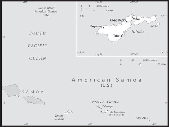
INTRODUCTION
Background: Tutuila was settled by 1000 B.C. and the island served as a refuge for exiled chiefs and defeated warriors from the other Samoan islands. The Manu’a Islands developed its own traditional chiefdom that maintained its autonomy by controlling oceanic trade. In 1722, Dutch explorer Jacob ROGGEVEEN was the first European to sail through the Manu’a Islands, and he was followed by French explorer Louis Antoine DE BOUGAINVILLE in 1768. Whalers and missionaries arrived in American Samoa in the 1830s, but American and European traders tended to favor the port in Apia - now in independent Samoa - over the smaller and less-developed Pago Pago on Tutuila. In the mid-1800s, a dispute arose in Samoa over control of the Samoan archipelago, with different chiefs gaining support from Germany, the UK, and the US. In 1872, the high chief of Tutuila offered the US exclusive rights to Pago Pago in return for US protection, but the US rejected this offer. As fighting resumed, the US agreed to the chief’s request in 1878 and set up a coaling station at Pago Pago. In 1899, with continued disputes over succession, Germany and the US agreed to divide the Samoan islands, while the UK withdrew its claims in exchange for parts of the Solomon Islands. Local chiefs on Tutuila formally ceded their land to the US in 1900, followed by the chief of Manu’a in 1904. The territory was officially named “American Samoa” in 1911.
The US administered the territory through the Department of the Navy. In 1949, there was an attempt to organize the territory, granting it formal self-government, but local chiefs helped defeat the measure in the US Congress. Administration was transferred to the Department of the Interior in 1951, and in 1967, American Samoa adopted a constitution that provides significant protections for traditional Samoan land tenure rules, language, and culture. In 1977, after four attempts, voters approved a measure to directly elect their governor. Nevertheless, American Samoa officially remains an unorganized territory and people born in American Samoa are US nationals instead of US citizens, a status many American Samoans prefer.
GEOGRAPHY
Location: Oceania, group of islands in the South Pacific Ocean, about halfway between Hawaii and New Zealand
Geographic coordinates: 14 20 S, 170 00 W
Map references: Oceania
Area: total: 224 sq km
land: 224 sq km
water: 0 sq km
note: includes Rose Atoll and Swains Island
comparison ranking: total 215
Area - comparative: slightly larger than Washington, DC
Land boundaries: total: 0 km
Coastline: 116 km
Maritime claims: territorial sea: 12 nm
exclusive economic zone: 200 nm
Climate: tropical marine, moderated by southeast trade winds; annual rainfall averages about 3 m; rainy season (November to April), dry season (May to October); little seasonal temperature variation
Terrain: five volcanic islands with rugged peaks and limited coastal plains, two coral atolls (Rose Atoll, Swains Island)
Elevation: highest point: Lata Mountain 964 m
lowest point: Pacific Ocean 0 m
Natural resources: pumice, pumicite
Land use: agricultural land: 24.5% (2018 est.)
arable land: 15% (2018 est.)
permanent crops: 9.5% (2018 est.)
permanent pasture: 0% (2018 est.)
forest: 75.5% (2018 est.)
other: 0% (2018 est.)
Irrigated land: 0 sq km (2022)
Natural hazards: cyclones common from December to March
volcanism: limited volcanic activity on the Ofu and Olosega Islands; neither has erupted since the 19th century
Geography - note: Pago Pago has one of the best natural deepwater harbors in the South Pacific Ocean, sheltered by shape from rough seas and protected by peripheral mountains from high winds; strategic location in the South Pacific Ocean
PEOPLE AND SOCIETY
Population: 44,620 (2023 est.)
comparison ranking: 211
Nationality: noun: American Samoan(s) (US nationals)
adjective: American Samoan
Ethnic groups: Pacific Islander 88.7% (includes Samoan 83.2%, Tongan 2.2%, other 3.3%), Asian 5.8% (includes Filipino 3.4%, other 2.4%), mixed 4.4%, other 1.1% (2020 est.)
note: data represent population by ethnic origin or race
Languages: Samoan 87.9% (closely related to Hawaiian and other Polynesian languages), English 3.3%, Tongan 2.1%, other Pacific Islander 4.1%, Asian languages 2.1%, other 0.5% (2010 est.)
note: most people are bilingual
Religions: Christian 98.3%, other <1%, unaffiliated <1% (2020 est.)
Age structure: 0-14 years: 25.91% (male 5,963/female 5,600)
15-64 years: 65.89% (male 14,512/female 14,888)
65 years and over: 8.2% (2023 est.) (male 1,707/female 1,950)
Dependency ratios: total dependency ratio: 52.3
youth dependency ratio: 41.9
elderly dependency ratio: 10.4
potential support ratio: 9.6 (2021)
Median age: total: 27.2 years (2020)
male: 26.7 years
female: 27.7 years
comparison ranking: total 149
Population growth rate: -1.74% (2023 est.)
comparison ranking: 235
Birth rate: 16.18 births/1,000 population (2023 est.)
comparison ranking: 98
Death rate: 6.19 deaths/1,000 population (2023 est.)
comparison ranking: 148
Net migration rate: -27.36 migrant(s)/1,000 population (2023 est.)
comparison ranking: 231
Urbanization: urban population: 87.2% of total population (2023)
rate of urbanization: 0.26% annual rate of change (2020-25 est.)
Major urban areas - population: 49,000 PAGO PAGO (capital) (2018)
Sex ratio: at birth: 1.06 male(s)/female
0-14 years: 1.06 male(s)/female
15-64 years: 0.97 male(s)/female
65 years and over: 0.88 male(s)/female
total population: 0.99 male(s)/female (2023 est.)
Infant mortality rate: total: 9.87 deaths/1,000 live births (2023 est.)
male: 11.9 deaths/1,000 live births
female: 7.72 deaths/1,000 live births
comparison ranking: total 137
Life expectancy at birth: total population: 75.58 years (2023 est.)
male: 73.1 years
female: 78.22 years
comparison ranking: total population 124
Total fertility rate: 2.13 children born/woman (2023 est.)
comparison ranking: 91
Gross reproduction rate: 1.04 (2023 est.)
Contraceptive prevalence rate: NA
Drinking water source: improved:
total: 99.8% of population
unimproved: total: 0.2% of population (2020 est.)
Sanitation facility access: improved:
total: 99% of population
unimproved: total: 1% of population (2020 est.)
Currently married women (ages 15-49): 53.5% (2023 est.)
ENVIRONMENT
Environment - current issues: limited supply of drinking water; pollution; waste disposal; coastal and stream alteration; soil erosion
Climate: tropical marine, moderated by southeast trade winds; annual rainfall averages about 3 m; rainy season (November to April), dry season (May to October); little seasonal temperature variation
Land use: agricultural land: 24.5% (2018 est.)
arable land: 15% (2018 est.)
permanent crops: 9.5% (2018 est.)
permanent pasture: 0% (2018 est.)
forest: 75.5% (2018 est.)
other: 0% (2018 est.)
Urbanization: urban population: 87.2% of total population (2023)
rate of urbanization: 0.26% annual rate of change (2020-25 est.)
Revenue from forest resources: 0% of GDP (2018 est.)
comparison ranking: 167
Revenue from coal: 0% of GDP (2018 est.)
comparison ranking: 83
Waste and recycling: municipal solid waste generated annually: 18,989 tons (2016 est.)
GOVERNMENT
Country name: conventional long form: American Samoa
conventional short form: American Samoa
former: Eastern Samoa
abbreviation: AS
etymology: the meaning of Samoa is disputed; some modern explanations are that the “sa” connotes “sacred” and “moa” indicates “center,” so the name can mean “Holy Center”; alternatively, some assertions state that it can mean “place of the sacred moa bird” of Polynesian mythology; the name, however, may go back to Proto-Polynesian (PPn) times (before 1000 B.C.); a plausible PPn reconstruction has the first syllable as “sa’a” meaning “tribe or people” and “moa” meaning “deep sea or ocean” to convey the meaning “people of the deep sea”
Government type: unincorporated, unorganized Territory of the US with local self-government; republican form of territorial government with separate executive, legislative, and judicial branches
Dependency status: unincorporated, unorganized Territory of the US; administered by the Office of Insular Affairs, US Department of the Interior
Capital: name: Pago Pago
geographic coordinates: 14 16 S, 170 42 W
time difference: UTC-11 (6 hours behind Washington, DC, during Standard Time)
note: pronounced pahn-go pahn-go
Administrative divisions: none (territory of the US); there are no first-order administrative divisions as defined by the US Government, but there are 3 districts and 2 islands* at the second order; Eastern, Manu’a, Rose Island*, Swains Island*, Western
Independence: none (territory of the US)
National holiday: Flag Day, 17 April (1900)
Constitution: history: adopted 17 October 1960; revised 1 July 1967
amendments: proposed by either house of the Legislative Assembly; passage requires three-fifths majority vote by the membership of each house, approval by simple majority vote in a referendum, approval by the US Secretary of the Interior, and only by an act of the US Congress; amended several times, last in 2021
Legal system: mixed legal system of US common law and customary law
Citizenship: see United States
Note: in accordance with US Code Title 8, Section 1408, persons born in American Samoa are US nationals but not US citizens
Suffrage: 18 years of age; universal
Executive branch: chief of state: President Joseph R. BIDEN Jr. (since 20 January 2021); Vice President Kamala D. HARRIS (since 20 January 2021)
head of government: Governor Lemanu Peleti MAUGA (since 3 January 2021)
cabinet: Cabinet consists of 12 department directors appointed by the governor with the consent of the Legislature or Fono
elections/appointments: president and vice president indirectly elected on the same ballot by an Electoral College of ‘electors’ chosen from each state to serve a 4-year term (eligible for a second term); under the US Constitution, residents of unincorporated territories, such as American Samoa, do not vote in elections for US president and vice president; however, they may vote in Democratic and Republican presidential primary elections; governor and lieutenant governor directly elected on the same ballot by absolute majority popular vote in 2 rounds if needed for a 4-year term (eligible for a second term); election last held on 3 November 2020 (next to be held in November 2024)
election results: Lemanu Peleti MAUGA elected governor in first round; percent of vote - Lemanu Peleti MAUGA (independent) 60.3%, Gaoteote Palaie TOFAU (independent) 21.9%, I’aulualo Fa’afetai TALIA (independent) 12.3%
Legislative branch: description: bicameral Legislature or Fono consists of:
Senate (18 seats; members indirectly selected by regional governing councils to serve 4-year terms)
House of Representatives (21 seats; 20 members in single- and multi-seat constituencies directly elected by simple majority popular vote and 1 decided by public meeting on Swains Island; members serve 2-year terms)
elections: Senate - last held on 3 November 2020 (next to be held in November 2024)
House of Representatives - last held on 3 November 2020 (next to be held in November 2024)
election results: Senate - percent of vote by party - NA; seats by party - independent 18; composition - men 17, women 1; percent of women 5.6%
House of Representatives - percent of vote by party - NA; seats by party - NA; composition - men 20, women 1; percent of women 4.8%; note total Legislature percent of women 5.1%
note: American Samoa elects 1 member by simple majority popular vote to serve a 2-year term as a delegate to the US House of Representatives; the delegate can vote when serving on a committee and when the House meets as the Committee of the Whole House, but not when legislation is submitted for a “full floor” House vote; election of delegate last held on 3 November 2020 (next to be held in November 2022); Amata Coleman RADEWAGEN elected delegate; Amata Coleman RADEWAGEN (Republican Party) 83.5%, Oreta CHRICHTON (Democratic Party) 14.4%, Meleagi SUITONU-CHAPMAN (Democratic Party) 2.1%
Judicial branch: highest court(s): High Court of American Samoa (consists of the chief justice, associate chief justice, and 6 Samoan associate judges and organized into trial, family, drug, and appellate divisions); note - American Samoa has no US federal courts
judge selection and term of office: chief justice and associate chief justice appointed by the US Secretary of the Interior to serve for life; Samoan associate judges appointed by the governor to serve for life
subordinate courts: district and village courts
Political parties and leaders: Democratic Party [T’ia REID, chairman]
Republican Party [Taulapapa William SWORD, chairman]
International organization participation: AOSIS (observer), Interpol (subbureau), IOC, PIF (observer), SPC
Diplomatic representation in the US: none (territory of the US)
Diplomatic representation from the US: embassy: none (territory of the US)
Flag description: a large white triangle edged in red that is based on the fly side and extends to the hoist side and is charged with an eagle, all on a blue field; the red, white, and blue colors are those traditionally used by both the United States and Samoa; the brown and white American bald eagle flies toward the hoist side and carries 2 traditional Samoan symbols of authority, a war club known as a “fa’alaufa’i” (upper; left talon), and a coconut-fiber fly whisk known as a “fue” (lower; right talon); the combination of symbols broadly mimics that seen on the US Great Seal and reflects the relationship between the US and American Samoa
National symbol(s): a fue (coconut fiber fly whisk; representing wisdom) crossed with a to’oto’o (staff; representing authority); national colors: red, white, blue
National anthem: name: “Amerika Samoa” (American Samoa)
lyrics/music: Mariota Tiumalu TUIASOSOPO/Napoleon Andrew TUITELELEAPAGA
note: local anthem adopted 1950; as a territory of the United States, “The Star-Spangled Banner” is official (see United States)
ECONOMY
Economic overview: tourism, tuna, and government services-based territorial economy; sustained economic decline; vulnerable tuna canning industry; large territorial government presence; minimum wage increases to rise to federal standards by 2036
Real GDP (purchasing power parity): $658 million (2016 est.)
$674.9 million (2015 est.)
$666.9 billion (2014 est.)
note: data are in 2016 US dollars
comparison ranking: 211
Real GDP growth rate: -1.87% (2021 est.)
5.07% (2020 est.)
-0.49% (2019 est.)
comparison ranking: 204
Real GDP per capita: $11,200 (2016 est.)
$11,300 (2015 est.)
$11,200 (2014 est.)
comparison ranking: 135
GDP (official exchange rate): $658 million (2016 est.)
Inflation rate (consumer prices): -0.5% (2015 est.)
1.4% (2014 est.)
comparison ranking: 221
GDP - composition, by sector of origin: agriculture: 27.4% (2012)
industry: 12.4% (2012)
services: 60.2% (2012)
comparison rankings: services 125; industry 199; agriculture 23
GDP - composition, by end use: household consumption: 66.4% (2016 est.)
government consumption: 49.7% (2016 est.)
investment in fixed capital: 7.3% (2016 est.)
investment in inventories: 5.1% (2016 est.)
exports of goods and services: 65% (2016 est.)
imports of goods and services: -93.5% (2016 est.)
Agricultural products: bananas, coconuts, vegetables, taro, breadfruit, yams, copra, pineapples, papayas; dairy products, livestock
Industries: tuna canneries (largely supplied by foreign fishing vessels), handicrafts
Industrial production growth rate: NA
Labor force: 17,850 (2015 est.)
comparison ranking: 213
Labor force - by occupation: agriculture: NA
industry: 15.5%
services: 46.4% (2015 est.)
Unemployment rate: 29.8% (2005)
comparison ranking: 5
Budget: revenues: $249 million (2016 est.)
expenditures: $262.5 million (2016 est.)
Budget surplus (+) or deficit (-): -2.1% (of GDP) (2016 est.)
comparison ranking: 106
Public debt: 12.2% of GDP (2016 est.)
comparison ranking: 197
Taxes and other revenues: 37.8% (of GDP) (2016 est.)
comparison ranking: 16
Fiscal year: 1 October - 30 September
Exports: $428 million (2016 est.)
$427 million (2015 est.)
note: Data are in current year dollars and do not include illicit exports or re-exports.
comparison ranking: 190
Exports - partners: Australia 25%, Ghana 19%, Indonesia 15.6%, Burma 10.4%, Portugal 5.1% (2017)
Exports - commodities: refined petroleum, animal meal, vaccines and cultures, ethylene polymers, vulcanized rubber (2021)
Imports: $615 million (2016 est.)
$657 million (2015 est.)
comparison ranking: 198
Imports - partners: Fiji 10.7%, Singapore 10.4%, NZ 10.4%, South Korea 9.3%, Samoa 8.2%, Kenya 6.4%, Australia 5.2% (2017)
Imports - commodities: raw materials for canneries, food, petroleum products, machinery and parts
Debt - external: NA
Exchange rates: the US dollar is used
ENERGY
Electricity access: electrification - total population: 59% (2020)
electrification - urban areas: 60% (2020)
electrification - rural areas: 45% (2020)
Electricity: installed generating capacity: 47,000 kW (2020 est.)
consumption: 151 million kWh (2019 est.)
exports: 0 kWh (2020 est.)
imports: 0 kWh (2020 est.)
transmission/distribution losses: 12 million kWh (2019 est.)
comparison rankings: imports 202; exports 202; installed generating capacity 193; transmission/distribution losses 192; consumption 189
Electricity generation sources: fossil fuels: 100% of total installed capacity (2020 est.)
Petroleum: total petroleum production: 0 bbl/day (2021 est.)
refined petroleum consumption: 2,300 bbl/day (2019 est.)
crude oil and lease condensate exports: 0 bbl/day (2018 est.)
crude oil and lease condensate imports: 0 bbl/day (2018 est.)
crude oil estimated reserves: 0 barrels (2021 est.)
Refined petroleum products - production: 0 bbl/day (2015 est.)
comparison ranking: 194
Refined petroleum products - exports: 0 bbl/day (2015 est.)
comparison ranking: 153
Refined petroleum products - imports: 2,346 bbl/day (2015 est.)
comparison ranking: 188
Carbon dioxide emissions: 355,000 metric tonnes of CO2 (2019 est.)
from petroleum and other liquids: 355,000 metric tonnes of CO2 (2019 est.)
Energy consumption per capita: 88.796 million Btu/person (2019 est.)
comparison ranking: 65
COMMUNICATIONS
Telephones - fixed lines: total subscriptions: 10,000 (2021 est.)
subscriptions per 100 inhabitants: 22 (2021 est.)
comparison ranking: total subscriptions 191
Telephones - mobile cellular: total subscriptions: 2,250 (2009 est.)
subscriptions per 100 inhabitants: 4 (2009 est.)
comparison ranking: total subscriptions 224
Telecommunication systems: general assessment: American Samoa Telecommunications Authority, ASTCA, supplies telecommunication services to the residents of the American Samoan islands, a territory of the United States, which are found in a remote area of the Pacific Ocean; the primary system between the islands consists of fiber-optic cables and satellite connections; over Independence Day weekend 2021, the undersea fiber-optic cable linking the Tutuila and Manu’a Islands failed, completely stranding the Manu’a Islands from all telecommunication services; telecommunication services were restored to the people of Manu’a islands through microwave link between Tutuila to the Manu’a Islands; the link is now providing a steady 1 Gbps backhaul most of the time of the year with 600Mbps at four 9’s availability, over this extremely long distance (2022)
domestic: nearly 22 per 100 fixed-line teledensity (2020)
international: country code - 1-684; landing points for the ASH, Southern Cross NEXT and Hawaiki providing connectivity to New Zealand, Australia, American Samoa, Hawaii, California, and SAS connecting American Samoa with Samoa; satellite earth station - 1 (Intelsat-Pacific Ocean) (2019)
Broadcast media: 3 TV stations; multi-channel pay TV services are available; about a dozen radio stations, some of which are repeater stations
Internet country code: .as
Internet users: total: 18,135 (2021 est.)
percent of population: 40.3% (2021 est.)
comparison ranking: total 213
TRANSPORTATION
Airports: 3 (2021)
comparison ranking: total 196
Airports - with paved runways: 3
note: paved runways have a concrete or asphalt surface but not all have facilities for refueling, maintenance, or air traffic control; the length of a runway required for aircraft to safely operate depends on a number of factors including the type of aircraft, the takeoff weight (including passengers, cargo, and fuel), engine types, flap settings, landing speed, elevation of the airport, and average maximum daily air temperature; paved runways can reach a length of 5,000 m (16,000 ft.), but the “typical” length of a commercial airline runway is between 2,500-4,000 m (8,000-13,000 ft.)
Roadways: total: 241 km (2016)
comparison ranking: total 205
Ports and terminals: major seaport(s): Pago Pago
MILITARY AND SECURITY
Military - note: defense is the responsibility of the US
TRANSNATIONAL ISSUES
Disputes - international: none identified
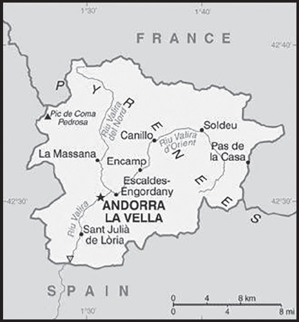
INTRODUCTION
Background: The Moorish invasion of Spain in the 8th century and subsequent incursions into France were finally stemmed at the Pyrenees by Frankish King Charlemagne, who in 795 created the Hispanic March, a series of buffer states to keep the Muslim Moors from advancing into Christian France. The landlocked Principality of Andorra, one of the smallest states in Europe and nestled high in the Pyrenees between the French and Spanish borders, is the last independent survivor of these March states. For 715 years, from 1278 to 1993, Andorrans lived under a unique coprincipality, ruled by French and Spanish leaders (from 1607 onward, the French chief of state and the Bishop of Urgell). In 1993, this feudal system was modified with the introduction of a modern constitution; the co-princes remained as titular heads of state, but the government transformed into a parliamentary democracy.
Andorra has become a popular tourist destination visited by approximately 8 million people each year drawn by the winter sports, summer climate, and duty-free shopping. Andorra has also become a wealthy international commercial center because of its mature banking sector and low taxes. As part of its effort to modernize its economy, Andorra has opened to foreign investment, and engaged in other reforms, such as advancing tax initiatives aimed at supporting a broader infrastructure. Although not a member of the EU, Andorra enjoys a special relationship with the bloc that is governed by various customs and cooperation agreements and uses the euro as its national currency.
GEOGRAPHY
Location: Southwestern Europe, Pyrenees mountains, on the border between France and Spain
Geographic coordinates: 42 30 N, 1 30 E
Map references: Europe
Area: total: 468 sq km
land: 468 sq km
water: 0 sq km
comparison ranking: total 195
Area - comparative: 2.5 times the size of Washington, DC
Land boundaries: total: 118 km
border countries (2): France 55 km; Spain 63 km
Coastline: 0 km (landlocked)
Maritime claims: none (landlocked)
Climate: temperate; snowy, cold winters and warm, dry summers
Terrain: rugged mountains dissected by narrow valleys
Elevation: highest point: Pic de Coma Pedrosa 2,946 m
lowest point: Riu Runer 840 m
mean elevation: 1,996 m
Natural resources: hydropower, mineral water, timber, iron ore, lead
Land use: agricultural land: 40% (2018 est.)
arable land: 1.7% (2018 est.)
permanent crops: 0% (2018 est.)
permanent pasture: 38.3% (2018 est.)
forest: 34% (2018 est.)
other: 26% (2018 est.)
Irrigated land: 0 sq km (2022)
Population distribution: population is unevenly distributed and is concentrated in the seven urbanized valleys that make up the country’s parishes (political administrative divisions)
Natural hazards: avalanches
Geography - note: landlocked; straddles a number of important crossroads in the Pyrenees
PEOPLE AND SOCIETY
Population: 85,468 (2023 est.)
comparison ranking: 199
Nationality: noun: Andorran(s)
adjective: Andorran
Ethnic groups: Andorran 48.3%, Spanish 24.8%, Portuguese 11.2%, French 4.5%, Argentine 1.4%, other 9.8% (2021 est.)
note: data represent population by nationality
Languages: Catalan (official) 35.7%, Castilian 43.2%, Portuguese 17.1%, French 8.9%, English 1.8%, other 5% (2018 est.)
note: data represent mother tongue
Religions: Christian (predominantly Roman Catholic) 89.5, other 8.8%, unaffiliated 1.7% (2020 est.)
Age structure: 0-14 years: 12.31% (male 5,426/female 5,096)
15-64 years: 68.17% (male 29,845/female 28,419)
65 years and over: 19.52% (2023 est.) (male 8,471/female 8,211)
Dependency ratios: total dependency ratio: 38.1
youth dependency ratio: 18.1
elderly dependency ratio: 20.1
potential support ratio: 5 (2021)
Median age: total: 46.2 years (2020)
male: 46.3 years
female: 46.1 years
comparison ranking: total 6
Population growth rate: -0.11% (2023 est.)
comparison ranking: 203
Birth rate: 6.87 births/1,000 population (2023 est.)
comparison ranking: 226
Death rate: 7.98 deaths/1,000 population (2023 est.)
comparison ranking: 89
Net migration rate: 0 migrant(s)/1,000 population (2023 est.)
comparison ranking: 83
Population distribution: population is unevenly distributed and is concentrated in the seven urbanized valleys that make up the country’s parishes (political administrative divisions)
Urbanization: urban population: 87.8% of total population (2023)
rate of urbanization: 0.11% annual rate of change (2020-25 est.)
Major urban areas - population: 23,000 ANDORRA LA VELLA (capital) (2018)
Sex ratio: at birth: 1.07 male(s)/female
0-14 years: 1.06 male(s)/female
15-64 years: 1.05 male(s)/female
65 years and over: 1.03 male(s)/female
total population: 1.05 male(s)/female (2023 est.)
Mother’s mean age at first birth: 32.8 years (2019)
Infant mortality rate: total: 3.39 deaths/1,000 live births (2023 est.)
male: 3.49 deaths/1,000 live births
female: 3.27 deaths/1,000 live births
comparison ranking: total 199
Life expectancy at birth: total population: 83.61 years (2023 est.)
male: 81.4 years
female: 85.97 years
comparison ranking: total population 9
Total fertility rate: 1.46 children born/woman (2023 est.)
comparison ranking: 210
Gross reproduction rate: 0.7 (2023 est.)
Drinking water source: improved: total: 100% of population
unimproved: total: 0% of population (2020 est.)
Current health expenditure: 9.1% of GDP (2020)
Physicians density: 3.63 physicians/1,000 population (2015)
Hospital bed density: 2.5 beds/1,000 population
Sanitation facility access: improved: urban:
total: 100% of population
unimproved: total: 0% of population (2020 est.)
Obesity - adult prevalence rate: 25.6% (2016)
comparison ranking: 50
Alcohol consumption per capita: total: 10.99 liters of pure alcohol (2019 est.)
beer: 3.59 liters of pure alcohol (2019 est.)
wine: 4.98 liters of pure alcohol (2019 est.)
spirits: 2.32 liters of pure alcohol (2019 est.)
other alcohols: 0 liters of pure alcohol (2019 est.)
comparison ranking: total 12
Tobacco use: total: 31.8% (2020 est.)
male: 35.3% (2020 est.)
female: 28.3% (2020 est.)
comparison ranking: total 23
Education expenditures: 2.9% of GDP (2021 est.)
comparison ranking: 163
Literacy: definition: age 15 and over can read and write
total population: 100%
ENVIRONMENT
Environment - current issues: deforestation; overgrazing of mountain meadows contributes to soil erosion; air pollution; wastewater treatment and solid waste disposal
Environment - international agreements: party to: Biodiversity, Climate Change, Climate Change-Paris Agreement, Comprehensive Nuclear Test Ban, Desertification, Hazardous Wastes, Ozone Layer Protection, Wetlands
signed, but not ratified: none of the selected agreements
Climate: temperate; snowy, cold winters and warm, dry summers
Land use: agricultural land: 40% (2018 est.)
arable land: 1.7% (2018 est.)
permanent crops: 0% (2018 est.)
permanent pasture: 38.3% (2018 est.)
forest: 34% (2018 est.)
other: 26% (2018 est.)
Urbanization: urban population: 87.8% of total population (2023)
rate of urbanization: 0.11% annual rate of change (2020-25 est.)
Revenue from forest resources: 0% of GDP (2018 est.)
comparison ranking: 191
Air pollutants: particulate matter emissions: 8.52 micrograms per cubic meter (2019 est.)
carbon dioxide emissions: 0.47 megatons (2016 est.)
methane emissions: 0.05 megatons (2020 est.)
Waste and recycling: municipal solid waste generated annually: 43,000 tons (2012 est.)
Total renewable water resources: 320 million cubic meters (2020 est.)
GOVERNMENT
Country name: conventional long form: Principality of Andorra
conventional short form: Andorra
local long form: Principat d’Andorra
local short form: Andorra
etymology: the origin of the country’s name is obscure; the name may derive from the Arabic “ad-darra” meaning “the forest,” a reference to its location as part of the Spanish March (defensive buffer zone) against the invading Moors in the 8th century; an alternate explanation is that the name originates from a Navarrese word “andurrial” meaning “shrub-covered land”
Government type: parliamentary democracy (since March 1993) that retains its chiefs of state in the form of a co-principality; the two princes are the President of France and Bishop of Seu d’Urgell, Spain
Capital: name: Andorra la Vella
geographic coordinates: 42 30 N, 1 31 E
time difference: UTC+1 (6 hours ahead of Washington, DC during Standard Time)
daylight saving time: +1hr, begins last Sunday in March; ends last Sunday in October
etymology: translates as “Andorra the Old” in Catalan
Administrative divisions: 7 parishes (parroquies, singular - parroquia); Andorra la Vella, Canillo, Encamp, Escaldes-Engordany, La Massana, Ordino, Sant Julia de Loria
Independence: 1278 (formed under the joint sovereignty of the French Count of Foix and the Spanish Bishop of Urgell)
National holiday: Our Lady of Meritxell Day, 8 September (1278)
Constitution: history: drafted 1991, approved by referendum 14 March 1993, effective 28 April 1993
amendments: proposed by the coprinces jointly or by the General Council; passage requires at least a two-thirds majority vote by the General Council, ratification in a referendum, and sanctioning by the coprinces
Legal system: mixed legal system of civil and customary law with the influence of canon (religious) law
International law organization participation: has not submitted an ICJ jurisdiction declaration; accepts ICCt jurisdiction
Citizenship: citizenship by birth: no
citizenship by descent only: the mother must be an Andorran citizen or the father must have been born in Andorra and both parents maintain permanent residence in Andorra
dual citizenship recognized: no
residency requirement for naturalization: 25 years
Suffrage: 18 years of age; universal
Executive branch: chief of state: Co-prince Emmanuel MACRON (since 14 May 2017); represented by Patrick STROZDA (since 14 May 2017); and Co-prince Archbishop Joan-Enric VIVES i Sicilia (since 12 May 2003); represented by Josep Maria MAURI (since 20 July 2012)
head of government: Xavier Espot ZAMORA (since 16 May 2019)
cabinet: Executive Council of 12 ministers designated by the head of government
elections/appointments: head of government indirectly elected by the General Council (Andorran parliament), formally appointed by the co-princes for a 4-year term; election last held on 2 April 2023 (next to be held in April 2027); the leader of the majority party in the General Council is usually elected head of government
election results: 2023: Xaviar Espot ZAMORA (DA) re-elected head of government; percent of General Council vote - 57.1%
2019: Xaviar Espot ZAMORA (DA) elected head of government; percent of General Council vote - 60.7
Legislative branch: description: unicameral General Council of the Valleys or Consell General de les Valls (a minimum of 28 seats; 14 members directly elected in two-seat constituencies (7 parishes) by simple majority vote and 14 directly elected in a single national constituency by proportional representation vote; members serve 4-year terms); note - voters cast two separate ballots - one for national and one for their parish
elections: last held on 2 April 2023 (next to be held in April 2027)
election results: percent of vote by party - DA 57.1%, Concord 17.8%, Forward 10.7%, SDP 10.7%, L’A 3.6%; seats by party - DA 16, Concord 5, Forward 3, SDP 3, L’A 1; composition as of August 2023 - men 14, women 14, percent of women 50%
Judicial branch: highest court(s): Supreme Court of Justice of Andorra or Tribunal Superior de la Justicia d’Andorra (consists of the court president and 8 judges organized into civil, criminal, and administrative chambers); Constitutional Court or Tribunal Constitucional (consists of 4 magistrates)
judge selection and term of office: Supreme Court president and judges appointed by the Supreme Council of Justice, a 5-member judicial policy and administrative body appointed 1 each by the coprinces, 1 by the General Council, 1 by the executive council president, and 1 by the courts; judges serve 6-year renewable terms; Constitutional magistrates - 2 appointed by the coprinces and 2 by the General Council; magistrates’ appointments limited to 2 consecutive 8-year terms
subordinate courts: Tribunal of Judges or Tribunal de Batlles; Tribunal of the Courts or Tribunal de Corts
Political parties and leaders: Concord [Cerni ESCALE Cabre]
Democrats for Andorra or DA [Xaviar ESPOT ZAMORA]
Forward Andorra [Carine Montaner RAYNAUD]
Liberals of Andorra or L’A [Joseph Maria CABANES]
Social Democracy and Progress or SDP [Pere Lopez AGRAS]
note: Andorra has several smaller parties at the parish level (one is Lauredian Union)
International organization participation: CE, FAO, ICAO, ICC (NGOs), ICCt, ICRM, IFRCS, Interpol, IOC, IPU, ITU, OIF, OPCW, OSCE, UN, UNCTAD, UNESCO, Union Latina, UNWTO, WCO, WHO, WIPO, WTO (observer)
Diplomatic representation in the US: chief of mission: Ambassador Elisenda VIVES BALMANA (since 2 March 2016)
chancery: 2 United Nations Plaza, 27th Floor, New York, NY 10017
telephone: [1] (212) 750-8064
FAX: [1] (212) 750-6630
email address and website: contact@andorraun.org
https://www.exteriors.ad/en/embassies-of-andorra/andorra-usa-embassy
Diplomatic representation from the US: embassy: the US does not have an embassy in Andorra; the US ambassador to Spain is accredited to Andorra; US interests in Andorra are represented by the US Consulate General’s office in Barcelona (Spain); mailing address: Paseo Reina Elisenda de Montcada, 23, 08034 Barcelona, Espana; telephone: [34] (93) 280-22-27; FAX: [34] (93) 280-61-75; email address: Barcelonaacs@state.gov
Flag description: three vertical bands of blue (hoist side), yellow, and red, with the national coat of arms centered in the yellow band; the latter band is slightly wider than the other 2 so that the ratio of band widths is 8:9:8; the coat of arms features a quartered shield with the emblems of (starting in the upper left and proceeding clockwise): Urgell, Foix, Bearn, and Catalonia; the motto reads VIRTUS UNITA FORTIOR (Strength United is Stronger); the flag combines the blue and red French colors with the red and yellow of Spain to show Franco-Spanish protection
note: similar to the flags of Chad and Romania, which do not have a national coat of arms in the center, and the flag of Moldova, which does bear a national emblem
National symbol(s): red cow (breed unspecified); national colors: blue, yellow, red
National anthem: name: “El Gran Carlemany” (The Great Charlemagne)
lyrics/music: Joan BENLLOCH i VIVO/Enric MARFANY BONS
note: adopted 1921; the anthem provides a brief history of Andorra in a first person narrative
National heritage: total World Heritage Sites: 1 (cultural)
selected World Heritage Site locales: Madriu-Perafita-Claror Valley
ECONOMY
Economic overview: high GDP; low unemployment; non-EU Euro user; co-principality duty-free area between Spain and France; tourist hub but hit hard by COVID-19; modern, non-tax haven financial sector; looking for big tech investments; new member of SEPA and IMF
Real GDP (purchasing power parity): $3.327 billion (2015 est.)
$3.363 billion (2014 est.)
$3.273 billion (2013 est.)
note: data are in 2012 US dollars
comparison ranking: 190
Real GDP growth rate: 8.95% (2021 est.)
-11.18% (2020 est.)
2.02% (2019 est.)
comparison ranking: 32
Real GDP per capita: $49,900 (2015 est.)
$51,300 (2014 est.)
$50,300 (2013 est.)
comparison ranking: 29
GDP (official exchange rate): $2.712 billion (2016 est.)
Inflation rate (consumer prices): -0.9% (2015 est.)
-0.1% (2014 est.)
comparison ranking: 225
Credit ratings: Fitch rating: A- (2022)
Moody’s rating: Baa2 (2022)
Standard & Poors rating: BBB+ (2023)
note: The year refers to the year in which the current credit rating was first obtained.
GDP - composition, by sector of origin: agriculture: 11.9% (2015 est.)
industry: 33.6% (2015 est.)
services: 54.5% (2015 est.)
comparison rankings: services 159; industry 52; agriculture 80
Agricultural products: small quantities of rye, wheat, barley, oats, vegetables, tobacco, sheep, cattle
Industries: tourism (particularly skiing), banking, timber, furniture
Industrial production growth rate: -3.9% (2020 est.) NA
comparison ranking: 184
Labor force: 39,750 (2016)
comparison ranking: 197
Labor force - by occupation: agriculture: 0.5%
industry: 4.4%
services: 95.1% (2015)
Unemployment rate: 3.7% (2016 est.)
4.1% (2015 est.)
comparison ranking: 183
Budget: revenues: $1.872 billion (2016)
expenditures: $2.06 billion (2016)
Budget surplus (+) or deficit (-): -6.9% (of GDP) (2016)
comparison ranking: 192
Public debt: 41% of GDP (2014 est.)
41.4% of GDP (2013 est.)
comparison ranking: 133
Taxes and other revenues: 69% (of GDP) (2016)
comparison ranking: 3
Fiscal year: calendar year
Current account balance: $448.869 million (2020 est.)
$568.257 million (2019 est.)
comparison ranking: 58
Exports: $1.842 billion (2020 est.)
$2.335 billion (2019 est.)
note: Data are in current year dollars and do not include illicit exports or re-exports.
comparison ranking: 162
Exports - partners: Spain 40%, France 19%, United States 11%, Mauritania 5% (2019)
Exports - commodities: integrated circuits, dental fitting supplies, cars, gold, essential oils (2021)
Imports: $1.727 billion (2020 est.)
$2.032 billion (2019 est.)
comparison ranking: 178
Imports - partners: Spain 71%, France 17% (2019)
Imports - commodities: cars, refined petroleum, perfumes, shaving products, liquors (2019)
Debt - external: $0 (2016)
comparison ranking: 205
Exchange rates: euros (EUR) per US dollar -
Exchange rates: 0.845 (2021 est.)
0.885 (2017 est.)
0.903 (2016 est.)
note: while not an EU member state, Andorra has a 2011 monetary agreement with the EU to produce limited euro coinage—but not banknotes—that began enforcement in April 2012
ENERGY
Electricity access: electrification - total population: 100% (2021)
Refined petroleum products - production: 0 bbl/day (2016)
comparison ranking: 115
COMMUNICATIONS
Telephones - fixed lines: total subscriptions: 50,000 (2021 est.)
subscriptions per 100 inhabitants: 63 (2021 est.)
comparison ranking: total subscriptions 156
Telephones - mobile cellular: total subscriptions: 89,000 (2021 est.)
subscriptions per 100 inhabitants: 110 (2021 est.)
comparison ranking: total subscriptions 194
Telecommunication systems: general assessment: Andorra has a modern telecommunications system with microwave radio relay connections between the exchanges and land line circuits to France and Spain (2020)
domestic: about 63 per 100 fixed-line, 110 per 100 mobile-cellular (2021)
international: country code - 376; landline circuits to France and Spain; modern system with microwave radio relay connections between exchanges (2019)
Broadcast media: 1 public TV station and 2 public radio stations; about 10 commercial radio stations; good reception of radio and TV broadcasts from stations in France and Spain; upgraded to terrestrial digital TV broadcasting in 2007; roughly 25 international TV channels available (2019)
Internet country code: .ad
Internet users: total: 74,260 (2021 est.)
percent of population: 94% (2021 est.)
comparison ranking: total 193
Broadband - fixed subscriptions: total: 37,000 (2020 est.)
subscriptions per 100 inhabitants: 48 (2020 est.)
comparison ranking: total 146
TRANSPORTATION
Civil aircraft registration country code prefix: C3
Roadways: total: 320 km (2019)
comparison ranking: total 201
MILITARY AND SECURITY
Military and security forces: no regular military forces; Police Corps of Andorra (under the Ministry of Justice and Interior)
Military - note: defense is the responsibility of France and Spain
TRANSNATIONAL ISSUES
Disputes - international: Andorra-France: none identified
Andorra-Spain: none identified