INTRODUCTION
Background: Belize was the site of several Mayan city states until their decline at the end of the first millennium A.D. The British and Spanish disputed the region in the 17th and 18th centuries; it formally became the colony of British Honduras in 1862. Territorial disputes between the UK and Guatemala delayed the independence of Belize until 1981. Guatemala refused to recognize the new nation until 1992 and the two countries are involved in an ongoing border dispute. Both nations have voted to send the dispute for final resolution to the International Court of Justice. Tourism has become the mainstay of the economy. Current concerns include the country’s heavy foreign debt burden, high crime rates, high unemployment combined with a majority youth population, growing involvement in the Mexican and South American drug trade, and one of the highest HIV/AIDS prevalence rates in Central America.
GEOGRAPHY
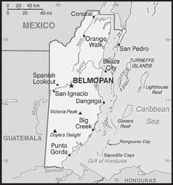
Location: Central America, bordering the Caribbean Sea, between Guatemala and Mexico
Geographic coordinates: 17 15 N, 88 45 W
Map references: Central America and the Caribbean
Area: total: 22,966 sq km
land: 22,806 sq km
water: 160 sq km
comparison ranking: total 151
Area - comparative: slightly smaller than Massachusetts
Land boundaries: total: 542 km
border countries (2): Guatemala 266 km; Mexico 276 km
Coastline: 386 km
Maritime claims: territorial sea: 12 nm in the north, 3 nm in the south; note - from the mouth of the Sarstoon River to Ranguana Cay, Belize’s territorial sea is 3 nm; according to Belize’s Maritime Areas Act, 1992, the purpose of this limitation is to provide a framework for negotiating a definitive agreement on territorial differences with Guatemala
exclusive economic zone: 200 nm
Climate: tropical; very hot and humid; rainy season (May to November); dry season (February to May)
Terrain: flat, swampy coastal plain; low mountains in south
Elevation: highest point: Doyle’s Delight 1,124 m
lowest point: Caribbean Sea 0 m
mean elevation: 173 m
Natural resources: arable land potential, timber, fish, hydropower
Land use: agricultural land: 6.9% (2018 est.)
arable land: 3.3% (2018 est.)
permanent crops: 1.4% (2018 est.)
permanent pasture: 2.2% (2018 est.)
forest: 60.6% (2018 est.)
other: 32.5% (2018 est.)
Irrigated land: 35 sq km (2012)
Population distribution: approximately 25% to 30% of the population lives in the former capital, Belize City; over half of the overall population is rural; population density is slightly higher in the north and east
Natural hazards: frequent, devastating hurricanes (June to November) and coastal flooding (especially in south)
Geography - note: only country in Central America without a coastline on the North Pacific Ocean
PEOPLE AND SOCIETY
Population: 419,137 (2023 est.)
comparison ranking: 175
Nationality: noun: Belizean(s)
adjective: Belizean
Ethnic groups: Mestizo 52.9%, Creole 25.9%, Maya 11.3%, Garifuna 6.1%, East Indian 3.9%, Mennonite 3.6%, White 1.2%, Asian 1%, other 1.2%, unknown 0.3% (2010 est.)
note: percentages add up to more than 100% because respondents were able to identify more than one ethnic origin
Languages: English 62.9% (official), Spanish 56.6%, Creole 44.6%, Maya 10.5%, German 3.2%, Garifuna 2.9%, other 1.8%, unknown 0.5%; note - shares sum to more than 100% because some respondents gave more than one answer on the census (2010 est.)
major-language sample(s): The World Factbook, the indispensable source for basic information. (English)
La Libreta Informativa del Mundo, la fuente indispensable de información básica. (Spanish)
Religions: Roman Catholic 40.1%, Protestant 31.5% (includes Pentecostal 8.4%, Seventh Day Adventist 5.4%, Anglican 4.7%, Mennonite 3.7%, Baptist 3.6%, Methodist 2.9%, Nazarene 2.8%), Jehovah’s Witness 1.7%, other 10.5% (includes Baha’i, Buddhist, Hindu, Church of Jesus Christ, Muslim, Rastafarian, Salvation Army), unspecified 0.6%, none 15.5% (2010 est.)
Demographic profile: Migration continues to transform Belize’s population. About 16% of Belizeans live abroad, while immigrants constitute approximately 15% of Belize’s population. Belizeans seeking job and educational opportunities have preferred to emigrate to the United States rather than former colonizer Great Britain because of the United States’ closer proximity and stronger trade ties with Belize. Belizeans also emigrate to Canada, Mexico, and English-speaking Caribbean countries. The emigration of a large share of Creoles (Afro-Belizeans) and the influx of Central American immigrants, mainly Guatemalans, Salvadorans, and Hondurans, has changed Belize’s ethnic composition. Mestizos have become the largest ethnic group, and Belize now has more native Spanish speakers than English or Creole speakers, despite English being the official language. In addition, Central American immigrants are establishing new communities in rural areas, which contrasts with the urbanization trend seen in neighboring countries. Recently, Chinese, European, and North American immigrants have become more frequent.
Immigration accounts for an increasing share of Belize’s population growth rate, which is steadily falling due to fertility decline. Belize’s declining birth rate and its increased life expectancy are creating an aging population. As the elderly population grows and nuclear families replace extended households, Belize’s government will be challenged to balance a rising demand for pensions, social services, and healthcare for its senior citizens with the need to reduce poverty and social inequality and to improve sanitation.
Age structure: 0-14 years: 30.93% (male 66,160/female 63,478)
15-64 years: 64.15% (male 134,019/female 134,867)
65 years and over: 4.92% (2023 est.) (male 9,741/female 10,872)
Dependency ratios: total dependency ratio: 49.7
youth dependency ratio: 42.3
elderly dependency ratio: 7.4
potential support ratio: 13.5 (2021 est.)
Median age: total: 23.9 years (2020)
male: 23 years
female: 24.8 years
comparison ranking: total 172
Population growth rate: 1.61% (2023 est.)
comparison ranking: 57
Birth rate: 20.93 births/1,000 population (2023 est.)
comparison ranking: 62
Death rate: 3.89 deaths/1,000 population (2023 est.)
comparison ranking: 216
Net migration rate: -0.95 migrant(s)/1,000 population (2023 est.)
comparison ranking: 143
Population distribution: approximately 25% to 30% of the population lives in the former capital, Belize City; over half of the overall population is rural; population density is slightly higher in the north and east
Urbanization: urban population: 46.6% of total population (2023)
rate of urbanization: 2.3% annual rate of change (2020-25 est.)
Major urban areas - population: 23,000 BELMOPAN (capital) (2018)
Sex ratio: at birth: 1.05 male(s)/female
0-14 years: 1.04 male(s)/female
15-64 years: 0.99 male(s)/female
65 years and over: 0.9 male(s)/female
total population: 1 male(s)/female (2023 est.)
Maternal mortality ratio: 130 deaths/100,000 live births (2020 est.)
comparison ranking: 57
Infant mortality rate: total: 10.9 deaths/1,000 live births (2023 est.)
male: 12.08 deaths/1,000 live births
female: 9.66 deaths/1,000 live births
comparison ranking: total 130
Life expectancy at birth: total population: 76.08 years (2023 est.)
male: 74.49 years
female: 77.75 years
comparison ranking: total population 115
Total fertility rate: 2.59 children born/woman (2023 est.)
comparison ranking: 64
Gross reproduction rate: 1.26 (2023 est.)
Contraceptive prevalence rate: 51.4% (2015/16)
Drinking water source: improved: urban: 100% of population
rural: 99.4% of population
total: 99.7% of population
unimproved: urban: 0% of population
rural: 0.6% of population
total: 0.3% of population (2020 est.)
Current health expenditure: 6.9% of GDP (2020)
Physicians density: 1.08 physicians/1,000 population (2018)
Hospital bed density: 1 beds/1,000 population (2017)
Sanitation facility access: improved: urban: 99.1% of population
rural: 95.7% of population
total: 97.3% of population
unimproved: urban: 0.9% of population
rural: 4.3% of population
total: 2.7% of population (2020 est.)
Obesity - adult prevalence rate: 24.1% (2016)
comparison ranking: 60
Alcohol consumption per capita: total: 5.93 liters of pure alcohol (2019 est.)
beer: 3.88 liters of pure alcohol (2019 est.)
wine: 0.68 liters of pure alcohol (2019 est.)
spirits: 1.19 liters of pure alcohol (2019 est.)
other alcohols: 0.17 liters of pure alcohol (2019 est.)
comparison ranking: total 72
Tobacco use: total: 8.5% (2020 est.)
male: 15.1% (2020 est.)
female: 1.8% (2020 est.)
comparison ranking: total 142
Children under the age of 5 years underweight: 4.6% (2015/16)
comparison ranking: 76
Currently married women (ages 15-49): 64.3% (2023 est.)
Child marriage: women married by age 15: 6.3%
women married by age 18: 33.5%
men married by age 18: 22.2% (2016 est.)
Education expenditures: 8.7% of GDP (2021 est.)
comparison ranking: 9
School life expectancy (primary to tertiary education): total: 13 years
male: 12 years
female: 13 years (2021)
Youth unemployment rate (ages 15-24): total: 19.3% (2021 est.)
male: 12.2%
female: 31.9%
comparison ranking: total 86
ENVIRONMENT
Environment - current issues: deforestation; water pollution, including pollution of Belize’s Barrier Reef System, from sewage, industrial effluents, agricultural runoff; inability to properly dispose of solid waste
Environment - international agreements: party to: Biodiversity, Climate Change, Climate Change-Kyoto Protocol, Climate Change-Paris Agreement, Comprehensive Nuclear Test Ban, Desertification, Endangered Species, Hazardous Wastes, Law of the Sea, Ozone Layer Protection, Ship Pollution, Wetlands, Whaling
signed, but not ratified: none of the selected agreements
Climate: tropical; very hot and humid; rainy season (May to November); dry season (February to May)
Land use: agricultural land: 6.9% (2018 est.)
arable land: 3.3% (2018 est.)
permanent crops: 1.4% (2018 est.)
permanent pasture: 2.2% (2018 est.)
forest: 60.6% (2018 est.)
other: 32.5% (2018 est.)
Urbanization: urban population: 46.6% of total population (2023)
rate of urbanization: 2.3% annual rate of change (2020-25 est.)
Revenue from forest resources: 0.31% of GDP (2018 est.)
comparison ranking: 79
Revenue from coal: 0% of GDP (2018 est.)
comparison ranking: 107
Air pollutants: particulate matter emissions: 10.51 micrograms per cubic meter (2019 est.)
carbon dioxide emissions: 0.57 megatons (2016 est.)
methane emissions: 0.55 megatons (2020 est.)
Waste and recycling: municipal solid waste generated annually: 101,379 tons (2015 est.)
Total water withdrawal: municipal: 10 million cubic meters (2020 est.)
industrial: 20 million cubic meters (2020 est.)
agricultural: 70 million cubic meters (2020 est.)
Total renewable water resources: 21.73 billion cubic meters (2020 est.)
GOVERNMENT
Country name: conventional long form: none
conventional short form: Belize
former: British Honduras
etymology: may be named for the Belize River, whose name possibly derives from the Maya word “belix,” meaning “muddy-watered”
Government type: parliamentary democracy (National Assembly) under a constitutional monarchy; a Commonwealth realm
Capital: name: Belmopan
geographic coordinates: 17 15 N, 88 46 W
time difference: UTC-6 (1 hour behind Washington, DC, during Standard Time)
etymology: the decision to move the capital of the country inland to higher and more stable land was made in the 1960s; the name chosen for the new city was formed from the union of two words: “Belize,” the name of the longest river in the country, and “Mopan,” one of the rivers in the area of the new capital that empties into the Belize River
Administrative divisions: 6 districts; Belize, Cayo, Corozal, Orange Walk, Stann Creek, Toledo
Independence: 21 September 1981 (from the UK)
National holiday: Battle of St. George’s Caye Day (National Day), 10 September (1798); Independence Day, 21 September (1981)
Constitution: history: previous 1954, 1963 (preindependence); latest signed and entered into force 21 September 1981
amendments: proposed and adopted by two-thirds majority vote of the National Assembly House of Representatives except for amendments relating to rights and freedoms, changes to the Assembly, and to elections and judiciary matters, which require at least three-quarters majority vote of the House; both types of amendments require assent of the governor general; amended several times, last in 2017
Legal system: English common law
International law organization participation: has not submitted an ICJ jurisdiction declaration; accepts ICCt jurisdiction
Citizenship: citizenship by birth: yes
citizenship by descent only: yes
dual citizenship recognized: yes
residency requirement for naturalization: 5 years
Suffrage: 18 years of age; universal
Executive branch: chief of state: King CHARLES III (since 8 September 2022); represented by Governor-General Froyla TZALAM (since 27 May 2021)
head of government: Prime Minister Juan Antonio BRICENO (since 12 November 2020); Deputy Prime Minister Cordel HYDE (since 16 November 2020)
cabinet: Cabinet appointed by the governor general on the advice of the prime minister from among members of the National Assembly
elections/appointments: the monarchy is hereditary; governor general appointed by the monarch; following legislative elections, the leader of the majority party or majority coalition usually appointed prime minister by the governor general; prime minister recommends the deputy prime minister
Legislative branch: description: bicameral National Assembly consists of:
Senate (14 seats, including the president); members appointed by the govenor-general - 6 on the advice of the prime minister, 3 on the advice of the leader of the opposition, and 1 each on the advice of the Belize Council of Churches and Evangelical Association of Churches, the Belize Chamber of Commerce and Industry and the Belize Better Business Bureau, non-governmental organizations in good standing, and the National Trade Union Congress and the Civil Society Steering Committee; Senate president elected from among the Senate members or from outside the Senate; members serve 5-year terms
House of Representatives (32 seats; 31 members directly elected in single-seat constituencies by simple majority vote and the speaker, who may be designated from outside the government; members serve 5-year terms)
elections: Senate - last appointed 11 November 2020 (next appointments in November 2025)
House of Representatives - last held on 11 November 2020 (next to be held in November 2025)
election results:
Senate - all members appointed; composition as of August 2023 - composition - men 8, women 6, percent of women 43%
House of Representatives - percent of vote by party - PUP 59.6%, UDP 38.8%, other 1.6%; seats by party - PUP 26, UDP 5; composition as of August 2023 - men 27, women 5, percent of women 15.6%; note - total percent of women in the National Assembly 24%
Judicial branch: highest court(s): Supreme Court of Judicature (consists of the Court of Appeal with the court president and 3 justices, and the Supreme Court with the chief justice and 10 justices); note - in 2010, Belize acceded to the Caribbean Court of Justice as the final court of appeal, replacing that of the Judicial Committee of the Privy Council in London
judge selection and term of office: Court of Appeal president and justices appointed by the governor-general upon advice of the prime minister after consultation with the National Assembly opposition leader; justices’ tenures vary by terms of appointment; Supreme Court chief justice appointed by the governor-general upon the advice of the prime minister and the National Assembly opposition leader; other judges appointed by the governor-general upon the advice of the Judicial and Legal Services Section of the Public Services Commission and with the concurrence of the prime minister after consultation with the National Assembly opposition leader; judges can be appointed beyond age 65 but must retire by age 75; in 2013, the Supreme Court chief justice overturned a constitutional amendment that had restricted Court of Appeal judge appointments to as short as 1 year
subordinate courts: Magistrates’ Courts; Family Court
Political parties and leaders: Belize Progressive Party or BPP [Wil MAHEIA] (formed in 2015 from a merger of the People’s National Party, elements of the Vision Inspired by the People, and other smaller political groups)
People’s United Party or PUP [Juan Antonio “Johnny” BRICENO]
United Democratic Party or UDP [Dean Oliver Barrow and Patrick FABER]
Vision Inspired by the People or VIP [Hubert ENRIQUEZ]
International organization participation: ACP, AOSIS, C, Caricom, CD, CDB, CELAC, FAO, G-77, IADB, IAEA, IBRD, ICAO, ICC (NGOs), ICRM, IDA, IFAD, IFC, IFRCS, ILO, IMF, IMO, Interpol, IOC, IOM, ITU, LAES, MIGA, NAM, OAS, OPANAL, OPCW, PCA, Petrocaribe, SICA, UN, UNCTAD, UNESCO, UNIDO, UPU, WCO, WHO, WIPO, WMO, WTO
Diplomatic representation in the US: chief of mission: Ambassador Lynn Raymond YOUNG (since 7 July 2021)
chancery: 2535 Massachusetts Avenue NW, Washington, DC 20008-2826
telephone: [1] (202) 332-9636
FAX: [1] (202) 332-6888
email address and website:
https://www.belizeembassyusa.mfa.gov.bz/
consulate(s) general: Los Angeles, New York (consular services temporarily suspended beginning 18 December 2020)
consulate(s): Miami
Diplomatic representation from the US: chief of mission: Ambassador Michelle KWAN (since 5 December 2022)
embassy: Floral Park Road, Belmopan, Cayo
mailing address: 3050 Belmopan Place, Washington DC 20521-3050
telephone: (501) 822-4011
FAX: (501) 822-4012
email address and website:
Flag description: royal blue with a narrow red stripe along the top and the bottom edges; centered is a large white disk bearing the coat of arms; the coat of arms features a shield flanked by two workers in front of a mahogany tree with the related motto SUB UMBRA FLOREO (I Flourish in the Shade) on a scroll at the bottom, all encircled by a green garland of 50 mahogany leaves; the colors are those of the two main political parties: blue for the PUP and red for the UDP; various elements of the coat of arms - the figures, the tools, the mahogany tree, and the garland of leaves - recall the logging industry that led to British settlement of Belize
note: Belize’s flag is the only national flag that depicts human beings; two British overseas territories, Montserrat and the British Virgin Islands, also depict humans
National symbol(s): Baird’s tapir (a large, browsing, forest-dwelling mammal), keel-billed toucan, Black Orchid; national colors: red, blue
National anthem: name: Land of the Free
lyrics/music: Samuel Alfred HAYNES/Selwyn Walford YOUNG
note: adopted 1981; as a Commonwealth country, in addition to the national anthem, “God Save the King” serves as the royal anthem (see United Kingdom)
National heritage: total World Heritage Sites: 1 (natural)
selected World Heritage Site locales: Belize Barrier Reef Reserve System
ECONOMY
Economic overview: tourism- and agriculture-driven economy; strong post-pandemic rebound; innovative and ecological bond restructuring that significantly lowered public debt and expanded marine protections; central bank offering USD-denominated treasury notes; high mobility across borders
Real GDP (purchasing power parity): $3.505 billion (2021 est.)
$3.042 billion (2020 est.)
$3.513 billion (2019 est.)
note: data are in 2017 dollars
comparison ranking: 188
Real GDP growth rate: 15.23% (2021 est.)
-13.4% (2020 est.)
4.5% (2019 est.)
comparison ranking: 9
Real GDP per capita: $8,800 (2021 est.)
$7,700 (2020 est.)
$9,000 (2019 est.)
note: data are in 2017 dollars
comparison ranking: 152
GDP (official exchange rate): $1.854 billion (2017 est.)
Inflation rate (consumer prices): 3.24% (2021 est.)
0.12% (2020 est.)
0.19% (2019 est.)
comparison ranking: 116
Credit ratings: Moody’s rating: Caa3 (2020)
Standard & Poors rating: CCC+ (2020)
note: The year refers to the year in which the current credit rating was first obtained.
GDP - composition, by sector of origin: agriculture: 10.3% (2017 est.)
industry: 21.6% (2017 est.)
services: 68% (2017 est.)
comparison rankings: services 81; industry 135; agriculture 88
GDP - composition, by end use: household consumption: 75.1% (2017 est.)
government consumption: 15.2% (2017 est.)
investment in fixed capital: 22.5% (2017 est.)
investment in inventories: 1.2% (2017 est.)
exports of goods and services: 49.1% (2017 est.)
imports of goods and services: -63.2% (2017 est.)
Agricultural products: sugar care, oranges, bananas, maize, poultry, rice, sorghum, papayas, grapefruit, soybeans
Industries: garment production, food processing, tourism, construction, oil
Industrial production growth rate: 15.08% (2021 est.)
comparison ranking: 17
Labor force: 176,900 (2021 est.)
note: shortage of skilled labor and all types of technical personnel
comparison ranking: 178
Labor force - by occupation: agriculture: 10.2%
industry: 18.1%
services: 71.7% (2007 est.)
Unemployment rate: 8.22% (2021 est.)
8.46% (2020 est.)
6.71% (2019 est.)
comparison ranking: 92
Youth unemployment rate (ages 15-24): total: 19.3% (2021 est.)
male: 12.2%
female: 31.9%
comparison ranking: total 86
Population below poverty line: 41% (2013 est.)
Budget: revenues: $583 million (2019 est.)
expenditures: $656 million (2019 est.)
Budget surplus (+) or deficit (-): -1% (of GDP) (2017 est.)
comparison ranking: 77
Public debt: 99% of GDP (2017 est.)
95.9% of GDP (2016 est.)
comparison ranking: 26
Taxes and other revenues: 21.16% (of GDP) (2017 est.)
comparison ranking: 80
Fiscal year: 1 April - 31 March
Current account balance: -$162.434 million (2021 est.)
-$127.92 million (2020 est.)
-$184.646 million (2019 est.)
comparison ranking: 97
Exports: $1.044 billion (2021 est.)
$714.624 million (2020 est.)
$1.102 billion (2019 est.)
note: Data are in current year dollars and do not include illicit exports or re-exports.
comparison ranking: 177
Exports - partners: United States 16%, United Kingdom 16%, Guatemala 7%, Italy 6%, Spain 6% (2021)
Exports - commodities: raw sugar, bananas, fishing ships, lobsters and crawfish, beer (2021)
Imports: $1.252 billion (2021 est.) note: data are in current year dollars
$901.819 million (2020 est.) note: data are in current year dollars
$1.203 billion (2019 est.) note: data are in current year dollars
comparison ranking: 183
Imports - partners: United States 29%, China 14%, Seychelles 13%, Guatemala 10%, Mexico 9% (2021)
Imports - commodities: recreational boats, refined petroleum, cigarettes, ships, natural gas (2021)
Reserves of foreign exchange and gold: $420,102,800 (31 December 2021 est.)
$348,090,100 (31 December 2020 est.)
$277,578,800 (31 December 2019 est.)
comparison ranking: 169
Debt - external: $1.315 billion (31 December 2017 est.)
$1.338 billion (31 December 2016 est.)
comparison ranking: 162
Exchange rates: Belizean dollars (BZD) per US dollar -
Exchange rates: 2 (2021 est.)
2 (2020 est.)
2 (2019 est.)
ENERGY
Electricity access: electrification - total population: 97.7% (2021)
electrification - urban areas: 98.4% (2021)
electrification - rural areas: 97% (2021)
Electricity: installed generating capacity: 204,000 kW (2020 est.)
consumption: 992.305 million kWh (2019 est.)
exports: 0 kWh (2019 est.)
imports: 240 million kWh (2019 est.)
transmission/distribution losses: 80.3 million kWh (2019 est.)
comparison rankings: installed generating capacity 171; transmission/distribution losses 163; imports 100; exports 154; consumption 161
Electricity generation sources: fossil fuels: 63.6% of total installed capacity (2020 est.)
solar: 0.2% of total installed capacity (2020 est.)
hydroelectricity: 13.4% of total installed capacity (2020 est.)
biomass and waste: 22.9% of total installed capacity (2020 est.)
Petroleum: total petroleum production: 1,300 bbl/day (2021 est.)
refined petroleum consumption: 3,900 bbl/day (2019 est.)
crude oil and lease condensate exports: 1,200 bbl/day (2018 est.)
crude oil and lease condensate imports: 0 bbl/day (2018 est.)
crude oil estimated reserves: 6.7 million barrels (2021 est.)
Refined petroleum products - production: 36 bbl/day (2015 est.)
comparison ranking: 109
Refined petroleum products - exports: 0 bbl/day (2015 est.)
comparison ranking: 180
Refined petroleum products - imports: 4,161 bbl/day (2015 est.)
comparison ranking: 176
Carbon dioxide emissions: 541,000 metric tonnes of CO2 (2019 est.)
from petroleum and other liquids: 541,000 metric tonnes of CO2 (2019 est.)
comparison ranking: total emissions 188
Energy consumption per capita: 31.552 million Btu/person (2019 est.)
comparison ranking: 120
COMMUNICATIONS
Telephones - fixed lines: total subscriptions: 19,000 (2021 est.)
subscriptions per 100 inhabitants: 5 (2021 est.)
comparison ranking: total subscriptions 174
Telephones - mobile cellular: total subscriptions: 260,000 (2021 est.)
subscriptions per 100 inhabitants: 66 (2021 est.)
comparison ranking: total subscriptions 181
Telecommunication systems: general assessment: Belize’s fixed-line teledensity and mobile penetration remain lower than average for the region, a legacy of insufficient market competition and under investment in telecoms services; a significant investment in infrastructure, launching an LTE-A service at the end of 2016 and in mid-2017 completing a submarine cable to Ambergris Caye, enabling it to launch an FttP service in San Pedro; the nfrastructure has been updated from the legacy copper to fiber; investments have been made to provide high speed broadband to 80% of residences across Belize. (2021)
domestic: roughly 5 per 100 fixed-line and mobile-cellular teledensity of 66 per 100 persons; mobile sector accounting for over 90% of all phone subscriptions (2021)
international: country code - 501; landing points for the ARCOS and SEUL fiber-optic telecommunications submarine cable that provides links to South and Central America, parts of the Caribbean, and the US; satellite earth station - 8 (Intelsat - 2, unknown - 6) (2019)
Broadcast media: 8 privately owned TV stations; multi-channel cable TV provides access to foreign stations; about 25 radio stations broadcasting on roughly 50 different frequencies; state-run radio was privatized in 1998 (2019)
Internet country code: .bz
Internet users: total: 248,000 (2021 est.)
percent of population: 62% (2021 est.)
comparison ranking: total 176
Broadband - fixed subscriptions: total: 36,000 (2020 est.)
subscriptions per 100 inhabitants: 9 (2020 est.)
comparison ranking: total 147
TRANSPORTATION
National air transport system: number of registered air carriers: 2 (2020)
inventory of registered aircraft operated by air carriers: 28
annual passenger traffic on registered air carriers: 1,297,533 (2018)
annual freight traffic on registered air carriers: 3.78 million (2018) mt-km
Civil aircraft registration country code prefix: V3
Airports: 47 (2021)
comparison ranking: total 91
Airports - with paved runways: 6
note: paved runways have a concrete or asphalt surface but not all have facilities for refueling, maintenance, or air traffic control; the length of a runway required for aircraft to safely operate depends on a number of factors including the type of aircraft, the takeoff weight (including passengers, cargo, and fuel), engine types, flap settings, landing speed, elevation of the airport, and average maximum daily air temperature; paved runways can reach a length of 5,000 m (16,000 ft.), but the “typical” length of a commercial airline runway is between 2,500-4,000 m (8,000-13,000 ft.)
Airports - with unpaved runways: 41
note: unpaved runways have a surface composition such as grass or packed earth and are most suited to the operation of light aircraft; unpaved runways are usually short, often less than 1,000 m (3,280 ft.) in length; airports with unpaved runways often lack facilities for refueling, maintenance, or air traffic control
Roadways: total: 3,281 km (2017)
paved:601 km (2017)
unpaved: 2,680 km (2017)
comparison ranking: total 160
Waterways: 825 km (2011) (navigable only by small craft)
comparison ranking: 77
Merchant marine: total: 817 (2022)
by type: bulk carrier 51, general cargo 433, oil tanker 67, other 266
comparison ranking: total 31
Ports and terminals: major seaport(s): Belize City, Big Creek
MILITARY AND SECURITY
Military and security forces: Belize Defense Force (BDF): Army, Air Wing; Belize Coast Guard; Belize Police Department (2023)
note: the Ministry of National Defense and Border Security is responsible for oversight of the BDF and the Coast Guard, while the Ministry of Home Affairs and New Growth Industries has responsibility for the Belize Police Department and prisons; the Police Department is primarily responsible for internal security
Military expenditures: 1.1% of GDP (2022 est.)
1.3% of GDP (2021 est.)
1.5% of GDP (2020 est.)
1.4% of GDP (2019 est.)
1.4% of GDP (2018 est.)
comparison ranking: 121
Military and security service personnel strengths: approximately 1,500 BDF personnel; approximately 500 Coast Guard (2023)
Military equipment inventories and acquisitions: the military has a small inventory consisting mostly of UK- and US-origin equipment (2023)
Military service age and obligation: 18 years of age for voluntary military service; laws allow for conscription only if volunteers are insufficient, but conscription has never been implemented; initial service obligation is 12 years (2023)
Military - note: the Belize Defense Force (BDF) is responsible for external security but also provides some support to civilian authorities; it has limited powers of arrest within land and shoreline areas, while the Coast Guard has arrest powers and jurisdiction within coastal and maritime areas; the BDF traces its history back to the Prince Regent Royal Honduras Militia, a volunteer force established in 1817; the BDF was established in 1978 from the disbanded Police Special Force and the Belize Volunteer Guard to assist the resident British forces with the defense of Belize against Guatemala
the British Army has maintained a presence in Belize since its independence; the presence consists of a small training support unit that provides jungle training to troops from the UK and international partners
(2023)
TRANSNATIONAL ISSUES
Disputes - international: Belize-Guatemala: Demarcated but insecure boundary due to Guatemala’s claims to more than half of Belizean territory. Line of Adjacency operates in lieu of an international boundary to control influx of Guatemalan squatters onto Belizean territory. Smuggling, narcotics trafficking, and human trafficking for sexual exploitation and debt bondage are all problems. Belize lacks resources to detect and extradite impoverished Guatemalan peasants squatting in Belizean rain forests in the remote border areas. At present, Belize and Honduras 12-nm territorial sea claims close off Guatemalan access to Caribbean in the Bahia de Amatique. Maritime boundary remains unresolved pending further negotiation.
Belize-Honduras: Honduras claims the Belizean-administered Sapodilla Cays off the coast of Belize in its constitution, but agreed to a joint ecological park around the cays should Guatemala consent to a maritime corridor in the Caribbean under the OAS-sponsored 2002 Belize-Guatemala Differendum.
Belize-Mexico: Belize and Mexico are working to solve minor border demarcation discrepancies arising from inaccuracies in the 1898 border treaty. Transshipment of illegal narcotics, smuggling, human trafficking, illegal immigration, and the growing of marijuana in very low population areas are all issues in the region today.
Illicit drugs: a significant drug trafficking and transit point between countries in South America and the United States; primary domestic use of narcotics is marijuana and some crack cocaine; a major source of precursor or essential chemicals used in the production of illicit narcotics
INTRODUCTION
Background: Present day Benin is comprised of about 42 ethnic groups, including the Yoruba in the southeast, who migrated from what is now Nigeria in the 12th century; the Dendi in the north-central area, who came from Mali in the 16th century; the Bariba and the Fula in the northeast; the Ottamari in the Atakora mountains; the Fon in the area around Abomey in the south-central area; and the Mina, Xueda, and Aja, who came from Togo, on the coast. The Kingdom of Dahomey emerged on the Abomey plateau in the 17th century and was a regional power for much of the 18th and 19th centuries. Dahomey had an organized domestic economy, international trade with Europeans, and a highly organized military. The growth of Dahomey coincided with the growth of the Atlantic slave trade, and it became known as a major source of enslaved people. France began to control the coastal areas of Dahomey in the second half of the 19th century; the entire kingdom was conquered by 1894. French Dahomey achieved independence in 1960; it changed its name to the Republic of Benin in 1975.
A succession of military governments ended in 1972 with the rise to power of Mathieu KEREKOU and the establishment of a government based on Marxist-Leninist principles. A move to representative government began in 1989. Two years later, free elections ushered in former Prime Minister Nicephore SOGLO as president, marking the first successful transfer of power in Africa from a dictatorship to a democracy. KEREKOU was returned to power by elections held in 1996 and 2001, though some irregularities were alleged. KEREKOU stepped down at the end of his second term in 2006 and was succeeded by Thomas YAYI Boni, a political outsider and independent, who won a second five-year term in March 2011. Patrice TALON, a wealthy businessman, took office in 2016; the space for pluralism, dissent, and free expression has narrowed under his administration. TALON won a second term in April 2021.
GEOGRAPHY
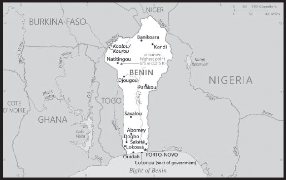
Location: Western Africa, bordering the Bight of Benin, between Nigeria and Togo
Geographic coordinates: 9 30 N, 2 15 E
Map references: Africa
Area: total: 112,622 sq km
land: 110,622 sq km
water: 2,000 sq km
comparison ranking: total 102
Area - comparative: slightly smaller than Pennsylvania
Land boundaries: total: 2,123 km
border countries (4): Burkina Faso 386 km; Niger 277 km; Nigeria 809 km; Togo 651 km
Coastline 121 km
Maritime claims: territorial sea: 200 nm; note: the US does not recognize this claim
continental shelf: 200 nm
exclusive fishing zone: 200 nm
Climate: tropical; hot, humid in south; semiarid in north
Terrain: mostly flat to undulating plain; some hills and low mountains
Elevation: highest point: unnamed elevation 675 m; located 2.5 km southeast of the town of Kotopounga
lowest point: Atlantic Ocean 0 m
mean elevation: 273 m
Natural resources: small offshore oil deposits, limestone, marble, timber
Land use: agricultural land: 31.3% (2018 est.)
arable land: 22.9% (2018 est.)
permanent crops: 3.5% (2018 est.)
permanent pasture: 4.9% (2018 est.)
forest: 40% (2018 est.)
other: 28.7% (2018 est.)
Irrigated land: 172 sq km (2017)
Major watersheds (area sq km): Atlantic Ocean drainage: Niger (2,261,741 sq km), Volta (410,991 sq km)
Population distribution: the population is primarily located in the south, with the highest concentration of people residing in and around the cities on the Atlantic coast; most of the north remains sparsely populated with higher concentrations of residents in the west as shown in this population distribution map
Natural hazards: hot, dry, dusty harmattan wind may affect north from December to March
Geography - note: sandbanks create difficult access to a coast with no natural harbors, river mouths, or islands
PEOPLE AND SOCIETY
Population: 14,219,908 (2023 est.)
comparison ranking: 74
Nationality: noun: Beninese (singular and plural)
adjective: Beninese
Ethnic groups: Fon and related 38.4%, Adja and related 15.1%, Yoruba and related 12%, Bariba and related 9.6%, Fulani and related 8.6%, Ottamari and related 6.1%, Yoa-Lokpa and related 4.3%, Dendi and related 2.9%, other 0.9%, foreigner 1.9% (2013 est.)
Languages: 55 languages; French (official); Fon (a Gbe language), Yom (a Gur language) and Yoruba are the most important indigenous languages in the south; half a dozen regionally important languages in the north, including Bariba (once counted as a Gur language) and Fulfulde
Religions: Muslim 27.7%, Roman Catholic 25.5%, Protestant 13.5% (Celestial 6.7%, Methodist 3.4%, other Protestant 3.4%), Vodoun 11.6%, other Christian 9.5%, other traditional religions 2.6%, other 2.6%, none 5.8% (2013 est.)
Demographic profile: Benin has a youthful age structure – almost 65% of the population is under the age of 25 as of 2022 – which is bolstered by high fertility and population growth rates. Benin’s total fertility has been falling over time but remains high, declining from almost 7 children per women in 1990 to 5.4 in 2022. Benin’s low contraceptive use and high unmet need for contraception contribute to the sustained high fertility rate. Although the majority of Beninese women use skilled health care personnel for antenatal care and delivery, the high rate of maternal mortality indicates the need for more access to high quality obstetric care.
Poverty, unemployment, increased living costs, and dwindling resources increasingly drive the Beninese to migrate. An estimated 4.4 million, more than 30%, of Beninese live abroad. Virtually all Beninese emigrants move to West African countries, particularly Nigeria and Cote d’Ivoire. Of the less than 1% of Beninese emigrants who settle in Europe, the vast majority live in France, Benin’s former colonial ruler.
With about 40% of the population living below the poverty line as of 2019, many desperate parents resort to sending their children to work in wealthy households as domestic servants (a common practice known as vidomegon), mines, quarries, or agriculture domestically or in Nigeria and other neighboring countries, often under brutal conditions. Unlike in other West African countries, where rural people move to the coast, farmers from Benin’s densely populated southern and northwestern regions move to the historically sparsely populated central region to pursue agriculture. Immigrants from West African countries came to Benin in increasing numbers between 1992 and 2002 because of its political stability and porous borders.
Age structure: 0-14 years: 45.37% (male 3,256,439/female 3,194,700)
15-64 years: 52.18% (male 3,595,897/female 3,823,786)
65 years and over: 2.45% (2023 est.) (male 159,363/female 189,723)
Dependency ratios: total dependency ratio: 84
youth dependency ratio: 78.3
elderly dependency ratio: 5.7
potential support ratio: 17.7 (2021 est.)
Median age: total: 17 years (2020)
male: 16.4 years
female: 17.6 years
comparison ranking: total 218
Population growth rate: 3.31% (2023 est.)
comparison ranking: 7
Birth rate: 40.72 births/1,000 population (2023 est.)
comparison ranking: 3
Death rate: 7.82 deaths/1,000 population (2023 est.)
comparison ranking: 97
Net migration rate: 0.24 migrant(s)/1,000 population (2023 est.)
comparison ranking: 76
Population distribution: the population is primarily located in the south, with the highest concentration of people residing in and around the cities on the Atlantic coast; most of the north remains sparsely populated with higher concentrations of residents in the west as shown in this population distribution map
Urbanization: urban population: 50.1% of total population (2023)
rate of urbanization: 3.74% annual rate of change (2020-25 est.)
Major urban areas - population: 285,000 PORTO-NOVO (capital) (2018); 1.253 million Abomey-Calavi, 722,000 COTONOU (seat of government) (2022)
Sex ratio: at birth: 1.05 male(s)/female
0-14 years: 1.02 male(s)/female
15-64 years: 0.94 male(s)/female
65 years and over: 0.84 male(s)/female
total population: 0.97 male(s)/female (2023 est.)
Mother’s mean age at first birth: 20.5 years (2017/18 est.)
note: data represents median age at first birth among women 25-49
Maternal mortality ratio: 523 deaths/100,000 live births (2020 est.)
comparison ranking: 13
Infant mortality rate: total: 54.33 deaths/1,000 live births (2023 est.)
male: 59.28 deaths/1,000 live births
female: 49.14 deaths/1,000 live births
comparison ranking: total 15
Life expectancy at birth: total population: 62.6 years (2023 est.)
male: 60.75 years
female: 64.55 years
comparison ranking: total population 213
Total fertility rate: 5.39 children born/woman (2023 est.)
comparison ranking: 5
Gross reproduction rate: 2.63 (2023 est.)
Contraceptive prevalence rate: 15.5% (2017/18)
Drinking water source: improved: urban: 79% of population
rural: 70.8% of population
total: 74.7% of population
unimproved: urban: 21% of population
rural: 29.2% of population
total: 25.3% of population (2020 est.)
Current health expenditure: 2.6% of GDP (2020)
Physicians density: 0.07 physicians/1,000 population (2019)
Hospital bed density: 0.5 beds/1,000 population
Sanitation facility access: improved: urban: 56.3% of population
rural: 18.1% of population
total: 36.6% of population
unimproved: urban: 43.7% of population
rural: 81.9% of population
total: 63.4% of population (2020 est.)
Major infectious diseases: degree of risk: very high (2023)
food or waterborne diseases: bacterial and protozoal diarrhea, hepatitis A, and typhoid fever
vectorborne diseases: dengue fever and malaria
animal contact diseases: rabies
respiratory diseases: meningococcal meningitis
note: on 31 August 2023, the US Centers for Disease Control and Prevention (CDC) issued a Travel Alert for polio in Africa; Benin is currently considered a high risk to travelers for circulating vaccine-derived polioviruses (cVDPV); vaccine- derived poliovirus (VDPV) is a strain of the weakened poliovirus that was initially included in oral polio vaccine (OPV) and that has changed over time and behaves more like the wild or naturally occurring virus; this means it can be spread more easily to people who are unvaccinated against polio and who come in contact with the stool or respiratory secretions, such as from a sneeze, of an “infected” person who received oral polio vaccine; the CDC recommends that before any international travel, anyone unvaccinated, incompletely vaccinated, or with an unknown polio vaccination status should complete the routine polio vaccine series; before travel to any high-risk destination, the CDC recommends that adults who previously completed the full, routine polio vaccine series receive a single, lifetime booster dose of polio vaccine
Obesity - adult prevalence rate: 9.6% (2016)
comparison ranking: 142
Alcohol consumption per capita: total: 1.25 liters of pure alcohol (2019 est.)
beer: 0.81 liters of pure alcohol (2019 est.)
wine: 0.02 liters of pure alcohol (2019 est.)
spirits: 0.2 liters of pure alcohol (2019 est.)
other alcohols: 0.22 liters of pure alcohol (2019 est.)
comparison ranking: total 145
Tobacco use: total: 6.9% (2020 est.)
male: 11.8% (2020 est.)
female: 1.9% (2020 est.)
comparison ranking: total 157
Children under the age of 5 years underweight: 16.8% (2017/18)
comparison ranking: 28
Currently married women (ages 15-49): 68.3% (2023 est.)
Child marriage: women married by age 15: 9.4%
women married by age 18: 30.6%
men married by age 18: 4.8% (2018 est.)
Education expenditures: 3% of GDP (2020 est.)
comparison ranking: 159
Literacy: definition: age 15 and over can read and write
total population: 45.8%
male: 56.9%
female: 35% (2021)
School life expectancy (primary to tertiary education): total: 11 years
male: 12 years
female: 10 years (2020)
Youth unemployment rate (ages 15-24): total: 3.9% (2021 est.)
male: 3.1%
female: 4.6%
comparison ranking: total 193
ENVIRONMENT
Environment - current issues: inadequate supplies of potable water; water pollution; poaching threatens wildlife populations; deforestation; desertification (the spread of the desert into agricultural lands in the north is accelerated by regular droughts)
Environment - international agreements: party to: Biodiversity, Climate Change, Climate Change-Kyoto Protocol, Climate Change-Paris Agreement, Comprehensive Nuclear Test Ban, Desertification, Endangered Species, Environmental Modification, Hazardous Wastes, Law of the Sea, Marine Dumping-London Convention, Nuclear Test Ban, Ozone Layer Protection, Ship Pollution, Tropical Timber 2006, Wetlands, Whaling
signed, but not ratified: none of the selected agreements
Climate: tropical; hot, humid in south; semiarid in north
Land use: agricultural land: 31.3% (2018 est.)
arable land: 22.9% (2018 est.)
permanent crops: 3.5% (2018 est.)
permanent pasture: 4.9% (2018 est.)
forest: 40% (2018 est.)
other: 28.7% (2018 est.)
Urbanization: urban population: 50.1% of total population (2023)
rate of urbanization: 3.74% annual rate of change (2020-25 est.)
Revenue from forest resources: 2.24% of GDP (2018 est.)
comparison ranking: 31
Revenue from coal: 0% of GDP (2018 est.)
comparison ranking: 54
Air pollutants: particulate matter emissions: 31.51 micrograms per cubic meter (2019 est.)
carbon dioxide emissions: 6.48 megatons (2016 est.)
methane emissions: 5.8 megatons (2020 est.)
Waste and recycling: municipal solid waste generated annually: 685,936 tons (1993 est.)
municipal solid waste recycled annually: 171,484 tons (2005 est.)
percent of municipal solid waste recycled: 25% (2005 est.)
Major watersheds (area sq km): Atlantic Ocean drainage: Niger (2,261,741 sq km), Volta (410,991 sq km)
Total water withdrawal: municipal: 150 million cubic meters (2020 est.)
industrial: 30 million cubic meters (2020 est.)
agricultural: 60 million cubic meters (2020 est.)
Total renewable water resources: 26.39 billion cubic meters (2020 est.)
GOVERNMENT
Country name: conventional long form: Republic of Benin
conventional short form: Benin
local long form: Republique du Benin
local short form: Benin
former: Dahomey, People’s Republic of Benin
etymology: named for the Bight of Benin, the body of water on which the country lies
Government type: presidential republic
Capital: name: Porto-Novo (constitutional capital); Cotonou (seat of government)
geographic coordinates: 6 29 N, 2 37 E
time difference: UTC+1 (6 hours ahead of Washington, DC, during Standard Time)
etymology: the name Porto-Novo is Portuguese for “new port”; Cotonou means “by the river of death” in the native Fon language
Administrative divisions: 12 departments; Alibori, Atacora, Atlantique, Borgou, Collines, Couffo, Donga, Littoral, Mono, Oueme, Plateau, Zou
Independence: 1 August 1960 (from France)
National holiday: Independence Day, 1 August (1960)
Constitution: history: previous 1946, 1958 (preindependence); latest adopted by referendum 2 December 1990, promulgated 11 December 1990
amendments: proposed concurrently by the president of the republic (after a decision in the Council of Ministers) and the National Assembly; consideration of drafts or proposals requires at least three-fourths majority vote of the Assembly membership; passage requires approval in a referendum unless approved by at least four-fifths majority vote of the Assembly membership; constitutional articles affecting territorial sovereignty, the republican form of government, and secularity of Benin cannot be amended; amended 2019
Legal system: civil law system modeled largely on the French system and some customary law
International law organization participation: has not submitted an ICJ jurisdiction declaration; accepts ICCt jurisdiction
Citizenship: citizenship by birth: no
citizenship by descent only: at least one parent must be a citizen of Benin
dual citizenship recognized: yes
residency requirement for naturalization: 10 years
Suffrage: 18 years of age; universal
Executive branch: chief of state: President Patrice TALON (since 6 April 2016); note - the president is both head of state and head of government
head of government: President Patrice TALON (since 6 April 2016); prime minister position abolished
cabinet: Council of Ministers appointed by the president
elections/appointments: president directly elected by absolute majority popular vote in 2 rounds if needed for a 5-year term (eligible for a second term); last held on 11 April 2021 (next to be held on 12 April 2026)
election results:
2021: Patrice TALON elected to a second term; percent of vote - Patrice TALON (independent) 86.4%, Alassane SOUMANOU (FCBE) 11.3%, other 2.3%
2016: Patrice TALON elected president in second round; percent of vote in first round - Lionel ZINSOU (FCBE) 28.4%, Patrice TALON (independent) 24.8%, Sebastien AJAVON (independent) 23.%, Abdoulaye Bio TCHANE (ABT) 8.8%, Pascal KOUPAKI (NC) 5.9%, other 9.1%; percent of vote in second round - Patrice TALON 65.4%, Lionel ZINSOU 34.6%
Legislative branch: description: unicameral National Assembly or Assemblee Nationale (109 seats, including 24 seats reserved for women; members directly elected in multi-seat constituencies by party-list proportional representation vote; members serve 5-year terms except for the current members whose terms will end in 2026 to facilitate general elections)
elections: last held on 8 January 2023 (next to be held on 11 January 2027)
election results: percent of vote by party - Progressive Union for Renewal 37.6%, Bloc Republicain 29.2%, The Democrats 24%; seats by party - Progressive Union for Renewal 53, Bloc Republicain 28, The Democrats 28; composition as of May 2023 - men 80, women 29, percent of women 26.6%
Judicial branch: highest court(s): Supreme Court or Cour Supreme (consists of the chief justice and 16 justices organized into an administrative division, judicial chamber, and chamber of accounts); Constitutional Court or Cour Constitutionnelle (consists of 7 members, including the court president); High Court of Justice (consists of the Constitutional Court members, 6 members appointed by the National Assembly, and the Supreme Court president); note - jurisdiction of the High Court of Justice is limited to cases of high treason by the national president or members of the government while in office
judge selection and term of office: Supreme Court president and judges appointed by the president of the republic upon the advice of the National Assembly; judges appointed for single renewable 5-year terms; Constitutional Court members - 4 appointed by the National Assembly and 3 by the president of the republic; members appointed for single renewable 5-year terms; other members of the High Court of Justice elected by the National Assembly; member tenure NA
subordinate courts: Court of Appeal or Cour d’Appel; district courts; village courts; Assize courts
Political parties and leaders: African Movement for Development and Progress or MADEP [Sefou FAGBOHOUN]
Benin Renaissance or RB [Lehady SOGLO]
Cowrie Force for an Emerging Benin or FCBE [Thomas Boni YAYI]
Democratic Renewal Party or PRD [Adrien HOUNGBEDJI]
United Dynamics for Development and Democracy or AND [Valentin Aditi HOUDE]
Progressive Union for Renewal [Joseph DJOGBENOU]
Republican Bloc [Abdoulaye B IO TCHANE]
Sun Alliance or AS [Sacca LAFIA]
The Democrats [Eric HOUNDETE]
Union Makes the Nation or UN [Adrien HOUNGBEDJI] (includes PRD, MADEP)
note: approximately 20 additional minor parties
International organization participation: ACP, AfDB, AU, CD, ECOWAS, Entente, FAO, FZ, G-77, IAEA, IBRD, ICAO, ICCt, ICRM, IDA, IDB, IFAD, IFC, IFRCS, ILO, IMF, IMO, Interpol, IOC, IOM, IPU, ISO, ITSO, ITU, ITUC (NGOs), MIGA, MINUSMA, MNJTF, MONUSCO, NAM, OAS (observer), OIC, OIF, OPCW, PCA, UN, UNAMID, UNCTAD, UNESCO, UNHCR, UNHRC, UNIDO, UNISFA, UNMIL, UNMISS, UNOCI, UNWTO, UPU, WADB (regional), WAEMU, WCO, WFTU (NGOs), WHO, WIPO, WMO, WTO
Diplomatic representation in the US: chief of mission: Ambassador Jean-Claude Felix DO REGO (since 17 July 2020)
chancery: 2124 Kalorama Road NW, Washington, DC 20008
telephone: [1] (202) 232-6656; [1] (202) 232-2611
FAX: [1] (202) 265-1996
email address and website:
Diplomatic representation from the US: chief of mission: Ambassador Brian SHUKAN (since 5 May 2022)
embassy: 01 BP 2012, Cotonou
mailing address: 2120 Cotonou Place, Washington DC 20521-2120
telephone: [229] 21-30-06-50
FAX: [229] 21-30-03-84
email address and website:
Flag description: two equal horizontal bands of yellow (top) and red (bottom) with a vertical green band on the hoist side; green symbolizes hope and revival, yellow wealth, and red courage
note: uses the popular Pan-African colors of Ethiopia
National symbol(s): leopard; national colors: green, yellow, red
National anthem: name: “L’Aube Nouvelle” (The Dawn of a New Day)
lyrics/music: Gilbert Jean DAGNON
note: adopted 1960
National heritage: total World Heritage Sites: 2 (1 cultural, 1 natural)
selected World Heritage Site locales: Royal Palaces of Abomey (c); W-Arly-Pendjari Complex (n)
ECONOMY
Economic overview: robust economic growth; slightly declining but still widespread poverty; strong trade relations with Nigeria; cotton exporter; COVID-19 has led to capital outflows and border closures; WAEMU member with currency pegged to the euro; recent fiscal deficit and debt reductions
Real GDP (purchasing power parity): $43.17 billion (2021 est.)
$40.287 billion (2020 est.)
$38.794 billion (2019 est.)
note: data are in 2017 dollars
comparison ranking: 118
Real GDP growth rate: 7.16% (2021 est.)
3.85% (2020 est.)
6.87% (2019 est.)
comparison ranking: 53
Real GDP per capita: $3,300 (2021 est.)
$3,200 (2020 est.)
$3,200 (2019 est.)
note: data are in 2017 dollars
comparison ranking: 192
GDP (official exchange rate): $10.315 billion (2018 est.)
Inflation rate (consumer prices): 1.73% (2021 est.)
3.02% (2020 est.)
-0.71% (2019 est.)
comparison ranking: 170
Credit ratings: Fitch rating: B (2019)
Moody’s rating: B2 (2019)
Standard & Poors rating: B+ (2018)
note: The year refers to the year in which the current credit rating was first obtained.
GDP - composition, by sector of origin: agriculture: 26.1% (2017 est.)
industry: 22.8% (2017 est.)
services: 51.1% (2017 est.)
comparison rankings: services 174; industry 125; agriculture 27
GDP - composition, by end use: household consumption: 70.5% (2017 est.)
government consumption: 13.1% (2017 est.)
investment in fixed capital: 27.6% (2017 est.)
investment in inventories: 0% (2017 est.)
exports of goods and services: 31.6% (2017 est.)
imports of goods and services: -43% (2017 est.)
Agricultural products: cassava, yams, maize, cotton, oil palm fruit, rice, pineapples, tomatoes, vegetables, soybeans
Industries: textiles, food processing, construction materials, cement
Industrial production growth rate: 9.12% (2021 est.)
comparison ranking: 36
Labor force: 5.295 million (2021 est.)
comparison ranking: 76
Unemployment rate: 1.57% (2021 est.)
1.58% (2020 est.)
1.47% (2019 est.)
comparison ranking: 219
Youth unemployment rate (ages 15-24): total: 3.9% (2021 est.)
male: 3.1%
female: 4.6%
comparison ranking: total 193
Population below poverty line: 38.5% (2019 est.)
Gini Index coefficient - distribution of family income: 37.8 (2018 est.)
comparison ranking: 74
Household income or consumption by percentage share: lowest 10%: 3.1%
highest 10%: 29% (2003)
Budget: revenues: $2.024 billion (2019 est.)
expenditures: $2.101 billion (2019 est.)
Budget surplus (+) or deficit (-): -6.2% (of GDP) (2017 est.)
comparison ranking: 186
Public debt: 54.6% of GDP (2017 est.)
49.7% of GDP (2016 est.)
comparison ranking: 89
Taxes and other revenues: 17.1% (of GDP) (2017 est.)
comparison ranking: 119
Fiscal year: calendar year
Current account balance: -$273.967 million (2020 est.)
-$575.593 million (2019 est.)
-$648.825 million (2018 est.)
comparison ranking: 104
Exports: $3.506 billion (2020 est.)
$3.585 billion (2019 est.)
$3.848 billion (2018 est.)
note: Data are in current year dollars and do not include illicit exports or re-exports.
comparison ranking: 140
Exports - partners: Nigeria 25%, Bangladesh 14%, United Arab Emirates 14%, India 13%, China 8%, Vietnam 5% (2019)
Exports - commodities: gold, cotton, cashews, refined petroleum, soybeans (2021)
Imports: $3.942 billion (2020 est.) note: data are in current year dollars
$4.307 billion (2019 est.) note: data are in current year dollars
$4.669 billion (2018 est.)
comparison ranking: 153
Imports - partners: China 28%, Thailand 9%, India 8%, Togo 6%, United States 5% (2019)
Imports - commodities: rice, cars, palm oil, electricity, cotton (2019)
Reserves of foreign exchange and gold: $698.9 million (31 December 2017 est.)
$57.5 million (31 December 2016 est.)
comparison ranking: 159
Debt - external: $2.804 billion (31 December 2017 est.)
$2.476 billion (31 December 2016 est.)
comparison ranking: 145
Exchange rates: Communaute Financiere Africaine francs (XOF) per US dollar -
Exchange rates: 554.608 (2021 est.)
574.295 (2020 est.)
585.951 (2019 est.)
555.446 (2018 est.)
580.657 (2017 est.)
ENERGY
Electricity access: population without electricity: 8 million (2020)
electrification - total population: 41.9% (2021)
electrification - urban areas: 66.9% (2021)
electrification - rural areas: 17.9% (2021)
Electricity: installed generating capacity: 475,000 kW (2020 est.)
consumption: 524.08 million kWh (2020 est.)
exports: 2 million kWh (2020 est.)
imports: 646 million kWh (2020 est.)
transmission/distribution losses: 346 million kWh (2020 est.)
comparison rankings: transmission/distribution losses 137; imports 81; exports 98; consumption 171; installed generating capacity 152
Electricity generation sources: fossil fuels: 96.9% of total installed capacity (2020 est.)
solar: 3.1% of total installed capacity (2020 est.)
Coal: production: 0 metric tons (2020 est.)
consumption: 78,000 metric tons (2020 est.)
exports: 0 metric tons (2020 est.)
imports: 78,000 metric tons (2020 est.)
proven reserves: 0 metric tons (2019 est.)
Petroleum: total petroleum production: 0 bbl/day (2021 est.)
refined petroleum consumption: 46,300 bbl/day (2019 est.)
crude oil and lease condensate exports: 0 bbl/day (2018 est.)
crude oil and lease condensate imports: 0 bbl/day (2018 est.)
crude oil estimated reserves: 8 million barrels (2021 est.)
Refined petroleum products - production: 0 bbl/day (2015 est.)
comparison ranking: 156
Refined petroleum products - exports: 1,514 bbl/day (2015 est.)
comparison ranking: 107
Refined petroleum products - imports: 38,040 bbl/day (2015 est.)
comparison ranking: 93
Natural gas: production: 0 cubic meters (2021 est.)
consumption: 19.057 million cubic meters (2019 est.)
exports: 0 cubic meters (2021 est.)
imports: 19.057 million cubic meters (2019 est.)
proven reserves: 1.133 billion cubic meters (2021 est.)
Carbon dioxide emissions: 6.903 million metric tonnes of CO2 (2019 est.)
from coal and metallurgical coke: 274,000 metric tonnes of CO2 (2019 est.)
from petroleum and other liquids: 6.592 million metric tonnes of CO2 (2019 est.)
from consumed natural gas: 37,000 metric tonnes of CO2 (2019 est.)
comparison ranking: total emissions 126
Energy consumption per capita: 8.468 million Btu/person (2019 est.)
comparison ranking: 159
COMMUNICATIONS
Telephones - fixed lines: total subscriptions: 11,493 (2021 est.)
subscriptions per 100 inhabitants: (2021 est.) less than 1
comparison ranking: total subscriptions 187
Telephones - mobile cellular: total subscriptions: 12,731,782 (2021 est.)
subscriptions per 100 inhabitants: 98 (2021 est.)
comparison ranking: total subscriptions 78
Telecommunication systems: general assessment: Benin’s telecom market continues to be restricted by the poor condition of the country’s fixed-line infrastructure; this has hampered the development of fixed-line voice and internet services, and there is negligible revenue derived from these sectors; mobile networks account for almost all internet connections, and also carry most voice traffic; there is promise for considerable change in the mobile sector; slow progress is being made in developing competition in the mobile sector; in May 2021 the government sought foreign companies to bid for a fourth mobile license; improved international internet connectivity has contributed to a reduction in end-user pricing, and provided the potential to transform many areas of the country’s economy, bringing a greater proportion of the population into the orbit of internet commerce and connectivity; a 2,000km fiber project started in 2016 was finally completed in mid-2021, prompting the government to secure a loan to build additional fiber infrastructure connecting four of the country’s 12 departments (2022)
domestic: fixed-line teledensity less than 1 per 100 people; mobile cellular subscriptions are 98 per 100 people (2021)
international: country code - 229; landing points for the SAT-3/WASC and ACE fiber-optic submarine cable that provides connectivity to Europe, and most West African countries; satellite earth stations - 7 (Intelsat-Atlantic Ocean) (2019)
Broadcast media: state-run Office de Radiodiffusion et de Television du Benin (ORTB) operates a TV station providing a wide broadcast reach; several privately owned TV stations broadcast from Cotonou; satellite TV subscription service is available; state-owned radio, under ORTB control, includes a national station supplemented by a number of regional stations; substantial number of privately owned radio broadcast stations; transmissions of a few international broadcasters are available on FM in Cotonou (2019)
Internet country code: .bj
Internet users: total: 4.42 million (2021 est.)
percent of population: 34% (2021 est.)
comparison ranking: total 103
Broadband - fixed subscriptions: total: 29,981 (2020 est.)
subscriptions per 100 inhabitants: 0.3 (2020 est.)
comparison ranking: total 155
TRANSPORTATION
National air transport system: number of registered air carriers: 1 (2015)
inventory of registered aircraft operated by air carriers: 1 (2015)
annual passenger traffic on registered air carriers: 112,392 (2015)
annual freight traffic on registered air carriers: 805,347 (2015) mt-km
Civil aircraft registration country code prefix: TY
Airports: 6 (2021)
comparison ranking: total 176
Airports - with paved runways: 1
note: paved runways have a concrete or asphalt surface but not all have facilities for refueling, maintenance, or air traffic control; the length of a runway required for aircraft to safely operate depends on a number of factors including the type of aircraft, the takeoff weight (including passengers, cargo, and fuel), engine types, flap settings, landing speed, elevation of the airport, and average maximum daily air temperature; paved runways can reach a length of 5,000 m (16,000 ft.), but the “typical” length of a commercial airline runway is between 2,500-4,000 m (8,000-13,000 ft.)
Airports - with unpaved runways: 5
note: unpaved runways have a surface composition such as grass or packed earth and are most suited to the operation of light aircraft; unpaved runways are usually short, often less than 1,000 m (3,280 ft.) in length; airports with unpaved runways often lack facilities for refueling, maintenance, or air traffic control
Pipelines: 134 km gas
Railways: total: 438 km (2014)
narrow gauge: 438 km (2014) 1.000-m gauge
comparison ranking: total 115
Roadways: total: 16,000 km (2006)
paved: 1,400 km (2006)
unpaved: 14,600 km (2006)
comparison ranking: total 121
Waterways: 150 km (2011) (seasonal navigation on River Niger along northern border)
comparison ranking: 111
Merchant marine: total: 7 (2022)
by type: other 7
comparison ranking: total 163
Ports and terminals: major seaport(s): Cotonou
LNG terminal(s) (import): Cotonou
MILITARY AND SECURITY
Military and security forces: Beninese Armed Forces (Forces Armees Beninoises, FAB; aka Benin Defense Forces): Army, Navy, Air Force, National Guard (aka Republican Guard)
Ministry of Interior and Public Security: Republican Police (Police Republicaine, DGPR) (2023)
note: FAB is under the Ministry of Defense and is responsible for external security and supporting the DGPR in maintaining internal security, which has primary responsibility for enforcing law and maintaining order; the DGPR was formed in 2018 through a merger of police and gendarmes
Military expenditures: 0.7% of GDP (2022 est.)
0.7% of GDP (2021 est.)
0.5% of GDP (2020 est.)
0.5% of GDP (2019 est.)
0.7% of GDP (2018 est.)
comparison ranking: 142
Military and security service personnel strengths: approximately 12,000 active-duty troops, including about 3,000 National Guard; estimated 5,000 Republican Police (2023)
Military equipment inventories and acquisitions: the FAB is equipped with a small mix of mostly older or secondhand French, Soviet-era, and US equipment; in recent years, France has provided it with limited amounts of newer military hardware such as armored vehicles and helicopters (2023)
Military service age and obligation: 18-35 years of age for voluntary and selective compulsory military service for men and women; a higher education diploma is required; conscript service is 18 months (2023)
Military deployments: 250 Mali (MINUSMA) (2023)
Military - note: a key focus for the security forces of Benin is countering infiltrations into the country by terrorist groups tied to al-Qa’ida and the Islamic State of Iraq and ash-Sham (ISIS) operating just over the border from northern Benin in Burkina Faso and Niger; in May 2022, the Benin Government said it was “at war” after suffering a series of attacks from these groups; later that same year, President TALON said his government would spend more than $130 million to recruit up to 4,000 additional military personnel, modernize military equipment, and build and fortify operating bases; in addition, the FAB participates in the Multinational Joint Task Force (MNJTF) along with Cameroon, Chad, Niger, and Nigeria against Boko Haram and ISIS-West Africa in the general area of the Lake Chad Basin and along Nigeria’s northeastern border
the FAB has a close working relationship with the Belgian armed forces; the Belgians offer military advice, training, and second-hand equipment donations, and deploy to Benin for limited military exercises (2023)
TERRORISM
Terrorist group(s): Terrorist group(s): al-Qa’ida (Jama’at Nusrat al Islam wal Muslimeen); Islamic State in the Greater Sahara (ISIS-GS); Boko Haram
note: details about the history, aims, leadership, organization, areas of operation, tactics, targets, weapons, size, and sources of support of the group(s) appear(s) in Appendix-T
TRANSNATIONAL ISSUES
Disputes - international: Benin-Burkina Faso: Benin retains a border dispute with Burkina Faso near the town of Koualau/Kourou.
Benin-Togo: Talks continue between Benin and Togo on funding the Adjarala hydroelectric dam on the Mona River.
Benin-Niger: The location of Benin-Niger-Nigeria tripoint is unresolved.
Illicit drugs: a significant transit and departure country for cocaine shipments in Africa destined for Europe
INTRODUCTION
Background: Bermuda was first settled in 1609 by shipwrecked English colonists heading for Virginia. Self-governing since 1620, Bermuda is the oldest and most populous of the British overseas territories. Vacationing to the island to escape North American winters first developed in Victorian times. Tourism continues to be important to the island’s economy, although international business has overtaken it in recent years. Bermuda has also developed into a highly successful offshore financial center. A referendum on independence from the UK was soundly defeated in 1995.
GEOGRAPHY
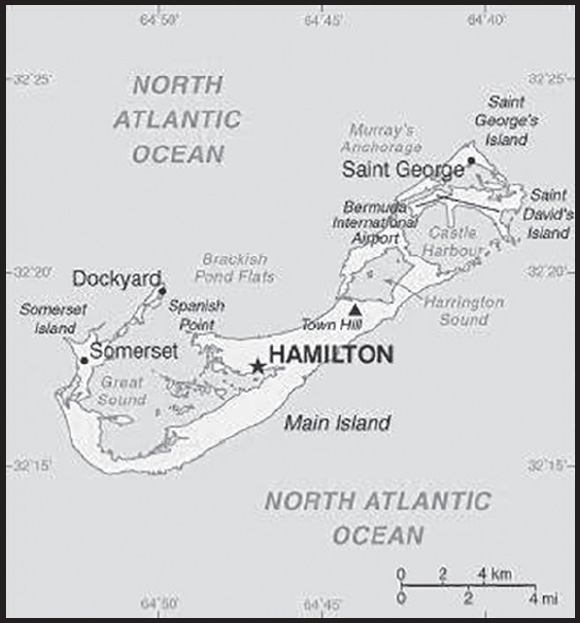
Location: North America, group of islands in the North Atlantic Ocean, east of South Carolina (US)
Geographic coordinates: 32 20 N, 64 45 W
Map references: North America
Area: total: 54 sq km
land: 54 sq km
water: 0 sq km
comparison ranking: total 230
Area - comparative: about one-third the size of Washington, DC
Land boundaries: total: 0 km
Coastline: 103 km
Maritime claims: territorial sea: 12 nm
exclusive economic zone: 200 nm
exclusive fishing zone: 200 nm
Climate: subtropical; mild, humid; gales, strong winds common in winter
Terrain: low hills separated by fertile depressions
Elevation: highest point: Town Hill 79 m
lowest point: Atlantic Ocean 0 m
Natural resources: limestone, pleasant climate fostering tourism
Land use: agricultural land: 14.8% (2018 est.)
arable land: 14.8% (2018 est.)
permanent crops: 0% (2018 est.)
permanent pasture: 0% (2018 est.)
forest: 20% (2018 est.)
other: 65.2% (2018 est.)
Irrigated land: NA
Population distribution: relatively even population distribution throughout
Natural hazards: hurricanes (June to November)
Geography - note: consists of about 138 coral islands and islets with ample rainfall, but no rivers or freshwater lakes; some land was leased by the US Government from 1941 to 1995
PEOPLE AND SOCIETY
Population: 72,576 (2023 est.)
comparison ranking: 202
Nationality: noun: Bermudian(s)
adjective: Bermudian
Ethnic groups: African descent 52%, White 31%, mixed 9%, Asian 4%, other 4% (2010 est.)
Languages: English (official), Portuguese
Religions: Protestant 46.2% (includes Anglican 15.8%, African Methodist Episcopal 8.6%, Seventh Day Adventist 6.7, Pentecostal 3.5%, Methodist 2.7%, Presbyterian 2.0%, Church of God 1.6%, Baptist 1.2%, Salvation Army 1.1%, Brethren 1.0%, other Protestant 2.0%), Roman Catholic 14.5%, Jehovah’s Witness 1.3%, other Christian 9.1%, Muslim 1%, other 3.9%, none 17.8%, unspecified 6.2% (2010 est.)
Age structure: 0-14 years: 16.45% (male 6,126/female 5,815)
15-64 years: 61.66% (male 22,401/female 22,347)
65 years and over: 21.89% (2023 est.) (male 6,763/female 9,124)
Dependency ratios: total dependency ratio: 52.9
youth dependency ratio: 22.8
elderly dependency ratio: 30.1
potential support ratio: 3.3 (2021)
Median age: total: 43.6 years (2020)
male: 41.6 years
female: 45.7 years
comparison ranking: total 25
Population growth rate: 0.32% (2023 est.)
comparison ranking: 163
Birth rate: 10.97 births/1,000 population (2023 est.)
comparison ranking: 167
Death rate: 9.2 deaths/1,000 population (2023 est.)
comparison ranking: 53
Net migration rate: 1.43 migrant(s)/1,000 population (2023 est.)
comparison ranking: 59
Population distribution: relatively even population distribution throughout
Urbanization: urban population: 100% of total population (2023)
rate of urbanization: -0.2% annual rate of change (2020-25 est.)
Major urban areas - population: 10,000 HAMILTON (capital) (2018)
Sex ratio: at birth: 1.05 male(s)/female
0-14 years: 1.05 male(s)/female
15-64 years: 1 male(s)/female
65 years and over: 0.74 male(s)/female
total population: 0.95 male(s)/female (2023 est.)
Infant mortality rate: total: 2.17 deaths/1,000 live births (2023 est.)
male: 2.48 deaths/1,000 live births
female: 1.84 deaths/1,000 live births
comparison ranking: total 221
Life expectancy at birth: total population: 82.25 years (2023 est.)
male: 79.18 years
female: 85.47 years
comparison ranking: total population 30
Total fertility rate: 1.89 children born/woman (2023 est.)
comparison ranking: 126
Gross reproduction rate: 0.92 (2023 est.)
Drinking water source: improved: total: 99.9% of population
unimproved: total: 0.1% of population (2020)
Sanitation facility access: improved:
total: 99.9% of population
unimproved: total: 0.1% of population (2020)
Currently married women (ages 15-49): 47.6% (2023 est.)
Education expenditures: 1.9% of GDP (2021 est.)
comparison ranking: 188
School life expectancy (primary to tertiary education): total: 13 years
male: 12 years
female: 13 years (2015)
Youth unemployment rate (ages 15-24): total: 29.3% (2014 est.)
male: 29.7%
female: 29%
comparison ranking: total 43
ENVIRONMENT
Environment - current issues: dense population and heavy vehicle traffic create serious congestion and air pollution problems; water resources scarce (most obtained as rainwater or from wells); solid waste disposal; hazardous waste disposal; sewage disposal; overfishing; oil spills
Climate: subtropical; mild, humid; gales, strong winds common in winter
Land use: agricultural land: 14.8% (2018 est.)
arable land: 14.8% (2018 est.)
permanent crops: 0% (2018 est.)
permanent pasture: 0% (2018 est.)
forest: 20% (2018 est.)
other: 65.2% (2018 est.)
Urbanization: urban population: 100% of total population (2023)
rate of urbanization: -0.2% annual rate of change (2020-25 est.)
Air pollutants: carbon dioxide emissions: 0.61 megatons (2016 est.)
Waste and recycling: municipal solid waste generated annually: 82,000 tons (2012 est.)
municipal solid waste recycled annually: 1,640 tons (2012 est.)
percent of municipal solid waste recycled: 2% (2012 est.)
GOVERNMENT
Country name: conventional long form: none
conventional short form: Bermuda
former: Somers Islands
etymology: the islands making up Bermuda are named after Juan de BERMUDEZ, an early 16th century Spanish sea captain and the first European explorer of the archipelago
Government type: Overseas Territory of the UK with limited self-government; parliamentary democracy
Dependency status: overseas territory of the UK
Capital: name: Hamilton
geographic coordinates: 32 17 N, 64 47 W
time difference: UTC-4 (1 hour ahead of Washington, DC, during Standard Time)
daylight saving time: +1hr, begins second Sunday in March; ends first Sunday in November
etymology: named after Henry HAMILTON (ca. 1734-1796) who served as governor of Bermuda from 1788-1794
Administrative divisions: 9 parishes and 2 municipalities*; Devonshire, Hamilton, Hamilton*, Paget, Pembroke, Saint George*, Saint George’s, Sandys, Smith’s, Southampton, Warwick
Independence: none (overseas territory of the UK)
National holiday: Bermuda Day, 24 May; note - formerly known as Victoria Day, Empire Day, and Commonwealth Day
Constitution: history: several previous (dating to 1684); latest entered into force 8 June 1968 (Bermuda Constitution Order 1968)
amendments: proposal procedure - NA; passage by an Order in Council in the UK; amended several times, last in 2012
Legal system: English common law
International law organization participation: has not submitted an ICJ jurisdiction declaration; non-party state to the ICCt
Citizenship: citizenship by birth: no
citizenship by descent only: at least one parent must be a citizen of the UK
dual citizenship recognized: yes
residency requirement for naturalization: 10 years
Suffrage: 18 years of age; universal
Executive branch: chief of state: King CHARLES III (since 8 September 2022); represented by Governor Rena LALGIE (since 14 December 2020)
head of government: Premier David BURT (since 19 July 2017)
cabinet: Cabinet nominated by the premier, appointed by the governor
elections/appointments: the monarchy is hereditary; governor appointed by the monarch; following legislative elections, the leader of the majority party or majority coalition usually appointed premier by the governor
Legislative branch: description: bicameral Parliament consists of:
Senate (11 seats; 3 members appointed by the governor, 5 by the premier, and 3 by the opposition party; members serve 5-year terms)
House of Assembly (36 seats; members directly elected in single-seat constituencies by simple majority vote to serve up to 5-year terms)
elections:
Senate - last appointments in 2022 (next appointments in 2027)
House of Assembly - last held on 1 October 2020 (next to be held not later than 2025)
election results:
Senate - composition as of October 2023 - men 4, women 7, percent of women 63.6%
House of Assembly - percent of vote by party - PLP 62.1%, OBA 32.3%, other 5.4%, independent 0.2%; seats by party - PLP 30, OBA 6 1 vacant; composition as of October 2023 - men 26, women 9, percent of women 25%; note - total Parliament percent of women as of September 2023 - 34%
Judicial branch: highest court(s): Court of Appeal (consists of the court president and at least 2 justices); Supreme Court (consists of the chief justice, 4 puisne judges, and 1 associate justice); note - the Judicial Committee of the Privy Council (in London) is the court of final appeal
judge selection and term of office: Court of Appeal justice appointed by the governor; justice tenure by individual appointment; Supreme Court judges nominated by the Judicial and Legal Services Commission and appointed by the governor; judge tenure based on terms of appointment
subordinate courts: commercial court (began in 2006); magistrates’ courts
Political parties and leaders: Free Democratic Movement or FDM [Marc A. R. BEAN]
One Bermuda Alliance or OBA [N. H. Cole SIMONS]
Progressive Labor Party or PLP [E. David BURT]
International organization participation: Caricom (associate), ICC (NGOs), Interpol (subbureau), IOC, ITUC (NGOs), UPU, WCO
Diplomatic representation in the US: none (overseas territory of the UK)
Diplomatic representation from the US: chief of mission: Consul General Karen GRISSETTE (since 6 July 2021)
embassy: US Consulate Bermuda, 16 Middle Road, Devonshire, DV 03, Bermuda
mailing address: 5300 Hamilton Place, Washington, DC 20520-5300
telephone: (441) 295-1342
FAX: (441) 295-1592
email address and website:
consulate(s) general: 16 Middle Road, Devonshire DV O3
Flag description: red, with the flag of the UK in the upper hoist-side quadrant and the Bermudian coat of arms (a white shield with a red lion standing on a green grassy field holding a scrolled shield showing the sinking of the ship Sea Venture off Bermuda in 1609) centered on the outer half of the flag; it was the shipwreck of the vessel, filled with English colonists originally bound for Virginia, that led to the settling of Bermuda
note: the flag is unusual in that it is only British overseas territory that uses a red ensign, all others use blue
National symbol(s): red lion
National anthem: name: Hail to Bermuda
lyrics/music: Bette JOHNS
note: serves as a local anthem; as a territory of the United Kingdom, “God Save the King” is official (see United Kingdom)
National heritage: total World Heritage Sites: 1 (cultural); note - excerpted from the UK entry
selected World Heritage Site locales: Historic Town of St George and Related Fortifications
ECONOMY
Economic overview: small, tourism- and construction-based, territorial-island economy; American import and tourist destination; known offshore banking hub; increasing inflation; major re-exportation and re-importation area
Real GDP (purchasing power parity): $5.127 billion (2021 est.) note: data are in 2017 dollars
$4.863 billion (2020 est.) note: data are in 2017 dollars
$5.22 billion (2019 est.)
comparison ranking: 179
Real GDP growth rate: 5.41% (2021 est.)
-6.84% (2020 est.)
0.31% (2019 est.)
comparison ranking: 83
Real GDP per capita: $80,300 (2021 est.) note: data are in 2017 dollars
$76,100 (2020 est.) note: data are in 2017 dollars
$81,700 (2019 est.)
comparison ranking: 8
GDP (official exchange rate): $6.127 billion (2016 est.)
Inflation rate (consumer prices): 1.9% (2017 est.)
1.4% (2016 est.)
comparison ranking: 160
Credit ratings: Fitch rating: N/A (2015)
Moody’s rating: A2 (2016)
Standard & Poors rating: A+ (2015)
note: The year refers to the year in which the current credit rating was first obtained.
GDP - composition, by sector of origin: agriculture: 0.9% (2017 est.)
industry: 5.3% (2017 est.)
services: 93.8% (2017 est.)
comparison rankings: services 3; industry 221; agriculture 200
GDP - composition, by end use: household consumption: 51.3% (2017 est.)
government consumption: 15.7% (2017 est.)
investment in fixed capital: 13.7% (2017 est.)
investment in inventories: 0% (2017 est.)
exports of goods and services: 49.8% (2017 est.)
imports of goods and services: -30.4% (2017 est.)
Agricultural products: bananas, vegetables, citrus, flowers; dairy products, honey
Industries: international business, tourism, light manufacturing
Industrial production growth rate: 0.1% (2021 est.)
comparison ranking: 157
Labor force: 33,480 (2016 est.)
comparison ranking: 202
Labor force - by occupation: agriculture: 2%
industry: 13%
services: 85% (2016 est.)
Unemployment rate: 7% (2017 est.)
7% (2016 est.)
comparison ranking: 113
Youth unemployment rate (ages 15-24): total: 29.3% (2014 est.)
male: 29.7%
female: 29%
comparison ranking: total 43
Population below poverty line: 11% (2008 est.)
Budget: revenues: $999.2 million (2017 est.)
expenditures: $1.176 billion (2017 est.)
Budget surplus (+) or deficit (-): -2.9% (of GDP) (2017 est.)
comparison ranking: 128
Public debt: 43% of GDP (FY14/15)
comparison ranking: 128
Taxes and other revenues: 16.3% (of GDP) (2017 est.)
comparison ranking: 132
Fiscal year: 1 April - 31 March
Current account balance: $1.015 billion (2021 est.)
$853.85 million (2020 est.)
$838.701 million (2019 est.)
comparison ranking: 51
Exports: $1.123 billion (2021 est.)
$1.027 billion (2020 est.)
$1.605 billion (2019 est.)
note: Data are in current year dollars and do not include illicit exports or re-exports.
comparison ranking: 175
Exports - partners: Jamaica 49.1%, Luxembourg 36.1%, US 4.9% (2017)
Exports - commodities: recreational boats, ships, trailers, aircraft, fertilizers (2021)
Imports: $1.925 billion (2021 est.) note: data are in current year dollars
$1.723 billion (2020 est.) note: data are in current year dollars
$2.224 billion (2019 est.)
comparison ranking: 174
Imports - partners: United States 44%, South Korea 17%, Germany 10%, Canada 8% (2019)
Imports - commodities: ships, refined petroleum, postage stamps, recreational boats, aircraft (2019)
Debt - external: $2.515 billion (2017 est.)
$2.435 billion (2015 est.)
comparison ranking: 149
Exchange rates: Bermudian dollars (BMD) per US dollar -
Exchange rates: 1 (2021 est.)
1 (2020 est.)
1 (2019 est.)
1 (2018 est.)
1 (2017 est.)
ENERGY
Electricity access: electrification - total population: 100% (2021)
Electricity: installed generating capacity: 172,000 kW (2020 est.)
consumption: 533.434 million kWh (2019 est.)
exports: 0 kWh (2020 est.)
imports: 0 kWh (2020 est.)
transmission/distribution losses: 41 million kWh (2019 est.)
comparison rankings: imports 213; exports 213; installed generating capacity 176; transmission/distribution losses 173; consumption 169
Electricity generation sources: fossil fuels: 100% of total installed capacity (2020 est.)
Petroleum: total petroleum production: 0 bbl/day (2021 est.)
refined petroleum consumption: 5,200 bbl/day (2019 est.)
Refined petroleum products - imports: 3,939 bbl/day (2015 est.)
comparison ranking: 178
Carbon dioxide emissions: 796,000 metric tonnes of CO2 (2019 est.)
from petroleum and other liquids: 796,000 metric tonnes of CO2 (2019 est.)
comparison ranking: total emissions 180
Energy consumption per capita: 176.312 million Btu/person (2019 est.)
comparison ranking: 24
COMMUNICATIONS
Telephones - fixed lines: total subscriptions: 25,000 (2021 est.)
subscriptions per 100 inhabitants: 39 (2021 est.)
comparison ranking: total subscriptions 171
Telephones - mobile cellular: total subscriptions: 68,000 (2021 est.)
subscriptions per 100 inhabitants: 110 (2021 est.)
comparison ranking: total subscriptions 200
Telecommunication systems: general assessment: the telecom sector has seen a decline in subscriber numbers (particularly for prepaid mobile services the mainstay of short term visitors) and revenue; fixed and mobile broadband services are two areas that have benefited from the crisis as employees and students have resorted to working from home; one area of the telecom market that is not prepared for growth is 5G mobile; governments, regulators, and even the mobile network operators have shown that they have not been investing in 5G opportunities at the present time; network expansion and enhancements remain concentrated around improving LTE coverage (2021)
domestic: the system has a fixed-line teledensity of 39 per 100, coupled with a mobile-cellular teledensity of roughly 110 per 100 persons (2021)
international: country code - 1-441; landing points for the GlobeNet, Gemini Bermuda, CBUS, and the CB-1 submarine cables to the Caribbean, South America and the US; satellite earth stations - 3 (2019)
Broadcast media: 3 TV stations; cable and satellite TV subscription services are available; roughly 13 radio stations operating
Internet country code: .bm
Internet users: total: 64,000 (2021 est.)
percent of population: 100% (2021 est.)
comparison ranking: total 197
Broadband - fixed subscriptions: total: 23,000 (2020 est.)
subscriptions per 100 inhabitants: 37 (2020 est.)
comparison ranking: total 163
TRANSPORTATION
Civil aircraft registration country code prefix: VP-B
Airports: 1 (2021)
comparison ranking: total 235
Airports - with paved runways: 1
note: paved runways have a concrete or asphalt surface but not all have facilities for refueling, maintenance, or air traffic control; the length of a runway required for aircraft to safely operate depends on a number of factors including the type of aircraft, the takeoff weight (including passengers, cargo, and fuel), engine types, flap settings, landing speed, elevation of the airport, and average maximum daily air temperature; paved runways can reach a length of 5,000 m (16,000 ft.), but the “typical” length of a commercial airline runway is between 2,500-4,000 m (8,000-13,000 ft.)
Roadways: total: 447 km (2010)
paved: 447 km (2010)
note: 225 km public roads; 222 km private roads
comparison ranking: total 197
Merchant marine: total: 135 (2022)
by type: container ship 14, oil tanker 15, other 106
comparison ranking: total 78
Ports and terminals: major seaport(s): Hamilton, Ireland Island, Saint George
MILITARY AND SECURITY
Military and security forces: Royal Bermuda Regiment; Bermuda Police Service (2023)
note: the Royal Bermuda Regiment (aka “The Regiment”) includes the Royal Bermuda Regiment Coast Guard
Military and security service personnel strengths: the Royal Bermuda Regiment has about 350 troops (2023)
Military equipment inventories and acquisitions: the Regiment is equipped with small arms (2023)
Military service age and obligation: men and women who are Commonwealth citizens and 18-45 years of age can volunteer for the Bermuda Regiment; service is for a minimum period of three years and two months from the date of enlistment; service can be extended only by volunteering or an executive order from the Governor; annual training commitment is about 30 days a year, which includes a two-week camp, weekends, and drill nights (2023)
Military - note: defense is the responsibility of the UK; the Royal Bermuda Regiment’s responsibilities include maritime security of Bermuda’s inshore waters, search and rescue, ceremonial duties, humanitarian/disaster assistance, security of key installations, and assisting the Bermuda Police with maintaining public order; it includes explosive ordnance disposal, diver, maritime, security police, and support units (2023)
TRANSNATIONAL ISSUES
Disputes - international: none identified
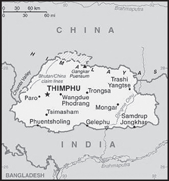
INTRODUCTION
Background: Following Britain’s victory in the 1865 Duar War, Britain and Bhutan signed the Treaty of Sinchulu, under which Bhutan would receive an annual subsidy in exchange for ceding land to British India. Ugyen WANGCHUCK - who had served as the de facto ruler of an increasingly unified Bhutan and had improved relations with the British toward the end of the 19th century - was named king in 1907. Three years later, a treaty was signed whereby the British agreed not to interfere in Bhutanese internal affairs, and Bhutan allowed Britain to direct its foreign affairs. Bhutan negotiated a similar arrangement with independent India in 1949. The Indo-Bhutanese Treaty of Friendship returned to Bhutan a small piece of the territory annexed by the British, formalized the annual subsidies the country received, and defined India’s responsibilities in defense and foreign relations. Under a succession of modernizing monarchs beginning in the 1950s, Bhutan joined the Un in 1971 and slowly continued its engagement beyond its borders.
In 2005, King Jigme Singye WANGCHUCK unveiled the draft of Bhutan’s first constitution - which introduced major democratic reforms - and held a national referendum for its approval. The King abdicated the throne in 2006 in favor of his son, Jigme Khesar Namgyel WANGCHUCK. In 2007, India and Bhutan renegotiated their treaty, eliminating the clause that stated that Bhutan would be “guided by” India in conducting its foreign policy, although Thimphu continues to coordinate closely with New Delhi. In 2008, Bhutan held its first parliamentary election in accordance with the constitution. Bhutan experienced a peaceful turnover of power following a parliamentary election in 2013, which resulted in the defeat of the incumbent party. In 2018, the incumbent party again lost the parliamentary election. Of the more than 100,000 ethnic Nepali - predominantly Lhotshampa - refugees who fled or were forced out of Bhutan in the 1990s, about 6,500 remain displaced in Nepal.
GEOGRAPHY
Location: Southern Asia, between China and India
Geographic coordinates: 27 30 N, 90 30 E
Map references: Asia
Area: total: 38,394 sq km
land: 38,394 sq km
water: 0 sq km
comparison ranking: total 136
Area - comparative: slightly larger than Maryland; about one-half the size of Indiana
Land boundaries: total: 1,136 km
border countries (2): China 477 km; India 659 km
Coastline: 0 km (landlocked)
Maritime claims: none (landlocked)
Climate: varies; tropical in southern plains; cool winters and hot summers in central valleys; severe winters and cool summers in Himalayas
Terrain: mostly mountainous with some fertile valleys and savanna
Elevation: highest point: Gangkar Puensum 7,570 m
lowest point: Drangeme Chhu 97 m
mean elevation: 2,220 m
Natural resources: timber, hydropower, gypsum, calcium carbonate
Land use: agricultural land: 13.6% (2018 est.)
arable land: 2.6% (2018 est.)
permanent crops: 0.3% (2018 est.)
permanent pasture: 10.7% (2018 est.)
forest: 85.5% (2018 est.)
other: 0.9% (2018 est.)
Irrigated land: 320 sq km (2012)
Natural hazards: violent storms from the Himalayas are the source of the country’s Bhutanese name, which translates as Land of the Thunder Dragon; frequent landslides during the rainy season
Geography - note: landlocked; strategic location between China and India; controls several key Himalayan mountain passes
PEOPLE AND SOCIETY
Population: 876,181 (2023 est.)
comparison ranking: 165
Nationality: noun: Bhutanese (singular and plural)
adjective: Bhutanese
Ethnic groups: Ngalop (also known as Bhote) 50%, ethnic Nepali 35% (predominantly Lhotshampas), indigenous or migrant tribes 15%
Languages: Sharchopkha 28%, Dzongkha (official) 24%, Lhotshamkha 22%, other 26% (includes foreign languages) (2005 est.)
Religions: Lamaistic Buddhist 75.3%, Indian- and Nepali-influenced Hinduism 22.1%, other 2.6% (2005 est.)
Age structure: 0-14 years: 23.49% (male 105,317/female 100,526)
15-64 years: 69.97% (male 318,732/female 294,292)
65 years and over: 6.54% (2023 est.) (male 29,582/female 27,732)
Dependency ratios: total dependency ratio: 40.7
youth dependency ratio: 32.1
elderly dependency ratio: 8.6
potential support ratio: 11.1 (2021 est.)
Median age: total: 29.1 years (2020)
male: 29.6 years
female: 28.6 years
comparison ranking: total 136
Population growth rate: 0.96% (2023 est.)
comparison ranking: 95
Birth rate: 15.61 births/1,000 population (2023 est.)
comparison ranking: 103
Death rate: 6.05 deaths/1,000 population (2023 est.)
comparison ranking: 155
Net migration rate: 0 migrant(s)/1,000 population (2023 est.)
comparison ranking: 95
Urbanization: urban population: 44.4% of total population (2023)
rate of urbanization: 2.52% annual rate of change (2020-25 est.)
Major urban areas - population: 203,000 THIMPHU (capital) (2018)
Sex ratio: at birth: 1.05 male(s)/female
0-14 years: 1.05 male(s)/female
15-64 years: 1.08 male(s)/female
65 years and over: 1.07 male(s)/female
total population: 1.07 male(s)/female (2023 est.)
Maternal mortality ratio: 60 deaths/100,000 live births (2020 est.)
comparison ranking: 92
Infant mortality rate: total: 25.61 deaths/1,000 live births (2023 est.)
male: 25.86 deaths/1,000 live births
female: 25.34 deaths/1,000 live births
comparison ranking: total 61
Life expectancy at birth: total population: 73.01 years (2023 est.)
male: 71.84 years
female: 74.25 years
comparison ranking: total population 152
Total fertility rate: 1.77 children born/woman (2023 est.)
comparison ranking: 148
Gross reproduction rate: 0.86 (2023 est.)
Drinking water source: improved: urban: 99.5% of population
rural: 100% of population
total: 99.8% of population
unimproved: urban: 0.5% of population
rural: 0% of population
total: 0.2% of population (2020 est.)
Current health expenditure: 4.4% of GDP (2020)
Physicians density: 0.5 physicians/1,000 population (2020)
Hospital bed density: 1.7 beds/1,000 population (2012)
Sanitation facility access: improved: urban: 90.8% of population
rural: 83.1% of population
total: 86.4% of population
unimproved: urban: 9.2% of population
rural: 16.9% of population
total: 13.6% of population (2020 est.)
Obesity - adult prevalence rate: 6.4% (2016)
comparison ranking: 168
Alcohol consumption per capita: total: 0.07 liters of pure alcohol (2019 est.)
beer: 0.01 liters of pure alcohol (2019 est.)
wine: 0.05 liters of pure alcohol (2019 est.)
spirits: 0 liters of pure alcohol (2019 est.)
other alcohols: 0 liters of pure alcohol (2019 est.)
comparison ranking: total 179
Currently married women (ages 15-49): 62.8% (2023 est.)
Education expenditures: 7% of GDP (2021 est.)
comparison ranking: 22
Literacy: definition: age 15 and over can read and write
total population: 70.9%
male: 77.9%
female: 62.8% (2021)
School life expectancy (primary to tertiary education): total: 13 years
male: 13 years
female: 13 years (2018)
Youth unemployment rate (ages 15-24): total: 18.8% (2021 est.)
male: 15.6%
female: 22%
comparison ranking: total 90
ENVIRONMENT
Environment - current issues: soil erosion; limited access to potable water; wildlife conservation; industrial pollution; waste disposal
Environment - international agreements: party to: Biodiversity, Climate Change, Climate Change-Kyoto Protocol, Climate Change-Paris Agreement, Desertification, Endangered Species, Hazardous Wastes, Nuclear Test Ban, Ozone Layer Protection, Wetlands
signed, but not ratified: Law of the Sea
Climate: varies; tropical in southern plains; cool winters and hot summers in central valleys; severe winters and cool summers in Himalayas
Land use: agricultural land: 13.6% (2018 est.)
arable land: 2.6% (2018 est.)
permanent crops: 0.3% (2018 est.)
permanent pasture: 10.7% (2018 est.)
forest: 85.5% (2018 est.)
other: 0.9% (2018 est.)
Urbanization: urban population: 44.4% of total population (2023)
rate of urbanization: 2.52% annual rate of change (2020-25 est.)
Revenue from forest resources: 1.89% of GDP (2018 est.)
comparison ranking: 37
Revenue from coal: 0% of GDP (2018 est.)
comparison ranking: 64
Air pollutants: particulate matter emissions: 26.1 micrograms per cubic meter (2019 est.)
carbon dioxide emissions: 1.26 megatons (2016 est.)
methane emissions: 1.11 megatons (2020 est.)
Waste and recycling: municipal solid waste generated annually: 111,314 tons (2007 est.)
municipal solid waste recycled annually: 957 tons (2016 est.)
percent of municipal solid waste recycled: 0.9% (2016 est.)
Total water withdrawal: municipal: 20 million cubic meters (2020 est.)
industrial: 3 million cubic meters (2019 est.)
agricultural: 320 million cubic meters (2020 est.)
Total renewable water resources: 78 billion cubic meters (2020 est.)
GOVERNMENT
Country name: conventional long form: Kingdom of Bhutan
conventional short form: Bhutan
local long form: Druk Gyalkhap
local short form: Druk Yul
etymology: named after the Bhotia, the ethnic Tibetans who migrated from Tibet to Bhutan; “Bod” is the Tibetan name for their land; the Bhutanese name “Druk Yul” means “Land of the Thunder Dragon”
Government type: constitutional monarchy
Capital: name: Thimphu
geographic coordinates: 27 28 N, 89 38 E
time difference: UTC+6 (11 hours ahead of Washington, DC, during Standard Time)
etymology: the origins of the name are unclear; the traditional explanation, dating to the 14th century, is that thim means “dissolve” and phu denotes “high ground” to express the meaning of “dissolving high ground,” in reference to a local deity that dissolved before a traveler’s eyes, becoming a part of the rock on which the present city stands
Administrative divisions: 20 districts (dzongkhag, singular and plural); Bumthang, Chhukha, Dagana, Gasa, Haa, Lhuentse, Mongar, Paro, Pemagatshel, Punakha, Samdrup Jongkhar, Samtse, Sarpang, Thimphu, Trashigang, Trashi Yangtse, Trongsa, Tsirang, Wangdue Phodrang, Zhemgang
Independence: 17 December 1907 (became a unified kingdom under its first hereditary king); 8 August 1949 (Treaty of Friendship with India maintains Bhutanese independence)
National holiday: National Day (Ugyen WANGCHUCK became first hereditary king), 17 December (1907)
Constitution: history: previous governing documents were various royal decrees; first constitution drafted November 2001 to March 2005, ratified 18 July 2008
amendments: proposed as a motion by simple majority vote in a joint session of Parliament; passage requires at least a three-fourths majority vote in a joint session of the next Parliament and assent by the king
Legal system: civil law based on Buddhist religious law
International law organization participation: has not submitted an ICJ jurisdiction declaration; non-party state to the ICCt
Citizenship: citizenship by birth: no
citizenship by descent only: the father must be a citizen of Bhutan
dual citizenship recognized: no
residency requirement for naturalization: 10 years
Suffrage: 18 years of age; universal
Executive branch: chief of state: King Jigme Khesar Namgyel WANGCHUCK (since 14 December 2006); note - King Jigme Singye WANGCHUCK abdicated the throne on 14 December 2006 to his son
head of government: Prime Minister Lotay TSHERING (since 7 November 2018)
cabinet: Council of Ministers or Lhengye Zhungtshog members nominated by the monarch in consultation with the prime minister and approved by the National Assembly; members serve 5-year terms
elections/appointments: the monarchy is hereditary but can be removed by a two-thirds vote of Parliament; leader of the majority party in Parliament is nominated as the prime minister, appointed by the monarch
Legislative branch: description: bicameral Parliament or Chi Tshog consists of:
non-partisan National Council or Gyelyong Tshogde (25 seats; 20 members directly elected in single-seat constituencies by simple majority vote and 5 members appointed by the king; members serve 5-year terms)
National Assembly or Tshogdu (46 seats; members directly elected in single-seat constituencies in a two-round system; in the primary round, contesting political parties are directly selected by simple majority vote; in the main round, the two top parties in the primary round field candidates who are directly elected by simple majority vote; members serve 5-year terms)
elections:
National Council - last held on 20 April 2023 (next to be held in 2028)
National Assembly - primary round held on 15 September 2018 and main round held on 18 October 2018 (next primary round be held in December 2023 and main round to be held in January 2024)
election results:
National Council - seats by party - independent 20 (all candidates ran as independents) and 5 appointed by the king; composition as of October 2023 - men 22, women 3, percent of women 12%
National Assembly - first round - percent of vote by party - DNT 31.9%, DPT 30.9%, PDP 27.4%, BKP 9.8%; second round - percent of vote by party - NA; seats by party - DNT 30, DPT 17; composition as of October 2023 - men 39, women 8, percent of women 17%; note - total Parliament percent of women 15.3%
Judicial branch: highest court(s): Supreme Court (consists of the chief justice and 4 associate justices); note - the Supreme Court has sole jurisdiction in constitutional matters
judge selection and term of office: Supreme Court chief justice appointed by the monarch upon the advice of the National Judicial Commission, a 4-member body to include the Legislative Committee of the National Assembly, the attorney general, the Chief Justice of Bhutan and the senior Associate Justice of the Supreme Court; other judges (drangpons) appointed by the monarch from among the High Court judges selected by the National Judicial Commission; chief justice serves a 5-year term or until reaching age 65 years, whichever is earlier; the 4 other judges serve 10-year terms or until age 65, whichever is earlier
subordinate courts: High Court (first appellate court); District or Dzongkhag Courts; sub-district or Dungkhag Courts
Political parties and leaders: Bhutan Kuen-Nyam Party (dissolved in January 2023)
Bhutan Peace and Prosperity Party (Druk Phuensum Tshogpa) or DPT [Dorji WANGDI] (Druk Chirwang Tshogpa or DCT merged with DPT in March 2018)
People’s Democratic Party or PDP [Tshering TOBGAY]
United Party of Bhutan (Druk Nyamrup Tshogpa) or DNT [Lotay TSHERING]
International organization participation: ADB, BIMSTEC, CP, FAO, G-77, IBRD, ICAO, IDA, IFAD, IFC, IMF, Interpol, IOC, IOM (observer), IPU, ISO (correspondent), ITSO, ITU, MIGA, NAM, OPCW, SAARC, SACEP, UN, UNCTAD, UNESCO, UNIDO, UNISFA, UNTSO, UNWTO, UPU, WCO, WHO, WIPO, WMO, WTO (observer)
Diplomatic representation in the US: chief of mission: Ambassador (vacant); Chargé d’Affaires Phuntsho NORBU (since October 2022)
note – also the Deputy Permanent Representative to the UN
telephone: [1] (212) 682-2268
FAX: [1] (212) 661-0551
email address and website:
consulate(s) general: New York
embassy: 343 East 43rd Street, New York, NY 10017
note – the Permanent Mission to the UN for Bhutan has consular jurisdiction in the US
Diplomatic representation from the US: embassy: none; frequent informal contact is maintained via the US embassy in New Delhi (India) and Bhutan’s Permanent Mission to the UN
Flag description: divided diagonally from the lower hoist-side corner; the upper triangle is yellow and the lower triangle is orange; centered along the dividing line is a large black and white dragon facing away from the hoist side; the dragon, called the Druk (Thunder Dragon), is the emblem of the nation; its white color stands for purity and the jewels in its claws symbolize wealth; the background colors represent spiritual and secular powers within Bhutan: the orange is associated with Buddhism, while the yellow denotes the ruling dynasty
National symbol(s): thunder dragon known as Druk Gyalpo; national colors: orange, yellow
National anthem: name: “Druk tsendhen” (The Thunder Dragon Kingdom)
lyrics/music: Gyaldun Dasho Thinley DORJI/Aku TONGMI
note: adopted 1953
ECONOMY
Economic overview: hydropower investments spurring economic development; Gross National Happiness economy; sharp poverty declines; low inflation; strong monetary and fiscal policies; stable currency; fairly resilient response to COVID-19; key economic and strategic relations with India; climate vulnerabilities
Real GDP (purchasing power parity): $8.481 billion (2021 est.)
$8.148 billion (2020 est.)
$9.054 billion (2019 est.)
note: data are in 2017 dollars
comparison ranking: 168
Real GDP growth rate: 4.09% (2021 est.)
-10.01% (2020 est.)
5.76% (2019 est.)
comparison ranking: 119
Real GDP per capita: $10,900 (2021 est.)
$10,500 (2020 est.)
$11,800 (2019 est.)
note: data are in 2017 dollars
comparison ranking: 139
GDP (official exchange rate): $2.405 billion (2017 est.)
Inflation rate (consumer prices): 7.35% (2021 est.)
5.63% (2020 est.)
2.73% (2019 est.)
comparison ranking: 41
GDP - composition, by sector of origin: agriculture: 16.2% (2017 est.)
industry: 41.8% (2017 est.)
services: 42% (2017 est.)
comparison rankings: services 205; industry 23; agriculture 60
GDP - composition, by end use: household consumption: 58% (2017 est.)
government consumption: 16.8% (2017 est.)
investment in fixed capital: 47.2% (2017 est.)
investment in inventories: 0% (2017 est.)
exports of goods and services: 26% (2017 est.)
imports of goods and services: -48% (2017 est.)
Agricultural products: milk, rice, maize, potatoes, roots/tubers, oranges, areca nuts, chillies/peppers, spices, ginger
Industries: cement, wood products, processed fruits, alcoholic beverages, calcium carbide, tourism
Industrial production growth rate: 1.96% (2021 est.)
comparison ranking: 134
Labor force: 361,000 (2021 est.)
note: major shortage of skilled labor
comparison ranking: 165
Labor force - by occupation: agriculture: 58%
industry: 20%
services: 22% (2015 est.)
Unemployment rate: 4.33% (2021 est.)
3.65% (2020 est.)
2.5% (2019 est.)
comparison ranking: 169
Youth unemployment rate (ages 15-24): total: 18.8% (2021 est.)
male: 15.6%
female: 22%
comparison ranking: total 90
Population below poverty line: 8.2% (2017 est.)
Gini Index coefficient - distribution of family income: 37.4 (2017 est.)
comparison ranking: 77
Household income or consumption by percentage share: lowest 10%: 2.8%
highest 10%: 30.6% (2012)
Budget: revenues: $710 million (2020 est.)
expenditures: $777 million (2020 est.)
note: the Government of India finances nearly one-quarter of Bhutan’s budget expenditures
Budget surplus (+) or deficit (-): -3.4% (of GDP) (2017 est.)
comparison ranking: 143
Public debt: 117.33% of GDP (2020 est.)
97.49% of GDP (2019 est.)
101.19% of GDP (2018 est.)
comparison ranking: 17
Taxes and other revenues: 12.98% (of GDP) (2020 est.)
comparison ranking: 169
Fiscal year: 1 July - 30 June
Current account balance: -$321.535 million (2021 est.)
-$381.153 million (2020 est.)
-$500.802 million (2019 est.)
comparison ranking: 110
Exports: $741.602 million (2021 est.)
$786.681 million (2020 est.)
$777.529 million (2019 est.)
note: Data are in current year dollars and do not include illicit exports or re-exports.
comparison ranking: 185
Exports - partners: India 94% (2019)
Exports - commodities: iron alloys, dolomite, aircraft, cement, gypsum (2021)
Imports: $1.027 billion (2021 est.) note: data are in current year dollars
$1.188 billion (2020 est.) note: data are in current year dollars
$1.23 billion (2019 est.) note: data are in current year dollars
comparison ranking: 187
Imports - partners: India 85%, Thailand 5% (2019)
Imports - commodities: refined petroleum, iron products, delivery trucks, cars, wood charcoal (2019)
Reserves of foreign exchange and gold: $1.056 billion (31 December 2021 est.)
$1.473 billion (31 December 2020 est.)
$1.238 billion (31 December 2019 est.)
comparison ranking: 144
Debt - external: $2.671 billion (31 December 2017 est.)
$2.355 billion (31 December 2016 est.)
comparison ranking: 147
Exchange rates: ngultrum (BTN) per US dollar -
Exchange rates: 73.939 (2021 est.)
74.1 (2020 est.)
70.42 (2019 est.)
68.389 (2018 est.)
65.122 (2017 est.)
ENERGY
Electricity access: electrification - total population: 100% (2021)
Electricity: installed generating capacity: 2.334 million kW (2020 est.)
consumption: 4.315 billion kWh (2019 est.)
exports: 4.6 billion kWh (2019 est.)
imports: 22.85 million kWh (2019 est.)
transmission/distribution losses: 60 million kWh (2019 est.)
comparison rankings: installed generating capacity 116; transmission/distribution losses 170; imports 115; exports 38; consumption 130
Electricity generation sources: hydroelectricity: 100% of total installed capacity (2020 est.)
Coal: production: 174,000 metric tons (2020 est.)
consumption: 211,000 metric tons (2020 est.)
exports: 0 metric tons (2020 est.)
imports: 37,000 metric tons (2020 est.)
proven reserves: 0 metric tons (2019 est.)
Petroleum: total petroleum production: 0 bbl/day (2021 est.)
refined petroleum consumption: 4,400 bbl/day (2019 est.)
Refined petroleum products - production: 0 bbl/day (2017 est.)
comparison ranking: 185
Refined petroleum products - exports: 0 bbl/day (2015 est.)
comparison ranking: 126
Refined petroleum products - imports: 3,120 bbl/day (2015 est.)
comparison ranking: 183
Carbon dioxide emissions: 934,000 metric tonnes of CO2 (2019 est.)
from coal and metallurgical coke: 328,000 metric tonnes of CO2 (2019 est.)
from petroleum and other liquids: 606,000 metric tonnes of CO2 (2019 est.)
comparison ranking: total emissions 174
Energy consumption per capita: 100.135 million Btu/person (2019 est.)
comparison ranking: 59
COMMUNICATIONS
Telephones - fixed lines: total subscriptions: 19,680 (2021 est.)
subscriptions per 100 inhabitants: 3 (2021 est.)
comparison ranking: total subscriptions 173
Telephones - mobile cellular: total subscriptions: 778,008 (2021 est.)
subscriptions per 100 inhabitants: 100 (2021 est.)
comparison ranking: total subscriptions 168
Telecommunication systems: general assessment: the small land-locked Kingdom of Bhutan has only recently emerged from decades of isolation from the modern world; that, and its mountainous terrain, left the country far back in the field in terms of teledensity as well as access to the Internet; over the last decade, the country has undergone a significant transformation due to the opening of its borders, liberalization of its telecom sector, and the active support from the government towards increased competition in the mobile, broadband, and ISP segments; the relatively widespread availability of the mobile platform has caused an explosion in mobile broadband subscriber numbers, growing from zero to over 100% penetration in just ten years (between 2010 and 2019).; the onset of the Covid-19 crisis in 2020 caused the subscription rates to drop back a little; growth is projected to return in 2022 (along with the broader mobile market) as the overall economy recovers; the government opens up more to foreign investment, trade, and tourism; and network expansion continues – the recent (December 2021) launch of 5G services by both of the country’s mobile operators being particularly noteworthy (2022)
domestic: approximately 3 to 100 fixed-line and 100 mobile cellular subscriptions per 100 people (2021)
international: country code - 975; international telephone and telegraph service via landline and microwave relay through India; satellite earth station - 1 Intelsat
Broadcast media: state-owned TV station established in 1999; cable TV service offers dozens of Indian and other international channels; first radio station, privately launched in 1973, is now state-owned; 5 private radio stations are currently broadcasting (2012)
Internet country code: .bt
Internet users: total: 670,800 (2021 est.)
percent of population: 86% (2021 est.)
comparison ranking: total 162
Broadband - fixed subscriptions: total: 3,189 (2020 est.)
subscriptions per 100 inhabitants: 0.4 (2020 est.)
comparison ranking: total 192
TRANSPORTATION
National air transport system: number of registered air carriers: 2 (2020)
inventory of registered aircraft operated by air carriers: 6
annual passenger traffic on registered air carriers: 275,849 (2018)
annual freight traffic on registered air carriers: 690,000 (2018) mt-km
Civil aircraft registration country code prefix: A5
Airports: 3 (2021)
comparison ranking: total 191
Airports - with paved runways: 2
note: paved runways have a concrete or asphalt surface but not all have facilities for refueling, maintenance, or air traffic control; the length of a runway required for aircraft to safely operate depends on a number of factors including the type of aircraft, the takeoff weight (including passengers, cargo, and fuel), engine types, flap settings, landing speed, elevation of the airport, and average maximum daily air temperature; paved runways can reach a length of 5,000 m (16,000 ft.), but the “typical” length of a commercial airline runway is between 2,500-4,000 m (8,000-13,000 ft.)
Airports - with unpaved runways: 1
note: unpaved runways have a surface composition such as grass or packed earth and are most suited to the operation of light aircraft; unpaved runways are usually short, often less than 1,000 m (3,280 ft.) in length; airports with unpaved runways often lack facilities for refueling, maintenance, or air traffic control
Roadways: total: 12,205 km (2017)
paved: (2017)
unpaved: (2017)
urban: 437 km (2017)
comparison ranking: total 132
MILITARY AND SECURITY
Military and security forces: Royal Bhutan Army (includes Royal Bodyguard and an air wing); National Militia
Ministry of Home and Cultural Affairs: Royal Bhutan Police (2023)
Military and security service personnel strengths: estimated 8,000 active personnel (2023)
Military equipment inventories and acquisitions: India has provided most of the Royal Bhutan Army’s equipment (2023)
Military service age and obligation: 18 years of age for voluntary military service for men and women; no conscription; militia training is compulsory for males aged 20-25, over a 3-year period (2023)
note: in 2021, the Royal Bhutan Army graduated from a year-long training course the first batch of 150 women to be allowed to serve in combat roles; previously, women were allowed to serve in medical and other non-combat roles
Military - note: the Army is responsible for external threats but also has some internal security functions such as conducting counterinsurgency operations, guarding forests, and providing security for prominent persons; the force is deployed throughout the country in more than a dozen “wings,” each comprised of a few infantry companies; the Army also has units of royal bodyguards and special forces; Bhutan relies on India for military training, arms supplies, and the country’s air defense (2023)
SPACE
Space agency/agencies: announced in 2018 that it intends to establish a space agency, but has not yet done so (2023)
Space program overview: has a small, recently established program focused on acquiring satellites and developing the capabilities to manufacture satellites; cooperates with India (2023)
note: further details about the key activities, programs, and milestones of the country’s space program, as well as government spending estimates on the space sector, appear in Appendix S
TRANSNATIONAL ISSUES
Disputes - international: Bhutan-China: Lacking any treaty describing the boundary, Bhutan and China continue negotiations to establish a common boundary alignment to resolve territorial disputes arising from substantial cartographic discrepancies, the most contentious of which lie in Bhutan’s west along China’s Chumbi salient.
Bhutan-India: none identified
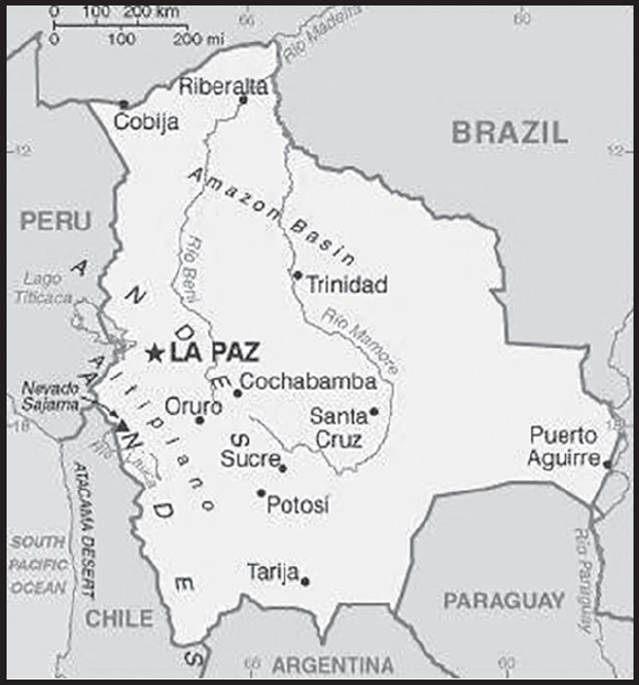
INTRODUCTION
Background: Bolivia, named after independence fighter Simon BOLIVAR, broke away from Spanish rule in 1825. Much of its subsequent history has consisted of a series of coups and countercoups, with the last coup occurring in 1978. Democratic civilian rule was established in 1982, but leaders have faced problems of deep-seated poverty, social unrest, and illegal drug production.
In December 2005, Bolivians elected Movement Toward Socialism leader Evo MORALES president - by the widest margin of any leader since the restoration of civilian rule in 1982 - after he ran on a promise to change the country’s traditional political class and empower the nation’s poor and indigenous majority. In December 2009 and October 2014, President MORALES easily won reelection. His party maintained control of the legislative branch of the government, which has allowed him to continue his “process of change.” In February 2016, MORALES narrowly lost a referendum to approve a constitutional amendment that would have allowed him to compete in the 2019 presidential election. However, a 2017 Supreme Court ruling stating that term limits violate human rights provided the justification for MORALES to be chosen by his party to run again in 2019. MORALES attempted to claim victory in the October 2019 election, but widespread allegations of electoral fraud, rising violence, and pressure from the military ultimately forced him to flee the country. An interim government, led by President Jeanine ANEZ Chavez, prepared new elections that took place in October 2020; President Luis Alberto ARCE Catacora took office the following month.
GEOGRAPHY
Location: Central South America, southwest of Brazil
Geographic coordinates: 17 00 S, 65 00 W
Map references: South America
Area: total: 1,098,581 sq km
land: 1,083,301 sq km
water: 15,280 sq km
comparison ranking: total 29
Area - comparative: slightly less than three times the size of Montana
Land boundaries: total: 7,252 km
border countries (5): Argentina 942 km; Brazil 3,403 km; Chile 942 km; Paraguay 753 km; Peru 1,212 km
Coastline: 0 km (landlocked)
Maritime claims: none (landlocked)
Climate: varies with altitude; humid and tropical to cold and semiarid
Terrain: rugged Andes Mountains with a highland plateau (Altiplano), hills, lowland plains of the Amazon Basin
Elevation: highest point: Nevado Sajama 6,542 m
lowest point: Rio Paraguay 90 m
mean elevation: 1,192 m
Natural resources: lithium, tin, natural gas, petroleum, zinc, tungsten, antimony, silver, iron, lead, gold, timber, hydropower
Land use: agricultural land: 34.3% (2018 est.)
arable land: 3.6% (2018 est.)
permanent crops: 0.2% (2018 est.)
permanent pasture: 30.5% (2018 est.)
forest: 52.5% (2018 est.)
other: 13.2% (2018 est.)
Irrigated land: 2,972 sq km (2017)
Major lakes (area sq km): fresh water lake(s): Lago Titicaca (shared with Peru) - 8,030 sq km
salt water lake(s): Lago Poopo - 1,340 sq km
Major watersheds (area sq km): Atlantic Ocean drainage: Amazon (6,145,186 sq km), Paraná (2,582,704 sq km)
Major aquifers: Amazon Basin
Population distribution: a high altitude plain in the west between two cordillera of the Andes, known as the Altiplano, is the focal area for most of the population; a dense settlement pattern is also found in and around the city of Santa Cruz, located on the eastern side of the Andes
Natural hazards: flooding in the northeast (March to April)
volcanism: volcanic activity in Andes Mountains on the border with Chile; historically active volcanoes in this region are Irruputuncu (5,163 m), which last erupted in 1995, and the Olca-Paruma volcanic complex (5,762 m to 5,167 m)
Geography - note: note 1: landlocked; shares control of Lago Titicaca, world’s highest navigable lake (elevation 3,805 m), with Peru
note 2: the southern regions of Peru and the extreme northwestern part of Bolivia are considered to be the place of origin for the common potato, while southeast Bolivia and northwest Argentina seem to be the original development site for peanuts
PEOPLE AND SOCIETY
Population: 12,186,079 (2023 est.)
comparison ranking: 79
Nationality: noun: Bolivian(s)
adjective: Bolivian
Ethnic groups: Mestizo (mixed White and Amerindian ancestry) 68%, Indigenous 20%, White 5%, Cholo/Chola 2%, African descent 1%, other 1%, unspecified 3%; 44% of respondents indicated feeling part of some indigenous group, predominantly Quechua or Aymara (2009 est.)
note: results among surveys vary based on the wording of the ethnicity question and the available response choices; the 2001 national census did not provide “Mestizo” as a response choice, resulting in a much higher proportion of respondents identifying themselves as belonging to one of the available indigenous ethnicity choices; the use of “Mestizo” and “Cholo” varies among response choices in surveys, with surveys using the terms interchangeably, providing one or the other as a response choice, or providing the two as separate response choices
Languages: Spanish (official) 68.1%, Quechua (official) 17.2%, Aymara (official) 10.5%, Guarani (official) 0.6%, other 1.5%, unspecified 2.1%; note - Bolivia’s 2009 constitution designates Spanish and all indigenous languages as official; 36 indigenous languages are specified, including a few that are extinct (2012 est.)
major-language sample(s): La Libreta Informativa del Mundo, la fuente indispensable de información básica. (Spanish)
Religions: Roman Catholic 70%, Evangelical 14.5%, Adventist 2.5%, Church of Jesus Christ 1.2%, agnostic 0.3%, atheist 0.8%, other 3.5%, none 6.6%, unspecified 0.6% (2018 est.)
Demographic profile: Bolivia ranks at or near the bottom among Latin American countries in several areas of health and development, including poverty, education, fertility, malnutrition, mortality, and life expectancy. On the positive side, more children are being vaccinated and more pregnant women are getting prenatal care and having skilled health practitioners attend their births.
Bolivia’s income inequality is the highest in Latin America and one of the highest in the world. Public education is of poor quality, and educational opportunities are among the most unevenly distributed in Latin America, with girls and indigenous and rural children less likely to be literate or to complete primary school. The lack of access to education and family planning services helps to sustain Bolivia’s high fertility rate—approximately three children per woman. Bolivia’s lack of clean water and basic sanitation, especially in rural areas, contributes to health problems.
Between 7% and 16% of Bolivia’s population lives abroad (estimates vary in part because of illegal migration). Emigrants primarily seek jobs and better wages in Argentina (the principal destination), the US, and Spain. In recent years, more restrictive immigration policies in Europe and the US have increased the flow of Bolivian emigrants to neighboring countries. Fewer Bolivians migrated to Brazil in 2015 and 2016 because of its recession; increasing numbers have been going to Chile, mainly to work as miners.
Age structure: 0-14 years: 29.14% (male 1,813,044/female 1,737,699)
15-64 years: 64.03% (male 3,929,462/female 3,872,943)
65 years and over: 6.84% (2023 est.) (male 384,356/female 448,575)
Dependency ratios: total dependency ratio: 56.3
youth dependency ratio: 48.7
elderly dependency ratio: 12
potential support ratio: 8.3 (2021 est.)
Median age: total: 25.3 years (2020)
male: 24.5 years
female: 26 years
comparison ranking: total 162
Population growth rate: 1.06% (2023 est.)
comparison ranking: 89
Birth rate: 18.08 births/1,000 population (2023 est.)
comparison ranking: 79
Death rate: 4.33 deaths/1,000 population (2023 est.)
comparison ranking: 206
Net migration rate: -0.96 migrant(s)/1,000 population (2023 est.)
comparison ranking: 144
Population distribution: a high altitude plain in the west between two cordillera of the Andes, known as the Altiplano, is the focal area for most of the population; a dense settlement pattern is also found in and around the city of Santa Cruz, located on the eastern side of the Andes
Urbanization: urban population: 71.2% of total population (2023)
rate of urbanization: 1.87% annual rate of change (2020-25 est.)
Major urban areas - population: 1.936 million LA PAZ (capital), 1.820 million Santa Cruz, 1.400 million Cochabamba (2022); 278,000 Sucre (constitutional capital) (2018)
Sex ratio: at birth: 1.05 male(s)/female
0-14 years: 1.04 male(s)/female
15-64 years: 1.01 male(s)/female
65 years and over: 0.86 male(s)/female
total population: 1.01 male(s)/female (2023 est.)
Mother’s mean age at first birth: 21.1 years (2008 est.)
note: data represents median age at first birth among women 25-49
Maternal mortality ratio: 161 deaths/100,000 live births (2020 est.)
comparison ranking: 53
Infant mortality rate: total: 22.28 deaths/1,000 live births (2023 est.)
male: 24.5 deaths/1,000 live births
female: 19.95 deaths/1,000 live births
comparison ranking: total 72
Life expectancy at birth: total population: 72.5 years (2023 est.)
male: 71.04 years
female: 74.02 years
comparison ranking: total population 161
Total fertility rate: 2.26 children born/woman (2023 est.)
comparison ranking: 79
Gross reproduction rate: 1.1 (2023 est.)
Contraceptive prevalence rate: 66.5% (2016)
Drinking water source: improved: urban: 99.2% of population
rural: 80.2% of population
total: 93.5% of population
unimproved: urban: 0.8% of population
rural: 19.8% of population
total: 6.5% of population (2020 est.)
Current health expenditure: 7.9% of GDP (2020)
Physicians density: 1.03 physicians/1,000 population (2017)
Hospital bed density: 1.3 beds/1,000 population (2017)
Sanitation facility access: improved: urban: 97.8% of population
rural: 48.4% of population
total: 83.1% of population
unimproved: urban: 2.2% of population
rural: 51.6% of population
total: 16.9% of population (2020 est.)
Major infectious diseases: degree of risk: very high (2023)
food or waterborne diseases: bacterial diarrhea and hepatitis A
vectorborne diseases: dengue fever and malaria
Obesity - adult prevalence rate: 20.2% (2016)
comparison ranking: 103
Alcohol consumption per capita: total: 2.98 liters of pure alcohol (2019 est.)
beer: 2.22 liters of pure alcohol (2019 est.)
wine: 0.14 liters of pure alcohol (2019 est.)
spirits: 0.54 liters of pure alcohol (2019 est.)
other alcohols: 0.08 liters of pure alcohol (2019 est.)
comparison ranking: total 115
Tobacco use: total: 12.7% (2020 est.)
male: 20.5% (2020 est.)
female: 4.8% (2020 est.)
comparison ranking: total 120
Children under the age of 5 years underweight: 3.4% (2016)
comparison ranking: 86
Currently married women (ages 15-49): 57.1% (2023 est.)
Child marriage: women married by age 15: 3.4%
women married by age 18: 19.7%
men married by age 18: 5.2% (2016 est.)
Education expenditures: 9.8% of GDP (2020 est.)
comparison ranking: 5
Literacy: definition: age 15 and over can read and write
total population: 92.5%
male: 96.5%
female: 88.6% (2015)
Youth unemployment rate (ages 15-24): total: 17.4% (2021 est.)
male: 16.8%
female: 18.4%
comparison ranking: total 99
ENVIRONMENT
Environment - current issues: the clearing of land for agricultural purposes and the international demand for tropical timber are contributing to deforestation; soil erosion from overgrazing and poor cultivation methods (including slash-and-burn agriculture); desertification; loss of biodiversity; industrial pollution of water supplies used for drinking and irrigation
Environment - international agreements: party to: Biodiversity, Climate Change, Climate Change-Kyoto Protocol, Climate Change-Paris Agreement, Comprehensive Nuclear Test Ban, Desertification, Endangered Species, Hazardous Wastes, Law of the Sea, Marine Dumping-London Convention, Nuclear Test Ban, Ozone Layer Protection, Ship Pollution, Wetlands,
signed, but not ratified: Environmental Modification, Marine Life Conservation
Climate: varies with altitude; humid and tropical to cold and semiarid
Land use: agricultural land: 34.3% (2018 est.)
arable land: 3.6% (2018 est.)
permanent crops: 0.2% (2018 est.)
permanent pasture: 30.5% (2018 est.)
forest: 52.5% (2018 est.)
other: 13.2% (2018 est.)
Urbanization: urban population: 71.2% of total population (2023)
rate of urbanization: 1.87% annual rate of change (2020-25 est.)
Revenue from forest resources: 0.33% of GDP (2018 est.)
comparison ranking: 78
Revenue from coal: 0% of GDP (2018 est.)
comparison ranking: 171
Air pollutants: particulate matter emissions: 25.23 micrograms per cubic meter (2019 est.)
carbon dioxide emissions: 21.61 megatons (2016 est.)
methane emissions: 21.01 megatons (2020 est.)
Waste and recycling: municipal solid waste generated annually: 2,219,052 tons (2015 est.)
municipal solid waste recycled annually: 268,727 tons (2015 est.)
percent of municipal solid waste recycled: 12.1% (2015 est.)
Major lakes (area sq km): fresh water lake(s): Lago Titicaca (shared with Peru) - 8,030 sq km
salt water lake(s): Lago Poopo - 1,340 sq km
Major watersheds (area sq km): Atlantic Ocean drainage: Amazon (6,145,186 sq km), Paraná (2,582,704 sq km)
Major aquifers: Amazon Basin
Total water withdrawal: municipal: 140 million cubic meters (2020 est.)
industrial: 30 million cubic meters (2020 est.)
agricultural: 1.92 billion cubic meters (2020 est.)
Total renewable water resources: 574 billion cubic meters (2020 est.)
GOVERNMENT
Country name: conventional long form: Plurinational State of Bolivia
conventional short form: Bolivia
local long form: Estado Plurinacional de Bolivia
local short form: Bolivia
etymology: the country is named after Simon BOLIVAR, a 19th-century leader in the South American wars for independence
Government type: presidential republic
Capital: name: La Paz (administrative capital); Sucre (constitutional [legislative and judicial] capital)
geographic coordinates: 16 30 S, 68 09 W
time difference: UTC-4 (1 hour ahead of Washington, DC, during Standard Time)
etymology: La Paz is a shortening of the original name of the city, Nuestra Senora de La Paz (Our Lady of Peace); Sucre is named after Antonio Jose de SUCRE (1795-1830), military hero in the independence struggle from Spain and the second president of Bolivia
note: at approximately 3,630 m above sea level, La Paz’s elevation makes it the highest capital city in the world
Administrative divisions: 9 departments (departamentos, singular - departamento); Beni, Chuquisaca, Cochabamba, La Paz, Oruro, Pando, Potosi, Santa Cruz, Tarija
Independence: 6 August 1825 (from Spain)
National holiday: Independence Day, 6 August (1825)
Constitution: history: many previous; latest drafted 6 August 2006 to 9 December 2008, approved by referendum 25 January 2009, effective 7 February 2009
amendments: proposed through public petition by at least 20% of voters or by the Plurinational Legislative Assembly; passage requires approval by at least two-thirds majority vote of the total membership of the Assembly and approval in a referendum; amended 2013
Legal system: civil law system with influences from Roman, Spanish, canon (religious), French, and indigenous law
International law organization participation: has not submitted an ICJ jurisdiction declaration; accepts ICCt jurisdiction
Citizenship: citizenship by birth: yes
citizenship by descent only: yes
dual citizenship recognized: yes
residency requirement for naturalization: 3 years
Suffrage: 18 years of age; universal and compulsory
Executive branch: chief of state: President Luis Alberto ARCE Catacora (since 8 November 2020); Vice President David CHOQUEHUANCA Cespedes (since 8 November 2020); note - the president is both chief of state and head of government
head of government: President Luis Alberto ARCE Catacora (since 8 November 2020); Vice President David CHOQUEHUANCA Cespedes (since 8 November 2020)
cabinet: Cabinet appointed by the president
elections/appointments: president and vice president directly elected on the same ballot one of 3 ways: candidate wins at least 50% of the vote, or at least 40% of the vote and 10% more than the next highest candidate; otherwise a second round is held and the winner determined by simple majority vote; president and vice president are elected by majority vote to serve a 5-year term; no term limits (changed from two-consecutive-term limit by Constitutional Court in late 2017); election last held on 18 October 2020 (next to be held in October 2025)
election results:
2020: Luis Alberto ARCE Catacora elected president; percent of vote - Luis Alberto ARCE Catacora (MAS) 55.1%; Carlos Diego MESA Gisbert (CC) 28.8%; Luis Fernando CAMACHO Vaca (Creemos) 14%; other 2.1%
2019: Juan Evo MORALES Ayma reelected president; percent of vote - Juan Evo MORALES Ayma (MAS) 61%; Samuel DORIA MEDINA Arana (UN) 24.5%; Jorge QUIROGA Ramirez (POC) 9.1%; other 5.4%; note - MORALES resigned from office on 10 November 2019 over alleged election rigging; resignations of all his constitutionally designated successors followed, including the Vice President, President of the Senate, President of the Chamber of Deputies, and First Vice President of the Senate, leaving the Second Vice President of the Senate, Jeanine ANEZ Chavez, the highest-ranking official still in office; her appointment to the presidency was endorsed by Bolivia’s Constitutional Court, and she served as interim president until the 8 November 2020 inauguration of Luis Alberto ARCE Catacora, who won the 18 October 2020 presidential election
Legislative branch: description: bicameral Plurinational Legislative Assembly or Asamblea Legislativa Plurinacional consists of:
Chamber of Senators or Camara de Senadores (36 seats; members directly elected in multi-seat constituencies by party-list proportional representation vote; members serve 5-year terms)
Chamber of Deputies or Camara de Diputados (130 seats; 70 members directly elected in single-seat constituencies by simple majority vote, 53 directly elected in single-seat constituencies by closed party-list proportional representation vote, and 7 (apportioned to non-contiguous, rural areas in 7 of the 9 states) directly elected in single-seat constituencies by simple majority vote; members serve 5-year terms)
elections:
Chamber of Senators - last held on 18 October 2020 (next to be held in 2025)
Chamber of Deputies - last held on 18 October 2020 (next to be held in 2025)
election results:
Chamber of Senators - percent of vote by party - NA; seats by party - MAS 21, ACC 11, Creemos 4; composition as of October 2023 - men 16, women 20, percent of women 55.6%
Chamber of Deputies - percent of vote by party - NA; seats by party - MAS 75, ACC 39, Creemos 16; composition as of October 2023 - men 70, women 60, percent of women 46.2%; note - total Plurinational Legislative Assembly percent of women - 48.2%
Judicial branch: highest court(s): Supreme Court or Tribunal Supremo de Justicia (consists of 12 judges or ministros organized into civil, penal, social, and administrative chambers); Plurinational Constitutional Tribunal (consists of 7 primary and 7 alternate magistrates); Plurinational Electoral Organ (consists of 7 members and 6 alternates); National Agro-Environment Court (consists of 5 primary and 5 alternate judges; Council of the Judiciary (consists of 3 primary and 3 alternate judges)
judge selection and term of office: Supreme Court, Plurinational Constitutional Tribunal, National Agro-Environmental Court, and Council of the Judiciary candidates pre-selected by the Plurinational Legislative Assembly and elected by direct popular vote; judges elected for 6-year terms; Plurinational Electoral Organ judges appointed - 6 by the Legislative Assembly and 1 by the president of the republic; members serve single 6-year terms
subordinate courts: National Electoral Court; District Courts (in each of the 9 administrative departments); agro-environmental lower courts
Political parties and leaders: Community Citizen Alliance or ACC [Carlos Diego MESA Gisbert]
Movement Toward Socialism or MAS [Juan Evo MORALES Ayma]
National Unity or UN [Samuel DORIA MEDINA Auza]
Revolutionary Left Front or FRI [Edgar GUZMAN Jauregui]
Social Democrat Movement or MDS [Ruben COSTAS Aguilera]
We Believe or Creemos [Luis Fernando CAMACHO Vaca]
note: We Believe or Creemos [Luis Fernando CAMACHO Vaca] is a coalition comprised of several opposition parties that participated in the 2020 election, which includes the Christian Democratic Party (PDC) and Solidarity Civic Unity (UCS)
International organization participation: CAN, CD, CELAC, FAO, G-77, IADB, IAEA, IBRD, ICAO, ICC (national committees), ICCt, ICRM, IDA, IFAD, IFC, IFRCS, ILO, IMF, IMO, Interpol, IOC, IOM, IPU, ISO (correspondent), ITSO, ITU, LAES, LAIA, Mercosur (associate), MIGA, MINUSTAH, MONUSCO, NAM, OAS, OPANAL, OPCW, PCA, UN, UN Security Council (temporary), UNAMID, UNASUR, UNCTAD, UNESCO, UNHRC, UNIDO, Union Latina, UNISFA, UNMIL, UNMISS, UNOCI, UNWTO, UPU, WCO, WFTU (NGOs), WHO, WIPO, WMO, WTO
Diplomatic representation in the US: chief of mission: Ambassador (vacant); Charge d’Affaires Maysa Rossana URENA MENACHO (since 1 September 2022)
chancery: 3014 Massachusetts Ave., NW, Washington, DC 20008
telephone: [1] (202) 483-4410
FAX: [1] (202) 328-3712
email address and website:
https://www.boliviawdc.org/en-us/
consulate(s) general: Houston, Los Angeles, Maple Grove (MN), Miami, New York, Washington, DC
Diplomatic representation from the US: chief of mission: Ambassador (vacant); Chargé d’Affaires Debra HEVIA (since September 2023)
embassy: Avenida Arce 2780, La Paz
mailing address: 3220 La Paz Place, Washington DC 20512-3220
telephone: [591] (2) 216-8000
FAX: [591] (2) 216-8111
email address and website:
note: in September 2008, the Bolivian Government expelled the US Ambassador to Bolivia, Philip GOLDBERG, and both countries have yet to reinstate their ambassadors
Flag description: three equal horizontal bands of red (top), yellow, and green with the coat of arms centered on the yellow band; red stands for bravery and the blood of national heroes, yellow for the nation’s mineral resources, and green for the fertility of the land
note: similar to the flag of Ghana, which has a large black five-pointed star centered in the yellow band; in 2009, a presidential decree made it mandatory for a so-called wiphala - a square, multi-colored flag representing the country’s indigenous peoples - to be used alongside the traditional flag
National symbol(s): llama, Andean condor, two national flowers: the cantuta and the patuju; national colors: red, yellow, green
National anthem: name: “Cancion Patriotica” (Patriotic Song)
lyrics/music: Jose Ignacio de SANJINES/Leopoldo Benedetto VINCENTI
note: adopted 1852
National heritage: total World Heritage Sites: 7 (6 cultural, 1 natural)
selected World Heritage Site locales: City of Potosi (c); El Fuerte de Samaipata (c); Historic Sucre (c); Jesuit Missions of Chiquitos (c); Noel Kempff Mercado National Park (n); Tiahuanacu (c); Qhapaq Ñan/Andean Road System (c)
ECONOMY
Economic overview: resource-rich economy benefits during commodity booms; has bestowed juridical rights to Mother Earth, impacting extraction industries; increasing Chinese lithium mining trade relations; hard hit by COVID-19; increased fiscal spending amid poverty increases; rampant banking and finance corruption
Real GDP (purchasing power parity): $97.266 billion (2021 est.)
$91.669 billion (2020 est.)
$100.446 billion (2019 est.)
note: data are in 2017 dollars
comparison ranking: 94
Real GDP growth rate: 6.11% (2021 est.)
-8.74% (2020 est.)
2.22% (2019 est.)
comparison ranking: 72
Real GDP per capita: $8,100 (2021 est.)
$7,700 (2020 est.)
$8,500 (2019 est.)
note: data are in 2017 dollars
comparison ranking: 154
GDP (official exchange rate): $40.822 billion (2019 est.)
Inflation rate (consumer prices): 0.74% (2021 est.)
0.94% (2020 est.)
1.84% (2019 est.)
comparison ranking: 205
Credit ratings: Fitch rating: B (2020)
Moody’s rating: B2 (2020)
Standard & Poors rating: B+ (2020)
note: The year refers to the year in which the current credit rating was first obtained.
GDP - composition, by sector of origin: agriculture: 13.8% (2017 est.)
industry: 37.8% (2017 est.)
services: 48.2% (2017 est.)
comparison rankings: services 187; industry 39; agriculture 70
GDP - composition, by end use: household consumption: 67.7% (2017 est.)
government consumption: 17% (2017 est.)
investment in fixed capital: 21.3% (2017 est.)
investment in inventories: 3.8% (2017 est.)
exports of goods and services: 21.7% (2017 est.)
imports of goods and services: -31.3% (2017 est.)
Agricultural products: sugar cane, soybeans, potatoes, maize, sorghum, rice, milk, plantains, poultry, bananas
Industries: mining, smelting, electricity, petroleum, food and beverages, handicrafts, clothing, jewelry
Industrial production growth rate: 9.56% (2021 est.)
comparison ranking: 31
Labor force: 6.322 million (2021 est.)
comparison ranking: 72
Labor force - by occupation: agriculture: 29.4%
industry: 22%
services: 48.6% (2015 est.)
Unemployment rate: 8.51% (2021 est.)
7.9% (2020 est.)
3.82% (2019 est.)
note: data are for urban areas; widespread underemployment
comparison ranking: 88
Youth unemployment rate (ages 15-24): total: 17.4% (2021 est.)
male: 16.8%
female: 18.4%
comparison ranking: total 99
Population below poverty line: 37.2% (2019 est.)
Gini Index coefficient - distribution of family income: 43.6 (2020 est.)
comparison ranking: 33
Average household expenditures: on food: 29.1% of household expenditures (2018 est.)
on alcohol and tobacco: 2.1% of household expenditures (2018 est.)
Household income or consumption by percentage share: lowest 10%: 0.9%
highest 10%: 36.1% (2014 est.)
Budget: revenues: $11.796 billion (2019 est.)
expenditures: $14.75 billion (2019 est.)
Budget surplus (+) or deficit (-): -7.8% (of GDP) (2017 est.)
comparison ranking: 197
Public debt: 49% of GDP (2017 est.)
44.9% of GDP (2016 est.)
note: data cover general government debt and includes debt instruments issued by government entities other than the treasury; the data include treasury debt held by foreign entities; the data include debt issued by subnational entities
comparison ranking: 109
Taxes and other revenues: 39.9% (of GDP) (2017 est.)
comparison ranking: 11
Fiscal year: calendar year
Current account balance: $802.112 million (2021 est.)
-$269.456 million (2020 est.)
-$1.366 billion (2019 est.)
comparison ranking: 54
Exports: $11.439 billion (2021 est.)
$7.383 billion (2020 est.)
$10.271 billion (2019 est.)
note: Data are in current year dollars and do not include illicit exports or re-exports.
comparison ranking: 99
Exports - partners: Argentina 16%, Brazil 15%, United Arab Emirates 12%, India 10%, United States 6%, South Korea 5%, Peru 5%, Colombia 5% (2019)
Exports - commodities: gold, natural gas, zinc, silver, soy products, tin (2021)
note: Bolivian cocaine production remains a significant illicit trade commodity
Imports: $10.799 billion (2021 est.) note: data are in current year dollars
$8.261 billion (2020 est.) note: data are in current year dollars
$11.957 billion (2019 est.) note: data are in current year dollars
comparison ranking: 108
Imports - partners: Brazil 22%, Chile 15%, China 13%, Peru 11%, Argentina 8%, United States 7% (2017)
Imports - commodities: cars, refined petroleum, delivery trucks, iron, buses (2019)
Reserves of foreign exchange and gold: $4.73 billion (31 December 2021 est.)
$5.247 billion (31 December 2020 est.)
$6.455 billion (31 December 2019 est.)
comparison ranking: 105
Debt - external: $12.81 billion (31 December 2017 est.)
$7.268 billion (31 December 2016 est.)
comparison ranking: 106
Exchange rates: bolivianos (BOB) per US dollar -
Exchange rates: 6.91 (2021 est.)
6.91 (2020 est.)
6.91 (2019 est.)
6.91 (2018 est.)
6.91 (2017 est.)
ENERGY
Electricity access: population without electricity: 2 million (2020)
electrification - total population: 98.5% (2021)
electrification - urban areas: 100% (2021)
electrification - rural areas: 95.1% (2021)
Electricity: installed generating capacity: 3.834 million kW (2020 est.)
consumption: 8,756,690,000 kWh (2019 est.)
exports: 0 kWh (2019 est.)
imports: 0 kWh (2019 est.)
transmission/distribution losses: 1.227 billion kWh (2019 est.)
comparison rankings: installed generating capacity 98; transmission/distribution losses 105; imports 126; exports 106; consumption 105
Electricity generation sources: fossil fuels: 64.4% of total installed capacity (2020 est.)
solar: 2.6% of total installed capacity (2020 est.)
wind: 0.7% of total installed capacity (2020 est.)
hydroelectricity: 30.5% of total installed capacity (2020 est.)
biomass and waste: 1.8% of total installed capacity (2020 est.)
Coal: proven reserves: 1 million metric tons (2019 est.)
Petroleum: total petroleum production: 65,400 bbl/day (2021 est.)
refined petroleum consumption: 87,800 bbl/day (2019 est.)
crude oil and lease condensate exports: 0 bbl/day (2018 est.)
crude oil and lease condensate imports: 0 bbl/day (2018 est.)
crude oil estimated reserves: 240.9 million barrels (2021 est.)
Refined petroleum products - production: 65,960 bbl/day (2015 est.)
comparison ranking: 75
Refined petroleum products - exports: 9,686 bbl/day (2015 est.)
comparison ranking: 82
Refined petroleum products - imports: 20,620 bbl/day (2015 est.)
comparison ranking: 118
Natural gas: production: 15,328,422,000 cubic meters (2019 est.)
consumption: 2,918,839,000 cubic meters (2019 est.)
exports: 11,818,215,000 cubic meters (2019 est.)
imports: 0 cubic meters (2021 est.)
proven reserves: 302.99 billion cubic meters (2021 est.)
Carbon dioxide emissions: 17.786 million metric tonnes of CO2 (2019 est.)
from coal and metallurgical coke: 0 metric tonnes of CO2 (2019 est.)
from petroleum and other liquids: 12.071 million metric tonnes of CO2 (2019 est.)
from consumed natural gas: 5.715 million metric tonnes of CO2 (2019 est.)
comparison ranking: total emissions 89
Energy consumption per capita: 27.094 million Btu/person (2019 est.)
comparison ranking: 126
COMMUNICATIONS
Telephones - fixed lines: total subscriptions: 539,481 (2021 est.)
subscriptions per 100 inhabitants: 4 (2021 est.)
comparison ranking: total subscriptions 90
Telephones - mobile cellular: total subscriptions: 12,033,941 (2021 est.)
subscriptions per 100 inhabitants: 100 (2021 est.)
comparison ranking: total subscriptions 81
Telecommunication systems: general assessment: the structure of Bolivia’s fixed telecom market is different from most other countries; local services are primarily provided by 15 telecom cooperatives; these are non-profit-making companies privately owned and controlled by their users; since the market was liberalized, the cooperatives have also provided long-distance telephony, while several also offer broadband and pay TV service; they have invested in network upgrades in a bid to improve services for customers, and to expand their footprints; Bolivia has a multi-carrier system wherein consumers can choose a long-distance carrier for each call by dialing the carrier’s prefix; several operators have also adopted fixed-wireless technologies, and some rent fiber-optic capacity; the fixed broadband services remain expensive, though the cost of bandwidth is only a fraction of what it was only a few years ago; services are still unavailable in many rural and remote areas, and even in some of the major urban areas; being a landlocked country, Bolivia had no direct access to submarine cable networks, and relies on satellite services or terrestrial links across neighboring countries; in September 2020 a new cable running via Peru, has increased capacity and contributed to a dramatic fall in end-user prices; fixed broadband services are fast migrating from DSL to fiber, while there are also cable broadband services available in some major cities; in 2007 the focus was on providing telecom services in rural areas under a project known as ‘Territory with Total Coverage’; this project aims to increase telecom coverage through mobile rather than through fixed networks; Bolivia has almost twenty times as many mobile phone subscribers as fixed line connections, and the trend towards fixed-mobile substitution continues; all the mobile companies offer 3G and LTE services; due to the poor quality, high cost, and poor reach of DSL, mobile networks have become the principal platform for voice services and data access; by early 2021 companies’ networks reached more than 95% of the population; about 92% of all internet accesses are via smartphones (2021)
domestic: 4 per 100 fixed-line, mobile-cellular telephone use expanding rapidly and teledensity stands at 100 per 100 persons; most telephones are concentrated in La Paz, Santa Cruz, and other capital cities (2021)
international: country code - 591; Bolivia has no direct access to submarine cable networks and must therefore connect to the rest of the world either via satellite or through terrestrial links across neighboring countries; satellite earth station - 1 Intelsat (Atlantic Ocean) (2019)
Broadcast media: large number of radio and TV stations broadcasting with private media outlets dominating; state-owned and private radio and TV stations generally operating freely, although both pro-government and anti-government groups have attacked media outlets in response to their reporting (2019)
Internet country code: .bo
Internet users: total: 7.92 million (2021 est.)
percent of population: 66% (2021 est.)
comparison ranking: total 75
Broadband - fixed subscriptions: total: 931,918 (2020 est.)
subscriptions per 100 inhabitants: 8 (2020 est.)
comparison ranking: total 76
TRANSPORTATION
National air transport system: number of registered air carriers: 7 (2020)
inventory of registered aircraft operated by air carriers: 39
annual passenger traffic on registered air carriers: 4,122,113 (2018)
annual freight traffic on registered air carriers: 13.73 million (2018) mt-km
Civil aircraft registration country code prefix: CP
Airports: 855 (2021)
comparison ranking: total 7
Airports - with paved runways: 21
civil airports: 3
military airports: 1
joint use (civil-military) airports: 4
other airports: 13
note: paved runways have a concrete or asphalt surface but not all have facilities for refueling, maintenance, or air traffic control; the length of a runway required for aircraft to safely operate depends on a number of factors including the type of aircraft, the takeoff weight (including passengers, cargo, and fuel), engine types, flap settings, landing speed, elevation of the airport, and average maximum daily air temperature; paved runways can reach a length of 5,000 m (16,000 ft.), but the “typical” length of a commercial airline runway is between 2,500-4,000 m (8,000-13,000 ft.)
Airports - with unpaved runways: 834
note: unpaved runways have a surface composition such as grass or packed earth and are most suited to the operation of light aircraft; unpaved runways are usually short, often less than 1,000 m (3,280 ft.) in length; airports with unpaved runways often lack facilities for refueling, maintenance, or air traffic control
Pipelines: 5,457 km gas, 51 km liquid petroleum gas, 2,511 km oil, 1,627 km refined products (2013)
Railways: total: 3,960 km (2019)
narrow gauge: 3,960 km (2014) 1.000-m gauge
comparison ranking: total 49
Roadways: total: 90,568 km (2017)
paved: 9,792 km (2017)
unpaved: 80,776 km (2017)
comparison ranking: total 53
Waterways: 10,000 km (2012) (commercially navigable almost exclusively in the northern and eastern parts of the country)
comparison ranking: 15
Merchant marine: total: 46 (2022)
by type: general cargo 29, oil tanker 3, other 14
comparison ranking: total 121
Ports and terminals: river port(s): Puerto Aguirre (Paraguay/Parana)
note: Bolivia has free port privileges in maritime ports in Argentina, Brazil, Chile, and Paraguay
MILITARY AND SECURITY
Military and security forces: Bolivian Armed Forces (Fuerzas Armadas de Bolivia or FAB): Bolivian Army (Ejercito de Boliviano, EB), Bolivian Naval Force (Fuerza Naval Boliviana, FNB), Bolivian Air Force (Fuerza Aerea Boliviana, FAB)
Ministry of Government: National Police (Policía Nacional de Bolivia, PNB) (2023)
note: the PNB includes two paramilitary forces, the Anti-Narcotics Special Forces (Fuerza Especial de Lucha Contra el Narcotráfico, FELCN) and the Anti-Terrorist Group (GAT); the PNB is part of the reserves for the Armed Forces; the police and military share responsibility for border enforcement
Military expenditures: 1.3% of GDP (2022 est.)
1.4% of GDP (2021 est.)
1.4% of GDP (2020 est.)
1.4% of GDP (2019 est.)
1.5% of GDP (2018 est.)
comparison ranking: 106
Military and security service personnel strengths: approximately 40,000 active-duty military personnel; approximately 40,000 National Police (2023)
Military equipment inventories and acquisitions: the military is equipped with a mix of mostly older Brazilian, Chinese, European, and US equipment; in recent years, France has been the leading supplier (2023)
Military service age and obligation: compulsory for all men between the ages of 18 and 22; men can volunteer from the age of 16, women from 18; service is for 12 months; Search and Rescue service can be substituted for citizens who have reached the age of compulsory military service; duration of this service is 24 months (2023)
note 1: foreign nationals 18-22 residing in Bolivia may join the armed forces; joining speeds the process of acquiring Bolivian citizenship by naturalization
note 2: as of 2022, women comprised about 8% of the Bolivian military’s personnel
Military - note: the Bolivian Armed Forces (FAB) are responsible for territorial defense but also have some internal security duties, particularly counternarcotics and border security; the FAB shares responsibility for border enforcement with the National Police (PNB), and it may be called out to assist the PNB with maintaining public order in critical situations; the Army is the largest service and is organized into 6 military regions and 10 divisional headquarters; most of the combat units are light, motorized, or mechanized infantry along with a sizeable contingent of mechanized, motorized, or horse cavalry; the Army also has a special operations command with airborne, ranger, and special forces units; the Air Force does not have any fighter aircraft but rather a small force of reconnaissance and transport aircraft and multirole helicopters
Bolivia has a small naval force for patrolling some 5,000 miles of navigable rivers to combat narcotics trafficking and smuggling, provide disaster relief, and deliver supplies to remote rural areas, as well as for maintaining a presence on Lake Titicaca; the Navy also exists in part to cultivate a maritime tradition and as a reminder of Bolivia’s desire to regain the access to the Pacific Ocean that the country lost to Chile in the War of the Pacific (1879-1884); every year on 23 March, the Navy participates in parades and government ceremonies commemorating the Día Del Mar (Day of the Sea) holiday that remembers the loss (2023)
SPACE
Space agency/agencies: Bolivian Space Agency (la Agencia Boliviana Espacial, ABE; established 2010) (2023)
Space program overview: has a small space program focused on acquiring and operating satellites; operates a telecommunications satellite and two ground stations; has cooperated with China and India and member states of the Latin American and Caribbean Space Agency (ALCE) (2023)
note: further details about the key activities, programs, and milestones of the country’s space program, as well as government spending estimates on the space sector, appear in Appendix S
TRANSNATIONAL ISSUES
Disputes - international: contraband smuggling, human trafficking, and illegal narcotic trafficking are problems in the porous areas of its border regions with all of its neighbors (Argentina, Brazil, Chile, Paraguay, and Peru)
Bolivia-Chile: despite tariff-free access to ports in southern Peru and northern Chile, Bolivia persists with its long-standing claims to regain sovereign access to the Pacific Ocean
Bolivia-Peru: despite tariff-free access to ports in southern Peru and northern Chile, Bolivia persists with its long-standing claims to regain sovereign access to the Pacific Ocean; smuggling of archaeological artifacts from Peru to Bolivia, illegal timber and narcotics smuggling, human trafficking, and falsified documents are current issues
Bolivia-Brazil: the Roboré Accord of March 29, 1958 placed the long-disputed Isla Suárez/Ilha de Guajará-Mirim, a fluvial island on the Río Mamoré, between the two towns of Guajará-Mirim (Brazil) and Guayaramerin (Bolivia), under Bolivian administration but did not resolve the sovereignty dispute
Bolivia-Argentina: contraband smuggling, human trafficking, and illegal narcotic trafficking are problems in the porous areas of the border
Bolivia-Paraguay: on April 27, 2009, the president of Argentina hosted the presidents of Bolivia and Paraguay together with representatives of the five other guarantor states -- Brazil, Chile, Peru, the US, and Uruguay -- to the signing for the Final Record of the Boundary Commission in execution of the 1938 Peace Treaty between Bolivia and Paraguay
Refugees and internally displaced persons: refugees (country of origin): 12,400 (Venezuela) (2022)
Trafficking in persons: tier rating: Tier 2 Watch List — Bolivia does not fully meet the minimum standards for the elimination of trafficking but is making significant efforts to do so; the government adopted a National Action Plan for the elimination of trafficking and reportedly sentenced three traffickers who had been detained since 2016; however, Bolivia did not demonstrate overall increasing efforts compared with the previous reporting period; officials did not report investigating, prosecuting, or convicting traffickers and did not report identifying or referring victims to care; therefore, Bolivia was downgraded to Tier 2 Watch List (2023)
trafficking profile: Human traffickers exploit domestic and foreign victims in Bolivia, and victims from Bolivia abroad; Bolivian adults and children are exploited in sex trafficking and forced labor at home and abroad; officials report 63% of the victims identified were female; to a lesser extent, women from neighboring countries, including Brazil, Colombia, Haiti, Paraguay, and Venezuela, are exploited in sex trafficking in Bolivia; some migrants from Chile, The Gambia, Venezuela, and the Caribbean travelling to or through Bolivia are subject to sex trafficking and forced labor; child sex tourists exploit children within Bolivia; rural, poor, mostly indigenous Bolivians, and LGBTQIA+ youth are particularly at risk for sex and labor trafficking; Bolivian women and girls are exploited in sex trafficking at home and abroad in Argentina, Brazil, Chile, Panama, and Peru; within Bolivia, adults and children are exploited in domestic work, mining, ranching, and agriculture; forced criminality continues, including cases of children being forced to commit crimes, such as robbery and drug production, as well as forced begging; traffickers exploit Bolivians in forced labor in Argentina, Brazil, and Chile in sweatshops, agriculture, brickmaking, domestic work, textile factories, and the informal sector; social media is used as the primary recruitment tool, luring vulnerable individuals with fraudulent employment opportunities (2023)
Illicit drugs: the third-largest source country of cocaine and a major transit country for Peruvian cocaine; coca cultivation in 2021 totaled 39,700 hectares (ha); most cocaine is exported to other Latin American countries, especially Brazil, Paraguay, and Argentina, for domestic consumption, or for onward transit from those countries to West Africa and Europe, not the United States.
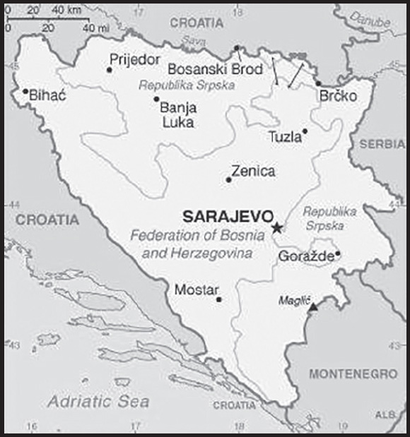
INTRODUCTION
Background: Bosnia and Herzegovina declared sovereignty in October 1991 and independence from the former Yugoslavia on 3 March 1992 after a referendum boycotted by ethnic Serbs. The Bosnian Serbs - supported by neighboring Serbia and Montenegro - responded with armed resistance aimed at partitioning the republic along ethnic lines and joining Serb-held areas to form a “Greater Serbia.” In March 1994, Bosniaks and Croats reduced the number of warring factions from three to two by signing an agreement creating a joint Bosniak-Croat Federation of Bosnia and Herzegovina. On 21 November 1995, in Dayton, Ohio, the warring parties initialed a peace agreement that ended three years of interethnic civil strife (the final agreement was signed in Paris on 14 December 1995).
The Dayton Peace Accords retained Bosnia and Herzegovina’s international boundaries and created a multiethnic and democratic government charged with conducting foreign, diplomatic, and fiscal policy. Also recognized was a second tier of government composed of two entities roughly equal in size: the predominantly Bosniak-Bosnian Croat Federation of Bosnia and Herzegovina and the predominantly Bosnian Serb-led Republika Srpska (RS). The Federation and RS governments are responsible for overseeing most government functions. Additionally, the Dayton Accords established the Office of the High Representative to oversee the implementation of the civilian aspects of the agreement. The Peace Implementation Council at its conference in Bonn in 1997 also gave the High Representative the authority to impose legislation and remove officials, the so-called “Bonn Powers.” In 1995, the NATO-led international peacekeeping force (IFOR) of 60,000 troops enforced the peace, but was replaced the next year by a smaller, NATO-led Stabilization Force (SFOR). In 2004, European Union peacekeeping troops (EUFOR) replaced SFOR. Currently, EUFOR deploys around 1,200 troops in Bosnia in a peacekeeping capacity.
GEOGRAPHY
Location: Southeastern Europe, bordering the Adriatic Sea and Croatia
Geographic coordinates: 44 00 N, 18 00 E
Map references: Europe
Area: total: 51,197 sq km
land: 51,187 sq km
water: 10 sq km
comparison ranking: total 128
Area - comparative: slightly smaller than West Virginia
Land boundaries: total: 1,543 km
border countries (3): Croatia 956 km; Montenegro 242 km; Serbia 345 km
Coastline: 20 km
Climate: hot summers and cold winters; areas of high elevation have short, cool summers and long, severe winters; mild, rainy winters along coast
Terrain: mountains and valleys
Elevation: highest point: Maglic 2,386 m
lowest point: Adriatic Sea 0 m
mean elevation: 500 m
Natural resources: coal, iron ore, antimony, bauxite, copper, lead, zinc, chromite, cobalt, manganese, nickel, clay, gypsum, salt, sand, timber, hydropower
Land use: agricultural land: 42.2% (2018 est.)
arable land: 19.7% (2018 est.)
permanent crops: 2% (2018 est.)
permanent pasture: 20.5% (2018 est.)
forest: 42.8% (2018 est.)
other: 15% (2018 est.)
Irrigated land: 30 sq km (2012)
Major watersheds (area sq km): Atlantic Ocean drainage: (Black Sea) Danube (795,656 sq km)
Population distribution: the northern and central areas of the country are the most densely populated
Natural hazards: destructive earthquakes
Geography - note: within Bosnia and Herzegovina’s recognized borders, the country is divided into a joint Bosniak/Croat Federation (about 51% of the territory) and the Bosnian Serb-led Republika Srpska or RS (about 49% of the territory); the region called Herzegovina is contiguous to Croatia and Montenegro, and traditionally has been settled by an ethnic Croat majority in the west and an ethnic Serb majority in the east
PEOPLE AND SOCIETY
Population: 3,807,764 (2023 est.)
comparison ranking: 131
Nationality: noun: Bosnian(s), Herzegovinian(s)
adjective: Bosnian, Herzegovinian
Ethnic groups: Bosniak 50.1%, Serb 30.8%, Croat 15.4%, other 2.7%, not declared/no answer 1% (2013 est.)
note: Republika Srpska authorities dispute the methodology and refuse to recognize the results; Bosniak has replaced Muslim as an ethnic term in part to avoid confusion with the religious term Muslim - an adherent of Islam
Languages: Bosnian (official) 52.9%, Serbian (official) 30.8%, Croatian (official) 14.6%, other 1.6%, no answer 0.2% (2013 est.)
major-language sample(s): Knjiga svjetskih činjenica, neophodan izvor osnovnih informacija. (Bosnian)
Knjiga svetskih činjenica, neophodan izvor osnovnih informacija. (Serbian)
Knjiga svjetskih činjenica, nužan izvor osnovnih informacija. (Croatian)
Religions: Muslim 50.7%, Orthodox 30.7%, Roman Catholic 15.2%, atheist 0.8%, agnostic 0.3%, other 1.2%, undeclared/no answer 1.1% (2013 est.)
Age structure: 0-14 years: 13.14% (male 258,937/female 241,581)
15-64 years: 69% (male 1,319,995/female 1,307,304)
65 years and over: 17.86% (2023 est.) (male 277,555/female 402,392)
Dependency ratios: total dependency ratio: 48
youth dependency ratio: 22.3
elderly dependency ratio: 27.1
potential support ratio: 3.7 (2021 est.)
Median age: total: 43.3 years (2020)
male: 41.6 years
female: 44.8 years
comparison ranking: total 27
Population growth rate: -0.23% (2023 est.)
comparison ranking: 211
Birth rate: 8.31 births/1,000 population (2023 est.)
comparison ranking: 214
Death rate: 10.26 deaths/1,000 population (2023 est.)
comparison ranking: 31
Net migration rate: -0.38 migrant(s)/1,000 population (2023 est.)
comparison ranking: 123
Population distribution: the northern and central areas of the country are the most densely populated
Urbanization: urban population: 50.3% of total population (2023)
rate of urbanization: 0.61% annual rate of change (2020-25 est.)
Major urban areas - population: 346,000 SARAJEVO (capital) (2023)
Sex ratio: at birth: 1.07 male(s)/female
0-14 years: 1.07 male(s)/female
15-64 years: 1.01 male(s)/female
65 years and over: 0.69 male(s)/female
total population: 0.95 male(s)/female (2023 est.)
Mother’s mean age at first birth: 27.7 years (2019 est.)
Maternal mortality ratio: 6 deaths/100,000 live births (2020 est.)
comparison ranking: 160
Infant mortality rate: total: 5.1 deaths/1,000 live births (2023 est.)
male: 5.23 deaths/1,000 live births
female: 4.96 deaths/1,000 live births
comparison ranking: total 174
Life expectancy at birth: total population: 78.22 years (2023 est.)
male: 75.28 years
female: 81.38 years
comparison ranking: total population 83
Total fertility rate: 1.37 children born/woman (2023 est.)
comparison ranking: 217
Gross reproduction rate: 0.66 (2023 est.)
Contraceptive prevalence rate: 45.8% (2011/12)
Drinking water source: improved: urban: 99.9% of population
rural: 100% of population
total: 99.9% of population
unimproved: urban: 0.1% of population
rural: 0% of population
total: 0.1% of population (2020 est.)
Current health expenditure: 9.8% of GDP (2020)
Physicians density: 2.16 physicians/1,000 population (2015)
Hospital bed density: 3.5 beds/1,000 population (2014)
Sanitation facility access: improved: urban: 99.5% of population
unimproved: urban: 0.5% of population
Obesity - adult prevalence rate: 17.9% (2016)
comparison ranking: 118
Alcohol consumption per capita: total: 5.46 liters of pure alcohol (2019 est.)
beer: 4.19 liters of pure alcohol (2019 est.)
wine: 0.47 liters of pure alcohol (2019 est.)
spirits: 0.62 liters of pure alcohol (2019 est.)
other alcohols: 0.17 liters of pure alcohol (2019 est.)
comparison ranking: total 81
Tobacco use: total: 35% (2020 est.)
male: 42% (2020 est.)
female: 28% (2020 est.)
comparison ranking: total 15
Currently married women (ages 15-49): 63.8% (2023 est.)
Literacy: definition: age 15 and over can read and write
total population: 98.1%
male: 99.4%
female: 98.1% (2021)
School life expectancy (primary to tertiary education): total: 14 years
male: 14 years
female: 15 years (2014)
Youth unemployment rate (ages 15-24): total: 32.9% (2021 est.)
male: 28.2%
female: 39.9%
comparison ranking: total 30
ENVIRONMENT
Environment - current issues: air pollution; deforestation and illegal logging; inadequate wastewater treatment and flood management facilities; sites for disposing of urban waste are limited; land mines left over from the 1992-95 civil strife are a hazard in some areas
Environment - international agreements: party to: Air Pollution, Biodiversity, Climate Change, Climate Change-Kyoto Protocol, Climate Change-Paris Agreement, Comprehensive Nuclear Test Ban, Desertification, Endangered Species, Hazardous Wastes, Law of the Sea, Marine Life Conservation, Nuclear Test Ban, Ozone Layer Protection, Wetlands
signed, but not ratified: none of the selected agreements
Climate: hot summers and cold winters; areas of high elevation have short, cool summers and long, severe winters; mild, rainy winters along coast
Land use: agricultural land: 42.2% (2018 est.)
arable land: 19.7% (2018 est.)
permanent crops: 2% (2018 est.)
permanent pasture: 20.5% (2018 est.)
forest: 42.8% (2018 est.)
other: 15% (2018 est.)
Urbanization: urban population: 50.3% of total population (2023)
rate of urbanization: 0.61% annual rate of change (2020-25 est.)
Revenue from forest resources: 0.49% of GDP (2018 est.)
comparison ranking: 66
Revenue from coal: 0.34% of GDP (2018 est.)
comparison ranking: 17
Air pollutants: particulate matter emissions: 26.19 micrograms per cubic meter (2019 est.)
carbon dioxide emissions: 21.85 megatons (2016 est.)
methane emissions: 2.92 megatons (2020 est.)
Waste and recycling: municipal solid waste generated annually: 1,248,718 tons (2015 est.)
municipal solid waste recycled annually: 12 tons (2015 est.)
percent of municipal solid waste recycled: 0% (2015 est.)
Major watersheds (area sq km): Atlantic Ocean drainage: (Black Sea) Danube (795,656 sq km)
Total water withdrawal: municipal: 310 million cubic meters (2020 est.)
industrial: 60 million cubic meters (2020 est.)
Total renewable water resources: 37.5 billion cubic meters (2020 est.)
GOVERNMENT
Country name: conventional long form: none
conventional short form: Bosnia and Herzegovina
local long form: none
local short form: Bosna i Hercegovina
former: People’s Republic of Bosnia and Herzegovina, Socialist Republic of Bosnia and Herzegovina
abbreviation: BiH
etymology: the larger northern territory is named for the Bosna River; the smaller southern section takes its name from the German word “herzog,” meaning “duke,” and the ending “-ovina,” meaning “land,” forming the combination denoting “dukedom”
Government type: parliamentary republic
Capital: name: Sarajevo
geographic coordinates: 43 52 N, 18 25 E
time difference: UTC+1 (6 hours ahead of Washington, DC, during Standard Time)
daylight saving time: +1hr, begins last Sunday in March; ends last Sunday in October
etymology: the name derives from the Turkish noun saray, meaning “palace” or “mansion,” and the term ova, signifying “plain(s),” to give a meaning of “palace plains” or “the plains about the palace”
Administrative divisions: 3 first-order administrative divisions - Brcko District (Brcko Distrikt) (ethnically mixed), Federation of Bosnia and Herzegovina (Federacija Bosne i Hercegovine) (predominantly Bosniak-Croat), Republika Srpska (predominantly Serb)
Independence: 1 March 1992 (from Yugoslavia); note - referendum for independence completed on 1 March 1992; independence declared on 3 March 1992
National holiday: Independence Day, 1 March (1992) and Statehood Day, 25 November (1943) - both observed in the Federation of Bosnia and Herzegovina entity; Victory Day, 9 May (1945) and Dayton Agreement Day, 21 November (1995) - both observed in the Republika Srpska entity
note: there is no national-level holiday
Constitution: history: 14 December 1995 (constitution included as part of the Dayton Peace Accords); note - each of the political entities has its own constitution
amendments: decided by the Parliamentary Assembly, including a two-thirds majority vote of members present in the House of Representatives; the constitutional article on human rights and fundamental freedoms cannot be amended; amended several times, last in 2009
Legal system: civil law system; Constitutional Court review of legislative acts
International law organization participation: has not submitted an ICJ jurisdiction declaration; accepts ICCt jurisdiction
Citizenship: citizenship by birth: no
citizenship by descent only: at least one parent must be a citizen of Bosnia and Herzegovina
dual citizenship recognized: yes, provided there is a bilateral agreement with the other state
residency requirement for naturalization: 8 years
Suffrage: 18 years of age, 16 if employed; universal
Executive branch: chief of state: Chairman of the Presidency Zeljko KOMSIC (chairman since 16 July 2023; presidency member since 20 November 2018 - Croat seat); Zeljka CVIJANOVIC (presidency member since 16 November 2022 - Serb seat); Denis BECIROVIC (presidency member since 16 November 2022 - Bosniak seat)
head of government: Chairman of the Council of Ministers Borjana KRISTO (since 25 January 2023)
cabinet: Council of Ministers nominated by the council chairman, approved by the state-level House of Representatives
elections/appointments: 3-member presidency (1 Bosniak and 1 Croat elected from the Federation of Bosnia and Herzegovina and 1 Serb elected from the Republika Srpska) directly elected by simple majority popular vote for a 4-year term (eligible for a second term, but then ineligible for 4 years); the presidency chairpersonship rotates every 8 months with the new member of the presidency elected with the highest number of votes starting the new mandate as chair; election last held on 2 October 2022 (next to be held in October 2026); the chairman of the Council of Ministers appointed by the presidency and confirmed by the state-level House of Representatives
election results:
2022: percent of vote - Denis BECIROVIC - (SDP BiH) 57.4% - Bosniak seat; Zeljko KOMSIC (DF) 55.8% - Croat seat; Zeljka CVIJANOVIC (SNSD) 51.7% - Serb seat
2018: percent of vote - Milorad DODIK (SNSD) 53.9% - Serb seat; Zeljko KOMSIC (DF) 52.6% - Croat seat; Sefik DZAFEROVIC (SDA) 36.6% - Bosniak seat
note: President of the Federation of Bosnia and Herzegovina Lidiia BRADARA (since 28 February 2023); Vice Presidents Refik LENDO (since 28 February 2023) and Igor STOJANOVIC (since 28 February 2023); President of the Republika Srpska Milorad DODIK (since 15 November 2022); Vice Presidents Camil DURAKOVIC (since 15 November 2022) and Davor PRANJIC (since 15 November 2022)
Legislative branch: description: bicameral Parliamentary Assembly or Skupstina consists of:
House of Peoples or Dom Naroda (15 seats - 5 Bosniak, 5 Croat, 5 Serb; members designated by the Federation of Bosnia and Herzegovina’s House of Peoples and the Republika Srpska’s National Assembly serve 4-year terms) House of Representatives or Predstavnicki Dom (42 seats to include 28 seats allocated to the Federation of Bosnia and Herzegovina and 14 to the Republika Srpska; members directly elected by proportional representation vote to serve 4-year terms); note - the Federation of Bosnia and Herzegovina has a bicameral legislature that consists of the House of Peoples (80 seats - 23 Bosniak, 23 Croat, 23 Serb, 11 other) and the House of Representatives (98 seats; members directly elected by proportional representation vote to serve 4-year terms); Republika Srpska’s unicameral legislature is the National Assembly or Narodna skupština Republike Srpske (83 directly elected delegates serve 4-year terms)
elections: House of Peoples - last held on 2 October 2022 (next to be held in 2026)
House of Representatives - last held on 2 October 2022 (next to be held in 2026)
election results: House of Peoples - percent of vote by coalition/party - NA; seats by coalition/party - NA; composition - men 12, women 3, percent of women 20%
House of Representatives - percent of vote by party/coalition - SDA 17.2%, SNSD 16.3%, HDZ BiH 8.8%, SDP 8.2%, SDS 7.1%, DF-GS 6.4%, NiP 5%, PDP 4.6%, NS/HC 3.1%, NES 3%, For Justice and Order 2.1%, DEMOS 1.9%, US 1.6%, BHI KF 1.3%, other 13.4%; seats by party/coalition - SDA 9, SNSD 6, SDP 5, HDZ BiH 4, DF-GS 3, NiP 3, SDS 2, PDP 2, NS/HC 2, NES 2, For Justice and Order 1, DEMOS 1, US 1, BHI KF 1; composition - men 31, women 11, percent of women 26.2%; note - total Parliamentary Assembly percent of women 24.6%
Judicial branch: highest court(s): Bosnia and Herzegovina (BiH) Constitutional Court (consists of 9 members); Court of BiH (consists of 44 national judges and 7 international judges organized into 3 divisions - Administrative, Appellate, and Criminal, which includes a War Crimes Chamber)
judge selection and term of office: BiH Constitutional Court judges - 4 selected by the Federation of Bosnia and Herzegovina House of Representatives, 2 selected by the Republika Srpska’s National Assembly, and 3 non-Bosnian judges selected by the president of the European Court of Human Rights; Court of BiH president and national judges appointed by the High Judicial and Prosecutorial Council; Court of BiH president appointed for renewable 6-year term; other national judges appointed to serve until age 70; international judges recommended by the president of the Court of BiH and appointed by the High Representative for Bosnia and Herzegovina; international judges appointed to serve until age 70
subordinate courts: the Federation has 10 cantonal courts plus a number of municipal courts; the Republika Srpska has a supreme court, 5 district courts, and a number of municipal courts
Political parties and leaders: Alliance of Independent Social Democrats or SNSD [Milorad DODIK]
Bosnian-Herzegovinian Initiative or BHI KF [Fuad KASUMOVIC]
Civic Alliance or GS [Reuf BAJROVIC]
Croatian Democratic Union of Bosnia and Herzegovina or HDZ-BiH [Dragan COVIC]
Democratic Front or DF [Zeljko KOMSIC]
Democratic Union or DEMOS [Nedeljko CUBRILOVIC]
For Justice and Order [Nebojsa VUKANOVIC]
Our Party or NS/HC [Edin FORTO]
Party for Democratic Action or SDA [Bakir IZETBEGOVIC]
Party of Democratic Progress or PDP [Branislav BORENOVIC]
People and Justice Party or NiP [Elmedin KONAKOVIC]
People’s European Union of Bosnia and Herzegovina or NES [Nermin OGRESEVIC]
Serb Democratic Party or SDS [Milan MILICEVIC]
Social Democratic Party or SDP [Nermin NIKSIC]
United Srpska or US [Nenad STEVANDIC]
International organization participation: BIS, CD, CE, CEI, EAPC, EBRD, FAO, G-77, IAEA, IBRD, ICAO, ICC (NGOs), ICCt, ICRM, IDA, IFAD, IFC, IFRCS, ILO, IMF, IMO, IMSO, Interpol, IOC, IOM, IPU, ISO, ITSO, ITU, ITUC (NGOs), MIGA, MINUSMA, MONUSCO, NAM (observer), OAS (observer), OIC (observer), OIF (observer), OPCW, OSCE, PFP, SELEC, UN, UNCTAD, UNESCO, UNIDO, UNWTO, UPU, WCO, WHO, WIPO, WMO, WTO (observer)
note: Bosnia-Herzegovina is an EU candidate country whose satisfactory completion of accession criteria is required before being granted full EU membership
Diplomatic representation in the US: chief of mission: Ambassador Sven ALKALAJ (since 30 June 2023)
chancery: 2109 E Street NW, Washington, DC 20037
telephone: [1] (202) 337-1500
FAX: [1] (202) 337-1502
email address and website:
consularaffairs@bhembassy; info@bhembassy.org
http://www.bhembassy.org/index.html
consulate(s) general: Chicago, New York
Diplomatic representation from the US: chief of mission: Ambassador Michael J. MURPHY (since 23 February 2022)
embassy: 1 Robert C. Frasure Street, 71000 Sarajevo
mailing address: 7130 Sarajevo Place, Washington DC 20521-7130
telephone: [387] (33) 704-000
FAX: [387] (33) 659-722
email address and website:
branch office(s): Banja Luka, Mostar
Flag description: a wide blue vertical band on the fly side with a yellow isosceles triangle abutting the band and the top of the flag; the remainder of the flag is blue with seven full five-pointed white stars and two half stars top and bottom along the hypotenuse of the triangle; the triangle approximates the shape of the country and its three points stand for the constituent peoples - Bosniaks, Croats, and Serbs; the stars represent Europe and are meant to be continuous (thus the half stars at top and bottom); the colors (white, blue, and yellow) are often associated with neutrality and peace, and traditionally are linked with Bosnia
note: one of several flags where a prominent component of the design reflects the shape of the country; other such flags are those of Brazil, Eritrea, and Vanuatu
National symbol(s): golden lily; national colors: blue, yellow, white
National anthem: name: “Drzavna himna Bosne i Hercegovine” (The National Anthem of Bosnia and Herzegovina)
lyrics/music: none officially/Dusan SESTIC
note: music adopted 1999; lyrics proposed in 2008 and others in 2016 were not approved
National heritage: total World Heritage Sites: 4 (3 cultural, 1 natural)
selected World Heritage Site locales: Old Bridge Area of Mostar (c); Mehmed Paša Sokolović Bridge (c); Stećci Medieval Tombstones Graveyards (c); Primeval Beech Forests - Janj Forest (n)
ECONOMY
Economic overview: import-dominated economy; remains consumption-heavy; lack of private sector investments and diversification; jointly addressing structural economic challenges; Chinese energy infrastructure investments; high unemployment; tourism industry impacted by COVID-19
Real GDP (purchasing power parity): $51.244 billion (2021 est.)
$47.649 billion (2020 est.)
$49.183 billion (2019 est.)
note: data are in 2017 dollars
comparison ranking: 113
Real GDP growth rate: 7.55% (2021 est.)
-3.12% (2020 est.)
2.83% (2019 est.)
comparison ranking: 48
Real GDP per capita: $15,700 (2021 est.)
$14,400 (2020 est.)
$14,600 (2019 est.)
note: data are in 2017 dollars
comparison ranking: 103
GDP (official exchange rate): $20.078 billion (2019 est.)
Inflation rate (consumer prices): 1.98% (2021 est.)
-1.05% (2020 est.)
0.56% (2019 est.)
comparison ranking: 158
Credit ratings: Moody’s rating: B3 (2012)
Standard & Poors rating: B (2011)
note: The year refers to the year in which the current credit rating was first obtained.
GDP - composition, by sector of origin: agriculture: 6.8% (2017 est.)
industry: 28.9% (2017 est.)
services: 64.3% (2017 est.)
comparison rankings: services 98; industry 85; agriculture 112
GDP - composition, by end use: household consumption: 77.4% (2017 est.)
government consumption: 20% (2017 est.)
investment in fixed capital: 16.6% (2017 est.)
investment in inventories: 2.3% (2017 est.)
exports of goods and services: 38.7% (2017 est.)
imports of goods and services: -55.1% (2017 est.)
Agricultural products: maize, milk, vegetables, potatoes, wheat, plums/sloes, apples, barley, cabbages, poultry
Industries: steel, coal, iron ore, lead, zinc, manganese, bauxite, aluminum, motor vehicle assembly, textiles, tobacco products, wooden furniture, ammunition, domestic appliances, oil refining
Industrial production growth rate: 8.87% (2021 est.)
comparison ranking: 38
Labor force: 1.169 million (2021 est.)
comparison ranking: 140
Labor force - by occupation: agriculture: 18%
industry: 30.4%
services: 51.7% (2017 est.)
Unemployment rate: 15.22% (2021 est.)
15.27% (2020 est.)
15.69% (2019 est.)
note: official rate; actual rate is lower as many technically unemployed persons work in the gray economy
comparison ranking: 35
Youth unemployment rate (ages 15-24): total: 32.9% (2021 est.)
male: 28.2%
female: 39.9%
comparison ranking: total 30
Population below poverty line: 16.9% (2015 est.)
Gini Index coefficient - distribution of family income: 33 (2011 est.)
comparison ranking: 125
Average household expenditures: on food: 30.7% of household expenditures (2018 est.)
on alcohol and tobacco: 9.2% of household expenditures (2018 est.)
Household income or consumption by percentage share: lowest 10%: 2.9%
highest 10%: 25.8% (2011 est.)
Budget: revenues: $8.434 billion (2019 est.)
expenditures: $8.154 billion (2019 est.)
Budget surplus (+) or deficit (-): 2.1% (of GDP) (2017 est.)
comparison ranking: 15
Public debt: 46.05% of GDP (2020 est.)
44.63% of GDP (2019 est.)
45.56% of GDP (2018 est.)
note: data cover general government debt and includes debt instruments issued (or owned) by government entities other than the treasury; the data include treasury debt held by foreign entities; the data include debt issued by subnational entities, as well as intra-governmental debt; intra-governmental debt consists of treasury borrowings from surpluses in the social funds, such as for retirement, medical care, and unemployment; debt instruments for the social funds are not sold at public auctions.
comparison ranking: 122
Taxes and other revenues: 19.01% (of GDP) (2020 est.)
comparison ranking: 99
Fiscal year: calendar year
Current account balance: -$557.887 million (2021 est.)
-$658.601 million (2020 est.)
-$531.917 million (2019 est.)
comparison ranking: 120
Exports: $9.948 billion (2021 est.)
$6.936 billion (2020 est.)
$8.199 billion (2019 est.)
note: Data are in current year dollars and do not include illicit exports or re-exports.
comparison ranking: 105
Exports - partners: Germany 14%, Italy 12%, Croatia 11%, Serbia 11%, Austria 9%, Slovenia 8% (2019)
Exports - commodities: electricity, seating, insulated wiring, lumber, furniture (2021)
Imports: $12.726 billion (2021 est.) note: data are in current year dollars
$9.726 billion (2020 est.) note: data are in current year dollars
$11.156 billion (2019 est.) note: data are in current year dollars
comparison ranking: 103
Imports - partners: Croatia 15%, Serbia 13%, Germany 10%, Italy 9%, Slovenia 7%, China 6% (2019)
Imports - commodities: refined petroleum, cars, packaged medicines, coal, electricity (2019)
Reserves of foreign exchange and gold: $9.475 billion (31 December 2021 est.)
$8.707 billion (31 December 2020 est.)
$7.208 billion (31 December 2019 est.)
comparison ranking: 86
Debt - external: $10.87 billion (31 December 2017 est.)
$10.64 billion (31 December 2016 est.)
comparison ranking: 112
Exchange rates: konvertibilna markas (BAM) per US dollar -
Exchange rates: 1.654 (2021 est.)
1.717 (2020 est.)
1.747 (2019 est.)
1.657 (2018 est.)
1.735 (2017 est.)
ENERGY
Electricity access: electrification - total population: 100% (2021)
Electricity: installed generating capacity: 4.775 million kW (2020 est.)
consumption: 11,657,450,000 kWh (2019 est.)
exports: 7.316 billion kWh (2020 est.)
imports: 3.266 billion kWh (2020 est.)
transmission/distribution losses: 1.257 billion kWh (2019 est.)
comparison rankings: imports 50; exports 26; installed generating capacity 90; transmission/distribution losses 104; consumption 94
Electricity generation sources: fossil fuels: 62.8% of total installed capacity (2020 est.)
solar: 0.3% of total installed capacity (2020 est.)
wind: 1.5% of total installed capacity (2020 est.)
hydroelectricity: 35.4% of total installed capacity (2020 est.)
biomass and waste: 0.1% of total installed capacity (2020 est.)
Coal: production: 6.966 million metric tons (2020 est.)
consumption: 7.752 million metric tons (2020 est.)
exports: 525,000 metric tons (2020 est.)
imports: 1.366 million metric tons (2020 est.)
proven reserves: 2.264 billion metric tons (2019 est.)
Petroleum: total petroleum production: 0 bbl/day (2021 est.)
refined petroleum consumption: 34,700 bbl/day (2019 est.)
crude oil and lease condensate exports: 0 bbl/day (2018 est.)
crude oil and lease condensate imports: 13,900 bbl/day (2018 est.)
crude oil estimated reserves: 0 barrels (2021 est.)
Refined petroleum products - production: 0 bbl/day (2015 est.)
comparison ranking: 213
Refined petroleum products - exports: 4,603 bbl/day (2015 est.)
comparison ranking: 92
Refined petroleum products - imports: 18,280 bbl/day (2015 est.)
comparison ranking: 129
Natural gas: production: 0 cubic meters (2021 est.)
consumption: 218.266 million cubic meters (2019 est.)
exports: 0 cubic meters (2021 est.)
imports: 218.266 million cubic meters (2019 est.)
proven reserves: 0 cubic meters (2021 est.)
Carbon dioxide emissions: 16.209 million metric tonnes of CO2 (2019 est.)
from coal and metallurgical coke: 10.923 million metric tonnes of CO2 (2019 est.)
from petroleum and other liquids: 4.871 million metric tonnes of CO2 (2019 est.)
from consumed natural gas: 415,000 metric tonnes of CO2 (2019 est.)
comparison ranking: total emissions 95
Energy consumption per capita: 71.815 million Btu/person (2019 est.)
comparison ranking: 83
COMMUNICATIONS
Telephones - fixed lines: total subscriptions: 689,295 (2021 est.)
subscriptions per 100 inhabitants: 21 (2021 est.)
comparison ranking: total subscriptions 83
Telephones - mobile cellular: total subscriptions: 3,728,775 (2021 est.)
subscriptions per 100 inhabitants: 114 (2021 est.)
comparison ranking: total subscriptions 135
Telecommunication systems: general assessment: the telecom market has been liberalized and a regulatory framework created based on the EU’s regulatory framework for communications; although Bosnia-Herzegovina remains an EU candidate country, in July 2017 it applied amended mobile roaming charges to fit in with changes introduced across the Union; further roaming agreements were made in 2019 with other western Balkan countries; the fixed-line broadband network is comparatively underdeveloped, with the result that investments made in mobile upgrades to facilitate broadband connectivity in the country to a greater extent than is common elsewhere in Europe; internet services are available; DSL and cable are the main platforms for fixed-line connectivity, while fiber broadband as yet has only a small market presence; the three MNOs, each affiliated with one of the incumbent fixed-line operators, provide national coverage with 3G, though LTE coverage is only about 89%; their upgraded networks are helping to support broadband in rural areas where fixed-line infrastructure is insufficient; mobile data and mobile broadband offers will provide future revenue growth given the limited potential of mobile voice services; the MNOs tested LTE services under trial licenses from 2013, commercial launches were delayed until the award of spectrum in early 2019; the regulator stipulated that licenses must provide national coverage within five years; trials of 5G technology have been undertaken, though there are no plans to launch services commercially in the short term, given that the MNOs can continue to exploit the capacity of their existing LTE networks (2021)
domestic: fixed-line teledensity roughly 21 per 100 persons and mobile-cellular subscribership stands at 114 telephones per 100 persons (2021)
international: country code - 387; no satellite earth stations
Broadcast media: 3 public TV broadcasters: Radio and TV of Bosnia and Herzegovina, Federation TV (operating 2 networks), and Republika Srpska Radio-TV; a local commercial network of 5 TV stations; 3 private, near-national TV stations and dozens of small independent TV broadcasting stations; 3 large public radio broadcasters and many private radio stations (2019)
Internet country code: .ba
Internet users: total: 2.508 million (2021 est.)
percent of population: 76% (2021 est.)
comparison ranking: total 128
Broadband - fixed subscriptions: total: 770,424 (2020 est.)
subscriptions per 100 inhabitants: 24 (2020 est.)
comparison ranking: total 78
TRANSPORTATION
National air transport system: number of registered air carriers: 1 (2020)
inventory of registered aircraft operated by air carriers: 1
annual passenger traffic on registered air carriers: 7,070 (2015)
annual freight traffic on registered air carriers: 87 (2015) mt-km
Civil aircraft registration country code prefix: T9
Airports: 24 (2021)
comparison ranking: total 130
Airports - with paved runways: 7
note: paved runways have a concrete or asphalt surface but not all have facilities for refueling, maintenance, or air traffic control; the length of a runway required for aircraft to safely operate depends on a number of factors including the type of aircraft, the takeoff weight (including passengers, cargo, and fuel), engine types, flap settings, landing speed, elevation of the airport, and average maximum daily air temperature; paved runways can reach a length of 5,000 m (16,000 ft.), but the “typical” length of a commercial airline runway is between 2,500-4,000 m (8,000-13,000 ft.)
Airports - with unpaved runways: 17
note: unpaved runways have a surface composition such as grass or packed earth and are most suited to the operation of light aircraft; unpaved runways are usually short, often less than 1,000 m (3,280 ft.) in length; airports with unpaved runways often lack facilities for refueling, maintenance, or air traffic control
Heliports: 6 (2021)
Pipelines: 147 km gas, 9 km oil (2013)
Railways: total: 965 km (2014)
standard gauge: 965 km (2014) 1.435-m gauge (565 km electrified)
comparison ranking: total 91
Roadways: total: 22,926 km (2010)
paved: 19,426 km (2010) (4,652 km of interurban roads)
unpaved: 3,500 km (2010)
comparison ranking: total 108
Waterways: 990 km (2022) (Sava River on northern border; open to shipping but use limited)
comparison ranking: 70
Ports and terminals: river port(s): Bosanska Gradiska, Bosanski Brod, Bosanski Samac, Brcko, Orasje (Sava River)
MILITARY AND SECURITY
Military and security forces: Armed Forces of Bosnia and Herzegovina (AFBiH or Oruzanih Snaga Bosne i Hercegovine, OSBiH): Army, Air, Air Defense forces organized into an Operations Command and a Support Command (2023)
Military expenditures: 0.8% of GDP (2022 est.)
0.9% of GDP (2021)
0.9% of GDP (2020)
0.8% of GDP (2019)
0.9% of GDP (2018)
comparison ranking: 133
Military and security service personnel strengths: approximately 10,000 active-duty personnel (2023)
Military equipment inventories and acquisitions: the military’s inventory is largely Soviet-era material with a smaller mix of mostly secondhand from other countries, particularly the US (2023)
Military service age and obligation: 18 years of age for voluntary military service; conscription abolished in 2005 (2023)
note: as of 2022, women made up about 7% of the military’s full-time personnel
Military - note: the Armed Forces of Bosnia and Herzegovina (AFBiH) are comprised of the former Bosnian-Croat Army of the Federation of Bosnia and Herzegovina (Vojska Federacije Bosne i Hercegovin, VF) and the Bosnian-Serb Republic of Serbia Army (Vojska Republike Srpske, VRS); the two forces were unified under the 2006 Law on Defense, and the combined force includes each ethnic group; the 2006 law also established the country’s Ministry of Defense
the AFBiH is responsible for territorial defense, providing assistance to civil authorities during disasters or other emergencies, and participating in collective security and peace support operations; it is a compact and professional force organized into five brigades under an Operational Command: three infantry, one tactical support, and one air and air defense; each of the infantry brigades is headquartered inside of their respective ethnicity territory, while the Operational Command is in Sarajevo; Bosnia and Herzegovina aspires to join NATO; it joined NATO’s Partnership for Peace (PfP) program in 2007 and was invited to join NATO’s Membership Action Plan in 2010; the AFBiH is undergoing a defense modernization and reform program for preparing to join and integrate with NATO; it has contributed small numbers of troops to EU, NATO, and UN missions
NATO maintains a military headquarters in Sarajevo with the mission of assisting Bosnia and Herzegovina with the PfP program and promoting closer integration with NATO, as well as providing logistics and other support to the EU Force Bosnia and Herzegovina (EUFOR), which has operated in the country to oversee implementation of the Dayton/Paris Agreement since taking over from NATO’s Stabilization Force (SFOR) in 2004; EUfOr has about 1,100 troops from 22 countries (2023)
TERRORISM
Terrorist group(s): Terrorist group(s): Islamic Revolutionary Guard Corps/Qods Force
note: details about the history, aims, leadership, organization, areas of operation, tactics, targets, weapons, size, and sources of support of the group(s) appear(s) in Appendix-T
TRANSNATIONAL ISSUES
Disputes - international: Bosnia and Herzegovina-Serbia: Serbia delimited about half of the boundary with Bosnia and Herzegovina, but sections along the Drina River remain in dispute.
Bosnia and Herzegovina-Croatia: none identified
Bosnia and Herzegovina-Montenegro: none identified
Refugees and internally displaced persons: IDPs: 91,000 (Bosnian Croats, Serbs, and Bosniaks displaced by inter-ethnic violence, human rights violations, and armed conflict during the 1992-95 war) (2022)
stateless persons: 48 (2022)
note: 141,723 estimated refugee and migrant arrivals (January 2015-October 2023)
Illicit drugs: drug trafficking groups are major players in the procurement and transportation of of large quantities of cocaine destined for European markets