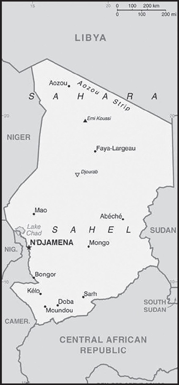
INTRODUCTION
Background: Chad emerged from a collection of powerful states that controlled the Sahelian belt starting around the 9th century. These states focused on controlling trans-Saharan trade routes and profited mostly from the slave trade. The Kanem-Bornu Empire, centered around the Lake Chad Basin, existed between the 9th and 19th centuries, and during its peak, the empire controlled territory stretching from southern Chad to southern Libya and included portions of modern-day Algeria, Cameroon, Nigeria, Niger, and Sudan. The Sudanese warlord Rabih AZ-ZUBAYR used an army comprised largely of slaves to conquer the Kanem-Bornu Empire in the late 19th century. In southeastern Chad, the Bagirmi and Ouaddai (Wadai) kingdoms emerged in the 15th and 16th centuries and lasted until the arrival of the French in the 19th and 20th centuries. France began moving into the region in the late 1880s and defeated the Bagirmi kingdom in 1897, Rabih AZ-ZUBAYR in 1900, and the Ouddai kingdom in 1909. In the arid regions of northern Chad and southern Libya, an Islamic order called the Sanusiyya (Sanusi) relied heavily on the trans-Saharan slave trade and had upwards of 3 million followers by the 1880s. The French arrived in the region in the early 1900s and defeated the Sanusiyya in 1910 after years of intermittent war. By 1910, France had incorporated the northern arid region, the Lake Chad Basin, and southeastern Chad into French Equatorial Africa.
Chad achieved its independence in 1960 and saw three decades of instability, oppressive rule, civil war, and a Libyan invasion. With the help of the French military and several African countries, Chadian leaders expelled Libyan forces during the 1987 “Toyota War,” so named for the use of Toyota pickup trucks as fighting vehicles. In 1990, Chadian general Idriss DEBY led a rebellion against President Hissene HABRE. Under DEBY, Chad drafted and approved a constitution and held elections in 1996. DEBY led the country until April 2021 when he was killed during a rebel incursion. Shortly after his death, a group of military officials - led by former President DEBY’s son, Mahamat Idriss DEBY - took control of the government. The military officials dismissed the National Assembly, suspended the Constitution, and formed a Transitional Military Council while pledging to hold democratic elections in October 2022.
Chad faces widespread poverty, an economy severely weakened by low international oil prices, and rebel and terrorist-led insurgencies in the Lake Chad Basin. Additionally, northern Chad has seen several waves of rebellions since 1998. In late 2015, the government imposed a state of emergency in the Lake Chad Basin following multiple attacks by the terrorist group Boko Haram, now known as ISIS-West Africa. In mid-2015, Boko Haram conducted bombings in N’Djamena. In late 2019, the Chadian government also declared a state of emergency in the Sila and Ouaddai regions bordering Sudan and in the Tibesti region bordering Niger where rival ethnic groups are still fighting. The army has suffered heavy losses to Islamic terror groups in the Lake Chad Basin. In March 2020, Islamic militants attacked a Chadian military camp in the Lake Chad Basin and killed nearly 100 soldiers; it was the deadliest attack in the history of the Chadian military.
GEOGRAPHY
Location: Central Africa, south of Libya
Geographic coordinates: 15 00 N, 19 00 E
Map references: Africa
Area: total: 1.284 million sq km
land: 1,259,200 sq km
water: 24,800 sq km
comparison ranking: total 22
Area - comparative: almost nine times the size of New York state; slightly more than three times the size of California
Land boundaries: total: 6,406 km
border countries (6): Cameroon 1,116 km; Central African Republic 1,556 km; Libya 1,050 km; Niger 1,196 km; Nigeria 85 km; Sudan 1,403 km
Coastline: 0 km (landlocked)
Maritime claims: none (landlocked)
Climate: tropical in south, desert in north
Terrain: broad, arid plains in center, desert in north, mountains in northwest, lowlands in south
Elevation: highest point: Emi Koussi 3,445 m
lowest point: Djourab 160 m
mean elevation: 543 m
Natural resources: petroleum, uranium, natron, kaolin, fish (Lake Chad), gold, limestone, sand and gravel, salt
Land use: agricultural land: 39.6% (2018 est.)
arable land: 3.9% (2018 est.)
permanent crops: 0% (2018 est.)
permanent pasture: 35.7% (2018 est.)
forest: 9.1% (2018 est.)
other: 51.3% (2018 est.)
Irrigated land: 300 sq km (2012)
Major lakes (area sq km): fresh water lake(s): Lake Chad (endorheic lake shared with Niger, Nigeria, and Cameroon) - 10,360-25,900 sq km
note - area varies by season and year to year
Major watersheds (area sq km): Atlantic Ocean drainage: Niger (2,261,741 sq km)
Internal (endorheic basin) drainage: Lake Chad (2,497,738 sq km)
Major aquifers: Lake Chad Basin, Nubian Aquifer System
Population distribution: the population is unevenly distributed due to contrasts in climate and physical geography; the highest density is found in the southwest, particularly around Lake Chad and points south; the dry Saharan zone to the north is the least densely populated as shown in this population distribution map
Natural hazards: hot, dry, dusty harmattan winds occur in north; periodic droughts; locust plagues
Geography - note: note 1: Chad is the largest of Africa’s 16 landlocked countries
note 2: not long ago - geologically speaking - what is today the Sahara was green savannah teeming with wildlife; during the African Humid Period, roughly 11,000 to 5,000 years ago, a vibrant animal community, including elephants, giraffes, hippos, and antelope lived there; the last remnant of the “Green Sahara” exists in the Lakes of Ounianga (oo-nee-ahn-ga) in northern Chad, a series of 18 interconnected freshwater, saline, and hypersaline lakes now protected as a World Heritage site
note 3: Lake Chad, the most significant water body in the Sahel, is a remnant of a former inland sea, paleolake Mega-Chad; at its greatest extent, sometime before 5000 B.C., Lake Mega-Chad was the largest of four Saharan paleolakes that existed during the African Humid Period; it covered an area of about 400,000 sq km (150,000 sq mi), roughly the size of today’s Caspian Sea
PEOPLE AND SOCIETY
Population: 18,523,165 (2023 est.)
comparison ranking: 66
Nationality: noun: Chadian(s)
adjective: Chadian
Ethnic groups: Sara (Ngambaye/Sara/Madjingaye/Mbaye) 30.5%, Kanembu/Bornu/Buduma 9.8%, Arab 9.7%, Wadai/Maba/Masalit/Mimi 7%, Gorane 5.8%, Masa/Musseye/Musgum 4.9%, Bulala/Medogo/Kuka 3.7%, Marba/Lele/Mesme 3.5%, Mundang 2.7%, Bidiyo/Migaama/Kenga/Dangleat 2.5%, Dadjo/Kibet/Muro 2.4%, Tupuri/Kera 2%, Gabri/Kabalaye /Nanchere/Somrai 2%, Fulani/Fulbe/Bodore 1.8%, Karo/Zime/Peve 1.3%, Baguirmi/Barma 1.2%, Zaghawa/Bideyat/Kobe 1.1%, Tama/Assongori/Mararit 1.1%, Mesmedje/Massalat/Kadjakse 0.8%, other Chadian ethnicities 3.4%, Chadians of foreign ethnicities 0.9%, foreign nationals 0.3%, unspecified 1.7% (2014-15 est.)
Languages: French (official), Arabic (official), Sara (in south), more than 120 different languages and dialects
major-language sample(s):
The World Factbook, une source indispensable d’informations de base. (French)

(Arabic)
RELIGIONS
Muslim 52.1%, Protestant 23.9%, Roman Catholic 20%, animist 0.3%, other Christian 0.2%, none 2.8%, unspecified 0.7% (2014-15 est.)
Demographic profile: Despite the start of oil production in 2003, around 40% of Chad’s population lived below the poverty line as of 2018. The population will continue to grow rapidly because of the country’s very high fertility rate and large youth cohort – more than 65% of the populace is under the age of 25 as of 2022 – although the mortality rate is high and life expectancy is low. Chad has the world’s second highest maternal mortality rate as of 2017. Among the primary risk factors are poverty, anemia, rural habitation, high fertility, poor education, and a lack of access to family planning and obstetric care. Impoverished, uneducated adolescents living in rural areas are most affected. To improve women’s reproductive health and reduce fertility, Chad will need to increase women’s educational attainment, job participation, and knowledge of and access to family planning. Less than a quarter of women are literate, less than 10% use contraceptives, and more than 40% undergo genital cutting.
As of December 2022, more than 403,000 refugees from Sudan and more than 120,000 from the Central African Republic strain Chad’s limited resources and create tensions in host communities. Thousands of new refugees fled to Chad in 2013 to escape worsening violence in the Darfur region of Sudan. The large refugee populations are hesitant to return to their home countries because of continued instability. Chad was relatively stable in 2012 in comparison to other states in the region, but past fighting between government forces and opposition groups and inter-communal violence have left more than 380,000 of its citizens displaced in the eastern part of the country as of 2022.
Age structure: 0-14 years: 46.24% (male 4,334,264/female 4,231,658)
15-64 years: 51.27% (male 4,646,510/female 4,849,878)
65 years and over: 2.49% (2023 est.) (male 197,450/female 263,405)
Dependency ratios: total dependency ratio: 98.7
youth dependency ratio: 94.7
elderly dependency ratio: 4
potential support ratio: 24.9 (2021 est.)
Median age: total: 16.1 years (2020)
male: 15.6 years
female: 16.5 years
comparison ranking: total 223
Population growth rate: 3.05% (2023 est.)
comparison ranking: 10
Birth rate: 39.85 births/1,000 population (2023 est.)
comparison ranking: 6
Death rate: 9.21 deaths/1,000 population (2023 est.)
comparison ranking: 52
Net migration rate: -0.12 migrant(s)/1,000 population (2023 est.)
comparison ranking: 105
Population distribution: the population is unevenly distributed due to contrasts in climate and physical geography; the highest density is found in the southwest, particularly around Lake Chad and points south; the dry Saharan zone to the north is the least densely populated as shown in this population distribution map
Urbanization: urban population: 24.4% of total population (2023)
rate of urbanization: 4.1% annual rate of change (2020-25 est.)
Major urban areas - population: 1.592 million N’DJAMENA (capital) (2023)
Sex ratio: at birth: 1.04 male(s)/female
0-14 years: 1.02 male(s)/female
15-64 years: 0.96 male(s)/female
65 years and over: 0.75 male(s)/female
total population: 0.98 male(s)/female (2023 est.)
Mother’s mean age at first birth: 18.1 years (2014/15 est.)
note: data represents median age at first birth among women 20-49
Maternal mortality ratio: 1,063 deaths/100,000 live births (2020 est.)
comparison ranking: 2
Infant mortality rate: total: 63.99 deaths/1,000 live births (2023 est.)
male: 69.63 deaths/1,000 live births
female: 58.11 deaths/1,000 live births
comparison ranking: total 7
Life expectancy at birth: total population: 59.57 years (2023 est.)
male: 57.71 years
female: 61.51 years
comparison ranking: total population 222
Total fertility rate: 5.35 children born/woman (2023 est.)
comparison ranking: 6
Gross reproduction rate: 2.62 (2023 est.)
Contraceptive prevalence rate: 8.1% (2019)
Drinking water source: improved: urban: 90.2% of population
rural: 51.9% of population
total: 60.9% of population
unimproved: urban: 9.8% of population
rural: 48.1% of population
total: 39.1% of population (2020 est.)
Current health expenditure: 5.4% of GDP (2020)
Physicians density: 0.06 physicians/1,000 population (2020)
Sanitation facility access: improved: urban: 57.5% of population
rural: 4.9% of population
total: 17.3% of population
unimproved: urban: 42.5% of population
rural: 95.1% of population
total: 82.7% of population (2020 est.)
Major infectious diseases: degree of risk: very high (2023)
food or waterborne diseases: bacterial and protozoal diarrhea, hepatitis A and E, and typhoid fever
vectorborne diseases: malaria and dengue fever
water contact diseases: schistosomiasis
animal contact diseases: rabies
respiratory diseases: meningococcal meningitis
note: on 31 August 2023, the US Centers for Disease Control and Prevention (CDC) issued a Travel Alert for polio in Africa; Chad is currently considered a high risk to travelers for circulating vaccine-derived polioviruses (cVDPV); vaccine-derived poliovirus (VDPV) is a strain of the weakened poliovirus that was initially included in oral polio vaccine (OPV) and that has changed over time and behaves more like the wild or naturally occurring virus; this means it can be spread more easily to people who are unvaccinated against polio and who come in contact with the stool or respiratory secretions, such as from a sneeze, of an “infected” person who received oral polio vaccine; the CDC recommends that before any international travel, anyone unvaccinated, incompletely vaccinated, or with an unknown polio vaccination status should complete the routine polio vaccine series; before travel to any high-risk destination, the CDC recommends that adults who previously completed the full, routine polio vaccine series receive a single, lifetime booster dose of polio vaccine
Obesity - adult prevalence rate: 6.1% (2016)
comparison ranking: 171
Alcohol consumption per capita: total: 0.55 liters of pure alcohol (2019 est.)
beer: 0.37 liters of pure alcohol (2019 est.)
wine: 0.01 liters of pure alcohol (2019 est.)
spirits: 0.01 liters of pure alcohol (2019 est.)
other alcohols: 0.16 liters of pure alcohol (2019 est.)
comparison ranking: total 162
Tobacco use: total: 8.3% (2020 est.)
male: 13.8% (2020 est.)
female: 2.7% (2020 est.)
comparison ranking: total 147
Children under the age of 5 years underweight: 18.9% (2022)
comparison ranking: 21
Currently married women (ages 15-49): 70.6% (2023 est.)
Child marriage: women married by age 15: 24.2%
women married by age 18: 60.6%
men married by age 18: 8.1% (2019 est.)
Education expenditures: 2.9% of GDP (2021 est.)
comparison ranking: 161
Literacy: definition: age 15 and over can read and write French or Arabic
total population: 26.8%
male: 35.4%
female: 18.2% (2021)
School life expectancy (primary to tertiary education): total: 7 years
male: 9 years
female: 6 years (2015)
Youth unemployment rate (ages 15-24): total: 2.4% (2021 est.)
male: 3.3%
female: 1.4%
comparison ranking: total 199
ENVIRONMENT
Environment - current issues: inadequate supplies of potable water; improper waste disposal in rural areas and poor farming practices contribute to soil and water pollution; desertification
Environment - international agreements: party to: Biodiversity, Climate Change, Climate Change-Kyoto Protocol, Climate Change-Paris Agreement, Comprehensive Nuclear Test Ban, Desertification, Endangered Species, Hazardous Wastes, Law of the Sea, Nuclear Test Ban, Ozone Layer Protection, Wetlands
signed, but not ratified: Marine Dumping-London Convention
Climate: tropical in south, desert in north
Land use: agricultural land: 39.6% (2018 est.)
arable land: 3.9% (2018 est.)
permanent crops: 0% (2018 est.)
permanent pasture: 35.7% (2018 est.)
forest: 9.1% (2018 est.)
other: 51.3% (2018 est.)
Urbanization: urban population: 24.4% of total population (2023)
rate of urbanization: 4.1% annual rate of change (2020-25 est.)
Food insecurity: widespread lack of access: due to civil insecurity and shortfall in cereal production - according to the latest analysis, about 1.86 million people are projected to experience acute food insecurity during the June to August 2023 lean season period; this would be an improvement compared to the previous year, mostly due to the higher year-on-year cereal output in 2022 after the below average 2021 production; acute food insecurity is underpinned by persisting insecurity in the Lac and Tibesti regions, which had displaced over 380 000 people by April 2023; furthermore, elevated food prices due to high fuel costs and localized crop losses during the 2022 floods are aggravating food insecurity (2023)
Revenue from forest resources: 3.81% of GDP (2018 est.)
comparison ranking: 19
Revenue from coal: 0% of GDP (2018 est.)
comparison ranking: 73
Air pollutants: particulate matter emissions: 41.15 micrograms per cubic meter (2019 est.)
carbon dioxide emissions: 1.02 megatons (2016 est.)
methane emissions: 30.69 megatons (2020 est.)
Waste and recycling: municipal solid waste generated annually: 1,358,851 tons (2010 est.)
Major lakes (area sq km): fresh water lake(s): Lake Chad (endorheic lake shared with Niger, Nigeria, and Cameroon) - 10,360-25,900 sq km note - area varies by season and year to year
Major watersheds (area sq km): Atlantic Ocean drainage: Niger (2,261,741 sq km)
Internal (endorheic basin) drainage: Lake Chad (2,497,738 sq km)
Major aquifers: Lake Chad Basin, Nubian Aquifer System
Total water withdrawal: municipal: 100 million cubic meters (2020 est.)
industrial: 100 million cubic meters (2020 est.)
agricultural: 670 million cubic meters (2020 est.)
Total renewable water resources: 45.7 billion cubic meters (2020 est.)
GOVERNMENT
Country name: conventional long form: Republic of Chad
conventional short form: Chad
local long form: Republique du Tchad/Jumhuriyat Tshad
local short form: Tchad/Tshad
etymology: named for Lake Chad, which lies along the country’s western border; the word “tsade” means “large body of water” or “lake” in several local native languages
note: the only country whose name is composed of a single syllable with a single vowel
Government type: presidential republic
Capital: name: N’Djamena
geographic coordinates: 12 06 N, 15 02 E
time difference: UTC+1 (6 hours ahead of Washington, DC, during Standard Time)
etymology: name taken from the Arab name of a nearby village, Nijamina, meaning “place of rest”
Administrative divisions: 23 provinces (provinces, singular - province); Barh-El-Gazel, Batha, Borkou, Chari-Baguirmi, Ennedi-Est, Ennedi-Ouest, Guera, Hadjer-Lamis, Kanem, Lac, Logone Occidental, Logone Oriental, Mandoul, Mayo-Kebbi-Est, Mayo-Kebbi-Ouest, Moyen-Chari, N’Djamena, Ouaddai, Salamat, Sila, Tandjile, Tibesti, Wadi-Fira
Independence: 11 August 1960 (from France)
National holiday: Independence Day, 11 August (1960)
Constitution: history: several previous; latest approved 30 April 2018 by the National Assembly, entered into force 4 May 2018; suspended 21 April 2021 and remained so through April 2022
amendments: proposed as a revision by the president of the republic after a Council of Ministers (cabinet) decision or by the National Assembly; approval for consideration of a revision requires at least three-fifths majority vote by the Assembly; passage requires approval by referendum or at least two-thirds majority vote by the Assembly
Legal system: mixed legal system of civil and customary law
International law organization participation: has not submitted an ICJ jurisdiction declaration; accepts ICCt jurisdiction
Citizenship: citizenship by birth: no
citizenship by descent only: both parents must be citizens of Chad
dual citizenship recognized: Chadian law does not address dual citizenship
residency requirement for naturalization: 15 years
Suffrage: 18 years of age; universal
Executive branch: chief of state: Interim President Mahamat Idriss DEBY (since 20 April 2021); note - on 20 April 2021, newly reelected President Idriss DEBY Itno, Lt. Gen. died of injuries sustained following clashes between government forces he was commanding and insurgents in the northern part of the country; following his death, Mahamat Idriss DEBY took control of the country and dismissed the Chadian parliament, establishing a Transitional Military Council and promising elections within 18 months
head of government: Interim Prime Minister Albert Pahimi PADACKE (since 26 April 2021); note - PADACKE was appointed interim prime minister by the Transitional Military Council led by Mahamat Idriss DEBY
cabinet: Council of Ministers
elections/appointments: president directly elected by absolute majority popular vote in 2 rounds if needed for a 5-year term (no term limits); election last held on 11 April 2021; note - on 20 April 2021, military officials suspended the constitution and formed a Transitional Military Council, pledging to hold democratic elections in October 2022
election results: 2021: Lt. Gen. Idriss DEBY Itno reelected; percent of vote - Lt. Gen. Idriss DEBY (MPS) 79.3%, Pahimi PADACKET Albert (RNDT) 10.3%, Lydie BEASSEMDA (Party for Democracy and Independence) 3.2%, other 7.2%
2016: Lt. Gen. Idriss DEBY Itno reelected president in first round; percent of vote - Lt. Gen. Idriss DEBY (MPS) 61.6%, Saleh KEBZABO (UNDR) 12.8%, Laokein Kourayo MEDAR (CTPD) 10.7%, Djimrangar DADNADJI (CAP-SUR) 5.1%, other 9.8%
Legislative branch: description: formerly a unicameral National Assembly or Assemblée Nationale (188 seats; 163 directly elected in multi-seat constituencies by proportional representation vote and 25 directly elected in single-seat constituencies by absolute majority vote with a second round if needed; members serve 4-year terms); note - on 5 October 2021, Interim President Mahamat Idriss DEBY installed 93 members of an interim parliament, called the National Transitional Council (NTC), replacing the National Assembly which was disbanded after he took control of the country on 20 April 2021; according to DEBY, the NTC will act as a national assembly of transition until the country’s next elections take place
elections: members of the so called “National Transitional Council” were installed by Interim President DEBY on 5 October 2021 (next parliamentary elections to be held September 2022)
election results: percent of vote by party - NA; seats by party - NA; composition - men 64, women 29, percent of women 31.2%
note: the National Assembly mandate was extended to 2020, reportedly due to a lack of funding for the scheduled 2015 election; the MPS has held a majority in the NA since 1997
Judicial branch: highest court(s): Supreme Court (consists of the chief justice, 3 chamber presidents, and 12 judges or councilors and divided into 3 chambers); Constitutional Council (consists of 3 judges and 6 jurists)
judge selection and term of office: Supreme Court chief justice selected by the president; councilors - 8 designated by the president and 7 by the speaker of the National Assembly; chief justice and councilors appointed for life; Constitutional Council judges - 2 appointed by the president and 1 by the speaker of the National Assembly; jurists - 3 each by the president and by the speaker of the National Assembly; judges appointed for 9-year terms
subordinate courts: High Court of Justice; Courts of Appeal; tribunals; justices of the peace
Political parties and leaders: Chadian Convention for Peace and Development or CTPD [Laoukein Kourayo MEDARD]
Federation Action for the Republic or FAR [Ngarledjy YORONGAR]
National Rally for Development and Progress or Viva-RNDP [Dr. Nouradine Delwa Kassire COUMAKOYE]
National Union for Democracy and Renewal or UNDR [Saleh KEBZABO]
Party for Unity and Reconstruction or PUR
Patriotic Salvation Movement or MPS [formerly Idriss DEBY]
Rally for Democracy and Progress or RDP [Mahamat Allahou TAHER]
Rally of Chadian Nationalists/Awakening or RNDT/Le Reveil [Albert Pahimi PADACKE]
Social Democratic Party for a Change-over of Power or PDSA [Malloum YOBODA]
Union for Democracy and the Republic or UDR
Union for Renewal and Democracy or URD [Felix Romadoumngar NIALBE]
note 1: 19 additional parties each contributed one member
note 2: only parties with at least two seats in the last elected National Assembly (February 2011) included
note: on 5 October 2021, Interim President Mahamat Idriss DEBY appointed 93 members to the interim National Transitional Council (NTC); 30% of the NTC members were retained from parties previously represented in the National Assembly
International organization participation: ACP, AfDB, AU, BDEAC, CEMAC, EITI (compliant country), FAO, FZ, G-77, IAEA, IBRD, ICAO, ICCt, ICRM, IDA, IDB, IFAD, IFC, IFRCS, ILO, IMF, Interpol, IOC, IOM, IPU, ITSO, ITU, ITUC (NGOs), LCBC, MIGA, MINUSMA, MNJTF, NAM, OIC, OIF, OPCW, UN, UNCTAD, UNESCO, UNIDO, UNOCI, UNWTO, UPU, WCO, WHO, WIPO, WMO, WTO
Diplomatic representation in the US: chief of mission: Ambassador KITOKO GATA Ngoulou (since 30 June 2023)
chancery: 2401 Massachusetts Avenue NW, Washington, DC 20008
telephone: [1] (202) 652-1312
FAX: [1] (202) 578-0431
email address and website:
Diplomatic representation from the US: chief of mission: Ambassador Alexander LASKARIS (since 18 August 2022)
embassy: Rond-Point Chagoua, B.P. 413, N’Djamena
mailing address: 2410 N’Djamena Place, Washington DC 20521-2410
telephone: [235] 2251-5017
FAX: [235] 2253-9102
email address and website:
Flag description: three equal vertical bands of blue (hoist side), gold, and red; the flag combines the blue and red French (former colonial) colors with the red and yellow (gold) of the Pan-African colors; blue symbolizes the sky, hope, and the south of the country, which is relatively well-watered; gold represents the sun, as well as the desert in the north of the country; red stands for progress, unity, and sacrifice
note: almost identical to the flag of Romania but with a darker shade of blue; also similar to the flags of Andorra and Moldova, both of which have a national coat of arms centered in the yellow band; design based on the flag of France
National symbol(s): goat (north), lion (south); national colors: blue, yellow, red
National anthem: name: “La Tchadienne” (The Chadian)
lyrics/music: Louis GIDROL and his students/Paul VILLARD
note: adopted 1960
National heritage: total World Heritage Sites: 2 (1 natural, 1 mixed)
selected World Heritage Site locales: Lakes of Ounianga (n); Ennedi Massif: Natural and Cultural Landscape (m)
ECONOMY
Economic overview: primarily oil-based economy, vulnerable to regional competition and international price shocks; increasing extreme poverty and minimal human capital capacities; one of the most environmentally disrupted economies; high maternal and infant mortality rates destabilizing labor force potentials
Real GDP (purchasing power parity): $24.49 billion (2021 est.)
$24.787 billion (2020 est.)
$25.19 billion (2019 est.)
note: data are in 2017 dollars
comparison ranking: 147
Real GDP growth rate: -1.2% (2021 est.)
-1.6% (2020 est.)
3.25% (2019 est.)
comparison ranking: 200
Real GDP per capita: $1,400 (2021 est.)
$1,500 (2020 est.)
$1,600 (2019 est.)
note: data are in 2017 dollars
comparison ranking: 223
GDP (official exchange rate)
$10.912 billion (2019 est.)
Inflation rate (consumer prices): -0.77% (2021 est.)
4.46% (2020 est.)
-0.97% (2019 est.)
comparison ranking: 224
GDP - composition, by sector of origin
agriculture: 52.3% (2017 est.)
industry: 14.7% (2017 est.)
services: 33.1% (2017 est.)
comparison rankings: services 221; industry 184; agriculture 3
GDP - composition, by end use
household consumption: 75.1% (2017 est.)
government consumption: 4.4% (2017 est.)
investment in fixed capital: 24.1% (2017 est.)
investment in inventories: 0.7% (2017 est.)
exports of goods and services: 35.1% (2017 est.)
imports of goods and services: -39.4% (2017 est.)
Agricultural products: sorghum, groundnuts, millet, yams, cereals, sugar cane, beef, maize, cotton, cassava
Industries: oil, cotton textiles, brewing, natron (sodium carbonate), soap, cigarettes, construction materials
Industrial production growth rate: 0.3% (2021 est.)
comparison ranking: 156
Labor force: 5.246 million (2021 est.)
comparison ranking: 79
Labor force - by occupation: agriculture: 80%
industry: 20% (2006 est.)
Unemployment rate: 1.88% (2021 est.)
1.74% (2020 est.)
1.12% (2019 est.)
comparison ranking: 214
Youth unemployment rate (ages 15-24): total: 2.4% (2021 est.)
male: 3.3%
female: 1.4%
comparison ranking: total 199
Population below poverty line: 42.3% (2018 est.)
Gini Index coefficient - distribution of family income: 37.5 (2018 est.)
comparison ranking: 76
Household income or consumption by percentage share: lowest 10%: 2.6%
highest 10%: 30.8% (2003)
Budget: revenues: $2.29 billion (2020 est.)
expenditures: $2.12 billion (2020 est.)
Budget surplus (+) or deficit (-): -1.5% (of GDP) (2017 est.)
comparison ranking: 91
Public debt: 52.5% of GDP (2017 est.)
52.4% of GDP (2016 est.)
comparison ranking: 99
Taxes and other revenues: 13.5% (of GDP) (2017 est.)
comparison ranking: 164
Fiscal year: calendar year
Current account balance: -$558 million (2017 est.)
-$926 million (2016 est.)
comparison ranking: 121
Exports: $2.464 billion (2017 est.)
$2.187 billion (2016 est.)
note: Data are in current year dollars and do not include illicit exports or re-exports.
comparison ranking: 153
Exports - partners: China 32%, United Arab Emirates 21%, India 19%, United States 10%, France 6%, Germany 5% (2019)
Exports - commodities: crude petroleum, gold, sesame seeds, gum arabic, silver (2021)
Imports: $2.16 billion (2017 est.)
$1.997 billion (2016 est.)
comparison ranking: 171
Imports - partners: China 29%, United Arab Emirates 16%, France 10%, United States 8%, India 5% (2019)
Imports - commodities: delivery trucks, paints, packaged medicines, aircraft, broadcasting equipment (2019)
Reserves of foreign exchange and gold: $310.032 million (31 December 2019 est.)
$147.75 million (31 December 2018 est.)
$8.575 million (31 December 2017 est.)
comparison ranking: 180
Debt - external: $1.724 billion (31 December 2017 est.)
$1.281 billion (31 December 2016 est.)
comparison ranking: 154
Exchange rates: Cooperation Financiere en Afrique Centrale francs (XAF) per US dollar -
Exchange rates:: 554.531 (2021 est.)
575.586 (2020 est.)
585.911 (2019 est.)
555.446 (2018 est.)
580.657 (2017 est.)
ENERGY
Electricity access: population without electricity: 15 million (2020)
electrification - total population: 11.2% (2021)
electrification - urban areas: 43.2% (2021)
electrification - rural areas: 1.3% (2021)
Electricity: installed generating capacity: 87,000 kW (2020 est.)
consumption: 188.46 million kWh (2019 est.)
exports: 0 kWh (2019 est.)
imports: 0 kWh (2019 est.)
transmission/distribution losses: 111 million kWh (2019 est.)
comparison rankings: installed generating capacity 186; transmission/distribution losses 159; imports 190; exports 185; consumption 187
Electricity generation sources: fossil fuels: 96.8% of total installed capacity (2020 est.)
wind: 3.2% of total installed capacity (2020 est.)
Petroleum: total petroleum production: 87,900 bbl/day (2021 est.)
refined petroleum consumption: 12,600 bbl/day (2019 est.)
crude oil and lease condensate exports: 116,000 bbl/day (2018 est.)
crude oil and lease condensate imports: 0 bbl/day (2018 est.)
crude oil estimated reserves: 1.5 billion barrels (2021 est.)
Refined petroleum products - imports: 2,285 bbl/day (2015 est.)
comparison ranking: 189
Carbon dioxide emissions: 1.771 million metric tonnes of CO2 (2019 est.)
from petroleum and other liquids: 1.771 million metric tonnes of CO2 (2019 est.)
comparison ranking: total emissions 162
Energy consumption per capita: 1.575 million Btu/person (2019 est.)
comparison ranking: 190
COMMUNICATIONS
Telephones - fixed lines: total subscriptions: 5,300 (2021 est.)
subscriptions per 100 inhabitants: (2021 est.) less than 1
comparison ranking: total subscriptions 205
Telephones - mobile cellular: total subscriptions: 10 million (2021 est.)
subscriptions per 100 inhabitants: 60 (2021 est.)
comparison ranking: total subscriptions 93
Telecommunication systems: general assessment: the telecom infrastructure is particularly poor; fixed, mobile and internet is well below African averages; Chad’s telecom market offers some potential for investors to develop services given the low starting base; the country’s first 3G/LTE mobile license was awarded in April 2014; Chad finally gained access to international fiber bandwidth in 2012 its national backbone infrastructure remains underdeveloped; the World Bank-funded Central African Backbone (CAB) project takes in Chad, while the country is also party to a Trans-Saharan Backbone project which will link a fiber cable to Nigeria and Algeria (2022)
domestic: fixed-line connections less than 1 per 100 persons; mobile-cellular subscribership base of about 60 per 100 persons (2021)
international: country code - 235; satellite earth station - 1 Intelsat (Atlantic Ocean)
Broadcast media: 1 state-owned TV station; 2 privately-owned TV stations; state-owned radio network, Radiodiffusion Nationale Tchadienne (RNT), operates national and regional stations; over 10 private radio stations; some stations rebroadcast programs from international broadcasters (2017)
Internet country code: .td
Internet users: total: 3.06 million (2021 est.)
percent of population: 18% (2021 est.)
comparison ranking: total 119
Broadband - fixed subscriptions: total: (2020 est.)
subscriptions per 100 inhabitants: (2020 est.)
TRANSPORTATION
National air transport system: number of registered air carriers: 2 (2020)
inventory of registered aircraft operated by air carriers: 3
Civil aircraft registration country code prefix: TT
Airports: 59 (2021)
comparison ranking: total 81
Airports - with paved runways: 9
note: paved runways have a concrete or asphalt surface but not all have facilities for refueling, maintenance, or air traffic control; the length of a runway required for aircraft to safely operate depends on a number of factors including the type of aircraft, the takeoff weight (including passengers, cargo, and fuel), engine types, flap settings, landing speed, elevation of the airport, and average maximum daily air temperature; paved runways can reach a length of 5,000 m (16,000 ft.), but the “typical” length of a commercial airline runway is between 2,500-4,000 m (8,000-13,000 ft.)
Airports - with unpaved runways: 50
note: unpaved runways have a surface composition such as grass or packed earth and are most suited to the operation of light aircraft; unpaved runways are usually short, often less than 1,000 m (3,280 ft.) in length; airports with unpaved runways often lack facilities for refueling, maintenance, or air traffic control
Pipelines: 582 km oil (2013)
Roadways: total: 40,000 km (2018)
note: consists of 25,000 km of national and regional roads and 15,000 km of local roads; 206 km of urban roads are paved
comparison ranking: total 88
Waterways: 12,400 km (2022) (Chari and Logone Rivers are navigable only in wet season) Chari is 11,400 km Legone is 1,000 km
comparison ranking: 12
MILITARY AND SECURITY
Military and security forces: Chadian National Army (Armee Nationale du Tchad, ANT): Land Forces (l’Armee de Terre, AdT), Chadian Air Force (l’Armee de l’Air Tchadienne, AAT), General Direction of the Security Services of State Institutions (Direction Generale des Services de Securite des Institutions de l’Etat, GDSSIE); National Gendarmerie; Ministry of Public Security and Immigration: National Nomadic Guard of Chad (GNNT) (2023)
note 1: the GDSSIE, formerly known as the Republican Guard, is the presidential guard force and is considered to be Chad’s elite military unit; it is reportedly a division-sized force with infantry, armor, and special forces/anti-terrorism regiments (known as the Special Anti-Terrorist Group or SATG, aka Division of Special Anti-Terrorist Groups or DGSAT)
note 2: the Chadian National Police are under the Ministry of Public Security and Immigration; border security duties are shared by the Army, Customs (Ministry of Public Security and Immigration), the Gendarmerie, and the GNNT
Military expenditures: 2.5% of GDP (2022 est.)
2.5% of GDP (2021 est.)
2.9% of GDP (2020 est.)
2% of GDP (2019 est.)
2% of GDP (2018 est.)
comparison ranking: 39
Military and security service personnel strengths: limited and varied information; estimated to have up to 35,000 active ANT personnel (approximately 25-30,000 Ground Forces, 5,000 GDSSIE, and a few hundred Air Force); approximately 5,000 National Gendarmerie; approximately 3,000 Nomadic Guard (2023)
Military equipment inventories and acquisitions: the ANT is mostly armed with older or secondhand equipment from Belgium, France, Russia, and the former Soviet Union; in recent years it has received equipment, including donations, from other countries, including China, Turkey, and the US (2023)
Military service age and obligation: 20 is the legal minimum age for compulsory military service for men with an 18-36 month service obligation (information varies); women are subject to 12 months of compulsory military or civic service at age 21; 18-35 for voluntary service; soldiers released from active duty are in the reserves until the age of 50 (2023)
Military deployments: 1,425 Mali (MINUSMA) (2023)
note 1: Chad has committed approximately 1,000-1,500 troops to the Multinational Joint Task Force (MNJTF) against Boko Haram and other terrorist groups operating in the general area of the Lake Chad Basin and along Nigeria’s northeast border; national MNJTF troop contingents are deployed within their own territories, although cross-border operations are conducted periodically; in 2019, Chad sent more than 1,000 troops to Nigeria’s Borno State to fight Boko Haram as part of the MNJTF mission
note 2: Chad is also part of a four (formerly five)-nation anti-jihadist task force known as the G4 Sahel Group, set up in 2014 with Chad, Mali (withdrew in 2022), Mauritania, and Niger; it has committed 550 troops and 100 gendarmes to the force; as of 2020, defense forces from each of the participating states were allowed to pursue terrorist fighters up to 100 km into neighboring countries; the force is backed by France, the UN, and the US
Military - note: the ANT has considerable combat experience against insurgents and terrorist groups; it also has a tradition of deep involvement in domestic politics; over the past decade, the ANT has received substantial foreign military assistance, particularly from France, which maintains a military base in N’Djamena; the ANT’s current operational focus is on counterterrorism and counterinsurgency operations; it is engaged with the Boko Haram and Islamic State of Iraq and ash-Sham in West Africa terrorist groups in the Lake Chad Basin area (primarily the Lac Province) and in the Sahel, particularly the tri-border area with Burkina Faso, Mali, and Niger; in addition, the ANT conducts frequent operations against internal anti-government militias and armed dissident groups
several rebel groups operate in northern Chad from bases in southern Libya, including the FACT (Front pour le Changement et la Concorde au Tchad), the Military Command Council for the Salvation of the Republic le Conseil de Commandement Militaire pour le salut de la République or CCSMR), the Union of Forces for Democracy and Development (le Union des Forces pour la Démocratie et le Développement or UFDD), and the Union of Resistance Forces (le Union des Forces de la Résistance UFR); former Chadian President Idriss DEBY was killed in April 2021 during fighting in the northern part of the country between the FACT and the Chadian Army; some armed groups, including the UFDD and UFR, signed an accord in August 2022 in return for the release of prisoners, amnesty, and an end to hostilities between the Chadian Government and these armed factions; however, other armed groups, including the FACT and CCSMR, refused to join the accord (2023)
TERRORISM
Terrorist group(s): Terrorist group(s): Boko Haram; Islamic State of Iraq and ash-Sham - West Africa (ISIS-WA)
note: details about the history, aims, leadership, organization, areas of operation, tactics, targets, weapons, size, and sources of support of the group(s) appear(s) in Appendix-T
TRANSNATIONAL ISSUES
Disputes - international: over 100,000 refugees have fled the 2023 conflict in Sudan to Chad, adding to the 600,000 mostly Sudanese refugees already in Chad after fleeing previous conflicts, especially in the Darfur region; Chad and Sudan share the same ethnic groups along both sides of their common 1,400-km-long border; in 2010, relations with Sudan were normalized, and the two countries established a joint border monitoring force, which has helped to reduce cross-border banditry and violence; only Nigeria and Cameroon have heeded the Lake Chad Commission’s admonition to ratify the delimitation treaty, which also includes the Chad-Niger and Niger-Nigeria boundaries
Refugees and internally displaced persons: refugees (country of origin): 418,187 (Sudan) (includes refugees since 15 April 2023), 128,619 (Central African Republic), 26,692 (Cameroon), 21,178 (Nigeria) (2023)
IDPs: 215,918 (majority are in the east) (2023)
Trafficking in persons: tier rating: Tier 2 Watch List — Chad does not fully meet the minimum standards for the elimination of trafficking but is making significant efforts to do so; officials investigated trafficking cases and finalized a National Action Plan for 2021-2022 and began implementation of standard operating procedures and a National Referral Mechanism for identifying and referring victims for care; however, the government did not demonstrate overall increased efforts to increase anti-trafficking capacity; government turnover hindered Chad’s ability to maintain consistent anti-trafficking efforts and reporting; authorities did not report prosecuting or convicting any traffickers, identifying victims, or conducting awareness campaigns; nonetheless, because the government has devoted sufficient resources to a written plan that, if implemented, would constitute significant efforts to meet the minimum standards, Chad was granted a waiver per the Trafficking Victims Protection Act from downgrade to Tier 3; therefore, Chad remained on Tier 2 Watch List for the third consecutive year (2022)
trafficking profile: human traffickers exploit domestic and foreign victims in Chad, and traffickers exploit Chadian victims abroad; most trafficking is internal; some children are sent by their parents to relatives or intermediaries to receive education, an apprenticeship, goods, or money and are then forced to work in domestic service or cattle herding; children are also forced to work in agriculture, gold mines, charcoal vending, and fishing, and those attending Koranic schools are forced into begging and street vending; girls from rural areas who search for work in larger towns are exploited in sex trafficking and domestic servitude; terrorist groups abduct children to serve as soldiers, suicide bombers, brides, and forced laborers (2022)
Illicit drugs: NA
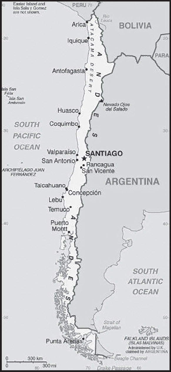
INTRODUCTION
Background: Indigenous groups inhabited central and southern Chile for several thousands of years, living in mixed pastoralist and settled communities, ending with the Inca ruling the north of the country for nearly a century prior to the arrival of the Spanish in the 16th century. The Captaincy General of Chile was founded by the Spanish in 1541, lasting until Chile declared its independence in 1810. The subsequent struggle became tied to other South American independence conflicts, with a decisive victory over the Spanish not being achieved until 1818. In the War of the Pacific (1879-83), Chile defeated Peru and Bolivia to win its current northernmost regions. By the 1880s, the Chilean central government cemented its control over the central and southern regions inhabited by Mapuche Indigenous peoples. Between 1891 and 1973, a series of elected governments succeeded each other until the three-year-old Marxist government of Salvador ALLENDE was overthrown in 1973 by a military coup led by General Augusto PINOCHET, who ruled until a democratically elected president was inaugurated in 1990. Economic reforms, maintained consistently since the 1980s, contributed to steady growth, reduced poverty rates by over half, and helped secure the country’s commitment to democratic and representative government. Chile has increasingly assumed regional and international leadership roles befitting its status as a stable, democratic nation.
GEOGRAPHY
Location: Southern South America, bordering the South Pacific Ocean, between Argentina and Peru
Geographic coordinates: 30 00 S, 71 00 W
Map references: South America
Area: total: 756,102 sq km
land: 743,812 sq km
water: 12,290 sq km
note: includes Easter Island (Isla de Pascua) and Isla Sala y Gomez
comparison ranking: total 39
Area - comparative: slightly smaller than twice the size of Montana
Land boundaries: total: 7,801 km
border countries (3): Argentina 6,691 km; Bolivia 942 km; Peru 168 km
Coastline: 6,435 km
Maritime claims: territorial sea: 12 nm
contiguous zone: 24 nm
exclusive economic zone: 200 nm
continental shelf: 200/350 nm
Climate: temperate; desert in north; Mediterranean in central region; cool and damp in south
Terrain: low coastal mountains, fertile central valley, rugged Andes in east
Elevation: highest point: Nevado Ojos del Salado 6,893 m (highest volcano in the world)
lowest point: Pacific Ocean 0 m
mean elevation: 1,871 m
Natural resources: copper, timber, iron ore, nitrates, precious metals, molybdenum, hydropower
Land use: agricultural land: 21.1% (2018 est.)
arable land: 1.7% (2018 est.)
permanent crops: 0.6% (2018 est.)
permanent pasture: 18.8% (2018 est.)
forest: 21.9% (2018 est.)
other: 57% (2018 est.)
Irrigated land: 11,100 sq km (2012)
Major lakes (area sq km): fresh water lake(s): Lago General Carrera (shared with Argentina) - 2,240 sq km; Lago O’Higgins (shared with Argentina) - 1,010 sq km; Lago Llanquihue - 800 sq km; Lago Fagnano (shared with Argentina) - 590 sq km
Population distribution: 90% of the population is located in the middle third of the country around the capital of Santiago; the far north (anchored by the Atacama Desert) and the extreme south are relatively underpopulated
Natural hazards: severe earthquakes; active volcanism; tsunamis
volcanism: significant volcanic activity due to more than three-dozen active volcanoes along the Andes Mountains; Lascar (5,592 m), which last erupted in 2007, is the most active volcano in the northern Chilean Andes; Llaima (3,125 m) in central Chile, which last erupted in 2009, is another of the country’s most active; Chaiten’s 2008 eruption forced major evacuations; other notable historically active volcanoes include Cerro Hudson, Calbuco, Copahue, Guallatiri, Llullaillaco, Nevados de Chillan, Puyehue, San Pedro, and Villarrica; see note 2 under “Geography - note”
Geography - note: note 1: the longest north-south trending country in the world, extending across 39 degrees of latitude; strategic location relative to sea lanes between the Atlantic and Pacific Oceans (Strait of Magellan, Beagle Channel, Drake Passage)
note 2: Chile is one of the countries along the Ring of Fire, a belt of active volcanoes and earthquake epicenters bordering the Pacific Ocean; up to 90% of the world’s earthquakes and some 75% of the world’s volcanoes occur within the Ring of Fire
note 3: the Atacama Desert - the driest desert in the world - spreads across the northern part of the country; Ojos del Salado (6,893 m) in the Atacama Desert is the highest active volcano in the world, Chile’s tallest mountain, and the second highest in the Western Hemisphere and the Southern Hemisphere - its small crater lake (at 6,390 m) is the world’s highest lake
PEOPLE AND SOCIETY
Population: 18,549,457 (2023 est.)
comparison ranking: 65
Nationality: noun: Chilean(s)
adjective: Chilean
Ethnic groups: White and non-Indigenous 88.9%, Mapuche 9.1%, Aymara 0.7%, other Indigenous groups 1% (includes Rapa Nui, Likan Antai, Quechua, Colla, Diaguita, Kawesqar, Yagan or Yamana), unspecified 0.3% (2012 est.)
Languages: Spanish 99.5% (official), English 10.2%, Indigenous 1% (includes Mapudungun, Aymara, Quechua, Rapa Nui), other 2.3%, unspecified 0.2%; note - shares sum to more than 100% because some respondents gave more than one answer on the census (2012 est.)
major-language sample(s):
La Libreta Informativa del Mundo, la fuente indispensable de información básica. (Spanish)
Religions: Roman Catholic 60%, Evangelical 18%, atheist or agnostic 4%, none 17% (2018 est.)
Demographic profile: Chile is in the advanced stages of demographic transition and is becoming an aging society - with fertility below replacement level, low mortality rates, and life expectancy on par with developed countries. Nevertheless, with its dependency ratio nearing its low point, Chile could benefit from its favorable age structure. It will need to keep its large working-age population productively employed, while preparing to provide for the needs of its growing proportion of elderly people, especially as women - the traditional caregivers - increasingly enter the workforce. Over the last two decades, Chile has made great strides in reducing its poverty rate, which is now lower than most Latin American countries. However, its severe income inequality ranks as the worst among members of the Organization for Economic Cooperation and Development. Unequal access to quality education perpetuates this uneven income distribution. Chile has historically been a country of emigration but has slowly become more attractive to immigrants since transitioning to democracy in 1990 and improving its economic stability (other regional destinations have concurrently experienced deteriorating economic and political conditions). Most of Chile’s small but growing foreign-born population consists of transplants from other Latin American countries, especially Peru.
Age structure: 0-14 years: 19.34% (male 1,829,801/female 1,758,137)
15-64 years: 67.56% (male 6,259,566/female 6,273,074)
65 years and over: 13.09% (2023 est.) (male 1,024,692/female 1,404,187)
Dependency ratios: total dependency ratio: 45.2
youth dependency ratio: 26.8
elderly dependency ratio: 18.4
potential support ratio: 5.4 (2021 est.)
Median age: total: 35.5 years (2020)
male: 34.3 years
female: 36.7 years
comparison ranking: total 85
Population growth rate: 0.63% (2023 est.)
comparison ranking: 137
Birth rate: 12.57 births/1,000 population (2023 est.)
comparison ranking: 142
Death rate: 6.58 deaths/1,000 population (2023 est.)
comparison ranking: 132
Net migration rate: 0.32 migrant(s)/1,000 population (2023 est.)
comparison ranking: 75
Population distribution: 90% of the population is located in the middle third of the country around the capital of Santiago; the far north (anchored by the Atacama Desert) and the extreme south are relatively underpopulated
Urbanization: urban population: 88% of total population (2023)
rate of urbanization: 0.78% annual rate of change (2020-25 est.)
Major urban areas - population: 6.903 million SANTIAGO (capital), 1.009 million Valparaiso, 912,000 Concepcion (2023)
Sex ratio: at birth: 1.04 male(s)/female
0-14 years: 1.04 male(s)/female
15-64 years: 1 male(s)/female
65 years and over: 0.73 male(s)/female
total population: 0.97 male(s)/female (2023 est.)
Maternal mortality ratio: 15 deaths/100,000 live births (2020 est.)
comparison ranking: 136
Infant mortality rate: total: 6.41 deaths/1,000 live births (2023 est.)
male: 6.98 deaths/1,000 live births
female: 5.82 deaths/1,000 live births
comparison ranking: total 165
Life expectancy at birth: total population: 80.02 years (2023 est.)
male: 77.04 years
female: 83.13 years
comparison ranking: total population 54
Total fertility rate: 1.75 children born/woman (2023 est.)
comparison ranking: 151
Gross reproduction rate: 0.86 (2023 est.)
Contraceptive prevalence rate: 76.3% (2015/16)
Drinking water source: improved:
total: 100% of population
unimproved: total: 0% of population (2020 est.)
Current health expenditure: 9.8% of GDP (2020)
Physicians density: 2.84 physicians/1,000 population (2020)
Hospital bed density: 2.1 beds/1,000 population (2018)
Sanitation facility access: improved:
total: 100% of population
unimproved: total: 0% of population (2020 est.)
Obesity - adult prevalence rate: 28% (2016)
comparison ranking: 32
Alcohol consumption per capita: total: 7.8 liters of pure alcohol (2019 est.)
beer: 2.76 liters of pure alcohol (2019 est.)
wine: 2.61 liters of pure alcohol (2019 est.)
spirits: 2.43 liters of pure alcohol (2019 est.)
other alcohols: 0 liters of pure alcohol (2019 est.)
comparison ranking: total 47
Tobacco use: total: 29.2% (2020 est.)
male: 31.6% (2020 est.)
female: 26.8% (2020 est.)
comparison ranking: total 34
Children under the age of 5 years underweight: 0.5% (2014)
comparison ranking: 122
Currently married women (ages 15-49): 46.3% (2023 est.)
Education expenditures: 5.6% of GDP (2019 est.)
comparison ranking: 53
Literacy: definition: age 15 and over can read and write
total population: 97%
male: 97.1%
female: 97% (2021)
School life expectancy (primary to tertiary education): total: 17 years
male: 16 years
female: 17 years (2020)
Youth unemployment rate (ages 15-24): total: 21.4% (2021 est.)
male: 20.4%
female: 22.8%
comparison ranking: total 75
ENVIRONMENT
Environment - current issues: air pollution from industrial and vehicle emissions; water pollution from raw sewage; noise pollution; improper garbage disposal; soil degradation; widespread deforestation and mining threaten the environment; wildlife conservation
Environment - international agreements: party to: Antarctic-Environmental Protection, Antarctic-Marine Living Resources, Antarctic Seals, Antarctic Treaty, Biodiversity, Climate Change, Climate Change-Kyoto Protocol, Climate Change-Paris Agreement, Comprehensive Nuclear Test Ban, Desertification, Endangered Species, Environmental Modification, Hazardous Wastes, Law of the Sea, Marine Dumping-London Convention, Marine Dumping-London Protocol, Nuclear Test Ban, Ozone Layer Protection, Ship Pollution, Wetlands, Whaling
signed, but not ratified: none of the selected agreements
Climate: temperate; desert in north; Mediterranean in central region; cool and damp in south
Land use: agricultural land: 21.1% (2018 est.)
arable land: 1.7% (2018 est.)
permanent crops: 0.6% (2018 est.)
permanent pasture: 18.8% (2018 est.)
forest: 21.9% (2018 est.)
other: 57% (2018 est.)
Urbanization: urban population: 88% of total population (2023)
rate of urbanization: 0.78% annual rate of change (2020-25 est.)
Revenue from forest resources: 0.49% of GDP (2018 est.)
comparison ranking: 67
Revenue from coal: 0.01% of GDP (2018 est.)
comparison ranking: 46
Air pollutants: particulate matter emissions: 20.49 micrograms per cubic meter (2019 est.)
carbon dioxide emissions: 85.82 megatons (2016 est.)
methane emissions: 15.97 megatons (2020 est.)
Waste and recycling: municipal solid waste generated annually: 6.517 million tons (2009 est.)
municipal solid waste recycled annually: 24,113 tons (2009 est.)
percent of municipal solid waste recycled: 0.4% (2009 est.)
Major lakes (area sq km): fresh water lake(s): Lago General Carrera (shared with Argentina) - 2,240 sq km; Lago O’Higgins (shared with Argentina) - 1,010 sq km; Lago Llanquihue - 800 sq km; Lago Fagnano (shared with Argentina) - 590 sq km
Total water withdrawal: municipal: 1.29 billion cubic meters (2020 est.)
industrial: 1.66 billion cubic meters (2020 est.)
agricultural: 29.42 billion cubic meters (2020 est.)
Total renewable water resources: 923.1 billion cubic meters (2020 est.)
GOVERNMENT
Country name: conventional long form: Republic of Chile
conventional short form: Chile
local long form: República de Chile
local short form: Chile
etymology: derivation of the name is unclear, but it may come from the Mapuche word “chilli” meaning “limit of the earth” or from the Quechua “chiri” meaning “cold”
Government type: presidential republic
Capital: name: Santiago; note - Valparaiso is the seat of the national legislature
geographic coordinates: 33 27 S, 70 40 W
time difference: UTC-3 (2 hours ahead of Washington, DC, during Standard Time)
daylight saving time: +1hr, begins second Sunday in August; ends second Sunday in May; note - Punta Arenas observes DST throughout the year
time zone note: Chile has three time zones: the continental portion at UTC-3; the southern Magallanes region, which does not use daylight savings time and remains at UTC-3 for the summer months; and Easter Island at UTC-5
etymology: Santiago is named after the biblical figure Saint James (ca. A.D. 3-44), patron saint of Spain, but especially revered in Galicia; “Santiago” derives from the local Galician evolution of the Vulgar Latin “Sanctu Iacobu”; Valparaiso derives from the Spanish “Valle Paraiso” meaning “Paradise Valley”
Administrative divisions: 16 regions (regiones, singular - region); Aysen, Antofagasta, Araucania, Arica y Parinacota, Atacama, Biobio, Coquimbo, Libertador General Bernardo O’Higgins, Los Lagos, Los Rios, Magallanes y de la Antartica Chilena (Magallanes and Chilean Antarctica), Maule, Nuble, Region Metropolitana (Santiago), Tarapaca, Valparaiso
note: the US does not recognize any claims to Antarctica
Independence: 18 September 1810 (from Spain)
National holiday: Independence Day, 18 September (1810)
Constitution: history: many previous; latest adopted 11 September 1980, effective 11 March 1981; a referendum held on 4 September 2022 to implement a new constitution was defeated by nearly 62% of voters; a second 50-member constitutional council elected in early May 2023 is charged with producing another draft constitution for submission to a national referendum by 17 December 2023
amendments: proposed by members of either house of the National Congress or by the president of the republic; passage requires at least three-fifths majority vote of the membership in both houses and approval by the president; passage of amendments to constitutional articles, such as the republican form of government, basic rights and freedoms, the Constitutional Tribunal, electoral justice, the Council of National Security, or the constitutional amendment process, requires at least two-third majority vote by both houses of Congress and approval by the president; the president can opt to hold a referendum when Congress and the president disagree on an amendment; amended many times, last in 2020
Legal system: civil law system influenced by several West European civil legal systems; judicial review of legislative acts by the Constitutional Tribunal
International law organization participation: has not submitted an ICJ jurisdiction declaration; accepts ICCt jurisdiction
Citizenship: citizenship by birth: yes
citizenship by descent only: yes
dual citizenship recognized: yes
residency requirement for naturalization: 5 years
Suffrage: 18 years of age; universal
Executive branch: chief of state: President Gabriel BORIC (since 11 March 2022); note - the president is both chief of state and head of government
head of government: President Gabriel BORIC (since 11 March 2022)
cabinet: Cabinet appointed by the president
elections/appointments: president directly elected by absolute majority popular vote in 2 rounds if needed for a single 4-year term; election last held on 21 November 2021 with a runoff held on 19 December 2021 (next to be held on 23 November 2025 with runoff if needed on 20 December)
election results: 2021: Gabriel BORIC elected president in second round; percent of vote in first round - Jose Antonio KAST (FSC) 27.9%; Gabriel BORIC (AD) 25.8%; Franco PARISI (PDG) 12.8%; Sebastian SICHEL (ChP+) 12.8%; Yasna PROVOSTE (New Social Pact) 11.6%; other 9.1%; percent of vote in second round - Gabriel BORIC 55.9%; Jose Antonio KAST 44.1%
2017: Sebastian PINERA Echenique elected president in second round; percent of vote in first round - Sebastian PINERA Echenique (independent) 36.6%; Alejandro GUILLIER (independent) 22.7%; Beatriz SANCHEZ (independent) 20.3%; Jose Antonio KAST (independent) 7.9%; Carolina GOIC (PDC) 5.9%; Marco ENRIQUEZ-OMINAMI (PRO) 5.7%; other 0.9%; percent of vote in second round - Sebastian PINERA Echenique 54.6%, Alejandro GUILLIER 45.4%
Legislative branch: description: bicameral National Congress or Congreso Nacional consists of:
Senate or Senado (50 seats); members directly elected in multi-seat constituencies by open party-list proportional representation vote to serve 8-year terms with one-half of the membership renewed every 4 years)
Chamber of Deputies or Camara de Diputados (155 seats; members directly elected in multi-seat constituencies by open party-list proportional representation vote to serve 4-year terms)
elections:
Senate - last held on 21 November 2021 (next to be held on 23 November 2025)
Chamber of Deputies - last held on 21 November 2021 (next to be held on 23 November 2025)
election results:
Senate - percent of vote by party - NA; seats by party - ChP+ 12 (RN 5, UDI 5, EVOPOLI 2), NPS 8 (PS 4, PPD 2, PDC 2), PLR 1, AD 4 (PCCh 2, FREVS 2) independent 2; note - total composition of the Senate as of 1 May 2022: seats by party - ChP+ 24 (RN 12, UDI 9, EVOPOLI 3), NPS 18 (PS 7, PPD 6, PDC 5), AD 6 (PCCh 2, FREVS 2, RD 2), PLR 1, independent 1; composition - men 38, women 12, percent of women 24%
Chamber of Deputies - percent of vote by party - NA; seats by party - ChP+ 53 (RN 25, UDI 23, EVOPOLI 4, PRI 1), AD 37 (PCCh 12, CS 9, RD 8, Commons 6, FREVS 2), NPS 37 (PS 13, PDC 8, PPD 7, PL 4, PRSD 4, CIU 1), FSC 15 (PLR 14, PCC 1), PDG 6, PH 3, PEV 2, IU 1, independent 1; composition - men 100, women 55, percent of women 35.5%; note - overall National Congress percent of women 32.7%
Judicial branch: highest court(s): Supreme Court or Corte Suprema (consists of a court president and 20 members or ministros); Constitutional Court (consists of 10 members and is independent of the rest of the judiciary); Elections Qualifying Court (consists of 5 members)
judge selection and term of office: Supreme Court president and judges (ministers) appointed by the president of the republic and ratified by the Senate from lists of candidates provided by the court itself; judges appointed for life with mandatory retirement at age 70; Constitutional Court members appointed - 3 by the Supreme Court, 3 by the president of the republic, 2 by the Chamber of Deputies, and 2 by the Senate; members serve 9-year terms with partial membership replacement every 3 years (the court reviews constitutionality of legislation); Elections Qualifying Court members appointed by lottery - 1 by the former president or vice president of the Senate and 1 by the former president or vice president of the Chamber of Deputies, 2 by the Supreme Court, and 1 by the Appellate Court of Valparaiso; members appointed for 4-year terms
subordinate courts: Courts of Appeal; oral criminal tribunals; military tribunals; local police courts; specialized tribunals and courts in matters such as family, labor, customs, taxes, and electoral affairs
Political parties and leaders: Approve Dignity (Apruebo Dignidad) coalition or AD (includes PC, FA, and FREVS) [Gabriel BORIC]
Broad Front Coalition (Frente Amplio) or FA (includes RD, CS, and Comunes) [Gonzalo WINTER]
Broad Social Movement of Leftist Citizens (includes former MAS and Izquierda Ciudadana) [Fernando ZAMORANO]
Chile We Can Do More or ChP+ [Sebastian SICHEL] (coalition includes EVOPOLI, PRI, RN, UDI)
Christian Conservative Party or PCC [Antaris VARELA]
Christian Democratic Party or PDC [Carmen FREI Ruiz-Tagle]
Christian Social Front or FSC [Jose Antonio KAST] (includes PCC, PLR)
Citizens or CIU [María Ignacia GOMEZ Martinez]
Commons (Comunes) [Jorge RAMIREZ]
Communist Party of Chile or PCCh [Guillermo TEILLIER del Valle]
Democratic Revolution or RD [Margarita PORTUGUEZ]
Green Ecological Party or PEV [Felix GONZALEZ] (dissolved 7 February 2022)
Humanist Party or PH [Octavio GONZALEZ]
Independent Democratic Union or UDI [Javier MACAYA]
Independent Regionalist Democratic Party or PRI [Hugo ORTIZ de Filippi]
Liberal Party (Partido Liberal de Chile) or PL [Patricio MORALES]
National Renewal or RN [Francisco CHAHUAN]
New Social Pact or NPS [Yasna PROVOSTE] (includes PDC, PL, PPD, PRSD, PS)
Party for Democracy or PPD [Natalia PERGIENTILI Domenech]
Party of the People or PDG [Franco Aldo PARISI Fernandez]
Political Evolution or EVOPOLI [Luz POBLETE Coddou]
Radical Social Democratic Party or PRSD [Carlos MALDONADO Curti]
Republican Party or PLR [Rojo EDWARDS]
Social Convergence or CS [Alondra ARELLANO Hernandez]
Social Green Regionalist Federation or FREVS [Flavia TORREALBA Diaz]
Socialist Party or PS [Alvaro Antonio ELIZALDE Soto]
United Independents or IU [Cristian Alejandro CONTRERAS Radovic]
International organization participation: APEC, BIS, CAN (associate), CD, CELAC, FAO, G-15, G-77, IADB, IAEA, IBRD, ICAO, ICC (national committees), ICCt, ICRM, IDA, IFAD, IFC, IFRCS, IHO, ILO, IMF, IMO, IMSO, Interpol, IOC, IOM, IPU, ISO, ITSO, ITU, ITUC (NGOs), LAES, LAIA, Mercosur (associate), MIGA, MINUSTAH, NAM, OAS, OECD (enhanced engagement), OPANAL, OPCW, Pacific Alliance, PCA, PROSUR, SICA (observer), UN, UNASUR, UNCTAD, UNESCO, UNFICYP, UNHCR, UNIDO, Union Latina, UNMOGIP, UNTSO, UNWTO, UPU, WCO, WFTU (NGOs), WHO, WIPO, WMO, WTO
Diplomatic representation in the US: chief of mission: Ambassador Juan Gabriel VALDES Soublette (since 7 June 2022)
chancery: 1732 Massachusetts Avenue NW, Washington, DC 20036
telephone: [1] (202) 785-1746
FAX: [1] (202) 887-5579
email address and website:
https://chile.gob.cl/estados-unidos/en/
consulate(s) general: Chicago, Houston, Los Angeles, Miami, New York, San Francisco
Diplomatic representation from the US: chief of mission: Ambassador Bernadette M. MEEHAN (since 30 September 2022)
embassy: Avenida Andres Bello 2800, Las Condes, Santiago
mailing address: 3460 Santiago Place, Washington DC 20521-3460
telephone: [56] (2) 2330-3000
FAX: [56] (2) 2330-3710
email address and website:
Flag description: two equal horizontal bands of white (top) and red; a blue square the same height as the white band at the hoist-side end of the white band; the square bears a white five-pointed star in the center representing a guide to progress and honor; blue symbolizes the sky, white is for the snow-covered Andes, and red represents the blood spilled to achieve independence
note: design influenced by the US flag
National symbol(s): huemul (mountain deer), Andean condor; national colors: red, white, blue
National anthem: name: “Himno Nacional de Chile” (National Anthem of Chile)
lyrics/music: Eusebio LILLO Robles and Bernardo DE VERA y Pintado/Ramon CARNICER y Battle
note: music adopted 1828, original lyrics adopted 1818, adapted lyrics adopted 1847; under Augusto PINOCHET’s military rule, a verse glorifying the army was added; however, as a protest, some citizens refused to sing this verse; it was removed when democracy was restored in 1990
National heritage: total World Heritage Sites: 7 (all cultural)
selected World Heritage Site locales: Rapa Nui National Park; Churches of Chiloe; Historic Valparaiso; Humberstone and Santa Laura Saltpeter Works; Sewell Mining Town; Qhapaq Ñan/Andean Road System; Chinchorro archeological sites
ECONOMY
Economic overview: export-driven economy; leading copper producer; though hit by COVID-19, fairly quick rebound from increased liquidity and rapid vaccine rollouts; decreasing poverty but still lingering inequality; public debt rising but still manageable; recent political violence has had negative economic consequences
Real GDP (purchasing power parity): $496.085 billion (2021 est.)
$444.249 billion (2020 est.)
$472.495 billion (2019 est.)
note: data are in 2017 dollars
comparison ranking: 42
Real GDP growth rate: 11.67% (2021 est.)
-5.98% (2020 est.)
0.77% (2019 est.)
comparison ranking: 19
Real GDP per capita: $25,400 (2021 est.)
$23,000 (2020 est.)
$24,800 (2019 est.)
note: data are in 2017 dollars
comparison ranking: 79
GDP (official exchange rate)
$282.655 billion (2019 est.)
Inflation rate (consumer prices): 4.52% (2021 est.)
3.05% (2020 est.)
2.56% (2019 est.)
comparison ranking: 76
Credit ratings: Fitch rating: A- (2020)
Moody’s rating: A1 (2018)
Standard & Poors rating: A+ (2017)
note: The year refers to the year in which the current credit rating was first obtained.
GDP - composition, by sector of origin
agriculture: 4.2% (2017 est.)
industry: 32.8% (2017 est.)
services: 63% (2017 est.)
comparison rankings: services 102; industry 62; agriculture 135
GDP - composition, by end use
household consumption: 62.3% (2017 est.)
government consumption: 14% (2017 est.)
investment in fixed capital: 21.5% (2017 est.)
investment in inventories: 0.5% (2017 est.)
exports of goods and services: 28.7% (2017 est.)
imports of goods and services: -27% (2017 est.)
Agricultural products: grapes, apples, wheat, sugar beet, milk, potatoes, tomatoes, maize, poultry, pork
Industries: copper, lithium, other minerals, foodstuffs, fish processing, iron and steel, wood and wood products, transport equipment, cement, textiles
Industrial production growth rate: 5.06% (2021 est.)
comparison ranking: 89
Labor force: 8.684 million (2021 est.)
comparison ranking: 60
Labor force - by occupation: agriculture: 9.2%
industry: 23.7%
services: 67.1% (2013)
Unemployment rate: 9.13% (2021 est.)
11.18% (2020 est.)
7.29% (2019 est.)
comparison ranking: 79
Youth unemployment rate (ages 15-24): total: 21.4% (2021 est.)
male: 20.4%
female: 22.8%
comparison ranking: total 75
Population below poverty line: 8.6% (2017 est.)
Gini Index coefficient - distribution of family income: 44.9 (2020 est.)
comparison ranking: 27
Average household expenditures: on food: 16% of household expenditures (2018 est.)
on alcohol and tobacco: 2.9% of household expenditures (2018 est.)
Household income or consumption by percentage share: lowest 10%: 1.7%
highest 10%: 41.5% (2013 est.)
Budget: revenues: $55.16 billion (2020 est.)
expenditures: $73.176 billion (2020 est.)
Budget surplus (+) or deficit (-): -2.8% (of GDP) (2017 est.)
comparison ranking: 124
Public debt: 23.6% of GDP (2017 est.)
21% of GDP (2016 est.)
comparison ranking: 182
Taxes and other revenues: 16.24% (of GDP) (2020 est.)
comparison ranking: 133
Fiscal year: calendar year
Current account balance: -$20.307 billion (2021 est.)
-$4.283 billion (2020 est.)
-$14.505 billion (2019 est.)
comparison ranking: 204
Exports: $100.634 billion (2021 est.)
$79.733 billion (2020 est.)
$77.255 billion (2019 est.)
note: Data are in current year dollars and do not include illicit exports or re-exports.
comparison ranking: 46
Exports - partners: China 32%, United States 14%, Japan 9%, South Korea 7% (2019)
Exports - commodities: copper, fish fillets, wood pulp, pitted fruits, wine (2021)
Imports: $102.086 billion (2021 est.) note: data are in current year dollars
$68.118 billion (2020 est.) note: data are in current year dollars
$82.324 billion (2019 est.) note: data are in current year dollars
comparison ranking: 46
Imports - partners: China 24%, United States 20%, Brazil 8%, Germany 5%, Argentina 5% (2019)
Imports - commodities: refined petroleum, crude petroleum, cars, broadcasting equipment, delivery trucks (2019)
Reserves of foreign exchange and gold: $51.252 billion (31 December 2021 est.)
$39.166 billion (31 December 2020 est.)
$40.656 billion (31 December 2019 est.)
comparison ranking: 44
Debt - external: $193.298 billion (2019 est.)
$181.089 billion (2018 est.)
comparison ranking: 39
Exchange rates: Chilean pesos (CLP) per US dollar -
Exchange rates:: 758.955 (2021 est.)
792.727 (2020 est.)
702.897 (2019 est.)
641.277 (2018 est.)
648.834 (2017 est.)
ENERGY
Electricity access: electrification - total population: 100% (2021)
Electricity: installed generating capacity: 29.808 million kW (2020 est.)
consumption: 75.302 billion kWh (2020 est.)
exports: 0 kWh (2020 est.)
imports: 0 kWh (2020 est.)
transmission/distribution losses: 4.62 billion kWh (2020 est.)
comparison rankings: transmission/distribution losses 48; imports 187; exports 181; consumption 40; installed generating capacity 35
Electricity generation sources: fossil fuels: 51.9% of total installed capacity (2020 est.)
solar: 9.5% of total installed capacity (2020 est.)
wind: 6.9% of total installed capacity (2020 est.)
hydroelectricity: 26% of total installed capacity (2020 est.)
geothermal: 0.3% of total installed capacity (2020 est.)
biomass and waste: 5.4% of total installed capacity (2020 est.)
Coal: production: 542,000 metric tons (2020 est.)
consumption: 10.573 million metric tons (2020 est.)
exports: 134,000 metric tons (2020 est.)
imports: 10.607 million metric tons (2020 est.)
proven reserves: 1.181 billion metric tons (2019 est.)
Petroleum: total petroleum production: 11,900 bbl/day (2021 est.)
refined petroleum consumption: 361,700 bbl/day (2019 est.)
crude oil and lease condensate exports: 0 bbl/day (2018 est.)
crude oil and lease condensate imports: 172,700 bbl/day (2018 est.)
crude oil estimated reserves: 150 million barrels (2021 est.)
Refined petroleum products - production: 216,200 bbl/day (2017 est.)
comparison ranking: 49
Refined petroleum products - exports: 7,359 bbl/day (2017 est.)
comparison ranking: 87
Refined petroleum products - imports: 166,400 bbl/day (2017 est.)
comparison ranking: 38
Natural gas: production: 1,109,962,000 cubic meters (2020 est.)
consumption: 6,558,312,000 cubic meters (2020 est.)
exports: 0 cubic meters (2021 est.)
imports: 4,602,471,000 cubic meters (2020 est.)
proven reserves: 97.976 billion cubic meters (2021 est.)
Carbon dioxide emissions: 88.333 million metric tonnes of CO2 (2019 est.)
from coal and metallurgical coke: 24.217 million metric tonnes of CO2 (2019 est.)
from petroleum and other liquids: 51.228 million metric tonnes of CO2 (2019 est.)
from consumed natural gas: 12.888 million metric tonnes of CO2 (2019 est.)
comparison ranking: total emissions 47
Energy consumption per capita: 81.953 million Btu/person (2019 est.)
comparison ranking: 72
COMMUNICATIONS
Telephones - fixed lines: total subscriptions: 2,510,972 (2021 est.)
subscriptions per 100 inhabitants: 13 (2021 est.)
comparison ranking: total subscriptions 49
Telephones - mobile cellular: total subscriptions: 26,571,823 (2021 est.)
subscriptions per 100 inhabitants: 136 (2021 est.)
comparison ranking: total subscriptions 50
Telecommunication systems: general assessment: the market for fixed and mobile telephony is highly competitive and rapidly evolving; the mobile rate is among the highest in South America; LTE infrastructure is extensive and 5G spectrum auctions which took place in February 2021 are expected to prompt the deployment of 5G networks by the end of the year, following extensive trials held by the MNOs; fixed broadband is relatively high for the region, with services among the fastest and least expensive in Latin America; government initiatives such as the National Fiber Optic project and Fibra Óptica Austral are providing high-capacity connectivity across the country and will further increase fixed-line broadband; there is a strong focus on fiber broadband, with the number of fiber subscribers having increased 61.7% in 2020, year-on-year; technological improvements have allowed operators to provide a variety of services via their networks, giving rise to a number of bundled packages at competitive prices, including access to video on demand services which in turn is increasing fixed-line broadband; traditional fixed-line teledensity continues to fall as consumers switch to mobile networks and to fixed broadband for voice and data connectivity; more than 8,300 schools receive free broadband as part of the ‘Connectivity for Education 2030’ project (2021)
domestic: number of fixed-line connections 13 per 100, mobile-cellular usage continues to increase, reaching 136 telephones per 100 persons (2021)
international: country code - 56; landing points for the Pan-Am, Prat, SAm-1, American Movil-Telxius West Coast Cable, FOS Quellon-Chacabuco, Fibra Optical Austral, SAC and Curie submarine cables providing links to the US, Caribbean and to Central and South America; satellite earth stations - 2 Intelsat (Atlantic Ocean) (2019)
Broadcast media: national and local terrestrial TV channels, coupled with extensive cable TV networks; the state-owned Television Nacional de Chile (TVN) network is self-financed through commercial advertising revenues and is not under direct government control; large number of privately owned TV stations; about 250 radio stations
Internet country code: .cl
Internet users: total: 17.1 million (2021 est.)
percent of population: 90% (2021 est.)
comparison ranking: total 45
Broadband - fixed subscriptions: total: 3,763,826 (2020 est.)
subscriptions per 100 inhabitants: 20 (2020 est.)
comparison ranking: total 41
TRANSPORTATION
National air transport system: number of registered air carriers: 9 (2020)
inventory of registered aircraft operated by air carriers: 173
annual passenger traffic on registered air carriers: 19,517,185 (2018)
annual freight traffic on registered air carriers: 1,226,440,000 (2018) mt-km
Civil aircraft registration country code prefix: CC
Airports: 481 (2021)
comparison ranking: total 14
Airports - with paved runways: 90
note: paved runways have a concrete or asphalt surface but not all have facilities for refueling, maintenance, or air traffic control; the length of a runway required for aircraft to safely operate depends on a number of factors including the type of aircraft, the takeoff weight (including passengers, cargo, and fuel), engine types, flap settings, landing speed, elevation of the airport, and average maximum daily air temperature; paved runways can reach a length of 5,000 m (16,000 ft.), but the “typical” length of a commercial airline runway is between 2,500-4,000 m (8,000-13,000 ft.)
Airports - with unpaved runways: 391
note: unpaved runways have a surface composition such as grass or packed earth and are most suited to the operation of light aircraft; unpaved runways are usually short, often less than 1,000 m (3,280 ft.) in length; airports with unpaved runways often lack facilities for refueling, maintenance, or air traffic control
Heliports: 1 (2021)
Pipelines: 3,160 km gas, 781 km liquid petroleum gas, 985 km oil, 722 km refined products (2013)
Railways: total: 7,281.5 km (2014)
narrow gauge: 3,853.5 km (2014) 1.000-m gauge
broad gauge: 3,428 km (2014) 1.676-m gauge (1,691 km electrified)
comparison ranking: total 30
Roadways: total: 77,801 km (2016)
paved: (2010)
unpaved: (2010)
comparison ranking: total 62
Merchant marine: total: 239 (2022)
by type: bulk carrier 4, container ship 5, general cargo 64, oil tanker 14, other 152 comparison ranking: total 63
Ports and terminals: major seaport(s): Coronel, Huasco, Lirquen, Puerto Ventanas, San Antonio, San Vicente, Valparaiso
container port(s) (TEUs): San Antonio (1,840,458), Valparaiso (793,118) (2021)
LNG terminal(s) (import): Mejillones, Quintero
Transportation - note: Chile operates one PC 5 or 6 class light icebreaker for operations in Antarctica and the Southern Ocean
note - PC indicates a Polar Class vessel: PC 5 - year-round operation in medium first-year ice which may include old ice inclusions (ice thickness up to 70-120 cm); PC 6 - summer/autumn operation in medium first-year ice which may include old ice inclusions (ice thickness up to 30-70 cm)
MILITARY AND SECURITY
Military and security forces: Armed Forces of Chile (Fuerzas Armadas de Chile): Chilean Army (Ejército de Chile), Chilean Navy (Armada de Chile, includes marine units and coast guard or Maritime Territory and Merchant Marine Directorate (Directemar)), Chilean Air Force (Fuerza Aerea de Chile, FACh) (2023)
note: the National Police Force (Carabineros de Chile) are responsible to both the Ministry of Defense and the Ministry of the Interior and Public Security
Military expenditures: 1.6% of GDP (2022 est.)
2% of GDP (2021 est.)
2% of GDP (2020 est.)
1.9% of GDP (2019 est.)
1.9% of GDP (2018 est.)
comparison ranking: 82
Military and security service personnel strengths: approximately 75,000 active armed forces personnel (45,000 Army; 20,000 Navy; 10,000 Air Force); approximately 50,000 Carabineros (2023)
Military equipment inventories and acquisitions: the Chilean military inventory is comprised of a wide mix of mostly Western equipment and some domestically produced systems; in recent years, it has received military hardware from a variety of countries, including Australia, the UK, and the US; Chile’s defense industry has capabilities in military aircraft, ships, and vehicles (2023)
Military service age and obligation: 18-45 years of age for voluntary male and female military service; selective compulsory service (there are usually enough volunteers to make compulsory service unnecessary); service obligation is a minimum of 12 months for Army and 22 months for Navy and Air Force (2023)
note: as of 2021, women comprised approximately 18% of the armed forces
Military - note: the Chilean military is a professional volunteer force that is regarded as one of the top militaries in the region; it is responsible for territorial defense and ensuring the country’s sovereignty; the military also assists with disaster and humanitarian relief and some internal security duties such as border security or maintaining public order if required; a key focus in recent years has been securing the border area with Bolivia and Peru; it trains regularly and participates in bilateral and multinational training exercises, as well as international peacekeeping operations
the Chilean Army was founded in 1810, but traces its origins back to the Army of the Kingdom of Chile, which was established by the Spanish Crown in the early 1600s; the current Army has 6 divisions, an aviation brigade, and a special operations command; the divisions are comprised of a mix of armored, light infantry, mechanized infantry, motorized infantry, and mountain infantry brigades, regiments, and detachments; Chile’s military aviation was inaugurated in 1913 with the creation of a military aviation school; the modern Air Force has about 200 fixed-wing aircraft and helicopters, including about 50 US-made fighters
the Navy traces its origins to 1817; it was first led by a British officer and its first ships were largely crewed by American, British, and Irish sailors; by the 1880s, the Chilean Navy was one of the most powerful in the Americas, and included the world’s first protected cruiser (a ship with an armored deck to protect vital machine spaces); today, its principle warships are 8 frigates, 4 offshore patrol ships, a landing platform dock (LPD) amphibious assault ship, 4 attack submarines, and a few missile attack craft, supported by dozens of coastal patrol boats; the Navy also has marine amphibious infantry brigade and an aviation force with maritime patrol and anti-submarine warfare aircraft
Chile and Argentina have a joint peacekeeping force known as the Combined Southern Cross Peacekeeping Force (FPC), designed to be made available to the UN; the FPC is made up of two battalions, one from each country, a command and service company, an air component (a squadron of Argentine and Chilean helicopters), a naval component, and a combined logistics support unit (2023)
SPACE
Space agency/agencies: the Chilean Space Agency was established in 2001 and dissolved in 2014, at which time the space program became part of the Ministry of Defense; the Ministry of Science also participates in Chile’s space program (2023)
Space program overview: has a space program with a considerable history and largely focused on the acquisition and operation of satellites; operates foreign-built satellites and satellite ground stations; building small remote sensing (RS) satellites; researching and developing additional capabilities and technologies associated with the production of satellites and satellite sub-systems; is a world leader in astronomy and astrophysics (Chile’s Atacama Desert, where the skies are exceptionally clear and dry for more than 300 days a year, is home to the Cerro Tololo Inter-American Observatory, the Las Campanas Observatory, and the European Southern Observatory); Chile is also home to several astronomy institutes; has established relations with space agencies and industries of Canada, China, France, India, Israel, Mexico, Russia, the UK, and the US (2023)
note: further details about the key activities, programs, and milestones of the country’s space program, as well as government spending estimates on the space sector, appear in Appendix S
TRANSNATIONAL ISSUES
Disputes - international: Chile and Peru rebuff Bolivia’s reactivated claim to restore the Atacama corridor, ceded to Chile in 1884, but Chile has offered instead unrestricted but not sovereign maritime access through Chile to Bolivian natural gas; Chile rejects Peru’s unilateral legislation to change its latitudinal maritime boundary with Chile to an equidistance line with a southwestern axis favoring Peru; in October 2007, Peru took its maritime complaint with Chile to the ICJ; territorial claim in Antarctica (Chilean Antarctic Territory) partially overlaps Argentine and British claims; the joint boundary commission, established by Chile and Argentina in 2001, has yet to map and demarcate the delimited boundary in the inhospitable Southern Patagonian Ice Field (Campo de Hielo Sur)
Refugees and internally displaced persons: refugees (country of origin): 448,138 (Venezuela) (economic and political crisis; includes Venezuelans who have claimed asylum or have received alternative legal stay) (2020)
Illicit drugs: transshipment country for cocaine destined for Europe and the region; some money laundering activity, especially through the Iquique Free Trade Zone; imported precursors passed on to Bolivia; domestic cocaine consumption is rising, making Chile a significant consumer of cocaine
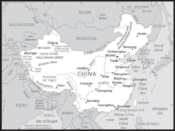
INTRODUCTION
Background: China’s historical civilization dates to at least the 13th century B.C., first under the Shang (to 1046 B.C.) and then the Zhou (1046-221 B.C) dynasties. The imperial era of China began in 221 B.C. under the Qin Dynasty and lasted until the fall of the Qing Dynasty in 1912. During this period, China alternated between periods of unity and disunity under a succession of imperial dynasties. In the 19th century, the Qing Dynasty suffered heavily from overextension by territorial conquest, insolvency, civil war, imperialism, military defeats, and foreign expropriation of ports and infrastructure. It collapsed following the Revolution of 1911, and China became a republic under SUN Yat-sen of the Kuomintang (KMT or Nationalist) Party. However, the republic was beset by division, warlordism, and continued foreign intervention. In the late 1920s, a civil war erupted between the ruling KMT-controlled government led by CHIANG Kai-shek, and the Chinese Communist Party (CCP). Japan occupied much of northeastern China in the early 1930s, and then launched a full-scale invasion of the country in 1937. The resulting eight years of warfare devastated the country and cost up to 20 million Chinese lives by the time of Japan’s defeat in 1945. The Nationalist-Communist civil war continued with renewed intensity following the end of World War II and culminated with a CCP victory in 1949, under the leadership of MAO Zedong.
MAO and the CCP established an autocratic socialist system that, while ensuring the PRC’s sovereignty, imposed strict controls over everyday life and launched agricultural, economic, political, and social policies - such as the Great Leap Forward (1958-1962) and the Cultural Revolution (1966-1976) - that cost the lives of millions of people. MAO died in 1976. Beginning in 1978, subsequent leaders DENG Xiaoping, JIANG Zemin, and HU Jintao focused on market-oriented economic development and opening up the country to foreign trade, while maintaining the rule of the CCP. Since the change, China has been among the world’s fastest growing economies, with real gross domestic product averaging over 9% growth annually through 2021, lifting an estimated 800 million people out of poverty, and dramatically improving overall living standards. By 2011, the PRC’s economy was the second largest in the world. The growth, however, has created considerable social displacement, adversely affected the country’s environment, and reduced the country’s natural resources. Current leader XI Jinping has continued these policies, but also has maintained tight political controls. Over the past decade, China has also increased its global outreach, including military deployments, participation in international organizations, and initiating a global connectivity initiative in 2013 called the “Belt and Road Initiative” (BRI). While many nations have signed on to BRI agreements to attract PRC investment, others have balked at the opaque lending behavior; weak environment, social, and governance (ESG) standards; and other practices that undermine local governance and foster corruption associated with some BRI-linked projects. XI Jinping assumed the positions of General Secretary of the Chinese Communist Party and Chairman of the Central Military Commission in 2012 and President in 2013. In March 2018, the PRC’s National People’s Congress passed an amendment abolishing presidential term limits, opening the door for XI to seek a third five-year term in 2023, which he ultimately secured.
GEOGRAPHY
Location: Eastern Asia, bordering the East China Sea, Korea Bay, Yellow Sea, and South China Sea, between North Korea and Vietnam
Geographic coordinates: 35 00 N, 105 00 E
Map references: Asia
Area: total: 9,596,960 sq km
land: 9,326,410 sq km
water: 270,550 sq km
comparison ranking: total 5
Area - comparative: slightly smaller than the US
Land boundaries: total: 22,457 km
border countries (14): Afghanistan 91 km; Bhutan 477 km; Burma 2,129 km; India 2,659 km; Kazakhstan 1,765 km; North Korea 1,352 km; Kyrgyzstan 1,063 km; Laos 475 km; Mongolia 4,630 km; Nepal 1,389 km; Pakistan 438 km; Russia (northeast) 4,133 km and Russia (northwest) 46 km; Tajikistan 477 km; Vietnam 1,297 km
Coastline: 14,500 km
Maritime claims: territorial sea: 12 nm
contiguous zone: 24 nm
exclusive economic zone: 200 nm
continental shelf: 200 nm or to the edge of the continental margin
Climate: extremely diverse; tropical in south to subarctic in north
Terrain: mostly mountains, high plateaus, deserts in west; plains, deltas, and hills in east
Elevation: highest point: Mount Everest (highest peak in Asia and highest point on earth above sea level) 8,849 m
lowest point: Turpan Pendi (Turfan Depression) -154 m
mean elevation: 1,840 m
Natural resources: coal, iron ore, helium, petroleum, natural gas, arsenic, bismuth, cobalt, cadmium, ferrosilicon, gallium, germanium, hafnium, indium, lithium, mercury, tantalum, tellurium, tin, titanium, tungsten, antimony, manganese, magnesium, molybdenum, selenium, strontium, vanadium, magnetite, aluminum, lead, zinc, rare earth elements, uranium, hydropower potential (world’s largest), arable land
Land use: agricultural land: 54.7% (2018 est.)
arable land: 11.3% (2018 est.)
permanent crops: 1.6% (2018 est.)
permanent pasture: 41.8% (2018 est.)
forest: 22.3% (2018 est.)
other: 23% (2018 est.)
Irrigated land: 690,070 sq km (2012)
Major lakes (area sq km): fresh water lake(s): Dongting Hu - 3,100 sq km; Poyang Hu - 3,350 sq km; Hongze Hu - 2,700 sq km; Tai Hu - 2,210 sq km; Hulun Nur - 1,590
salt water lake(s): Quinghai Hu - 4,460 sq km; Nam Co - 2,500 sq km; Siling Co - 1,860 sq km; Tangra Yumco - 1,400 sq km; Bosten Hu 1,380 sq km
Major rivers (by length in km): Yangtze - 6,300 km; Huang He - 5,464 km; Amur river source (shared with Mongolia and Russia [m]) - 4,444 km; Lancang Jiang (Mekong) river source (shared with Burma, Laos, Thailand, Cambodia, and Vietnam [m]) - 4,350 km; Yarlung Zangbo Jiang (Brahmaputra) river source (shared with India and Bangladesh [m]) - 3,969 km; Yin-tu Ho (Indus) river source (shared with India and Pakistan [m]) - 3,610 km; Nu Jiang (Salween) river source (shared with Thailand and Burma [m]) - 3,060 km; Irrawaddy river source (shared with Burma [m]) - 2,809 km; Zhu Jiang (Pearl) (shared with Vietnam [s]) - 2,200 km; Yuan Jiang (Red river) source (shared with Vietnam [m]) - 1,149 km
note – [s] after country name indicates river source; [m] after country name indicates river mouth
Major watersheds (area sq km): Pacific Ocean drainage: Amur (1,929,955 sq km), Huang He (944,970 sq km), Mekong (805,604 sq km), Yangtze (1,722,193 sq km)
Indian Ocean drainage: Brahmaputra (651,335 sq km), Ganges (1,016,124 sq km), Indus (1,081,718 sq km), Irrawaddy (413,710 sq km), Salween (271,914 sq km)
Arctic Ocean drainage: Ob (2,972,493 sq km)
Internal (endorheic basin) drainage: Tarim Basin (1,152,448 sq km), Amu Darya (534,739 sq km), Syr Darya (782,617 sq km), Lake Balkash (510,015 sq km)
Major aquifers: North China Aquifer System (Huang Huai Hai Plain), Song-Liao Plain, Tarim Basin
Population distribution: overwhelming majority of the population is found in the eastern half of the country; the west, with its vast mountainous and desert areas, remains sparsely populated; though ranked first in the world in total population, overall density is less than that of many other countries in Asia and Europe; high population density is found along the Yangtze and Yellow River valleys, the Xi Jiang River delta, the Sichuan Basin (around Chengdu), in and around Beijing, and the industrial area around Shenyang
Natural hazards: frequent typhoons (about five per year along southern and eastern coasts); damaging floods; tsunamis; earthquakes; droughts; land subsidence
volcanism: China contains some historically active volcanoes including Changbaishan (also known as Baitoushan, Baegdu, or P’aektu-san), Hainan Dao, and Kunlun although most have been relatively inactive in recent centuries
Geography - note: note 1: world’s fourth largest country (after Russia, Canada, and US) and largest country situated entirely in Asia; Mount Everest on the border with Nepal is the world’s tallest peak above sea level
note 2: the largest cave chamber in the world is the Miao Room, in the Gebihe cave system at China’s Ziyun Getu He Chuandong National Park, which encloses some 10.78 million cu m (380.7 million cu ft) of volume; the world’s largest sinkhole is the Xiaoxhai Tiankeng sinkhole in Chongqing Municipality, which is 660 m deep, with a volume of 130 million cu m
note 3: China appears to have been the center of domestication for two of the world’s leading cereal crops: millet in the north along the Yellow River and rice in the south along the lower or middle Yangtze River
PEOPLE AND SOCIETY
Population: 1,413,142,846 (2023 est.)
comparison ranking: 1
Nationality: noun: Chinese (singular and plural)
adjective: Chinese
Ethnic groups: Han Chinese 91.1%, ethnic minorities 8.9% (includes Zhang, Hui, Manchu, Uighur, Miao, Yi, Tujia, Tibetan, Mongol, Dong, Buyei, Yao, Bai, Korean, Hani, Li, Kazakh, Dai, and other nationalities) (2021 est.)
note: the PRC officially recognizes 56 ethnic groups
Languages: Standard Chinese or Mandarin (official; Putonghua, based on the Beijing dialect), Yue (Cantonese), Wu (Shanghainese), Minbei (Fuzhou), Minnan (Hokkien-Taiwanese), Xiang, Gan, Hakka dialects, minority languages (see Ethnic groups entry); note - Zhuang is official in Guangxi Zhuang, Yue is official in Guangdong, Mongolian is official in Nei Mongol, Uyghur is official in Xinjiang Uygur, Kyrgyz is official in Xinjiang Uyghur, and Tibetan is official in Xizang (Tibet)
major-language sample(s):

(Standard Chinese)
Religions: folk religion 21.9%, Buddhist 18.2%, Christian 5.1%, Muslim 1.8%, Hindu < 0.1%, Jewish < 0.1%, other 0.7% (includes Daoist (Taoist)), unaffiliated 52.1% (2021 est.)
note: officially atheist
Age structure: 0-14 years: 16.48% (male 124,166,174/female 108,729,429)
15-64 years: 69.4% (male 504,637,819/female 476,146,909)
65 years and over: 14.11% (2023 est.) (male 92,426,805/female 107,035,710)
Dependency ratios: total dependency ratio: 44.5
youth dependency ratio: 25.5
elderly dependency ratio: 19
potential support ratio: 5.3 (2021 est.)
note: data do not include Hong Kong, Macau, and Taiwan
Median age: total: 38.4 years (2020)
male: 37.5 years
female: 39.4 years
comparison ranking: total 62
Population growth rate: 0.18% (2023 est.)
comparison ranking: 180
Birth rate: 9.69 births/1,000 population (2023 est.)
comparison ranking: 191
Death rate: 7.82 deaths/1,000 population (2023 est.)
comparison ranking: 96
Net migration rate: -0.11 migrant(s)/1,000 population (2023 est.)
comparison ranking: 104
Population distribution: overwhelming majority of the population is found in the eastern half of the country; the west, with its vast mountainous and desert areas, remains sparsely populated; though ranked first in the world in total population, overall density is less than that of many other countries in Asia and Europe; high population density is found along the Yangtze and Yellow River valleys, the Xi Jiang River delta, the Sichuan Basin (around Chengdu), in and around Beijing, and the industrial area around Shenyang
Urbanization: urban population: 64.6% of total population (2023)
rate of urbanization: 1.78% annual rate of change (2020-25 est.)
note: data do not include Hong Kong and Macau
Major urban areas - population: 29.211 million Shanghai, 21.766 million BEIJING (capital), 17.341 million Chongqing, 14.284 million Guangzhou, 14.239 million Tianjin, 13.073 million Shenzhen (2023)
Sex ratio: at birth: 1.09 male(s)/female
0-14 years: 1.14 male(s)/female
15-64 years: 1.06 male(s)/female
65 years and over: 0.86 male(s)/female
total population: 1.04 male(s)/female (2023 est.)
Maternal mortality ratio: 23 deaths/100,000 live births (2020 est.)
comparison ranking: 117
Infant mortality rate: total: 6.49 deaths/1,000 live births (2023 est.)
male: 6.93 deaths/1,000 live births
female: 6.01 deaths/1,000 live births
comparison ranking: total 162
Life expectancy at birth: total population: 78.23 years (2023 est.)
male: 75.5 years
female: 81.2 years
comparison ranking: total population 82
Total fertility rate: 1.45 children born/woman (2023 est.)
comparison ranking: 211
Gross reproduction rate: 0.69 (2023 est.)
Contraceptive prevalence rate: 84.5% (2017)
Drinking water source: improved: urban: 97.3% of population
rural: 91.5% of population
total: 95.1% of population
unimproved: urban: 2.7% of population
rural: 8.5% of population
total: 4.9% of population (2020 est.)
Current health expenditure: 5.6% of GDP (2020)
Physicians density: 2.23 physicians/1,000 population (2019)
Hospital bed density: 4.3 beds/1,000 population (2017)
Sanitation facility access: improved: urban: 97.6% of population
rural: 90.6% of population
total: 94.9% of population
unimproved: urban: 2.4% of population
rural: 9.4% of population
total: 5.1% of population (2020 est.)
Major infectious diseases: degree of risk: high (2023)
food or waterborne diseases: bacterial diarrhea, hepatitis A, and typhoid fever
vectorborne diseases: Crimean-Congo hemorrhagic fever, dengue fever, Japanese encephalitis, severe fever thrombocytopenia syndrome (SFTS)
soil contact diseases: hantaviral hemorrhagic fever with renal syndrome (HFRS)
Obesity - adult prevalence rate: 6.2% (2016)
comparison ranking: 169
Alcohol consumption per capita: total: 4.48 liters of pure alcohol (2019 est.)
beer: 1.66 liters of pure alcohol (2019 est.)
wine: 0.18 liters of pure alcohol (2019 est.)
spirits: 2.63 liters of pure alcohol (2019 est.)
other alcohols: 0 liters of pure alcohol (2019 est.)
comparison ranking: total 89
Tobacco use: total: 25.6% (2020 est.)
male: 49.4% (2020 est.)
female: 1.7% (2020 est.)
comparison ranking: total 44
Children under the age of 5 years underweight: 2.4% (2013)
comparison ranking: 100
Currently married women (ages 15-49): 75.9% (2023 est.)
Child marriage: women married by age 15: 0.1%
women married by age 18: 2.8%
men married by age 18: 0.7% (2020 est.)
Education expenditures: 3.6% of GDP (2020 est.)
comparison ranking: 133
Literacy: definition: age 15 and over can read and write
total population: 96.8%
male: 98.5%
female: 95.2% (2018)
School life expectancy (primary to tertiary education): total: 14 years
male: 14 years
female: 14 years (2015)
Youth unemployment rate (ages 15-24): total: 11.4% (2021 est.)
male: 12.1%
female: 10.4%
comparison ranking: total 142
People - note: in October 2015, the Chinese Government announced that it would change its rules to allow all couples to have two children, loosening a 1979 mandate that restricted many couples to one child; the new policy was implemented on 1 January 2016 to address China’s rapidly aging population and future economic needs
ENVIRONMENT
Environment - current issues: air pollution (greenhouse gases, sulfur dioxide particulates) from reliance on coal produces acid rain; China is the world’s largest single emitter of carbon dioxide from the burning of fossil fuels; water shortages, particularly in the north; water pollution from untreated wastes; coastal destruction due to land reclamation, industrial development, and aquaculture; deforestation and habitat destruction; poor land management leads to soil erosion, landslides, floods, droughts, dust storms, and desertification; trade in endangered species
Environment - international agreements: party to: Antarctic-Environmental Protection, Antarctic-Marine Living Resources, Antarctic Treaty, Biodiversity, Climate Change, Climate Change-Kyoto Protocol, Climate Change-Paris Agreement, Desertification, Endangered Species, Environmental Modification, Hazardous Wastes, Law of the Sea, Marine Dumping-London Convention, Marine DumpingLondon Protocol, Ozone Layer Protection, Ship Pollution, Tropical Timber 2006, Wetlands, Whaling
signed, but not ratified: Comprehensive Nuclear Test Ban
Climate: extremely diverse; tropical in south to subarctic in north
Land use: agricultural land: 54.7% (2018 est.)
arable land: 11.3% (2018 est.)
permanent crops: 1.6% (2018 est.)
permanent pasture: 41.8% (2018 est.)
forest: 22.3% (2018 est.)
other: 23% (2018 est.)
Urbanization: urban population: 64.6% of total population (2023)
rate of urbanization: 1.78% annual rate of change (2020-25 est.)
note: data do not include Hong Kong and Macau
Revenue from forest resources: 0.08% of GDP (2018 est.)
comparison ranking: 117
Revenue from coal: 0.57% of GDP (2018 est.)
comparison ranking: 9
Air pollutants: particulate matter emissions: 38.15 micrograms per cubic meter (2019 est.)
carbon dioxide emissions: 9,893.04 megatons (2016 est.)
methane emissions: 1,490.24 megatons (2020 est.)
Waste and recycling: municipal solid waste generated annually: 210 million tons (2015 est.)
Major lakes (area sq km): fresh water lake(s): Dongting Hu - 3,100 sq km; Poyang Hu - 3,350 sq km; Hongze Hu - 2,700 sq km; Tai Hu - 2,210 sq km; Hulun Nur - 1,590
salt water lake(s): Quinghai Hu - 4,460 sq km; Nam Co - 2,500 sq km; Siling Co - 1,860 sq km; Tangra Yumco - 1,400 sq km; Bosten Hu 1,380 sq km
Major rivers (by length in km): Yangtze - 6,300 km; Huang He - 5,464 km; Amur river source (shared with Mongolia and Russia [m]) - 4,444 km; Lancang Jiang (Mekong) river source (shared with Burma, Laos, Thailand, Cambodia, and Vietnam [m]) - 4,350 km; Yarlung Zangbo Jiang (Brahmaputra) river source (shared with India and Bangladesh [m]) - 3,969 km; Yin-tu Ho (Indus) river source (shared with India and Pakistan [m]) - 3,610 km; Nu Jiang (Salween) river source (shared with Thailand and Burma [m]) - 3,060 km; Irrawaddy river source (shared with Burma [m]) - 2,809 km; Zhu Jiang (Pearl) (shared with Vietnam [s]) - 2,200 km; Yuan Jiang (Red river) source (shared with Vietnam [m]) - 1,149 km
note – [s] after country name indicates river source; [m] after country name indicates river mouth
Major watersheds (area sq km): Pacific Ocean drainage: Amur (1,929,955 sq km), Huang He (944,970 sq km), Mekong (805,604 sq km), Yangtze (1,722,193 sq km)
Indian Ocean drainage: Brahmaputra (651,335 sq km), Ganges (1,016,124 sq km), Indus (1,081,718 sq km), Irrawaddy (413,710 sq km), Salween (271,914 sq km)
Arctic Ocean drainage: Ob (2,972,493 sq km)
Internal (endorheic basin) drainage: Tarim Basin (1,152,448 sq km), Amu Darya (534,739 sq km), Syr Darya (782,617 sq km), Lake Balkash (510,015 sq km)
Major aquifers: North China Aquifer System (Huang Huai Hai Plain), Song-Liao Plain, Tarim Basin
Total water withdrawal: municipal: 117.01 billion cubic meters (2020 est.)
industrial: 103.04 billion cubic meters (2020 est.)
agricultural: 361.24 billion cubic meters (2020 est.)
Total renewable water resources: 2.84 trillion cubic meters (2020 est.)
GOVERNMENT
Country name: conventional long form: People’s Republic of China
conventional short form: China
local long form: Zhonghua Renmin Gongheguo
local short form: Zhongguo
abbreviation: PRC
etymology: English name derives from the Qin (Chin) rulers of the 3rd century B.C., who comprised the first imperial dynasty of ancient China; the Chinese name Zhongguo translates as “Central Nation” or “Middle Kingdom”
Government type: communist party-led state
Capital: name: Beijing
geographic coordinates: 39 55 N, 116 23 E
time difference: UTC+8 (13 hours ahead of Washington, DC, during Standard Time)
time zone note: China is the largest country (in terms of area) with just one time zone; before 1949 it was divided into five
etymology: the Chinese meaning is “Northern Capital”
Administrative divisions: 23 provinces (sheng, singular and plural), 5 autonomous regions (zizhiqu, singular and plural), 4 municipalities (shi, singular and plural), and two special administrative regions (tebie xingzhengqu, singular and plural)
provinces: Anhui, Fujian, Gansu, Guangdong, Guizhou, Hainan, Hebei, Heilongjiang, Henan, Hubei, Hunan, Jiangsu, Jiangxi, Jilin, Liaoning, Qinghai, Shaanxi, Shandong, Shanxi, Sichuan, Yunnan, Zhejiang; (see note on Taiwan)
autonomous regions: Guangxi, Nei Mongol (Inner Mongolia), Ningxia, Xinjiang Uyghur, Xizang (Tibet)
municipalities: Beijing, Chongqing, Shanghai, Tianjin
special administrative regions: Hong Kong, Macau
note: China considers Taiwan its 23rd province; see separate entries for the special administrative regions of Hong Kong and Macau
Independence: 1 October 1949 (People’s Republic of China established); notable earlier dates: 221 B.C. (unification under the Qin Dynasty); 1 January 1912 (Qing Dynasty replaced by the Republic of China)
National holiday: National Day (anniversary of the founding of the People’s Republic of China), 1 October (1949)
Constitution: history: several previous; latest promulgated 4 December 1982
amendments: proposed by the Standing Committee of the National People’s Congress or supported by more than one fifth of the National People’s Congress membership; passage requires more than two-thirds majority vote of the Congress membership; amended several times, last in 2018
Legal system: civil law influenced by Soviet and continental European civil law systems; legislature retains power to interpret statutes; note - on 28 May 2020, the National People’s Congress adopted the PRC Civil Code, which codifies personal relations and property relations
International law organization participation: has not submitted an ICJ jurisdiction declaration; non-party state to the ICCt
Citizenship: citizenship by birth: no
citizenship by descent only: least one parent must be a citizen of China
dual citizenship recognized: no
residency requirement for naturalization: while naturalization is theoretically possible, in practical terms it is extremely difficult; residency is required but not specified
Suffrage: 18 years of age; universal
Executive branch: chief of state: President XI Jinping (since 14 March 2013); Vice President HAN Zheng (since 10 March 2023)
head of government: Premier LI Qiang (since 11 March 2023)
cabinet: State Council appointed by National People’s Congress
elections/appointments: president and vice president indirectly elected by National People’s Congress; election last held on 10 March 2023 (next to be held in March 2028); premier nominated by president, confirmed by National People’s Congress
election results:
2023: XI Jinping reelected president; National People’s Congress vote - 2,952 (unanimously); HAN Zheng elected vice president with 2,952 votes
2018: XI Jinping reelected president; National People’s Congress vote - 2,970 (unanimously); WANG Qishan elected vice president with 2,969 votes
note: ultimate authority rests with the Communist Party Central Committee’s 25-member Political Bureau (Politburo) and its seven-member Standing Committee; XI Jinping holds the three most powerful positions as party general secretary, state president, and chairman of the Central Military Commission
Legislative branch: description: unicameral National People’s Congress (NPC) or Quanguo Renmin Daibiao Dahui (maximum of 3,000 seats; members indirectly elected by municipal, regional, and provincial people’s congresses, and the People’s Liberation Army; members serve 5-year terms); note - in practice, only members of the Chinese Communist Party (CCP), its 8 allied independent parties, and CCP-approved independent candidates are elected
elections: the 14th NPC convened on 5 March 2023; the 15th NPC will convene in March 2028
election results: the 14th NPC consists of 2,977 delegates; 2,187 men; 790 women (26.5%)
Judicial branch: highest court(s): Supreme People’s Court (consists of over 340 judges, including the chief justice and 13 grand justices organized into a civil committee and tribunals for civil, economic, administrative, complaint and appeal, and communication and transportation cases)
judge selection and term of office: chief justice appointed by the People’s National Congress (NPC); limited to 2 consecutive 5-year-terms; other justices and judges nominated by the chief justice and appointed by the Standing Committee of the NPC; term of other justices and judges determined by the NPC
subordinate courts: Higher People’s Courts; Intermediate People’s Courts; District and County People’s Courts; Autonomous Region People’s Courts; International Commercial Courts; Special People’s Courts for military, maritime, transportation, and forestry issues
Political parties and leaders: Chinese Communist Party or CCP [XI Jinping]
note: China has 8 nominally independent small parties controlled by the CCP
International organization participation: ADB, AfDB (nonregional member), APEC, Arctic Council (observer), ARF, ASEAN (dialogue partner), BIS, BRICS, CDB, CICA, EAS, FAO, FATF, G-20, G-24 (observer), G-5, G-77, IADB, IAEA, IBRD, ICAO, ICC (national committees), ICRM, IDA, IFAD, IFC, IFRCS, IHO, ILO, IMF, IMO, IMSO, Interpol, IOC, IOM (observer), IPU, ISO, ITSO, ITU, LAIA (observer), MIGA, MINURSO, MINUSMA, MONUSCO, NAM (observer), NSG, OAS (observer), OPCW, Pacific Alliance (observer), PCA, PIF (partner), SAARC (observer), SCO, SICA (observer), UN, UNAMID, UNCTAD, UNESCO, UNFICYP, UNHCR, UNHRC, UNIDO, UNIFIL, UNISFA, UNMIL, UNMISS, UNOCI, UN Security Council (permanent), UNTSO, UNWTO, UPU, WCO, WHO, WIPO, WMO, WTO, ZC
Diplomatic representation in the US: chief of mission: Ambassador XIE Feng (since 30 June 2023)
chancery: 3505 International Place NW, Washington, DC 20008
telephone: [1] (202) 495-2266
FAX: [1] (202) 495-2138
email address and website:
http://www.china-embassy.org/eng/
consulate(s) general: Chicago, Los Angeles, New York, San Francisco; note - the US ordered closure of the Houston consulate in late July 2020
Diplomatic representation from the US: chief of mission: Ambassador Nicholas BURNS (since 2 April 2022)
embassy: 55 An Jia Lou Road, Chaoyang District, Beijing 100600
mailing address: 7300 Beijing Place, Washington DC 20521-7300
telephone: [86] (10) 8531-3000
FAX: [86] (10) 8531-4200
email address and website:
https://china.usembassy-china.org.cn/
consulate(s) general: Guangzhou, Shanghai, Shenyang, Wuhan; note - the Chinese Government ordered closure of the US consulate in Chengdu in late July 2020
Flag description: red with a large yellow five-pointed star and four smaller yellow five-pointed stars (arranged in a vertical arc toward the middle of the flag) in the upper hoist-side corner; the color red represents revolution, while the stars symbolize the four social classes - the working class, the peasantry, the urban petty bourgeoisie, and the national bourgeoisie (capitalists) - united under the Communist Party of China
National symbol(s): dragon, giant panda; national colors: red, yellow
National anthem: name: “Yiyongjun Jinxingqu” (The March of the Volunteers)
lyrics/music: TIAN Han/NIE Er
note: adopted 1949; the anthem, though banned during the Cultural Revolution, is more commonly known as “Zhongguo Guoge” (Chinese National Song); it was originally the theme song to the 1935 Chinese movie, “Sons and Daughters in a Time of Storm”
National heritage: total World Heritage Sites: 57 (14 natural, 39 cultural, 4 mixed)
selected World Heritage Site locales: Imperial Palaces of the Ming and Qing Dynasties (c); Mausoleum of the First Qin Emperor (c); The Great Wall (c); Summer Palace (c); Jiuzhaigou Valley (n); Potala Palace (c); Ancient Pingyao (c); Historic Macau (c); Dengfeng (c); Grand Canal (c); Mount Huangshan (m)
Government - note: in 2018, the Beijing established an investigatory National Supervisory Commission to oversee all state employees
ECONOMY
Economic overview: one of the world’s top two economies; sustained growth due to export relations, its manufacturing sector, and low-wage workers; only major economy to avoid COVID-19 economic decline; recovery efforts slowing due to longstanding poverty imbalances and other institutional issues; state-sponsored economic controls
Real GDP (purchasing power parity): $24.861 trillion (2021 est.)
$22.996 trillion (2020 est.)
$22.493 trillion (2019 est.)
note: data are in 2017 dollars
comparison ranking: 1
Real GDP growth rate: 8.11% (2021 est.)
2.24% (2020 est.)
5.95% (2019 est.)
comparison ranking: 39
Real GDP per capita: $17,600 (2021 est.)
$16,300 (2020 est.)
$16,000 (2019 est.)
note: data are in 2017 dollars
comparison ranking: 100
GDP (official exchange rate)
$14,327,359,000,000 (2019 est.)
note: because China’s exchange rate is determined by fiat rather than by market forces, the official exchange rate measure of GDP is not an accurate measure of China’s output; GDP at the official exchange rate substantially understates the actual level of China’s output vis-a-vis the rest of the world; in China’s situation, GDP at purchasing power parity provides the best measure for comparing output across countries
Inflation rate (consumer prices): 0.98% (2021 est.)
2.42% (2020 est.)
2.9% (2019 est.)
comparison ranking: 201
Credit ratings: Fitch rating: A+ (2007)
Moody’s rating: A1 (2017)
Standard & Poors rating: A+ (2017)
note: The year refers to the year in which the current credit rating was first obtained.
GDP - composition, by sector of origin
agriculture: 7.9% (2017 est.)
industry: 40.5% (2017 est.)
services: 51.6% (2017 est.)
comparison rankings: services 171; industry 28; agriculture 101
GDP - composition, by end use
household consumption: 39.1% (2017 est.)
government consumption: 14.5% (2017 est.)
investment in fixed capital: 42.7% (2017 est.)
investment in inventories: 1.7% (2017 est.)
exports of goods and services: 20.4% (2017 est.)
imports of goods and services: -18.4% (2017 est.)
Agricultural products: maize, rice, vegetables, wheat, sugar cane, potatoes, cucumbers, tomatoes, watermelons, sweet potatoes
Industries: world leader in gross value of industrial output; mining and ore processing, iron, steel, aluminum, and other metals, coal; machine building; armaments; textiles and apparel; petroleum; cement; chemicals; fertilizer; consumer products (including footwear, toys, and electronics); food processing; transportation equipment, including automobiles, railcars and locomotives, ships, aircraft; telecommunications equipment, commercial space launch vehicles, satellites
Industrial production growth rate: 8.22% (2021 est.)
comparison ranking: 50
Labor force: 791.383 million (2021 est.)
note: by the end of 2012, China’s working age population (15-64 years) was 1.004 billion
comparison ranking: 1
Labor force - by occupation: agriculture: 27.7%
industry: 28.8%
services: 43.5% (2016 est.)
Unemployment rate: 4.82% (2021 est.)
5% (2020 est.)
4.52% (2019 est.)
note: data are for registered urban unemployment, which excludes private enterprises and migrants
comparison ranking: 156
Youth unemployment rate (ages 15-24): total: 11.4% (2021 est.)
male: 12.1%
female: 10.4%
comparison ranking: total 142
Population below poverty line: 0.6% (2019 est.)
Gini Index coefficient - distribution of family income: 38.2 (2019 est.)
comparison ranking: 69
Average household expenditures: on food: 21.6% of household expenditures (2018 est.)
on alcohol and tobacco: 2.5% of household expenditures (2018 est.)
Household income or consumption by percentage share: lowest 10%: 2.1%
highest 10%: 31.4% (2012)
note: data are for urban households only
Budget: revenues: $3.983 trillion (2019 est.)
expenditures: $4.893 trillion (2019 est.)
Budget surplus (+) or deficit (-): -3.8% (of GDP) (2017 est.)
comparison ranking: 152
Public debt: 47% of GDP (2017 est.)
44.2% of GDP (2016 est.)
note: official data; data cover both central and local government debt, including debt officially recognized by China’s National Audit Office report in 2011; data exclude policy bank bonds, Ministry of Railway debt, and China Asset Management Company debt
comparison ranking: 116
Taxes and other revenues: 8.09% (of GDP) (2020 est.)
comparison ranking: 209
Fiscal year: calendar year
Current account balance: $317.301 billion (2021 est.)
$248.836 billion (2020 est.)
$102.91 billion (2019 est.)
comparison ranking: 1
Exports: $3.554 trillion (2021 est.)
$2.739 trillion (2020 est.)
$2.631 trillion (2019 est.)
note: Data are in current year dollars and do not include illicit exports or re-exports.
comparison ranking: 1
Exports - partners: United States 17%, Hong Kong 10%, Japan 6% (2019)
Exports - commodities: broadcasting equipment, computers, integrated circuits, office machinery and parts, telephones (2021)
Imports: $3.091 trillion (2021 est.) note: data are in current year dollars
$2.38 trillion (2020 est.) note: data are in current year dollars
$2.499 trillion (2019 est.) note: data are in current year dollars
comparison ranking: 2
Imports - partners: South Korea 9%, Japan 8%, Australia 7%, Germany 7%, US 7%, Taiwan 6% (2019)
Imports - commodities: crude petroleum, integrated circuits, iron, natural gas, cars, gold (2019)
Reserves of foreign exchange and gold: $3.428 trillion (31 December 2021 est.)
$3.357 trillion (31 December 2020 est.)
$3.223 trillion (31 December 2019 est.)
comparison ranking: 1
Debt - external: $2,027,950,000,000 (2019 est.)
$1,935,206,000,000 (2018 est.)
comparison ranking: 13
Exchange rates: Renminbi yuan (RMB) per US dollar -
Exchange rates:: 6.449 (2021 est.)
6.901 (2020 est.)
6.908 (2019 est.)
6.616 (2018 est.)
6.759 (2017 est.)
ENERGY
Electricity access: electrification - total population: 100% (2021)
Electricity: installed generating capacity: 2,217,925,000 kW (2020 est.)
consumption: 6,875,088,640,000 kWh (2019 est.)
exports: 21.655 billion kWh (2019 est.)
imports: 4.858 billion kWh (2019 est.)
transmission/distribution losses: 333.01 billion kWh (2019 est.)
comparison rankings: installed generating capacity 1; transmission/distribution losses 1; imports 41; exports 12; consumption 1
Electricity generation sources: fossil fuels: 66% of total installed capacity (2020 est.)
nuclear: 4.8% of total installed capacity (2020 est.)
solar: 3.5% of total installed capacity (2020 est.)
wind: 6.2% of total installed capacity (2020 est.)
hydroelectricity: 17.8% of total installed capacity (2020 est.)
tide and wave: 0% of total installed capacity (2020 est.)
geothermal: 0% of total installed capacity (2020 est.)
biomass and waste: 1.6% of total installed capacity (2020 est.)
Nuclear energy: Number of operational nuclear reactors: 55 (2023)
Number of nuclear reactors under construction: 21
Net capacity of operational nuclear reactors: 53.18GW (2021)
Percent of total electricity production: 5.02% (2021)
Percent of total energy produced: 3% (2021)
Number of nuclear reactors permanently shut down: 0
Coal: production: 4,314,681,000 metric tons (2020 est.)
consumption: 4,506,387,000 metric tons (2020 est.)
exports: 6.652 million metric tons (2020 est.)
imports: 307.047 million metric tons (2020 est.)
proven reserves: 141.595 billion metric tons (2019 est.)
Petroleum: total petroleum production: 4,712,200 bbl/day (2021 est.)
refined petroleum consumption: 14,007,500 bbl/day (2019 est.)
crude oil and lease condensate exports: 52,500 bbl/day (2018 est.)
crude oil and lease condensate imports: 9,238,100 bbl/day (2018 est.)
crude oil estimated reserves: 26,022,600,000 barrels (2021 est.)
Refined petroleum products - production: 11.51 million bbl/day (2015 est.)
comparison ranking: 2
Refined petroleum products - exports: 848,400 bbl/day (2015 est.)
comparison ranking: 9
Refined petroleum products - imports: 1.16 million bbl/day (2015 est.)
comparison ranking: 4
Natural gas: production: 179,317,495,000 cubic meters (2019 est.)
consumption: 306,576,649,000 cubic meters (2019 est.)
exports: 3,548,831,000 cubic meters (2019 est.)
imports: 131,608,161,000 cubic meters (2019 est.)
proven reserves: 6,654,250,000,000 cubic meters (2021 est.)
Carbon dioxide emissions: 10,773,248,000 metric tonnes of CO2 (2019 est.)
from coal and metallurgical coke: 8,652,419,000 metric tonnes of CO2 (2019 est.)
from petroleum and other liquids: 1,520,552,000 metric tonnes of CO2 (2019 est.)
from consumed natural gas: 600.276 million metric tonnes of CO2 (2019 est.)
comparison ranking: total emissions 1
Energy consumption per capita: 105.687 million Btu/person (2019 est.)
comparison ranking: 54
COMMUNICATIONS
Telephones - fixed lines: total subscriptions: 180,700,500 (2021 est.)
subscriptions per 100 inhabitants: 13 (2021 est.)
comparison ranking: total subscriptions 1
Telephones - mobile cellular: total subscriptions: 1.73 billion (2021 est.)
subscriptions per 100 inhabitants: 122 (2021 est.)
comparison ranking: total subscriptions 1
Telecommunication systems: general assessment: China has the largest Internet market in the world with almost all subscribers accessing Internet through mobile devices; market is driven through government-allied investment; fast-developing data center market; government aims to provide universal and affordable broadband coverage through market competition and private investment in state-controlled enterprises; 3G and LTE subscribers will migrate to 5G aiming for 2 million 5G base stations by the end of 2022; government strengthens IoT policies to boost economic growth; China is pushing development of smart cities beyond Beijing; Beijing residents carry virtual card integrating identity, social security, health, and education documents; government controls gateways to global Internet through censorship, surveillance, and shutdowns; major exporter of broadcasting equipment world-wide (2022)
domestic: nearly 13 per 100 fixed line and 122 per 100 mobile-cellular (2021)
international: country code - 86; landing points for the RJCN, EAC-C2C, TPE, APCN-2, APG, NCP, TEA, SeaMeWe-3, SJC2, Taiwan Strait Express-1, AAE-1, APCN-2, AAG, FEA, FLAG and TSE submarine cables providing connectivity to Asia, the Middle East, Europe, and the US; satellite earth stations - 7 (5 Intelsat - 4 Pacific Ocean and 1 Indian Ocean; 1 Intersputnik - Indian Ocean region; and 1 Inmarsat - Pacific and Indian Ocean regions) (2019)
Broadcast media: all broadcast media are owned by, or affiliated with, the Chinese Communisty Party (CCP) or a government agency; no privately owned TV or radio stations; state-run Chinese Central TV, provincial, and municipal stations offer more than 2,000 channels; the Central Propaganda Department as well as local (provincial, municipal) sends directives to all domestic media outlets to guide its reporting with the government maintaining authority to approve all programming; foreign-made TV programs must be approved/censored prior to broadcast; increasingly, PRC nationals turn to online platforms (Bilibili, Tencent Video, iQiyi, etc) to access PRC and international films and television shows. Video platforms have to abide by regulations issued by the Cyberspace Administration of China (CAC), which align with censorship policies from CCP propaganda authorities. (2022)
Internet country code: .cn
Internet users: total: 1.022 billion (2021 est.)
percent of population: 73% (2021 est.)
comparison ranking: total 1
Broadband - fixed subscriptions: total: 483,549,500 (2020 est.)
subscriptions per 100 inhabitants: 34 (2020 est.)
comparison ranking: total 1
TRANSPORTATION
National air transport system: number of registered air carriers: 56 (2020)
inventory of registered aircraft operated by air carriers: 2,890
annual passenger traffic on registered air carriers: 436,183,969 (2018)
annual freight traffic on registered air carriers: 611,439,830 (2018) mt-km
Civil aircraft registration country code prefix: B
Airports: 507 (2021)
comparison ranking: total 13
Airports - with paved runways: 510
civil airports: 131
military airports: 127
joint use (civil-military) airports: 69
other airports: 183
note: paved runways have a concrete or asphalt surface but not all have facilities for refueling, maintenance, or air traffic control; the length of a runway required for aircraft to safely operate depends on a number of factors including the type of aircraft, the takeoff weight (including passengers, cargo, and fuel), engine types, flap settings, landing speed, elevation of the airport, and average maximum daily air temperature; paved runways can reach a length of 5,000 m (16,000 ft.), but the “typical” length of a commercial airline runway is between 2,500-4,000 m (8,000-13,000 ft.)
Airports - with unpaved runways: 23
note: unpaved runways have a surface composition such as grass or packed earth and are most suited to the operation of light aircraft; unpaved runways are usually short, often less than 1,000 m (3,280 ft.) in length; airports with unpaved runways often lack facilities for refueling, maintenance, or air traffic control
Heliports: 39 (2021)
Pipelines: 76,000 km gas, 30,400 km crude oil, 27,700 km refined petroleum products, 797,000 km water (2018)
Railways: total: 150,000 km (2021) 1.435-m gauge (100,000 km electrified); 104,0000 traditional, 40,000 high-speed
standard gauge: (2018)
comparison ranking: total 2
Roadways: total: 5.2 million km (2020)
paved: 4.578 million km (2020) (includes 168000 km of expressways)
unpaved: 622,000 km (2017)
comparison ranking: total 3
Waterways: 27,700 km (2020) (navigable waterways)
comparison ranking: 6
Merchant marine: total: 7,362 (2022)
by type: bulk carrier 1,684, container ship 355, general cargo 1,164, oil tanker 1,133, other 3,026
comparison ranking: total 3
Ports and terminals: major seaport(s): Dalian, Ningbo, Qingdao, Qinhuangdao, Shanghai, Shenzhen, Tianjin, Xiamen
container port(s) (TEUs): Dalian (3,672,000), Guangzhou (24,180,000), Ningbo (31,070,000), Qingdao (23,710,000), Shanghai (47,030,300), Shenzhen (28,767,600), Tianjin (20,269,400), Xiamen (12,045,700) (2021)
LNG terminal(s) (import): Fujian, Guangdong, Jiangsu, Shandong, Shanghai, Tangshan, Zhejiang
river port(s): Guangzhou (Pearl)
Transportation - note: note 1: seven of the world’s ten largest container ports are in China
note 2: China operates one PC 3 or 4 class medium ice breaker and three PC 5 or 6 class light icebreakers
note - PC indicates a Polar Class vessel: PC 3 - year-round operation in second-year ice which may include multi-year ice inclusions (ice thickness up to 2.5 m); PC 4 - year-round operation in thick first-year ice which may include old ice inclusions (ice thickness up to 120 cm); PC 5 - year-round operation in medium first-year ice which may include old ice inclusions (ice thickness up to 70-120 cm); PC 6 - summer/autumn operation in medium first-year ice which may include old ice inclusions (ice thickness up to 30-70 cm)
MILITARY AND SECURITY
Military and security forces: People’s Liberation Army (PLA): Ground Forces, Navy (PLAN, includes naval aviation), Navy Marine Corps (PLANMC), Air Force (PLAAF, includes airborne forces), Rocket Force (strategic missile force), and Strategic Support Force (information, electronic, and cyber warfare, as well as space forces); People’s Armed Police (PAP, includes Coast Guard, Border Defense Force, Internal Security Forces); PLA Reserve Force (2023)
note 1: the Strategic Support Force includes the Space Systems Department, which is responsible for nearly all PLA space operations, including space launch and support, space surveillance, space information support, space telemetry, tracking, and control, and space warfare
note 2: the PAP is a paramilitary police component of China’s armed forces that is under the dual authority of the Central Committee of the Communist Party and the Central Military Commission and charged with internal security, law enforcement, counterterrorism, and maritime rights protection
note 3: in 2018, the Coast Guard was moved from the State Oceanic Administration to the PAP; in 2013, China merged four of its five major maritime law enforcement agencies – the China Marine Surveillance (CMS), Maritime Police, Fishery Law Enforcement (FLE), and Anti-Smuggling Police – into a unified coast guard
Military expenditures: 1.5% of GDP (2022 est.)
1.5% of GDP (2021 est.)
1.7% of GDP (2020 est.)
1.7% of GDP (2019 est.)
1.7% of GDP (2018 est.)
comparison ranking: 88
Military and security service personnel strengths: approximately 2 million active-duty troops (approximately 1 million Ground; 250,000 Navy/Marines; 350-400,000 Air Force; 120,000 Rocket Forces; 150-175,000 Strategic Support Forces); estimated 600-650,000 People’s Armed Police (2023)
Military equipment inventories and acquisitions: the PLA has a mix of some older and an increasing amount of modern, largely domestically produced systems heavily influenced by technology derived from other countries; Russia has been the top supplier of foreign military equipment in recent years; China has one of the world’s largest defense-industrial sectors and is capable of producing advanced weapons systems across all military domains (2023)
note: the PLA is in the midst of a decades-long modernization effort; in 2017, President XI set three developmental goals for the force - becoming a mechanized force with increased information and strategic capabilities by 2020, a fully modernized force by 2035, and a world-class military by mid-century
Military service age and obligation: 18-22 years of age for men for selective compulsory military service, with a 2-year service obligation; women 18-19 years of age who are high school graduates and meet requirements for specific military jobs are subject to conscription (2023)
note: the PLA’s conscription system functions as a levy; the PLA establishes the number of enlistees needed, which produces quotas for the provinces; each province provides a set number of soldiers or sailors; if the number of volunteers fails to meet quotas, the local governments may compel individuals to enter military service
Military deployments: 400 Mali (MINUSMA); 225 Democratic Republic of the Congo (MONUSCO); 420 Lebanon (UNIFIL); 1,050 South Sudan (UNMISS); 150 Sudan/South Sudan (UNISFA); up to 2,000 Djibouti (2023)
Military - note: established in 1927, the PLA is the military arm of the ruling Chinese Communist Party (CCP), which oversees the PLA through its Central Military Commission; the Central Military Commission is China’s top military decision making body
the PLA is the World’s largest military; its primary responsibility is external security but it also has some domestic security duties; China’s stated defense policy includes safeguarding sovereignty, security, and development interests while emphasizing a greater global role for the PLA; the PLA conducts air, counterspace, cyber, electronic warfare, joint, land, maritime, missile, nuclear, and space operations; it is a professional force that trains regularly, including multinational and multiservice exercises, deploys overseas, and participates in international peacekeeping missions
the majority of the Ground Forces are organized into 13 group armies with approximately 80 subordinate combined arms brigades--some of which are amphibious units--that serve as the primary ground maneuver forces; each group army also controls artillery, air defense, aviation/air assault, special operations, engineer, and logistics brigades; there are also a several independent mechanized and motorized infantry divisions
the Navy is numerically the largest in the World with an overall battle force of some 380 ships and submarines, including 2 aircraft carriers (with a third in trials), 8 cruisers, more than 80 destroyers and frigates, and approximately 60 submarines; it also has a large naval aviation force, as well as a growing Marine Corps comprised of 6 amphibious brigades supplemented by aviation and special operations forces
the combined aviation forces of the Air Force and Navy are the largest in the region and third largest in the World with nearly 3,000 total aircraft, of which more than 2,200 are combat aircraft, including fighter, bomber, ground attack, and multipurpose fighter aircraft; the Air Force also has an airborne/rapid reaction corps with a mix of airborne, air assault, special operations, and aviation brigades; the PLA’s ground-based air defense forces operate surface-to-air missiles, air defense artillery, jammers, and a variety of sensors; the PLA Rocket Force manages the PRC’s land-based conventional and nuclear missile units
the PRC’s internal security forces consist primarily of the Ministry of Public Security (MPS), the Ministry of State Security (MSS), the People’s Armed Police (PAP), and the militia; the PLA support the internal security forces as necessary:
the MPS controls the civilian national police, which serves as the first-line force for public order; its primary mission is domestic law enforcement and maintaining order, including anti-rioting and anti-terrorism
the MSS is the PRC’s main civilian intelligence and counterintelligence service
the PAP is a paramilitary component (or adjunct) of the PLA; its primary missions include internal security, maintaining public order, maritime security, and assisting the PLA in times of war; it is under the command of the Central Military Commission; the China Coast Guard (CCG) administratively falls under the PAP; the CCG has a variety of missions, such as maritime sovereignty enforcement, surveillance, resource protection, anti-smuggling, and general law enforcement; it is the largest maritime law enforcement fleet in the world with approximately 150 large patrol craft
the militia is an armed reserve of civilians which serves as an auxiliary and reserve force for the PLA upon mobilization, although it is distinct from the PLA’s reserve forces; militia units are organized around towns, villages, urban sub-districts, and enterprises, and vary widely in composition and mission; they have dual civilian-military command structures; a key component of the militia are the local maritime forces, commonly referred to as the People’s Armed Forces Maritime Militia (PAFMM); the PAFMM consists of mariners (and their vessels) who receive training, equipment, and other forms of support from the Navy and CCG (although the PAFMM remains separate from both) to perform tasks such as maritime patrolling, surveillance and reconnaissance, emergency/disaster response, transportation, search and rescue, and auxiliary tasks in support of naval operations in wartime; the PAFMM’s tasks are often conducted in conjunction or coordination with the Navy and the CCG; it has been used to assert Beijing’s maritime claims in the Sea of Japan and South China Sea (2023)
SPACE
Space agency/agencies: China National Space Administration (CNSA; established in 1993); Administration for Science, Technology, and Industry for National Defense (SASTIND; subordinate to the Ministry of Industry and Information Technology); People’s Liberation Army Strategic Support Force (PLASSF; established 2016; includes the Space Systems Department and the China Manned Space Engineering Office or CMSEO) (2023)
Space launch site(s): Jiuquan Launch Center (Inner Mongolia), Xichang Launch Center (Sichuan), Wenchang Launch Center (Hainan), Taiyuan Launch Center (Shanxi), Eastern (Haiyang City) coastal spaceport (Shandong; designed to facilitate maritime launches) (2023)
Space program overview: has a large, comprehensive, and ambitious space program and is considered one of the World’s leading space powers; capable of manufacturing and operating the full spectrum of space launch vehicles (SLVs) and spacecraft, including human crewed, satellite launchers, lunar/inter-planetary/asteroid probes, satellites (communications, remote sensing, navigational, scientific, etc.), space stations, and re-usable space transportation systems, such as orbital space planes/shuttles; trains astronauts (taikonauts); researches and develops a range of other space-related capabilities, including advanced telecommunications, optics, spacecraft components, satellite payloads, etc.; participates in international space programs, such as the Square Kilometer Array Project radio telescope project and co-leads (with Australian and Japan) the Global Earth Observation System of Systems; has signed space cooperation agreements with more than 30 countries, including Brazil, Canada, France, and Russia, as well as the European Space Agency (note – the US NASA is barred by a 2011 law from cooperating with the Chinese bilaterally in space unless approved by the US Congress; the US also objected to China’s participation in the International Space Station program); has a space industry dominated by two state-owned aerospace enterprises but since announcing in 2014 that it would allow private investment into the traditionally state-dominated space industry has developed a substantial commercial space sector, including space launch services (2023)
note: further details about the key activities, programs, and milestones of the country’s space program, as well as government spending estimates on the space sector, appear in Appendix S
TRANSNATIONAL ISSUES
Disputes - international: China-India: continue their security and foreign policy dialogue started in 2005 related to a number of boundary disputes across the 2,000 mile shared border; India does not recognize Pakistan’s 1964 ceding to China of the Aksai Chin, a territory designated as part of the princely state of Kashmir by the British Survey of India in 1865; China claims most of the Indian state Arunachal Pradesh to the base of the Himalayas, but the US recognizes the state of Arunachal Pradesh as Indian territory
China-Bhutan: continue negotiations to establish a common boundary alignment to resolve territorial disputes arising from substantial cartographic discrepancies, the most contentious of which lie in Bhutan’s west along China’s Chumbi salient
China-North Korea: certain islands in the Yalu and Tumen Rivers are in dispute with North Korea; both countries seek to stem illegal migration to China by North Koreans fleeing privation and oppression
China-Russia: have demarcated the once disputed islands at the Amur and Ussuri confluence and in the Argun River in accordance with their 2004 Agreement
China-Tajikistan: have begun demarcating the revised boundary agreed to in the delimitation of 2002
Southeast Asia: the decade-long demarcation of the China-Vietnam land boundary was completed in 2009; citing environmental, cultural, and social concerns, China has reconsidered construction of 13 dams on the Salween River, but energy-starved Burma, with backing from Thailand, continues to consider building five hydro-electric dams downstream despite regional and international protests
Maritime: Chinese maps show an international boundary symbol (the so-called “nine-dash line”) off the coasts of the littoral states of the South China Sea, where China has interrupted Vietnamese hydrocarbon exploration; China asserts sovereignty over Scarborough Reef along with the Philippines and Taiwan, and over the Spratly Islands together with Malaysia, the Philippines, Taiwan, Vietnam, and Brunei; the 2002 Declaration on the Conduct of Parties in the South China Sea eased tensions in the Spratlys, and in 2017 China and ASEAN began confidential negotiations for an updated Code of Conduct for the South China Sea designed not to settle territorial disputes but establish rules and norms in the region; this still is not the legally binding code of conduct sought by some parties; both China and Vietnam continue to expand construction of facilities in the Spratlys, and in early 2018 China began deploying advanced military systems to disputed Spratly outposts; China occupies some of the Paracel Islands also claimed by Vietnam and Taiwan; the Japanese-administered Senkaku Islands are also claimed by China and Taiwan
Refugees and internally displaced persons: refugees (country of origin): 303,107 (Vietnam), undetermined (North Korea) (mid-year 2021)
IDPs: undetermined (2021)
Trafficking in persons: tier rating: Tier 3 — China does not fully meet the minimum standards for elimination of trafficking and is not making significant efforts to do so, therefore China remained on Tier 3; the government initiated its first prosecution of a domestic trafficking case, approved a new national action plan for 2021-2030, and conducted some anti-trafficking training; however, there was a government policy or pattern of widespread forced labor, including continued mass arbitrary detention of Uyghurs, ethnic Kazakhs, ethnic Kyrgyz, and members of other Turkic and Muslim minorities in the Xinjiang Uyghur Autonomous Region; the government also implemented similar policies against other religious minorities and Tibetans in other provinces; Chinese nationals reportedly suffered forced labor in several countries in Asia, the Middle East, Africa, and Europe hosting Belt and Road Initiative (BRI) projects; for the fifth consecutive year, the government did not report complete law enforcement data, nor did it identify any trafficking victims or refer them to protection services (2022)
trafficking profile: human traffickers exploit domestic and foreign victims in China, as well as Chinese people abroad; Chinese men, women, and children are victims of forced labor and sex trafficking in more than 80 countries; traffickers also use China as a transit point to subject foreign individuals to trafficking in other countries throughout Asia and in international maritime industries; state-sponsored forced labor persists under the government’s mass detention and political indoctrination campaign against Muslim and Turkic minorities in the Xinjiang Uyghur Autonomous Region; authorities in some localities subject families of men arbitrarily detained in Xinjiang to forced labor; highly organized criminal syndicates and local gangs subject Chinese women and girls to sex trafficking within China; women and girls from South Asia, Southeast Asia, and several countries in Africa experience forced labor in domestic service, forced concubinism leading to forced childbearing, and sex trafficking via forced and fraudulent marriage to Chinese men; African and Asian men reportedly experience conditions indicative of forced labor aboard Chinese-flagged fishing vessels; many North Korean refugees and asylum-seekers living in China illegally are particularly vulnerable to trafficking, while some of the women are forced into commercial sex, forced marriage, or forced labor; North Korea exploits some of its citizens in forced labor in China as part of its proliferation finance system (2022)
Illicit drugs: a major source of precursor chemicals for narcotics such as fentanyl and methamphetamine, new psychoactive substances (NPS), and synthetic drugs; is a destination and transit country for methamphetamine and heroin produced in South east and Southwest Asia; China remains a major source of precursor chemicals sold in North America via the internet and shipped to overseas customers; domestic use of synthetic drugs is prevalent; chemical alterations of drugs circumvent laws and hamper efforts to stem the flow of these (2021)
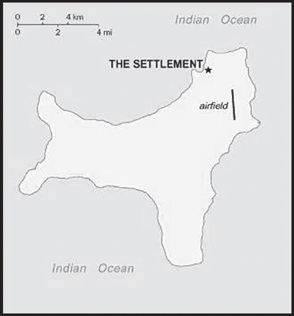
INTRODUCTION
Background: Although Europeans sighted the island as early as 1615, it was only named in 1643 by English Captain William MYNORS for the day of its rediscovery. Another English ship sailed by the island in 1688 and found it uninhabited. Attempts to explore the island over the next two centuries were hampered by steep cliffs and dense jungle. The discovery of phosphate on the island in 1887 led to the UK annexing it the following year. In 1898, the Christmas Island Phosphate Company brought in 200 Chinese indentured servants to work the mines, along with Malays, Sikhs, and a small number of Europeans. The UK administered Christmas Island from Singapore.
Japan invaded the island in 1942, but islanders sabotaged Japanese mining operations, making the mines relatively unproductive. After World War II, Australia and New Zealand bought the Christmas Island Phosphate Company, and in 1958, the UK transferred sovereignty from Singapore to Australia in exchange for $20 million for the loss of future phosphate income. In 1980, Australia set up the Christmas Island National Park and expanded its boundaries throughout the 1980s until it covered more than 60% of the island’s territory. The phosphate mine was closed in 1987 because of environmental concerns and Australia has rejected several efforts to reopen it.
In the 1980s, boats of asylum seekers started landing on Christmas Island and the migrants claimed refugee status since they were on Australian territory. In 2001, Australia declared Christmas Island outside the Australian migration zone and built an immigration detention center on the island. Completed in 2008, the controversial detention center was officially closed in 2018, but then reopened in early 2019. In 2020, the center served as a coronavirus quarantine facility for Australian citizens evacuated from China.
GEOGRAPHY
Location: Southeastern Asia, island in the Indian Ocean, south of Indonesia
Geographic coordinates: 10 30 S, 105 40 E
Map references: Southeast Asia
Area: total: 135 sq km
land: 135 sq km
water: 0 sq km
comparison ranking: total 221
Area - comparative: about three-quarters the size of Washington, DC
Land boundaries: total: 0 km
Coastline: 138.9 km
Maritime claims: territorial sea: 12 nm
contiguous zone: 12 nm
exclusive fishing zone: 200 nm
Climate: tropical with a wet season (December to April) and dry season; heat and humidity moderated by trade winds
Terrain: steep cliffs along coast rise abruptly to central plateau
Elevation: highest point: Murray Hill 361 m
lowest point: Indian Ocean 0 m
Natural resources: phosphate, beaches
Land use: agricultural land: 0% (2018 est.)
other: 100% (2018 est.)
Population distribution: majority of the population lives on the northern tip of the island
Natural hazards: the narrow fringing reef surrounding the island can be a maritime hazard
Geography - note: located along major sea lanes of the Indian Ocean
PEOPLE AND SOCIETY
Population: 2,205 (2016 est.)
comparison ranking: 230
Nationality: noun: Christmas Islander(s)
adjective: Christmas Island
Ethnic groups: Chinese 70%, European 20%, Malay 10% (2001)
note: no indigenous population
Languages: English (official) 27.6%, Mandarin 17.2%, Malay 17.1%, Cantonese 3.9%, Min Nan 1.6%, Tagalog 1%, other 4.5%, unspecified 27.1% (2016 est.)
note: data represent language spoken at home
Religions: Muslim 19.4%, Buddhist 18.3%, Roman Catholic 8.8%, Protestant 6.5% (includes Anglican 3.6%, Uniting Church 1.2%, other 1.7%), other Christian 3.3%, other 0.6%, none 15.3%, unspecified 27.7% (2016 est.)
Age structure: 0-14 years: 12.79% (male 147/female 135)
15-64 years: 12.2% (male 202/female 67)
65 years and over: 5.44% (male 84/female 36) (2017 est.)
Population growth rate: 1.11% (2014 est.)
comparison ranking: 85
Population distribution: majority of the population lives on the northern tip of the island
ENVIRONMENT
Environment - current issues: loss of rainforest; impact of phosphate mining
Climate: tropical with a wet season (December to April) and dry season; heat and humidity moderated by trade winds
GOVERNMENT
Country name: conventional long form: Territory of Christmas Island
conventional short form: Christmas Island
etymology: named by English Captain William MYNORS for the day of its rediscovery, Christmas Day (25 December 1643); the island had been sighted by Europeans as early as 1615
Government type: non-self-governing overseas territory of Australia
Dependency status: non-self-governing territory of Australia; administered from Canberra by the Department of Infrastructure, Transport, Cities & Regional Development
Capital: name: The Settlement (Flying Fish Cove)
geographic coordinates: 10 25 S, 105 43 E
time difference: UTC+7 (12 hours ahead of Washington, DC, during Standard Time)
etymology: self-descriptive name for the main locus of population
Administrative divisions: none (territory of Australia)
Independence: none (territory of Australia)
National holiday: Australia Day (commemorates the arrival of the First Fleet of Australian settlers), 26 January (1788)
Constitution: history: 1 October 1958 (Christmas Island Act 1958)
amendments: amended many times, last in 2020
Legal system: legal system is under the authority of the governor general of Australia and Australian law
Citizenship: see Australia
Suffrage: 18 years of age
Executive branch: chief of state: King CHARLES III (since 8 September 2022); represented by Governor-General of the Commonwealth of Australia General David HURLEY (since 1 July 2019)
head of government: Administrator Ms. Farzian ZAINAL (since 11 May 2023)
cabinet: NA
elections/appointments: the monarchy is hereditary; governor general appointed by the monarch on the recommendation of the Australian prime minister; administrator appointed by the governor general of Australia for a 2-year term and represents the monarch and Australia
Legislative branch: description: unicameral Christmas Island Shire Council (9 seats; members directly elected by simple majority vote to serve 4-year terms)
elections: held every 2 years with half the members standing for election; last held in October 2023 (next to be held in October 2025)
election results: percent of vote - NA; seats by party - independent 9; composition as of October 2023 - men 7, women 2, percent of women 22%
Judicial branch: highest court(s): under the terms of the Territorial Law Reform Act 1992, Western Australia provides court services as needed for the island, including the Supreme Court and subordinate courts (District Court, Magistrate Court, Family Court, Children’s Court, and Coroners’ Court)
Political parties and leaders: none
International organization participation: none
Diplomatic representation in the US: none (territory of Australia)
Diplomatic representation from the US: embassy: none (territory of Australia)
Flag description: territorial flag; divided diagonally from upper hoist to lower fly; the upper triangle is green with a yellow image of the Golden Bosun Bird superimposed; the lower triangle is blue with the Southern Cross constellation, representing Australia, superimposed; a centered yellow disk displays a green map of the island
note: the flag of Australia is used for official purposes
National symbol(s): golden bosun bird
National anthem: note: as a territory of Australia, “Advance Australia Fair” remains official as the national anthem, while “God Save the King” serves as the royal anthem (see Australia)
ECONOMY
Economic overview: high-income Australian territorial economy; development through government services and phosphate mining; operates Australia’s Immigration Detention Centre; increasing tourism and government investments; sustained environmental protections
Industries: tourism, phosphate extraction (near depletion)
Fiscal year: 1 July - 30 June
Exports - partners: Malaysia 36%, New Zealand 21%, Indonesia 20%, Australia 10% (2019)
Exports - commodities: calcium phosphates, fertilizers, barometers, electrical transformers, sulfates (2021)
Imports - partners: Australia 80%, United States 7%, Canada 5% (2019)
Imports - commodities: refined petroleum, cars, iron structures, aircraft, crustaceans (2019)
Exchange rates: Australian dollars (AUD) per US dollar -
Exchange rates:: 1.311 (2017 est.)
1.3442 (2016 est.)
1.3442 (2015)
1.3291 (2014 est.)
1.1094 (2013 est.)
COMMUNICATIONS
Telecommunication systems: general assessment: internet access on Christmas Island is provided by satellite; improvements through the Regional Connectivity Program to the macro and small cell mobile sites will provide new and improved mobile, voice and data connectivity for residents and visitors; the upgrade will also support local businesses and community facilities, enabling increased residential access to essential services such as telehealth and education (2022)
domestic: improvements to Christmas Island include an upgrade to the macro cell base stations and deploy a new macro cell base station at the airport (2022)
international: international code - 61 8; ASC submarine cable to Singapore and Australia; satellite earth station - 1 (Intelsat provides telephone and telex service) (2019)
Broadcast media: 1 community radio station; satellite broadcasts of several Australian radio and TV stations (2017)
Internet country code: .cx
Internet users: total: 1,139 (2021 est.)
percent of population: 78.6% (2021 est.)
comparison ranking: total 229
TRANSPORTATION
Airports: 1 (2021)
comparison ranking: total 233
Airports - with paved runways: 1
note: paved runways have a concrete or asphalt surface but not all have facilities for refueling, maintenance, or air traffic control; the length of a runway required for aircraft to safely operate depends on a number of factors including the type of aircraft, the takeoff weight (including passengers, cargo, and fuel), engine types, flap settings, landing speed, elevation of the airport, and average maximum daily air temperature; paved runways can reach a length of 5,000 m (16,000 ft.), but the “typical” length of a commercial airline runway is between 2,500-4,000 m (8,000-13,000 ft.)
Railways: total: 18 km (2017)
standard gauge: 18 km (2017) 1.435-m (not in operation)
note: the 18-km Christmas Island Phosphate Company Railway between Flying Fish Cove and South Point was decommissioned in 1987; some tracks and scrap remain in place
comparison ranking: total 135
Roadways: total: 142 km (2011)
paved: 32 km (2011)
unpaved: 110 km (2011)
comparison ranking: total 210
Ports and terminals: major seaport(s): Flying Fish Cove
MILITARY AND SECURITY
Military - note: defense is the responsibility of Australia
TRANSNATIONAL ISSUES
Disputes - international: none
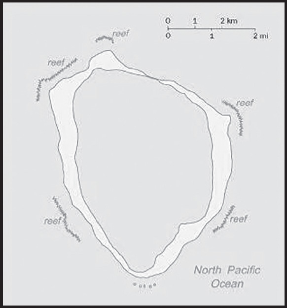
INTRODUCTION
Background: This isolated atoll was named for John CLIPPERTON, an English pirate who was rumored to have made it his hideout early in the 18th century. Annexed by France in 1855 and claimed by the US, it was seized by Mexico in 1897. Arbitration eventually awarded the island to France in 1931, which took possession in 1935.
GEOGRAPHY
Location: Middle America, atoll in the North Pacific Ocean, 1,120 km southwest of Mexico
Geographic coordinates: 10 17 N, 109 13 W
Map references: Political Map of the World
Area: total: 6 sq km
land: 6 sq km
water: 0 sq km
comparison ranking: total 246
Area - comparative: about 12 times the size of The Mall in Washington, DC
Land boundaries: total: 0 km
Coastline: 11.1 km
Maritime claims: territorial sea: 12 nm
exclusive economic zone: 200 nm
Climate: tropical; humid, average temperature 20-32 degrees Celsius, wet season (May to October)
Terrain: coral atoll
Elevation: highest point: Rocher Clipperton 29 m
lowest point: Pacific Ocean 0 m
Natural resources: fish
Land use: agricultural land: 0% (2018 est.)
forest: 0% (2018 est.)
other: 100% (2018 est.)
Natural hazards: subject to tropical storms and hurricanes from May to October
Geography - note: the atoll reef is approximately 12 km (7.5 mi) in circumference; an attempt to colonize the atoll in the early 20th century ended in disaster and was abandoned in 1917
PEOPLE AND SOCIETY
Population: uninhabited
ENVIRONMENT
Environment - current issues: no natural resources, guano deposits depleted; the ring-shaped atoll encloses a stagnant fresh-water lagoon
Climate: tropical; humid, average temperature 20-32 degrees Celsius, wet season (May to October)
Land use: agricultural land: 0% (2018 est.)
forest: 0% (2018 est.)
other: 100% (2018 est.)
GOVERNMENT
Country name: conventional long form: none
conventional short form: Clipperton Island
local long form: none
local short form: Ile Clipperton
former: sometimes referred to as Ile de la Passion or Atoll Clipperton
etymology: named after an 18th-century English pirate who supposedly used the island as a base
Dependency status: possession of France; administered directly by the Minister of Overseas France
Legal system: the laws of France apply
Flag description: the flag of France is used
TRANSPORTATION
Ports and terminals: none; offshore anchorage only
MILITARY AND SECURITY
Military - note: defense is the responsibility of France
TRANSNATIONAL ISSUES
Disputes - international: none
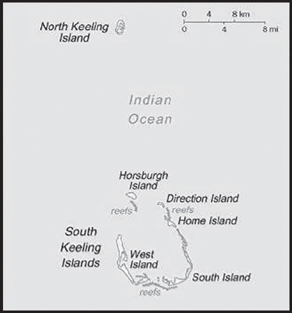
INTRODUCTION
Background: British captain William KEELING discovered Cocos (Keeling) Islands in 1609, and they were named the Cocos Islands in 1622 for their coconut trees. Some maps began referring to them as the Keeling Islands in 1703. In 1825, Scottish trader John CLUNIES-ROSS was trying to get to Christmas Island but was blown off-course and landed on Cocos (Keeling) Islands. The next year, a British trader hired John’s brother to bring slaves and a harem of Malay women to create the first permanent settlement on the island. By the 1830s, the Clunies-Ross family had firmly established themselves as the leaders of the islands and they ruled Cocos (Keeling) Islands in a feudal style until 1978.
The UK annexed the islands in 1857 and administered them from Ceylon after 1878 and from Singapore after 1886. Cocos (Keeling) Islands hosted a cable relaying station and was attacked by the Germans in World War I. The Japanese similarly attacked the islands in World War II. The UK transferred the islands to Australia in 1955, which officially named the islands the Cocos (Keeling) Islands, and in 1978, Australia bought all the land held by the Clunies-Ross family, ending their control of the islands’ governance. In a referendum in 1984, most islanders voted to integrate with Australia, and Western Australian laws have applied on the islands since 1992.
GEOGRAPHY
Location: Southeastern Asia, group of islands in the Indian Ocean, southwest of Indonesia, about halfway between Australia and Sri Lanka
Geographic coordinates: 12 30 S, 96 50 E
Map references: Southeast Asia
Area: total: 14 sq km
land: 14 sq km
water: 0 sq km
note: includes the two main islands of West Island and Home Island
comparison ranking: total 240
Area - comparative: about 24 times the size of The Mall in Washington, DC
Land boundaries: total: 0 km
Coastline: 26 km
Maritime claims: territorial sea: 12 nm
exclusive fishing zone: 200 nm
Climate: tropical with high humidity, moderated by the southeast trade winds for about nine months of the year
Terrain: flat, low-lying coral atolls
Elevation: highest point: South Point on South Island 9 m
lowest point: Indian Ocean 0 m
Natural resources: fish
Land use: agricultural land: 0% (2018 est.)
forest: 0% (2018 est.)
other: 100% (2018 est.)
Irrigated land: NA
Population distribution: only Home Island and West Island are populated
Natural hazards: cyclone season is October to April
Geography - note: note 1: there are 27 coral islands in the group; apart from North Keeling Island, which lies 30 km north of the main group, the islands form a horseshoe-shaped atoll surrounding a lagoon; North Keeling Island was declared a national park in 1995 and is administered by Parks Australia; the population on the two inhabited islands generally is split between the ethnic Europeans on West Island and the ethnic Malays on Home Island; the islands are thickly covered with coconut palms and other vegetation
note 2: site of a World War I naval battle in November 1914 between the Australian light cruiser HMAS Sydney and the German raider SMS Emden; after being heavily damaged in the engagement, the Emden was beached by her captain on North Keeling Island
PEOPLE AND SOCIETY
Population: 596 (July 2014 est.)
comparison ranking: 236
Nationality: noun: Cocos Islander(s)
adjective: Cocos Islander
Ethnic groups: Europeans, Cocos Malays
Languages: Malay (Cocos dialect) 68.8%, English 22.3%, unspecified 8.9%; note - data represent language spoken at home (2016 est.)
major-language sample(s):
Buku Fakta Dunia, sumber yang diperlukan untuk maklumat asas. (Malay)
Religions: Muslim (predominantly Sunni) 75%, Anglican 3.5%, Roman Catholic 2.2%, none 12.9%, unspecified 6.3% (2016 est.)
Death rate: 8.89 deaths/1,000 population (2021 est.)
comparison ranking: 65
Population distribution: only Home Island and West Island are populated
ENVIRONMENT
Environment - current issues: freshwater resources are limited to rainwater accumulations in natural underground reservoirs; illegal fishing a concern
Climate: tropical with high humidity, moderated by the southeast trade winds for about nine months of the year
Land use: agricultural land: 0% (2018 est.)
forest: 0% (2018 est.)
other: 100% (2018 est.)
GOVERNMENT
Country name: conventional long form: Territory of Cocos (Keeling) Islands
conventional short form: Cocos (Keeling) Islands
etymology: the name refers to the abundant coconut trees on the islands and to English Captain William KEELING, the first European to sight the islands in 1609
Government type: non-self-governing overseas territory of Australia
Dependency status: non-self governing territory of Australia; administered from Canberra by the Department of Infrastructure, Transport, Cities & Regional Development
Capital: name: West Island
geographic coordinates: 12 10 S, 96 50 E
time difference: UTC+6.5 (11.5 hours ahead of Washington, DC, during Standard Time)
Administrative divisions: none (territory of Australia)
Independence: none (territory of Australia)
National holiday: Australia Day (commemorates the arrival of the First Fleet of Australian settlers), 26 January (1788)
Constitution: history: 23 November 1955 (Cocos (Keeling) Islands Act 1955)
amendments: amended many times, last in 2020
Legal system: common law based on the Australian model
Citizenship: see Australia
Suffrage: 18 years of age
Executive branch: chief of state: King CHARLES III (since 8 September 2022); represented by Governor General of the Commonwealth of Australia General David HURLEY (since 1 July 2019)
head of government: Administrator Ms. Farzian ZAINAL (since 11 May 2023)
cabinet: NA
elections/appointments: the monarchy is hereditary; governor general appointed by the monarch on the recommendation of the Australian prime minister; administrator appointed by the governor general for a 2-year term and represents the monarch and Australia
Legislative branch: description: unicameral Cocos (Keeling) Islands Shire Council (7 seats; members directly elected by simple majority vote to serve 4-year terms with 4 members renewed every 2 years)
elections: last held on 16 October 2023 (next to be held in October 2025)
election results: percent of vote by party - NA; seats by party - NA; composition - men 4, women 3, percent of women 43%
Judicial branch: highest court(s): under the terms of the Territorial Law Reform Act 1992, Western Australia provides court services as needed for the island including the Supreme Court and subordinate courts (District Court, Magistrate Court, Family Court, Children’s Court, and Coroners’ Court)
Political parties and leaders: none
International organization participation: none
Diplomatic representation in the US: none (territory of Australia)
Diplomatic representation from the US: embassy: none (territory of Australia)
Flag description: the flag of Australia is used
National anthem: note: as a territory of Australia, “Advance Australia Fair” remains official as the national anthem, while “God Save the King” serves as the royal anthem (see Australia)
ECONOMY
Real GDP growth rate: 1% (2003)
comparison ranking: 185
Agricultural products: vegetables, bananas, pawpaws, coconuts
Industries: copra products, tourism
Labor force: NA
Labor force - by occupation: note: the Cocos Islands Cooperative Society Ltd. employs construction workers, stevedores, and lighterage workers; tourism is the other main source of employment
Unemployment rate: 0.1% (2011)
60% (2000 est.)
comparison ranking: 228
Fiscal year: 1 July - 30 June
Exports - partners: United States 57%, Ireland 15% (2019)
Exports - commodities: integrated circuits, vaccines and cultures, furniture, carbon batteries, rubber gloves (2021)
Imports - partners: Australia 73%, United Arab Emirates 15%, Netherlands 5% (2019)
Imports - commodities: gold, x-ray equipment, cars, prefabricated buildings, packaged medicines (2019)
Exchange rates: Australian dollars (AUD) per US dollar -
Exchange rates:: 1.311 (2017 est.)
1.3442 (2016 est.)
1.3442 (2015)
1.3291 (2014)
1.1094 (2013)
COMMUNICATIONS
Telecommunication systems: general assessment: telephone service is part of the Australian network; an operational local mobile-cellular network available; wireless Internet connectivity available
domestic: local area code - 08
international: international code - 61 8; telephone, telex, and facsimile communications with Australia and elsewhere via satellite; satellite earth station - 1 (Intelsat)
Broadcast media: 1 local radio station staffed by community volunteers; satellite broadcasts of several Australian radio and TV stations available (2017)
Internet country code: .cc
Internet users: total: 80 (2021 est.)
percent of population: 13.4% (2021 est.)
comparison ranking: total 233
TRANSPORTATION
Airports: 1 (2021)
comparison ranking: total 219
Airports - with paved runways: 1
note: paved runways have a concrete or asphalt surface but not all have facilities for refueling, maintenance, or air traffic control; the length of a runway required for aircraft to safely operate depends on a number of factors including the type of aircraft, the takeoff weight (including passengers, cargo, and fuel), engine types, flap settings, landing speed, elevation of the airport, and average maximum daily air temperature; paved runways can reach a length of 5,000 m (16,000 ft.), but the “typical” length of a commercial airline runway is between 2,500-4,000 m (8,000-13,000 ft.)
Roadways: total: 22 km (2007)
paved: 10 km (2007)
unpaved: 12 km (2007)
comparison ranking: total 221
Ports and terminals: major seaport(s): Port Refuge
MILITARY AND SECURITY
Military - note: defense is the responsibility of Australia
TRANSNATIONAL ISSUES
Disputes - international: none
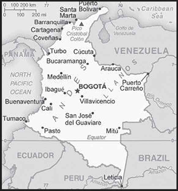
INTRODUCTION
Background: Colombia was one of the three countries that emerged after the dissolution of Gran Colombia in 1830 (the others are Ecuador and Venezuela). A decades-long conflict between government forces, paramilitaries, and antigovernment insurgent groups heavily funded by the drug trade, principally the Revolutionary Armed Forces of Colombia (FARC), escalated during the 1990s. More than 31,000 former United Self Defense Forces of Colombia (AUC) paramilitaries demobilized by the end of 2006, and the AUC as a formal organization ceased to operate. In the wake of the paramilitary demobilization, new criminal groups arose, whose members include some former paramilitaries. After four years of formal peace negotiations, the Colombian Government signed a final peace accord with the FARC in November 2016, which was subsequently ratified by the Colombian Congress. The accord calls for members of the FARC to demobilize, disarm, and reincorporate into society and politics. The accord also committed the Colombian Government to create three new institutions to form a ‘comprehensive system for truth, justice, reparation, and non-repetition,’ to include a truth commission, a special unit to coordinate the search for those who disappeared during the conflict, and a ‘Special Jurisdiction for Peace’ to administer justice for conflict-related crimes. Despite decades of internal conflict and drug-related security challenges, Colombia maintains relatively strong and independent democratic institutions characterized by peaceful, transparent elections and the protection of civil liberties.
GEOGRAPHY
Location: Northern South America, bordering the Caribbean Sea, between Panama and Venezuela, and bordering the North Pacific Ocean, between Ecuador and Panama
Geographic coordinates: 4 00 N, 72 00 W
Map references: South America
Area: total: 1,138,910 sq km
land: 1,038,700 sq km
water: 100,210 sq km
note: includes Isla de Malpelo, Roncador Cay, and Serrana Bank
comparison ranking: total 27
Area - comparative: slightly less than twice the size of Texas
Land boundaries: total: 6,672 km
border countries (5): Brazil 1,790 km; Ecuador 708 km; Panama 339 km; Peru 1,494 km; Venezuela 2,341 km
Coastline: 3,208 km (Caribbean Sea 1,760 km, North Pacific Ocean 1,448 km)
Maritime claims: territorial sea: 12 nm
exclusive economic zone: 200 nm
continental shelf: 200-m depth or to the depth of exploitation
Climate: tropical along coast and eastern plains; cooler in highlands
Terrain: flat coastal lowlands, central highlands, high Andes Mountains, eastern lowland plains (Llanos)
Elevation: highest point: Pico Cristobal Colon 5,730 m
lowest point: Pacific Ocean 0 m
mean elevation: 593 m
Natural resources: petroleum, natural gas, coal, iron ore, nickel, gold, copper, emeralds, hydropower
Land use: agricultural land: 37.5% (2018 est.)
arable land: 1.4% (2018 est.)
permanent crops: 1.6% (2018 est.)
permanent pasture: 34.5% (2018 est.)
forest: 54.4% (2018 est.)
other: 8.1% (2018 est.)
Irrigated land: 10,900 sq km (2012)
Major rivers (by length in km): Rio Negro river source (shared with Venezuela and Brazil [m]) - 2,250 km; Orinoco (shared with Venezuela [s]) - 2,101 km
note – [s] after country name indicates river source; [m] after country name indicates river mouth
Major watersheds (area sq km): Atlantic Ocean drainage: Amazon (6,145,186 sq km), Orinoco (953,675 sq km)
Major aquifers: Amazon Basin
Population distribution: the majority of people live in the north and west where agricultural opportunities and natural resources are found; the vast grasslands of the llanos to the south and east, which make up approximately 60% of the country, are sparsely populated
Natural hazards: highlands subject to volcanic eruptions; occasional earthquakes; periodic droughts
volcanism: Galeras (4,276 m) is one of Colombia’s most active volcanoes, having erupted in 2009 and 2010 causing major evacuations; it has been deemed a Decade Volcano by the International Association of Volcanology and Chemistry of the Earth’s Interior, worthy of study due to its explosive history and close proximity to human populations; Nevado del Ruiz (5,321 m), 129 km (80 mi) west of Bogota, erupted in 1985 producing lahars (mudflows) that killed 23,000 people; the volcano last erupted in 1991; additionally, after 500 years of dormancy, Nevado del Huila reawakened in 2007 and has experienced frequent eruptions since then; other historically active volcanoes include Cumbal, Dona Juana, Nevado del Tolima, and Purace
Geography - note: only South American country with coastlines on both the North Pacific Ocean and Caribbean Sea
PEOPLE AND SOCIETY
Population: 49,336,454 (2023 est.)
comparison ranking: 29
Nationality: noun: Colombian(s)
adjective: Colombian
Ethnic groups: Mestizo and White 87.6%, Afro-Colombian (includes Mulatto, Raizal, and Palenquero) 6.8%, Amerindian 4.3%, unspecified 1.4% (2018 est.)
Languages: Spanish (official) and 65 Amerindian languages
major-language sample(s):
La Libreta Informativa del Mundo, la fuente indispensable de información básica. (Spanish)
Religions: Christian 92.3% (predominantly Roman Catholic), other 1%, unspecified 6.7% (2020 est.)
Demographic profile: Colombia is in the midst of a demographic transition resulting from steady declines in its fertility, mortality, and population growth rates. The birth rate has fallen from more than 6 children per woman in the 1960s to just below replacement level today as a result of increased literacy, family planning services, and urbanization. However, income inequality is among the worst in the world, and almost one-third of the population lives below the poverty line.
Colombia experiences significant legal and illegal economic emigration and refugee outflows. Large-scale labor emigration dates to the 1960s; the United States and, until recently, Venezuela have been the main host countries. Emigration to Spain picked up in the 1990s because of its economic growth, but this flow has since diminished because of Spain’s ailing economy and high unemployment. Venezuela’s political and economic crisis since 2015 has prompted many Colombians to return home.
Forced displacement continues to be prevalent because of violence among guerrillas, paramilitary groups, and Colombian security forces. Afro-Colombian and indigenous populations are disproportionately affected. Even with the Colombian Government’s December 2016 peace agreement with the Revolutionary Armed Forces of Colombia (FARC), the risk of displacement remains as other rebel groups fill the void left by the FARC. As of April 2023, almost 6.9 million people were internally displaced in Colombia. This estimate may undercount actual numbers because many internally displaced persons are not registered. Historically, Colombia also has one of the world’s highest levels of forced disappearances. The Colombian Truth Commission estimated than nearly 122,000 people were the victims of forced disappearances during the countries five-decade-long armed conflict—including human rights activists, trade unionists, Afro-Colombians, indigenous people, and farmers in rural conflict zones.
Because of political violence and economic problems, Colombia received limited numbers of immigrants during the 19th and 20th centuries, mostly from the Middle East, Europe, and Japan. More recently, growth in the oil, mining, and manufacturing sectors has attracted increased labor migration; the primary source countries are Venezuela, the US, Mexico, and Argentina. Colombia has also become a transit area for illegal migrants from Africa, Asia, and the Caribbean – especially Haiti and Cuba – who are en route to the US or Canada. Between 2016 and October 2022, Colombia was host to the largest number of Venezuelan refugees and migrants, totaling almost 2.9 million. Ecuadorian migrants also go to Colombia, most of them attempting to transit the dense and dangerous jungles of the Darien Gap to enter Panama and head onward to the US.
Age structure: 0-14 years: 22.45% (male 5,663,590/female 5,413,209)
15-64 years: 66.66% (male 16,066,724/female 16,820,068)
65 years and over: 10.89% (2023 est.) (male 2,367,369/female 3,005,494)
Dependency ratios: total dependency ratio: 43.5
youth dependency ratio: 31
elderly dependency ratio: 12.5
potential support ratio: 8 (2021 est.)
Median age: total: 31.2 years (2020)
male: 30.2 years
female: 32.2 years
comparison ranking: total 115
Population growth rate: 0.54% (2023 est.)
comparison ranking: 150
Birth rate: 15.06 births/1,000 population (2023 est.)
comparison ranking: 111
Death rate: 7.84 deaths/1,000 population (2023 est.)
comparison ranking: 95
Net migration rate: -1.85 migrant(s)/1,000 population (2023 est.)
comparison ranking: 168
Population distribution: the majority of people live in the north and west where agricultural opportunities and natural resources are found; the vast grasslands of the llanos to the south and east, which make up approximately 60% of the country, are sparsely populated
Urbanization: urban population: 82.4% of total population (2023)
rate of urbanization: 1.01% annual rate of change (2020-25 est.)
Major urban areas - population: 11.508 million BOGOTA (capital), 4.102 million Medellin, 2.864 million Cali, 2.349 million Barranquilla, 1.381 million Bucaramanga, 1.088 million Cartagena (2023)
Sex ratio: at birth: 1.05 male(s)/female
0-14 years: 1.05 male(s)/female
15-64 years: 0.96 male(s)/female
65 years and over: 0.79 male(s)/female
total population: 0.95 male(s)/female (2023 est.)
Mother’s mean age at first birth: 21.7 years (2015 est.)
note: data represents median age at first birth among women 25-49
Maternal mortality ratio: 75 deaths/100,000 live births (2020 est.)
comparison ranking: 80
Infant mortality rate: total: 11.65 deaths/1,000 live births (2023 est.)
male: 13.07 deaths/1,000 live births
female: 10.15 deaths/1,000 live births
comparison ranking: total 121
Life expectancy at birth: total population: 74.89 years (2023 est.)
male: 71.27 years
female: 78.69 years
comparison ranking: total population 136
Total fertility rate: 1.94 children born/woman (2023 est.)
comparison ranking: 116
Gross reproduction rate: 0.95 (2023 est.)
Contraceptive prevalence rate: 81% (2015/16)
Drinking water source: improved: urban: 100% of population
rural: 87.5% of population
total: 97.7% of population
unimproved: urban: 0% of population
rural: 12.5% of population
total: 2.3% of population (2020 est.)
Current health expenditure: 9% of GDP (2020)
Physicians density: 2.33 physicians/1,000 population (2020)
Hospital bed density: 1.7 beds/1,000 population (2018)
Sanitation facility access: improved: urban: 99.1% of population
rural: 87.7% of population
total: 97% of population
unimproved: urban: 0.9% of population
rural: 12.3% of population
total: 3% of population (2020 est.)
Major infectious diseases: degree of risk: high (2023)
food or waterborne diseases: bacterial diarrhea
vectorborne diseases: dengue fever and malaria
Obesity - adult prevalence rate: 22.3% (2016)
comparison ranking: 78
Alcohol consumption per capita: total: 4.09 liters of pure alcohol (2019 est.)
beer: 3.09 liters of pure alcohol (2019 est.)
wine: 0.06 liters of pure alcohol (2019 est.)
spirits: 0.92 liters of pure alcohol (2019 est.)
other alcohols: 0.02 liters of pure alcohol (2019 est.)
comparison ranking: total 93
Tobacco use: total: 8.5% (2020 est.)
male: 12.4% (2020 est.)
female: 4.6% (2020 est.)
comparison ranking: total 143
Children under the age of 5 years underweight: 3.7% (2015/16)
comparison ranking: 81
Currently married women (ages 15-49): 55.3% (2023 est.)
Education expenditures: 4.9% of GDP (2020 est.)
comparison ranking: 81
Literacy: definition: age 15 and over can read and write
total population: 95.6%
male: 95.4%
female: 95.9% (2020)
School life expectancy (primary to tertiary education): total: 14 years
male: 14 years
female: 15 years (2020)
Youth unemployment rate (ages 15-24): total: 26.4% (2021 est.)
male: 21.9%
female: 32.8%
comparison ranking: total 55
ENVIRONMENT
Environment - current issues: deforestation resulting from timber exploitation in the jungles of the Amazon and the region of Chocó; illicit drug crops grown by peasants in the national parks; soil erosion; soil and water quality damage from overuse of pesticides; air pollution, especially in Bogota, from vehicle emissions
Environment - international agreements: party to: Antarctic-Environmental Protection, Antarctic Treaty, Biodiversity, Climate Change, Climate Change-Kyoto Protocol, Climate Change-Paris Agreement, Comprehensive Nuclear Test Ban, Desertification, Endangered Species, Hazardous Wastes, Marine Life Conservation, Nuclear Test Ban, Ozone Layer Protection, Ship Pollution, Tropical Timber 2006, Wetlands, Whaling
signed, but not ratified: Law of the Sea
Climate: tropical along coast and eastern plains; cooler in highlands
Land use: agricultural land: 37.5% (2018 est.)
arable land: 1.4% (2018 est.)
permanent crops: 1.6% (2018 est.)
permanent pasture: 34.5% (2018 est.)
forest: 54.4% (2018 est.)
other: 8.1% (2018 est.)
Urbanization: urban population: 82.4% of total population (2023)
rate of urbanization: 1.01% annual rate of change (2020-25 est.)
Revenue from forest resources: 0.1% of GDP (2018 est.)
comparison ranking: 110
Revenue from coal: 0.75% of GDP (2018 est.)
comparison ranking: 8
Air pollutants: particulate matter emissions: 14.04 micrograms per cubic meter (2019 est.)
carbon dioxide emissions: 97.81 megatons (2016 est.)
methane emissions: 81.52 megatons (2020 est.)
Waste and recycling: municipal solid waste generated annually: 12,150,120 tons (2011 est.)
municipal solid waste recycled annually: 2,089,821 tons (2013 est.)
percent of municipal solid waste recycled: 17.2% (2013 est.)
Major rivers (by length in km): Rio Negro river source (shared with Venezuela and Brazil [m]) - 2,250 km; Orinoco (shared with Venezuela [s]) - 2,101 km
note – [s] after country name indicates river source; [m] after country name indicates river mouth
Major watersheds (area sq km): Atlantic Ocean drainage: Amazon (6,145,186 sq km), Orinoco (953,675 sq km)
Major aquifers: Amazon Basin
Total water withdrawal: municipal: 3.72 billion cubic meters (2020 est.)
industrial: 360 million cubic meters (2020 est.)
agricultural: 25.04 billion cubic meters (2020 est.)
Total renewable water resources: 2.36 trillion cubic meters (2020 est.)
GOVERNMENT
Country name: conventional long form: Republic of Colombia
conventional short form: Colombia
local long form: República de Colombia
local short form: Colombia
etymology: the country is named after explorer Christopher COLUMBUS
Government type: presidential republic
Capital: name: Bogota
geographic coordinates: 4 36 N, 74 05 W
time difference: UTC-5 (same time as Washington, DC, during Standard Time)
etymology: originally referred to as “Bacata,” meaning “enclosure outside of the farm fields,” by the indigenous Muisca
Administrative divisions: 32 departments (departamentos, singular - departamento) and 1 capital district* (distrito capital); Amazonas, Antioquia, Arauca, Atlantico, Bogota*, Bolivar, Boyaca, Caldas, Caqueta, Casanare, Cauca, Cesar, Choco, Cordoba, Cundinamarca, Guainia, Guaviare, Huila, La Guajira, Magdalena, Meta, Narino, Norte de Santander, Putumayo, Quindio, Risaralda, Archipielago de San Andres, Providencia y Santa Catalina (colloquially San Andres y Providencia), Santander, Sucre, Tolima, Valle del Cauca, Vaupes, Vichada
Independence: 20 July 1810 (from Spain)
National holiday: Independence Day, 20 July (1810)
Constitution: history: several previous; latest promulgated 4 July 1991
amendments: proposed by the government, by Congress, by a constituent assembly, or by public petition; passage requires a majority vote by Congress in each of two consecutive sessions; passage of amendments to constitutional articles on citizen rights, guarantees, and duties also require approval in a referendum by over one half of voters and participation of over one fourth of citizens registered to vote; amended many times, last in 2020
Legal system: civil law system influenced by the Spanish and French civil codes
International law organization participation: has not submitted an ICJ jurisdiction declaration; accepts ICCt jurisdiction
Citizenship: citizenship by birth: no
citizenship by descent only: least one parent must be a citizen or permanent resident of Colombia
dual citizenship recognized: yes
residency requirement for naturalization: 5 years
Suffrage: 18 years of age; universal
Executive branch: chief of state: President Gustavo Francisco PETRO Urrego (since 7 August 2022); Vice President Francia Elena MÁRQUEZ Mina (since 7 August 2022); the president is both chief of state and head of government
head of government: President Gustavo Francisco PETRO Urrego (since 7 August 2022); Vice President Francia Elena MÁRQUEZ Mina (since 7 August 2022)
cabinet: Cabinet appointed by the president
elections/appointments: president directly elected by absolute majority vote in 2 rounds if needed for a single 4-year term; election last held on 29 May 2022 with a runoff held on 19 June 2022 (next to be held on 31 May 2026); note - political reform in 2015 eliminated presidential reelection
election results: 2022: Gustavo Francisco PETRO Urrego elected president in second round; percent of vote in first round - Gustavo Francisco PETRO Urrego (PHxC) 40.3%, Rodolfo HERNÁNDEZ Suárez (LIGA) 28.2%, Federico GUTIÉRREZ Zuluaga (Team for Colombia / CREEMOS) 23.9%, other 7.6%; percent of vote in second round - Gustavo Francisco PETRO Urrego 50.4%, Rodolfo HERNÁNDEZ Suarez 47.3%, blank 2.3%
2018: Iván DUQUE Márquez elected president in second round; percent of vote - Iván DUQUE Márquez (CD) 54%, Gustavo Francisco PETRO Urrego (Humane Colombia) 41.8%, other/blank/invalid 4.2%
Legislative branch: description: bicameral Congress or Congreso consists of:
Senate or Senado (108 seats; 100 members elected in a single nationwide constituency by party-list proportional representation vote, 2 members elected in a special nationwide constituency for indigenous communities, 5 members of the Commons political party, formerly the People’s Alternative Revolutionary Force (FARC), for 2 legislative terms only: 2018-2022 and 2022-2026 as per the 2016 peace accord, and 1 seat reserved for the runner-up presidential candidate in the recent election; all members serve 4-year terms)
Chamber of Representatives or Camara de Representantes (188 seats; 162 members elected in multi-seat constituencies by party-list proportional representation vote, 2 members elected in a special nationwide constituency for Afro-Colombians, 1 member elected by Colombians residing abroad, 1 member elected in a special nationwide constituency for the indigenous communities, 5 members of the Commons political party for two legislative terms only: 2018-2022 and 2022-2026 as per the 2016 peace accord, 16 seats for rural conflict victims for two legislative terms only: 2022-2026 and 2026-2030, and 1 seat reserved for the runner-up vice presidential candidate in the recent election; all members serve 4-year terms)
elections:
Senate - last held on 13 March 2022 (next to be held in March 2026)
Chamber of Representatives - last held on 13 March 2022 (next to be held in March 2026)
election results: Senate - percent of vote by party - NA; seats by party - PHxC 16, PC 16, PL 15, Green Alliance and Center Hope Coalition 14, CD 14, CR 11, U Party 10, MIRA–Colombia Free and Just Coalition 4; composition - men 75, women 33, percent of women 31%
Chamber of Representatives - percent of vote by party - NA; seats by party - PL 33, PHxC 28, PC 27, CR 18, CD 16, U Party 16, Green Alliance 14, League of Anticorruption Governors 2, others 34; composition - men 136, women 52, percent of women 28%; total Congress percent of women 29%
Judicial branch: highest court(s): Supreme Court of Justice or Corte Suprema de Justicia (consists of the Civil-Agrarian and Labor Chambers each with 7 judges, and the Penal Chamber with 9 judges); Constitutional Court (consists of 9 magistrates); Council of State (consists of 27 judges); Superior Judiciary Council (consists of 13 magistrates)
judge selection and term of office: Supreme Court judges appointed by the Supreme Court members from candidates submitted by the Superior Judiciary Council; judges elected for individual 8-year terms; Constitutional Court magistrates - nominated by the president, by the Supreme Court, and elected by the Senate; judges elected for individual 8-year terms; Council of State members appointed by the State Council plenary from lists nominated by the Superior Judiciary Council
subordinate courts: Superior Tribunals (appellate courts for each of the judicial districts); regional courts; civil municipal courts; Superior Military Tribunal; first instance administrative courts
Political parties and leaders: Alternative Democratic Pole or PDA [Alexander LOPEZ Maya]
Citizens Option (Opcion Ciudadana) or OC [Angel ALIRIO Moreno] (formerly known as the National Integration Party or PIN)
The Commons (formerly People’s Alternative Revolutionary Force or FARC) [Rodrigo LONDONO Echeverry]
Conservative Party or PC [Carlos Andres TRUJILLO]
Democratic Center Party or CD [Alvaro URIBE Velez]
Fair and Free Colombia (Colombia Justa Libres) [Eduardo Canas Estrada and Ricardo Arias Mora]
Green Alliance [Claudia LOPEZ Hernandez]
Historic Pact for Colombia or PHxC (coalition composed of several left-leaning political parties and social movements)
Humane Colombia [Gustavo PETRO]
Independent Movement of Absolute Renovation or MIRA [Carlos Eduardo GUEVARA]
League of Anti-Corruption Rulers or LIGA [Rodolfo HERNANDEZ Suarez]
Liberal Party or PL [Cesar GAVIRIA]
People’s Alternative Revolutionary Force or FARC [Rodrigo LONDONO Echeverry]
Radical Change or CR [German VARGAS Lleras]
Team for Colombia - also known as the Experience Coalition or Coalition of the Regions (coalition composed of center-right and right-wing parties)
Union Party for the People or U Party [Dilian Francisca TORO]
We Believe Colombia or CREEMOS [Federico GUTIERREZ]
note: Colombia has numerous smaller political parties and movements
International organization participation: BCIE, BIS, CAN, Caricom (observer), CD, CDB, CELAC, EITI (candidate country), FAO, G-3, G-24, G-77, IADB, IAEA, IBRD, ICAO, ICC (national committees), ICCt, ICRM, IDA, IFAD, IFC, IFRCS, IHO, ILO, IMF, IMO, IMSO, Interpol, IOC, IOM, IPU, ISO, ITSO, ITU, ITUC (NGOs), LAES, LAIA, Mercosur (associate), MIGA, NAM, OAS, OPANAL, OPCW, Pacific Alliance, PCA, PROSUR, UN, UNASUR, UNCTAD, UNESCO, UNHCR, UNIDO, Union Latina, UNWTO, UPU, WCO, WFTU (NGOs), WHO, WIPO, WMO, WTO
Diplomatic representation in the US: chief of mission: Ambassador Luis Gilberto MURILLO URRUTIA (since 16 September 2022)
chancery: 1724 Massachusetts Avenue NW, Washington, DC 20036
telephone: [1] (202) 387-8338
FAX: [1] (202) 232-8643
email address and website:
eestadosunidos@cancilleria.gov.co
consulate(s) general: Atlanta, Houston, Los Angeles, Miami, New York, Newark (NJ), Orlando, San Juan (Puerto Rico), Washington, DC
consulate(s): Boston, Chicago, San Francisco
Diplomatic representation from the US: chief of mission: Ambassador (vacant); Chargé d’Affaires Francisco L. PALMIERI (since 1 June 2022)
embassy: Carrera 45, No. 24B-27, Bogota
mailing address: 3030 Bogota Place, Washington DC 20521-3030
telephone: [57] (1) 275-2000
FAX: [57] (1) 275-4600
email address and website:
Flag description: three horizontal bands of yellow (top, double-width), blue, and red; the flag retains the three main colors of the banner of Gran Colombia, the short-lived South American republic that broke up in 1830; various interpretations of the colors exist and include: yellow for the gold in Colombia’s land, blue for the seas on its shores, and red for the blood spilled in attaining freedom; alternatively, the colors have been described as representing more elemental concepts such as sovereignty and justice (yellow), loyalty and vigilance (blue), and valor and generosity (red); or simply the principles of liberty, equality, and fraternity
note: similar to the flag of Ecuador, which is longer and bears the Ecuadorian coat of arms superimposed in the center
National symbol(s): Andean condor; national colors: yellow, blue, red
National anthem: name: “Himno Nacional de la Republica de Colombia” (National Anthem of the Republic of Colombia)
lyrics/music: Rafael NUNEZ/Oreste SINDICI
note: adopted 1920; the anthem was created from an inspirational poem written by President Rafael NUNEZ
National heritage: total World Heritage Sites: 9 (6 cultural, 2 natural, 1 mixed)
selected World Heritage Site locales: Chiribiquete National Park (m); Coffee Cultural Landscape of Colombia (c); Historic Center of Santa Cruz de Mompox (c); Los Katíos National Park (n); Malpelo Fauna and Flora Sanctuary (n); Tierradentro National Archeological Park (c); San Agustín Archaeological Park (c); Colonial Cartagena (c); Qhapaq Ñan/Andean Road System (c)
ECONOMY
Economic overview: prior to COVID-19, one of the most consistent growth economies; declining poverty; large stimulus package has mitigated economic fallout, but delayed key infrastructure investments; successful inflation management; sound flexible exchange rate regime; domestic economy suffers from lack of trade integration and infrastructure
Real GDP (purchasing power parity): $754.645 billion (2021 est.)
$681.844 billion (2020 est.)
$733.546 billion (2019 est.)
note: data are in 2017 dollars
comparison ranking: 33
Real GDP growth rate: 10.68% (2021 est.)
-7.05% (2020 est.)
3.19% (2019 est.)
comparison ranking: 24
Real GDP per capita: $14,600 (2021 est.)
$13,400 (2020 est.)
$14,600 (2019 est.)
note: data are in 2017 dollars
comparison ranking: 112
GDP (official exchange rate)
$323.255 billion (2019 est.)
Inflation rate (consumer prices): 3.5% (2021 est.)
2.53% (2020 est.)
3.52% (2019 est.)
comparison ranking: 107
Credit ratings: Fitch rating: BBB- (2020)
Moody’s rating: Baa2 (2014)
Standard & Poors rating: BBB- (2017)
note: The year refers to the year in which the current credit rating was first obtained.
GDP - composition, by sector of origin
agriculture: 7.2% (2017 est.)
industry: 30.8% (2017 est.)
services: 62.1% (2017 est.)
comparison rankings: services 107; industry 72; agriculture 107
GDP - composition, by end use
household consumption: 68.2% (2017 est.)
government consumption: 14.8% (2017 est.)
investment in fixed capital: 22.2% (2017 est.)
investment in inventories: 0.2% (2017 est.)
exports of goods and services: 14.6% (2017 est.)
imports of goods and services: -19.7% (2017 est.)
Agricultural products: sugar cane, milk, oil palm fruit, potatoes, rice, bananas, cassava leaves, plantains, poultry, maize
Industries: textiles, food processing, oil, clothing and footwear, beverages, chemicals, cement; gold, coal, emeralds
Industrial production growth rate: 9.65% (2021 est.)
comparison ranking: 30
Labor force: 26.137 million (2021 est.)
comparison ranking: 25
Labor force - by occupation: agriculture: 17%
industry: 21%
services: 62% (2011 est.)
Unemployment rate: 14.34% (2021 est.)
15.04% (2020 est.)
9.96% (2019 est.)
comparison ranking: 41
Youth unemployment rate (ages 15-24): total: 26.4% (2021 est.)
male: 21.9%
female: 32.8%
comparison ranking: total 55
Population below poverty line: 35.7% (2019 est.)
Gini Index coefficient - distribution of family income: 54.2 (2020 est.)
comparison ranking: 6
Average household expenditures: on food: 19.2% of household expenditures (2018 est.)
on alcohol and tobacco: 3% of household expenditures (2018 est.)
Household income or consumption by percentage share: lowest 10%: 1.2%
highest 10%: 39.6% (2015 est.)
Budget: revenues: $94.985 billion (2019 est.)
expenditures: $103.098 billion (2019 est.)
Budget surplus (+) or deficit (-): -2.7% (of GDP) (2017 est.)
comparison ranking: 117
Public debt: 90.4% of GDP (2020 est.)
72.7% of GDP (2019 est.)
71.65% of GDP (2018 est.)
note: data cover general government debt, and includes debt instruments issued (or owned) by government entities other than the treasury; the data include treasury debt held by foreign entities; the data include debt issued by subnational entities
comparison ranking: 32
Taxes and other revenues: 14.23% (of GDP) (2020 est.)
comparison ranking: 156
Fiscal year: calendar year
Current account balance: -$17.621 billion (2021 est.)
-$9.347 billion (2020 est.)
-$14.808 billion (2019 est.)
comparison ranking: 202
Exports: $50.793 billion (2021 est.)
$38.224 billion (2020 est.)
$51.324 billion (2019 est.)
note: Data are in current year dollars and do not include illicit exports or re-exports.
comparison ranking: 63
Exports - partners: United States 31%, China 11%, Panama 6%, Ecuador 5% (2019)
Exports - commodities: crude petroleum, coal, coffee, gold, refined petroleum (2021)
Imports: $70.84 billion (2021 est.) note: data are in current year dollars
$51.312 billion (2020 est.) note: data are in current year dollars
$65.47 billion (2019 est.) note: data are in current year dollars
comparison ranking: 54
Imports - partners: United States 27%, China 20%, Mexico 7%, Brazil 6% (2019)
Imports - commodities: refined petroleum, cars, broadcasting equipment, packaged medicines, corn (2019)
Reserves of foreign exchange and gold: $58.019 billion (31 December 2021 est.)
$58.499 billion (31 December 2020 est.)
$52.653 billion (31 December 2019 est.)
comparison ranking: 39
Debt - external: $135.644 billion (2019 est.)
$128.238 billion (2018 est.)
comparison ranking: 47
Exchange rates: Colombian pesos (COP) per US dollar -
Exchange rates:: 3,743.59 (2021 est.)
3,694.854 (2020 est.)
3,280.832 (2019 est.)
2,955.704 (2018 est.)
2,951.327 (2017 est.)
ENERGY
Electricity access: population without electricity: 2 million (2020)
electrification - total population: 99.9% (2021)
electrification - urban areas: 100% (2021)
electrification - rural areas: 99.9% (2021)
Electricity: installed generating capacity: 19.769 million kW (2020 est.)
consumption: 69,856,680,000 kWh (2019 est.)
exports: 251 million kWh (2020 est.)
imports: 1.302 billion kWh (2020 est.)
transmission/distribution losses: 5.724 billion kWh (2019 est.)
comparison rankings: imports 68; exports 86; installed generating capacity 48; transmission/distribution losses 44; consumption 42
Electricity generation sources: fossil fuels: 32.9% of total installed capacity (2020 est.)
solar: 0.3% of total installed capacity (2020 est.)
wind: 0.1% of total installed capacity (2020 est.)
hydroelectricity: 65.7% of total installed capacity (2020 est.)
biomass and waste: 1% of total installed capacity (2020 est.)
Coal: production: 51.395 million metric tons (2020 est.)
consumption: 8.547 million metric tons (2020 est.)
exports: 69.861 million metric tons (2020 est.)
imports: 79,000 metric tons (2020 est.)
proven reserves: 4.554 billion metric tons (2019 est.)
Petroleum: total petroleum production: 756,400 bbl/day (2021 est.)
refined petroleum consumption: 352,400 bbl/day (2019 est.)
crude oil and lease condensate exports: 481,300 bbl/day (2018 est.)
crude oil and lease condensate imports: 0 bbl/day (2018 est.)
crude oil estimated reserves: 2.036 billion barrels (2021 est.)
Refined petroleum products - production: 303,600 bbl/day (2015 est.)
comparison ranking: 41
Refined petroleum products - exports: 56,900 bbl/day (2015 est.)
comparison ranking: 52
Refined petroleum products - imports: 57,170 bbl/day (2015 est.)
comparison ranking: 74
Natural gas: production: 11,305,086,000 cubic meters (2020 est.)
consumption: 11,708,232,000 cubic meters (2020 est.)
exports: 0 cubic meters (2020 est.)
imports: 403.146 million cubic meters (2020 est.)
proven reserves: 87.782 billion cubic meters (2021 est.)
Carbon dioxide emissions: 81.007 million metric tonnes of CO2 (2019 est.)
from coal and metallurgical coke: 12.666 million metric tonnes of CO2 (2019 est.)
from petroleum and other liquids: 47.679 million metric tonnes of CO2 (2019 est.)
from consumed natural gas: 20.662 million metric tonnes of CO2 (2019 est.)
comparison ranking: total emissions 48
Energy consumption per capita: 34.703 million Btu/person (2019 est.)
comparison ranking: 116
COMMUNICATIONS
Telephones - fixed lines: total subscriptions: 7.6 million (2021 est.)
subscriptions per 100 inhabitants: 15 (2021 est.)
comparison ranking: total subscriptions 21
Telephones - mobile cellular: total subscriptions: 75 million (2021 est.)
subscriptions per 100 inhabitants: 150 (2021 est.)
comparison ranking: total subscriptions 22
Telecommunication systems: general assessment: the telecom sector had a solid year thanks to positive performances in the fixed-line broadband, mobile broadband, and mobile voice and data markets; the fixed-line penetration remained stable by the end of 2020, though began to increase into 2021 as a result of the particular demands on households resulting from government measures associated with addressing the pandemic; the mobile market reached a penetration rate of 136% (an increase of over three percentage points on 2019) and managed to keep the same upward growth trajectory that it has sustained over the last ten years; the fixed-line broadband market also expanded, with the number of subscribers increasing 11.4%, and with revenue increasing 9.9% thanks to increased data usage as many customers were forced to work or study from home during the year; the mobile broadband market was the standout performer in 2020, with a 13% increase in the number of subscribers year-on-year, the penetration rate is relatively low compared to other Latin American countries; most significant of all was the surge in mobile broadband traffic a 51% increase over the previous year (2022)
domestic: fixed-line connections stand at about 15 per 100 persons; mobile cellular telephone subscribership is 150 per 100 persons (2021)
international: country code - 57; landing points for the SAC, Maya-1, SAIT, ACROS, AMX-1, CFX-1, PCCS, Deep Blue Cable, Globe Net, PAN-AM, SAm-1 submarine cable systems providing links to the US, parts of the Caribbean, and Central and South America; satellite earth stations - 10 (6 Intelsat, 1 Inmarsat, 3 fully digitalized international switching centers) (2019)
Broadcast media: combination of state-owned and privately owned broadcast media provide service; more than 500 radio stations and many national, regional, and local TV stations (2019)
Internet country code: .co
Internet users: total: 37.96 million (2021 est.)
percent of population: 73% (2021 est.)
comparison ranking: total 26
Broadband - fixed subscriptions: total: 7,764,772 (2020 est.)
subscriptions per 100 inhabitants: 15 (2020 est.)
comparison ranking: total 28
TRANSPORTATION
National air transport system: number of registered air carriers: 12 (2020)
inventory of registered aircraft operated by air carriers: 157
annual passenger traffic on registered air carriers: 33,704,037 (2018)
annual freight traffic on registered air carriers: 1,349,450,000 (2018) mt-km
Civil aircraft registration country code prefix: HJ, HK
Airports: 836 (2021)
comparison ranking: total 8
Airports - with paved runways: 121
note: paved runways have a concrete or asphalt surface but not all have facilities for refueling, maintenance, or air traffic control; the length of a runway required for aircraft to safely operate depends on a number of factors including the type of aircraft, the takeoff weight (including passengers, cargo, and fuel), engine types, flap settings, landing speed, elevation of the airport, and average maximum daily air temperature; paved runways can reach a length of 5,000 m (16,000 ft.), but the “typical” length of a commercial airline runway is between 2,500-4,000 m (8,000-13,000 ft.)
Airports - with unpaved runways: 715
note: unpaved runways have a surface composition such as grass or packed earth and are most suited to the operation of light aircraft; unpaved runways are usually short, often less than 1,000 m (3,280 ft.) in length; airports with unpaved runways often lack facilities for refueling, maintenance, or air traffic control
Heliports: 3 (2021)
Pipelines: 4,991 km gas, 6,796 km oil, 3,429 km refined products (2013)
Railways: total: 2,141 km (2019)
standard gauge: 150 km (2019) 1.435-m gauge
narrow gauge: 1,991 km (2019) 0.914-m gauge
comparison ranking: total 71
Roadways: total: 205,379 km (2019)
comparison ranking: total 26
Waterways: 24,725 km (2019) (18,225 km navigable; the most important waterway, the River Magdalena, of which 1,092 km is navigable, is dredged regularly to ensure safe passage of cargo vessels and container barges)
comparison ranking: 7
Merchant marine: total: 148 (2022)
by type: general cargo 28, oil tanker 12, other 108
comparison ranking: total 75
Ports and terminals: major seaport(s): Atlantic Ocean (Caribbean) - Cartagena, Santa Marta, Turbo
Pacific Ocean - Buenaventura
oil terminal(s): Covenas offshore terminal
container port(s) (TEUs): Buenaventura (1,082,746), Cartagena (3,343,810) (2021)
river port(s): Barranquilla (Rio Magdalena)
dry bulk cargo port(s): Puerto Bolivar (coal)
Pacific Ocean - Buenaventura
MILITARY AND SECURITY
Military and security forces: Military Forces of Colombia (Fuerzas Militares de Colombia): National Army (Ejercito Nacional), Republic of Colombia Navy (Armada Republica de Colombia, ARC; includes Coast Guard), Colombian Air Force (Fuerza Aerea de Colombia, FAC); Colombian National Police (PNC; civilian force that is under the jurisdiction of the Ministry of Defense) (2023)
Military expenditures: 3% of GDP (2022 est.)
3% of GDP (2021 est.)
3% of GDP (2020 est.)
3.1% of GDP (2019 est.)
3.1% of GDP (2018 est.)
comparison ranking: 30
Military and security service personnel strengths: information varies; approximately 290,000 active troops (225,000 Army; 50,000 Navy, including about 20,000 marines; 15,000 Air Force); approximately 180,000 National Police (2023)
Military equipment inventories and acquisitions: the military’s inventory includes a wide mix of equipment from a variety of suppliers, including Canada, Europe, Israel, South Korea, and the US; the US has been the top provider in recent years; Colombia’s defense industry is active in producing air, land, and naval platforms (2023)
Military service age and obligation: 18-24 years of age for compulsory (men) and voluntary (men and women) military service; conscript service obligation is 18 months; conscripted soldiers reportedly include regular soldiers (conscripts without a high school degree), drafted high school graduates (bachilleres), and rural (campesino) soldiers who serve in their home regions (2023)
note 1: conscripts reportedly comprise about 50% of the Colombian military’s active force with more than 50,000 conscripts brought into the military annually
note 2: the Colombian military first incorporated women in 1976 in administrative positions; women were incorporated as non-commissioned officers in 1983 and officers in 2009; women comprised about 1% of the military in 2023
Military deployments: 275 Egypt (MFO) (2023)
Military - note: the Colombian military is responsible for defending and maintaining the country’s independence, national sovereignty, and territorial integrity but also has an internal security role, which includes protecting the civilian population, as well as private and state-owned assets, and ensuring a secure environment; the military’s primary focus is the conduct of counternarcotics, counterterrorism, and counterinsurgency operations against drug traffickers, several factions of the Revolutionary Armed Forces of Colombia (FARC), and the insurgent/terrorist group National Liberation Army (ELN); the Colombian Government signed a peace agreement with the FARC in 2016, but some former members (known as dissidents) have returned to fighting (note - these dissident groups include the US-designated foreign terrorist groups Revolutionary Armed Forces of Colombia - People’s Army or FARC-EP and Segunda Marquetalia; see Appendix T); in 2017, the Colombian Government initiated formal peace talks with the ELN, but it officially ended the talks shortly after the ELN exploded a car bomb at the National Police Academy in Bogota in January 2019; operations against the FARC dissident groups and the ELN continued into 2023, although the Colombian Government resumed talks with the ELN in November 2022 and began exploratory talks with the FARC-EP and Segunda Marquetalia; a 6-month cease-fire agreement was reached with the ELN in June 2023, which was scheduled to go into effect in August 2023; the military is also focused on the security challenges posed by its neighbor, Venezuela, where instability has attracted narcotics traffickers, and both the ELN and FARC dissidents operate openly; Colombia shares a 1,370-mile (2,200 km) border with Venezuela; ELN and FARC insurgents have also used neighboring Ecuador to rest, resupply, and shelter
the Colombian National Army is one of the largest and most experienced ground forces in the Western Hemisphere, having spent decades conducting operations against insurgents and terrorist groups; it has also kept a small battalion (about 250-300 troops) in the Sinai Peninsula with the Multinational Observer Force since 1980; the Army’s primary focus is ongoing operations against the ELN, FARC dissidents, and other illegal armed groups, which are challenged by difficult topography and long and porous land borders; the Air Force and Navy play a role in the counterinsurgency campaign but their participation is minor in comparison to the Army; the Army is largely configured for flexible and mobile counterinsurgency operations with one mechanized and seven light infantry divisions; the light infantry divisions are not uniformly structured and typically include a mix of conventional infantry and specialized air mobile, counterinsurgency, jungle, mountain, and security brigades; some divisions may also have special task forces for anti-kidnapping, counternarcotics, or urban operations; the Army also has a special forces division, a rapid deployment force (Fuerza de Despliegue Rápido or FUDRA) comprised of special forces and counterinsurgency brigades, and an air assault division with aviation and light infantry/air mobile forces; the National Police works with the Army against illegal armed groups and has a variety of specialized forces, including commandos, quick reaction, counterterrorism, counternarcotics, motorized, and anti-riot (Escuadron Móvil Antidisturbios, or ESMAD) units
the Navy is responsible for security in Colombia’s waters in the Caribbean Sea and the Pacific Oceans, the country’s extensive network of rivers, and a few small land areas under its direct jurisdiction; it takes part in multinational naval exercises, and over the past decade has undertaken efforts to modernize; its principal warships are a mix of 10 frigates, corvettes, and offshore patrol ships, and four attack submarines, which are supplemented by dozens of coastal and riverine patrol craft; the Navy also has a 22,000-man marine force comprised of five marine/riverine infantry brigades and a special forces brigade, as well as a small aviation force; the Air Force has an air defense role, but also supports the Army’s counterinsurgency operations; it has a mix of about 50 fighters and ground attack combat aircraft, plus reconnaissance, electronic warfare, logistical, and training fixed-wing aircraft, as well as approximately 100 multirole helicopters
Colombia has close security ties with the US, including joint training, military assistance, and designation in 2022 as a Major Non-NATO Ally, which provides foreign partners with certain benefits in the areas of defense, trade, and security cooperation; it also has close ties with some regional neighbors, such as Argentina, Chile, and Peru; Colombian military and security forces have training programs with their counterparts from a variety of countries, mostly those from Mexico, Central America, and the Caribbean; security ties with Ecuador and Venezuela have been challenged by the presence of narcotics traffickers, ELN, and FARC dissidents in the border regions (2023)
SPACE
Space agency/agencies: Colombian Space Commission (Comision Colombiana Del Espacio, CCE; established 2006); Air and Space Operations Command (Colombian military); note – the Colombian Space Agency (Agencia Espacial Del Colombia, AEC) is a private, non-profit agency established in 2017 (2023)
Space program overview: has a small program focused on acquiring satellites, particularly remote sensing (RS) satellites; operates satellites and produces nanosatellites; researches other space technologies, including telecommunications, satellite navigation, and astronautics; has relations with a variety of foreign space agencies or commercial space industries, including those of Denmark, India, Russia, the US, and some members of the Latin American and Caribbean Space Agency (ALCE) (2023)
note: further details about the key activities, programs, and milestones of the country’s space program, as well as government spending estimates on the space sector, appear in Appendix S
TERRORISM
Terrorist group(s): Terrorist group(s): National Liberation Army (ELN); Revolutionary Armed Forces of Colombia – People’s Army (FARC-EP); Segunda Marquetalia
note: details about the history, aims, leadership, organization, areas of operation, tactics, targets, weapons, size, and sources of support of the group(s) appear(s) in Appendix-T
TRANSNATIONAL ISSUES
Disputes - international: in December 2007, ICJ allocated San Andres, Providencia, and Santa Catalina islands to Colombia under 1928 Treaty but did not rule on 82 degrees W meridian as maritime boundary with Nicaragua; managed dispute with Venezuela over maritime boundary and Venezuelan-administered Los Monjes Islands near the Gulf of Venezuela; Colombian-organized illegal narcotics, guerrilla, and paramilitary activities penetrate all neighboring borders and have caused Colombian citizens to flee mostly into neighboring countries; Colombia, Honduras, Nicaragua, Jamaica, and the US assert various claims to Bajo Nuevo and Serranilla Bank
Refugees and internally displaced persons: refugees (country of origin): 1,842,390 (Venezuela) (economic and political crisis; includes Venezuelans who have claimed asylum, are recognized as refugees, or received alternative legal stay) (2022)
IDPs: 6,863,334 (conflict between government and illegal armed groups and drug traffickers since 1985) (2023)
stateless persons: 11 (2022)
Illicit drugs: Colombia is the world’s top cocaine producer and exporter; is a source of heroin and marijuana; coca cultivation estimated at 234,000 hectares (ha) in 2021; pure cocaine production decreased to 972 metric tons in 2021; a major source of precursor or essential chemicals used in the production of illicit narcotics