F
FALKLAND ISLANDS (ISLAS MALVINAS)
INTRODUCTION
Background: Although first sighted by an English navigator in 1592, the first landing (English) did not occur until almost a century later in 1690, and the first settlement (French) was not established until 1764. The colony was turned over to Spain two years later and the islands have since been the subject of a territorial dispute, first between Britain and Spain, then between Britain and Argentina. The UK asserted its claim to the islands by establishing a naval garrison there in 1833. Argentina invaded the islands on 2 April 1982. The British responded with an expeditionary force that landed seven weeks later and after fierce fighting forced an Argentine surrender on 14 June 1982. With hostilities ended and Argentine forces withdrawn, UK administration resumed. In response to renewed calls from Argentina for Britain to relinquish control of the islands, a referendum was held in March 2013, which resulted in 99.8% of the population voting to remain a part of the UK.
GEOGRAPHY
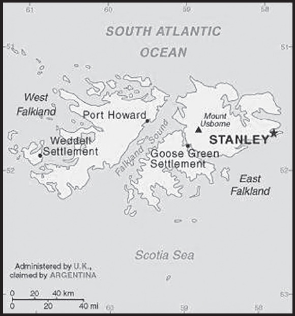
Location: Southern South America, islands in the South Atlantic Ocean, about 500 km east of southern Argentina
Geographic coordinates: 51 45 S, 59 00 W
Map references: South America
Area: total: 12,173 sq km
land: 12,173 sq km
water: 0 sq km
note: includes the two main islands of East and West Falkland and about 200 small islands
comparison ranking: total 163
Area - comparative: slightly smaller than Connecticut
Land boundaries: total: 0 km
Coastline: 1,288 km
Maritime claims: territorial sea: 12 nm
continental shelf: 200 nm
exclusive fishing zone: 200 nm
Climate: cold marine; strong westerly winds, cloudy, humid; rain occurs on more than half of days in year; average annual rainfall is 60 cm in Stanley; occasional snow all year, except in January and February, but typically does not accumulate
Terrain: rocky, hilly, mountainous with some boggy, undulating plains
Elevation: highest point: Mount Usborne 705 m
lowest point: Atlantic Ocean 0 m
Natural resources: fish, squid, wildlife, calcified seaweed, sphagnum moss
Land use: agricultural land: 92.4% (2018 est.)
permanent pasture: 92.4% (2018 est.)
other: 7.6% (2018 est.)
Irrigated land: NA
Population distribution: a very small population, with most residents living in and around Stanley
Natural hazards: strong winds persist throughout the year
Geography - note: deeply indented coast provides good natural harbors; short growing season
PEOPLE AND SOCIETY
Population: 3,662 (2021 est.)
note: data include all persons usually resident in the islands at the time of the 2021 census
comparison ranking: 228
Nationality: noun: Falkland Islander(s)
adjective: Falkland Island
Ethnic groups: Falkland Islander 48.3%, British 23.1%, St. Helenian 7.5%, Chilean 4.6%, mixed 6%, other 8.5%, unspecified 2% (2016 est.)
note: data represent population by national identity
Languages: English 89%, Spanish 7.7%, other 3.3% (2006 est.)
Religions: Christian 57.1%, other 1.6%, none 35.4%, unspecified 6% (2016 est.)
Dependency ratios: total dependency ratio: 39.8
youth dependency ratio: 24.8
elderly dependency ratio: 14.9
potential support ratio: 6.7 (2021)
Population growth rate: 0.01% (2014 est.)
comparison ranking: 193
Birth rate: 10.9 births/1,000 population (2012 est.)
comparison ranking: 168
Death rate: 4.9 deaths/1,000 population (2012 est.)
comparison ranking: 198
Population distribution: a very small population, with most residents living in and around Stanley
Urbanization: urban population: 79.7% of total population (2023)
rate of urbanization: 0.53% annual rate of change (2020-25 est.)
Major urban areas - population: 2,000 STANLEY (capital) (2018)
Sex ratio: total population: 1.12 male(s)/female (2016 est.)
note: sex ratio is somewhat skewed by the high proportion of males at the Royal Air Force station, Mount Pleasant Airport (MPA); excluding MPA, the sex ratio of the total population would be 1.04
Life expectancy at birth: total population: (2017 est.) 77.9
male: 75.6
female: 79.6
Drinking water source: improved: urban: 100% of population
rural: 78.2% of population
total: 95.3% of population
unimproved: urban: 0% of population
rural: 21.8% of population
total: 4.7% of population (2020)
Sanitation facility access: improved:
total: 100% of population
unimproved: total: 0% of population (2020)
Currently married women (ages 15-49): 44.8% (2023 est.)
ENVIRONMENT
Environment - current issues: overfishing by unlicensed vessels is a problem; reindeer - introduced to the islands in 2001 from South Georgia - are part of a farming effort to produce specialty meat and diversify the islands’ economy; this is the only commercial reindeer herd in the world unaffected by the 1986 Chornobyl disaster; grazing threatens important habitats including tussac grass and its ecosystem with penguins and sea lions; soil erosion from fires
Climate: cold marine; strong westerly winds, cloudy, humid; rain occurs on more than half of days in year; average annual rainfall is 60 cm in Stanley; occasional snow all year, except in January and February, but typically does not accumulate
Urbanization: urban population: 79.7% of total population (2023)
rate of urbanization: 0.53% annual rate of change (2020-25 est.)
GOVERNMENT
Country name: conventional long form: none
conventional short form: Falkland Islands (Islas Malvinas)
etymology: the archipelago takes its name from the Falkland Sound, the strait separating the two main islands; the channel itself was named after the Viscount of FALKLAND, who sponsored an expedition to the islands in 1690; the Spanish name for the archipelago derives from the French “Iles Malouines,” meaning Islands of Malo, the name applied to the islands by French explorer Louis-Antoine de BOUGAINVILLE in 1764 after the port of Saint-Malo
Government type: parliamentary democracy (Legislative Assembly); self-governing overseas territory of the UK
Dependency status: overseas territory of the UK; also claimed by Argentina
Capital: name: Stanley
geographic coordinates: 51 42 S, 57 51 W
time difference: UTC-4 (1 hour ahead of Washington, DC, during Standard Time)
etymology: named after Edward SMITH-STANLEY (1799-1869), the 14th Earl of Derby, a British statesman and three-time prime minister of the UK who never visited the islands
Administrative divisions: none (overseas territory of the UK; also claimed by Argentina)
Independence: none (overseas territory of the UK; also claimed by Argentina)
National holiday: Liberation Day, 14 June (1982)
Constitution: history: previous 1985; latest entered into force 1 January 2009 (The Falkland Islands Constitution Order 2008)
Legal system: English common law and local statutes
Citizenship: see United Kingdom
Suffrage: 18 years of age; universal
Executive branch: chief of state: King CHARLES III (since 8 September 2022); represented by Governor Alison BLAKE (since 23 July 2022)
head of government: Chief Executive Andy KEELING (since April 2021)
cabinet: Executive Council elected by the Legislative Council
elections/appointments: the monarchy is hereditary; governor appointed by the monarch; chief executive appointed by the governor
Legislative branch: description: unicameral Legislative Assembly, formerly the Legislative Council (10 seats; 5 members directly elected in the Stanley constituency and 3 members in the Camp constituency by simple majority vote, 2 appointed non-voting ex-officio members - the chief executive, appointed by the governor, and the financial secretary; members serve 4-year terms); note - several previous referendums - the latest in September 2020 - on whether to merge the Stanley and Camp constituencies into a single islands wide constituency, failed
elections: last held on 4 November 2021 (next to be held in November 2025)
election results: percent of vote - NA; seats - independent 8; composition of elected members -men 6, women 2, percent of women 25%
Judicial branch: highest court(s): Court of Appeal (consists of the court president, the chief justice as an ex officio non-resident member, and 2 justices of appeal); Supreme Court (consists of the chief justice); note - appeals beyond the Court of Appeal are referred to the Judicial Committee of the Privy Council (in London)
judge selection and term of office: chief justice, court of appeal president, and justices appointed by the governor; tenure specified in each justice’s instrument of appointment
subordinate courts: Magistrate’s Court (senior magistrate presides over civil and criminal divisions); Court of Summary Jurisdiction
Political parties and leaders: none; all independents
International organization participation: UPU
Diplomatic representation in the US: none (overseas territory of the UK)
Diplomatic representation from the US: embassy: none (overseas territory of the UK; also claimed by Argentina)
Flag description: blue with the flag of the UK in the upper hoist-side quadrant and the Falkland Island coat of arms centered on the outer half of the flag; the coat of arms contains a white ram (sheep raising was once the major economic activity) above the sailing ship Desire (whose crew discovered the islands) with a scroll at the bottom bearing the motto DESIRE THE RIGHT
National symbol(s): ram
National anthem: name: “Song of the Falklands”
lyrics/music: Christopher LANHAM
note: adopted 1930s; the song is the local unofficial anthem; as a territory of the United Kingdom, “God Save the King” is official (see United Kingdom)
ECONOMY
Economic overview: British South American territorial economy; longstanding fishing industry; surging tourism prior to COVID-19 and Brexit; recent offshore hydrocarbon discoveries threaten ecotourism industries; no central bank and must have British approval on currency shifts
Real GDP (purchasing power parity): $206.4 million (2015 est.)
$164.5 million (2014 est.)
$167.5 million (2013 est.)
comparison ranking: 221
Real GDP growth rate: 25.5% (2015 est.)
-1.8% (2014 est.)
-20.4% (2013 est.)
comparison ranking: 3
Real GDP per capita: $70,800 (2015 est.)
$63,000 (2014 est.)
comparison ranking: 10
GDP (official exchange rate)
$206.4 million (2015 est.)
Inflation rate (consumer prices): 1.4% (2014 est.)
comparison ranking: 184
GDP - composition, by sector of origin
agriculture: 41% (2015 est.)
industry: 20.6% (2015 est.)
services: 38.4% (2015 est.)
comparison rankings: services 216; industry 144; agriculture 9
Agricultural products: fodder and vegetable crops; venison, sheep, dairy products; fish, squid
Industries: fish and wool processing; tourism
Industrial production growth rate: NA
Labor force: 1,850 (2016 est.)
comparison ranking: 227
Labor force - by occupation: agriculture: 41%
industry: 24.5%
services: 34.5% (2015 est.)
Unemployment rate: 1% (2016 est.)
comparison ranking: 223
Gini Index coefficient - distribution of family income: 36 (2015)
comparison ranking: 89
Budget: revenues: $67.1 million (FY09/10)
expenditures: $75.3 million (FY09/10)
Budget surplus (+) or deficit (-): -4% (of GDP) (FY09/10)
comparison ranking: 155
Public debt: 0% of GDP (2015 est.)
comparison ranking: 209
Taxes and other revenues: 32.5% (of GDP) (FY09/10)
comparison ranking: 22
Fiscal year: 1 April - 31 March
Exports: $257.3 million (2015 est.)
$125 million (2004 est.)
comparison ranking: 198
Exports - partners: Spain 78%, United States 6% (2019)
Exports - commodities: mollusks, fish, wool, sheep and goat meats, aircraft parts (2021)
Imports: $90 million (2004 est.)
comparison ranking: 218
Imports - partners: United Kingdom 79%, Netherlands 16% (2019)
Imports - commodities: comparison rankings: imports 185; exports 179, construction vehicles, cars (2019)
Debt - external: $0 (2017 est.)
$0 (2016 est.)
comparison ranking: 204
Exchange rates: Falkland pounds (FKP) per US dollar -
Exchange rates: 0.7836 (2017 est.)
0.6542 (2016 est.)
0.6542 (2015)
0.6542 (2014 est.)
0.6391 (2013 est.)
ENERGY
Electricity: installed generating capacity: 11,000 kW (2020 est.)
consumption: 19.133 million kWh (2019 est.)
exports: 0 kWh (2020 est.)
imports: 0 kWh (2020 est.)
transmission/distribution losses: 1 million kWh (2019 est.)
comparison rankings: imports 185; exports 179; installed generating capacity 208; transmission/distribution losses 208; consumption 207
Electricity generation sources: fossil fuels: 66.7% of total installed capacity (2020 est.)
wind: 33.3% of total installed capacity (2020 est.)
Petroleum: total petroleum production: 0 bbl/day (2021 est.)
refined petroleum consumption: 300 bbl/day (2019 est.)
Refined petroleum products - imports: 286 bbl/day (2015 est.)
comparison ranking: 208
Carbon dioxide emissions: 46,000 metric tonnes of CO2 (2019 est.)
from petroleum and other liquids: 46,000 metric tonnes of CO2 (2019 est.)
comparison ranking: total emissions 212
Energy consumption per capita: 0 Btu/person (2019 est.)
comparison ranking: 211
COMMUNICATIONS
Telephones - fixed lines: total subscriptions: 2,000 (2021 est.)
subscriptions per 100 inhabitants: 53 (2021 est.)
comparison ranking: total subscriptions 217
Telephones - mobile cellular: total subscriptions: 6,000 (2021 est.)
subscriptions per 100 inhabitants: 160 (2021 est.)
comparison ranking: total subscriptions 221
Telecommunication systems: general assessment: the replacement of the rural internet and phone system was delayed due to COVID; upgrades started at the end of 2019, this included the replacement of all Multi Service Access Nodes (MSANs), the technology used to connect larger settlements; in early 2020 a new system to replace the WiMAX system (the technology used to connect smaller settlements and households) had been delayed as well due to COVID-19; once the equipment is received it will be installed in the largest base stations on East Falklands: Malo, Bombilla, and Mt Pleasant peak “We also have MSAN equipment and radio links due to arrive towards the end of this month, and these and will be installed at Chartres, New Island, Sea Lion Island, Onion Range, Sand Bay, and Mare Harbour enabling us to migrate additional customers from the existing WiMAX network and also releasing equipment for spares.” (2020)
domestic: fixed-line subscriptions approximately 53 per 100, 160 per 100 for mobile-cellular (2021)
international: country code - 500; satellite earth station - 1 Intelsat (Atlantic Ocean) with links through London to other countries (2015)
Broadcast media: TV service provided by a multi-channel service provider; radio services provided by the public broadcaster, Falkland Islands Radio Service, broadcasting on both AM and FM frequencies, and by the British Forces Broadcasting Service (BFBS) (2007)
Internet country code: .fk
Internet users: total: 3,762 (2021 est.)
percent of population: 99% (2021 est.)
comparison ranking: total 225
Broadband - fixed subscriptions: total: 1,000 (2020 est.)
subscriptions per 100 inhabitants: 33 (2020 est.)
comparison ranking: total 208
TRANSPORTATION
National air transport system: number of registered air carriers: 1 (2020)
inventory of registered aircraft operated by air carriers: 5
Civil aircraft registration country code prefix: VP-F
Airports: 7 (2021)
comparison ranking: total 171
Airports - with paved runways: 2
note: paved runways have a concrete or asphalt surface but not all have facilities for refueling, maintenance, or air traffic control; the length of a runway required for aircraft to safely operate depends on a number of factors including the type of aircraft, the takeoff weight (including passengers, cargo, and fuel), engine types, flap settings, landing speed, elevation of the airport, and average maximum daily air temperature; paved runways can reach a length of 5,000 m (16,000 ft.), but the “typical” length of a commercial airline runway is between 2,500-4,000 m (8,000-13,000 ft.)
Airports - with unpaved runways: 5
note: unpaved runways have a surface composition such as grass or packed earth and are most suited to the operation of light aircraft; unpaved runways are usually short, often less than 1,000 m (3,280 ft.) in length; airports with unpaved runways often lack facilities for refueling, maintenance, or air traffic control
Roadways: total: 440 km (2008)
paved:50 km (2008)
unpaved:390 km (2008)
comparison ranking: total 198
Merchant marine: total: 2 (2022)
by type: general cargo 1, other 1
comparison ranking: total 179
Ports and terminals: major seaport(s): Stanley
MILITARY AND SECURITY
Military and security forces: no regular military forces
Military - note: defense is the responsibility of the UK, which maintains about 1,200 troops on the islands (2023)
TRANSNATIONAL ISSUES
Disputes - international: Argentina, which claims the islands in its constitution and briefly occupied them by force in 1982, agreed in 1995 to no longer seek settlement by force; UK continues to reject Argentine requests for sovereignty talks
INTRODUCTION
Background: The Faroe Islands were already populated by ca. A.D. 500, but whether the settlers were Celtic or early Norse (or someone else) has yet to be determined. The islands served as an important stepping stone for Medieval Viking exploration of the North Atlantic and Viking settlers arrived on the islands in the 9th century. The islands have been connected politically to Denmark since the 14th century and today the Faroe Islands are a self-governing dependency of Denmark. The Home Rule Act of 1948 granted a high degree of self-government to the Faroese, who have autonomy over most internal affairs and external trade, while Denmark is responsible for justice, defense, and some foreign affairs. The Faroe Islands are not part of the European Union.
GEOGRAPHY
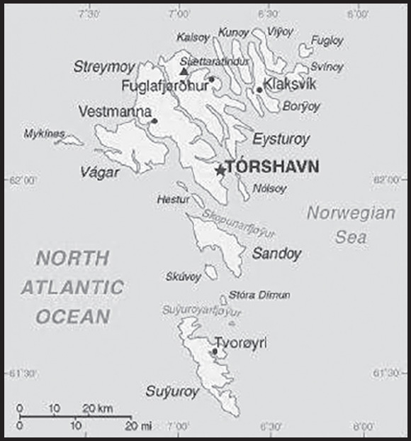
Location: Northern Europe, island group between the Norwegian Sea and the North Atlantic Ocean, about halfway between Iceland and Norway
Geographic coordinates: 62 00 N, 7 00 W
Map references: Europe
Area: total: 1,393 sq km
land: 1,393 sq km
water: 0 sq km (some lakes and streams)
comparison ranking: total 182
Area - comparative: eight times the size of Washington, DC
Land boundaries: total: 0 km
Coastline: 1,117 km
Maritime claims: territorial sea: 12 nm
continental shelf: 200 nm or agreed boundaries or median line
exclusive fishing zone: 200 nm or agreed boundaries or median line
Climate: mild winters, cool summers; usually overcast; foggy, windy
Terrain: rugged, rocky, some low peaks; cliffs along most of coast
Elevation: highest point: Slaettaratindur 882 m
lowest point: Atlantic Ocean 0 m
Natural resources: fish, whales, hydropower, possible oil and gas
Land use: agricultural land: 2.1% (2018 est.)
arable land: 2.1% (2018 est.)
permanent crops: 0% (2018 est.)
permanent pasture: 0% (2018 est.)
forest: 0.1% (2018 est.)
other: 97.8% (2018 est.)
Population distribution: the island of Streymoy is by far the most populous with over 40% of the population; it has approximately twice as many inhabitants as Eysturoy, the second most populous island; seven of the inhabited islands have fewer than 100 people
Natural hazards: strong winds and heavy rains can occur throughout the year
Geography - note: archipelago of 17 inhabited islands and one uninhabited island, and a few uninhabited islets; strategically located along important sea lanes in northeastern Atlantic; precipitous terrain limits habitation to small coastal lowlands
PEOPLE AND SOCIETY
Population: 52,600 (2023 est.)
comparison ranking: 208
Nationality: noun: Faroese (singular and plural)
adjective: Faroese
Ethnic groups: Faroese 85.3% (Scandinavian and Anglo-Saxon descent), Danish 8.3%, other Nordic 1.4%, other 4.5% (includes Filipino, Poland, Romanian) (2022 est.)
note: data represent respondents by country of birth
Languages: Faroese 93.8% (derived from Old Norse), Danish 3.2%, other 3% (2011 est.)
note: data represent population by primary language
Religions: Christian 89.3% (predominantly Evangelical Lutheran), other 1%, none 3.8%, unspecified 6% (2011 est.)
Age structure: 0-14 years: 19.9% (male 5,415/female 5,053)
15-64 years: 61.94% (male 17,211/female 15,367)
65 years and over: 18.16% (2023 est.) (male 4,621/female 4,933)
Dependency ratios: total dependency ratio: 62.8
youth dependency ratio: 33.6
elderly dependency ratio: 29.1
potential support ratio: 3.4 (2021)
Median age: total: 37.2 years (2020)
male: 36.9 years
female: 37.7 years
comparison ranking: total 71
Population growth rate: 0.63% (2023 est.)
comparison ranking: 138
Birth rate: 14.94 births/1,000 population (2023 est.)
comparison ranking: 114
Death rate: 8.61 deaths/1,000 population (2023 est.)
comparison ranking: 70
Net migration rate: 0 migrant(s)/1,000 population (2023 est.)
comparison ranking: 96
Population distribution: the island of Streymoy is by far the most populous with over 40% of the population; it has approximately twice as many inhabitants as Eysturoy, the second most populous island; seven of the inhabited islands have fewer than 100 people
Urbanization: urban population: 43% of total population (2023)
rate of urbanization: 0.89% annual rate of change (2020-25 est.)
Major urban areas - population: 21,000 TORSHAVN (capital) (2018)
Sex ratio: at birth: 1.07 male(s)/female
0-14 years: 1.07 male(s)/female
15-64 years: 1.12 male(s)/female
65 years and over: 0.94 male(s)/female
total population: 1.07 male(s)/female (2023 est.)
Infant mortality rate: total: 5.86 deaths/1,000 live births (2023 est.)
male: 6.48 deaths/1,000 live births
female: 5.2 deaths/1,000 live births
comparison ranking: total 171
Life expectancy at birth: total population: 81.47 years (2023 est.)
male: 78.96 years
female: 84.17 years
comparison ranking: total population 42
Total fertility rate: 2.28 children born/woman (2023 est.)
comparison ranking: 77
Gross reproduction rate: 1.1 (2023 est.)
Drinking water source: improved:
total: 100% of population
unimproved: total: 0% of population (2020)
Physicians density: 2.62 physicians/1,000 population (2016)
Hospital bed density: 4.2 beds/1,000 population (2016)
Currently married women (ages 15-49): 34.8% (2023 est.)
Education expenditures: 7.6% of GDP (2019 est.)
comparison ranking: 14
ENVIRONMENT
Environment - current issues: coastal erosion, landslides and rockfalls, flash flooding, wind storms; oil spills
Climate: mild winters, cool summers; usually overcast; foggy, windy
Land use: agricultural land: 2.1% (2018 est.)
arable land: 2.1% (2018 est.)
permanent crops: 0% (2018 est.)
permanent pasture: 0% (2018 est.)
forest: 0.1% (2018 est.)
other: 97.8% (2018 est.)
Urbanization: urban population: 43% of total population (2023)
rate of urbanization: 0.89% annual rate of change (2020-25 est.)
Revenue from forest resources: 0% of GDP (2017 est.)
comparison ranking: 201
Air pollutants: carbon dioxide emissions: 0.63 megatons (2016 est.)
Waste and recycling: municipal solid waste generated annually: 61,000 tons (2014 est.)
municipal solid waste recycled annually: 40,870 tons (2012 est.)
percent of municipal solid waste recycled: 67% (2012 est.)
Total renewable water resources: 0 cubic meters (2017 est.)
GOVERNMENT
Country name: conventional long form: none
conventional short form: Faroe Islands
local long form: none
local short form: Foroyar
etymology: the archipelago’s name may derive from the Old Norse word “faer,” meaning sheep
Government type: parliamentary democracy (Faroese Parliament); part of the Kingdom of Denmark
Dependency status: part of the Kingdom of Denmark; self-governing overseas administrative division of Denmark since 1948
Capital: name: Torshavn
geographic coordinates: 62 00 N, 6 46 W
time difference: UTC 0 (5 hours ahead of Washington, DC, during Standard Time)
daylight saving time: +1hr, begins last Sunday in March; ends last Sunday in October
etymology: the meaning in Danish is “Thor’s harbor”
Administrative divisions: part of the Kingdom of Denmark; self-governing overseas administrative division of Denmark; there are 29 first-order municipalities (kommunur, singular - kommuna) Eidhi, Eystur, Famjin, Fuglafjordhur, Fugloy, Hov, Husavik, Hvalba, Hvannasund, Klaksvik, Kunoy, Kvivik, Nes, Porkeri, Runavik, Sandur, Sjovar, Skalavik, Skopun, Skuvoy, Sorvagur, Sumba, Sunda, Torshavn, Tvoroyri, Vagar, Vagur, Vestmanna, Vidhareidhi
Independence: none (part of the Kingdom of Denmark; self-governing overseas administrative division of Denmark)
National holiday: Olaifest (Olavsoka) (commemorates the death in battle of King OLAF II of Norway, later St. OLAF), 29 July (1030)
Constitution: history: 5 June 1953 (Danish Constitution), 23 March 1948 (Home Rule Act), and 24 June 2005 (Takeover Act) serve as the Faroe Islands’ constitutional position in the Unity of the Realm
amendments: see entry for Denmark
Legal system: the laws of Denmark apply where applicable
Citizenship: see Denmark
Suffrage: 18 years of age; universal
Executive branch: chief of state: Queen MARGRETHE II of Denmark (since 14 January 1972), represented by High Commissioner Lene Moyell JOHANSEN, chief administrative officer (since 15 May 2017)
head of government: Prime Minister Aksel V. JOHANNESEN (since 22 December 2022)
cabinet: Landsstyri appointed by the prime minister
elections/appointments: the monarchy is hereditary; high commissioner appointed by the monarch; following legislative elections, the leader of the majority party or majority coalition usually elected prime minister by the Faroese Parliament; election last held on 8 December 2022 (next to be held in 2026)
Legislative branch: description: unicameral Faroese Parliament or Logting (33 seats; members directly elected in a single nationwide constituency by proportional representation vote; members serve 4-year terms)
the Faroe Islands elect 2 members to the Danish Parliament to serve 4-year terms
elections: Faroese Parliament - last held on 8 December 2022 (next to be held in 2026)
Faroese seats in the Danish Parliament last held on 31 October 2022 (next to be held no later than 31 October 2026)
election results: Faroese Parliament percent of vote by party - JF 26.6%, B 20%, A 18.9%, E 17.7%, F 7.5%, H 6.6%, seats by party - JF 9, B 7, A 6, E 6, F 3, H 2; composition - men 27, women 6; percent of women 18.2%
Faroese seats in Danish Parliament - percent of vote by party - NA; seats by party - JF 1, B 1; composition - men 2
2019: Faroese Parliament percent of vote by party – People’s Party 24.2%, JF 21.2%, Union Party 21.2%, Republic 18.2%, Center Party 6%, Progress Party 6%, Self-Government Party 3%, seats by party - People’s Party 8, JF 7, Union Party 7, Republic 6, Center Party 2, Progress Party 2, Self-Government Party 1, composition - men 25, women 8; percent of women 24.2%
Faroese seats in Danish Parliament - percent of vote by party - NA; seats by party - JF 1, Republic 1; composition - men 2
Judicial branch: highest court(s): Faroese Court or Raett (Rett - Danish) decides both civil and criminal cases; the Court is part of the Danish legal system
subordinate courts: Court of the First Instance or Tribunal de Premiere Instance; Court of Administrative Law or Tribunal Administratif; Mixed Commercial Court; Land Court
Political parties and leaders: Center Party or H (Midflokkurin) [Jenis av RANA]
People’s Party or A (Folkaflokkurin) [Benir JOHANNESEN]
Progress Party or F (Framsokn) [Ruth VANG]
Republic or E (Tjodveldi) [Hogni HOYDAL] (formerly the Republican Party)
Self-Government Party or D (Sjalvstyri or Sjalvstyrisflokkurin) [Samal Peter I GRUND]
Social Democratic Party or JF (Javnadarflokkurin) or JF [Aksel V. JOHANNESEN]
Union Party or B (Sambandsflokkurin) [Bardur A STEIG NIELSEN]
International organization participation: Arctic Council, IMO (associate), NC, NIB, UNESCO (associate), UPU
Diplomatic representation in the US: none (self-governing overseas administrative division of Denmark)
Diplomatic representation from the US: embassy: none (self-governing overseas administrative division of Denmark)
Flag description: white with a red cross outlined in blue extending to the edges of the flag; the vertical part of the cross is shifted toward the hoist side in the style of the Dannebrog (Danish flag); referred to as Merkid, meaning “the banner” or “the mark,” the flag resembles those of neighboring Iceland and Norway, and uses the same three colors - but in a different sequence; white represents the clear Faroese sky, as well as the foam of the waves; red and blue are traditional Faroese colors
note: the blue on the flag is a lighter blue (azure) than that found on the flags of Iceland or Norway
National symbol(s): ram; national colors: red, white, blue
National anthem: name: “Mitt alfagra land” (My Fairest Land)
lyrics/music: Simun av SKAROI/Peter ALBERG
note: adopted 1948; the anthem is also known as “Tu alfagra land mitt” (Thou Fairest Land of Mine); as a self-governing overseas administrative division of Denmark, the Faroe Islands are permitted their own national anthem
ECONOMY
Economic overview: high-income Danish territorial economy; party neither to the EU nor the Schengen Area; associate Nordic Council member; very low unemployment; unique foreign ownership allowance in fishing industry; known salmon exporter; growing IT industries
Real GDP (purchasing power parity): $2.001 billion (2014 est.)
$1.89 billion (2013 est.)
$1.608 billion (2012 est.)
comparison ranking: 197
Real GDP growth rate: 5.9% (2017 est.)
7.5% (2016 est.)
2.4% (2015 est.)
comparison ranking: 76
Real GDP per capita: $40,000 (2014 est.)
comparison ranking: 50
GDP (official exchange rate)
$2.765 billion (2014 est.)
Inflation rate (consumer prices): -0.3% (2016)
-1.7% (2015)
comparison ranking: 218
GDP - composition, by sector of origin
agriculture: 18% (2013 est.)
industry: 39% (2013 est.)
services: 43% (2013 est.)
comparison rankings: services 201; industry 36; agriculture 53
GDP - composition, by end use
household consumption: 52% (2013)
government consumption: 29.6% (2013)
investment in fixed capital: 18.4% (2013)
Agricultural products: potatoes, mutton, sheep skins, sheep offals, beef, sheep fat, cattle offals, cattle hides, cattle fat
Industries: fishing, fish processing, tourism, small ship repair and refurbishment, handicrafts
Industrial production growth rate: 3.4% (2009 est.)
comparison ranking: 115
Labor force: 27,540 (2017 est.)
comparison ranking: 206
Labor force - by occupation: agriculture: 15%
industry: 15%
services: 70% (December 2016 est.)
Unemployment rate: 2.2% (2017 est.)
3.4% (2016 est.)
comparison ranking: 207
Population below poverty line: 10% (2015 est.)
Gini Index coefficient - distribution of family income: 22.7 (2013 est.)
comparison ranking: 177
Household income or consumption by percentage share: lowest 10%: NA
highest 10%: NA
Budget: revenues: $835.6 million (2014 est.)
expenditures: $883.8 million (2014)
note: Denmark supplies the Faroe Islands with almost one-third of its public funds
Budget surplus (+) or deficit (-): -1.7% (of GDP) (2014 est.)
comparison ranking: 95
Public debt: 35% of GDP (2014 est.)
comparison ranking: 154
Taxes and other revenues: 30.2% (of GDP) (2014 est.)
comparison ranking: 29
Fiscal year: calendar year
Exports: $1.184 billion (2016 est.)
$1.019 billion (2015 est.)
comparison ranking: 172
Exports - partners: Russia 26.4%, UK 14.1%, Germany 8.4%, China 7.9%, Spain 6.8%, Denmark 6.2%, US 4.7%, Poland 4.4%, Norway 4.1% (2017)
Exports - commodities: fish and fish products (2021)
Imports: $978.4 million (2016 est.)
$906.1 million (2015 est.)
comparison ranking: 189
Imports - partners: Denmark 33%, China 10.7%, Germany 7.6%, Poland 6.8%, Norway 6.7%, Ireland 5%, Chile 4.3% (2017)
Imports - commodities: goods for household consumption, machinery and transport equipment, fuels, raw materials and semi-manufactures, cars
Debt - external: $387.6 million (2012)
$274.5 million (2010)
comparison ranking: 181
Exchange rates: Danish kroner (DKK) per US dollar -
Exchange rates: 6.287 (2021 est.)
6.542 (2020 est.)
6.669 (2019 est.)
6.315 (2018 est.)
6.603 (2017 est.)
ENERGY
Electricity access: electrification - total population: 100% (2021)
Electricity: installed generating capacity: 128,000 kW (2020 est.)
consumption: 358.64 million kWh (2019 est.)
exports: 0 kWh (2020 est.)
imports: 0 kWh (2020 est.)
transmission/distribution losses: 23.16 million kWh (2019 est.)
comparison rankings: imports 162; exports 149; installed generating capacity 180; transmission/distribution losses 182; consumption 177
Electricity generation sources: fossil fuels: 58.9% of total installed capacity (2020 est.)
wind: 15.1% of total installed capacity (2020 est.)
hydroelectricity: 26% of total installed capacity (2020 est.)
Petroleum: total petroleum production: 0 bbl/day (2021 est.)
refined petroleum consumption: 5,500 bbl/day (2019 est.)
Refined petroleum products - imports: 4,555 bbl/day (2015 est.)
comparison ranking: 174
Carbon dioxide emissions: 870,000 metric tonnes of CO2 (2019 est.)
from petroleum and other liquids: 870,000 metric tonnes of CO2 (2019 est.)
comparison ranking: total emissions 177
Energy consumption per capita: 0 Btu/person (2019 est.)
comparison ranking: 212
COMMUNICATIONS
Telephones - fixed lines: total subscriptions: 15,000 (2021 est.)
subscriptions per 100 inhabitants: 29 (2021 est.)
comparison ranking: total subscriptions 181
Telephones - mobile cellular: total subscriptions: 59,000 (2021 est.)
subscriptions per 100 inhabitants: 110 (2021 est.)
comparison ranking: total subscriptions 204
Telecommunication systems: general assessment: the Faroe Islands have a highly developed communication network, which covers the whole country; from telecommunication and mobile phones to the internet and media, the Faroe Islands are at the forefront of modern communications technology; working within the special geographic circumstances of the Faroe Islands; companies have become world experts in providing digital communication solutions to remote and sparsely populated areas (2022)
domestic: 29 per 100 teledensity for fixed-line and nearly 110 per 100 for mobile-cellular (2021)
international: country code - 298; landing points for the SHEFA-2, FARICE-1, and CANTAT-3 fiber-optic submarine cables from the Faroe Islands, to Denmark, Germany, UK and Iceland; satellite earth stations - 1 Orion; (2019)
Broadcast media: 1 publicly owned TV station; the Faroese telecommunications company distributes local and international channels through its digital terrestrial network; publicly owned radio station supplemented by 3 privately owned stations broadcasting over multiple frequencies
Internet country code: .fo
Internet users: total: 51,728 (2021 est.)
percent of population: 97.6% (2021 est.)
comparison ranking: total 201
Broadband - fixed subscriptions: total: 18,443 (2020 est.)
subscriptions per 100 inhabitants: 38 (2020 est.)
comparison ranking: total 169
TRANSPORTATION
National air transport system: number of registered air carriers: 1 (2020) (registered in Denmark)
inventory of registered aircraft operated by air carriers: 3 (registered in Denmark)
Civil aircraft registration country code prefix: OY-H
Airports: 1 (2021)
comparison ranking: total 232
Airports - with paved runways: 1
note: paved runways have a concrete or asphalt surface but not all have facilities for refueling, maintenance, or air traffic control; the length of a runway required for aircraft to safely operate depends on a number of factors including the type of aircraft, the takeoff weight (including passengers, cargo, and fuel), engine types, flap settings, landing speed, elevation of the airport, and average maximum daily air temperature; paved runways can reach a length of 5,000 m (16,000 ft.), but the “typical” length of a commercial airline runway is between 2,500-4,000 m (8,000-13,000 ft.)
Roadways: total: 960 km (2017)
paved:500 km (2017)
unpaved:460 km (2017)
note: those islands not connected by roads (bridges or tunnels) are connected by seven different ferry links operated by the nationally owned company SSL; 28 km of tunnels
comparison ranking: total 187
Merchant marine: total: 91 (2022)
by type: container ships 6, general cargo 43, other 42
comparison ranking: total 96
Ports and terminals: major seaport(s): Fuglafjordur, Torshavn, Vagur
MILITARY AND SECURITY
Military and security forces: no regular military forces or conscription
Military - note: the Government of Denmark has responsibility for defense; as such, the Danish military’s Joint Arctic Command in Nuuk, Greenland is responsible for coordinating the defense of the Faroe Islands; the Joint Arctic Command has a contact element in the capital of Torshavn
TRANSNATIONAL ISSUES
Disputes - international: because anticipated offshore hydrocarbon resources have not been realized, earlier Faroese proposals for full independence have been deferred; Iceland, the UK, and Ireland dispute Denmark’s claim to UNCLOS that the Faroe Islands’ continental shelf extends beyond 200 nm
INTRODUCTION
Background: Austronesians settled Fiji around 1000 B.C., followed by successive waves of Melanesians starting around the first century A.D. Fijians traded with Polynesian groups in Samoa and Tonga, and by about 900, much of Fiji was in the Tu’i Tongan Empire’s sphere of influence. The Tongan influence declined significantly by 1200, while Melanesian seafarers continued to periodically arrive in Fiji, further mixing Melanesian and Polynesian cultural traditions. Dutch explorer Abel TASMAN was the first European to spot Fiji in 1643, followed by British explorer James COOK in 1774. Captain William BLIGH plotted the islands in 1789. In the 1800s, merchants, traders, and whalers frequented the islands and the first missionaries arrived in 1835. Rival kings and chiefs competed for power, at times aided by Europeans and their weapons, and in 1865, Seru Epenisa CAKOBAU united many groups into the Confederacy of Independent Kingdoms of Viti. The arrangement proved weak and in 1871 CAKOBAU formed the Kingdom of Fiji in an attempt to centralize power. Fearing a hostile takeover by a foreign power as the kingdom’s economy began to falter, CAKOBAU ceded Fiji to the UK in 1874.
The first British governor set up a plantation-style economy and brought in more than 60,000 Indians as indentured laborers, most of whom chose to stay in Fiji rather than return to India when their contracts expired. In the early 1900s, society was divided along ethnic lines, with iTaukei (indigenous Fijians), Europeans, and Indo-Fijians living in separate areas and maintaining their own languages and traditions. ITaukei fears of an Indo-Fijian takeover of government delayed independence through the 1960s; Fiji achieved independence in 1970 with agreements in place to allocate parliamentary seats by ethnic groups. Long-serving Prime Minister Kamisese MARA largely balanced these ethnic divisions, but concerns about growing Indo-Fijian political influence led to two coups in 1987. A new constitution in 1990 cemented iTaukei control of politics, leading thousands of Indo-Fijians to leave. A reformed constitution in 1997 was more equitable and led to the election of an Indo-Fijian prime minister in 1999, who was ousted in a coup the following year. In 2005, the new prime minister put forward a bill that would grant pardons to the coup perpetrators, leading Commodore Josaia BAINIMARAMA to launch a coup in 2006. BAINIMARAMA appointed himself prime minister in 2007 and retained the position after elections in 2014 and 2018 that international observers deemed credible. BAINIMARAMA’s party lost control of the prime minister position following elections in December 2022 and former opposition leader Sitiveni Ligamamada RABUKA assumed the office with a slim, one-seat parliamentary margin.
With well-developed infrastructure, Fiji has become a hub for the Pacific, hosting the secretariat for the Pacific Islands Forum and the main campus of the University of the South Pacific. In addition, Fiji is a center for Pacific tourism, and Nadi International Airport is by far the busiest airport in a Pacific island country.
GEOGRAPHY
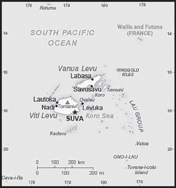
Location: Oceania, island group in the South Pacific Ocean, about two-thirds of the way from Hawaii to New Zealand
Geographic coordinates: 18 00 S, 175 00 E
Map references: Oceania
Area: total: 18,274 sq km
land: 18,274 sq km
water: 0 sq km
comparison ranking: total 156
Area - comparative: slightly smaller than New Jersey
Land boundaries: total: 0 km
Coastline: 1,129 km
Maritime claims: territorial sea: 12 nm
contiguous zone: 24 nm
exclusive economic zone: 200 nm
continental shelf: 200-m depth or to the depth of exploitation measured from claimed archipelagic straight baselines
Climate: tropical marine; only slight seasonal temperature variation
Terrain: mostly mountains of volcanic origin
Elevation: highest point: Tomanivi 1,324 m
lowest point: Pacific Ocean 0 m
Natural resources: timber, fish, gold, copper, offshore oil potential, hydropower
Land use: agricultural land: 23.3% (2018 est.)
arable land: 9% (2018 est.)
permanent crops: 4.7% (2018 est.)
permanent pasture: 9.6% (2018 est.)
forest: 55.7% (2018 est.)
other: 21% (2018 est.)
Irrigated land: 40 sq km (2012)
Population distribution: approximately 70% of the population lives on the island of Viti Levu; roughly half of the population lives in urban areas
Natural hazards: cyclonic storms can occur from November to January
Geography - note: consists of 332 islands, approximately 110 of which are inhabited, and more than 500 islets
PEOPLE AND SOCIETY
Population: 947,760 (2023 est.)
comparison ranking: 163
Nationality: noun: Fijian(s)
adjective: Fijian
Ethnic groups: iTaukei 56.8% (predominantly Melanesian with a Polynesian admixture), Indo-Fijian 37.5%, Rotuman 1.2%, other 4.5% (European, part European, other Pacific Islanders, Chinese) (2007 est.)
note: a 2010 law replaces ‘Fijian’ with ‘iTaukei’ when referring to the original and native settlers of Fiji
Languages: English (official), iTaukei (official), Fiji Hindi (official)
Religions: Protestant 45% (Methodist 34.6%, Assembly of God 5.7%, Seventh Day Adventist 3.9%, and Anglican 0.8%), Hindu 27.9%, other Christian 10.4%, Roman Catholic 9.1%, Muslim 6.3%, Sikh 0.3%, other 0.3%, none 0.8% (2007 est.)
Age structure: 0-14 years: 25.17% (male 121,809/female 116,737)
15-64 years: 66.31% (male 321,448/female 307,026)
65 years and over: 8.52% (2023 est.) (male 37,219/female 43,521)
Dependency ratios: total dependency ratio: 53
youth dependency ratio: 44.2
elderly dependency ratio: 8.7
potential support ratio: 11.4 (2021 est.)
Median age: total: 29.9 years (2020)
male: 29.7 years
female: 30.1 years
comparison ranking: total 125
Population growth rate: 0.42% (2023 est.)
comparison ranking: 159
Birth rate: 16.25 births/1,000 population (2023 est.)
comparison ranking: 96
Death rate: 6.44 deaths/1,000 population (2023 est.)
comparison ranking: 139
Net migration rate: -5.65 migrant(s)/1,000 population (2023 est.)
comparison ranking: 208
Population distribution: approximately 70% of the population lives on the island of Viti Levu; roughly half of the population lives in urban areas
Urbanization: urban population: 58.7% of total population (2023)
rate of urbanization: 1.37% annual rate of change (2020-25 est.)
Major urban areas - population: 178,000 SUVA (capital) (2018)
Sex ratio: at birth: 1.05 male(s)/female
0-14 years: 1.04 male(s)/female
15-64 years: 1.05 male(s)/female
65 years and over: 0.86 male(s)/female
total population: 1.03 male(s)/female (2023 est.)
Maternal mortality ratio: 38 deaths/100,000 live births (2020 est.)
comparison ranking: 107
Infant mortality rate: total: 9.85 deaths/1,000 live births (2023 est.)
male: 11.35 deaths/1,000 live births
female: 8.28 deaths/1,000 live births
comparison ranking: total 138
Life expectancy at birth: total population: 74.54 years (2023 est.)
male: 71.88 years
female: 77.32 years
comparison ranking: total population 141
Total fertility rate: 2.23 children born/woman (2023 est.)
comparison ranking: 80
Gross reproduction rate: 1.09 (2023 est.)
Contraceptive prevalence rate: 35.5% (2021)
Drinking water source: improved: urban: 98.2% of population
rural: 89.1% of population
total: 94.3% of population
unimproved: urban: 1.8% of population
rural: 10.9% of population
total: 5.7% of population (2020 est.)
Current health expenditure: 3.8% of GDP (2020)
Physicians density: 0.86 physicians/1,000 population (2015)
Hospital bed density: 2 beds/1,000 population (2016)
Sanitation facility access: improved:
unimproved: total: 0% of population (2020 est.)
Obesity - adult prevalence rate: 30.2% (2016)
comparison ranking: 24
Alcohol consumption per capita: total: 2.71 liters of pure alcohol (2019 est.)
beer: 1.64 liters of pure alcohol (2019 est.)
wine: 0.29 liters of pure alcohol (2019 est.)
spirits: 0.79 liters of pure alcohol (2019 est.)
other alcohols: 0 liters of pure alcohol (2019 est.)
comparison ranking: total 120
Tobacco use: total: 23.1% (2020 est.)
male: 35.6% (2020 est.)
female: 10.5% (2020 est.)
comparison ranking: total 65
Children under the age of 5 years underweight: 4.6% (2021)
comparison ranking: 77
Currently married women (ages 15-49): 58.8% (2023 est.)
Child marriage: women married by age 15: 0.2%
women married by age 18: 4%
men married by age 18: 1.7% (2021 est.)
Education expenditures: 5.7% of GDP (2020 est.)
comparison ranking: 51
Literacy: total population: 99.1%
male: 99.1%
female: 99.1% (2018)
Youth unemployment rate (ages 15-24): total: 18.1% (2021 est.)
male: 14.1%
female: 25.9%
comparison ranking: total 95
ENVIRONMENT
Environment - current issues: the widespread practice of waste incineration is a major contributor to air pollution in the country, as are vehicle emissions in urban areas; deforestation and soil erosion are significant problems; a contributory factor to erosion is clearing of land by bush burning, a widespread practice that threatens biodiversity
Environment - international agreements: party to: Biodiversity, Climate Change, Climate Change-Kyoto Protocol, Climate Change-Paris Agreement, Comprehensive Nuclear Test Ban, Desertification, Endangered Species, Law of the Sea, Marine Life Conservation, Nuclear Test Ban, Ozone Layer Protection, Ship Pollution, Tropical Timber 2006, Wetlands
signed, but not ratified: none of the selected agreements
Climate: tropical marine; only slight seasonal temperature variation
Land use: agricultural land: 23.3% (2018 est.)
arable land: 9% (2018 est.)
permanent crops: 4.7% (2018 est.)
permanent pasture: 9.6% (2018 est.)
forest: 55.7% (2018 est.)
other: 21% (2018 est.)
Urbanization: urban population: 58.7% of total population (2023)
rate of urbanization: 1.37% annual rate of change (2020-25 est.)
Revenue from forest resources: 0.59% of GDP (2018 est.)
comparison ranking: 63
Revenue from coal: 0% of GDP (2018 est.)
comparison ranking: 185
Air pollutants: particulate matter emissions: 7.36 micrograms per cubic meter (2019 est.)
carbon dioxide emissions: 2.05 megatons (2016 est.)
methane emissions: 0.95 megatons (2020 est.)
Waste and recycling: municipal solid waste generated annually: 189,390 tons (2011 est.)
municipal solid waste recycled annually: 10,322 tons (2013 est.)
percent of municipal solid waste recycled: 5.5% (2013 est.)
Total water withdrawal: municipal: 30 million cubic meters (2020 est.)
industrial: 10 million cubic meters (2020 est.)
agricultural: 50 million cubic meters (2020 est.)
Total renewable water resources: 28.55 billion cubic meters (2020 est.)
GOVERNMENT
Country name: conventional long form: Republic of Fiji
conventional short form: Fiji
local long form: Republic of Fiji (English)/ Matanitu ko Viti (Fijian)
local short form: Fiji (English)/ Viti (Fijian)
etymology: the Fijians called their home Viti, but the neighboring Tongans called it Fisi, and in the Anglicized spelling of the Tongan pronunciation - promulgated by explorer Captain James COOK - the designation became Fiji
Government type: parliamentary republic
Capital: name: Suva (on Viti Levu)
geographic coordinates: 18 08 S, 178 25 E
time difference: UTC+12 (17 hours ahead of Washington, DC, during Standard Time)
etymology: the name means “little hill” in the native Fijian (iTaukei) language and refers to a mound where a temple once stood
Administrative divisions: 14 provinces and 1 dependency*; Ba, Bua, Cakaudrove, Kadavu, Lau, Lomaiviti, Macuata, Nadroga and Navosa, Naitasiri, Namosi, Ra, Rewa, Rotuma*, Serua, Tailevu
Independence: 10 October 1970 (from the UK)
National holiday: Fiji (Independence) Day, 10 October (1970)
Constitution: history: several previous; latest signed into law 6 September 2013
amendments: proposed as a bill by Parliament and supported by at least three quarters of its members, followed by referral to the president and then to the Electoral Commission, which conducts a referendum; passage requires approval by at least three-quarters of registered voters and assent by the president
Legal system: common law system based on the English model
International law organization participation: has not submitted an ICJ jurisdiction declaration; accepts ICCt jurisdiction
Citizenship: citizenship by birth: no
only: at least one parent must be a citizen of Fiji
dual citizenship recognized: yes
residency requirement for naturalization: at least 5 years residency out of the 10 years preceding application
Suffrage: 18 years of age; universal
Executive branch: chief of state: President Ratu Wiliame KATONIVERE (since 12 November 2021)
head of government: Prime Minister Voreqe “Frank” BAINIMARAMA (since 22 September 2014)
cabinet: Cabinet appointed by the prime minister from among members of Parliament and is responsible to Parliament
elections/appointments: president elected by Parliament for a 3-year term (eligible for a second term); election last held on 22 October 2021 (next to be held in 2024); prime minister endorsed by the president
election results: Ratu Wiliame KATONIVERE elected president; Wiliame KATONIVERE 28 votes, Teimumu KEPA 23 votes
Legislative branch: description: unicameral Parliament (55 seats; members directly elected in a nationwide, multi-seat constituency by open-list proportional representation vote with a 5% electoral threshold; members serve 4-year terms)
elections: last held on 14 December 2022 (next to be held in 2026)
election results: percent of vote by party - FijiFirst 42.5%, People’s Alliance 35.8%, NFP 8.9%, SODELPA 5.1%, other 7.7%; seats by party - FijiFirst 26, People’s Alliance 21, NFP 5, SODELPA 3; composition - men 49, women 6, percent of women 10.9%
Judicial branch: highest court(s): Supreme Court (consists of the chief justice, all justices of the Court of Appeal, and judges appointed specifically as Supreme Court judges); Court of Appeal (consists of the court president, all puisne judges of the High Court, and judges specifically appointed to the Court of Appeal); High Court (chaired by the chief justice and includes a minimum of 10 puisne judges; High Court organized into civil, criminal, family, employment, and tax divisions)
judge selection and term of office: chief justice appointed by the president of Fiji on the advice of the prime minister following consultation with the parliamentary leader of the opposition; judges of the Supreme Court, the president of the Court of Appeal, the justices of the Court of Appeal, and puisne judges of the High Court appointed by the president of Fiji upon the nomination of the Judicial Service Commission after consulting with the cabinet minister and the committee of the House of Representatives responsible for the administration of justice; the chief justice, Supreme Court judges and justices of Appeal generally required to retire at age 70, but this requirement may be waived for one or more sessions of the court; puisne judges appointed for not less than 4 years nor more than 7 years, with mandatory retirement at age 65
subordinate courts: Magistrates’ Court (organized into civil, criminal, juvenile, and small claims divisions)
Political parties and leaders: FijiFirst [Veroqe “Frank” BAINIMARAMA]
Fiji Labor Party or FLP [Mahendra CHAUDHRY]
Freedom Alliance [Jagath KARUNARATNE] (formerly Fiji United Freedom Party or FUFP)
National Federation Party or NFP [Biman PRASAD] (primarily Indian)
People’s Alliance [Sitiveni RABUKA]
Peoples Democratic Party or PDP [Lynda TABUYA]
Social Democratic Liberal Party or SODELPA [Lenaitasi DURU, general secretary]
Unity Fiji [Savenaca NARUBE]
International organization participation: ACP, ADB, AOSIS, C, CP, FAO, G-77, IAEA, IBRD, ICAO, ICCt, ICRM, IDA, IFAD, IFC, IFRCS, IHO, ILO, IMF, IMO, Interpol, IOC, IOM, ISO, ITSO, ITU, ITUC (NGOs), MIGA, OPCW, PCA, PIF, Sparteca (suspended), SPC, UN, UNCTAD, UNDOF, UNESCO, UNIDO, UNISFA, UNMISS, UNWTO, UPU, WCO, WFTU (NGOs), WHO, WIPO, WMO, WTO
Diplomatic representation in the US: chief of mission: Ambassador (vacant); Chargé d’Affaires Aporosa BABAKOBUA
chancery: 1707 L Street NW, Suite 200, Washington, DC 20036
telephone: [1] (917) 208-4560
FAX: [1] (202) 466-8325
email address and website:
https://www.fijiembassydc.com/
Diplomatic representation from the US: chief of mission: Ambassador Marie DAMOUR (since 24 November 2022); note - also accredited to Kiribati, Nauru, Tonga, and Tuvalu
embassy: 158 Princes Road, Tamavua, Suva
mailing address: 4290 Suva Place, Washington DC 20521-4290
telephone: [679] 331-4466
FAX: [679] 330-2267
email address and website:
Flag description: light blue with the flag of the UK in the upper hoist-side quadrant and the Fijian shield centered on the outer half of the flag; the blue symbolizes the Pacific Ocean and the Union Jack reflects the links with Great Britain; the shield - taken from Fiji’s coat of arms - depicts a yellow lion, holding a coconut pod between its paws, above a white field quartered by the cross of Saint George; the four quarters depict stalks of sugarcane, a palm tree, a banana bunch, and a white dove of peace
National symbol(s): Fijian canoe; national color: light blue
National anthem: name: “God Bless Fiji”
lyrics/music: Michael Francis Alexander PRESCOTT/C. Austin MILES (adapted by Michael Francis Alexander PRESCOTT)
note: adopted 1970; known in Fijian as “Meda Dau Doka” (Let Us Show Pride); adapted from the hymn, “Dwelling in Beulah Land,” the anthem’s English lyrics are generally sung, although they differ in meaning from the official Fijian lyrics
National heritage: total World Heritage Sites: 1 (cultural)
selected World Heritage Site locales: Levuka Historical Port Town
ECONOMY
Economic overview: upper-middle income, tourism-based Pacific island economy; susceptible to ocean rises; key energy and infrastructure investments; post-pandemic tourism resurgence; improved debt standing; limited workforce
Real GDP (purchasing power parity): $9.578 billion (2021 est.)
$10.094 billion (2020 est.)
$12.162 billion (2019 est.)
note: data are in 2017 dollars
comparison ranking: 165
Real GDP growth rate: -5.11% (2021 est.)
-17% (2020 est.)
-0.58% (2019 est.)
comparison ranking: 211
Real GDP per capita: $10,400 (2021 est.)
$11,000 (2020 est.)
$13,200 (2019 est.)
note: data are in 2017 dollars
comparison ranking: 144
GDP (official exchange rate)
$4.891 billion (2017 est.)
Inflation rate (consumer prices): 0.16% (2021 est.)
-2.6% (2020 est.)
1.77% (2019 est.)
comparison ranking: 212
Credit ratings: Moody’s rating: Ba3 (2017)
Standard & Poors rating: BB- (2019)
note: The year refers to the year in which the current credit rating was first obtained.
GDP - composition, by sector of origin
agriculture: 13.5% (2017 est.)
industry: 17.4% (2017 est.)
services: 69.1% (2017 est.)
comparison rankings: services 76; industry 169; agriculture 72
GDP - composition, by end use
household consumption: 81.3% (2017 est.)
government consumption: 24.4% (2017 est.)
investment in fixed capital: 16.9% (2017 est.)
investment in inventories: 0% (2017 est.)
exports of goods and services: 29% (2017 est.)
imports of goods and services: -51.6% (2017 est.)
Agricultural products: sugar cane, cassava, taro, poultry, vegetables, coconuts, eggs, milk, ginger, sweet potatoes
Industries: tourism, sugar processing, clothing, copra, gold, silver, lumber
Industrial production growth rate: -8.34% (2021 est.)
comparison ranking: 197
Labor force: 372,200 (2021 est.)
comparison ranking: 163
Labor force - by occupation: agriculture: 44.2%
industry: 14.3%
services: 41.6% (2011)
Unemployment rate: 5.24% (2021 est.)
4.72% (2020 est.)
4.45% (2019 est.)
comparison ranking: 142
Youth unemployment rate (ages 15-24): total: 18.1% (2021 est.)
male: 14.1%
female: 25.9%
comparison ranking: total 95
Population below poverty line: 29.9% (2019 est.)
Gini Index coefficient - distribution of family income: 30.7 (2019 est.)
comparison ranking: 144
Household income or consumption by percentage share: lowest 10%: 2.6%
highest 10%: 34.9% (2009 est.)
Budget: revenues: $885 million (2020 est.)
expenditures: $1.515 billion (2020 est.)
Budget surplus (+) or deficit (-): -4% (of GDP) (2017 est.)
comparison ranking: 154
Public debt: 48.9% of GDP (2017 est.)
47.5% of GDP (2016 est.)
comparison ranking: 110
Taxes and other revenues: 19.26% (of GDP) (2020 est.)
comparison ranking: 96
Fiscal year: calendar year
Current account balance: -$597.29 million (2021 est.)
-$575.635 million (2020 est.)
-$689.438 million (2019 est.)
comparison ranking: 124
Exports: $1.171 billion (2021 est.) note: data are in current year dollars
$1.23 billion (2020 est.) note: data are in current year dollars
$2.636 billion (2019 est.) note: data are in current year dollars
comparison ranking: 173
Exports - partners: United States 34%, Australia 14%, China 7%, New Zealand 7%, Tonga 4% (2021)
Exports - commodities: water, fuel wood, gold, sugar, refined petroleum, fish (2021)
Imports: $2.344 billion (2021 est.) note: data are in current year dollars
$1.977 billion (2020 est.) note: data are in current year dollars
$3.206 billion (2019 est.) note: data are in current year dollars
comparison ranking: 166
Imports - partners: New Zealand 18%, China 16%, Singapore 14%, Australia 13%, United States 9% (2021)
Imports - commodities: refined petroleum, aircraft, cars, dentistry devices, broadcasting equipment (2021)
Reserves of foreign exchange and gold: $1.518 billion (31 December 2021 est.)
$1.082 billion (31 December 2020 est.)
$1.043 billion (31 December 2019 est.)
comparison ranking: 136
Debt - external: $1.022 billion (31 December 2017 est.)
$696.4 million (31 December 2016 est.)
comparison ranking: 165
Exchange rates: Fijian dollars (FJD) per US dollar -
Exchange rates: 2.071 (2021 est.)
2.169 (2020 est.)
2.16 (2019 est.)
2.087 (2018 est.)
2.067 (2017 est.)
ENERGY
Electricity access: electrification - total population: 92.1% (2021)
electrification - urban areas: 96% (2021)
electrification - rural areas: 86.7% (2021)
Electricity: installed generating capacity: 393,000 kW (2020 est.)
consumption: 1,022,955,000 kWh (2019 est.)
exports: 0 kWh (2020 est.)
imports: 0 kWh (2020 est.)
transmission/distribution losses: 90 million kWh (2019 est.)
comparison rankings: imports 158; exports 144; installed generating capacity 154; transmission/distribution losses 161; consumption 157
Electricity generation sources: fossil fuels: 41.9% of total installed capacity (2020 est.)
solar: 1.6% of total installed capacity (2020 est.)
wind: 0.3% of total installed capacity (2020 est.)
hydroelectricity: 50.2% of total installed capacity (2020 est.)
biomass and waste: 6% of total installed capacity (2020 est.)
Petroleum: total petroleum production: 0 bbl/day (2021 est.)
refined petroleum consumption: 11,500 bbl/day (2019 est.)
Refined petroleum products - imports: 17,460 bbl/day (2015 est.)
comparison ranking: 132
Carbon dioxide emissions: 1.691 million metric tonnes of CO2 (2019 est.)
from petroleum and other liquids: 1.691 million metric tonnes of CO2 (2019 est.)
comparison ranking: total emissions 164
Energy consumption per capita: 32.901 million Btu/person (2019 est.)
comparison ranking: 118
COMMUNICATIONS
Telephones - fixed lines: total subscriptions: 49,000 (2021 est.)
subscriptions per 100 inhabitants: 5 (2021 est.)
comparison ranking: total subscriptions 157
Telephones - mobile cellular: total subscriptions: 990,000 (2021 est.)
subscriptions per 100 inhabitants: 110 (2021 est.)
comparison ranking: total subscriptions 163
Telecommunication systems: general assessment: Fiji is the leading market to watch in terms of both LTE and 5G development in the region; the market boasts relatively sophisticated, advanced digital infrastructure, with telcos’ heavy investment resulting in the country having the highest mobile and internet subscriptions in the Pacific Islands region; LTE, LTE-A, and fiber technologies have received the most investment by the Fijian mobile operators, LTE now accounts for the largest share of connections in the mobile segment; concentrating on the more highly populated areas, the operators are preparing for the next growth area of high-speed data; they also have 5G in mind, and are preparing their networks to be 5G-ready, anticipating an easier migration to the technology based on the relatively high LTE subscription rate; Fiji presents a challenging geographic environment for infrastructure development due to its population being spread across more than 100 islands; the majority of Fijians live on the two main islands of Viti Levu and Vanua Levu; in July 2018, the two islands were linked by the Savusavu submarine cable system, which provides a more secure link in times of emergency weather events such as the regular tropical cyclones that often cause massive destruction to the area, including destroying essential infrastructure such as electricity and telecommunications equipment; notably, the December 2021 eruption of the Hunga Tonga–Hunga Ha’apai submarine volcano in Tonga damaged the Tonga Cable which connects Fiji, and Tonga blocking the latter off from internet services; cable theft and damage of critical communications infrastructure has also become a concern in Fiji, prompting authorities to establish a joint task force to tackle the issue (2022)
domestic: fixed-line nearly 5 per 100 persons and mobile-cellular teledensity roughly 110 per 100 persons (2021)
international: country code - 679; landing points for the ICN1, SCCN, Southern Cross NEXT, Tonga Cable and Tui-Samoa submarine cable links to US, NZ, Australia and Pacific islands of Fiji, Vanuatu, Kiribati, Samoa, Tokelau, Tonga, Fallis & Futuna, and American Samoa; satellite earth stations - 2 Inmarsat (Pacific Ocean) (2019)
Broadcast media: Fiji TV, a publicly traded company, operates a free-to-air channel; Digicel Fiji operates the Sky Fiji and Sky Pacific multi-channel pay-TV services; state-owned commercial company, Fiji Broadcasting Corporation, Ltd, operates 6 radio stations - 2 public broadcasters and 4 commercial broadcasters with multiple repeaters; 5 radio stations with repeaters operated by Communications Fiji, Ltd; transmissions of multiple international broadcasters are available
Internet country code: .fj
Internet users: total: 809,600 (2021 est.)
percent of population: 88% (2021 est.)
comparison ranking: total 155
Broadband - fixed subscriptions: total: 23,062 (2020 est.)
subscriptions per 100 inhabitants: 3 (2020 est.)
comparison ranking: total 162
TRANSPORTATION
National air transport system: number of registered air carriers: 2 (2020)
inventory of registered aircraft operated by air carriers: 16
annual passenger traffic on registered air carriers: 1,670,216 (2018)
annual freight traffic on registered air carriers: 106.83 million (2018) mt-km
Civil aircraft registration country code prefix: DQ
Airports: 28 (2021)
comparison ranking: total 122
Airports - with paved runways: 4
note: paved runways have a concrete or asphalt surface but not all have facilities for refueling, maintenance, or air traffic control; the length of a runway required for aircraft to safely operate depends on a number of factors including the type of aircraft, the takeoff weight (including passengers, cargo, and fuel), engine types, flap settings, landing speed, elevation of the airport, and average maximum daily air temperature; paved runways can reach a length of 5,000 m (16,000 ft.), but the “typical” length of a commercial airline runway is between 2,500-4,000 m (8,000-13,000 ft.)
Airports - with unpaved runways: 24
note: unpaved runways have a surface composition such as grass or packed earth and are most suited to the operation of light aircraft; unpaved runways are usually short, often less than 1,000 m (3,280 ft.) in length; airports with unpaved runways often lack facilities for refueling, maintenance, or air traffic control
Railways: total: 597 km (2008)
narrow gauge: 597 km (2008) 0.600-m gauge
note: belongs to the government-owned Fiji Sugar Corporation; used to haul sugarcane during the harvest season, which runs from May to December
comparison ranking: total 108
Roadways: total: 3,440 km (2011)
paved: 1,686 km (2011)
unpaved: 1,754 km (2011)
comparison ranking: total 159
Waterways: 203 km (2012) (122 km are navigable by motorized craft and 200-metric-ton barges)
comparison ranking: 107
Merchant marine: total: 75 (2022)
by type: general cargo 21, oil tanker 4, other 50
comparison ranking: total 104
Ports and terminals: major seaport(s): Lautoka, Levuka, Suva
MILITARY AND SECURITY
Military and security forces: Republic of Fiji Military Force (RFMF): Land Force Command, Maritime Command (2023)
note: the RFMF is subordinate to the president as the commander-in-chief, while the Fiji Police Force reports to the Ministry of Defense, National Security, and Policing
Military expenditures: 1.2% of GDP (2022 est.)
1.5% of GDP (2021 est.)
1.4% of GDP (2020 est.)
1.6% of GDP (2019 est.)
1.6% of GDP (2018 est.)
comparison ranking: 111
Military and security service personnel strengths: approximately 4,000 active personnel (2023)
Military equipment inventories and acquisitions: the RFMF is lightly armed and equipped; Australia has provided patrol boats and a few armored personnel carriers; it also provides logistical support for RFMF regional or UN operations; in recent years, China has provided construction equipment and military vehicles (2023)
Military service age and obligation: 18-25 years of age for voluntary military service for men and women; mandatory retirement at age 55 (2023)
Military deployments: 170 Egypt (MFO); 160 Iraq (UNAMI); 150 Golan Heights (UNDOF) (2023)
Military - note: established in 1920, the RFMF is a small and lightly-armed force with a history of intervening in the country’s politics, including coups in 1987 and 2006, and a mutiny in 2000, and it continues to have significant political power; the RFMF is responsible for external security but can be assigned some domestic security responsibilities in specific circumstances; it also has a tradition of participating in UN peacekeeping operations, having sent troops on nearly 20 such missions since first deploying personnel to South Lebanon in 1978; these deployments have offered experience and a source of financial support; the RFMF has an infantry regiment and a small naval element comprised of patrol boats
Fiji has a “shiprider” agreement with the US, which allows local maritime law enforcement officers to embark on US Coast Guard (USCG) and US Navy (USN) vessels, including to board and search vessels suspected of violating laws or regulations within Fiji’s designated exclusive economic zone (EEZ) or on the high seas; “shiprider” agreements also enable USCG personnel and USN vessels with embarked USCG law enforcement personnel to work with host nations to protect critical regional resources (2023)
TRANSNATIONAL ISSUES
Disputes - international: Fiji-Tonga: Fiji does not recognize Tonga’s 1972 claim to the Minerva Reefs and their surrounding waters; the Minerva Reefs’ 200-mile exclusive economic zone includes valuable fishing grounds
INTRODUCTION
Background: Finland was a province and then a grand duchy under Sweden from the 12th to the 19th centuries, and an autonomous grand duchy of Russia after 1809. It gained complete independence in 1917. During World War II, Finland successfully defended its independence through cooperation with Germany and resisted subsequent invasions by the Soviet Union - albeit with some loss of territory. In the subsequent half century, Finland transformed from a farm/forest economy to a diversified modern industrial economy; per capita income is among the highest in Western Europe. A member of the EU since 1995, Finland was the only Nordic state to join the euro single currency at its initiation in January 1999. In the 21st century, the key features of Finland’s modern welfare state are high quality education, promotion of equality, and a national social welfare system - currently challenged by an aging population and the fluctuations of an export-driven economy. Following Russia’s invasion of Ukraine in 2022, Finland opted to join NATO; it became the organization’s 31st member in April 2023.
GEOGRAPHY
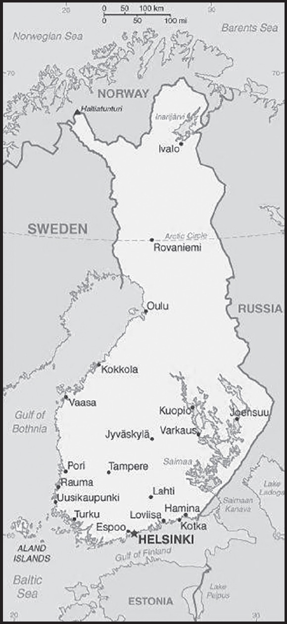
Location: Northern Europe, bordering the Baltic Sea, Gulf of Bothnia, and Gulf of Finland, between Sweden and Russia
Geographic coordinates: 64 00 N, 26 00 E
Map references: Europe
Area: total: 338,145 sq km
land: 303,815 sq km
water: 34,330 sq km
comparison ranking: total 66
Area - comparative: slightly more than two times the size of Georgia; slightly smaller than Montana
Land boundaries: total: 2,563 km
border countries (3): Norway 709 km; Sweden 545 km; Russia 1,309 km
Coastline: 1,250 km
Maritime claims: territorial sea: 12 nm (in the Gulf of Finland - 3 nm)
contiguous zone: 24 nm
continental shelf: 200 m depth or to the depth of exploitation
exclusive fishing zone: 12 nm; extends to continental shelf boundary with Sweden, Estonia, and Russia
Climate: cold temperate; potentially subarctic but comparatively mild because of moderating influence of the North Atlantic Current, Baltic Sea, and more than 60,000 lakes
Terrain: mostly low, flat to rolling plains interspersed with lakes and low hills
Elevation: highest point: Halti (alternatively Haltia, Haltitunturi, Haltiatunturi) 1,328 m
lowest point: Baltic Sea 0 m
mean elevation: 164 m
Natural resources: timber, iron ore, copper, lead, zinc, chromite, nickel, gold, silver, limestone
Land use: agricultural land: 7.5% (2018 est.)
arable land: 7.4% (2018 est.)
permanent crops: 0% (2018 est.)
permanent pasture: 0.1% (2018 est.)
forest: 72.9% (2018 est.)
other: 19.6% (2018 est.)
Irrigated land: 80 sq km (2015)
Major lakes (area sq km): fresh water lake(s): Saimaa - 1,760 sq km; Paijanne - 1,090 sq km; Inarijarvi - 1,000 sq km; Oulujarvi - 900 sq km; Pielinen - 850 sq km
Population distribution: the vast majority of people are found in the south; the northern interior areas remain sparsely populated
Natural hazards: severe winters in the north
Geography - note: long boundary with Russia; Helsinki is northernmost national capital on European continent; population concentrated on small southwestern coastal plain
PEOPLE AND SOCIETY
Population: 5,614,571 (2023 est.)
comparison ranking: 117
Nationality: noun: Finn(s)
adjective: Finnish
Ethnic groups: Finnish, Swedish, Russian, Estonian, Romani, Sami
note: 91.5% of the population has a Finnish background
Languages: Finnish (official) 86.5%, Swedish (official) 5.2%, Russian 1.6%, other 6.7% (2021 est.)
major-language sample(s): World Factbook, korvaamaton perustietolähde. (Finnish)
Religions: Lutheran 66.6%, Greek Orthodox 1.1%, other 1.7%, none 30.6% (2021 est.)
Demographic profile: Finland has a relatively high fertility rate for Europe at about 1.75 children per woman in 2023. Finnish women have high labor force participation rates, and their educational attainment is higher than that of Finnish men. Finland’s family policy, like other Nordic countries, puts an emphasis on reconciling work and family life. Both parents can stay at home with an earnings-based allowance until the baby is about 11 months old. Finland also has a publicly subsidized childcare system. Alternatively, parents can choose to take care of a small child through home care leave with a flat allowance rate. These benefits have encouraged fathers to do a greater share of housework and childcare, although women still perform the lion’s share of domestic work. In other instances, women have reduced the burden of household work by outsourcing domestic chores, rather than men taking on more of the responsibilities. Finland has high family size ideals compared to other European countries, and childlessness and one-child families are not favored. The proportion of couples having at least three children has been growing since the 1970s.
Finland has historically been a country of emigration. In the 20th century, Finns emigrated largely in two waves. Before World War II, the majority of Finns went to North America, and after World War II most went to Sweden, where industrialization was generating much-needed jobs that offered higher salaries and a better standard of living. In the 1980s and early 1990s, Finnish returnees (mainly from Sweden) began to outnumber Finnish emigrants. Also arriving in Finland between April 1990 and 2010, were Ingrian Finns – descendants of ethnic Finns who settled near St. Petersburg, Russia, in the 17th century – who immigrated to Finland under the Right of Return Law. In addition, the country has absorbed immigrants from Russia, Estonia, the former Yugoslavia, and Sweden for a variety of reasons, most commonly for marriage and family reunification. Finland has also accepted refugees and asylum seekers from Somalia, Iraq, China, and Thailand.
Age structure: 0-14 years: 16.25% (male 466,311/female 446,015)
15-64 years: 60.5% (male 1,726,110/female 1,670,981)
65 years and over: 23.25% (2023 est.) (male 575,259/female 729,895)
Dependency ratios: total dependency ratio: 62.1
youth dependency ratio: 25
elderly dependency ratio: 37.1
potential support ratio: 2.7 (2021 est.)
Median age: total: 42.8 years (2020)
male: 41.3 years
female: 44.4 years
comparison ranking: total 31
Population growth rate: 0.22% (2023 est.)
comparison ranking: 176
Birth rate: 10.33 births/1,000 population (2023 est.)
comparison ranking: 182
Death rate: 10.37 deaths/1,000 population (2023 est.)
comparison ranking: 29
Net migration rate: 2.25 migrant(s)/1,000 population (2023 est.)
comparison ranking: 46
Population distribution: the vast majority of people are found in the south; the northern interior areas remain sparsely populated
Urbanization: urban population: 85.8% of total population (2023)
rate of urbanization: 0.42% annual rate of change (2020-25 est.)
Major urban areas - population: 1.338 million HELSINKI (capital) (2023)
Sex ratio: at birth: 1.05 male(s)/female
0-14 years: 1.05 male(s)/female
15-64 years: 1.03 male(s)/female
65 years and over: 0.79 male(s)/female
total population: 0.97 male(s)/female (2023 est.)
Mother’s mean age at first birth: 29.5 years (2020 est.)
Maternal mortality ratio: 8 deaths/100,000 live births (2020 est.)
comparison ranking: 152
Infant mortality rate: total: 2.11 deaths/1,000 live births (2023 est.)
male: 2.29 deaths/1,000 live births
female: 1.92 deaths/1,000 live births
comparison ranking: total 222
Life expectancy at birth: total population: 81.96 years (2023 est.)
male: 79.08 years
female: 84.98 years
comparison ranking: total population 34
Total fertility rate: 1.74 children born/woman (2023 est.)
comparison ranking: 156
Gross reproduction rate: 0.85 (2023 est.)
Contraceptive prevalence rate: 85.5% (2015)
note: percent of women aged 18-49
Drinking water source: improved:
total: 100% of population
unimproved: total: 0% of population (2020 est.)
Current health expenditure: 9.6% of GDP (2020)
Physicians density: 4.64 physicians/1,000 population (2018)
Hospital bed density: 3.6 beds/1,000 population (2018)
Sanitation facility access: improved:
total: 100% of population
unimproved: total: 0% of population (2020 est.)
Obesity - adult prevalence rate: 22.2% (2016)
comparison ranking: 80
Alcohol consumption per capita: total: 8.23 liters of pure alcohol (2019 est.)
beer: 3.76 liters of pure alcohol (2019 est.)
wine: 1.59 liters of pure alcohol (2019 est.)
spirits: 1.96 liters of pure alcohol (2019 est.)
other alcohols: 0.91 liters of pure alcohol (2019 est.)
comparison ranking: total 41
Tobacco use: total: 21.6% (2020 est.)
male: 26.9% (2020 est.)
female: 16.3% (2020 est.)
comparison ranking: total 75
Currently married women (ages 15-49): 57.2% (2023 est.)
Child marriage: women married by age 18: 0.1% (2017 est.)
Education expenditures: 5.9% of GDP (2020 est.)
comparison ranking: 46
School life expectancy (primary to tertiary education): total: 19 years
male: 18 years
female: 20 years (2020)
Youth unemployment rate (ages 15-24): total: 18.1% (2021 est.)
male: 19%
female: 17.1%
comparison ranking: total 94
ENVIRONMENT
Environment - current issues: limited air pollution in urban centers; some water pollution from industrial wastes, agricultural chemicals; habitat loss threatens wildlife populations
Environment - international agreements: party to: Air Pollution, Air Pollution-Heavy Metals, Air Pollution-Multi-effect Protocol, Air Pollution-Nitrogen Oxides, Air Pollution-Persistent Organic Pollutants, Air Pollution-Sulphur 85, Air Pollution-Sulphur 94, Air Pollution-Volatile Organic Compounds, Antarctic-Environmental Protection, Antarctic-Marine Living Resources, Antarctic Treaty, Biodiversity, Climate Change, Climate Change-Kyoto Protocol, Climate Change-Paris Agreement, Comprehensive Nuclear Test Ban, Desertification, Endangered Species, Environmental Modification, Hazardous Wastes, Law of the Sea, Marine Dumping-London Convention, Marine Dumping-London Protocol, Marine Life Conservation, Nuclear Test Ban, Ozone Layer Protection, Ship Pollution, Tropical Timber 2006, Wetlands, Whaling
signed, but not ratified: none of the selected agreements
Climate: cold temperate; potentially subarctic but comparatively mild because of moderating influence of the North Atlantic Current, Baltic Sea, and more than 60,000 lakes
Land use: agricultural land: 7.5% (2018 est.)
arable land: 7.4% (2018 est.)
permanent crops: 0% (2018 est.)
permanent pasture: 0.1% (2018 est.)
forest: 72.9% (2018 est.)
other: 19.6% (2018 est.)
Urbanization: urban population: 85.8% of total population (2023)
rate of urbanization: 0.42% annual rate of change (2020-25 est.)
Revenue from forest resources: 0.36% of GDP (2018 est.)
comparison ranking: 74
Revenue from coal: 0% of GDP (2018 est.)
comparison ranking: 93
Air pollutants: particulate matter emissions: 5.47 micrograms per cubic meter (2019 est.)
carbon dioxide emissions: 45.87 megatons (2016 est.)
methane emissions: 4.46 megatons (2020 est.)
Waste and recycling: municipal solid waste generated annually: 2.738 million tons (2015 est.)
municipal solid waste recycled annually: 769,926 tons (2015 est.)
percent of municipal solid waste recycled: 28.1% (2015 est.)
Major lakes (area sq km): fresh water lake(s): Saimaa - 1,760 sq km; Paijanne - 1,090 sq km; Inarijarvi - 1,000 sq km; Oulujarvi - 900 sq km; Pielinen - 850 sq km
Total water withdrawal: municipal: 1 billion cubic meters (2020 est.)
industrial: 2 billion cubic meters (2020 est.)
agricultural: 500 million cubic meters (2020 est.)
Total renewable water resources: 110 billion cubic meters (2020 est.)
GOVERNMENT
Country name: conventional long form: Republic of Finland
conventional short form: Finland
local long form: Suomen tasavalta (Finnish)/ Republiken Finland (Swedish)
local short form: Suomi (Finnish)/ Finland (Swedish)
etymology: name may derive from the ancient Fenni peoples who are first described as living in northeastern Europe in the first centuries A.D.
Government type: parliamentary republic
Capital: name: Helsinki
geographic coordinates: 60 10 N, 24 56 E
time difference: UTC+2 (7 hours ahead of Washington, DC, during Standard Time)
daylight saving time: +1hr, begins last Sunday in March; ends last Sunday in October
etymology: the name may derive from the Swedish helsing, an archaic name for “neck” (hals), and which may refer to a narrowing of the Vantaa River that flows into the Gulf of Finland at Helsinki; fors refers to “rapids,” so helsing fors meaning becomes “the narrows’ rapids”
Administrative divisions: 19 regions (maakunnat, singular - maakunta (Finnish); landskapen, singular - landskapet (Swedish)); Aland (Swedish), Ahvenanmaa (Finnish); Etela-Karjala (Finnish), Sodra Karelen (Swedish) [South Karelia]; Etela-Pohjanmaa (Finnish), Sodra Osterbotten (Swedish) [South Ostrobothnia]; Etela-Savo (Finnish), Sodra Savolax (Swedish) [South Savo]; Kanta- Hame (Finnish), Egentliga Tavastland (Swedish); Kainuu (Finnish), Kajanaland (Swedish); Keski-Pohjanmaa (Finnish), Mellersta Osterbotten (Swedish) [Central Ostrobothnia]; Keski-Suomi (Finnish), Mellersta Finland (Swedish) [Central Finland]; Kymenlaakso (Finnish), Kymmenedalen (Swedish); Lappi (Finnish), Lappland (Swedish); Paijat-Hame (Finnish), Paijanne-Tavastland (Swedish); Pirkanmaa (Finnish), Birkaland (Swedish) [Tampere]; Pohjanmaa (Finnish), Osterbotten (Swedish) [Ostrobothnia]; Pohjois-Karjala (Finnish), Norra Karelen (Swedish) [North Karelia]; Pohjois-Pohjanmaa (Finnish), Norra Osterbotten (Swedish) [North Ostrobothnia]; Pohjois-Savo (Finnish), Norra Savolax (Swedish) [North Savo]; Satakunta (Finnish and Swedish); Uusimaa (Finnish), Nyland (Swedish) [Newland]; Varsinais- Suomi (Finnish), Egentliga Finland (Swedish) [Southwest Finland]
Independence: 6 December 1917 (from Russia)
National holiday: Independence Day, 6 December (1917)
Constitution: history: previous 1906, 1919; latest drafted 17 June 1997, approved by Parliament 11 June 1999, entered into force 1 March 2000
amendments: proposed by Parliament; passage normally requires simple majority vote in two readings in the first parliamentary session and at least two-thirds majority vote in a single reading by the newly elected Parliament; proposals declared “urgent” by five-sixths of Parliament members can be passed by at least two-thirds majority vote in the first parliamentary session only; amended several times, last in 2018
Legal system: civil law system based on the Swedish model
International law organization participation: accepts compulsory ICJ jurisdiction with reservations; accepts ICCt jurisdiction
Citizenship: citizenship by birth: no
citizenship by descent only: at least one parent must be a citizen of Finland
dual citizenship recognized: yes
residency requirement for naturalization: 6 years
Suffrage: 18 years of age; universal
Executive branch: chief of state: President Sauli NIINISTO (since 1 March 2012)
head of government: Prime Minister Petteri ORPO (since 20 June 2023)
cabinet: Council of State or Valtioneuvosto appointed by the president, responsible to Parliament
elections/appointments: president directly elected by absolute majority popular vote in 2 rounds if needed for a 6-year term (eligible for a second term); election last held on 28 January 2018 (next to be held in January 2024); prime minister appointed by Parliament
election results: 2018: Sauli NIINISTO reelected president; percent of vote - Sauli NIINISTO (independent) 62.7%, Pekka HAAVISTO (Vihr) 12.4%, Laura HUHTASAARI (PS) 6.9%, Paavo VAYRYNEN (independent) 6.2%, Matti VANHANEN (Kesk) 4.1%, other 7.7%
2012: Sauli NIINISTO elected president; percent of vote - Sauli NIINISTO (Kok) 62.6%, Pekka HAAVISTO (Vihr) 37.4%
Legislative branch: description: unicameral Parliament or Eduskunta (200 seats; 199 members directly elected in single- and multi-seat constituencies by proportional representation vote and 1 member in the province of Aland directly elected by simple majority vote; members serve 4-year terms)
elections: last held on 2 April 2023 (next to be held on 30 April 2027)
election results: percent of vote by party/coalition - Kok 24%, PS 23%, SDP 21.5%. Center Party 11.5%, Vihr 6.5%, Vas 5.5%, SFP 4.5%, KD 2.5%, Aland 0.5%; Movement Now 0.5%; seats by party/coalition - Kok 48, PS 46, SDP 43, Center Party 23, Vihr 13, Vas 11, SFP 9, KD 5; Aland 1; Movement Now 1; composition men 108, women 92, percent of women 46%
Judicial branch: highest court(s): Supreme Court or Korkein Oikeus (consists of the court president and 18 judges); Supreme Administrative Court (consists of 21 judges, including the court president and organized into 3 chambers); note - Finland has a dual judicial system - courts with civil and criminal jurisdiction and administrative courts with jurisdiction for litigation between individuals and administrative organs of the state and communities
judge selection and term of office: Supreme Court and Supreme Administrative Court judges appointed by the president of the republic; judges serve until mandatory retirement at age 68
subordinate courts: 6 Courts of Appeal; 8 regional administrative courts; 27 district courts; special courts for issues relating to markets, labor, insurance, impeachment, land, tenancy, and water rights
Political parties and leaders: Aland Coalition (a coalition of several political parties on the Aland Islands)
Center Party or Kesk [Annika SAARIKKO]
Christian Democrats or KD [Sari ESSAYAH]
Finns Party or PS [Riikka PURRA]
Green League or Vihr [Sofia VIRTA]
Left Alliance or Vas [Li ANDERSSON]
Movement Now or Liike Nyt [Harry HARKINO]
National Coalition Party or Kok [Petteri ORPO]
Social Democratic Party or SDP [Sanna MARIN]
Swedish People’s Party or RKP or SFP [Anna-Maja HENRIKSSON]
International organization participation: ADB (nonregional member), AfDB (nonregional member), Arctic Council, Australia Group, BIS, CBSS, CD, CE, CERN, EAPC, EBRD, ECB, EIB, EITI (implementing country), EMU, ESA, EU, FAO, FATF, G-9, IADB, IAEA, IBRD, ICAO, ICC (national committees), ICCt, ICRM, IDA, IEA, IFAD, IFC, IFRCS, IHO, ILO, IMF, IMO, IMSO, Interpol, IOC, IOM, IPU, ISO, ITSO, ITU, ITUC (NGOs), MIGA, MINUSMA, NATO, NC, NEA, NIB, NSG, OAS (observer), OECD, OPCW, OSCE, Pacific Alliance (observer), Paris Club, PCA, PFP, Schengen Convention, UN, UNCTAD, UNESCO, UNHCR, UNHRC, UNIDO, UNIFIL, UNMIL, UNMOGIP, UNOOSA, UNRWA, UNSOM, UNTSO, UPU, Wassenaar Arrangement, WCO, WFTU (NGOs), WHO, WIPO, WMO, WTO, ZC
Diplomatic representation in the US: chief of mission: Ambassador Mikko Tapani HAUTALA (since 17 September 2020)
chancery: 3301 Massachusetts Avenue NW, Washington, DC 20008
telephone: [1] (202) 298-5800
FAX: [1] (202) 298-6030
email address and website:
https://finlandabroad.fi/web/usa/mission
consulate(s) general: Los Angeles, New York
Diplomatic representation from the US: chief of mission: Ambassador Douglas HICKEY (since 11 May 2022)
embassy: Itainen Puistotie 14 B, 00140 Helsinki
mailing address: 5310 Helsinki Place, Washington DC 20521-5310
telephone: [358] (9) 616-250
FAX: [358] (9) 174-681
email address and website:
Flag description: white with a blue cross extending to the edges of the flag; the vertical part of the cross is shifted to the hoist side in the style of the Dannebrog (Danish flag); the blue represents the thousands of lakes scattered across the country, while the white is for the snow that covers the land in winter
National symbol(s): lion; national colors: blue, white
National anthem: name: “Maamme” (Our Land)
lyrics/music: Johan Ludvig RUNEBERG/Fredrik PACIUS
note: in use since 1848; although never officially adopted by law, the anthem has been popular since it was first sung by a student group in 1848; Estonia’s anthem uses the same melody as that of Finland
National heritage: total World Heritage Sites: 7 (6 cultural, 1 natural)
selected World Heritage Site locales: Fortress of Suomenlinna (c); Old Rauma (c); Petäjävesi Old Church (c); Verla Groundwood and Board Mill (c); Bronze Age Burial Site of Sammallahdenmäki (c); High Coast / Kvarken Archipelago (n); Struve Geodetic Arc (c)
ECONOMY
Economic overview: highly industrialized, export-based EU economy and euro user; high per capita GDP; major timber, metals, engineering, telecommunications, and electronics industries; manageable public debts; rigid labor laws impose higher regulatory burdens
Real GDP (purchasing power parity): $275.545 billion (2022 est.)
$270.143 billion (2021 est.)
$262.343 billion (2020 est.)
note: data are in 2017 dollars
comparison ranking: 59
Real GDP growth rate: 2.1% (2022 est.)
2.97% (2021 est.)
-2.21% (2020 est.)
comparison ranking: 162
Real GDP per capita: $49,600 (2022 est.)
$48,800 (2021 est.)
$47,400 (2020 est.)
note: data are in 2017 dollars
comparison ranking: 31
GDP (official exchange rate)
$269.259 billion (2019 est.)
Inflation rate (consumer prices): 2.19% (2021 est.)
0.29% (2020 est.)
1.02% (2019 est.)
comparison ranking: 151
Credit ratings: Fitch rating: AA+ (2016)
Moody’s rating: Aa1 (2016)
Standard & Poors rating: AA+ (2014)
note: The year refers to the year in which the current credit rating was first obtained.
GDP - composition, by sector of origin
agriculture: 2.7% (2017 est.)
industry: 28.2% (2017 est.)
services: 69.1% (2017 est.)
comparison rankings: services 75; industry 91; agriculture 157
GDP - composition, by end use
household consumption: 54.4% (2017 est.)
government consumption: 22.9% (2017 est.)
investment in fixed capital: 22.1% (2017 est.)
investment in inventories: 0.4% (2017 est.)
exports of goods and services: 38.5% (2017 est.)
imports of goods and services: -38.2% (2017 est.)
Agricultural products: milk, barley, oats, wheat, potatoes, sugar beets, rye, pork, poultry, beef
Industries: metals and metal products, electronics, machinery and scientific instruments, shipbuilding, pulp and paper, foodstuffs, chemicals, textiles, clothing
Industrial production growth rate: 2.77% (2021 est.)
comparison ranking: 126
Labor force: 2.82 million (2021 est.)
comparison ranking: 112
Labor force - by occupation: agriculture: 4%
industry: 20.7%
services: 75.3% (2017 est.)
Unemployment rate: 7.53% (2021 est.)
7.76% (2020 est.)
6.69% (2019 est.)
comparison ranking: 103
Youth unemployment rate (ages 15-24): total: 18.1% (2021 est.)
male: 19%
female: 17.1%
comparison ranking: total 94
Population below poverty line: 12.2% (2019 est.)
Gini Index coefficient - distribution of family income: 27.7 (2019 est.)
comparison ranking: 164
Average household expenditures: on food: 11.5% of household expenditures (2018 est.)
on alcohol and tobacco: 4.3% of household expenditures (2018 est.)
Household income or consumption by percentage share: lowest 10%: 6.7%
highest 10%: 45.2% (2013)
Budget: revenues: $140.643 billion (2020 est.)
expenditures: $153.635 billion (2020 est.)
note: Central Government Budget data; these numbers represent a significant reduction from previous official reporting
Budget surplus (+) or deficit (-): -0.6% (of GDP) (2017 est.)
comparison ranking: 65
Public debt: 61.3% of GDP (2017 est.)
62.9% of GDP (2016 est.)
note: data cover general government debt and include debt instruments issued (or owned) by government entities other than the treasury; the data include treasury debt held by foreign entities; the data include debt issued by subnational entities, as well as intragovernmental debt; intragovernmental debt consists of treasury borrowings from surpluses in the social funds, such as for retirement, medical care, and unemployment; debt instruments for the social funds are not sold at public auctions
comparison ranking: 81
Taxes and other revenues: 19.85% (of GDP) (2020 est.)
comparison ranking: 93
Fiscal year: calendar year
Current account balance: $1.896 billion (2021 est.)
$2.169 billion (2020 est.)
-$879.445 million (2019 est.)
comparison ranking: 45
Exports: $116.905 billion (2021 est.) note: data are in current year dollars
$97.789 billion (2020 est.) note: data are in current year dollars
$107.084 billion (2019 est.)
comparison ranking: 40
Exports - partners: Germany 13%, Sweden 9%, United States 8%, Netherlands 6%, China 6% (2021)
Exports - commodities: refined petroleum, kaolin coated paper, cars, lumber, stainless steel, wood pulp (2021)
Imports: $116.277 billion (2021 est.) note: data are in current year dollars
$97.037 billion (2020 est.) note: data are in current year dollars
$106.664 billion (2019 est.)
comparison ranking: 41
Imports - partners: Germany 16%, Sweden 15%, Russia 11%, China 7%, Netherlands 7% (2021)
Imports - commodities: cars and vehicle parts, crude petroleum, refined petroleum, broadcasting equipment, packaged medicines (2021)
Reserves of foreign exchange and gold: $16.744 billion (31 December 2021 est.)
$13.48 billion (31 December 2020 est.)
$11.427 billion (31 December 2019 est.)
comparison ranking: 70
Debt - external: $631.549 billion (2019 est.)
$536.301 billion (2018 est.)
comparison ranking: 22
Exchange rates: euros (EUR) per US dollar -
Exchange rates: 0.845 (2021 est.)
0.876 (2020 est.)
0.893 (2019 est.)
0.847 (2018 est.)
0.885 (2017 est.)
ENERGY
Electricity access: electrification - total population: 100% (2021)
Electricity: installed generating capacity: 20.418 million kW (2020 est.)
consumption: 79.356 billion kWh (2020 est.)
exports: 6.666 billion kWh (2020 est.)
imports: 21.615 billion kWh (2020 est.)
transmission/distribution losses: 2.574 billion kWh (2020 est.)
comparison rankings: transmission/distribution losses 75; imports 9; exports 28; consumption 37; installed generating capacity 47
Electricity generation sources: fossil fuels: 13.4% of total installed capacity (2020 est.)
nuclear: 33.4% of total installed capacity (2020 est.)
solar: 0.4% of total installed capacity (2020 est.)
wind: 11.9% of total installed capacity (2020 est.)
hydroelectricity: 23.2% of total installed capacity (2020 est.)
biomass and waste: 17.8% of total installed capacity (2020 est.)
Nuclear energy: Number of operational nuclear reactors: 5 (2023)
Number of nuclear reactors under construction: 0
Net capacity of operational nuclear reactors: 4.39GW (2023)
Percent of total electricity production: 32.8% (2021)
Percent of total energy produced: 41.3% (2021)
Number of nuclear reactors permanently shut down: 0
Coal: production: 762,000 metric tons (2020 est.)
consumption: 3.552 million metric tons (2020 est.)
exports: 101,000 metric tons (2020 est.)
imports: 2.661 million metric tons (2020 est.)
proven reserves: 0 metric tons (2019 est.)
Petroleum: total petroleum production: 8,300 bbl/day (2021 est.)
refined petroleum consumption: 207,400 bbl/day (2019 est.)
crude oil and lease condensate exports: 0 bbl/day (2018 est.)
crude oil and lease condensate imports: 232,400 bbl/day (2018 est.)
crude oil estimated reserves: 0 barrels (2021 est.)
Refined petroleum products - production: 310,600 bbl/day (2017 est.)
comparison ranking: 40
Refined petroleum products - exports: 166,200 bbl/day (2017 est.)
comparison ranking: 34
Refined petroleum products - imports: 122,200 bbl/day (2017 est.)
comparison ranking: 48
Natural gas: production: 0 cubic meters (2021 est.)
consumption: 2.393 billion cubic meters (2020 est.)
exports: 181.143 million cubic meters (2020 est.)
imports: 2.569 billion cubic meters (2020 est.)
proven reserves: 0 cubic meters (2021 est.)
Carbon dioxide emissions: 41.996 million metric tonnes of CO2 (2019 est.)
from coal and metallurgical coke: 9.377 million metric tonnes of CO2 (2019 est.)
from petroleum and other liquids: 27.737 million metric tonnes of CO2 (2019 est.)
from consumed natural gas: 4.882 million metric tonnes of CO2 (2019 est.)
comparison ranking: total emissions 62
Energy consumption per capita: 216.571 million Btu/person (2019 est.)
comparison ranking: 20
COMMUNICATIONS
Telephones - fixed lines: total subscriptions: 207,000 (2021 est.)
subscriptions per 100 inhabitants: 4 (2021 est.)
comparison ranking: total subscriptions 120
Telephones - mobile cellular: total subscriptions: 7.15 million (2021 est.)
subscriptions per 100 inhabitants: 129 (2021 est.)
comparison ranking: total subscriptions 109
Telecommunication systems: general assessment: Finland’s telecom market is among the more progressive in Europe, with operators having been at the forefront in deploying technologies and with the regulator being among the first to auction spectrum for 5G use; these efforts have been supported by the government which is working towards its target of providing a broadband service of at least 100Mb/s by 2025; 5G services were available to more than 40% of the population by early 2021, and take-up among subscribers has been strong although most will remain with LTE in the short term; the country enjoys one of the highest broadband and mobile subscription rates in the region, with customers able to make use of the latest iterations of technologies including DOCSIS3.1, LTE-A, 5G, and GPON fiber infrastructure; Finland has emerged as one of the pioneers in 5G; the auction of spectrum in the 700MHz and 3.5GHh bands has enabled network operators to extend the availability of LTE services nationally and to prepare for 5G services; Spectrum in the 2.5GHz band was auctioned in mid-2020 and has since enabled the MNOs to widen their 5G footprint considerably; there is an ongoing shift away from DSL to fiber and mobile networks (2021)
domestic: fixed-line 4 per 100 subscriptions and nearly 129 per 100 mobile-cellular (2021)
international: country code - 358; landing points for Botnia, BCS North-1 & 2, SFL, SFS-4, C-Lion1, Eastern Lights, Baltic Sea Submarine Cable, FEC, and EESF-2 & 3 submarine cables that provide links to many Finland points, Estonia, Sweden, Germany, and Russia; satellite earth stations - access to Intelsat transmission service via a Swedish satellite earth station, 1 Inmarsat (Atlantic and Indian Ocean regions); note - Finland shares the Inmarsat earth station with the other Nordic countries (Denmark, Iceland, Norway, and Sweden) (2019)
Broadcast media: a mix of 3 publicly operated TV stations and numerous privately owned TV stations; several free and special-interest pay-TV channels; cable and satellite multi-channel subscription services are available; all TV signals are broadcast digitally; Internet television, such as Netflix and others, is available; public broadcasting maintains a network of 13 national and 25 regional radio stations; a large number of private radio broadcasters and access to Internet radio
Internet country code: .fi
note - Aland Islands assigned .ax
Internet users: total: 5.115 million (2021 est.)
percent of population: 93% (2021 est.)
comparison ranking: total 91
Broadband - fixed subscriptions: total: 1.846 million (2020 est.)
subscriptions per 100 inhabitants: 33 (2020 est.)
comparison ranking: total 59
TRANSPORTATION
National air transport system: number of registered air carriers: 3 (2020)
inventory of registered aircraft operated by air carriers: 77
annual passenger traffic on registered air carriers: 13,364,839 (2018)
annual freight traffic on registered air carriers: 957.64 million (2018) mt-km
Civil aircraft registration country code prefix: OH
Airports: 148 (2021)
comparison ranking: total 37
Airports - with paved runways: 74
civil airports: 11
military airports: 2
joint use (civil-military) airports: 2
other airports: 59
note: paved runways have a concrete or asphalt surface but not all have facilities for refueling, maintenance, or air traffic control; the length of a runway required for aircraft to safely operate depends on a number of factors including the type of aircraft, the takeoff weight (including passengers, cargo, and fuel), engine types, flap settings, landing speed, elevation of the airport, and average maximum daily air temperature; paved runways can reach a length of 5,000 m (16,000 ft.), but the “typical” length of a commercial airline runway is between 2,500-4,000 m (8,000-13,000 ft.)
Airports - with unpaved runways: 74
note: unpaved runways have a surface composition such as grass or packed earth and are most suited to the operation of light aircraft; unpaved runways are usually short, often less than 1,000 m (3,280 ft.) in length; airports with unpaved runways often lack facilities for refueling, maintenance, or air traffic control
Pipelines: 1,288 km gas transmission pipes, 1,976 km distribution pipes (2016)
Railways: total: 5,918 km (2020) 3,349 km electrified
comparison ranking: total 33
Roadways: total: 454,000 km (2012)
highways: 78,000 km (2012) (50,000 paved, including 700 km of expressways; 28,000 unpaved)
private and forest roads: 350,000 km (2012)
urban: 26,000 km (2012)
comparison ranking: total 17
Waterways: 8,000 km (2013) (includes Saimaa Canal system of 3,577 km; southern part leased from Russia; water transport used frequently in the summer and widely replaced with sledges on the ice in winter; there are 187,888 lakes in Finland that cover 31,500 km); Finland also maintains 8,200 km of coastal fairways
comparison ranking: 19
Merchant marine: total: 278 (2022)
by type: bulk carrier 9, container ship 1, general cargo 74, oil tanker 5, other 189
comparison ranking: total 57
Ports and terminals: major seaport(s): Helsinki, Kotka, Naantali, Porvoo, Raahe, Rauma
LNG terminal(s) (import): Hamina, Inkoo (operational 2023), Pori, Tornio Manga
Transportation - note: Finland operates icebreakers in the Baltic Sea including seven PC 3 or 4 class medium icebreakers and two PC 5 or 6 class light icebreakers
note - PC indicates a Polar Class vessel: PC 3 - year-round operation in second-year ice which may include multi-year ice inclusions (ice thickness up to 2.5 m); PC 4 - year-round operation in thick first-year ice which may include old ice inclusions (ice thickness up to 120 cm); PC 5 - year-round operation in medium first-year ice which may include old ice inclusions (ice thickness up to 70-120 cm); PC 6 - summer/autumn operation in medium first-year ice which may include old ice inclusions (ice thickness up to 30-70 cm)
MILITARY AND SECURITY
Military and security forces: Finnish Defense Forces (FDF; Puolustusvoimat): Army (Maavoimat), Navy (Merivoimat), Air Force (Ilmavoimat) (2023)
note: the Border Guard (Rajavartiolaitos) and National Police are under the Ministry of the Interior; the Border Guard becomes part of the FDF in wartime
Military expenditures: 2.5% of GDP (2023 est.)
2% of GDP (2022)
1.9% of GDP (2021)
1.5% of GDP (2020)
1.4% of GDP (2019)
comparison ranking: 41
Military and security service personnel strengths: approximately 30,000 active-duty personnel (22,000 Army; 5,000 Navy; 3,000 Air Force) (2023)
note: active-duty figures include about 21,000 conscripts carrying out their obligated military service (approximately 17,000 Army; 3,500 Navy; 1,000 Air Force)
Military equipment inventories and acquisitions: the military’s inventory consists of a wide mix of mostly modern US, European, Israeli, South Korean, and domestically produced weapons systems; in recent years, the Netherlands and the US have been the leading suppliers; the Finnish defense industry produces a variety of military equipment, including wheeled armored vehicles and naval vessels (2023)
Military service age and obligation: at age 18, all Finnish men are obligated to serve 5.5-12 months of service within a branch of the military or the Border Guard (length of service depends on the type of duty); women 18-29 may volunteer for service; there is also an option to perform non-military service which lasts for 8.5 or 11.5 months; after completing their initial conscript obligation, individuals enter the reserves and remain eligible for mobilization until the age of 50 for rank-and-file and 60 for non-commissioned and commissioned officers (2023)
note 1: the military trains approximately 21,000 conscripts each year; women have served on a voluntary basis since 1995, and as of 2022 made up about 19% of the military’s full-time personnel
note 2: Finland has had conscription since 1951
Military deployments: 225 Lebanon (UNIFIL) (2023)
Military - note: the Finnish Defense Forces (FDF) are focused primarily on territorial defense, which is based on having a large, trained reserve force created by general conscription; active-duty FDF units absorb and train more than 20,000 conscripts annually; the resulting pool of trained reservists gives the FDF a wartime strength of approximately 280,000 and a total reserve of some 900,000 citizens with military service; other FDF responsibilities include support to international peacekeeping operations and some domestic security duties, such as assisting the National Police in maintaining law and order in crises
the FDF is also focused on fulfilling its new commitment to NATO; following Russia’s full-scale invasion of Ukraine in 2022, Finland reassessed its security policy situation and applied for NATO membership and gained entry in April 2023; as a member of the Alliance, Finland is part of NATO’s collective defense and is covered by the security guarantees enshrined in Article 5 of the North Atlantic Treaty (also known as the Washington Treaty); Finland had been part of NATO’s Partnership for Peace program since 1994, and the FDF exercised with some NATO members and participated in NATO-led military missions in the Balkans, Afghanistan, and Iraq; Finland also is a signatory of the EU’s Common Security and Defense Policy and actively participates in EU crisis management missions and operations; the FDF cooperates closely with the militaries of other Nordic countries through the Nordic Defense Cooperation structure (NORDEFCO; established 2009), which consists of Denmark, Finland, Iceland, Norway, and Sweden and involves cooperation in such areas as armaments, education, human resources, training and exercises, and operations; Finland considers Sweden as its closest bi-lateral security partner; the UK and the US are also close defense partners; in 2022, Finland signed a mutual security agreement with the UK, and since 2014 has been part of the UK-led Joint Expeditionary Force, a pool of high-readiness military forces from 10 Baltic and Scandinavian countries designed to respond to a wide range of contingencies in the North Atlantic, Baltic Sea, and High North regions
the bulk of the FDF’s annual intake of conscripts go into the Army; in peacetime, the Army has five combat brigades, which include armored, jaeger/light infantry, and mechanized infantry forces, plus two regiments of jaeger/light infantry and jaeger/special forces/helicopter assault forces; the Navy has a mix of missile-armed patrol craft, fast patrol boats, and mine warfare vessels; it is slated to receive four multirole corvettes between by 2029; the Navy also has a coastal defense brigade, which includes anti-ship missile and naval special operations forces and a naval infantry brigade maintained at cadre strength that incorporates about 1,500 conscripts annually; the Air Force has about 60 US-made F/A-18 multirole fighters, which are scheduled to be replaced by US-origin F-35 stealth multirole fighters beginning in 2025 (2023)
TRANSNATIONAL ISSUES
Disputes - international: various groups in Finland advocate restoration of Karelia and other areas ceded to the former Soviet Union, but the Finnish Government asserts no territorial demands
Refugees and internally displaced persons: refugees (country of origin): 9,175 (Iraq) (mid-year 2022); 61,520 (Ukraine) (as of 24 September 2023)
stateless persons: 3,546 (2022)
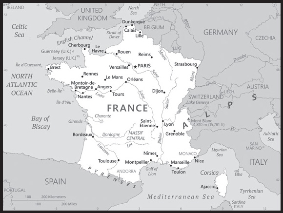
INTRODUCTION
Background: France today is one of the most modern countries in the world and is a leader among European nations. It plays an influential global role as a permanent member of the United Nations Security Council, NATO, the G-7, the G-20, the EU, and other multilateral organizations. France rejoined NATO’s integrated military command structure in 2009, reversing DE GAULLE’s 1966 decision to withdraw French forces from NATO. Since 1958, it has constructed a hybrid presidential-parliamentary governing system resistant to the instabilities experienced in earlier, more purely parliamentary administrations. In recent decades, its reconciliation and cooperation with Germany have proved central to the economic integration of Europe, including the introduction of a common currency, the euro, in January 1999. In the early 21st century, five French overseas entities - French Guiana, Guadeloupe, Martinique, Mayotte, and Reunion - became French regions and were made part of France proper.
GEOGRAPHY
Location: metropolitan France: Western Europe, bordering the Bay of Biscay and English Channel, between Belgium and Spain, southeast of the UK; bordering the Mediterranean Sea, between Italy and Spain;
French Guiana: Northern South America, bordering the North Atlantic Ocean, between Brazil and Suriname;
Guadeloupe: Caribbean, islands between the Caribbean Sea and the North Atlantic Ocean, southeast of Puerto Rico;
Martinique: Caribbean, island between the Caribbean Sea and North Atlantic Ocean, north of Trinidad and Tobago;
Mayotte: Southern Indian Ocean, island in the Mozambique Channel, about halfway between northern Madagascar and northern Mozambique;
Reunion: Southern Africa, island in the Indian Ocean, east of Madagascar
Geographic coordinates: metropolitan France: 46 00 N, 2 00 E;
French Guiana: 4 00 N, 53 00 W;
Guadeloupe: 16 15 N, 61 35 W;
Martinique: 14 40 N, 61 00 W;
Mayotte: 12 50 S, 45 10 E;
Reunion: 21 06 S, 55 36 E
Map references: metropolitan France: Europe;
French Guiana: South America;
Guadeloupe: Central America and the Caribbean;
Martinique: Central America and the Caribbean;
Mayotte: Africa;
Reunion: World
Area: total: 643,801 sq km ; 551,500 sq km (metropolitan France)
land: 640,427 sq km ; 549,970 sq km (metropolitan France)
water: 3,374 sq km ; 1,530 sq km (metropolitan France)
note: the first numbers include the overseas regions of French Guiana, Guadeloupe, Martinique, Mayotte, and Reunion
comparison ranking: total 45
Area - comparative: slightly more than four times the size of Georgia; slightly less than the size of Texas
Land boundaries: total: 3,956 km
border countries (8): Andorra 55 km; Belgium 556 km; Germany 418 km; Italy 476 km; Luxembourg 69 km; Monaco 6 km; Spain 646 km; Switzerland 525 km
metropolitan France - total: 2751 km
French Guiana - total: 1205 km
Coastline: 4,853 km
metropolitan France: 3,427 km
Maritime claims: territorial sea: 12 nm
contiguous zone: 24 nm
exclusive economic zone: 200 nm (does not apply to the Mediterranean Sea)
continental shelf: 200m depth or to the depth of exploitation
Climate: metropolitan France: generally cool winters and mild summers, but mild winters and hot summers along the Mediterranean; occasional strong, cold, dry, north-to-northwesterly wind known as the mistral
French Guiana: tropical; hot, humid; little seasonal temperature variation
Guadeloupe and Martinique: subtropical tempered by trade winds; moderately high humidity; rainy season (June to October); vulnerable to devastating cyclones (hurricanes) every eight years on average
Mayotte: tropical; marine; hot, humid, rainy season during northeastern monsoon (November to May); dry season is cooler (May to November)
Reunion: tropical, but temperature moderates with elevation; cool and dry (May to November), hot and rainy (November to April)
Terrain: metropolitan France: mostly flat plains or gently rolling hills in north and west; remainder is mountainous, especially Pyrenees in south, Alps in east;
French Guiana: low-lying coastal plains rising to hills and small mountains;
Guadeloupe: Basse-Terre is volcanic in origin with interior mountains; Grande-Terre is low limestone formation; most of the seven other islands are volcanic in origin;
Martinique: mountainous with indented coastline; dormant volcano;
Mayotte: generally undulating, with deep ravines and ancient volcanic peaks;
Reunion: mostly rugged and mountainous; fertile lowlands along coast
Elevation: highest point: Mont Blanc 4,810
lowest point: Rhone River delta -2 m
mean elevation: 375 m
note: to assess the possible effects of climate change on the ice and snow cap of Mont Blanc, its surface and peak have been extensively measured in recent years; these new peak measurements have exceeded the traditional height of 4,807 m and have varied between 4,808 m and 4,811 m; the actual rock summit is 4,792 m and is 40 m away from the ice-covered summit
Natural resources: metropolitan France: coal, iron ore, bauxite, zinc, uranium, antimony, arsenic, potash, feldspar, fluorspar, gypsum, timber, arable land, fish; French Guiana: gold deposits, petroleum, kaolin, niobium, tantalum, clay
Land use: agricultural land: 52.7% (2018 est.)
arable land: 33.4% (2018 est.)
permanent crops: 1.8% (2018 est.)
permanent pasture: 17.5% (2018 est.)
forest: 29.2% (2018 est.)
other: 18.1% (2018 est.)
Irrigated land: 14,236 sq km (2013)
Major lakes (area sq km): fresh water lake(s): Lake Geneva (shared with Switzerland) - 580 sq km
Major rivers (by length in km): Rhin (Rhine) (shared with Switzerland [s], Germany, and Netherlands [m]) - 1,233 km; Loire - 1,012 km
note – [s] after country name indicates river source; [m] after country name indicates river mouth
Major watersheds (area sq km): Atlantic Ocean drainage: Loire (115,282 sq km), Seine (78,919 sq km), Rhine-Maas (198,735 sq km), (Adriatic Sea) Po (76,997 sq km), (Mediterranean Sea) Rhone (100,543 sq km)
Major aquifers: Paris Basin
Population distribution: much of the population is concentrated in the north and southeast; although there are many urban agglomerations throughout the country, Paris is by far the largest city, with Lyon ranked a distant second
Natural hazards: metropolitan France: flooding; avalanches; midwinter windstorms; drought; forest fires in south near the Mediterranean;
overseas departments: hurricanes (cyclones); flooding;
volcanism: Montagne Pelee (1,394 m) on the island of Martinique in the Caribbean is the most active volcano of the Lesser Antilles arc, it last erupted in 1932; a catastrophic eruption in May 1902 destroyed the city of St. Pierre, killing an estimated 30,000 people; La Soufriere (1,467 m) on the island of Guadeloupe in the Caribbean last erupted from July 1976 to March 1977; these volcanoes are part of the volcanic island arc of the Lesser Antilles that extends from Saba in the north to Grenada in the south
Geography - note: largest West European nation; most major French rivers - the Meuse, Seine, Loire, Charente, Dordogne, and Garonne - flow northward or westward into the Atlantic Ocean, only the Rhone flows southward into the Mediterranean Sea
PEOPLE AND SOCIETY
Population: 68,521,974 (2023 est.)
note: the above figure is for metropolitan France and five overseas regions; the metropolitan France population is 62,814,233
comparison ranking: 21
Nationality: noun: Frenchman(men), Frenchwoman(women)
adjective: French
Ethnic groups: Celtic and Latin with Teutonic, Slavic, North African (Algerian, Moroccan, Tunisian), Indochinese, Basque minorities
note: overseas departments: Black, White, Mulatto, East Indian, Chinese, Amerindian
Languages: French (official) 100%, declining regional dialects and languages (Provencal, Breton, Alsatian, Corsican, Catalan, Basque, Flemish, Occitan, Picard); note - overseas departments: French, Creole patois, Mahorian (a Swahili dialect)
major-language sample(s): The World Factbook, une source indispensable d’informations de base. (French)
Religions: Roman Catholic 47%, Muslim 4%, Protestant 2%, Buddhist 2%, Orthodox 1%, Jewish 1%, other 1%, none 33%, unspecified 9% (2021 est.)
note: France maintains a tradition of secularism and has not officially collected data on religious affiliation since the 1872 national census, which complicates assessments of France’s religious composition; an 1872 law prohibiting state authorities from collecting data on individuals’ ethnicity or religious beliefs was reaffirmed by a 1978 law emphasizing the prohibition of the collection or exploitation of personal data revealing an individual’s race, ethnicity, or political, philosophical, or religious opinions; a 1905 law codified France’s separation of church and state
Age structure: 0-14 years: 18.04% (male 6,322,021/female 6,040,773)
15-64 years: 60.53% (male 20,846,592/female 20,632,418)
65 years and over: 21.42% (2023 est.) (male 6,409,883/female 8,270,287)
Dependency ratios: total dependency ratio: 63.1
youth dependency ratio: 28.3
elderly dependency ratio: 34.8
potential support ratio: 2.9 (2021 est.)
Median age: total: 41.7 years (2020)
male: 40 years
female: 43.4 years
comparison ranking: total 43
Population growth rate: 0.31% (2023 est.)
comparison ranking: 164
Birth rate: 11.56 births/1,000 population (2023 est.)
comparison ranking: 162
Death rate: 9.51 deaths/1,000 population (2023 est.)
comparison ranking: 46
Net migration rate: 1.06 migrant(s)/1,000 population (2023 est.)
comparison ranking: 64
Population distribution: much of the population is concentrated in the north and southeast; although there are many urban agglomerations throughout the country, Paris is by far the largest city, with Lyon ranked a distant second
Urbanization: urban population: 81.8% of total population (2023)
rate of urbanization: 0.67% annual rate of change (2020-25 est.)
Major urban areas - population: 11.208 million PARIS (capital), 1.761 million Lyon, 1.628 million Marseille-Aix-en-Provence, 1.079 million Lille, 1.060 million Toulouse, 1.000 million Bordeaux (2023)
Sex ratio: at birth: 1.05 male(s)/female
0-14 years: 1.05 male(s)/female
15-64 years: 1.01 male(s)/female
65 years and over: 0.78 male(s)/female
total population: 0.96 male(s)/female (2023 est.)
Mother’s mean age at first birth: 28.9 years (2020 est.)
Maternal mortality ratio: 8 deaths/100,000 live births (2020 est.)
comparison ranking: 150
Infant mortality rate: total: 3.1 deaths/1,000 live births (2023 est.)
male: 3.48 deaths/1,000 live births
female: 2.7 deaths/1,000 live births
comparison ranking: total 210
Life expectancy at birth: total population: 82.79 years (2023 est.)
male: 79.75 years
female: 85.97 years
comparison ranking: total population 19
Total fertility rate: 2.02 children born/woman (2023 est.)
comparison ranking: 103
Gross reproduction rate: 0.99 (2023 est.)
Drinking water source: improved:
total: 100% of population
unimproved: total: 0% of population (2020 est.)
Current health expenditure: 12.2% of GDP (2020)
Physicians density: 3.27 physicians/1,000 population (2019)
Hospital bed density: 5.9 beds/1,000 population (2018)
Sanitation facility access: improved:
total: 100% of population
unimproved: total: 0% of population (2020 est.)
Obesity - adult prevalence rate: 21.6% (2016)
comparison ranking: 87
Alcohol consumption per capita: total: 11.44 liters of pure alcohol (2019 est.)
beer: 2.52 liters of pure alcohol (2019 est.)
wine: 6.44 liters of pure alcohol (2019 est.)
spirits: 2.3 liters of pure alcohol (2019 est.)
other alcohols: 0.18 liters of pure alcohol (2019 est.)
comparison ranking: total 8
Tobacco use: total: 33.4% (2020 est.)
male: 34.9% (2020 est.)
female: 31.9% (2020 est.)
comparison ranking: total 19
Currently married women (ages 15-49): 54.8% (2023 est.)
Education expenditures: 5.5% of GDP (2020 est.)
comparison ranking: 56
School life expectancy (primary to tertiary education): total: 16 years
male: 16 years
female: 16 years (2020)
Youth unemployment rate (ages 15-24): total: 20.1% (2021 est.)
male: 19.9%
female: 20.3%
comparison ranking: total 82
ENVIRONMENT
Environment - current issues: some forest damage from acid rain; air pollution from industrial and vehicle emissions; water pollution from urban wastes, agricultural runoff
Environment - international agreements: party to: Air Pollution, Air Pollution-Heavy Metals, Air Pollution-Multi-effect Protocol, Air Pollution-Nitrogen Oxides, Air Pollution-Persistent Organic Pollutants, Air Pollution-Sulphur 85, Air Pollution-Sulphur 94, Air Pollution-Volatile Organic Compounds, Antarctic-Environmental Protection, Antarctic-Marine Living Resources, Antarctic Seals, Antarctic Treaty, Biodiversity, Climate Change, Climate Change-Kyoto Protocol, Climate Change-Paris Agreement, Comprehensive Nuclear Test Ban, Desertification, Endangered Species, Hazardous Wastes, Law of the Sea, Marine Dumping-London Convention, Marine Dumping-London Protocol, Marine Life Conservation, Ozone Layer Protection, Ship Pollution, Tropical Timber 2006, Wetlands, Whaling
signed, but not ratified: none of the selected agreements
Climate: metropolitan France: generally cool winters and mild summers, but mild winters and hot summers along the Mediterranean; occasional strong, cold, dry, north-to-northwesterly wind known as the mistral
French Guiana: tropical; hot, humid; little seasonal temperature variation
Guadeloupe and Martinique: subtropical tempered by trade winds; moderately high humidity; rainy season (June to October); vulnerable to devastating cyclones (hurricanes) every eight years on average
Mayotte: tropical; marine; hot, humid, rainy season during northeastern monsoon (November to May); dry season is cooler (May to November)
Reunion: tropical, but temperature moderates with elevation; cool and dry (May to November), hot and rainy (November to April)
Land use: agricultural land: 52.7% (2018 est.)
arable land: 33.4% (2018 est.)
permanent crops: 1.8% (2018 est.)
permanent pasture: 17.5% (2018 est.)
forest: 29.2% (2018 est.)
other: 18.1% (2018 est.)
Urbanization: urban population: 81.8% of total population (2023)
rate of urbanization: 0.67% annual rate of change (2020-25 est.)
Revenue from forest resources: 0.03% of GDP (2018 est.)
comparison ranking: 136
Revenue from coal: 0% of GDP (2018 est.)
comparison ranking: 184
Air pollutants: particulate matter emissions: 10.46 micrograms per cubic meter (2019 est.)
methane emissions: 55.99 megatons (2020 est.)
Waste and recycling: municipal solid waste generated annually: 33.399 million tons (2015 est.)
municipal solid waste recycled annually: 7,434,617 tons (2015 est.)
percent of municipal solid waste recycled: 22.3% (2015 est.)
Major lakes (area sq km): fresh water lake(s): Lake Geneva (shared with Switzerland) - 580 sq km
Major rivers (by length in km): Rhin (Rhine) (shared with Switzerland [s], Germany, and Netherlands [m]) - 1,233 km; Loire - 1,012 km
note – [s] after country name indicates river source; [m] after country name indicates river mouth
Major watersheds (area sq km): Atlantic Ocean drainage: Loire (115,282 sq km), Seine (78,919 sq km), Rhine-Maas (198,735 sq km), (Adriatic Sea) Po (76,997 sq km), (Mediterranean Sea) Rhone (100,543 sq km)
Major aquifers: Paris Basin
Total water withdrawal: municipal: 5.31 billion cubic meters (2020 est.)
industrial: 17.78 billion cubic meters (2020 est.)
agricultural: 3.18 billion cubic meters (2020 est.)
Total renewable water resources: 211 billion cubic meters (2020 est.)
GOVERNMENT
Country name: conventional long form: French Republic
conventional short form: France
local long form: Republique francaise
local short form: France
etymology: name derives from the Latin “Francia” meaning “Land of the Franks”; the Franks were a group of Germanic tribes located along the middle and lower Rhine River in the 3rd century A.D. who merged with Gallic-Roman populations in succeeding centuries and to whom they passed on their name
Government type: semi-presidential republic
Capital: name: Paris
geographic coordinates: 48 52 N, 2 20 E
time difference: UTC+1 (6 hours ahead of Washington, DC, during Standard Time)
daylight saving time: +1hr, begins last Sunday in March; ends last Sunday in October
time zone note: applies to metropolitan France only; for its overseas regions the time difference is UTC-4 for Guadeloupe and Martinique, UTC-3 for French Guiana, UTC+3 for Mayotte, and UTC+4 for Reunion
etymology: name derives from the Parisii, a Celtic tribe that inhabited the area from the 3rd century B.C., but who were conquered by the Romans in the 1st century B.C.; the Celtic settlement became the Roman town of Lutetia Parisiorum (Lutetia of the Parisii); over subsequent centuries it became Parisium and then just Paris
Administrative divisions: 18 regions (regions, singular - region); Auvergne-Rhone-Alpes, Bourgogne-Franche-Comte (Burgundy-Free County), Bretagne (Brittany), Centre-Val de Loire (Center-Loire Valley), Corse (Corsica), Grand Est (Grand East), Guadeloupe, Guyane (French Guiana), Hauts-de-France (Upper France), Ile-de-France, Martinique, Mayotte, Normandie (Normandy), Nouvelle-Aquitaine (New Aquitaine), Occitanie (Occitania), Pays de la Loire (Lands of the Loire), Provence-Alpes-Cote d’Azur, Reunion
note: France is divided into 13 metropolitan regions (including the “collectivity” of Corse or Corsica) and 5 overseas regions (French Guiana, Guadeloupe, Martinique, Mayotte, and Reunion) and is subdivided into 96 metropolitan departments and 5 overseas departments (which are the same as the overseas regions)
Dependent areas: Clipperton Island, French Polynesia, French Southern and Antarctic Lands, New Caledonia, Saint Barthelemy, Saint Martin, Saint Pierre and Miquelon, Wallis and Futuna (8)
note: the US Government does not recognize claims to Antarctica; New Caledonia has been considered a “sui generis” collectivity of France since 1998, a unique status falling between that of an independent country and a French overseas department
Independence: no official date of independence: 486 (Frankish tribes unified under Merovingian kingship); 10 August 843 (Western Francia established from the division of the Carolingian Empire); 14 July 1789 (French monarchy overthrown); 22 September 1792 (First French Republic founded); 4 October 1958 (Fifth French Republic established)
National holiday: Fete de la Federation, 14 July (1790); note - although often incorrectly referred to as Bastille Day, the celebration actually commemorates the holiday held on the first anniversary of the storming of the Bastille (on 14 July 1789) and the establishment of a constitutional monarchy; other names for the holiday are Fete Nationale (National Holiday) and quatorze juillet (14th of July)
Constitution: history: many previous; latest effective 4 October 1958
amendments: proposed by the president of the republic (upon recommendation of the prime minister and Parliament) or by Parliament; proposals submitted by Parliament members require passage by both houses followed by approval in a referendum; passage of proposals submitted by the government can bypass a referendum if submitted by the president to Parliament and passed by at least three-fifths majority vote by Parliament’s National Assembly; amended many times, last in 2008
Legal system: civil law; review of administrative but not legislative acts
International law organization participation: has not submitted an ICJ jurisdiction declaration; accepts ICCt jurisdiction
Citizenship: citizenship by birth: no
citizenship by descent only: at least one parent must be a citizen of France
dual citizenship recognized: yes
residency requirement for naturalization: 5 years
Suffrage: 18 years of age; universal
Executive branch: chief of state: President Emmanuel MACRON (since 14 May 2017)
head of government: Prime Minister Élisabeth BORNE (since 16 May 2022)
cabinet: Council of Ministers appointed by the president at the suggestion of the prime minister
elections/appointments: president directly elected by absolute majority popular vote in 2 rounds if needed for a 5-year term (eligible for a second term); election last held on 10 April 2022 with a runoff held on 24 April 2022 (next to be held in April 2027); prime minister appointed by the president
election results:
2022: Emmanuel MACRON reelected in second round; percent of vote in first round - Emmanuel MACRON (LREM) 27.8%, Marine LE PEN (RN) 23.2%, Jean-Luc MELENCHON (LFI) 22%, Eric ZEMMOUR (Reconquete) 7.1%, Valerie PECRESSE (LR) 4.8%, Yannick JADOT (EELV) 4.6%, other 10.6%; percent of vote in second round - MACRON 58.5%, LE PEN 41.5%
2017: Emmanuel MACRON elected president in second round; percent of vote in first round - Emmanuel MACRON (EM) 24%, Marine LE PEN (FN) 21.3%, Francois FILLON (LR) 20%, Jean-Luc MELENCHON (FI) 19.6%, Benoit HAMON (PS) 6.4%, other 8.7%; percent of vote in second round - MACRON 66.1%, LE PEN 33.9%
Legislative branch: description: bicameral Parliament or Parlement consists of:
Senate or Senat (348 seats - 328 for metropolitan France and overseas departments and regions of Guadeloupe, Martinique, French Guiana, Reunion, and Mayotte, 2 for New Caledonia, 2 for French Polynesia, 1 for Saint-Pierre and Miquelon, 1 for Saint-Barthelemy, 1 for Saint-Martin, 1 for Wallis and Futuna, and 12 for French nationals abroad; members indirectly elected by departmental electoral colleges using absolute majority vote in 2 rounds if needed for departments with 1-3 members, and proportional representation vote in departments with 4 or more members; members serve 6-year terms with one-half of the membership renewed every 3 years)
National Assembly or Assemblee Nationale (577 seats - 556 for metropolitan France, 10 for overseas departments, and 11 for citizens abroad; members directly elected by absolute majority vote in 2 rounds if needed to serve 5-year terms)
elections:
Senate - last held on 24 September 2023 (next to be held by 30 September 2026)
National Assembly - last held on 12 and 19 June 2022 (next to be held on 30 June 2027)
election results:
Senate - percent of vote by party - NA; seats by political caucus (party or group of parties) LR 139, SER 69, UC 51, RDPI 21, CRCE 17, LIRT 17, EST 16, RDSE 14: composition - men 222, women 126, percent of women 36.2%
National Assembly - percent of vote by party/coalition in the first round - ENS 25.8%, NUPES 25.7%, RN 18.7%, UDC 11.3%, other 18.5%; seats by party/coalition in the first round - NUPES 4, ENS 1; percent of vote in the second round - ENS 38.6%, NUPES 31.6%, RN 17.3%, UDC 7.3%, other 5.2%, seats by party/coalition in the second round - ENS 244, NUPES 127, RN 89, UDC 64, other 48; composition - men 362, women 215, percent of women 37.3%
Judicial branch: highest court(s): Court of Cassation or Cour de Cassation (consists of the court president, 6 divisional presiding judges, 120 trial judges, and 70 deputy judges organized into 6 divisions - 3 civil, 1 commercial, 1 labor, and 1 criminal); Constitutional Council (consists of 9 members)
judge selection and term of office: Court of Cassation judges appointed by the president of the republic from nominations from the High Council of the Judiciary, presided over by the Court of Cassation and 15 appointed members; judges appointed for life; Constitutional Council members - 3 appointed by the president of the republic and 3 each by the National Assembly and Senate presidents; members serve 9-year, non-renewable terms with one-third of the membership renewed every 3 years
subordinate courts: appellate courts or Cour d’Appel; regional courts or Tribunal de Grande Instance; first instance courts or Tribunal d’instance; administrative courts
note: in April 2021, the French Government submitted a bill on judicial reform to Parliament
Political parties and leaders: Citizen and Republican Movement or MRC [Jean-Luc LAURENT]
Debout la France or DLF [Nicolas DUPONT-AIGNAN]
Democratic Movement or MoDem [Francois BAYROU]
Ecologist Pole or PE
Ensemble or ENS [Richard Ferrand] (electoral coalition including RE, MoDem, Horizons, PRV)
Europe Ecology - the Greens or EELV [Marine TONDELIER]
French Communist Party or PCF [Fabien ROUSSEL]
Horizons [Hubert VALADE]
La France Insoumise or FI [Jean-Luc MELENCHON]
Liberties, Independents, Overseas and Territories or LIOT [Bertrand PANCHER, Christopher NAEGELEN]
Movement of Progressives or MDP [Robert HUE]
National Rally or RN [Jordan BARDELLA] (formerly National Front or FN)
New Democrats or LND [Aurelien TACHE, Emilie CARIOU] (formerly Ecology Democracy Solidarity or EDS)
New Ecological and Social People’s Union or NUPES [collective leadership] (electoral coalition including FI, PE, PS, PCF)
Radical Party of the Left or PRV [Laurent HENART]
Reconquete or REC [Eric ZEMMOUR]
Renaissance or RE [Stephane SEJOURNE]
Resistons! [Jean LASSALLE]
Socialist Party or PS [Olivier FAURE]
The Patriots or LP [Florian PHILIPPOT]
The Republicans or LR [Eric CIOTTI]
Union of Democrats and Independents or UDI [Jean-Christophe LAGARDE]
Union of Right and Center or UDC [Christian JACOB] (electoral coalition including LR, UDI)
International organization participation: ADB (nonregional member), AfDB (nonregional member), Arctic Council (observer), Australia Group, BDEAC, BIS, BSEC (observer), CBSS (observer), CE, CERN, EAPC, EBRD, ECB, EIB, EITI (implementing country), EMU, ESA, EU, FAO, FATF, FZ, G-5, G-7, G-8, G-10, G-20, IADB, IAEA, IBRD, ICAO, ICC (national committees), ICCt, ICRM, IDA, IEA, IFAD, IFC, IFRCS, IGAD (partners), IHO, ILO, IMF, IMO, IMSO, InOC, Interpol, IOC, IOM, IPU, ISO, ITSO, ITU, ITUC (NGOs), MIGA, MINURSO, MINUSMA, MINUSTAH, MONUSCO, NATO, NEA, NSG, OAS (observer), OECD, OIF, OPCW, OSCE, Pacific Alliance (observer), Paris Club, PCA, PIF (partner), Schengen Convention, SELEC (observer), SPC, UN, UNCTAD, UNESCO, UNHCR, UNHRC, UNIDO, UNIFIL, Union Latina, UNMIL, UNOCI, UNOOSA, UNRWA, UN Security Council (permanent), UNTSO, UNWTO, UPU, Wassenaar Arrangement, WCO, WFTU (NGOs), WHO, WIPO, WMO, WTO, ZC
Diplomatic representation in the US: chief of mission: Ambassador Laurent BILI (since 19 April 2023)
chancery: 4101 Reservoir Road NW, Washington, DC 20007
telephone: [1] (202) 944-6000
FAX: [1] (202) 944-6166
email address and website:
consulate(s) general: Atlanta, Boston, Chicago, Houston, Los Angeles, Miami, New Orleans, New York, San Francisco, Washington, DC
Diplomatic representation from the US: chief of mission: Ambassador Denise Campbell BAUER (since 5 February 2022); note - also accredited to Monaco
embassy: 2 avenue Gabriel, 75008 Paris
mailing address: 9200 Paris Place, Washington DC 20521-9200
telephone: [33] (1) 43-12-22-22, [33] (1) 42-66-97-83
FAX: [33] (1) 42-66-97-83
email address and website:
consulate(s) general: Marseille, Strasbourg
consulate(s): Bordeaux, Lyon, Rennes
Flag description: three equal vertical bands of blue (hoist side), white, and red; known as the “Le drapeau tricolore” (French Tricolor), the origin of the flag dates to 1790 and the French Revolution when the “ancient French color” of white was combined with the blue and red colors of the Parisian militia; the official flag for all French dependent areas
note: for the first four years, 1790-94, the order of colors was reversed, red-white-blue, instead of the current blue-white-red; the design and/or colors are similar to a number of other flags, including those of Belgium, Chad, Cote d’Ivoire, Ireland, Italy, Luxembourg, and Netherlands
National symbol(s): Gallic rooster, fleur-de-lis, Marianne (female personification of the country); national colors: blue, white, red
National anthem: name: “La Marseillaise” (The Song of Marseille)
lyrics/music: Claude-Joseph ROUGET de Lisle
note: adopted 1795, restored 1870; originally known as “Chant de Guerre pour l’Armee du Rhin” (War Song for the Army of the Rhine), the National Guard of Marseille made the song famous by singing it while marching into Paris in 1792 during the French Revolutionary Wars
National heritage: total World Heritage Sites: 51 (44 cultural, 6 natural, 1 mixed); note - includes one site in New Caledonia and one site in French Polynesia
selected World Heritage Site locales: Chartres Cathedral (c); Palace and Park of Versailles (c); Prehistoric Sites and Decorated Caves of the Vézère Valley (c); Pyrénées - Mont Perdu (m); Cistercian Abbey of Fontenay (c); Paris, Banks of the Seine (c); The Loire Valley between Sully-sur-Loire and Chalonnes (c); Pont du Gard (Roman Aqueduct) (c); Amiens Cathedral (c); Palace and Park of Fontainebleau (c); Historic Fortified City of Carcassonne (c); Gulf of Porto: Calanche of Piana, Gulf of Girolata, Scandola Reserve (n)
ECONOMY
Economic overview: high-income, advanced and diversified EU economy and euro user; strong tourism, aircraft manufacturing, pharmaceuticals, and industrial sectors; strong US partner; ongoing pension reform protests and civil unrest; transitioning to a green economy via “France 2030” strategy
Real GDP (purchasing power parity): $3.048 trillion (2021 est.)
$2.854 trillion (2020 est.)
$3.095 trillion (2019 est.)
note: data are in 2017 dollars
comparison ranking: 10
Real GDP growth rate: 6.82% (2021 est.)
-7.78% (2020 est.)
1.84% (2019 est.)
comparison ranking: 62
Real GDP per capita: $45,000 (2021 est.)
$42,200 (2020 est.)
$45,900 (2019 est.)
note: data are in 2017 dollars
comparison ranking: 37
GDP (official exchange rate)
$2.716 trillion (2019 est.)
Inflation rate (consumer prices): 1.64% (2021 est.)
0.48% (2020 est.)
1.11% (2019 est.)
comparison ranking: 172
Credit ratings: Fitch rating: AA (2014)
Moody’s rating: Aa2 (2015)
Standard & Poors rating: AA (2013)
note: The year refers to the year in which the current credit rating was first obtained.
GDP - composition, by sector of origin
agriculture: 1.7% (2017 est.)
industry: 19.5% (2017 est.)
services: 78.8% (2017 est.)
comparison rankings: services 35; industry 151; agriculture 183
GDP - composition, by end use
household consumption: 54.1% (2017 est.)
government consumption: 23.6% (2017 est.)
investment in fixed capital: 22.5% (2017 est.)
investment in inventories: 0.9% (2017 est.)
exports of goods and services: 30.9% (2017 est.)
imports of goods and services: -32% (2017 est.)
Agricultural products: wheat, sugar beets, milk, barley, maize, potatoes, grapes, rapeseed, pork, apples
Industries: machinery, chemicals, automobiles, metallurgy, aircraft, electronics, textiles, food processing, tourism
Industrial production growth rate: 6.98% (2021 est.)
comparison ranking: 61
Labor force: 31.132 million (2021 est.)
comparison ranking: 20
Labor force - by occupation: agriculture: 2.8% (2016 est.)
industry: 20% (2016 est.)
services: 77.2% (2016 est.)
Unemployment rate: 8.06% (2021 est.)
8.01% (2020 est.)
8.41% (2019 est.)
note: includes overseas territories
comparison ranking: 94
Youth unemployment rate (ages 15-24): total: 20.1% (2021 est.)
male: 19.9%
female: 20.3%
comparison ranking: total 82
Population below poverty line: 13.6% (2018 est.)
Gini Index coefficient - distribution of family income: 32.4 (2018 est.)
comparison ranking: 133
Average household expenditures: on food: 13.2% of household expenditures (2018 est.)
on alcohol and tobacco: 3.7% of household expenditures (2018 est.)
Household income or consumption by percentage share: lowest 10%: 3.6%
highest 10%: 25.4% (2013)
Budget: revenues: $1.427 trillion (2019 est.)
expenditures: $1.509 trillion (2019 est.)
Budget surplus (+) or deficit (-): -2.6% (of GDP) (2017 est.)
comparison ranking: 116
Public debt: 123.01% of GDP (2020 est.)
104.99% of GDP (2019 est.)
101.62% of GDP (2018 est.)
note: data cover general government debt and include debt instruments issued (or owned) by government entities other than the treasury; the data include treasury debt held by foreign entities; the data include debt issued by subnational entities, as well as intragovernmental debt; intragovernmental debt consists of treasury borrowings from surpluses in the social funds, such as for retirement, medical care, and unemployment; debt instruments for the social funds are not sold at public auctions
comparison ranking: 14
Taxes and other revenues: 24.69% (of GDP) (2020 est.)
comparison ranking: 54
Fiscal year: calendar year
Current account balance: $9.947 billion (2021 est.)
-$46.341 billion (2020 est.)
$13.699 billion (2019 est.)
comparison ranking: 26
Exports: $920.864 billion (2021 est.) note: data are in current year dollars
$751.384 billion (2020 est.) note: data are in current year dollars
$892.016 billion (2019 est.) note: data are in current year dollars
comparison ranking: 4
Exports - partners: Germany 13%, Italy 8%, Belgium 8%, United States 7%, Spain 7% (2021)
Exports - commodities: aircraft, packaged medicines, cars and vehicle parts, wine, beauty products, gas turbines (2021)
Imports: $957.717 billion (2021 est.) note: data are in current year dollars
$796.353 billion (2020 est.) note: data are in current year dollars
$916.214 billion (2019 est.) note: data are in current year dollars
comparison ranking: 4
Imports - partners: Germany 18%, Belgium 9%, Italy 9%, Spain 7%, China 7%, Netherlands 6%, United Kingdom 5% (2019)
Imports - commodities: cars, crude petroleum, refined petroleum, packaged medicines, aircraft machinery (2019)
Reserves of foreign exchange and gold: $244.28 billion (31 December 2021 est.)
$224.236 billion (31 December 2020 est.)
$189.006 billion (31 December 2019 est.)
comparison ranking: 15
Debt - external: $6.356 trillion (2019 est.)
$6.058 trillion (2018 est.)
comparison ranking: 3
Exchange rates: euros (EUR) per US dollar -
Exchange rates: 0.845 (2021 est.)
0.876 (2020 est.)
0.893 (2019 est.)
0.847 (2018 est.)
0.885 (2017 est.)
ENERGY
Electricity access: electrification - total population: 100% (2021)
Electricity: installed generating capacity: 138.611 million kW (2020 est.)
consumption: 472.699 billion kWh (2020 est.)
exports: 64.425 billion kWh (2020 est.)
imports: 19.613 billion kWh (2020 est.)
transmission/distribution losses: 36.203 billion kWh (2020 est.)
comparison rankings: transmission/distribution losses 9; imports 12; exports 3; consumption 10; installed generating capacity 9
Electricity generation sources: fossil fuels: 8% of total installed capacity (2020 est.)
nuclear: 68.4% of total installed capacity (2020 est.)
solar: 2.5% of total installed capacity (2020 est.)
wind: 7.3% of total installed capacity (2020 est.)
hydroelectricity: 11.7% of total installed capacity (2020 est.)
tide and wave: 0.2% of total installed capacity (2020 est.)
geothermal: 0% of total installed capacity (2020 est.)
biomass and waste: 2% of total installed capacity (2020 est.)
Nuclear energy: Number of operational nuclear reactors: 56 (2023)
Number of nuclear reactors under construction: 1
Net capacity of operational nuclear reactors: 61.37GW (2021)
Percent of total electricity production: 70% (2021)
Percent of total energy produced: 77% (2021)
Number of nuclear reactors permanently shut down: 6
Coal: production: 2.312 million metric tons (2020 est.)
consumption: 10.712 million metric tons (2020 est.)
exports: 35,000 metric tons (2020 est.)
imports: 7.891 million metric tons (2020 est.)
proven reserves: 0 metric tons (2019 est.)
Petroleum: total petroleum production: 81,500 bbl/day (2021 est.)
refined petroleum consumption: 1,688,500 bbl/day (2019 est.)
crude oil and lease condensate exports: 0 bbl/day (2018 est.)
crude oil and lease condensate imports: 1,064,700 bbl/day (2018 est.)
crude oil estimated reserves: 61.7 million barrels (2021 est.)
Refined petroleum products - production: 1.311 million bbl/day (2017 est.)
comparison ranking: 15
Refined petroleum products - exports: 440,600 bbl/day (2017 est.)
comparison ranking: 19
Refined petroleum products - imports: 886,800 bbl/day (2017 est.)
comparison ranking: 8
Natural gas: production: 16.226 million cubic meters (2019 est.)
consumption: 38.192 billion cubic meters (2020 est.)
exports: 9.104 billion cubic meters (2020 est.)
imports: 46.11 billion cubic meters (2020 est.)
proven reserves: 7.787 billion cubic meters (2021 est.)
Carbon dioxide emissions: 338.425 million metric tonnes of CO2 (2019 est.)
from coal and metallurgical coke: 26.971 million metric tonnes of CO2 (2019 est.)
from petroleum and other liquids: 225.865 million metric tonnes of CO2 (2019 est.)
from consumed natural gas: 85.589 million metric tonnes of CO2 (2019 est.)
comparison ranking: total emissions 18
Energy consumption per capita: 151.053 million Btu/person (2019 est.)
comparison ranking: 34
COMMUNICATIONS
Telephones - fixed lines: total subscriptions: 38 million (2021 est.)
subscriptions per 100 inhabitants: 59 (2021 est.)
comparison ranking: total subscriptions 5
Telephones - mobile cellular: total subscriptions: 73 million (2021 est.)
subscriptions per 100 inhabitants: 110 (2021 est.)
comparison ranking: total subscriptions 23
Telecommunication systems: general assessment: France’s telecom market is one of the largest in Europe; there is a multi-year Engage 2025 plan which is focused on growth in the developing markets, and on the greater use of artificial intelligence and data; there are many MVNOs in the market; LTE networks provide near universal coverage, and carry about 95% of mobile data traffic; operators have launched 5G services, and these have been supported by the late-2020 auction of spectrum in the 3.5GHz range; France’s fixed broadband market is increasingly focused on fiber, which accounted for 71% of all fixed lines at the beginning of 2021; growth in the fiber sector has been stimulated by households securing faster data packages during the pandemic; the number of DSL lines has fallen sharply as customers migrate to fiber infrastructure (2021)
domestic: nearly 59 per 100 persons for fixed-line and over 110 per 100 for mobile-cellular subscriptions (2021)
international: country code - 33; landing points for Circe South, TAT-14, INGRID, FLAG Atlantic-1, Apollo, HUGO, IFC-1, ACE, SeaMeWe-3 & 4, Dunant, Africa-1, AAE-1, Atlas Offshore, Hawk, IMEWE, Med Cable, PEACE Cable, and TE North/TGN-Eurasia/SEACOM/Alexandros/Medex submarine cables providing links throughout Europe, Asia, Australia, the Middle East, Southeast Asia, Africa and US; satellite earth stations - more than 3 (2 Intelsat (with total of 5 antennas - 2 for Indian Ocean and 3 for Atlantic Ocean), NA Eutelsat, 1 Inmarsat - Atlantic Ocean region); HF radiotelephone communications with more than 20 countries (2019)
overseas departments: country codes: French Guiana - 594; landing points for Ella Link, Kanawa, Americas II to South America, Europe, Caribbean and US; Guadeloupe - 590; landing points for GCN, Southern Caribbean Fiber, and ECFS around the Caribbean and US; Martinique - 596; landing points for Americas II, ECFS, and Southern Caribbean Fiber to South America, US and around the Caribbean; Mayotte - 262; landing points for FLY-LION3 and LION2 to East Africa and East African Islands in Indian Ocean; Reunion - 262; landing points for SAFE, METISS, and LION submarine cables to Asia, South and East Africa, Southeast Asia and nearby Indian Ocean Island countries of Mauritius, and Madagascar (2019)
Broadcast media: a mix of both publicly operated and privately owned TV stations; state-owned France television stations operate 4 networks, one of which is a network of regional stations, and has part-interest in several thematic cable/satellite channels and international channels; a large number of privately owned regional and local TV stations; multi-channel satellite and cable services provide a large number of channels; public broadcaster Radio France operates 7 national networks, a series of regional networks, and operates services for overseas territories and foreign audiences; Radio France Internationale, under the Ministry of Foreign Affairs, is a leading international broadcaster; a large number of commercial FM stations, with many of them consolidating into commercial networks
Internet country code: metropolitan France - .fr; French Guiana - .gf; Guadeloupe - .gp; Martinique - .mq; Mayotte - .yt; Reunion - .re
Internet users: total: 55.9 million (2021 est.)
percent of population: 86% (2021 est.)
comparison ranking: total 19
Broadband - fixed subscriptions: total: 30.627 million (2020 est.)
subscriptions per 100 inhabitants: 47 (2020 est.)
comparison ranking: total 7
TRANSPORTATION
National air transport system: number of registered air carriers: 19 (2020)
inventory of registered aircraft operated by air carriers: 553
annual passenger traffic on registered air carriers: 70,188,028 (2018)
annual freight traffic on registered air carriers: 4,443,790,000 (2018) mt-km
Civil aircraft registration country code prefix: F
Airports: 464 (2021)
comparison ranking: total 15
Airports - with paved runways: 294
civil airports: 64
military airports: 22
joint use (civil-military) airports: 5
other airports: 204
note: paved runways have a concrete or asphalt surface but not all have facilities for refueling, maintenance, or air traffic control; the length of a runway required for aircraft to safely operate depends on a number of factors including the type of aircraft, the takeoff weight (including passengers, cargo, and fuel), engine types, flap settings, landing speed, elevation of the airport, and average maximum daily air temperature; paved runways can reach a length of 5,000 m (16,000 ft.), but the “typical” length of a commercial airline runway is between 2,500-4,000 m (8,000-13,000 ft.)
Airports - with unpaved runways: 170
note: unpaved runways have a surface composition such as grass or packed earth and are most suited to the operation of light aircraft; unpaved runways are usually short, often less than 1,000 m (3,280 ft.) in length; airports with unpaved runways often lack facilities for refueling, maintenance, or air traffic control
Heliports: 1 (2021)
Pipelines: 15,322 km gas, 2,939 km oil, 5,084 km refined products (2013)
Railways: total: 27,860 km (2020) 16,660 km electrified
narrow gauge: -5 km
comparison ranking: total 9
Roadways: total: 1,053,215 km (2011)
paved: (2011)
urban: 654,201 km (2011)
non-urban: 399,014 km (2011)
comparison ranking: total 7
Waterways: metropolitan France: 8,501 km (1,621 km navigable by craft up to 3,000 metric tons) (2010)
Merchant marine: total: 549 (2022)
by type: container ship 32, general cargo 49, oil tanker 26, other 442
note: includes Monaco
comparison ranking: total 40
Ports and terminals: major seaport(s):
Atlantic Ocean: Brest, Calais, Dunkerque, Le Havre, Nantes
Mediterranean Sea: Marseille
container port(s) (TEUs): Le Havre (3,018,550) (2021)
LNG terminal(s) (import): Dunkerque, Fos Cavaou, Fos Tonkin, Montoir de Bretagne
river port(s): Bordeaux (Garronne); Nantes - Saint Nazaire (Loire); Paris, Rouen (Seine); Strasbourg (Rhine)
cruise/ferry port(s): Calais, Cherbourg, Le Havre
Transportation - note: note 1: begun in 1988 and completed in 1994, the Channel Tunnel (nicknamed the Chunnel) is a 50.5-km (31.4-mi) rail tunnel beneath the English Channel at the Strait of Dover that runs from Folkestone, Kent, England to Coquelles, Pas-de-Calais in northern France; it is the only fixed link between the island of Great Britain and mainland Europe
note 2: France operates two icebreakers, one PC 3 or 4 class icebreaker based in French Polynesia for operations in Antarctica and one PC 5 or 6 class icebreaker based in the North Atlantic
note - PC indicates a Polar Class vessel: PC 3 - year-round operation in second-year ice which may include multi-year ice inclusions (ice thickness up to 2.5 m); PC 4 - year-round operation in thick first-year ice which may include old ice inclusions (ice thickness up to 120 cm); PC 5 - year-round operation in medium first-year ice which may include old ice inclusions (ice thickness up to 70-120 cm); PC 6 - summer/autumn operation in medium first-year ice which may include old ice inclusions (ice thickness up to 30-70 cm)
MILITARY AND SECURITY
Military and security forces: French Armed Forces (Forces Armées Françaises): Army (l’Armee de Terre; includes Foreign Legion), Navy (Marine Nationale), Air and Space Force (l’Armee de l’Air et de l’Espace); includes Air Defense), National Guard (Reserves), National Gendarmerie (2023)
note: under the direction of the Ministry of the Interior, the civilian National Police and the National Gendarmerie maintain internal security; the National Gendarmerie is a paramilitary police force that is a branch of the Armed Forces and therefore part of the Ministry of Defense but under the jurisdiction of the Ministry of the Interior; it also has additional duties to the Ministry of Justice; the Gendarmerie includes the National Gendarmerie Intervention Group (Groupe d’intervention de la Gendarmerie Nationale or GIGN), an elite national-level tactical police unit set up in 1973 in response to the 1972 Munich massacre
Military expenditures: 1.9% of GDP (2023 est.)
1.9% of GDP (2022 est.)
1.9% of GDP (2021)
2% of GDP (2020)
1.8% of GDP (2019)
comparison ranking: 65
Military and security service personnel strengths: approximately 210,000 active-duty troops (120,000 Army; 35,000 Navy; 40,000 Air Force; 15,000 other, such as joint staffs, administration, logistics, procurement, medical service, etc.); approximately 100,000 National Gendarmerie; approximately 75,000 National Guard (2023)
Military equipment inventories and acquisitions: the French military’s inventory consists mostly of domestically produced weapons systems, including some jointly produced with other European countries; there is a limited mix of armaments from other Western countries, particularly the US; France has a large and sophisticated defense industry capable of manufacturing the full spectrum of air, land, and naval military weapons systems (2023)
note: two major future acquisition programs for the French military included the Franco-German-Spanish Future Combat Air System, or FCAS (known in France as the système combat aérien du futur, or SCAF) and a next-generation tank development project with Germany known as the Main Ground Combat System, or MGCS
Military service age and obligation: generally 17-30 years of age for both men and women with some variations by service, position, and enlisted versus officer; basic service contract is for 12 months; no conscription (abolished 2001) (2023)
note 1: in 2023, women comprised more than 16% of the uniformed armed forces
note 2: French citizens can also volunteer for the Voluntary Military Service (VMS), which allows unemployed youth aged 18-25 to learn a trade or gain work experience while receiving basic military training and sports activities; French citizens may also joint the military operational reserve up to age 72
note 3: men between the ages of 17.5 and 39.5 years of age, of any nationality, may join the French Foreign Legion; those volunteers selected for service sign five-year contracts
Military deployments: approximately 300 Central African Republic; approximately 1,000 Chad; 300 Comoros; approximately 900 Cote d’Ivoire; approximately 1,400 Djibouti; 300 Estonia (NATO); approximately 2,000 French Guyana; approximately 900 French Polynesia; approximately 1,000 French West Indies; 350 Gabon; approximately 500 Middle East (Iraq/Jordan/Syria); 650 Lebanon (UNIFIL); approximately 1,400 New Caledonia; approximately 1,500 Niger (France has pledged to remove these troops by the end of 2023); approximately 1,700 Reunion Island; approximately 800 Romania (NATO); approximately 350 Senegal; approximately 650 United Arab Emirates (2023)
note: in response to Russia’s 2022 invasion of Ukraine, some NATO countries, including France, have sent additional troops to the battlegroups deployed in NATO territory in eastern Europe
Military - note: the French military is a large, experienced, and professional force with a long history, a global footprint, and a wide range of missions and responsibilities; it operates under France’s overall defense and national security strategy, currently defined through the five major strategic functions of anticipation, prevention, deterrence, protection, and intervention; the military’s responsibilities include protecting French territory, population, and interests, and fulfilling France’s commitments to NATO, European security, and international peacekeeping operations under the UN; it is the largest military in the EU and has a leading role in the EU security framework, as well as in NATO; in recent years, it has actively participated in coalition peacekeeping and other security operations in regions such as Africa, the Middle East, and the Balkans, frequently taking a lead role in these operations; the military has more than 30,000 troops deployed worldwide and regularly conducts large-scale exercises and participates in a variety of bi-lateral and multinational exercises; it also has a domestic security mission, including providing enhanced security at sensitive sites and large events and support during national crises or disasters, such as fighting forest fires; in recent years, defense responsibilities have expanded to include cyber and space domains
the first permanent French Army was established in the 15th century; the French Army (or Land Army) today has 12 divisional-level commands, which includes commands for aviation and special forces and two combat divisions comprised of six brigades of airborne, armored, light armored, marine infantry, and mountain infantry forces, as well as a bi-national Franco-German mechanized brigade; the Army also has some garrison units for France’s overseas possessions
the French Navy (created in 1626) operates worldwide and conducts missions ranging from policing illegal fishing to combat operations involving air and missile strikes; it is a key component of France’s nuclear deterrent; the Navy is organized into a surface force, a submarine and strategic force, naval aviation, a marine and commando force, and a maritime gendarmerie; its principal warships include an aircraft carrier, about 20 destroyers or frigates of various types, six ocean-going patrol ships, three helicopter carrier/amphibious assault ships, six nuclear-powered attack submarines, and four nuclear-powered ballistic missile submarines (note – France became a nuclear power in 1960)
French military aviation was officially established in 1912 although its roots go back to the formation of a military balloon unit in 1794; France was the first country to categorize air squadrons into fighter, bomber, and reconnaissance types; the current Air and Space Force is organized into commands for air, air defense, space, and strategic operations; it has over 550 fixed and rotary wing aircraft, including about 200 domestically made fighters and multipurpose fighter aircraft
in 2010, France and the UK signed a declaration on defense and security cooperation that included greater military interoperability and a Combined Joint Expeditionary Force (CJEF), a deployable, combined Anglo-French military force for use in a wide range of crisis scenarios, up to and including high intensity combat operations; the CJEF has no standing forces, but would be available at short notice for French-UK bilateral, NATO, EU, UN, or other operations; combined training exercises began in 2011; as of 2020, the CJEF was assessed as having full operating capacity with the ability to rapidly deploy over 10,000 personnel capable of high intensity operations, peacekeeping, disaster relief, and humanitarian assistance
the French Foreign Legion, established in 1831, is a military force that is open to foreign recruits willing to serve in the French military for service in France and abroad; the Foreign Legion is an integrated part of the French Army and is comprised of approximately 8,000 personnel; its combat units are a mix of armored cavalry and airborne, light, mechanized, and motorized infantry regiments (2023)
SPACE
Space agency/agencies: National Center for Space Studies (Centre National D’études Spatiales, CNES; established 1961); established a military Space Command (Le Commandement de l’Espace, CDE) under the Air and Space Force, 2020 (2023)
Space launch site(s): Guiana Space Center (Kourou, French Guiana; also serves as the spaceport for the ESA); note – prior to the completion of the Guiana Space Center in 1969, France launched rockets from Algeria (2023)
Space program overview: has one of Europe’s largest space programs and is a key member of the European Space Agency (ESA), as well as one of its largest contributors; has independent capabilities in all areas of space categories except for autonomous manned space flight; can build, launch, and operate a range of space/satellite launch vehicles (SLVs) and spacecraft, including exploratory probes and a full spectrum of satellites; trained astronauts until training mission shifted to ESA in 2001; develops a wide range of space-related technologies; hosts the ESA headquarters; participates in international space programs such as the Square Kilometer Array Project (world’s largest radio telescope) and International Space Station (ISS); cooperates with a broad range of space agencies and commercial space companies, including those of China, Egypt, individual ESA member countries, India, Indonesia, Israel, Japan, Mexico, Russia, the UAE, the US, and several African countries; has a large commercial space sector involved in such areas as satellite construction and payloads, launch capabilities, and a range of other space-related capabilities and technologies (2023)
note: further details about the key activities, programs, and milestones of the country’s space program, as well as government spending estimates on the space sector, appear in Appendix S
TERRORISM
Terrorist group(s): Terrorist group(s): Islamic Revolutionary Guard Corps/Qods Force; Islamic State of Iraq and ash-Sham (ISIS); al-Qa’ida
note: details about the history, aims, leadership, organization, areas of operation, tactics, targets, weapons, size, and sources of support of the group(s) appear(s) in Appendix-T
TRANSNATIONAL ISSUES
Disputes - international: Madagascar claims the French territories of Bassas da India, Europa Island, Glorioso Islands, and Juan de Nova Island; Comoros claims Mayotte; Mauritius claims Tromelin Island; territorial dispute between Suriname and the French overseas department of French Guiana; France asserts a territorial claim in Antarctica (Adelie Land); France and Vanuatu claim Matthew and Hunter Islands, east of New Caledonia
Refugees and internally displaced persons: refugees (country of origin): 55,681 (Afghanistan), 39,091 (Syria), 33,834 (Sri Lanka), 33,148 (Russia), 31,935 (Democratic Republic of the Congo), 24,223 (Sudan), 21,225 (Guinea), 18,008 (Serbia and Kosovo), 17,032 (Turkey), 13,974 (Iraq), 12,286 (Cote d’Ivoire), 11,489 (Eritrea), 11,012 (Cambodia), 10,543 (China), 10,236 (Albania), 10,210 (Somalia), 8,858 (Bangladesh), 8,124 (Mauritania), 8,101 (Mali), 7,991 (Vietnam), 6,913 (Bosnia and Herzegovina), 6,910 (Haiti), 6,808 (Angola), 6,498 (Laos), 6,417 (Armenia), 6,111 (Nigeria), 5,896 (Georgia) (mid-year 2022); 118,994 (Ukraine) (as of 31 October 2022)
stateless persons: 3,633 (2022)
Illicit drugs: metropolitan France: transshipment point for South American cocaine, Southwest Asian heroin, and European synthetics;
French Guiana: small amount of marijuana grown for local consumption; minor transshipment point to Europe;
Martinique: transshipment point for cocaine and marijuana bound for the US and Europe
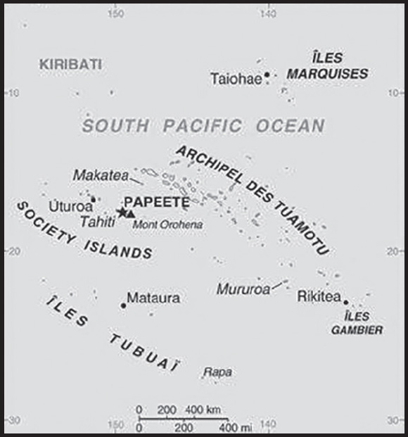
INTRODUCTION
Background: French Polynesia consists of five archipelagos - the Austral Islands, the Gambier Islands, the Marquesas Islands, the Society Islands, and the Tuamotu Archipelago. The Marquesas were first settled around 200 B.C. and the Society Islands around A.D. 300. Raiatea in the Society Islands became a center for religion and culture. Exploration of the other islands emanated from Raiatea and by 1000, there were small permanent settlements in all the island groups. Ferdinand MAGELLAN was the first European to see the islands of French Polynesia in 1520, and successive European voyagers traveled through them over the next two centuries. In 1767, British explorer Samuel WALLIS was the first European to visit Tahiti, followed by French navigator Louis Antoine de BOUGAINVILLE in 1768, and British explorer James COOK in 1769. King POMARE I united Tahiti and surrounding islands into the Kingdom of Tahiti in 1788. Protestant missionaries arrived in 1797 and POMARE I’s successor converted in the 1810s, along with most Tahitians. In the 1830s, Queen POMARE IV refused to allow French Catholic missionaries to operate, leading France to declare a protectorate over Tahiti and fight the French-Tahitian War of the 1840s in an attempt to annex the islands. POMARE IV requested British assistance to fight France, and while the UK did not provide material support, it did diplomatically pressure France to simply maintain its protectorate status.
In 1880, King POMARE V ceded Tahiti and its possessions to France, changing its status into a colony. France then claimed the Gambier Islands and Tuamotu Archipelago and by 1901 had incorporated all five island groups into its establishments in Oceania. A Tahitian nationalist movement formed in 1940, leading France to grant French citizenship to the islanders in 1946 and change it to an overseas territory. In 1957, the islands’ name was changed to French Polynesia and the following year, 64% of voters chose to stay part of France when they approved a new constitution. Uninhabited Mururoa Atoll was established as a French nuclear test site in 1962 and tests were conducted between 1966 and 1992 (underground beginning in 1975). France also conducted tests at Fangataufa Atoll, including its last nuclear test in 1996.
France granted French Polynesia partial internal autonomy in 1977 and expanded autonomy in 1984. French Polynesia was converted into an overseas collectivity in 2003 and renamed an overseas country inside the Republic in 2004. Proindependence politicians won a surprise majority in local elections that same year but in subsequent elections have been relegated to a vocal minority. In 2013, French Polynesia was relisted on the UN List of Non-Self Governing Territories.
GEOGRAPHY
Location: Oceania, five archipelagoes (Archipel des Tuamotu, Iles Gambier, Iles Marquises, Iles Tubuai, Society Islands) in the South Pacific Ocean about halfway between South America and Australia
Geographic coordinates: 15 00 S, 140 00 W
Map references: Oceania
Area: total: 4,167 sq km (118 islands and atolls; 67 are inhabited)
land: 3,827 sq km
water: 340 sq km
comparison ranking: total 174
Area - comparative: slightly less than one-third the size of Connecticut
Land boundaries: total: 0 km
Coastline: 2,525 km
Maritime claims: territorial sea: 12 nm
exclusive economic zone: 200 nm
Climate: tropical, but moderate
Terrain: mixture of rugged high islands and low islands with reefs
Elevation: highest point: Mont Orohena 2,241 m
lowest point: Pacific Ocean 0 m
Natural resources: timber, fish, cobalt, hydropower
Land use: agricultural land: 12.5% (2018 est.)
arable land: 0.7% (2018 est.)
permanent crops: 6.3% (2018 est.)
permanent pasture: 5.5% (2018 est.)
forest: 43.7% (2018 est.)
other: 43.8% (2018 est.)
Irrigated land: 10 sq km (2012)
Population distribution: the majority of the population lives in the Society Islands, one of five archipelagos that includes the most populous island - Tahiti - with approximately 70% of the nation’s population
Natural hazards: occasional cyclonic storms in January
Geography - note: includes five archipelagoes: four volcanic (Iles Gambier, Iles Marquises, Iles Tubuai, Society Islands) and one coral (Archipel des Tuamotu); the Tuamotu Archipelago forms the largest group of atolls in the world - 78 in total, 48 inhabited; Makatea in the Tuamotu Archipelago is one of the three great phosphate rock islands in the Pacific Ocean - the others are Banaba (Ocean Island) in Kiribati and Nauru
PEOPLE AND SOCIETY
Population: 301,488 (2023 est.)
comparison ranking: 181
Nationality: noun: French Polynesian(s)
adjective: French Polynesian
Ethnic groups: Polynesian 78%, Chinese 12%, local French 6%, metropolitan French 4%
Languages: French (official) 73.5%, Tahitian 20.1%, Marquesan 2.6%, Austral languages 1.2%, Paumotu 1%, other 1.6% (2017 est.)
major-language sample(s): The World Factbook, une source indispensable d’informations de base. (French)
Religions: Protestant 54%, Roman Catholic 30%, other 10%, no religion 6%
Age structure: 0-14 years: 20.62% (male 31,923/female 30,250)
15-64 years: 68.79% (male 106,657/female 100,731)
65 years and over: 10.59% (2023 est.) (male 15,567/female 16,360)
Dependency ratios: total dependency ratio: 45.6
youth dependency ratio: 31.6
elderly dependency ratio: 14
potential support ratio: 7.1 (2021 est.)
Median age: total: 33.3 years (2020)
male: 33 years
female: 33.5 years
comparison ranking: total 99
Population growth rate: 0.7% (2023 est.)
comparison ranking: 128
Birth rate: 13.22 births/1,000 population (2023 est.)
comparison ranking: 135
Death rate: 5.67 deaths/1,000 population (2023 est.)
comparison ranking: 173
Net migration rate: -0.61 migrant(s)/1,000 population (2023 est.)
comparison ranking: 128
Population distribution: the majority of the population lives in the Society Islands, one of five archipelagos that includes the most populous island - Tahiti - with approximately 70% of the nation’s population
Urbanization: urban population: 62.3% of total population (2023)
rate of urbanization: 0.65% annual rate of change (2020-25 est.)
Major urban areas - population: 136,000 PAPEETE (capital) (2018)
Sex ratio: at birth: 1.05 male(s)/female
0-14 years: 1.06 male(s)/female
15-64 years: 1.06 male(s)/female
65 years and over: 0.95 male(s)/female
total population: 1.05 male(s)/female (2023 est.)
Infant mortality rate: total: 4.34 deaths/1,000 live births (2023 est.)
male: 5.23 deaths/1,000 live births
female: 3.42 deaths/1,000 live births
comparison ranking: total 183
Life expectancy at birth: total population: 78.66 years (2023 est.)
male: 76.36 years
female: 81.08 years
comparison ranking: total population 70
Total fertility rate: 1.8 children born/woman (2023 est.)
comparison ranking: 144
Gross reproduction rate: 0.88 (2023 est.)
Drinking water source: improved:
total: 100% of population
unimproved: total: 0% of population (2020 est.)
Sanitation facility access: improved:
total: 97% of population
unimproved: total: 3% of population (2020 est.)
Currently married women (ages 15-49): 27.2% (2023 est.)
Youth unemployment rate (ages 15-24): total: 38.9% (2021 est.)
male: 35.4%
female: 43.9%
comparison ranking: total 16
ENVIRONMENT
Environment - current issues: sea level rise; extreme weather events (cyclones, storms, and tsunamis producing floods, landslides, erosion, and reef damage); droughts; fresh water scarcity
Climate: tropical, but moderate
Land use: agricultural land: 12.5% (2018 est.)
arable land: 0.7% (2018 est.)
permanent crops: 6.3% (2018 est.)
permanent pasture: 5.5% (2018 est.)
forest: 43.7% (2018 est.)
other: 43.8% (2018 est.)
Urbanization: urban population: 62.3% of total population (2023)
rate of urbanization: 0.65% annual rate of change (2020-25 est.)
Air pollutants: carbon dioxide emissions: 0.77 megatons (2016 est.)
Waste and recycling: municipal solid waste generated annually: 147,000 tons (2013 est.)
municipal solid waste recycled annually: 57,330 tons (2013 est.)
percent of municipal solid waste recycled: 39% (2013 est.)
GOVERNMENT
Country name: conventional long form: Overseas Lands of French Polynesia
conventional short form: French Polynesia
local long form: Pays d’outre-mer de la Polynesie Francaise
local short form: Polynesie Francaise
former: Establishments in Oceania, French Establishments in Oceania
etymology: the term “Polynesia” is an 18th-century construct composed of two Greek words, “poly” (many) and “nesoi” (islands), and refers to the more than 1,000 islands scattered over the central and southern Pacific Ocean
Government type: parliamentary democracy (Assembly of French Polynesia); an overseas collectivity of France
Dependency status: overseas country of France; note - overseas territory of France from 1946-2003; overseas collectivity of France since 2003, though it is often referred to as an overseas country due to its degree of autonomy
Capital: name: Papeete (located on Tahiti)
geographic coordinates: 17 32 S, 149 34 W
time difference: UTC-10 (5 hours behind Washington, DC, during Standard Time)
etymology: the name means “water basket” and refers to the fact that the islanders originally used calabashes enclosed in baskets to fetch water at a spring in the area
Administrative divisions: 5 administrative subdivisions (subdivisions administratives, singular - subdivision administrative): Iles Australes (Austral Islands), Iles du Vent (Windward Islands), Iles Marquises (Marquesas Islands), Iles Sous-le-Vent (Leeward Islands), Iles Tuamotu-Gambier; note - the Leeward Islands and the Windward Islands together make up the Society Islands (Iles de la Societe)
Independence: none (overseas land of France)
National holiday: Fete de la Federation, 14 July (1790); note - the local holiday is Internal Autonomy Day, 29 June (1880)
Constitution: history: 4 October 1958 (French Constitution)
amendments: French constitution amendment procedures apply
Legal system: the laws of France, where applicable, apply
Citizenship: see France
Suffrage: 18 years of age; universal
Executive branch: chief of state: President Emmanuel MACRON (since 14 May 2017), represented by High Commissioner of the Republic Dominique SORAIN (since 10 July 2019)
head of government: President of French Polynesia Moetai BROTHERSON (since 12 May 2023)
cabinet: Council of Ministers approved by the Assembly from a list of its members submitted by the president
elections/appointments: French president directly elected by absolute majority popular vote in 2 rounds if needed for a 5-year term (eligible for a second term); high commissioner appointed by the French president on the advice of the French Ministry of Interior; French Polynesia president indirectly elected by Assembly of French Polynesia for a 5-year term (no term limits)
Legislative branch: description: unicameral Assembly of French Polynesia or Assemblée de la Polynésie française (57 seats; elections held in 2 rounds; in the second round, 38 members directly elected in multi-seat constituencies by a closed-list proportional representation vote; the party receiving the most votes gets an additional 19 seats; members serve 5-year terms; French Polynesia indirectly elects 2 senators to the French Senate via an electoral college by absolute majority vote for 6-year terms with one-half the membership renewed every 3 years and directly elects 3 deputies to the French National Assembly by absolute majority vote in 2 rounds if needed for 5-year terms
elections: Assembly of French Polynesia - last held on 16 and 30 April 2023 (next to be held in 2028)
French Senate - last held on 24 September 2023 (next to be held on 30 September 2026)
French National Assembly - last held in 2 rounds on 12 and 19 June 2022 (next to be held in 2027)
election results: Assembly of French Polynesia - percent of vote by party - People’s Servant Party 66.7%; List of the People 26.3%, I Love Polynesia 5.3%, Rally of Mahoi People 1.8%; seats by party - People’s Servant People 38; List of the People 15, I Love Polynesia 3, Rally of the Mahoi People 1, composition - men 27, women 30, percent of women 52.6%
French Senate - percent of vote by party - NA; seats by party - Popular Rally 1, People’s Servant Party 1; composition - NA
French National Assembly - percent of vote by party - NA; seats by party - People’s Servant Party 3; composition - NA
Judicial branch: highest court(s): Court of Appeal or Cour d’Appel (composition NA); note - appeals beyond the French Polynesia Court of Appeal are heard by the Court of Cassation (in Paris)
judge selection and term of office: judges assigned from France normally for 3 years
subordinate courts: Court of the First Instance or Tribunal de Premiere Instance; Court of Administrative Law or Tribunal Administratif
Political parties and leaders: I Love Polynesia (A here la Porinetia) [Nicole SANQUER]
List of the People (Tapura Huiraatira) [Edouard FRITCH]
People’s Servant Party (Tavini Huiraatira) [Oscar TEMARU]
Rally of the Maohi People (Amuitahira’a o te Nuna’a Maohi) [Gaston FLOSSE] (formerly known as Popular Rally (Tahoeraa Huiraatira))
International organization participation: ITUC (NGOs), PIF (associate member), SPC, UPU, WMO
Diplomatic representation in the US: none (overseas lands of France)
Diplomatic representation from the US: embassy: none (overseas lands of France)
Flag description: two red horizontal bands encase a wide white band in a 1:2:1 ratio; centered on the white band is a disk with a blue and white wave pattern depicting the sea on the lower half and a gold and white ray pattern depicting the sun on the upper half; a Polynesian canoe rides on the wave pattern; the canoe has a crew of five represented by five stars that symbolize the five island groups; red and white are traditional Polynesian colors
note: identical to the red-white-red flag of Tahiti, the largest and most populous of the islands in French Polynesia, but which has no emblem in the white band; the flag of France is used for official occasions
National symbol(s): outrigger canoe, Tahitian gardenia (Gardenia taitensis) flower; national colors: red, white
National anthem: name: “Ia Ora ‘O Tahiti Nui” (Long Live Tahiti Nui)
lyrics/music: Maeva BOUGES, Irmine TEHEI, Angele TEROROTUA, Johanna NOUVEAU, Patrick AMARU, Louis MAMATUI, and Jean-Pierre CELESTIN (the compositional group created both the lyrics and music)
note: adopted 1993; serves as a local anthem; as a territory of France, “La Marseillaise” is official (see France)
National heritage: total World Heritage Sites: 1 (cultural); note - excerpted from the France entry
selected World Heritage Site locales: Taputapuātea
Government - note: under certain acts of France, French Polynesia has acquired autonomy in all areas except those relating to police, monetary policy, tertiary education, immigration, and defense and foreign affairs; the duties of its president are fashioned after those of the French prime minister
ECONOMY
Economic overview: small, territorial-island tourism-based economy; large French financing; lower EU import duties; Pacific Islands Forum member; fairly resilient from COVID-19; oil-dependent infrastructure
Real GDP (purchasing power parity): $5.65 billion (2021 est.)
$5.52 billion (2020 est.)
$5.94 billion (2019 est.)
note: data are in 2015 dollars
comparison ranking: 174
Real GDP growth rate: 1.02% (2021 est.)
-10% (2020 est.)
2.42% (2019 est.)
comparison ranking: 184
Real GDP per capita: $18,600 (2021 est.)
$18,300 (2020 est.)
$19,800 (2019 est.)
note: data are in 2015 dollars
comparison ranking: 98
GDP (official exchange rate)
$4.795 billion (2015 est.)
Inflation rate (consumer prices): 0% (2015 est.)
0.3% (2014 est.)
comparison ranking: 214
GDP - composition, by sector of origin
agriculture: 2.5% (2009)
industry: 13% (2009)
services: 84.5% (2009)
comparison rankings: services 20; industry 193; agriculture 161
GDP - composition, by end use
household consumption: 66.9% (2014 est.)
government consumption: 33.6% (2014 est.)
investment in fixed capital: 19.4% (2014 est.)
investment in inventories: 0.1% (2014 est.)
exports of goods and services: 17.5% (2014 est.)
imports of goods and services: -37.5% (2014 est.)
Agricultural products: coconuts, fruit, roots/tubers, pineapples, cassava, sugar cane, eggs, tropical fruit, tomatoes
Industries: tourism, pearls, agricultural processing, handicrafts, phosphates
Industrial production growth rate: NA
Labor force: 130,100 (2021 est.)
comparison ranking: 182
Labor force - by occupation: agriculture: 13%
industry: 19%
services: 68% (2013 est.)
Unemployment rate: 14.39% (2021 est.)
14.1% (2020 est.)
12.3% (2019 est.)
comparison ranking: 40
Youth unemployment rate (ages 15-24): total: 38.9% (2021 est.)
male: 35.4%
female: 43.9%
comparison ranking: total 16
Population below poverty line: 19.7% (2009 est.)
Budget: revenues: $1.891 billion (2012)
expenditures: $1.833 billion (2011)
Budget surplus (+) or deficit (-): 1.2% (of GDP) (2012)
comparison ranking: 28
Taxes and other revenues: 39.4% (of GDP) (2012)
comparison ranking: 13
Fiscal year: calendar year
Current account balance: $411.963 million (2016 est.)
$158.8 million (2013 est.)
comparison ranking: 60
Exports: $162 million (2021 est.)
$94.4 million (2020 est.)
$184 million (2019 est.)
comparison ranking: 204
Exports - partners: United States 47%, Japan 17%, France 14%, Netherlands 4%, Poland 3% (2021)
Exports - commodities: paintings, pearls, tuna, aircraft parts, coconut oil, vanilla, electrical panels (2021)
Imports: $1.66 billion (2021 est.)
$1.75 billion (2020 est.)
$2.24 billion (2019 est.)
comparison ranking: 179
Imports - partners: France 43%, New Zealand 12%, China 8%, United States 6%, Singapore 5% (2021)
Imports - commodities: refined petroleum, cars, packaged medicines, broadcasting equipment, passenger ships (2021)
Debt - external: NA
Exchange rates: Comptoirs Francais du Pacifique francs (XPF) per US dollar -
Exchange rates: 100.88 (2021 est.)
104.711 (2020 est.)
106.589 (2019 est.)
101.047 (2018 est.)
105.633 (2017 est.)
ENERGY
Electricity access: electrification - total population: 100% (2020)
Electricity: installed generating capacity: 272,000 kW (2020 est.)
consumption: 639.7 million kWh (2019 est.)
exports: 0 kWh (2019 est.)
imports: 0 kWh (2019 est.)
transmission/distribution losses: 41 million kWh (2019 est.)
comparison rankings: installed generating capacity 164; transmission/distribution losses 172; imports 152; exports 140; consumption 166
Electricity generation sources: fossil fuels: 66.5% of total installed capacity (2020 est.)
solar: 6.1% of total installed capacity (2020 est.)
hydroelectricity: 27.4% of total installed capacity (2020 est.)
Petroleum: total petroleum production: 0 bbl/day (2021 est.)
refined petroleum consumption: 6,700 bbl/day (2019 est.)
Refined petroleum products - imports: 6,785 bbl/day (2015 est.)
comparison ranking: 160
Carbon dioxide emissions: 1.03 million metric tonnes of CO2 (2019 est.)
from petroleum and other liquids: 1.03 million metric tonnes of CO2 (2019 est.)
comparison ranking: total emissions 172
Energy consumption per capita: 0 Btu/person (2019 est.)
comparison ranking: 204
COMMUNICATIONS
Telephones - fixed lines: total subscriptions: 108,051 (2021 est.)
subscriptions per 100 inhabitants: 36 (2021 est.)
comparison ranking: total subscriptions 136
Telephones - mobile cellular: total subscriptions: 322,918 (2021 est.)
subscriptions per 100 inhabitants: 106 (2021 est.)
comparison ranking: total subscriptions 178
Telecommunication systems: general assessment: French Polynesia has one of the most advanced telecoms infrastructures in the Pacific Islands region; the remoteness of the country with its scattering of 130 islands and atolls has made connectivity vital for its inhabitants; the first submarine cable was deployed in 2010 and since then additional cables have been connected to the islands, vastly improving French Polynesia’s international connectivity; an additional domestic submarine cable, the Natitua Sud, will connect more remote islands by the end of 2022; French Polynesia is also a hub for satellite communications in the region; a considerable number of consumers access FttP-based services; with the first data center in French Polynesia on the cards, the quality and price of broadband services is expected to improve as content will be able to be cached locally, reducing costs for consumers; for 2022, fixed broadband subscriptions reached an estimated 22%; about 43% of the country’s mobile connections are on 3G networks, while LTE accounts for 12%; by 2025, LTE is expected to account for more than half of all connections; it is also estimated that 77% of mobile subscribers will have smart phones by 2025 (2022)
domestic: fixed-line subscriptions nearly 36 per 100 persons and mobile-cellular density is roughly 106 per 100 persons (2021)
international: country code - 689; landing points for the NATITUA, Manatua, and Honotua submarine cables to other French Polynesian Islands, Cook Islands, Niue, Samoa and US; satellite earth station - 1 Intelsat (Pacific Ocean) (2019)
Broadcast media: French public overseas broadcaster Reseau Outre-Mer provides 2 TV channels and 1 radio station; 1 government-owned TV station; a small number of privately owned radio stations (2019)
Internet country code: .pf
Internet users: total: 218,100 (2021 est.)
percent of population: 72.7% (2021 est.)
comparison ranking: total 180
Broadband - fixed subscriptions: total: 64,000 (2020 est.)
subscriptions per 100 inhabitants: 23 (2020 est.)
comparison ranking: total 138
TRANSPORTATION
National air transport system: number of registered air carriers: 2 (2020) (registered in France)
inventory of registered aircraft operated by air carriers: 19 (registered in France)
Civil aircraft registration country code prefix: F-OH
Airports: 54 (2021)
comparison ranking: total 85
Airports - with paved runways: 45
note: paved runways have a concrete or asphalt surface but not all have facilities for refueling, maintenance, or air traffic control; the length of a runway required for aircraft to safely operate depends on a number of factors including the type of aircraft, the takeoff weight (including passengers, cargo, and fuel), engine types, flap settings, landing speed, elevation of the airport, and average maximum daily air temperature; paved runways can reach a length of 5,000 m (16,000 ft.), but the “typical” length of a commercial airline runway is between 2,500-4,000 m (8,000-13,000 ft.)
Airports - with unpaved runways: 9
note: unpaved runways have a surface composition such as grass or packed earth and are most suited to the operation of light aircraft; unpaved runways are usually short, often less than 1,000 m (3,280 ft.) in length; airports with unpaved runways often lack facilities for refueling, maintenance, or air traffic control
Heliports: 1 (2021)
Roadways: total: 2,590 km (1999)
paved: 1,735 km (1999)
unpaved: 855 km (1999)
comparison ranking: total 168
Merchant marine: total: 25 (2022)
by type: general cargo 14, other 11
comparison ranking: total 142
Ports and terminals: major seaport(s): Papeete
MILITARY AND SECURITY
Military and security forces: no regular military forces
Military - note: defense is the responsibility of France; France maintains forces (about 900 troops) in French Polynesia
TRANSNATIONAL ISSUES
Disputes - international: none identified
FRENCH SOUTHERN AND ANTARCTIC LANDS
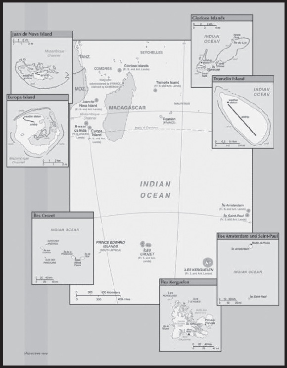
INTRODUCTION
Background: In February 2007, the Iles Eparses became an integral part of the French Southern and Antarctic Lands (TAAF). The Southern Lands are now divided into five administrative districts, two of which are archipelagos, Iles Crozet and Iles Kerguelen; the third is a district composed of two volcanic islands, Ile Saint-Paul and Ile Amsterdam; the fourth, Iles Eparses, consists of five scattered tropical islands around Madagascar. They contain no permanent inhabitants and are visited only by researchers studying the native fauna, scientists at the various scientific stations, fishermen, and military personnel. The fifth district is the Antarctic portion, which consists of “Adelie Land,” a thin slice of the Antarctic continent discovered and claimed by the French in 1840.
Ile Amsterdam: Discovered but not named in 1522 by the Spanish, the island subsequently received the appellation of Nieuw Amsterdam from a Dutchman; it was claimed by France in 1843. A short-lived attempt at cattle farming began in 1871. A French meteorological station established on the island in 1949 is still in use.
Ile Saint Paul: Claimed by France since 1893, the island was a fishing industry center from 1843 to 1914. In 1928, a spiny lobster cannery was established, but when the company went bankrupt in 1931, seven workers were abandoned. Only two survived until 1934 when rescue finally arrived.
Iles Crozet: A large archipelago formed from the Crozet Plateau, Iles Crozet is divided into two main groups: L’Occidental (the West), which includes Ile aux Cochons, Ilots des Apotres, Ile des Pingouins, and the reefs Brisants de I’Heroine; and L’Oriental (the East), which includes Ile d’Est and Ile de la Possession (the largest island of the Crozets). Discovered and claimed by France in 1772, the islands were used for seal hunting and as a base for whaling. Originally administered as a dependency of Madagascar, they became part of the TAAF in 1955.
Iles Kerguelen: This island group, discovered in 1772, consists of one large island (Ile Kerguelen) and about 300 smaller islands. A permanent group of 50 to 100 scientists resides at the main base at Port-aux-Francais.
Adelie Land: The only non-insular district of the TAAF is the Antarctic claim known as “Adelie Land.” The US Government does not recognize it as a French dependency.
Bassas da India: A French possession since 1897, this atoll is a volcanic rock surrounded by reefs and is awash at high tide.
Europa Island: This heavily wooded island has been a French possession since 1897; it is the site of a small military garrison that staffs a weather station.
Glorioso Islands: A French possession since 1892, the Glorioso Islands are composed of two lushly vegetated coral islands (Ile Glorieuse and Ile du Lys) and three rock islets. A military garrison operates a weather and radio station on Ile Glorieuse.
Juan de Nova Island: Named after a famous 15th-century Spanish navigator and explorer, the island has been a French possession since 1897. It has been exploited for its guano and phosphate. Presently a small military garrison oversees a meteorological station.
Tromelin Island: First explored by the French in 1776, the island came under the jurisdiction of Reunion in 1814. At present, it serves as a sea turtle sanctuary and is the site of an important meteorological station.
GEOGRAPHY
Location: southeast and east of Africa, islands in the southern Indian Ocean, some near Madagascar and others about equidistant between Africa, Antarctica, and Australia; note - French Southern and Antarctic Lands include Ile Amsterdam, Ile Saint-Paul, Iles Crozet, Iles Kerguelen, Bassas da India, Europa Island, Glorioso Islands, Juan de Nova Island, and Tromelin Island in the southern Indian Ocean, along with the French-claimed sector of Antarctica, “Adelie Land”; the US does not recognize the French claim to “Adelie Land”
Geographic coordinates: Ile Amsterdam (Ile Amsterdam et Ile Saint-Paul): 37 50 S, 77 32 E;
Ile Saint-Paul (Ile Amsterdam et Ile Saint-Paul): 38 72 S, 77 53 E;
Iles Crozet: 46 25 S, 51 00 E;
Iles Kerguelen: 49 15 S, 69 35 E;
Bassas da India (Iles Eparses): 21 30 S, 39 50 E;
Europa Island (Iles Eparses): 22 20 S, 40 22 E;
Glorioso Islands (Iles Eparses): 11 30 S, 47 20 E;
Juan de Nova Island (Iles Eparses): 17 03 S, 42 45 E;
Tromelin Island (Iles Eparses): 15 52 S, 54 25 E
Map references: Antarctic RegionAfrica
Area: Ile Amsterdam (Ile Amsterdam et Ile Saint-Paul): total - 55 sq km; land - 55 sq km; water - 0 sq km
Ile Saint-Paul (Ile Amsterdam et Ile Saint-Paul): total - 7 sq km; land - 7 sq km; water - 0 sq km
Iles Crozet: total - 352 sq km; land - 352 sq km; water - 0 sq km
Iles Kerguelen: total - 7,215 sq km; land - 7,215 sq km; water - 0 sq km
Bassas da India (Iles Eparses): total - 80 sq km; land - 0.2 sq km; water - 79.8 sq km (lagoon)
Europa Island (Iles Eparses): total - 28 sq km; land - 28 sq km; water - 0 sq km
Glorioso Islands (Iles Eparses): total - 5 sq km; land - 5 sq km; water - 0 sq km
Juan de Nova Island (Iles Eparses): total - 4.4 sq km; land - 4.4 sq km; water - 0 sq km
Tromelin Island (Iles Eparses): total - 1 sq km; land - 1 sq km; water - 0 sq km
note: excludes “Adelie Land” claim of about 500,000 sq km in Antarctica that is not recognized by the US
Area - comparative: Ile Amsterdam (Ile Amsterdam et Ile Saint-Paul): less than one-half the size of Washington, DC;
Ile Saint-Paul (Ile Amsterdam et Ile Saint-Paul): more than 10 times the size of the National Mall in Washington, DC;
Iles Crozet: about twice the size of Washington, DC;
Iles Kerguelen: slightly larger than Delaware;
Bassas da India (Iles Eparses): land area about one-third the size of the National Mall in Washington, DC;
Europa Island (Iles Eparses): about one-sixth the size of Washington, DC;
Glorioso Islands (Iles Eparses): about eight times the size of the National Mall in Washington, DC;
Juan de Nova Island (Iles Eparses): about seven times the size of the National Mall in Washington, DC;
Tromelin Island (Iles Eparses): about 1.7 times the size of the National Mall in Washington, DC
Land boundaries: total: 0 km
Coastline: Ile Amsterdam (Ile Amsterdam et Ile Saint-Paul): 28 km
Ile Saint-Paul (Ile Amsterdam et Ile Saint-Paul): Iles Kerguelen: 2,800 km
Bassas da India (Iles Eparses): 35.2 km
Europa Island (Iles Eparses): 22.2 km
Glorioso Islands (Iles Eparses): 35.2 km
Juan de Nova Island (Iles Eparses): 24.1 km
Tromelin Island (Iles Eparses): 3.7 km
Maritime claims: territorial sea: 12 nm
exclusive economic zone: 200 nm from Iles Kerguelen and Iles Eparses (does not include the rest of French Southern and Antarctic Lands); Juan de Nova Island and Tromelin Island claim a continental shelf of 200-m depth or to the depth of exploitation
Climate: Ile Amsterdam et Ile Saint-Paul: oceanic with persistent westerly winds and high humidity;
Iles Crozet: windy, cold, wet, and cloudy;
Iles Kerguelen: oceanic, cold, overcast, windy;
Iles Eparses: tropical
Terrain: Ile Amsterdam (Ile Amsterdam et Ile Saint-Paul): a volcanic island with steep coastal cliffs; the center floor of the volcano is a large plateau;
Ile Saint-Paul (Ile Amsterdam et Ile Saint-Paul): triangular in shape, the island is the top of a volcano, rocky with steep cliffs on the eastern side; has active thermal springs;
Iles Crozet: a large archipelago formed from the Crozet Plateau is divided into two groups of islands;
Iles Kerguelen: the interior of the large island of Ile Kerguelen is composed of high mountains, hills, valleys, and plains with peninsulas stretching off its coasts;
Bassas da India (Iles Eparses): atoll, awash at high tide; shallow (15 m) lagoon;
Europa Island, Glorioso Islands, Juan de Nova Island: low, flat, and sandy;
Tromelin Island (Iles Eparses): low, flat, sandy; likely volcanic seamount
Elevation: highest point: Mont de la Dives on Ile Amsterdam (Ile Amsterdam et Ile Saint- Paul) 867 m
lowest point: Indian Ocean 0 m
highest points throughout the French Southern and Antarctic Lands: unnamed location on Ile Saint-Paul (Ile Amsterdam et Ile Saint-Paul) 272 m; Pic Marion-Dufresne in Iles Crozet 1090 m; Mont Ross in Iles Kerguelen 1850 m; unnamed location on Bassas de India (Iles Eparses) 2.4 m;24 unnamed location on Europa Island (Iles Eparses) 24 m; unnamed location on Glorioso Islands (Iles Eparses) 12 m; unnamed location on Juan de Nova Island (Iles Eparses) 10 m; unnamed location on Tromelin Island (Iles Eparses) 7 m
Natural resources: fish, crayfish, note, Glorioso Islands and Tromelin Island (Iles Eparses) have guano, phosphates, and coconuts
note: in the 1950’s and 1960’s, several species of trout were introduced to Iles Kerguelen of which two, Brown trout and Brook trout, survived to establish wild populations; reindeer were also introduced to Iles Kerguelen in 1956 as a source of fresh meat for whaling crews, the herd today, one of two in the Southern Hemisphere, is estimated to number around 4,000
Natural hazards: Ile Amsterdam and Ile Saint-Paul are inactive volcanoes; Iles Eparses subject to periodic cyclones; Bassas da India is a maritime hazard since it is under water for a period of three hours prior to and following the high tide and surrounded by reefs
volcanism: Reunion Island - Piton de la Fournaise (2,632 m), which has erupted many times in recent years including 2010, 2015, and 2017, is one of the world’s most active volcanoes; although rare, eruptions outside the volcano’s caldera could threaten nearby cities
Geography - note: islands’ component is widely scattered across remote locations in the southern Indian Ocean
Bassas da India (Iles Eparses): atoll is a circular reef atop a long-extinct, submerged volcano;
Europa Island and Juan de Nova Island (Iles Eparses): wildlife sanctuary for seabirds and sea turtles;
Glorioso Island (Iles Eparses): islands and rocks are surrounded by an extensive reef system;
Tromelin Island (Iles Eparses): climatologically important location for forecasting cyclones in the western Indian Ocean; wildlife sanctuary (seabirds, tortoises)
PEOPLE AND SOCIETY
Population: no indigenous inhabitants
Ile Amsterdam (Ile Amsterdam et Ile Saint-Paul): uninhabited but has a meteorological station
Ile Saint-Paul (Ile Amsterdam et Ile Saint-Paul): uninhabited but is frequently visited by fishermen and has a scientific research cabin for short stays
Iles Crozet: uninhabited except for 18 to 30 people staffing the Alfred Faure research station on Ile del la Possession
Iles Kerguelen: 50 to 100 scientists are located at the main base at Port-aux-Francais on Ile Kerguelen
Bassas da India (Iles Eparses): uninhabitable
Europa Island, Glorioso Islands, Juan de Nova Island (Iles Eparses): a small French military garrison and a few meteorologists on each possession; visited by scientists
Tromelin Island (Iles Eparses): uninhabited, except for visits by scientists
ENVIRONMENT
Environment - current issues: introduction of foreign species on Iles Crozet has caused severe damage to the original ecosystem; overfishing of Patagonian toothfish around Iles Crozet and Iles Kerguelen
Climate: Ile Amsterdam et Ile Saint-Paul: oceanic with persistent westerly winds and high humidity;
Iles Crozet: windy, cold, wet, and cloudy;
Iles Kerguelen: oceanic, cold, overcast, windy;
Iles Eparses: tropical
GOVERNMENT
Country name: conventional long form: Territory of the French Southern and Antarctic Lands
conventional short form: French Southern and Antarctic Lands
local long form: Territoire des Terres Australes et Antarctiques Francaises
local short form: Terres Australes et Antarctiques Francaises
abbreviation: TAAF
etymology: self-descriptive name specifying the territories’ affiliation and location in the Southern Hemisphere
Dependency status: overseas territory of France since 1955
Administrative divisions: none (overseas territory of France); there are no first-order administrative divisions as defined by the US Government, but there are 5 administrative districts named Iles Crozet, Iles Eparses, Iles Kerguelen, Ile Saint-Paul et Ile Amsterdam; the fifth district is the “Adelie Land” claim in Antarctica that is not recognized by the US
Legal system: the laws of France, where applicable, apply
Citizenship: see France
Executive branch: chief of state: President Emmanuel MACRON (since 14 May 2017), represented by Prefect Florence JEANBLANC- RISLER (since 5 October 2022)
International organization participation: UPU
Diplomatic representation in the US: none (overseas territory of France)
Diplomatic representation from the US: embassy: none (overseas territory of France)
Flag description: the flag of France is used
National anthem: note: as a territory of France, “La Marseillaise” is official (see France)
ECONOMY
Economic overview: very small, fishing-based, domestic economic activity; military base servicing
COMMUNICATIONS
Internet country code: .tf
Communications - note: has one or more meteorological stations on each possession
TRANSPORTATION
Airports: 4 (2021)
comparison ranking: total 186
Airports - with unpaved runways: 4
note 1: 1 - Europa Island, 1 - Glorioso Islands, 1 - Juan de Nova Island, 1 - Tromelin Island
note 2: unpaved runways have a surface composition such as grass or packed earth and are most suited to the operation of light aircraft; unpaved runways are usually short, often less than 1,000 m (3,280 ft.) in length; airports with unpaved runways often lack facilities for refueling, maintenance, or air traffic control
Heliports: 3 (2022)
Note: 1 - Ile Amsterdam, 1 - Ile Kerguelen, 1 - Ile de la Possession
Merchant marine: total: 2 (2022)
by type: other 2
comparison ranking: total 178
Ports and terminals: none; offshore anchorage only
MILITARY AND SECURITY
Military - note: defense is the responsibility of France; French forces on Mayotte, the Détachement de Légion Étrangère de Mayotte (DLEM), regularly deploys small elements for periodic rotations to Europa Island, Glorioso Islands, Juan de Nova Island, and Tromelin Island
TRANSNATIONAL ISSUES
Disputes - international: French claim to “Adelie Land” in Antarctica is not recognized by the US;
Bassas da India, Europa Island, Glorioso Islands, Juan de Nova Island (Iles Eparses): ; claimed by Madagascar; the vegetated drying cays of Banc du Geyser, which were claimed by Madagascar in 1976, also fall within the EEZ claims of the Comoros and France (Glorioso Islands); ;
Tromelin Island (Iles Eparses): ; claimed by Mauritius