INTRODUCTION
Background: Strategically important, Gibraltar was reluctantly ceded to Great Britain by Spain in the 1713 Treaty of Utrecht; the British garrison was formally declared a colony in 1830. In a referendum held in 1967, Gibraltarians voted overwhelmingly to remain a British dependency. The subsequent granting of autonomy in 1969 by the UK led Spain to close the border and sever all communication links. Between 1997 and 2002, the UK and Spain held a series of talks on establishing temporary joint sovereignty over Gibraltar. In response to these talks, the Gibraltar Government called a referendum in late 2002 in which the majority of citizens voted overwhelmingly against any sharing of sovereignty with Spain. Since late 2004, Spain, the UK, and Gibraltar have held tripartite talks with the aim of cooperatively resolving problems that affect the local population, and work continues on cooperation agreements in areas such as taxation and financial services; communications and maritime security; policy; legal and customs services; environmental protection; and education and visa services. A new noncolonial constitution came into force in 2007, and the European Court of First Instance recognized Gibraltar’s right to regulate its own tax regime in December 2008. The UK retains responsibility for defense, foreign relations, internal security, and financial stability.
Spain and the UK continue to spar over the territory. Throughout 2009, a dispute over Gibraltar’s claim to territorial waters extending out three miles gave rise to periodic non-violent maritime confrontations between Spanish and UK naval patrols, and in 2013, the British reported a record number of entries by Spanish vessels into waters claimed by Gibraltar following a dispute over Gibraltar’s creation of an artificial reef in those waters. Spain renewed its demands for an eventual return of Gibraltar to Spanish control after the UK’s June 2016 vote to leave the EU, but London has dismissed any connection between the vote and its continued sovereignty over Gibraltar.
GEOGRAPHY
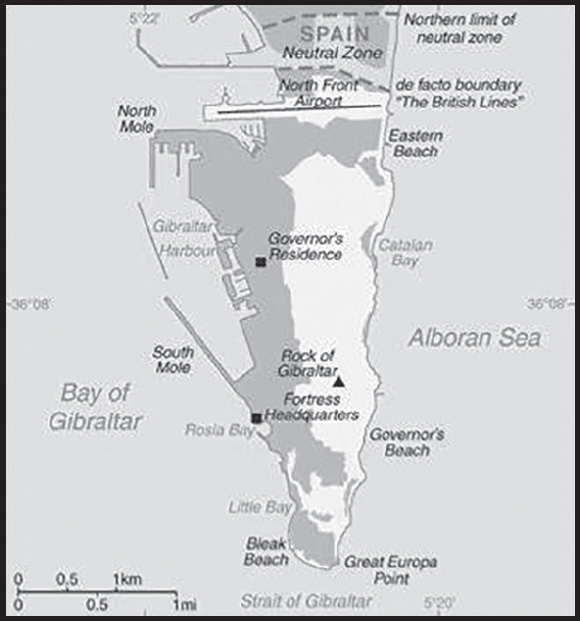
Location: Southwestern Europe, bordering the Strait of Gibraltar, which links the Mediterranean Sea and the North Atlantic Ocean, on the southern coast of Spain
Geographic coordinates: 36 08 N, 5 21 W
Map references: Europe
Area: total: 7 sq km
land: 6.5 sq km
water: 0 sq km
comparison ranking: total 245
Area - comparative: more than 10 times the size of The National Mall in Washington, D.C.
Land boundaries: total: 1.2 km
border countries (1): Spain 1.2 km
Coastline: 12 km
Maritime claims: territorial sea: 3 nm
Climate: Mediterranean with mild winters and warm summers
Terrain: a narrow coastal lowland borders the Rock of Gibraltar
Elevation: highest point: Rock of Gibraltar 426 m
lowest point: Mediterranean Sea 0 m
Natural resources: none
Land use: agricultural land: 0% (2011 est.)
other: 100% (2018 est.)
Natural hazards: occasional droughts; no streams or large bodies of water on the peninsula (all potable water comes from desalination)
Geography - note: note 1: strategic location on Strait of Gibraltar that links the North Atlantic Ocean and Mediterranean Sea
note 2: one of only two British territories where traffic drives on the right, the other being the island of Diego Garcia in the British Indian Ocean Territory
PEOPLE AND SOCIETY
Population: 29,629 (2023 est.)
comparison ranking: 217
Nationality: noun: Gibraltarian(s)
adjective: Gibraltar
Ethnic groups: Gibraltarian 79%, other British 13.2%, Spanish 2.1%, Moroccan 1.6%, other EU 2.4%, other 1.6% (2012 est.)
note: data represent population by nationality
Languages: English (used in schools and for official purposes), Spanish, Italian, Portuguese
Religions: Roman Catholic 72.1%, Church of England 7.7%, other Christian 3.8%, Muslim 3.6%, Jewish 2.4%, Hindu 2%, other 1.1%, none 7.1%, unspecified 0.1% (2012 est.)
Age structure: 0-14 years: 19.99% (male 3,034/female 2,888)
15-64 years: 62.62% (male 9,357/female 9,197)
65 years and over: 17.39% (2023 est.) (male 2,523/female 2,630)
Dependency ratios: total dependency ratio: 60.1
youth dependency ratio: 27.4
elderly dependency ratio: 32.7
potential support ratio: 3.1 (2021)
Median age: total: 35.5 years (2020)
male: 34.4 years
female: 36.6 years
comparison ranking: total 83
Population growth rate: 0.19% (2023 est.)
comparison ranking: 178
Birth rate: 13.84 births/1,000 population (2023 est.)
comparison ranking: 128
Death rate: 8.74 deaths/1,000 population (2023 est.)
comparison ranking: 68
Net migration rate: -3.24 migrant(s)/1,000 population (2023 est.)
comparison ranking: 186
Urbanization: urban population: 100% of total population (2023)
rate of urbanization: 0.45% annual rate of change (2015-20 est.)
Major urban areas - population: 35,000 GIBRALTAR (capital) (2018)
Sex ratio: at birth: 1.05 male(s)/female
0-14 years: 1.05 male(s)/female
15-64 years: 1.02 male(s)/female
65 years and over: 0.96 male(s)/female
total population: 1.01 male(s)/female (2023 est.)
Infant mortality rate: total: 6.13 deaths/1,000 live births (2023 est.)
male: 6.92 deaths/1,000 live births
female: 5.3 deaths/1,000 live births
comparison ranking: total 169
Life expectancy at birth: total population: 80.65 years (2023 est.)
male: 77.82 years
female: 83.62 years
comparison ranking: total population 50
Total fertility rate: 1.9 children born/woman (2023 est.)
comparison ranking: 124
Gross reproduction rate: 0.93 (2023 est.)
Drinking water source: improved: total: 100% of population
unimproved: total: 0% of population (2020)
Sanitation facility access: improved: total: 100% of population
unimproved: total: 0% of population (2020)
Currently married women (ages 15-49): 40.7% (2023 est.)
ENVIRONMENT
Environment - current issues: limited natural freshwater resources: more than 90% of drinking water supplied by desalination, the remainder from stored rainwater; a separate supply of saltwater used for sanitary services
Climate: Mediterranean with mild winters and warm summers
Land use: agricultural land: 0% (2011 est.)
other: 100% (2018 est.)
Urbanization: urban population: 100% of total population (2023)
rate of urbanization: 0.45% annual rate of change (2015-20 est.)
Air pollutants: carbon dioxide emissions: 0.63 megatons (2016 est.)
Waste and recycling: municipal solid waste generated annually: 16,954 tons (2012 est.)
GOVERNMENT
Country name: conventional long form: none
conventional short form: Gibraltar
etymology: from the Spanish derivation of the Arabic “Jabal Tariq,” which means “Mountain of Tariq” and which refers to the Rock of Gibraltar
Government type: parliamentary democracy (Parliament); self-governing overseas territory of the UK
Dependency status: overseas territory of the UK
Capital: name: Gibraltar
geographic coordinates: 36 08 N, 5 21 W
time difference: UTC+1 (6 hours ahead of Washington, DC, during Standard Time)
daylight saving time: +1hr, begins last Sunday in March; ends last Sunday in October
etymology: from the Spanish derivation of the Arabic “Jabal Tariq,” which means “Mountain of Tariq” and which refers to the Rock of Gibraltar
Administrative divisions: none (overseas territory of the UK)
Independence: none (overseas territory of the UK)
National holiday: National Day, 10 September (1967); note - day of the national referendum to decide whether to remain with the UK or join Spain
Constitution: history: previous 1969; latest passed by referendum 30 November 2006, entered into effect 14 December 2006, entered into force 2 January 2007
amendments: proposed by Parliament and requires prior consent of the British monarch (through the Secretary of State); passage requires at least three-fourths majority vote in Parliament followed by simple majority vote in a referendum; note – only sections 1 through 15 in Chapter 1 (Protection of Fundamental Rights and Freedoms) can be amended by Parliament
Legal system: the laws of the UK, where applicable, apply
Citizenship: see United Kingdom
Suffrage: 18 years of age; universal; and British citizens with six months residence or more
Executive branch: chief of state: King CHARLES III (since 8 September 2022); represented by Governor Sir David STEEL (since 11 June 2020)
head of government: Chief Minister Fabian PICARDO (since 9 December 2011)
cabinet: Council of Ministers appointed from among the 17 elected members of Parliament by the governor in consultation with the chief minister
elections/appointments: the monarchy is hereditary; governor appointed by the monarch; following legislative elections, the leader of the majority party or majority coalition usually appointed chief minister by the governor
Legislative branch: description: unicameral Parliament (18 seats; 17 members directly elected in a single nationwide constituency by majority vote and 1 appointed by Parliament as speaker; members serve 4-year terms)
elections: last held on 17 October 2019 (next to be held by February 2024)
election results: percent of vote by party - GSLP-Liberal Alliance 58.8% (GSLP 41.2%, LPG 17.6%), GSD 35.3%, TG 5.8%, independent 1.4%; seats by party - GSLP-Liberal Alliance 10 (GSLP 7, LPG 3), GSD 6, TG 1; composition including Parliament speaker - men 16, women 2, percent of women 11.1%
Judicial branch: highest court(s): Court of Appeal (consists of at least 3 judges, including the court president); Supreme Court of Gibraltar (consists of the chief justice and 3 judges); note - appeals beyond the Court of Appeal are heard by the Judicial Committee of the Privy Council (in London)
judge selection and term of office: Court of Appeal and Supreme Court judges appointed by the governor upon the advice of the Judicial Service Commission, a 7-member body of judges and appointees of the governor; tenure of the Court of Appeal president based on terms of appointment; Supreme Court chief justice and judges normally appointed until retirement at age 67 but tenure can be extended 3 years
subordinate courts: Court of First Instance; Magistrates’ Court; specialized tribunals for issues relating to social security, taxes, and employment
Political parties and leaders: Gibraltar Liberal Party or Liberal Party of Gibraltar or LPG [Joseph GARCIA]
Gibraltar Social Democrats or GSD [Keith AZOPARDI]
Gibraltar Socialist Labor Party or GSLP [Fabian PICARDO]
Together Gibraltar or TG [Marlene HASSAN-NAHON]
International organization participation: ICC (NGOs), Interpol (subbureau), UPU
Diplomatic representation in the US: none (overseas territory of the UK)
Diplomatic representation from the US: embassy: none (overseas territory of the UK)
Flag description: two horizontal bands of white (top, double width) and red with a three-towered red castle in the center of the white band; hanging from the castle gate is a gold key centered in the red band; the design is that of Gibraltar’s coat of arms granted on 10 July 1502 by King Ferdinand and Queen Isabella of Spain; the castle symbolizes Gibraltar as a fortress, while the key represents Gibraltar’s strategic importance - the key to the Mediterranean
National symbol(s): Barbary macaque; national colors: red, white, yellow
National anthem: name: “Gibraltar Anthem”
lyrics/music: Peter EMBERLEY
note: adopted 1994; serves as a local anthem; as an overseas territory of the United Kingdom, “God Save the King” is official (see United Kingdom)
ECONOMY
Economic overview: British territorial high-income economy; Brexit caused significant economic disruption to longstanding financial services, shipping, and tourism industries; ongoing negotiations to rejoin EU Schengen Area; independent taxation authority
Real GDP (purchasing power parity): $2.044 billion (2014 est.)
$1.85 billion (2013 est.)
$2 billion (2012 est.)
note: data are in 2014 dollars
comparison ranking: 196
Real GDP per capita: $61,700 (2014 est.)
$43,000 (2008 est.)
$41,200 (2007 est.)
comparison ranking: 16
GDP (official exchange rate): $2.044 billion (2014 est.)
Inflation rate (consumer prices): 2.5% (2013 est.)
2.2% (2012 est.)
comparison ranking: 136
GDP - composition, by sector of origin: agriculture: 0% (2016 est.)
industry: 0% (2008 est.)
services: 100% (2016 est.)
comparison rankings: services 1; agriculture 222; industry 224
Agricultural products: none
Industries: tourism, banking and finance, ship repairing, tobacco
Industrial production growth rate: NA
Labor force: 24,420 (2014 est.)
comparison ranking: 209
Labor force - by occupation: agriculture: NEGL
industry: 1.8%
services: 98.2% (2014 est.)
Unemployment rate: 1% (2016 est.)
comparison ranking: 224
Population below poverty line: NA
Household income or consumption by percentage share: lowest 10%: NA
highest 10%: NA
Budget: revenues: $475.8 million (2008 est.)
expenditures: $452.3 million (2008 est.)
Budget surplus (+) or deficit (-): 1.1% (of GDP) (2008 est.)
comparison ranking: 33
Public debt: 7.5% of GDP (2008 est.)
8.4% of GDP (2006 est.)
comparison ranking: 199
Taxes and other revenues: 23.3% (of GDP) (2008 est.)
comparison ranking: 61
Fiscal year: 1 July - 30 June
Exports: $202.3 million (2014 est.)
$271 million (2004 est.)
comparison ranking: 201
Exports - partners: Poland 31%, Netherlands 27%, France 11%, Germany 8%, United States 6% (2019)
Exports - commodities: cars and vehicle parts, ships, refined petroleum, recreational boats, designer watches (2021)
Imports: $2.967 billion (2004 est.)
comparison ranking: 160
Imports - partners: Spain 19%, US 12%, India 12%, Italy 12%, Netherlands 11%, United Kingdom 7%, Greece 6% (2019)
Imports - commodities: refined petroleum, recreational boats, cars, coal tar oil, crude petroleum (2019)
Debt - external: NA
Exchange rates: Gibraltar pounds (GIP) per US dollar -
Exchange rates: 0.727 (2021 est.)
0.78 (2020 est.)
0.783 (2019 est.)
0.75 (2018 est.)
0.777 (2017 est.)
ENERGY
Electricity access: electrification - total population: 100% (2021)
Electricity: installed generating capacity: 43,000 kW (2020 est.)
consumption: 198.86 million kWh (2019 est.)
exports: 0 kWh (2019 est.)
imports: 0 kWh (2019 est.)
transmission/distribution losses: 7 million kWh (2019 est.)
comparison rankings: installed generating capacity 194; transmission/distribution losses 198; imports 163; exports 150; consumption 185
Electricity generation sources: fossil fuels: 100% of total installed capacity (2020 est.)
Petroleum: total petroleum production: 0 bbl/day (2021 est.)
refined petroleum consumption: 83,700 bbl/day (2019 est.)
Refined petroleum products - imports: 74,200 bbl/day (2015 est.)
comparison ranking: 66
Natural gas: production: 0 cubic meters (2021 est.)
consumption: 74.756 million cubic meters (2020 est.)
exports: 0 cubic meters (2021 est.)
imports: 56.719 million cubic meters (2019 est.)
proven reserves: 0 cubic meters (2021 est.)
Carbon dioxide emissions: 14.256 million metric tonnes of CO2 (2019 est.)
from coal and metallurgical coke: 0 metric tonnes of CO2 (2019 est.)
from petroleum and other liquids: 14.146 million metric tonnes of CO2 (2019 est.)
from consumed natural gas: 111,000 metric tonnes of CO2 (2019 est.)
comparison ranking: total emissions 97
Energy consumption per capita: 0 Btu/person (2019 est.)
comparison ranking: 209
COMMUNICATIONS
Telephones - fixed lines: total subscriptions: 17,000 (2021 est.)
subscriptions per 100 inhabitants: 53 (2021 est.)
comparison ranking: total subscriptions 177
Telephones - mobile cellular: total subscriptions: 34,000 (2021 est.)
subscriptions per 100 inhabitants: 100 (2021 est.)
comparison ranking: total subscriptions 211
Telecommunication systems: general assessment: Gibraltar’s population is urban-based, served by a digital telephone exchange supported by a fiber optic and copper infrastructure; near universal mobile and Internet use (2019)
domestic: 53 per 100 fixed-line and 100 per 100 mobile-cellular (2021)
international: country code - 350; landing point for the EIG to Europe, Asia, Africa and the Middle East via submarine cables; radiotelephone; microwave radio relay; satellite earth station - 1 Intelsat (Atlantic Ocean) (2019)
Broadcast media: Gibraltar Broadcasting Corporation (GBC) provides TV and radio broadcasting services via 1 TV station and 4 radio stations; British Forces Broadcasting Service (BFBS) operates 1 radio station; broadcasts from Spanish radio and TV stations are accessible
Internet country code: .gi
Internet users: total: 31,152 (2021 est.)
percent of population: 94.4% (2021 est.)
comparison ranking: total 209
Broadband - fixed subscriptions: total: 21,009 (2020 est.)
subscriptions per 100 inhabitants: 62 (2020 est.)
comparison ranking: total 164
TRANSPORTATION
Civil aircraft registration country code prefix: VP-G
Airports: 1 (2021)
comparison ranking: total 215
Airports - with paved runways: 1
note: paved runways have a concrete or asphalt surface but not all have facilities for refueling, maintenance, or air traffic control; the length of a runway required for aircraft to safely operate depends on a number of factors including the type of aircraft, the takeoff weight (including passengers, cargo, and fuel), engine types, flap settings, landing speed, elevation of the airport, and average maximum daily air temperature; paved runways can reach a length of 5,000 m (16,000 ft.), but the “typical” length of a commercial airline runway is between 2,500-4,000 m (8,000-13,000 ft.)
Roadways: total: 29 km (2007)
paved:29 km (2007)
comparison ranking: total 220
Merchant marine: total: 155 (2022)
by type: bulk carrier 8, container ship 12, general cargo 36, oil tanker 16, other 83
comparison ranking: total 72
Ports and terminals: major seaport(s): Gibraltar
MILITARY AND SECURITY
Military and security forces: Royal Gibraltar Regiment (2023)
Military and security service personnel strengths: the Royal Gibraltar Regiment has more than 400 personnel (2023)
Military - note: defense is the responsibility of the UK
TRANSNATIONAL ISSUES
Disputes - international: the status of Gibraltar and how to police the border with Spain has been a point of contention since the UK’s 2016 vote to leave the EU; the peninsula was excluded from the exit deal reached between Britain and the EU; informal arrangements are in place while the two sides negotiate over Gibraltar, which overwhelmingly backed remaining in the EU in the Brexit referendum
INTRODUCTION
Background: Greece achieved independence from the Ottoman Empire in 1830. During the second half of the 19th century and the first half of the 20th century, it gradually added neighboring islands and territories, most with Greek-speaking populations. In World War II, Greece was first invaded by Italy (1940) and subsequently occupied by Germany (1941-44); fighting endured in a protracted civil war between supporters of the king and other anti-communist and communist rebels. Following the latter’s defeat in 1949, Greece joined NATO in 1952. In 1967, a group of military officers seized power, establishing a military dictatorship that suspended many political liberties and forced the king to flee the country. In 1974 following the collapse of the dictatorship, democratic elections and a referendum created a parliamentary republic and abolished the monarchy. In 1981, Greece joined the EC (now the EU); it became the 12th member of the European Economic and Monetary Union in 2001. From 2009 until 2019, Greece suffered a severe economic crisis, due to nearly a decade of chronic overspending and structural rigidities. Beginning in 2010, Greece entered three bailout agreements - the first two with the European Commission, the European Central Bank, and the IMF; and the third in 2015 with the European Stability Mechanism - worth in total about $300 billion. The Greek Government formally exited the third bailout in August 2018.
GEOGRAPHY
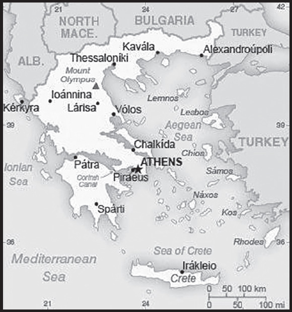
Location: Southern Europe, bordering the Aegean Sea, Ionian Sea, and the Mediterranean Sea, between Albania and Turkey
Geographic coordinates: 39 00 N, 22 00 E
Map references: Europe
Area: total: 131,957 sq km
land: 130,647 sq km
water: 1,310 sq km
comparison ranking: total 97
Area - comparative: slightly smaller than Alabama
Land boundaries: total: 1,110 km
border countries (4): Albania 212 km; Bulgaria 472 km; North Macedonia 234 km; Turkey 192 km
Coastline: 13,676 km
Maritime claims: territorial sea: 6 nm
continental shelf: 200-m depth or to the depth of exploitation
Climate: temperate; mild, wet winters; hot, dry summers
Terrain: mountainous with ranges extending into the sea as peninsulas or chains of islands
Elevation: highest point: Mount Olympus 2,917
lowest point: Mediterranean Sea 0 m
mean elevation: 498 m
note: Mount Olympus actually has 52 peaks but its highest point, Mytikas (meaning “nose”), rises to 2,917 meters; in Greek mythology, Olympus’ Mytikas peak was the home of the Greek gods
Natural resources: lignite, petroleum, iron ore, bauxite, lead, zinc, nickel, magnesite, marble, salt, hydropower potential
Land use: agricultural land: 63.4% (2018 est.)
arable land: 19.7% (2018 est.)
permanent crops: 8.9% (2018 est.)
permanent pasture: 34.8% (2018 est.)
forest: 30.5% (2018 est.)
other: 6.1% (2018 est.)
Irrigated land: 11,853 sq km (2019)
Population distribution: one-third of the population lives in and around metropolitan Athens; the remainder of the country has moderate population density mixed with sizeable urban clusters
Natural hazards: severe earthquakes
volcanism: Santorini (367 m) has been deemed a Decade Volcano by the International Association of Volcanology and Chemistry of the Earth’s Interior, worthy of study due to its explosive history and close proximity to human populations; although there have been very few eruptions in recent centuries, Methana and Nisyros in the Aegean are classified as historically active
Geography - note: strategic location dominating the Aegean Sea and southern approach to Turkish Straits; a peninsular country, possessing an archipelago of about 2,000 islands
PEOPLE AND SOCIETY
Population: 10,497,595 (2023 est.)
comparison ranking: 89
Nationality: noun: Greek(s)
adjective: Greek
Ethnic groups: Greek 91.6%, Albanian 4.4%, other 4% (2011 est.)
note: data represent citizenship; Greece does not collect data on ethnicity
Languages: Greek (official) 99%, other (includes English and French) 1%
major-language sample(s):
Παγκόσμιο Βιβλίο Δεδομένων, η απαραίτητη πηγή βασικών πληροφοριών. (Greek)
Religions: Greek Orthodox 81-90%, Muslim 2%, other 3%, none 4-15%, unspecified 1% (2015 est.)
Age structure: 0-14 years: 14.02% (male 758,311/female 713,794)
15-64 years: 62.66% (male 3,285,484/female 3,292,524)
65 years and over: 23.31% (2023 est.) (male 1,086,188/female 1,361,294)
Dependency ratios: total dependency ratio: 57.7
youth dependency ratio: 22.2
elderly dependency ratio: 35.5
potential support ratio: 2.8 (2021 est.)
Median age: total: 45.3 years (2020)
male: 43.7 years
female: 46.8 years
comparison ranking: total 9
Population growth rate: -0.35% (2023 est.)
comparison ranking: 218
Birth rate: 7.52 births/1,000 population (2023 est.)
comparison ranking: 220
Death rate: 12.02 deaths/1,000 population (2023 est.)
comparison ranking: 14
Net migration rate: 1.03 migrant(s)/1,000 population (2023 est.)
comparison ranking: 65
Population distribution: one-third of the population lives in and around metropolitan Athens; the remainder of the country has moderate population density mixed with sizeable urban clusters
Urbanization: urban population: 80.7% of total population (2023)
rate of urbanization: 0.11% annual rate of change (2020-25 est.)
Major urban areas - population: 3.154 million ATHENS (capital), 815,000 Thessaloniki (2023)
Sex ratio: at birth: 1.07 male(s)/female
0-14 years: 1.06 male(s)/female
15-64 years: 1 male(s)/female
65 years and over: 0.8 male(s)/female
total population: 0.96 male(s)/female (2023 est.)
Mother’s mean age at first birth: 30.7 years (2020 est.)
Maternal mortality ratio: 8 deaths/100,000 live births (2020 est.)
comparison ranking: 149
Infant mortality rate: total: 3.49 deaths/1,000 live births (2023 est.)
male: 3.89 deaths/1,000 live births
female: 3.07 deaths/1,000 live births
comparison ranking: total 195
Life expectancy at birth: total population: 81.71 years (2023 est.)
male: 79.18 years
female: 84.4 years
comparison ranking: total population 40
Total fertility rate: 1.4 children born/woman (2023 est.)
comparison ranking: 214
Gross reproduction rate: 0.68 (2023 est.)
Drinking water source: improved: total: 100% of population
unimproved: total: 0% of population (2020 est.)
Current health expenditure: 9.5% of GDP (2020)
Physicians density: 6.31 physicians/1,000 population (2019)
Hospital bed density: 4.2 beds/1,000 population (2018)
Sanitation facility access: improved: total: 100% of population
unimproved: total: 0% of population (2020 est.)
Obesity - adult prevalence rate: 24.9% (2016)
comparison ranking: 54
Alcohol consumption per capita: total: 6.33 liters of pure alcohol (2019 est.)
beer: 2.13 liters of pure alcohol (2019 est.)
wine: 2.66 liters of pure alcohol (2019 est.)
spirits: 1.45 liters of pure alcohol (2019 est.)
other alcohols: 0.08 liters of pure alcohol (2019 est.)
comparison ranking: total 66
Tobacco use: total: 33.5% (2020 est.)
male: 36.5% (2020 est.)
female: 30.5% (2020 est.)
comparison ranking: total 18
Currently married women (ages 15-49): 54.1% (2023 est.)
Education expenditures: 4.4% of GDP (2020 est.)
comparison ranking: 103
Literacy: definition: age 15 and over can read and write
total population: 97.9%
male: 98.5%
female: 97.4% (2018)
School life expectancy (primary to tertiary education): total: 20 years
male: 20 years
female: 20 years (2020)
Youth unemployment rate (ages 15-24): total: 36.9% (2021 est.)
male: 33.5%
female: 41.5%
comparison ranking: total 21
ENVIRONMENT
Environment - current issues: air pollution; air emissions from transport and electricity power stations; water pollution; degradation of coastal zones; loss of biodiversity in terrestrial and marine ecosystems; increasing municipal and industrial waste
Environment - international agreements: party to: Air Pollution, Air Pollution-Nitrogen Oxides, Air Pollution-Sulphur 94, Antarctic-Environmental Protection, Antarctic-Marine Living Resources, Antarctic Treaty, Biodiversity, Climate Change, Climate Change-Kyoto Protocol, Climate Change-Paris Agreement, Comprehensive Nuclear Test Ban, Desertification, Endangered Species, Environmental Modification, Hazardous Wastes, Law of the Sea, Marine Dumping-London Convention, Nuclear Test Ban, Ozone Layer Protection, Ship Pollution, Tropical Timber 2006, Wetlands
signed, but not ratified: Air Pollution-Heavy Metals, Air Pollution-Multi-effect Protocol, Air Pollution-Persistent Organic Pollutants, Air Pollution-Volatile Organic Compounds
Climate: temperate; mild, wet winters; hot, dry summers
Land use: agricultural land: 63.4% (2018 est.)
arable land: 19.7% (2018 est.)
permanent crops: 8.9% (2018 est.)
permanent pasture: 34.8% (2018 est.)
forest: 30.5% (2018 est.)
other: 6.1% (2018 est.)
Urbanization: urban population: 80.7% of total population (2023)
rate of urbanization: 0.11% annual rate of change (2020-25 est.)
Revenue from forest resources: 0.01% of GDP (2018 est.)
comparison ranking: 149
Revenue from coal: 0.04% of GDP (2018 est.)
comparison ranking: 32
Air pollutants: particulate matter emissions: 14.62 micrograms per cubic meter (2019 est.)
carbon dioxide emissions: 62.43 megatons (2016 est.)
methane emissions: 9.8 megatons (2020 est.)
Waste and recycling: municipal solid waste generated annually: 5,477,424 tons (2014 est.)
municipal solid waste recycled annually: 1,040,711 tons (2014 est.)
percent of municipal solid waste recycled: 19% (2014 est.)
Total water withdrawal: municipal: 1.69 billion cubic meters (2020 est.)
industrial: 330 million cubic meters (2020 est.)
agricultural: 8.11 billion cubic meters (2020 est.)
Total renewable water resources: 68.4 billion cubic meters (2020 est.)
GOVERNMENT
Country name: conventional long form: Hellenic Republic
conventional short form: Greece
local long form: Elliniki Dimokratia
local short form: Ellas or Ellada
former: Hellenic State, Kingdom of Greece
etymology: the English name derives from the Roman (Latin) designation “Graecia,” meaning “Land of the Greeks”; the Greeks call their country “Hellas” or “Ellada”
Government type: parliamentary republic
Capital: name: Athens
geographic coordinates: 37 59 N, 23 44 E
time difference: UTC+2 (7 hours ahead of Washington, DC, during Standard Time)
daylight saving time: +1hr, begins last Sunday in March; ends last Sunday in October
etymology: Athens is the oldest European capital city; according to tradition, the city is named after Athena, the Greek goddess of wisdom; in actuality, the appellation probably derives from a lost name in a pre-Hellenic language
Administrative divisions: 13 regions (perifereies, singular - perifereia) and 1 autonomous monastic state* (aftonomi monastiki politeia); Agion Oros* (Mount Athos), Anatoliki Makedonia kai Thraki (East Macedonia and Thrace), Attiki (Attica), Dytiki Ellada (West Greece), Dytiki Makedonia (West Macedonia), Ionia Nisia (Ionian Islands), Ipeiros (Epirus), Kentriki Makedonia (Central Macedonia), Kriti (Crete), Notio Aigaio (South Aegean), Peloponnisos (Peloponnese), Sterea Ellada (Central Greece), Thessalia (Thessaly), Voreio Aigaio (North Aegean)
Independence: 3 February 1830 (from the Ottoman Empire); note - 25 March 1821, outbreak of the national revolt against the Ottomans; 3 February 1830, signing of the London Protocol recognizing Greek independence by Great Britain, France, and Russia
National holiday: Independence Day, 25 March (1821)
Constitution: history: many previous; latest entered into force 11 June 1975
amendments: proposed by at least 50 members of Parliament and agreed by three-fifths majority vote in two separate ballots at least 30 days apart; passage requires absolute majority vote by the next elected Parliament; entry into force finalized through a “special parliamentary resolution”; articles on human rights and freedoms and the form of government cannot be amended; amended 1986, 2001, 2008, 2019
Legal system: civil legal system based on Roman law
International law organization participation: accepts compulsory ICJ jurisdiction with reservations; accepts ICCt jurisdiction
Citizenship: citizenship by birth: no
citizenship by descent only: at least one parent must be a citizen of Greece
dual citizenship recognized: yes
residency requirement for naturalization: 10 years
Suffrage: 17 years of age; universal and compulsory
Executive branch: chief of state: President Ekaterini SAKELLAROPOULOU (since 13 March 2020)
head of government: Prime Minister Kyriakos MITSOTAKIS (since 26 June 2023)
cabinet: Cabinet appointed by the president on the recommendation of the prime minister
elections/appointments: president elected by Hellenic Parliament for a 5-year term (eligible for a second term); election last held on 22 January 2020 (next to be held by February 2025); president appoints as prime minister the leader of the majority party or coalition in the Hellenic Parliament
election results:
2020: Katerina SAKELLAROPOULOU (independent) elected president by Parliament - 261 of 300 votes; note - SAKELLAROPOULOU is Greece’s first woman president
2015: Prokopis PAVLOPOULOS (ND) elected president by Parliament - 233 of 300 votes
Legislative branch: description: unicameral Hellenic Parliament or Vouli ton Ellinon (300 seats; 280 members in multi-seat and single-seat constituencies and 15 members - including 3 seats for Greek diaspora - in a single nationwide constituency directly elected by open party-list proportional representation vote; members serve up to 4 years); note - only parties surpassing a 3% threshold are entitled to parliamentary seats; parties need 10 seats to become formal parliamentary groups but can retain that status if the party participated in the last election and received the minimum 3% threshold
elections: last held on 25 June 2023 (next to be held in 2027)
election results: percent of vote by party - ND 40.6%, SYRIZA-PS 17.8%, PASOK-KINAL 11.9%, KKE 7.7%, Spartans 4.6%, Greek Solution 4.4%, NIKI 3.7%, Course of Freedom 3.2%, other 6.1%; seats by party - ND 158, SYRIZA-PS 48, PASOK-KINAL 32, KKE 20, Spartans 12, Greek Solution 12, NIKI 10, Course of Freedom 8
Judicial branch: highest court(s): Supreme Civil and Criminal Court or Areios Pagos (consists of 56 judges, including the court presidents); Council of State (supreme administrative court) (consists of the president, 7 vice presidents, 42 privy councilors, 48 associate councilors and 50 reporting judges, organized into six 5- and 7-member chambers; Court of Audit (government audit and enforcement) consists of the president, 5 vice presidents, 20 councilors, and 90 associate and reporting judges
judge selection and term of office: Supreme Court judges appointed by presidential decree on the advice of the Supreme Judicial Council (SJC), which includes the president of the Supreme Court, other judges, and the prosecutor of the Supreme Court; judges appointed for life following a 2-year probationary period; Council of State president appointed by the Greek Cabinet to serve a 4-year term; other judge appointments and tenure NA; Court of Audit president appointed by decree of the president of the republic on the advice of the SJC; court president serves a 4-year term or until age 67; tenure of vice presidents, councilors, and judges NA
subordinate courts: Courts of Appeal and Courts of First Instance (district courts)
Political parties and leaders: Coalition of the Radical Left-Progressive Alliance or SYRIZA-PS [Stefanos KASSELAKIS]
Communist Party of Greece or KKE [Dimitrios KOUTSOUMBAS]
Course of Freedom [Zoe KONSTANTOPOULOU]
Democratic Patriotic Movement-Victory or NIKI [Dimitris NATSIOS]
Greek Solution [Kyriakos VELOPOULOS]
New Democracy or ND [Kyriakos MITSOTAKIS]
PASOK - Movement for Change or PASOK-KINAL [Nikolaos (Nikos) ANDROULAKIS] Spartans [Vassilis STIGAS]
International organization participation: Australia Group, BIS, BSEC, CD, CE, CERN, EAPC, EBRD, ECB, EIB, EMU, ESA, EU, FAO, FATF, IAEA, IBRD, ICAO, ICC (national committees), ICCt, ICRM, IDA, IEA, IFAD, IFC, IFRCS, IGAD (partners), IHO, ILO, IMF, IMO, IMSO, Interpol, IOC, IOM, IPU, ISO, ITSO, ITU, ITUC (NGOs), MIGA, NATO, NEA, NSG, OAS (observer), OECD, OIF, OPCW, OSCE, PCA, Schengen Convention, SELEC, UN, UNCTAD, UNESCO, UNHCR, UNIDO, UNIFIL, UNWTO, UPU, Wassenaar Arrangement, WCO, WFTU (NGOs), WHO, WIPO, WMO, WTO, ZC
Diplomatic representation in the US: chief of mission: Ambassador (vacant); Chargé d’Affaires Theodoros BIZAKIS (since 22 September 2023)
chancery: 2217 Massachusetts Avenue NW, Washington, DC 20008
telephone: [1] (202) 939-1300
FAX: [1] (202) 939-1324
email address and website:
https://www.mfa.gr/usa/en/the-embassy/
consulate(s) general: Boston, Chicago, Los Angeles, New York, Tampa (FL), San Francisco
consulate(s): Atlanta, Houston
Diplomatic representation from the US: chief of mission: Ambassador George James TSUNIS (since 10 May 2022)
embassy: 91 Vasillisis Sophias Avenue, 10160 Athens
mailing address: 7100 Athens Place, Washington DC 20521-7100
telephone: [30] (210) 721-2951
FAX: [30] (210) 724-5313
email address and website:
athensamericancitizenservices@state.gov
consulate(s) general: Thessaloniki
Flag description: nine equal horizontal stripes of blue alternating with white; a blue square bearing a white cross appears in the upper hoist-side corner; the cross symbolizes Greek Orthodoxy, the established religion of the country; there is no agreed upon meaning for the nine stripes or for the colors
note: Greek legislation states that the flag colors are cyan and white, but cyan can mean “blue” in Greek, so the exact shade of blue has never been set and has varied from a light to a dark blue over time; in general, the hue of blue normally encountered is a form of azure
National symbol(s): Greek cross (white cross on blue field, arms equal length); national colors: blue, white
National anthem: name: “Ymnos eis tin Eleftherian” (Hymn to Liberty)
lyrics/music: Dionysios SOLOMOS/Nikolaos MANTZAROS
note: adopted 1864; the anthem is based on a 158-stanza poem by the same name, which was inspired by the Greek Revolution of 1821 against the Ottomans (only the first two stanzas are used); Cyprus also uses “Hymn to Liberty” as its anthem
National heritage: total World Heritage Sites: 18 (16 cultural, 2 mixed)
selected World Heritage Site locales: Acropolis, Athens (c); Archaeological site of Delphi (c); Meteora (m); Medieval City of Rhodes (c); Archaeological site of Olympia (c); Archaeological site of Mycenae and Tiryns (c); Old Town of Corfu (c); Mount Athos (m); Delos (c); Archaeological Site of Philippi (c)
ECONOMY
Economic overview: tourism- and shipping-based EU economy; clientelism economic culture and systemic corruption; new structural reforms for fiscal solvency; high public debts and unemployment; increasing Chinese port control; oil and gas disputes with Turkey
Real GDP (purchasing power parity): $314.427 billion (2021 est.)
$289.97 billion (2020 est.)
$318.662 billion (2019 est.)
note: data are in 2017 dollars
comparison ranking: 55
Real GDP growth rate: 8.43% (2021 est.)
-9% (2020 est.)
1.88% (2019 est.)
comparison ranking: 37
Real GDP per capita: $29,500 (2021 est.)
$27,100 (2020 est.)
$29,700 (2019 est.)
note: data are in 2017 dollars
comparison ranking: 72
GDP (official exchange rate): $209.79 billion (2019 est.)
Inflation rate (consumer prices): 1.22% (2021 est.)
-1.25% (2020 est.)
0.25% (2019 est.)
comparison ranking: 192
Credit ratings: Fitch rating: BB (2020)
Moody’s rating: Ba3 (2020)
Standard & Poors rating: BB- (2019)
note: The year refers to the year in which the current credit rating was first obtained.
GDP - composition, by sector of origin: agriculture: 4.1% (2017 est.)
industry: 16.9% (2017 est.)
services: 79.1% (2017 est.)
comparison rankings: services 34; industry 171; agriculture 136
GDP - composition, by end use: household consumption: 69.6% (2017 est.)
government consumption: 20.1% (2017 est.)
investment in fixed capital: 12.5% (2017 est.)
investment in inventories: -1% (2017 est.)
exports of goods and services: 33.4% (2017 est.)
imports of goods and services: -34.7% (2017 est.)
Agricultural products: maize, olives, wheat, milk, peaches/nectarines, oranges, tomatoes, grapes, milk, potatoes
Industries: tourism, food and tobacco processing, textiles, chemicals, metal products; mining, petroleum
Industrial production growth rate: 10.67% (2021 est.)
comparison ranking: 25
Labor force: 4.619 million (2021 est.)
comparison ranking: 91
Labor force - by occupation: agriculture: 12.6%
industry: 15%
services: 72.4% (30 October 2015 est.)
Unemployment rate: 14.8% (2021 est.)
16.3% (2020 est.)
17.31% (2019 est.)
comparison ranking: 36
Youth unemployment rate (ages 15-24): total: 36.9% (2021 est.)
male: 33.5%
female: 41.5%
comparison ranking: total 21
Population below poverty line: 17.9% (2018 est.)
Gini Index coefficient - distribution of family income: 33.1 (2019 est.)
comparison ranking: 122
Average household expenditures: on food: 17.1% of household expenditures (2018 est.)
on alcohol and tobacco: 4.9% of household expenditures (2018 est.)
Household income or consumption by percentage share: lowest 10%: 1.7%
highest 10%: 26.7% (2015 est.)
Budget: revenues: $98.523 billion (2019 est.)
expenditures: $97.277 billion (2019 est.)
Budget surplus (+) or deficit (-): 0.8% (of GDP) (2017 est.)
comparison ranking: 35
Public debt: 252.29% of GDP (2020 est.)
212.38% of GDP (2019 est.)
208.84% of GDP (2018 est.)
comparison ranking: 1
Taxes and other revenues: 24.74% (of GDP) (2020 est.)
comparison ranking: 51
Fiscal year: calendar year
Current account balance: -$13.858 billion (2021 est.)
-$12.413 billion (2020 est.)
-$3.112 billion (2019 est.)
comparison ranking: 199
Exports: $87.521 billion (2021 est.) note: data are in current year dollars
$59.022 billion (2020 est.) note: data are in current year dollars
$81.184 billion (2019 est.) note: data are in current year dollars
comparison ranking: 48
Exports - partners: Italy 10%, Germany 7%, Turkey 5%, Cyprus 5%, Bulgaria 5% (2019)
Exports - commodities: refined petroleum, packaged medicines, aluminum plating, cotton, cheese, copper piping (2021)
Imports: $103.532 billion (2021 est.) note: data are in current year dollars
$71.758 billion (2020 est.) note: data are in current year dollars
$83.192 billion (2019 est.) note: data are in current year dollars
comparison ranking: 45
Imports - partners: Germany 11%, China 9%, Italy 8%, Iraq 7%, Russia 6%, Netherlands 5% (2019)
Imports - commodities: crude petroleum, refined petroleum, packaged medicines, cars, ships (2019)
Reserves of foreign exchange and gold: $14.447 billion (31 December 2021 est.)
$11.931 billion (31 December 2020 est.)
$8.507 billion (31 December 2019 est.)
comparison ranking: 74
Debt - external: $484.888 billion (2019 est.)
$478.646 billion (2018 est.)
comparison ranking: 25
Exchange rates: euros (EUR) per US dollar -
Exchange rates: 0.845 (2021 est.)
0.876 (2020 est.)
0.893 (2019 est.)
0.847 (2018 est.)
0.885 (2017 est.)
ENERGY
Electricity access: electrification - total population: 100% (2021)
Electricity: installed generating capacity: 21.545 million kW (2020 est.)
consumption: 46.18 billion kWh (2020 est.)
exports: 967 million kWh (2020 est.)
imports: 9.831 billion kWh (2020 est.)
transmission/distribution losses: 3.256 billion kWh (2020 est.)
comparison rankings: transmission/distribution losses 63; imports 25; exports 63; consumption 54; installed generating capacity 45
Electricity generation sources: fossil fuels: 56.5% of total installed capacity (2020 est.)
nuclear: 0% of total installed capacity (2020 est.)
solar: 10.7% of total installed capacity (2020 est.)
wind: 23% of total installed capacity (2020 est.)
hydroelectricity: 8.5% of total installed capacity (2020 est.)
tide and wave: 0% of total installed capacity (2020 est.)
geothermal: 0% of total installed capacity (2020 est.)
biomass and waste: 1.4% of total installed capacity (2020 est.)
Coal: production: 13.851 million metric tons (2020 est.)
consumption: 13.828 million metric tons (2020 est.)
exports: 7,000 metric tons (2020 est.)
imports: 305,000 metric tons (2020 est.)
proven reserves: 2.876 billion metric tons (2019 est.)
Petroleum: total petroleum production: 4,800 bbl/day (2021 est.)
refined petroleum consumption: 309,600 bbl/day (2019 est.)
crude oil and lease condensate exports: 4,100 bbl/day (2018 est.)
crude oil and lease condensate imports: 491,300 bbl/day (2018 est.)
crude oil estimated reserves: 10 million barrels (2021 est.)
Refined petroleum products - production: 655,400 bbl/day (2017 est.)
comparison ranking: 28
Refined petroleum products - exports: 371,900 bbl/day (2017 est.)
comparison ranking: 22
Refined petroleum products - imports: 192,200 bbl/day (2017 est.)
comparison ranking: 35
Natural gas: production: 5.748 million cubic meters (2019 est.)
consumption: 5,831,987,000 cubic meters (2020 est.)
exports: 33.244 million cubic meters (2020 est.)
imports: 5,219,409,000 cubic meters (2019 est.)
proven reserves: 991 million cubic meters (2021 est.)
Carbon dioxide emissions: 70.163 million metric tonnes of CO2 (2019 est.)
from coal and metallurgical coke: 13.404 million metric tonnes of CO2 (2019 est.)
from petroleum and other liquids: 46.401 million metric tonnes of CO2 (2019 est.)
from consumed natural gas: 10.358 million metric tonnes of CO2 (2019 est.)
comparison ranking: total emissions 50
Energy consumption per capita: 108.022 million Btu/person (2019 est.)
comparison ranking: 51
COMMUNICATIONS
Telephones - fixed lines: total subscriptions: 4,913,036 (2021 est.)
subscriptions per 100 inhabitants: 47 (2021 est.)
comparison ranking: total subscriptions 29
Telephones - mobile cellular: total subscriptions: 11,494,008 (2021 est.)
subscriptions per 100 inhabitants: 110 (2021 est.)
comparison ranking: total subscriptions 86
Telecommunication systems: general assessment: Greece’s telecom market is susceptible to the country’s volatile economy, and, as a result, revenue among the key networks has been variable; broadband subscriptions in Greece are developing steadily; the main networks are concentrating investment on fiber-based next generation networks, enabling them to reach the European broadband targets for 2025; their work is also supported by government ultra-fast broadband projects, largely funded by the EC and aimed at delivering a service of at least 100Mb/s to under served areas; Greece’s well-developed mobile market is dominated by the three MNOs; Networks continue to invest in LTE infrastructure and technologies to provide networks capable of meeting customer demand for data services; after extensive trials of 5G, the MNOs were able to launch commercial services in early 2021 following the December 2020 allocation of frequencies in a range of bands; the rapid rollout of 5G encouraged the shut down of the 3G network (a process expected to be completed by the end of 2021) and reallocate for LTE and 5G. (2023)
domestic: 47 per 100 subscribers for fixed-line and 110 per 100 for mobile-cellular (2021)
international: country code - 30; landing points for the SEA-ME-WE-3, Adria-1, Italy-Greece 1, OTEGLOBE, MedNautilus Submarine System, Aphrodite 2, AAE-1 and Silphium optical telecommunications submarine cable that provides links to Europe, the Middle East, Africa, Southeast Asia, Asia and Australia; tropospheric scatter; satellite earth stations - 4 (2 Intelsat - 1 Atlantic Ocean and 1 Indian Ocean, 1 Eutelsat, and 1 Inmarsat - Indian Ocean region) (2019)
Broadcast media: broadcast media dominated by the private sector; roughly 150 private TV channels, about 10 of which broadcast nationwide; 1 government-owned terrestrial TV channel with national coverage; 3 privately owned satellite channels; multi-channel satellite and cable TV services available; upwards of 1,500 radio stations, all of them privately owned; government-owned broadcaster has 2 national radio stations
Internet country code: .gr
Internet users: total: 7.8 million (2021 est.)
percent of population: 78% (2021 est.)
comparison ranking: total 77
Broadband - fixed subscriptions: total: 4,257,026 (2020 est.)
subscriptions per 100 inhabitants: 41 (2020 est.)
comparison ranking: total 35
TRANSPORTATION
National air transport system: number of registered air carriers: 11 (2020)
inventory of registered aircraft operated by air carriers: 97
annual passenger traffic on registered air carriers: 15,125,933 (2018)
annual freight traffic on registered air carriers: 21.91 million (2018) mt-km
Civil aircraft registration country code prefix: SX
Airports: 77 (2021)
comparison ranking: total 69
Airports - with paved runways: 68
note: paved runways have a concrete or asphalt surface but not all have facilities for refueling, maintenance, or air traffic control; the length of a runway required for aircraft to safely operate depends on a number of factors including the type of aircraft, the takeoff weight (including passengers, cargo, and fuel), engine types, flap settings, landing speed, elevation of the airport, and average maximum daily air temperature; paved runways can reach a length of 5,000 m (16,000 ft.), but the “typical” length of a commercial airline runway is between 2,500-4,000 m (8,000-13,000 ft.)
Airports - with unpaved runways: 9
note: unpaved runways have a surface composition such as grass or packed earth and are most suited to the operation of light aircraft; unpaved runways are usually short, often less than 1,000 m (3,280 ft.) in length; airports with unpaved runways often lack facilities for refueling, maintenance, or air traffic control
Heliports: 9 (2021)
Pipelines: 1,466 km gas, 94 km oil (2013)
Railways: total: 2,345 km (2020) 731 km electrified
comparison ranking: total 67
Roadways: total: 117,000 km (2018)
comparison ranking: total 42
Waterways: 6 km (2012) (the 6-km-long Corinth Canal crosses the Isthmus of Corinth; it shortens a sea voyage by 325 km) comparison ranking: 117
Merchant marine: total: 1,234 (2022)
by type: bulk carrier 146, container ship 5, general cargo 83, oil tanker 311, other 689
comparison ranking: total 21
Ports and terminals: major seaport(s): Aspropyrgos, Pachi, Piraeus, Thessaloniki
oil terminal(s): Agioi Theodoroi
container port(s) (TEUs): Piraeus (5,311,810) (2021)
LNG terminal(s) (import): Revithoussa
MILITARY AND SECURITY
Military and security forces: Hellenic Armed Forces: Hellenic Army (Ellinikos Stratos, ES; includes National Guard), Hellenic Navy (Elliniko Polemiko Navtiko, EPN), Hellenic Air Force (Elliniki Polemiki Aeroporia, EPA; includes air defense) (2023)
note 1: the police (under the Ministry of Citizen Protection) and the armed forces (Ministry of National Defense) share law enforcement duties in certain border areas; border protection is coordinated by a deputy minister for national defense; the Greek Coast Guard is under the Ministry of Shipping Affairs and Island Policy
note 2: the National Guard was established in 1982 as an official part of the Army to help protect Greece and provide reinforcements and support to the Army in peacetime and in times of mobilization and war; members undergo weekly training run by the Army, which also provides weapons and ammunition
Military expenditures: 3% of GDP (2023 est.)
3.9% of GDP (2022 est.)
3.7% of GDP (2021)
2.9% of GDP (2020)
2.5% of GDP (2019)
comparison ranking: 31
Military and security service personnel strengths: approximately 120,000 active-duty personnel (85,000 Army; 15,000 Navy; 20,000 Air Force); approximately 35,000 National Guard (2023)
Military equipment inventories and acquisitions: the military’s inventory consists of a mix of imported weapons from Europe and the US, as well as a limited number of domestically produced systems; in recent years, France, Germany, and the US have been the top suppliers; Greece’s defense industry is capable of producing a range of military hardware, including naval vessels and associated subsystems (2023)
note: Greece is in the midst of a significant military modernization program which includes acquisitions of fighter aircraft and naval ships from France and armored vehicles and tanks from Germany; it has also boosted purchases of US equipment, including fighter aircraft upgrades, helicopters, and naval patrol craft
Military service age and obligation: 19-45 years of age for compulsory military service for men; 12-month obligation for all services (note - as an exception, the duration of the full military service is 9 instead of 12 months if conscripts, after the initial training, serve the entire remaining time in certain areas of the eastern borders, in Cyprus, or in certain military units); 18 years of age for voluntary military service for men and women (2023)
note 1: compulsory service applies to any individual whom the Greek authorities consider to be Greek, regardless of whether the individual considers himself Greek, has a foreign citizenship and passport, or was born or lives outside of Greece; Greek citizens living permanently outside of Greece have the right to postpone their conscription; they are permanently exempted from their military obligations when they reach the age of 45 years old
note 2: up to 50% of the Greek military is comprised of conscripts
note 3: as of 2020, women comprised approximately 16% of the military’s full-time personnel
Military deployments: approximately 1,000 Cyprus; 100 Kosovo (NATO); 140 Lebanon (UNIFIL) (2023)
Military - note: the Hellenic Armed Forces (HAF) are responsible for protecting Greece’s independence, sovereignty, and territorial integrity; the HAF also maintains a presence on Cyprus (the Hellenic Force in Cyprus or ELDYK) to assist and support the Cypriot National Guard; as a member of the EU, NATO, and other international organizations, the HAF participates in multinational peacekeeping and other security missions abroad, taking a particular interest in missions occurring in the near regions, such as the Balkans, the Mediterranean and Aegean seas, the Middle East, and North Africa; areas of focus for the HAF include instability in the Balkans, territorial disputes with Turkey, and support to European security through the EU and NATO
Greece’s NATO membership is a key component of its security; it became a NATO member in 1952 and occupies a strategic location in the Eastern Mediterranean on NATO’s southern flank; Greece is host to several NATO facilities, including the Deployable Corps Greece (NDC-GR) headquarters in Thessaloniki, the Combined Air Operations Center in Larissa, the Multinational Peace Support Operations Training Center in Kilkis, the Multinational Sealift Coordination Center in Athens, and the Naval Base, Maritime Interdiction Operational Training Centre, and NATO Missile Firing Installation at Souda, Crete
the Hellenic Army (established 1828) consists of the Active Army, the National Guard, the High Readiness Army Reserves, and the Reserves; the active Army has an army and several corps-level command formations, including a command for the Aegean Islands, a corps in Thrace to guard the Greco-Turkish land border, and the NDC-GR; there are several divisional headquarters and about 20 combat brigades, which include air mobile, airborne, amphibious, armored, helicopter aviation, infantry, and mechanized forces; National Guard units are organized into divisional and brigade-sized commands and typically based in border regions, both on the mainland and on some of Greece’s islands
also established in 1828, the Navy’s missions include naval presence operations, the protection of Greek sovereign rights, such as the continental shelf, EEZ, and Greek-owned shipping, the security of Greece’s sea lines of communication, and power projection; it has separate commands for frigates, patrol ships, mine warfare, submarines, the Aegean Sea, surveillance, amphibious, aviation, and special operations; its principal warships include 13 frigates and 10 attack submarines, which are supplemented by fast-attack and patrol vessels of varying size and capabilities
the Air Force, established in 1911, is organized into wings, squadrons, and groups and has nearly 200 combat aircraft of French and US origin, plus early warning, maritime patrol, reconnaissance, tanker, and transport aircraft, as well as helicopters; it also has air and missile defense units (2023)
SPACE
Space agency/agencies: Hellenic Space Center (HSC; aka Hellenic Space Agency; established 2018) (2023)
Space program overview: has a relatively new and growing space program focused on building and operating satellites; also researches and develops technologies in a variety of other space sectors, including such areas as remote sensing (RS), telecommunications, defense, environmental studies, and agricultural development; as a member of the European Space Agency (ESA), it contributes to, participates in, and benefits from ESA capabilities and programs; cooperates with space agencies and commercial space sectors of ESA and EU member states, as well as the US; has a robust commercial space sector that researches, develops, and produces a variety of space technologies and capabilities, including satellite components, electronics, sensors, and communications (2023)
note: further details about the key activities, programs, and milestones of the country’s space program, as well as government spending estimates on the space sector, appear in Appendix S
TERRORISM
Terrorist group(s): Terrorist group(s): Islamic State of Iraq and ash-Sham (ISIS); Revolutionary Struggle; Revolutionary People’s Liberation Party/Front (DHKP/C)
note: details about the history, aims, leadership, organization, areas of operation, tactics, targets, weapons, size, and sources of support of the group(s) appear(s) in Appendix-T
TRANSNATIONAL ISSUES
Disputes - international: Greece and Turkey continue discussions to resolve their complex maritime, air, territorial, and boundary disputes in the Aegean Sea; Greece has a security wall along a portion of its land border with Turkey to deter border crossings by migrants and has announced intentions to extend the wall along the entire border
Refugees and internally displaced persons: refugees (country of origin): 41,594 (Syria), 33,549 (Afghanistan), 14,228 (Iraq), 6,366 (West Bank and Gaza) (mid-year 2022); 25,050 (Ukraine) (as of 30 June 2023)
stateless persons: 4,488 (2022)
note: 1,272,420 estimated refugee and migrant arrivals (January 2015-November 2023)
Illicit drugs: a gateway to Europe for traffickers smuggling cannabis products and heroin from the Middle East and Southwest Asia to the West and precursor chemicals to the East; some South American cocaine transits or is consumed in Greece; money laundering related to drug trafficking and organized crime
INTRODUCTION
Background: Greenland, the world’s largest island, is about 80% ice-capped. Vikings reached the island in the 10th century from Iceland; Danish colonization began in the 18th century, and Greenland became an integral part of the Danish Realm in 1953. It joined the European Community (now the EU) with Denmark in 1973 but withdrew in 1985 over a dispute centered on stringent fishing quotas. Greenland remains a member of the Overseas Countries and Territories Association of the EU. Greenland was granted self-government in 1979 by the Danish parliament; the law went into effect the following year. Greenland voted in favor of increased self-rule in November 2008 and acquired greater responsibility for internal affairs when the Act on Greenland Self-Government was signed into law in June 2009. Denmark, however, continues to exercise control over several policy areas on behalf of Greenland, including foreign affairs, security, and financial policy in consultation with Greenland’s Self-Rule Government.
GEOGRAPHY
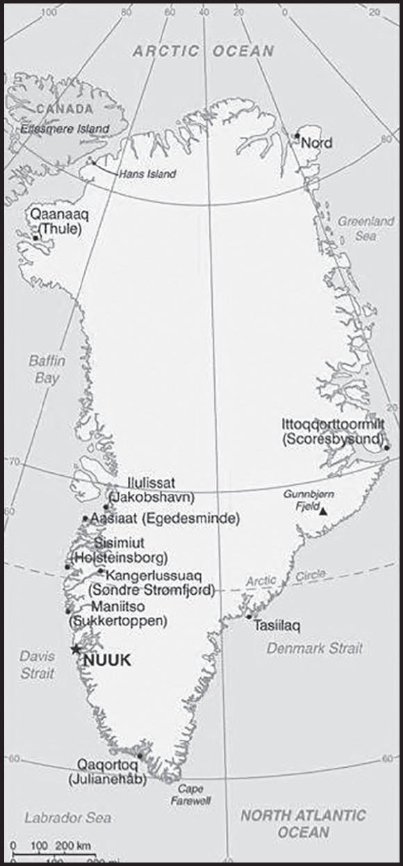
Location: Northern North America, island between the Arctic Ocean and the North Atlantic Ocean, northeast of Canada
Geographic coordinates: 72 00 N, 40 00 W
Map references: Arctic Region
Area: total: 2,166,086 sq km
land: 2,166,086 sq km (approximately 1,710,000 sq km ice-covered)
comparison ranking: total 13
Area - comparative: slightly more than three times the size of Texas
Land boundaries: total: 0 km
Coastline: 44,087 km
Maritime claims: territorial sea: 3 nm
continental shelf: 200 nm or agreed boundaries or median line
exclusive fishing zone: 200 nm or agreed boundaries or median line
Climate: arctic to subarctic; cool summers, cold winters
Terrain: flat to gradually sloping icecap covers all but a narrow, mountainous, barren, rocky coast
Elevation: highest point: Gunnbjorn Fjeld 3,694 m
lowest point: Atlantic Ocean 0 m
mean elevation: 1,792 m
Natural resources: coal, iron ore, lead, zinc, molybdenum, diamonds, gold, platinum, niobium, tantalite, uranium, fish, seals, whales, hydropower, possible oil and gas
Land use: agricultural land: 0.6% (2018 est.)
arable land: 0% (2018 est.)
permanent crops: 0% (2018 est.)
permanent pasture: 0.6% (2018 est.)
forest: 0% (2018 est.)
other: 99.4% (2018 est.)
Population distribution: settlement concentrated on the southwest shoreline, with limited settlements scattered along the remaining coast; interior is uninhabited
Natural hazards: continuous permafrost over northern two-thirds of the island
Geography - note: dominates North Atlantic Ocean between North America and Europe; sparse population confined to small settlements along coast; close to one-quarter of the population lives in the capital, Nuuk; world’s second largest ice sheet after that of Antarctica covering an area of 1.71 million sq km (660,000 sq mi) or about 79% of the island, and containing 2.85 million cu km (684 thousand cu mi) of ice (this is almost 7% of all of the world’s fresh water); if all this ice were converted to liquid water, one estimate is that it would be sufficient to raise the height of the world’s oceans by 7.2 m (24 ft)
PEOPLE AND SOCIETY
Population: 57,777 (2023 est.)
comparison ranking: 206
Nationality: noun: Greenlander(s)
adjective: Greenlandic
Ethnic groups: Greenlandic 89.1%, Danish 7.5%, other Nordic peoples 0.9%, and other 2.5% (2022 est.)
note: data represent population by country of birth
Languages: Greenlandic (West Greenlandic or Kalaallisut is the official language), Danish, English
Religions: Evangelical Lutheran, traditional Inuit spiritual beliefs
Age structure: 0-14 years: 20.46% (male 5,992/female 5,827)
15-64 years: 67.66% (male 20,271/female 18,820)
65 years and over: 11.89% (2023 est.) (male 3,641/female 3,226)
Dependency ratios: total dependency ratio: 43.6
youth dependency ratio: 30
elderly dependency ratio: 13.6
potential support ratio: 7.4 (2021)
Median age: total: 34.3 years (2020)
male: 35.1 years
female: 33.4 years
comparison ranking: total 92
Population growth rate: -0.04% (2023 est.)
comparison ranking: 200
Birth rate: 13.66 births/1,000 population (2023 est.)
comparison ranking: 129
Death rate: 9.07 deaths/1,000 population (2023 est.)
comparison ranking: 60
Net migration rate: -4.95 migrant(s)/1,000 population (2023 est.)
comparison ranking: 202
Population distribution: settlement concentrated on the southwest shoreline, with limited settlements scattered along the remaining coast; interior is uninhabited
Urbanization: urban population: 87.9% of total population (2023)
rate of urbanization: 0.41% annual rate of change (2020-25 est.)
Major urban areas - population: 18,000 NUUK (capital) (2018)
Sex ratio: at birth: 1.05 male(s)/female
0-14 years: 1.03 male(s)/female
15-64 years: 1.08 male(s)/female
65 years and over: 1.13 male(s)/female
total population: 1.07 male(s)/female (2023 est.)
Infant mortality rate: total: 8.6 deaths/1,000 live births (2023 est.)
male: 10.08 deaths/1,000 live births
female: 7.04 deaths/1,000 live births
comparison ranking: total 142
Life expectancy at birth: total population: 74.25 years (2023 est.)
male: 71.56 years
female: 77.07 years
comparison ranking: total population 143
Total fertility rate: 1.9 children born/woman (2023 est.)
comparison ranking: 122
Gross reproduction rate: 0.92 (2023 est.)
Drinking water source: improved: total: 100% of population
unimproved: total: 0% of population (2020 est.)
Physicians density: 1.87 physicians/1,000 population (2016)
Hospital bed density: 14 beds/1,000 population (2016)
Sanitation facility access: improved: total: 100% of population
unimproved: total: 0% of population (2020 est.)
Currently married women (ages 15-49): 39.4% (2023 est.)
Education expenditures: 10.2% of GDP (2019 est.)
comparison ranking: 4
Literacy: definition: age 15 and over can read and write
total population: 100%
male: 100%
female: 100% (2015)
ENVIRONMENT
Environment - current issues: especially vulnerable to climate change and disruption of the Arctic environment; preservation of the Inuit traditional way of life, including whaling and seal hunting
Climate: arctic to subarctic; cool summers, cold winters
Land use: agricultural land: 0.6% (2018 est.)
arable land: 0% (2018 est.)
permanent crops: 0% (2018 est.)
permanent pasture: 0.6% (2018 est.)
forest: 0% (2018 est.)
other: 99.4% (2018 est.)
Urbanization: urban population: 87.9% of total population (2023)
rate of urbanization: 0.41% annual rate of change (2020-25 est.)
Revenue from forest resources: 0% of GDP (2018 est.)
comparison ranking: 198
Revenue from coal: 0% of GDP (2018 est.)
comparison ranking: 89
Air pollutants: carbon dioxide emissions: 0.51 megatons (2016 est.)
Waste and recycling: municipal solid waste generated annually: 50,000 tons (2010 est.)
GOVERNMENT
Country name: conventional long form: none
conventional short form: Greenland
local long form: none
local short form: Kalaallit Nunaat
etymology: named by Norwegian adventurer Erik THORVALDSSON (Erik the Red) in A.D. 985 in order to entice settlers to the island
Government type: parliamentary democracy (Parliament of Greenland or Inatsisartut)
Dependency status: part of the Kingdom of Denmark; self-governing overseas administrative division of Denmark since 1979
Capital: name: Nuuk (Godthaab)
geographic coordinates: 64 11 N, 51 45 W
time difference: UTC-3 (2 hours ahead of Washington, DC, during Standard Time)
daylight saving time: +1hr, begins last Sunday in March; ends last Sunday in October
time zone note: Greenland has four time zones
etymology: “nuuk” is the Inuit word for “cape” and refers to the city’s position at the end of the Nuup Kangerlua fjord
Administrative divisions: 5 municipalities (kommuner, singular kommune); Avannaata, Kujalleq, Qeqertalik, Qeqqata, Sermersooq
note: Northeast Greenland National Park (Kalaallit Nunaanni Nuna Eqqissisimatitaq) and the Thule Air Base in Pituffik (in northwest Greenland) are two unincorporated areas; the national park’s 972,000 sq km - about 46% of the island - makes it the largest national park in the world and also the most northerly
Independence: none (extensive self-rule as part of the Kingdom of Denmark; foreign affairs is the responsibility of Denmark, but Greenland actively participates in international agreements relating to Greenland)
National holiday: National Day, June 21; note - marks the summer solstice and the longest day of the year in the Northern Hemisphere
Constitution: history: previous 1953 (Greenland established as a constituency in the Danish constitution), 1979 (Greenland Home Rule Act); latest 21 June 2009 (Greenland Self-Government Act)
Legal system: the laws of Denmark apply where applicable and Greenlandic law applies to other areas
Citizenship: see Denmark
Suffrage: 18 years of age; universal
Executive branch: chief of state: Queen MARGRETHE II of Denmark (since 14 January 1972), represented by High Commissioner Mikaela ENGELL (since April 2011)
head of government: Premier Mute B. EGEDE (since 23 April 2021)
cabinet: Self-rule Government (Naalakkersuisut) elected by the Parliament (Inatsisartut)
elections/appointments: the monarchy is hereditary; high commissioner appointed by the monarch; premier indirectly elected by Parliament for a 4-year term
election results:
2021: Mute B. EGEDE elected premier; Parliament vote - Mute B. EGEDE (Inuit Ataqatigiit) unanimous
2014: Kim KIELSEN elected premier; Parliament vote - Kim KIELSEN (S) 27.2%, Sara OLSVIG (IA) 25.5%, Randi Vestergaard EVALDSEN (D) 19.5%, other 27.8%
Legislative branch: description: unicameral Parliament or Inatsisartut (31 seats; members directly elected in multi-seat constituencies by party-list proportional representation vote - by the d’Hondt method - to serve 4-year terms)
Greenland elects 2 members to the Danish Parliament to serve 4-year terms
elections: Greenland Parliament - last held on 6 April 2021 (next to be held in 2025)
Greenland members to Danish Parliament - last held on 5 June 2019 (next to be held by 4 June 2023)
election results: Greenland Parliament - percent of vote by party - IA 38.7%, S 32.2%, N 12.9%, D 9.7%, A 6.5%; seats by party - IA 12, S 10, N 4, D 3, A 2; composition - men 21, women 10, percent of women 32.2%
Greenland members in Danish Parliament - percent of vote by party - NA; seats by party - IA 1, S 1; composition - 2 women
Judicial branch: highest court(s): High Court of Greenland (consists of the presiding professional judge and 2 lay assessors); note - appeals beyond the High Court of Greenland can be heard by the Supreme Court (in Copenhagen)
judge selection and term of office: judges appointed by the monarch upon the recommendation of the Judicial Appointments Council, a 6-member independent body of judges and lawyers; judges appointed for life with retirement at age 70
subordinate courts: Court of Greenland; 18 district or magistrates’ courts
Political parties and leaders: Democrats Party (Demokraatit) or D [Jens Frederik NIELSEN]
Fellowship Party (Atassut) or A [Aqqalu JERIMIASSEN]
Forward Party (Siumut) or S [Erik JENSEN]
Inuit Community (Inuit Ataqatigiit) or IA [Mute Bourup EGEDE]
Signpost Party (Naleraq) or N [Pele BROBERG] (formerly Partii Naleraq)
International organization participation: Arctic Council, ICC, NC, NIB, UPU
Diplomatic representation in the US: chief of mission: Kenneth HOEGH, Head of Representation; note - Greenland also has offices in the Danish consulates in Chicago and New York
chancery: Greenland Representation
3200 Whitehaven Street, NW
Washington, DC 20008
telephone: [1] (202) 234-4300
FAX: +1 (202) 328-1470
email address and website:
All Greenlandic Representations l Grønlands Repræsentation (grl-rep.dk);
https://naalakkersuisut.gl/en/Naalakkersuisut/Groenlands-repraesentation-Washington
Diplomatic representation from the US: chief of mission: Consul Monica BLAND (since July 2023)
embassy: Aalisartut Aqqutaa 47
Nuuk 3900
Greenland
telephone: (+299) 384100
email address and website:
https://dk.usembassy.gov/embassy-consulate/nuuk/
Flag description: two equal horizontal bands of white (top) and red with a large disk slightly to the hoist side of center - the top half of the disk is red, the bottom half is white; the design represents the sun reflecting off a field of ice; the colors are the same as those of the Danish flag and symbolize Greenland’s links to the Kingdom of Denmark
National symbol(s): polar bear; national colors: red, white
National anthem: name: “Nunarput utoqqarsuanngoravit” (Our Country, Who’s Become So Old also translated as You Our Ancient Land)
lyrics/music: Henrik LUND/Jonathan PETERSEN
note: adopted 1916; the government also recognizes “Nuna asiilasooq” as a secondary anthem
National heritage: total World Heritage Sites: 3 (2 cultural, 1 natural); note - excerpted from the Denmark entry
selected World Heritage Site locales: Ilulissat Icefjord (n); Kujataa, Norse and Inuit Farming (c); Aasivissuit–Nipisat, Inuit Hunting Ground (c)
ECONOMY
Economic overview: large self-governing Danish territorial economy; preferential EU market access; high-income economy; dependent on Danish financial support, even for whaling and sealing industries; growing tourism; hydropower-fueled but environmentally fragile economy
Real GDP (purchasing power parity): $2.413 billion (2015 est.)
$2.24 billion (2014 est.)
$2.203 billion (2013 est.)
note: data are in 2015 US dollars
comparison ranking: 194
Real GDP growth rate: 0.36% (2020 est.)
2.27% (2019 est.)
0.62% (2018 est.)
comparison ranking: 190
Real GDP per capita: $41,800 (2015 est.)
$38,800 (2014 est.)
$38,500 (2013 est.)
comparison ranking: 45
GDP (official exchange rate): $2.221 billion (2015 est.)
Inflation rate (consumer prices): 0.3% (January 2017 est.)
1.2% (January 2016 est.)
comparison ranking: 210
GDP - composition, by sector of origin: agriculture: 15.9% (2015 est.)
industry: 10.1% (2015 est.)
services: 73.9% (2015)
comparison rankings: services 51; industry 205; agriculture 61
GDP - composition, by end use: household consumption: 68.1% (2015 est.)
government consumption: 28% (2015 est.)
investment in fixed capital: 14.3% (2015 est.)
investment in inventories: -13.9% (2015 est.)
exports of goods and services: 18.2% (2015 est.)
imports of goods and services: -28.6% (2015 est.)
Agricultural products: sheep, cattle, reindeer, fish, shellfish
Industries: fish processing (mainly shrimp and Greenland halibut), anorthosite and ruby mining, handicrafts, hides and skins, small shipyards
Industrial production growth rate: 8.56% (2019 est.)
comparison ranking: 43
Labor force: 26,840 (2015 est.)
comparison ranking: 207
Labor force - by occupation: agriculture: 15.9%
industry: 10.1%
services: 73.9% (2015 est.)
Unemployment rate: 9.1% (2015 est.)
10.3% (2014 est.)
comparison ranking: 81
Population below poverty line: 16.2% (2015 est.)
Gini Index coefficient - distribution of family income: 33.9 (2015 est.)
comparison ranking: 115
Budget: revenues: $1.719 billion (2016 est.)
expenditures: $1.594 billion (2016 est.)
Budget surplus (+) or deficit (-): 5.6% (of GDP) (2016 est.)
comparison ranking: 5
Public debt: 13% of GDP (2015 est.)
comparison ranking: 196
Taxes and other revenues: 77.4% (of GDP) (2016 est.)
comparison ranking: 2
Fiscal year: calendar year
Exports: $407.1 million (2015 est.)
$599.7 million (2014 est.)
comparison ranking: 193
Exports - partners: Denmark 55%, China 22%, Japan 6% (2019)
Exports - commodities: shrimp, halibut, fish fillets, crabs, cod, mackerel (2021)
Imports: $783.5 million (2015 est.)
$866.1 million (2014 est.)
comparison ranking: 194
Imports - partners: Denmark 51%, Spain 23%, Sweden 12%, Iceland 7% (2019)
Imports - commodities: fishing ships, refined petroleum, construction vehicles, crustaceans, delivery trucks (2019)
Debt - external: $36.4 million (2010)
$58 million (2009)
comparison ranking: 197
Exchange rates: Danish kroner (DKK) per US dollar -
Exchange rates: 6.287 (2021 est.)
6.542 (2020 est.)
6.669 (2019 est.)
6.315 (2018 est.)
6.603 (2017 est.)
ENERGY
Electricity access: electrification - total population: 100% (2021)
Electricity: installed generating capacity: 187,000 kW (2020 est.)
consumption: 481.7 million kWh (2019 est.)
exports: 0 kWh (2020 est.)
imports: 0 kWh (2020 est.)
transmission/distribution losses: 17 million kWh (2019 est.)
comparison rankings: imports 188; exports 182; installed generating capacity 173; transmission/distribution losses 187; consumption 172
Electricity generation sources: fossil fuels: 15.8% of total installed capacity (2020 est.)
hydroelectricity: 84.2% of total installed capacity (2020 est.)
Coal: proven reserves: 183 million metric tons (2019 est.)
Petroleum: total petroleum production: 0 bbl/day (2021 est.)
refined petroleum consumption: 4,000 bbl/day (2019 est.)
Refined petroleum products - imports: 3,973 bbl/day (2015 est.)
comparison ranking: 177
Carbon dioxide emissions: 605,000 metric tonnes of CO2 (2019 est.)
from petroleum and other liquids: 605,000 metric tonnes of CO2 (2019 est.)
comparison ranking: total emissions 187
COMMUNICATIONS
Telephones - fixed lines: total subscriptions: 6,352 (2020 est.)
subscriptions per 100 inhabitants: 11 (2020 est.)
comparison ranking: total subscriptions 200
Telephones - mobile cellular: total subscriptions: 66,605 (2021 est.)
subscriptions per 100 inhabitants: 118 (2021 est.)
comparison ranking: total subscriptions 201
Telecommunication systems: general assessment: adequate domestic and international service provided by satellite, cables, and microwave radio relay; the fundamental telecommunications infrastructure consists of a digital radio link from Nanortalik in south Greenland to Uummannaq in north Greenland; satellites cover north and east Greenland for domestic and foreign telecommunications; a marine cable connects south and west Greenland to the rest of the world, extending from Nuuk and Qaqortoq to Canada and Iceland; a contract has been awarded to build a 5G network in Greenland, initially covering three towns, with 10 towns, including Greenland’s capital Nuuk to follow (2022)
domestic: nearly 11 per 100 for fixed-line subscriptions and 118 per 100 for mobile-cellular (2021)
international: country code - 299; landing points for Greenland Connect, Greenland Connect North, Nunavut Undersea Fiber System submarine cables to Greenland, Iceland, and Canada; satellite earth stations - 15 (12 Intelsat, 1 Eutelsat, 2 Americom GE-2 (all Atlantic Ocean)) (2019)
Broadcast media: the Greenland Broadcasting Company provides public radio and TV services throughout the island with a broadcast station and a series of repeaters; a few private local TV and radio stations; Danish public radio rebroadcasts are available (2019)
Internet country code: .gl
Internet users: total: 38,920 (2021 est.)
percent of population: 69.5% (2021 est.)
comparison ranking: total 204
Broadband - fixed subscriptions: total: 15,649 (2020 est.)
subscriptions per 100 inhabitants: 28 (2020 est.)
comparison ranking: total 173
TRANSPORTATION
National air transport system: number of registered air carriers: 1 (2020) (registered in Denmark)
inventory of registered aircraft operated by air carriers: 8 (registered in Denmark)
Civil aircraft registration country code prefix: OY-H
Airports: 15 (2021)
comparison ranking: total 146
Airports - with paved runways: 10
note: paved runways have a concrete or asphalt surface but not all have facilities for refueling, maintenance, or air traffic control; the length of a runway required for aircraft to safely operate depends on a number of factors including the type of aircraft, the takeoff weight (including passengers, cargo, and fuel), engine types, flap settings, landing speed, elevation of the airport, and average maximum daily air temperature; paved runways can reach a length of 5,000 m (16,000 ft.), but the “typical” length of a commercial airline runway is between 2,500-4,000 m (8,000-13,000 ft.)
Airports - with unpaved runways: 5
note: unpaved runways have a surface composition such as grass or packed earth and are most suited to the operation of light aircraft; unpaved runways are usually short, often less than 1,000 m (3,280 ft.) in length; airports with unpaved runways often lack facilities for refueling, maintenance, or air traffic control
Roadways: note: although there are short roads in towns, there are no roads between towns; inter-urban transport is either by sea or by air
Merchant marine: total: 6 (2022)
by type: other 6
comparison ranking: total 164
Ports and terminals: major seaport(s): Sisimiut
MILITARY AND SECURITY
Military and security forces: no regular military forces
Military - note: the Danish military’s Joint Arctic Command in Nuuk is responsible for coordinating Denmark’s defense of Greenland
TRANSNATIONAL ISSUES
Disputes - international: in 2022, Canada and Denmark signed an agreement resolving a managed dispute over uninhabited Tartupaluk/Hans Island in the Kennedy Channel between Canada’s Ellesmere Island and Greenland
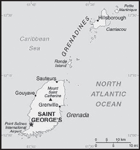
INTRODUCTION
Background: Carib Indians inhabited Grenada when Christopher COLUMBUS landed on the island in 1498, but it remained uncolonized for more than a century. The French settled Grenada in the 17th century, established sugar estates, and imported large numbers of African slaves. Britain took the island in 1762 and vigorously expanded sugar production. In the 19th century, cacao eventually surpassed sugar as the main export crop; in the 20th century, nutmeg became the leading export. In 1967, Britain gave Grenada autonomy over its internal affairs. Full independence was attained in 1974, making Grenada one of the smallest independent countries in the Western Hemisphere. In 1979, a leftist New Jewel Movement seized power under Maurice BISHOP, ushering in the Grenada Revolution. On 19 October 1983, factions within the revolutionary government overthrew and killed BISHOP and members of his party. Six days later, the island was invaded by US forces and those of six other Caribbean nations, which quickly captured the ringleaders and their hundreds of Cuban advisers. The rule of law was restored, and democratic elections were reinstituted the following year and have continued since then.
GEOGRAPHY
Location: Caribbean, island between the Caribbean Sea and Atlantic Ocean, north of Trinidad and Tobago
Geographic coordinates: 12 07 N, 61 40 W
Map references: Central America and the Caribbean
Area: total: 344 sq km
land: 344 sq km
water: 0 sq km
comparison ranking: total 207
Area - comparative: twice the size of Washington, DC
Land boundaries: total: 0 km
Coastline: 121 km
Maritime claims: territorial sea: 12 nm
exclusive economic zone: 200 nm
Climate: tropical; tempered by northeast trade winds
Terrain: volcanic in origin with central mountains
Elevation: highest point: Mount Saint Catherine 840 m
lowest point: Caribbean Sea 0 m
Natural resources: timber, tropical fruit
Land use: agricultural land: 32.3% (2018 est.)
arable land: 8.8% (2018 est.)
permanent crops: 20.6% (2018 est.)
permanent pasture: 2.9% (2018 est.)
forest: 50% (2018 est.)
other: 17.7% (2018 est.)
Irrigated land: 20 sq km (2012)
Population distribution: approximately one-third of the population is found in the capital of St. George’s; the island’s population is concentrated along the coast
Natural hazards: lies on edge of hurricane belt; hurricane season lasts from June to November
volcanism: Mount Saint Catherine (840 m) lies on the island of Grenada; Kick ’em Jenny, an active submarine volcano (seamount) on the Caribbean Sea floor, lies about 8 km north of the island of Grenada; these two volcanoes are at the southern end of the volcanic island arc of the Lesser Antilles that extends up to the Netherlands dependency of Saba in the north
Geography - note: the administration of the islands of the Grenadines group is divided between Saint Vincent and the Grenadines and Grenada
PEOPLE AND SOCIETY
Population: 114,299 (2023 est.)
comparison ranking: 190
Nationality: noun: Grenadian(s)
adjective: Grenadian
Ethnic groups: African descent 82.4%, mixed 13.3%, East Indian 2.2%, other 1.3%, unspecified 0.9% (2011 est.)
Languages: English (official), French patois
Religions: Protestant 49.2% (includes Pentecostal 17.2%, Seventh Day Adventist 13.2%, Anglican 8.5%, Baptist 3.2%, Church of God 2.4%, Evangelical 1.9%, Methodist 1.6%, other 1.2%), Roman Catholic 36%, Jehovah’s Witness 1.2%, Rastafarian 1.2%, other 5.5%, none 5.7%, unspecified 1.3% (2011 est.)
Age structure: 0-14 years: 22.23% (male 13,261/female 12,153)
15-64 years: 65.51% (male 38,112/female 36,765)
65 years and over: 12.26% (2023 est.) (male 6,630/female 7,378)
Dependency ratios: total dependency ratio: 51.3
youth dependency ratio: 36.4
elderly dependency ratio: 14.9
potential support ratio: 6.7 (2021 est.)
Median age: total: 33.3 years (2020)
male: 33.1 years
female: 33.4 years
comparison ranking: total 98
Population growth rate: 0.29% (2023 est.)
comparison ranking: 168
Birth rate: 13.61 births/1,000 population (2023 est.)
comparison ranking: 131
Death rate: 8.34 deaths/1,000 population (2023 est.)
comparison ranking: 77
Net migration rate: -2.34 migrant(s)/1,000 population (2023 est.)
comparison ranking: 173
Population distribution: approximately one-third of the population is found in the capital of St. George’s; the island’s population is concentrated along the coast
Urbanization: urban population: 37.1% of total population (2023)
rate of urbanization: 0.86% annual rate of change (2020-25 est.)
Major urban areas - population: 39,000 SAINT GEORGE’S (capital) (2018)
Sex ratio: at birth: 1.1 male(s)/female
0-14 years: 1.09 male(s)/female
15-64 years: 1.04 male(s)/female
65 years and over: 0.9 male(s)/female
total population: 1.03 male(s)/female (2023 est.)
Maternal mortality ratio: 21 deaths/100,000 live births (2020 est.)
comparison ranking: 121
Infant mortality rate: total: 9.2 deaths/1,000 live births (2023 est.)
male: 8.77 deaths/1,000 live births
female: 9.68 deaths/1,000 live births
comparison ranking: total 140
Life expectancy at birth: total population: 76 years (2023 est.)
male: 73.41 years
female: 78.84 years
comparison ranking: total population 117
Total fertility rate: 1.92 children born/woman (2023 est.)
comparison ranking: 117
Gross reproduction rate: 0.91 (2023 est.)
Drinking water source: improved: total: 96.8% of population
unimproved: total: 3.2% of population (2017 est.)
Current health expenditure: 5.8% of GDP (2020)
Physicians density: 1.44 physicians/1,000 population (2018)
Hospital bed density: 3.6 beds/1,000 population (2017)
Sanitation facility access: improved: total: 93.7% of population
unimproved: total: 6.3% of population (2020 est.)
Obesity - adult prevalence rate: 21.3% (2016)
comparison ranking: 91
Alcohol consumption per capita: total: 8.62 liters of pure alcohol (2019 est.)
beer: 3.54 liters of pure alcohol (2019 est.)
wine: 0.56 liters of pure alcohol (2019 est.)
spirits: 4.21 liters of pure alcohol (2019 est.)
other alcohols: 0.31 liters of pure alcohol (2019 est.)
comparison ranking: total 37
Currently married women (ages 15-49): 41.3% (2023 est.)
Education expenditures: 3.6% of GDP (2018 est.)
comparison ranking: 140
Literacy: definition: age 15 and over can read and write
total population: 98.6%
male: 98.6%
female: 98.6% (2014 est.)
School life expectancy (primary to tertiary education): total: 19 years
male: 18 years
female: 19 years (2018)
ENVIRONMENT
Environment - current issues: deforestation causing habitat destruction and species loss; coastal erosion and contamination; pollution and sedimentation; inadequate solid waste management
Environment - international agreements: party to: Biodiversity, Climate Change, Climate Change-Kyoto Protocol, Climate Change-Paris Agreement, Comprehensive Nuclear Test Ban, Desertification, Endangered Species, Law of the Sea, Ozone Layer Protection, Ship Pollution, Wetlands, Whaling
signed, but not ratified: none of the selected agreements
Climate: tropical; tempered by northeast trade winds
Land use: agricultural land: 32.3% (2018 est.)
arable land: 8.8% (2018 est.)
permanent crops: 20.6% (2018 est.)
permanent pasture: 2.9% (2018 est.)
forest: 50% (2018 est.)
other: 17.7% (2018 est.)
Urbanization: urban population: 37.1% of total population (2023)
rate of urbanization: 0.86% annual rate of change (2020-25 est.)
Revenue from forest resources: 0% of GDP (2018 est.)
comparison ranking: 161
Revenue from coal: 0% of GDP (2018 est.)
comparison ranking: 74
Air pollutants: particulate matter emissions: 10.08 micrograms per cubic meter (2019 est.)
carbon dioxide emissions: 0.27 megatons (2016 est.)
methane emissions: 2.04 megatons (2020 est.)
Waste and recycling: municipal solid waste generated annually: 29,536 tons (2012 est.)
Total water withdrawal: municipal: 10 million cubic meters (2020 est.)
industrial: 0 cubic meters (2017 est.)
agricultural: 2.1 million cubic meters (2017 est.)
Total renewable water resources: 200 million cubic meters (2020 est.)
GOVERNMENT
Country name: conventional long form: none
conventional short form: Grenada
etymology: derivation of the name remains obscure; some sources attribute the designation to Spanish influence (most likely named for the Spanish city of Granada), with subsequent French and English interpretations resulting in the present-day Grenada; in Spanish “Granada” means “pomegranate”
Government type: parliamentary democracy under a constitutional monarchy; a Commonwealth realm
Capital: name: Saint George’s
geographic coordinates: 12 03 N, 61 45 W
time difference: UTC-4 (1 hour ahead of Washington, DC, during Standard Time)
etymology: the 1763 Treaty of Paris transferred possession of Grenada from France to Great Britain; the new administration renamed Ville de Fort Royal (Fort Royal Town) to Saint George’s Town, after the patron saint of England; eventually the name became simply Saint George’s
Administrative divisions: 6 parishes and 1 dependency*; Carriacou and Petite Martinique*, Saint Andrew, Saint David, Saint George, Saint John, Saint Mark, Saint Patrick
Independence: 7 February 1974 (from the UK)
National holiday: Independence Day, 7 February (1974)
Constitution: history: previous 1967; latest presented 19 December 1973, effective 7 February 1974, suspended 1979 following a revolution but restored in 1983
amendments: proposed by either house of Parliament; passage requires two-thirds majority vote by the membership in both houses and assent of the governor general; passage of amendments to constitutional sections, such as personal rights and freedoms, the structure, authorities, and procedures of the branches of government, the delimitation of electoral constituencies, or the procedure for amending the constitution, also requires two-thirds majority approval in a referendum; amended 1991, 1992
Legal system: common law based on English model
International law organization participation: has not submitted an ICJ jurisdiction declaration; accepts ICCt jurisdiction
Citizenship: citizenship by birth: yes
citizenship by descent only: yes
dual citizenship recognized: yes
residency requirement for naturalization: 7 years for persons from a non-Caribbean state and 4 years for a person from a Caribbean state
Suffrage: 18 years of age; universal
Executive branch: chief of state: King CHARLES III (since 8 September 2022); represented by Governor General Cecile LA GRENADE (since 7 May 2013)
head of government: Prime Minister Dickon MITCHELL (since 24 June 2022)
cabinet: Cabinet appointed by the governor general on the advice of the prime minister
elections/appointments: the monarchy is hereditary; governor general appointed by the monarch; following legislative elections, the leader of the majority party or majority coalition usually appointed prime minister by the governor general
Legislative branch: description: bicameral Parliament consists of:
Senate (13 seats; members appointed by the governor general - 10 on the advice of the prime minister and 3 on the advice of the leader of the opposition party; members serve 5-year terms)
House of Representatives (15 seats; members directly elected in single-seat constituencies by simple majority vote to serve 5-year terms)
elections: Senate - last appointments on 3 August 2022 (next to be held no later than 2027) House of Representatives - last held on 23 June 2022 (next to be held no later than 2027)
election results: Senate - percent by party - NA; seats by party - NDC 7, NNP 3, independents 3
House of Representatives - percent of vote by party - NDC 51.8%; NNP 47.8%; other 0.4%; seats by party - NDC 9; NNP 6
Judicial branch: highest court(s): regionally, the Eastern Caribbean Supreme Court (ECSC) is the superior court of the Organization of Eastern Caribbean States; the ECSC - headquartered on St. Lucia - consists of the Court of Appeal - headed by the chief justice and 4 judges - and the High Court with 18 judges; the Court of Appeal is itinerant, traveling to member states on a schedule to hear appeals from the High Court and subordinate courts; High Court judges reside in the member states, with 2 in Grenada; appeals beyond the ECSC in civil and criminal matters are heard by the Judicial Committee of the Privy Council (in London)
judge selection and term of office: chief justice of Eastern Caribbean Supreme Court appointed by Her Majesty, Queen ELIZABETH II; other justices and judges appointed by the Judicial and Legal Services Commission, and independent body of judicial officials; Court of Appeal justices appointed for life with mandatory retirement at age 65; High Court judges appointed for life with mandatory retirement at age 62
subordinate courts: magistrates’ courts; Court of Magisterial Appeals
Political parties and leaders: National Democratic Congress or NDC [Dickon MITCHELL]
New National Party or NNP [Keith MITCHELL]
International organization participation: ACP, AOSIS, CARIFORUM, CARIBCAN, Caricom, CBI, CDB, CELAC, CSME, ECCU, EPA, FAO, G-77, IBRD, ICAO, ICCt (signatory), ICRM, IDA, IFAD, IFC, IFRCS, ILO, IMF, IMO, Interpol, IOC, ITU, ITUC, LAES, MIGA, NAM, OAS, OECS, OPANAL, OPCW, Petrocaribe, UN, UNCTAD, UNESCO, UNIDO, UPU, WHO, WIPO, WTO
Diplomatic representation in the US: chief of mission: Ambassador Tarlie FRANCIS (since 15 September 2023)
chancery: 1701 New Hampshire Avenue NW, Washington, DC 20009
telephone: [1] (202) 265-2561
FAX: [1] (202) 265-2468
email address and website:
https://grenadaembassyusa.org/
consulate(s) general: Miami, New York
Diplomatic representation from the US: chief of mission: the US does not have an official embassy in Grenada; the US Ambassador to Barbados is accredited to Grenada
embassy: Lance-aux-Epines, Saint George’s
mailing address: 3180 Grenada Place, Washington DC 20521-3180
telephone: [1] (473) 444-1173
FAX: [1] (473) 444-4820
email address and website:
https://bb.usembassy.gov/embassy/grenada/
Flag description: a rectangle divided diagonally into yellow triangles (top and bottom) and green triangles (hoist side and outer side), with a red border around the flag; there are seven yellow, five-pointed stars with three centered in the top red border, three centered in the bottom red border, and one on a red disk superimposed at the center of the flag; there is also a symbolic nutmeg pod on the hoist-side triangle (Grenada is a leading nutmeg producer); the seven stars stand for the seven administrative divisions, with the central star denoting the capital, St. George’s; yellow represents the sun and the warmth of the people, green stands for vegetation and agriculture, and red symbolizes harmony, unity, and courage
National symbol(s): Grenada dove, bougainvillea flower; national colors: red, yellow, green
National anthem: name: “Hail Grenada”
lyrics/music: Irva Merle BAPTISTE/Louis Arnold MASANTO
note: adopted 1974
ECONOMY
Economic overview: small OECS service-based economy; large tourism, construction, transportation, and education sectors; major spice exporter; shrinking but still high public debt; vulnerable to hurricanes; emerging blue economy incentives
Real GDP (purchasing power parity): $1.706 billion (2021 est.)
$1.629 billion (2020 est.)
$1.889 billion (2019 est.)
note: data are in 2017 dollars
comparison ranking: 200
Real GDP growth rate: 4.69% (2021 est.)
-13.76% (2020 est.)
0.68% (2019 est.)
comparison ranking: 98
Real GDP per capita: $13,700 (2021 est.)
$13,200 (2020 est.)
$15,400 (2019 est.)
note: data are in 2017 dollars
comparison ranking: 121
GDP (official exchange rate): $1.119 billion (2017 est.)
Inflation rate (consumer prices): 1.22% (2021 est.)
-0.74% (2020 est.)
0.6% (2019 est.)
comparison ranking: 193
Credit ratings: Standard & Poors rating: SD (2013)
note: The year refers to the year in which the current credit rating was first obtained.
GDP - composition, by sector of origin: agriculture: 6.8% (2017 est.)
industry: 15.5% (2017 est.)
services: 77.7% (2017 est.)
comparison rankings: services 38; industry 178; agriculture 113
GDP - composition, by end use: household consumption: 63% (2017 est.)
government consumption: 12% (2017 est.)
investment in fixed capital: 20% (2017 est.)
investment in inventories: -0.1% (2017 est.)
exports of goods and services: 60% (2017 est.)
imports of goods and services: -55% (2017 est.)
Agricultural products: bananas, watermelons, sweet potatoes, sugar cane, tomatoes, plantains, coconuts, melons, cucumbers, cabbages
Industries: food and beverages, textiles, light assembly operations, tourism, construction, education, call-center operations
Industrial production growth rate: 15.33% (2021 est.)
comparison ranking: 15
Labor force: 55,270 (2017 est.)
comparison ranking: 190
Labor force - by occupation: agriculture: 11%
industry: 20%
services: 69% (2008 est.)
Unemployment rate: 24% (2017 est.)
28.2% (2016 est.)
comparison ranking: 12
Population below poverty line: 38% (2008 est.)
Budget: revenues: $323 million (2019 est.)
expenditures: $263 million (2019 est.)
Budget surplus (+) or deficit (-): 3.2% (of GDP) (2017 est.)
comparison ranking: 12
Public debt: 70.4% of GDP (2017 est.)
82% of GDP (2016 est.)
comparison ranking: 60
Taxes and other revenues: 25.8% (of GDP) (2017 est.)
comparison ranking: 44
Fiscal year: calendar year
Current account balance: -$293.776 million (2021 est.)
-$219.561 million (2020 est.)
-$176.958 million (2019 est.)
comparison ranking: 106
Exports: $393.766 million (2021 est.) note: data are in current year dollars
$421.843 million (2020 est.)
$661.723 million (2019 est.)
comparison ranking: 194
Exports - partners: United States 30%, Saint Vincent and the Grenadines 12%, France 7%, Germany 5%, Trinidad and Tobago 5% (2021)
Exports - commodities: nutmeg, tuna, cocoa beans, fruits, nuts, toilet paper, acrylic paints, beer (2021)
Imports: $650 million (2021 est.) note: data are in current year dollars
$587 million (2020 est.)
$727 million (2019 est.)
comparison ranking: 196
Imports - partners: United States 35%, Trinidad and Tobago 17%, Cayman Islands 8%, China 5%, United Kingdom 4% (2021)
Imports - commodities: refined petroleum, poultry, cars, food preparation materials, delivery trucks (2021)
Reserves of foreign exchange and gold: $348.259 million (31 December 2021 est.)
$293.32 million (31 December 2020 est.)
$236.325 million (31 December 2019 est.)
comparison ranking: 175
Debt - external: $793.5 million (2017 est.)
$682.3 million (2016 est.)
comparison ranking: 169
Exchange rates: East Caribbean dollars (XCD) per US dollar -
Exchange rates: 2.7 (2021 est.)
2.7 (2020 est.)
2.7 (2019 est.)
2.7 (2018 est.)
2.7 (2017 est.)
ENERGY
Electricity access: electrification - total population: 93.7% (2021)
electrification - urban areas: 93% (2020)
electrification - rural areas: 96% (2020)
Electricity: installed generating capacity: 55,000 kW (2020 est.)
consumption: 194.495 million kWh (2019 est.)
exports: 0 kWh (2020 est.)
imports: 0 kWh (2020 est.)
transmission/distribution losses: 19 million kWh (2019 est.)
comparison rankings: imports 145; exports 130; installed generating capacity 190; transmission/distribution losses 186; consumption 186
Electricity generation sources: fossil fuels: 98.3% of total installed capacity (2020 est.)
solar: 1.6% of total installed capacity (2020 est.)
wind: 0.1% of total installed capacity (2020 est.)
Petroleum: total petroleum production: 0 bbl/day (2021 est.)
refined petroleum consumption: 2,200 bbl/day (2019 est.)
Refined petroleum products - imports: 1,886 bbl/day (2015 est.)
comparison ranking: 191
Natural gas: production: 0 cubic meters (2021 est.)
consumption: 0 cubic meters (2021 est.)
exports: 0 cubic meters (2021 est.)
imports: 0 cubic meters (2021 est.)
proven reserves: 0 cubic meters (2021 est.)
Carbon dioxide emissions: 316,000 metric tonnes of CO2 (2019 est.)
from petroleum and other liquids: 316,000 metric tonnes of CO2 (2019 est.)
comparison ranking: total emissions 196
Energy consumption per capita: 39.799 million Btu/person (2019 est.)
comparison ranking: 107
COMMUNICATIONS
Telephones - fixed lines: total subscriptions: 26,000 (2021 est.)
subscriptions per 100 inhabitants: 21 (2021 est.)
comparison ranking: total subscriptions 170
Telephones - mobile cellular: total subscriptions: 100,000 (2021 est.)
subscriptions per 100 inhabitants: 81 (2021 est.)
comparison ranking: total subscriptions 191
Telecommunication systems: general assessment: the telecom sector has seen a decline in subscriber numbers (particularly for prepaid mobile services the mainstay of short term visitors) and revenue; fixed and mobile broadband services are two areas that have benefited from the crisis as employees and students have resorted to working from home; one area of the telecom market that is not prepared for growth is 5G mobile; governments, regulators, and even the mobile network operators have shown that they have not been investing in 5G opportunities at the present time; network expansion and enhancements remain concentrated around improving LTE coverage (2021)
domestic: 21 per 100 for fixed-line and 81 per 100 for mobile-cellular (2021)
international: country code - 1-473; landing points for the ECFS, Southern Caribbean Fiber and CARCIP submarine cables with links to 13 Caribbean islands extending from the British Virgin Islands to Trinidad & Tobago including Puerto Rico and Barbados; SHF radiotelephone links to Trinidad and Tobago and Saint Vincent; VHF and UHF radio links to Trinidad (2019)
Broadcast media: multiple publicly and privately owned television and radio stations; Grenada Information Service (GIS) is government-owned and provides television and radio services; the Grenada Broadcasting Network, jointly owned by the government and the Caribbean Communications Network of Trinidad and Tobago, operates a TV station and 2 radio stations; Meaningful Television (MTV) broadcasts island-wide and is part of a locally-owned media house, Moving Target Company, that also includes an FM radio station and a weekly newspaper; multi-channel cable TV subscription service is provided by Columbus Communications Grenada (FLOW GRENADA) and is available island wide; approximately 25 private radio stations also broadcast throughout the country (2019)
Internet country code: .gd
Internet users: total: 93,600 (2021 est.)
percent of population: 78% (2021 est.)
comparison ranking: total 189
Broadband - fixed subscriptions: total: 32,000 (2020 est.)
subscriptions per 100 inhabitants: 28 (2020 est.)
comparison ranking: total 150
TRANSPORTATION
Civil aircraft registration country code prefix: J3
Airports: 3 (2021)
comparison ranking: total 195
Airports - with paved runways: 3
note: paved runways have a concrete or asphalt surface but not all have facilities for refueling, maintenance, or air traffic control; the length of a runway required for aircraft to safely operate depends on a number of factors including the type of aircraft, the takeoff weight (including passengers, cargo, and fuel), engine types, flap settings, landing speed, elevation of the airport, and average maximum daily air temperature; paved runways can reach a length of 5,000 m (16,000 ft.), but the “typical” length of a commercial airline runway is between 2,500-4,000 m (8,000-13,000 ft.)
Roadways: total: 1,127 km (2017)
paved:902 km (2017)
unpaved:225 km (2017)
comparison ranking: total 182
Merchant marine: total: 6 (2022)
by type: general cargo 3, other 3
comparison ranking: total 165
Ports and terminals: major seaport(s): Saint George’s
MILITARY AND SECURITY
Military and security forces: no regular military forces; the Royal Grenada Police Force (under the Ministry of National Security) includes a Coast Guard and a paramilitary Special Services Unit (2023)
Military - note: Grenada joined the Caribbean Regional Security System (RSS) in 1985; RSS signatories (Antigua and Barbuda, Barbados, Dominica, Saint Kitts, Saint Lucia, and Saint Vincent and the Grenadines) agreed to prepare contingency plans and assist one another, on request, in national emergencies, prevention of smuggling, search and rescue, immigration control, fishery protection, customs and excise control, maritime policing duties, protection of off-shore installations, pollution control, national and other disasters, and threats to national security (2023)
TRANSNATIONAL ISSUES
Disputes - international: none identified
Illicit drugs: a transit point for cocaine and marijuana destined for North America, Europe, and elsewhere in the Caribbean; some local demand for cocaine and some use of synthetic drugs
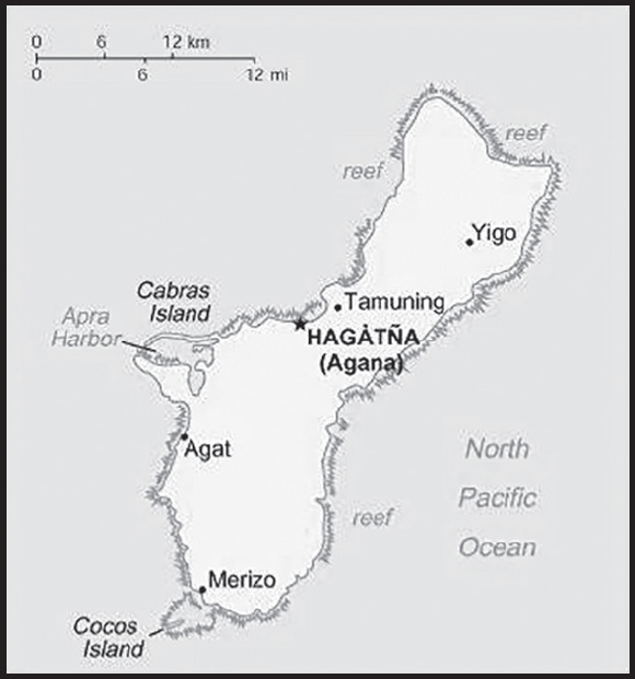
INTRODUCTION
Background: Guam was settled by Austronesian people around 1500 B.C. These people became the indigenous Chamorro and were influenced by later migrations, including the Micronesians in the first millennium A.D., and island Southeast Asians around 900. Society was stratified with higher classes living along the coast and lower classes living inland. Spanish explorer Ferdinand MAGELLAN was the first European to see Guam in 1521, and Spain claimed the island in 1565 as it served as a refueling stop for ships between Mexico and the Philippines. Spain formally colonized Guam in 1668. Spain’s brutal repression of the Chamorro, along with new diseases and intermittent warfare, reduced the indigenous population from more than 100,000 to less than 5,000 by the 1700s. Spain tried to repopulate the island by forcing people from nearby islands to settle on Guam and preventing them from escaping.
Guam became a hub for whalers and traders in the western Pacific in the early 1800s. During the 1898 Spanish-American War, the US Navy occupied Guam and set up a military administration. The US Navy opposed local control of government despite repeated petitions by the Chamorro. Japan invaded Guam in 1941 and instituted a repressive regime. During the US recapture of Guam in 1944, the island’s two largest villages were destroyed. After World War II, political pressure from local Chamorro leaders led to Guam being established as an unincorporated organized territory in 1950 with US citizenship granted to all Chamorro. In a referendum in 1982, more than 75% of voters chose closer relations with the US over independence, although no change in status was made because of disagreements on the future right of Chamorro self-determination. The US military holds about 29% of Guam’s land and stations several thousand troops on the island. The installations are some of the most strategically important US bases in the Pacific; they also constitute the island’s most important source of income and economic stability.
GEOGRAPHY
Location: Oceania, island in the North Pacific Ocean, about three-quarters of the way from Hawaii to the Philippines
Geographic coordinates: 13 28 N, 144 47 E
Map references: Oceania
Area: total: 544 sq km
land: 544 sq km
water: 0 sq km
comparison ranking: total 194
Area - comparative: three times the size of Washington, DC
Land boundaries: total: 0 km
Coastline: 125.5 km
Maritime claims: territorial sea: 12 nm
exclusive economic zone: 200 nm
Climate: tropical marine; generally warm and humid, moderated by northeast trade winds; dry season (January to June), rainy season (July to December); little seasonal temperature variation
Terrain: volcanic origin, surrounded by coral reefs; relatively flat coralline limestone plateau (source of most fresh water), with steep coastal cliffs and narrow coastal plains in north, low hills in center, mountains in south
Elevation: highest point: Mount Lamlam 406 m
lowest point: Pacific Ocean 0 m
Natural resources: aquatic wildlife (supporting tourism), fishing (largely undeveloped)
Land use: agricultural land: 33.4% (2018 est.)
arable land: 1.9% (2018 est.)
permanent crops: 16.7% (2018 est.)
permanent pasture: 14.8% (2018 est.)
forest: 47.9% (2018 est.)
other: 18.7% (2018 est.)
Irrigated land: 2 sq km (2012)
Population distribution: no large cities exist on the island, though large villages (municipalities) attract much of the population; the largest of these is Dededo
Natural hazards: frequent squalls during rainy season; relatively rare but potentially destructive typhoons (June to December)
Geography - note: largest and southernmost island in the Mariana Islands archipelago and the largest island in Micronesia; strategic location in western North Pacific Ocean
PEOPLE AND SOCIETY
Population: 169,330 (2023 est.)
comparison ranking: 185
Nationality: noun: Guamanian(s) (US citizens)
adjective: Guamanian
Ethnic groups: Chamorro 37.3%, Filipino 26.3%, White 7.1%, Chuukese 7%, Korean 2.2%, other Pacific Islander 2%, other Asian 2%, Chinese 1.6%, Palauan 1.6%, Japanese 1.5%, Pohnpeian 1.4%, mixed 9.4%, other 0.6% (2010 est.)
Languages: English 43.6%, Filipino 21.2%, Chamorro 17.8%, other Pacific island languages 10%, Asian languages 6.3%, other 1.1% (2010 est.)
Religions: Christian (predominantly Roman Catholic) 94.2%, folk religions 1.5%, Buddhist 1.1%, other 1.6%, unaffiliated 1.7% (2020 est.)
Age structure: 0-14 years: 26.64% (male 23,325/female 21,792)
15-64 years: 62.85% (male 55,606/female 50,816)
65 years and over: 10.51% (2023 est.) (male 8,290/female 9,501)
Dependency ratios: total dependency ratio: 60.7
youth dependency ratio: 42.3
elderly dependency ratio: 18.4
potential support ratio: 5.4 (2021 est.)
Median age: total: 29.4 years (2020)
male: 28.7 years
female: 30.2 years
comparison ranking: total 130
Population growth rate: 0.13% (2023 est.)
comparison ranking: 182
Birth rate: 18.33 births/1,000 population (2023 est.)
comparison ranking: 75
Death rate: 6.08 deaths/1,000 population (2023 est.)
comparison ranking: 150
Net migration rate: -10.94 migrant(s)/1,000 population (2023 est.)
comparison ranking: 224
Population distribution: no large cities exist on the island, though large villages (municipalities) attract much of the population; the largest of these is Dededo
Urbanization: urban population: 95.2% of total population (2022)
rate of urbanization: 0.84% annual rate of change (2020-25 est.)
Major urban areas - population: 147,000 HAGATNA (capital) (2018)
Sex ratio: at birth: 1.07 male(s)/female
0-14 years: 1.07 male(s)/female
15-64 years: 1.09 male(s)/female
65 years and over: 0.87 male(s)/female
total population: 1.06 male(s)/female (2023 est.)
Infant mortality rate: total: 11.2 deaths/1,000 live births (2023 est.)
male: 11.23 deaths/1,000 live births
female: 11.16 deaths/1,000 live births
comparison ranking: total 125
Life expectancy at birth: total population: 77.74 years (2023 est.)
male: 75.33 years
female: 80.31 years
comparison ranking: total population 89
Total fertility rate: 2.76 children born/woman (2023 est.)
comparison ranking: 56
Gross reproduction rate: 1.33 (2023 est.)
Drinking water source: improved: total: 99.7% of population
unimproved: total: 0.3% of population (2020 est.)
Sanitation facility access: improved: total: 89.8% of population (2015 est.)
unimproved: total: 10.2% of population (2015 est.)
Currently married women (ages 15-49): 37% (2023 est.)
Youth unemployment rate (ages 15-24): total: 15.3% (2021 est.)
male: 14.7%
female: 16.1%
comparison ranking: total 115
ENVIRONMENT
Environment - current issues: fresh water scarcity; reef damage; inadequate sewage treatment; extermination of native bird populations by the rapid proliferation of the brown tree snake, an exotic, invasive species
Climate: tropical marine; generally warm and humid, moderated by northeast trade winds; dry season (January to June), rainy season (July to December); little seasonal temperature variation
Land use: agricultural land: 33.4% (2018 est.)
arable land: 1.9% (2018 est.)
permanent crops: 16.7% (2018 est.)
permanent pasture: 14.8% (2018 est.)
forest: 47.9% (2018 est.)
other: 18.7% (2018 est.)
Urbanization: urban population: 95.2% of total population (2022)
rate of urbanization: 0.84% annual rate of change (2020-25 est.)
Revenue from forest resources: 0% of GDP (2018 est.)
comparison ranking: 200
Revenue from coal: 0% of GDP (2018 est.)
comparison ranking: 102
Waste and recycling: municipal solid waste generated annually: 141,500 tons (2012 est.)
municipal solid waste recycled annually: 25,258 tons (2011 est.)
percent of municipal solid waste recycled: 17.9% (2011 est.)
GOVERNMENT
Country name: conventional long form: none
conventional short form: Guam
local long form: none
local short form: Guahan
abbreviation: GU
etymology: the native Chamorro name for the island “Guahan” (meaning “we have” or “ours”) was changed to Guam in the 1898 Treaty of Paris, whereby Spain relinquished Guam, Cuba, Puerto Rico, and the Philippines to the US
Government type: unincorporated organized territory of the US with local self-government; republican form of territorial government with separate executive, legislative, and judicial branches
Dependency status: unincorporated organized territory of the US with policy relations between Guam and the Federal Government under the jurisdiction of the Office of Insular Affairs, US Department of the Interior, Washington, DC
Capital: name: Hagatna (Agana)
geographic coordinates: 13 28 N, 144 44 E
time difference: UTC+10 (15 hours ahead of Washington, DC, during Standard Time)
etymology: the name is derived from the Chamoru word “haga,” meaning “blood”, and may refer to the bloodlines of the various families that established the original settlement
Administrative divisions: none (territory of the US)
Independence: none (territory of the US)
National holiday: Discovery Day (or Magellan Day), first Monday in March (1521)
Constitution: history: effective 1 July 1950 (Guam Act of 1950 serves as a constitution)
amendments: amended many times, last in 2015
Legal system: common law modeled on US system; US federal laws apply
Citizenship: see United States
Suffrage: 18 years of age; universal; note - Guamanians are US citizens but do not vote in US presidential elections
Executive branch: chief of state: President Joseph R. BIDEN Jr. (since 20 January 2021); Vice President Kamala D. HARRIS (since 20 January 2021)
head of government: Governor Lourdes LEON GUERRERO (since 7 January 2019); Lieutenant Governor Josh TENORIO (since 7 January 2019)
cabinet: Cabinet appointed by the governor with the consent of the Legislature
elections/appointments: president and vice president indirectly elected on the same ballot by an Electoral College of ‘electors’ chosen from each state to serve a 4-year term (eligible for a second term); under the US Constitution, residents of unincorporated territories, such as Guam, do not vote in elections for US president and vice president; however, they may vote in Democratic and Republican presidential primary elections; governor and lieutenant governor elected on the same ballot by absolute majority vote in 2 rounds if needed for a 4-year term (eligible for 2 consecutive terms); gubernatorial election last held on 8 November 2022 (next to be held in November 2026)
election results: Lourdes LEON GUERRERO reelected governor; percent of vote - Lourdes LEON GUERRERO (Democratic Party) 55%, Felix CAMACHO (Republican Party) 44%; Josh TENORIO (Democratic Party) elected lieutenant governor
Legislative branch: description: unicameral Legislature of Guam or Liheslaturan Guahan (15 seats; members elected in a single countrywide constituency by simple majority vote to serve 2-year terms)
Guam directly elects 1 member by simple majority vote to serve a 2-year term as the delegate to the US House of Representatives; note - the delegate can vote when serving on a committee and when the House meets as the Committee of the Whole House, but not when legislation is submitted for a “full floor” House vote
elections: Guam Legislature - last held on 8 November 2022 (next to be held on November 2024) delegate to the US House of Representatives - last held on 8 November 2022 (next to be held on November 2024)
election results: Guam Legislature - percent of vote by party - NA; seats by party - Democratic Party 10, Republican Party 5; composition - men 5, women 10, percent of women 66.7%
Guam delegate to the US House of Representatives - Democratic Party 1 (man)
Judicial branch: highest court(s): Supreme Court of Guam (consists of 3 justices); note - appeals beyond the Supreme Court of Guam are referred to the US Supreme Court
judge selection and term of office: justices appointed by the governor and confirmed by the Guam legislature; justices appointed for life subject to retention election every 10 years
subordinate courts: Superior Court of Guam - includes several divisions; US Federal District Court for the District of Guam (a US territorial court; appeals beyond this court are heard before the US Court of Appeals for the Ninth Circuit)
Political parties and leaders: Democratic Party [Anthony “Tony” M. BABAUTA]
Republican Party [Juan Carlos BENITEZ]
International organization participation: AOSIS (observer), IOC, PIF (observer), SPC, UPU
Diplomatic representation in the US: none (territory of the US)
Diplomatic representation from the US: embassy: none (territory of the US)
Flag description: territorial flag is dark blue with a narrow red border on all four sides; centered is a red-bordered, pointed, vertical ellipse containing a beach scene, a proa or outrigger canoe with sail, and a palm tree with the word GUAM superimposed in bold red letters; the proa is sailing in Agana Bay with the promontory of Puntan Dos Amantes, near the capital, in the background; the shape of the central emblem is that of a Chamorro sling stone, used as a weapon for defense or hunting; blue represents the sea and red the blood shed in the struggle against oppression
note: the US flag is the national flag
National symbol(s): coconut tree; national colors: deep blue, red
National anthem: name: “Fanohge Chamoru” (Stand Ye Guamanians)
lyrics/music: Ramon Manalisay SABLAN [English], Lagrimas UNTALAN [Chamoru]/Ramon Manalisay SABLAN
note: adopted 1919; the local anthem is also known as “Guam Hymn”; as a territory of the United States, “The Star-Spangled Banner,” which generally follows the playing of “Stand Ye Guamanians,” is official (see United States)
ECONOMY
Economic overview: small Pacific island US territorial economy; upper income, tourism-based economy; hard-hit by COVID-19 disruptions; relaunched many industries via vaccination tourism; domestic economy relies on multiple military bases; environmentally fragile economy
Real GDP (purchasing power parity): $5.793 billion (2016 est.)
$5.697 billion (2015 est.)
$5.531 billion (2014 est.)
comparison ranking: 173
Real GDP growth rate: 1.06% (2021 est.)
-11.39% (2020 est.)
2.6% (2019 est.)
comparison ranking: 183
Real GDP per capita: $35,600 (2016 est.)
$35,200 (2015 est.)
$34,400 (2014 est.)
comparison ranking: 57
GDP (official exchange rate): $5.793 billion (2016 est.)
Inflation rate (consumer prices): 1% (2017 est.)
0% (2016 est.)
comparison ranking: 199
GDP - composition, by sector of origin: agriculture: NA
industry: NA
services: 58.4% (2015 est.)
comparison ranking: services 134
GDP - composition, by end use: household consumption: 56.2% (2016 est.)
government consumption: 55% (2016 est.)
investment in fixed capital: 20.6% (2016 est.)
investment in inventories: (2016 est.) NA
exports of goods and services: 19.4% (2016 est.)
imports of goods and services: -51.2% (2016 est.)
Agricultural products: fruits, copra, vegetables; eggs, pork, poultry, beef
Industries: national defense, tourism, construction, transshipment services, concrete products, printing and publishing, food processing, textiles
Industrial production growth rate: NA
Labor force: 76,200 (2021 est.)
note: includes only the civilian labor force
comparison ranking: 186
Labor force - by occupation: agriculture: 0.3%
industry: 21.6%
services: 78.1% (2013 est.)
Unemployment rate: 6.98% (2021 est.)
6.8% (2020 est.)
5.51% (2019 est.)
comparison ranking: 114
Youth unemployment rate (ages 15-24): total: 15.3% (2021 est.)
male: 14.7%
female: 16.1%
comparison ranking: total 115
Population below poverty line: 23% (2001 est.)
Household income or consumption by percentage share: lowest 10%: NA
highest 10%: NA
Budget: revenues: $1.24 billion (2016 est.)
expenditures: $1.299 billion (2016 est.)
Budget surplus (+) or deficit (-): -1% (of GDP) (2016 est.)
comparison ranking: 75
Public debt: 22.1% of GDP (2016 est.)
32.1% of GDP (2013)
comparison ranking: 185
Taxes and other revenues: 21.4% (of GDP) (2016 est.)
comparison ranking: 79
Fiscal year: 1 October - 30 September
Exports: $1.124 billion (2016 est.)
$1.046 billion (2015 est.)
comparison ranking: 174
Exports - partners: South Korea 31%, Hong Kong 27%, Taiwan 18%, Philippines 7% (2019)
Exports - commodities: scrap iron, scrap copper, boring/sinking machinery, leather handbags, rubber, scrap aluminum (2021)
Imports: $2.964 billion (2016 est.)
$3.054 billion (2015 est.)
comparison ranking: 161
Imports - partners: Singapore 33%, Japan 21%, South Korea 18%, Hong Kong 9%, Malaysia 6% (2019)
Imports - commodities: refined petroleum, trunks/cases, cars, insulated wire, broadcasting equipment (2019)
Debt - external: NA
Exchange rates: the US dollar is used
ENERGY
Electricity access: electrification - total population: 100% (2021)
Electricity: installed generating capacity: 455,000 kW (2020 est.)
consumption: 1.683 billion kWh (2019 est.)
exports: 0 kWh (2020 est.)
imports: 0 kWh (2020 est.)
transmission/distribution losses: 85 million kWh (2019 est.)
comparison rankings: imports 205; exports 205; installed generating capacity 153; transmission/distribution losses 162; consumption 151
Electricity generation sources: fossil fuels: 96% of total installed capacity (2020 est.)
solar: 4% of total installed capacity (2020 est.)
Petroleum: total petroleum production: 0 bbl/day (2021 est.)
refined petroleum consumption: 2,100 bbl/day (2019 est.) Data represented includes both Guam and Northern Mariana Islands
Refined petroleum products - imports: 13,500 bbl/day (2015 est.)
comparison ranking: 141
Carbon dioxide emissions: 1.828 million metric tonnes of CO2 (2019 est.)
from petroleum and other liquids: 1.828 million metric tonnes of CO2 (2019 est.)
comparison ranking: total emissions 160
Energy consumption per capita: 152.767 million Btu/person (2019 est.)
comparison ranking: 33
COMMUNICATIONS
Telephones - fixed lines: total subscriptions: 70,000 (2021 est.)
subscriptions per 100 inhabitants: 41 (2021 est.)
comparison ranking: total subscriptions 145
Telephones - mobile cellular: total subscriptions: 98,000 (2009 est.)
subscriptions per 100 inhabitants: 62 (2009 est.)
comparison ranking: total subscriptions 193
Telecommunication systems: general assessment: Guam’s telecommunications companies provide important services that allow other businesses on island to operate; Guam plays a larger, and growing role, in global telecommunications infrastructure, the submarine fiber optic cables that land on Guam benefit island residents and the local economy; in the Asia-Pacific region the demand for 4G, 5G, and broadband access is rapidly increasing; the 11 submarine cables that currently land on Guam, connecting the U.S. to the Asia-Pacific region, are some of the more than 400 cables that are the backbone of global telecommunications, providing nearly all of the world’s internet and phone service (2021)
domestic: fixed-line subscriptions 41 per 100 and 62 per 100 mobile-cellular subscriptions in 2004 (2020)
international: country code - 1-671; major landing points for Atisa, HANTRU1, HK-G, JGA-N, JGA-S, PIPE-1, SEA-US, SxS, Tata TGN-Pacific, AJC, GOKI, AAG, AJC and Mariana-Guam Cable submarine cables between Asia, Australia, and the US (Guam is a transpacific communications hub for major carriers linking the US and Asia); satellite earth stations - 2 Intelsat (Pacific Ocean) (2019)
Broadcast media: about a dozen TV channels, including digital channels; multi-channel cable TV services are available; roughly 20 radio stations
Internet country code: .gu
Internet users: total: 136,850 (2021 est.)
percent of population: 80.5% (2021 est.)
comparison ranking: total 184
Broadband - fixed subscriptions: total: 3,000 (2020 est.)
subscriptions per 100 inhabitants: 2 (2020 est.)
comparison ranking: total 193
TRANSPORTATION
Civil aircraft registration country code prefix: N
Airports: 5 (2021)
comparison ranking: total 179
Airports - with paved runways: 4
note: paved runways have a concrete or asphalt surface but not all have facilities for refueling, maintenance, or air traffic control; the length of a runway required for aircraft to safely operate depends on a number of factors including the type of aircraft, the takeoff weight (including passengers, cargo, and fuel), engine types, flap settings, landing speed, elevation of the airport, and average maximum daily air temperature; paved runways can reach a length of 5,000 m (16,000 ft.), but the “typical” length of a commercial airline runway is between 2,500-4,000 m (8,000-13,000 ft.)
Airports - with unpaved runways: 1
note: unpaved runways have a surface composition such as grass or packed earth and are most suited to the operation of light aircraft; unpaved runways are usually short, often less than 1,000 m (3,280 ft.) in length; airports with unpaved runways often lack facilities for refueling, maintenance, or air traffic control
Roadways: total: 1,045 km (2008)
comparison ranking: total 185
Merchant marine: total: 3 (2022)
by type: other 3
comparison ranking: total 173
Ports and terminals: major seaport(s): Apra Harbor
MILITARY AND SECURITY
Military and security forces: Guam National Guard (US Army)
Military - note: defense is the responsibility of the US; the US military maintains over 6,000 personnel on Guam, including an air base, an air wing, and a naval installation command (2023)
TRANSNATIONAL ISSUES
Disputes - international: none identified
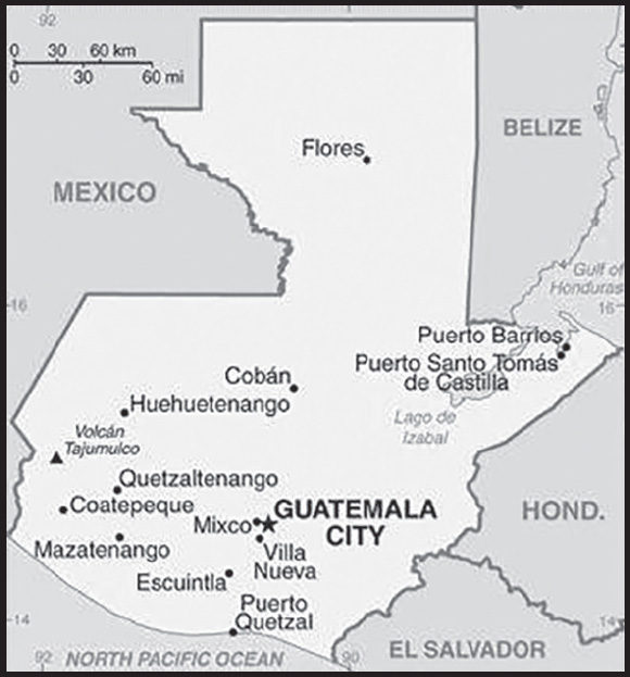
INTRODUCTION
Background: The Maya civilization flourished in Guatemala and surrounding regions during the first millennium A.D. After almost three centuries as a Spanish colony, Guatemala won its independence in 1821. During the second half of the 20th century, it experienced a variety of military and civilian governments, as well as a 36-year guerrilla war. In 1996, the government signed a peace agreement formally ending the internal conflict.
GEOGRAPHY
Location: Central America, bordering the North Pacific Ocean, between El Salvador and Mexico, and bordering the Gulf of Honduras (Caribbean Sea) between Honduras and Belize
Geographic coordinates: 15 30 N, 90 15 W
Map references: Central America and the Caribbean
Area: total: 108,889 sq km
land: 107,159 sq km
water: 1,730 sq km
comparison ranking: total 107
Area - comparative: slightly smaller than Pennsylvania
Land boundaries: total: 1,667 km
border countries (4): Belize 266 km; El Salvador 199 km; Honduras 244 km; Mexico 958 km
Coastline: 400 km
Maritime claims: territorial sea: 12 nm
exclusive economic zone: 200 nm
continental shelf: 200-m depth or to the depth of exploitation
Climate: tropical; hot, humid in lowlands; cooler in highlands
Terrain: two east-west trending mountain chains divide the country into three regions: the mountainous highlands, the Pacific coast south of mountains, and the vast northern Peten lowlands
Elevation: highest point: Volcan Tajumulco (highest point in Central America) 4,220 m
lowest point: Pacific Ocean 0 m
mean elevation: 759 m
Natural resources: petroleum, nickel, rare woods, fish, chicle, hydropower
Land use: agricultural land: 41.2% (2018 est.)
arable land: 14.2% (2018 est.)
permanent crops: 8.8% (2018 est.)
permanent pasture: 18.2% (2018 est.)
forest: 33.6% (2018 est.)
other: 25.2% (2018 est.)
Irrigated land: 3,375 sq km (2012)
Major lakes (area sq km): fresh water lake(s): Lago de Izabal - 590 sq km
Population distribution: the vast majority of the populace resides in the southern half of the country, particularly in the mountainous regions; more than half of the population lives in rural areas
Natural hazards: numerous volcanoes in mountains, with occasional violent earthquakes; Caribbean coast extremely susceptible to hurricanes and other tropical storms
volcanism: significant volcanic activity in the Sierra Madre range; Santa Maria (3,772 m) has been deemed a Decade Volcano by the International Association of Volcanology and Chemistry of the Earth’s Interior, worthy of study due to its explosive history and close proximity to human populations; Pacaya (2,552 m), which erupted in May 2010 causing an ashfall on Guatemala City and prompting evacuations, is one of the country’s most active volcanoes with frequent eruptions since 1965; other historically active volcanoes include Acatenango, Almolonga, Atitlan, Fuego, and Tacana; see note 2 under “Geography - note”
Geography - note: note 1: despite having both eastern and western coastlines (Caribbean Sea and Pacific Ocean respectively), there are no natural harbors on the west coast
note 2: Guatemala is one of the countries along the Ring of Fire, a belt of active volcanoes and earthquake epicenters bordering the Pacific Ocean; up to 90% of the world’s earthquakes and some 75% of the world’s volcanoes occur within the Ring of Fire
PEOPLE AND SOCIETY
Population: 17,980,803 (2023 est.)
comparison ranking: 69
Nationality: noun: Guatemalan(s)
adjective: Guatemalan
Ethnic groups: Mestizo (mixed Amerindian-Spanish - in local Spanish called Ladino) 56%, Maya 41.7%, Xinca (Indigenous, non-Maya) 1.8%, African descent 0.2%, Garifuna (mixed West and Central African, Island Carib, and Arawak) 0.1%, foreign 0.2% (2018 est.)
Languages: Spanish (official) 69.9%, Maya languages 29.7% (Q’eqchi’ 8.3%, K’iche 7.8%, Mam 4.4%, Kaqchikel 3%, Q’anjob’al 1.2%, Poqomchi’ 1%, other 4%), other 0.4% (includes Xinca and Garifuna); note - the 2003 Law of National Languages officially recognized 23 indigenous languages, including 21 Maya languages, Xinca, and Garifuna (2018 est.)
major-language sample(s):
La Libreta Informativa del Mundo, la fuente indispensable de información básica. (Spanish)
Religions: Roman Catholic 41.7%, Evangelical 38.8%, other 2.7%, atheist 0.1%, none 13.8%, unspecified 2.9% (2018 est.)
Demographic profile: Guatemala is a predominantly poor country that struggles in several areas of health and development, including infant, child, and maternal mortality, malnutrition, literacy, and contraceptive awareness and use. The country’s large indigenous population is disproportionately affected. Guatemala is the most populous country in Central America and has the highest fertility rate in Latin America. It also has the highest population growth rate in Latin America, which is likely to continue because of its large reproductive-age population and high birth rate. Almost half of Guatemala’s population is under age 19, making it the youngest population in Latin America. Guatemala’s total fertility rate has slowly declined during the last few decades due in part to limited government-funded health programs. However, the birth rate is still more close to three children per woman and is markedly higher among its rural and indigenous populations.
Guatemalans have a history of emigrating legally and illegally to Mexico, the United States, and Canada because of a lack of economic opportunity, political instability, and natural disasters. Emigration, primarily to the United States, escalated during the 1960 to 1996 civil war and accelerated after a peace agreement was signed. Thousands of Guatemalans who fled to Mexico returned after the war, but labor migration to southern Mexico continues.
Age structure: 0-14 years: 31.98% (male 2,927,423/female 2,822,441)
15-64 years: 62.78% (male 5,568,051/female 5,720,928)
65 years and over: 5.24% (2023 est.) (male 420,782/female 521,178)
Dependency ratios: total dependency ratio: 60.9
youth dependency ratio: 53
elderly dependency ratio: 7.9
potential support ratio: 12.7 (2021 est.)
Median age: total: 23.2 years (2020)
male: 22.6 years
female: 23.8 years
comparison ranking: total 178
Population growth rate: 1.54% (2023 est.)
comparison ranking: 62
Birth rate: 21.88 births/1,000 population (2023 est.)
comparison ranking: 58
Death rate: 4.89 deaths/1,000 population (2023 est.)
comparison ranking: 199
Net migration rate: -1.63 migrant(s)/1,000 population (2023 est.)
comparison ranking: 163
Population distribution: the vast majority of the populace resides in the southern half of the country, particularly in the mountainous regions; more than half of the population lives in rural areas
Urbanization: urban population: 53.1% of total population (2023)
rate of urbanization: 2.59% annual rate of change (2020-25 est.)
Major urban areas - population: 3.095 million GUATEMALA CITY (capital) (2023)
Sex ratio: at birth: 1.05 male(s)/female
0-14 years: 1.04 male(s)/female
15-64 years: 0.97 male(s)/female
65 years and over: 0.81 male(s)/female
total population: 0.98 male(s)/female (2023 est.)
Mother’s mean age at first birth: 20.6 years (2014/15 est.)
note: data represents median age at first birth among women 25-49
Maternal mortality ratio: 96 deaths/100,000 live births (2020 est.)
comparison ranking: 70
Infant mortality rate: total: 25.57 deaths/1,000 live births (2023 est.)
male: 28.81 deaths/1,000 live births
female: 22.18 deaths/1,000 live births
comparison ranking: total 62
Life expectancy at birth: total population: 73.18 years (2023 est.)
male: 71.17 years
female: 75.3 years
comparison ranking: total population 151
Total fertility rate: 2.57 children born/woman (2023 est.)
comparison ranking: 66
Gross reproduction rate: 1.25 (2023 est.)
Contraceptive prevalence rate: 60.6% (2014/15)
Drinking water source: improved: urban: 97.9% of population
rural: 92.2% of population
total: 95% of population
unimproved: urban: 2.1% of population
rural: 8% of population
total: 5% of population (2020 est.)
Current health expenditure: 6.5% of GDP (2020)
Physicians density: 1.24 physicians/1,000 population (2020)
Hospital bed density: 0.4 beds/1,000 population (2017)
Sanitation facility access: improved: urban: 90.4% of population
rural: 66.3% of population
total: 78.8% of population
unimproved: urban: 9.6% of population
rural: 33.7% of population
total: 21.2% of population (2020 est.)
Major infectious diseases: degree of risk: high (2023)
food or waterborne diseases: bacterial diarrhea, hepatitis A, and typhoid fever
vectorborne diseases: dengue fever and malaria
Obesity - adult prevalence rate: 21.2% (2016)
comparison ranking: 92
Alcohol consumption per capita: total: 1.63 liters of pure alcohol (2019 est.)
beer: 0.9 liters of pure alcohol (2019 est.)
wine: 0.05 liters of pure alcohol (2019 est.)
spirits: 0.68 liters of pure alcohol (2019 est.)
other alcohols: 0.01 liters of pure alcohol (2019 est.)
comparison ranking: total 135
Tobacco use: total: 10.9% (2020 est.)
male: 20.1% (2020 est.)
female: 1.6% (2020 est.)
comparison ranking: total 131
Children under the age of 5 years underweight: 14.4% (2021/22)
comparison ranking: 36
Currently married women (ages 15-49): 57.2% (2023 est.)
Education expenditures: 3.1% of GDP (2021 est.)
comparison ranking: 158
Literacy: definition: age 15 and over can read and write
total population: 83.3%
male: 87.7%
female: 79.3% (2021)
School life expectancy (primary to tertiary education): total: 11 years
male: 11 years
female: 10 years (2019)
Youth unemployment rate (ages 15-24): total: 7.2% (2021 est.)
male: 6.3%
female: 9.4%
comparison ranking: total 176
ENVIRONMENT
Environment - current issues: deforestation in the Peten rainforest; soil erosion; water pollution
Environment - international agreements: party to: Antarctic Treaty, Biodiversity, Climate Change, Climate Change-Kyoto Protocol, Climate Change-Paris Agreement, Comprehensive Nuclear Test Ban, Desertification, Endangered Species, Environmental Modification, Hazardous Wastes, Law of the Sea, Marine Dumping-London Convention, Marine Dumping-London Protocol, Nuclear Test Ban, Ozone Layer Protection, Ship Pollution, Tropical Timber 2006, Wetlands
signed, but not ratified: none of the selected agreements
Climate: tropical; hot, humid in lowlands; cooler in highlands
Land use: agricultural land: 41.2% (2018 est.)
arable land: 14.2% (2018 est.)
permanent crops: 8.8% (2018 est.)
permanent pasture: 18.2% (2018 est.)
forest: 33.6% (2018 est.)
other: 25.2% (2018 est.)
Urbanization: urban population: 53.1% of total population (2023)
rate of urbanization: 2.59% annual rate of change (2020-25 est.)
Revenue from forest resources: 0.78% of GDP (2018 est.)
comparison ranking: 59
Revenue from coal: 0% of GDP (2018 est.)
comparison ranking: 91
Air pollutants: particulate matter emissions: 20.75 micrograms per cubic meter (2019 est.)
carbon dioxide emissions: 16.78 megatons (2016 est.)
methane emissions: 10.7 megatons (2020 est.)
Waste and recycling: municipal solid waste generated annually: 2,756,741 tons (2015 est.)
Major lakes (area sq km): fresh water lake(s): Lago de Izabal - 590 sq km
Total water withdrawal: municipal: 840 million cubic meters (2020 est.)
industrial: 600 million cubic meters (2020 est.)
agricultural: 1.89 billion cubic meters (2020 est.)
Total renewable water resources: 127.91 billion cubic meters (2020 est.)
GOVERNMENT
Country name: conventional long form: Republic of Guatemala
conventional short form: Guatemala
local long form: República de Guatemala
local short form: Guatemala
etymology: the Spanish conquistadors used many native Americans as allies in their conquest of Guatemala; the site of their first capital (established in 1524), a former Maya settlement, was called “Quauhtemallan” by their Nahuatl-speaking Mexican allies, a name that means “land of trees” or “forested land”, but which the Spanish pronounced “Guatemala”; the Spanish applied that name to a re-founded capital city three years later and eventually it became the name of the country
Government type: presidential republic
Capital: name: Guatemala City
geographic coordinates: 14 37 N, 90 31 W
time difference: UTC-6 (1 hour behind Washington, DC, during Standard Time)
etymology: the Spanish conquistadors used many native Americans as allies in their conquest of Guatemala; the site of their first capital (established in 1524), a former Maya settlement, was called “Quauhtemallan” by their Nahuatl-speaking Mexican allies, a name that means “land of trees” or “forested land”, but which the Spanish pronounced “Guatemala”; the Spanish applied that name to a re-founded capital city three years later and eventually it became the name of the country
Administrative divisions: 22 departments (departamentos, singular - departamento); Alta Verapaz, Baja Verapaz, Chimaltenango, Chiquimula, El Progreso, Escuintla, Guatemala, Huehuetenango, Izabal, Jalapa, Jutiapa, Peten, Quetzaltenango, Quiche, Retalhuleu, Sacatepequez, San Marcos, Santa Rosa, Solola, Suchitepequez, Totonicapan, Zacapa
Independence: 15 September 1821 (from Spain)
National holiday: Independence Day, 15 September (1821)
Constitution: history: several previous; latest adopted 31 May 1985, effective 14 January 1986; suspended and reinstated in 1994
amendments: proposed by the president of the republic, by agreement of 10 or more deputies of Congress, by the Constitutional Court, or by public petition of at least 5,000 citizens; passage requires at least two-thirds majority vote by the Congress membership and approval by public referendum, referred to as “popular consultation”; constitutional articles such as national sovereignty, the republican form of government, limitations on those seeking the presidency, or presidential tenure cannot be amended; amended 1993
Legal system: civil law system; judicial review of legislative acts
International law organization participation: has not submitted an ICJ jurisdiction declaration; accepts ICCt jurisdiction
Citizenship: citizenship by birth: yes
citizenship by descent only: yes
dual citizenship recognized: yes
residency requirement for naturalization: 5 years with no absences of six consecutive months or longer or absences totaling more than a year
Suffrage: 18 years of age; universal; note - active duty members of the armed forces and police by law cannot vote and are restricted to their barracks on election day
Executive branch: chief of state: President Alejandro GIAMMATTEI (since 14 January 2020); Vice President Cesar Guillermo CASTILLO Reyes (since 14 January 2020); note - the president is both chief of state and head of government
head of government: President Alejandro GIAMMATTEI (since 14 January 2020); Vice President Cesar Guillermo CASTILLO Reyes (since 14 January 2020)
cabinet: Council of Ministers appointed by the president
elections/appointments: president and vice president directly elected on the same ballot by absolute majority popular vote in 2 rounds if needed for a 4-year term (not eligible for consecutive terms); election last held on 25 June 2023 with a runoff on 20 August 2023 (next to be held in June 2027)
election results:
2023: Bernardo ARÉVALO de León elected president in second round; percent of vote in first round - Sandra TORRES (UNE) 21%; Bernardo ARÉVALO de León (SEMILLA) 15.6%, Manuel CONDE Orellana (VAMOS) 10.4%; Armando CASTILLO Alvarado (VIVA) 9.6%, other 43.4%; percent of vote in second round - Bernardo ARÉVALO de León 60.9%, Sandra TORRES 39.1%
2019: Alejandro GIAMMATTEI elected president; percent of vote in first round - Sandra TORRES (UNE) 25.5%, Alejandro GIAMMATTEI (VAMOS) 14%, Edmond MULET (PHG) 11.2%, Thelma CABRERA (MLP) 10.4%, Roberto ARZU (PAN-PODEMOS) 6.1%, other 32.8%; percent of vote in second round - Alejandro GIAMMATTEI 58%, Sandra TORRES 42%
Legislative branch: description: unicameral Congress of the Republic or Congreso de la Republica (160 seats; 128 members directly elected in multi-seat constituencies in the country’s 22 departments and 32 directly elected in a single nationwide constituency by closed party-list proportional representation vote, using the D’Hondt method; members serve 4-year terms)
elections: last held on 25 June 2023 (next to be held in June 2027)
election results: percent of vote by party - NA; seats by party - VAMOS 39, UNE 28, SEMILLA 23, CABAL 18, Valor-Unionist 12, VIVA 11, TODOS 6, VOS 4, BIEN 4, CREO 3, PPN 3, Victoria 3, Blue 2, Elephant 2, Change 1, Winaq-URNG 1; composition - men 128, women 32, percent of women 20%
Judicial branch: highest court(s): Supreme Court of Justice or Corte Suprema de Justicia (consists of 13 magistrates, including the court president and organized into 3 chambers); note - the court president also supervises trial judges countrywide; note - the Constitutional Court or Corte de Constitucionalidad of Guatemala resides outside the country’s judicial system; its sole purpose is the interpretation of the constitution and to see that the laws and regulations are not superior to the constitution (consists of 5 titular magistrates and 5 substitute magistrates)
judge selection and term of office: Supreme Court magistrates elected by the Congress of the Republic from candidates proposed by the Postulation Committee, an independent body of deans of the country’s university law schools, representatives of the country’s law associations, and representatives of the Courts of Appeal; magistrates elected for concurrent, renewable 5-year terms; Constitutional Court judges - 1 elected by the Congress of the Republic, 1 by the Supreme Court, 1 by the president of the republic, 1 by the (public) University of San Carlos, and 1 by the Assembly of the College of Attorneys and Notaries; judges elected for renewable, consecutive 5-year terms; the presidency of the court rotates among the magistrates for a single 1-year term
subordinate courts: Appellate Courts of Accounts, Contentious Administrative Tribunal, courts of appeal, first instance courts, child and adolescence courts, minor or peace courts
Political parties and leaders: Bienestar Nacional or BIEN [Fidel REYES LEE]
Blue Party (Partido Azul) or Blue [Jorge VILLAGRÁN]
CABAL [Edmond MULET]
Cambio [Manuel BALDIZÓN]
Citizen Prosperity or PC [Hernan MEJIA and Jorge GARCIA SILVA]
Commitment, Renewal, and Order or CREO [Rodolfo NEUTZE]
Elephant Community (Comunidad Elefante) or Elephant [Hugo PEÑA Medina]
Everyone Together for Guatemala or TODOS [Felipe ALEJOS]
Guatemalan National Revolutionary Unity or URNG-MAIZ or URNG [Walter FELIX]
Humanist Party of Guatemala or PHG [Rudio MERIDA]
Movement for the Liberation of Peoples or MLP [Thelma CABRERA and Vincenta JERONIMO]
Movimiento Semilla or SEMILLA [Bernardo ARÉVALO de León]
National Advancement Party or PAN [Manuel CONDE]
National Convergence Front or FCN-NACION [Javier HERNANDEZ]
National Unity for Hope or UNE [Adim MALDONADO]
Nationalist Change Union or UCN [Carlos ROJAS and Sofia HERNANDEZ] (dissolved 16 December 2021)
Nosotros or PPN [Rudy GUZMAN and Nadia de LEÓN Torres]
PODEMOS [Jose LEON]
Political Movement Winaq or Winaq [Sonia GUTIERREZ Raguay]
TODOS [Felipe ALEJOS]
Value or VALOR [Zury RIOS and Lucrecia MARROQUIN]
Vamos por una Guatemala Diferente or VAMOS [Alejandro GIAMMATTEI]
Victory or VICTORIA [Juan Carlos RIVERA]
Vision with Values or VIVA [Armando Damian CASTILLO Alvarado]
Will, Opportunity and Solidarity (Voluntad, Oportunidad y Solidaridad) or VOS [Orlando BLANCO]
International organization participation: BCIE, CACM, CD, CELAC, EITI (compliant country), FAO, G-24, G-77, IADB, IAEA, IBRD, ICAO, ICC (national committees), ICCt (signatory), ICRM, IDA, IFAD, IFC, IFRCS, IHO, ILO, IMF, IMO, Interpol, IOC, IOM, IPU, ISO (correspondent), ITSO, ITU, ITUC (NGOs), LAES, LAIA (observer), MIGA, MINUSTAH, MONUSCO, NAM, OAS, OPANAL, OPCW, Pacific Alliance (observer), PCA, Petrocaribe, SICA, UN, UNCTAD, UNESCO, UNIDO, UNIFIL, Union Latina, UNISFA, UNITAR, UNMISS, UNOCI, UNWTO, UPU, WCO, WFTU (NGOs), WHO, WIPO, WMO, WTO
Diplomatic representation in the US: chief of mission: Ambassador Alfonso Jose QUINONEZ LEMUS (since 17 July 2020)
chancery: 2220 R Street NW, Washington, DC 20008
telephone: [1] (202) 745-4953
FAX: [1] (202) 745-1908
email address and website:
consulate(s) general: Atlanta, Chicago, Del Rio (TX), Denver, Houston, Los Angeles, McAllen (TX), Miami, New York, Oklahoma City, Philadelphia, Phoenix, Providence (RI), Raleigh (NC), San Bernardino (CA), San Francisco, Seattle
consulate(s): Lake Worth (FL), Silver Spring (MD), Tucson (AZ)
Diplomatic representation from the US: chief of mission: Ambassador (vacant); Chargé d’Affaires Patrick VENTRELL (since August 2023)
embassy: Avenida Reforma 7-01, Zone 10, Guatemala City
mailing address: 3190 Guatemala Place, Washington DC 20521-3190
telephone: [502] 2326-4000
FAX: [502] 2326-4654
email address and website:
Flag description: three equal vertical bands of light blue (hoist side), white, and light blue, with the coat of arms centered in the white band; the coat of arms includes a green and red quetzal (the national bird) representing liberty and a scroll bearing the inscription LIBERTAD 15 DE SEPTIEMBRE DE 1821 (the original date of independence from Spain) - all superimposed on a pair of crossed rifles signifying Guatemala’s willingness to defend itself and a pair of crossed swords representing honor - and framed by a laurel wreath symbolizing victory; the blue bands represent the Pacific Ocean and Caribbean Sea; the white band denotes peace and purity
note: one of only two national flags featuring a firearm, the other is Mozambique
National symbol(s): quetzal (bird); national colors: blue, white
National anthem: name: “Himno Nacional de Guatemala” (National Anthem of Guatemala)
lyrics/music: Jose Joaquin PALMA/Rafael Alvarez OVALLE
note: adopted 1897, modified lyrics adopted 1934; Cuban poet Jose Joaquin PALMA anonymously submitted lyrics to a public contest calling for a national anthem; his authorship was not discovered until 1911
National heritage: total World Heritage Sites: 4 (3 cultural, 1 mixed)
selected World Heritage Site locales: Antigua Guatemala (c); Tikal National Park (m); Archaeological Park and Ruins of Quirigua (c); National Archaeological Park Tak’alik Ab’aj (c)
ECONOMY
Economic overview: growing Central American economy; unique South Korean business relations; high poverty, inequality, and malnutrition; low government revenues impede educational, sanitation, and healthcare efforts; high migration, child labor, and remittances
Real GDP (purchasing power parity): $152.734 billion (2021 est.)
$141.445 billion (2020 est.)
$143.985 billion (2019 est.)
note: data are in 2017 dollars
comparison ranking: 77
Real GDP growth rate: 7.98% (2021 est.)
-1.76% (2020 est.)
4% (2019 est.)
comparison ranking: 41
Real GDP per capita: $8,900 (2021 est.)
$8,400 (2020 est.)
$8,700 (2019 est.)
note: data are in 2017 dollars
comparison ranking: 151
GDP (official exchange rate): $76.678 billion (2019 est.)
Inflation rate (consumer prices): 4.26% (2021 est.)
3.21% (2020 est.)
3.7% (2019 est.)
comparison ranking: 81
Credit ratings: Fitch rating: BB- (2020)
Moody’s rating: Ba1 (2010)
Standard & Poors rating: BB- (2017)
note: The year refers to the year in which the current credit rating was first obtained.
GDP - composition, by sector of origin: agriculture: 13.3% (2017 est.)
industry: 23.4% (2017 est.)
services: 63.2% (2017 est.)
comparison rankings: services 101; industry 121; agriculture 73
GDP - composition, by end use: household consumption: 86.3% (2017 est.)
government consumption: 9.7% (2017 est.)
investment in fixed capital: 12.3% (2017 est.)
investment in inventories: -0.2% (2017 est.)
exports of goods and services: 18.8% (2017 est.)
imports of goods and services: -26.9% (2017 est.)
Agricultural products: sugar cane, bananas, oil palm fruit, maize, melons, potatoes, milk, plantains, pineapples, rubber
Industries: sugar, textiles and clothing, furniture, chemicals, petroleum, metals, rubber, tourism
Industrial production growth rate: 8.49% (2021 est.)
comparison ranking: 47
Labor force: 6.671 million (2021 est.)
comparison ranking: 71
Labor force - by occupation: agriculture: 31.4%
industry: 12.8%
services: 55.8% (2017 est.)
Unemployment rate: 3.57% (2021 est.)
3.55% (2020 est.)
2.19% (2019 est.)
comparison ranking: 186
Youth unemployment rate (ages 15-24): total: 7.2% (2021 est.)
male: 6.3%
female: 9.4%
comparison ranking: total 176
Population below poverty line: 59.3% (2014 est.)
Gini Index coefficient - distribution of family income: 48.3 (2014 est.)
comparison ranking: 17
Average household expenditures: on food: 41.2% of household expenditures (2018 est.)
on alcohol and tobacco: 1.6% of household expenditures (2018 est.)
Household income or consumption by percentage share: lowest 10%: 1.6%
highest 10%: 38.4% (2014)
Budget: revenues: $8.647 billion (2019 est.)
expenditures: $10.373 billion (2019 est.)
Budget surplus (+) or deficit (-): -1.3% (of GDP) (2017 est.)
comparison ranking: 86
Public debt: 31.56% of GDP (2020 est.)
26.49% of GDP (2019 est.)
26.48% of GDP (2018 est.)
comparison ranking: 168
Taxes and other revenues: 9.97% (of GDP) (2020 est.)
comparison ranking: 192
Fiscal year: calendar year
Current account balance: $2.113 billion (2021 est.)
$3.918 billion (2020 est.)
$1.821 billion (2019 est.)
comparison ranking: 43
Exports: $15.318 billion (2021 est.) note: data are in current year dollars
$12.713 billion (2020 est.) note: data are in current year dollars
$13.598 billion (2019 est.) note: data are in current year dollars
comparison ranking: 91
Exports - partners: United States 32%, El Salvador 12%, Honduras 10%, Nicaragua 6%, Mexico 4% (2021)
Exports - commodities: clothing, bananas, coffee, palm oil, cardamoms, raw sugar, iron alloys (2021)
Imports: $27.388 billion (2021 est.) note: data are in current year dollars
$19.267 billion (2020 est.) note: data are in current year dollars
$21.527 billion (2019 est.) note: data are in current year dollars
comparison ranking: 78
Imports - partners: United States 33%, China 17%, Mexico 9%, El Salvador 5%, Costa Rica 3% (2021)
Imports - commodities: refined petroleum, broadcasting equipment, cars, packaged medicines, delivery trucks, clothing and apparel, polymers (2021)
Reserves of foreign exchange and gold: $20.935 billion (31 December 2021 est.)
$18.464 billion (31 December 2020 est.)
$14.784 billion (31 December 2019 est.)
comparison ranking: 65
Debt - external: $22.92 billion (31 December 2017 est.)
$21.45 billion (31 December 2016 est.)
comparison ranking: 91
Exchange rates: quetzales (GTQ) per US dollar -
Exchange rates: 7.734 (2021 est.)
7.722 (2020 est.)
7.697 (2019 est.)
7.519 (2018 est.)
7.348 (2017 est.)
ENERGY
Electricity access: population without electricity: 1 million (2020)
electrification - total population: 97.8% (2021)
electrification - urban areas: 97.6% (2021)
electrification - rural areas: 98.1% (2021)
Electricity: installed generating capacity: 5.185 million kW (2020 est.)
consumption: 10,793,650,000 kWh (2019 est.)
exports: 2.19 billion kWh (2019 est.)
imports: 1.141 billion kWh (2019 est.)
transmission/distribution losses: 1.587 billion kWh (2019 est.)
comparison rankings: installed generating capacity 87; transmission/distribution losses 97; imports 70; exports 49; consumption 99
Electricity generation sources: fossil fuels: 39.4% of total installed capacity (2020 est.)
solar: 1.5% of total installed capacity (2020 est.)
wind: 2.1% of total installed capacity (2020 est.)
hydroelectricity: 38% of total installed capacity (2020 est.)
geothermal: 2.2% of total installed capacity (2020 est.)
biomass and waste: 17% of total installed capacity (2020 est.)
Coal: production: 0 metric tons (2020 est.)
consumption: 2.28 million metric tons (2020 est.)
exports: 0 metric tons (2020 est.)
imports: 2.376 million metric tons (2020 est.)
proven reserves: 0 metric tons (2019 est.)
Petroleum: total petroleum production: 10,300 bbl/day (2021 est.)
refined petroleum consumption: 112,600 bbl/day (2019 est.)
crude oil and lease condensate exports: 6,700 bbl/day (2018 est.)
crude oil and lease condensate imports: 0 bbl/day (2018 est.)
crude oil estimated reserves: 86.1 million barrels (2021 est.)
Refined petroleum products - production: 1,162 bbl/day (2015 est.)
comparison ranking: 105
Refined petroleum products - exports: 10,810 bbl/day (2015 est.)
comparison ranking: 80
Refined petroleum products - imports: 97,900 bbl/day (2015 est.)
comparison ranking: 55
Carbon dioxide emissions: 19.041 million metric tonnes of CO2 (2019 est.)
from coal and metallurgical coke: 5.037 million metric tonnes of CO2 (2019 est.)
from petroleum and other liquids: 14.004 million metric tonnes of CO2 (2019 est.)
comparison ranking: total emissions 85
Energy consumption per capita: 19.411 million Btu/person (2019 est.)
comparison ranking: 135
COMMUNICATIONS
Telephones - fixed lines: total subscriptions: 2,319,643 (2021 est.)
subscriptions per 100 inhabitants: 13 (2021 est.)
comparison ranking: total subscriptions 51
Telephones - mobile cellular: total subscriptions: 22,124,839 (2021 est.)
subscriptions per 100 inhabitants: 126 (2021 est.)
comparison ranking: total subscriptions 57
Telecommunication systems: general assessment: Guatemala’s telecom infrastructure has suffered from years of under investment from state and provincial government; the poor state of fixed-line infrastructure has led to Guatemala having one of the lowest fixed-line teledensities in the region; in many rural regions of the country there is no fixed-line access available, and so mobile services are adopted by necessity; private investment has been supported by government and regulatory efforts, resulting in a steady growth in the number of fixed lines which has supported growth in the fixed broadband segment; delays in launching LTE services left the country lagging behind in the development of mobile broadband and the benefits which it can bring to the country’s social and economic growth; two new submarine cables are due for completion by 2022; improved international connectivity should drive further uptake of both fixed and mobile broadband services; intense competition among the networks has helped to improve services and lower prices for end-users; given the commercial impetus of networks, insufficient government financial investment has resulted in many regional areas remaining with poor or non-existent services; the country benefits from one of the most open regulatory frameworks, with all telecom sectors having been open to competition since 1996; mobile subscriptions are on par with the regional average, though the slower growth in the mobile subscriber base suggests a level of market saturation, with the emphasis among networks being on generating revenue via mobile data services (2021)
domestic: fixed-line teledensity roughly 13 per 100 persons; fixed-line investments are concentrating on improving rural connectivity; mobile-cellular teledensity about 126 per 100 persons (2021)
international: country code - 502; landing points for the ARCOS, AMX-1, American Movil-Texius West Coast Cable and the SAm-1 fiber-optic submarine cable system that, together, provide connectivity to South and Central America, parts of the Caribbean, and the US; connected to Central American Microwave System; satellite earth station - 1 Intelsat (Atlantic Ocean) (2019)
Broadcast media: 4 privately owned national terrestrial TV channels dominate TV broadcasting; multi-channel satellite and cable services are available; 1 government-owned radio station and hundreds of privately owned radio stations (2019)
Internet country code: .gt
Internet users: total: 9.18 million (2021 est.)
percent of population: 51% (2021 est.)
comparison ranking: total 62
Broadband - fixed subscriptions: total: 612,000 (2020 est.)
subscriptions per 100 inhabitants: 3 (2020 est.)
comparison ranking: total 86
TRANSPORTATION
National air transport system: number of registered air carriers: 3 (2020)
inventory of registered aircraft operated by air carriers: 5
annual passenger traffic on registered air carriers: 145,795 (2018)
annual freight traffic on registered air carriers: 110,000 (2018) mt-km
Civil aircraft registration country code prefix: TG
Airports: 291 (2021)
comparison ranking: total 23
Airports - with paved runways: 16
note: paved runways have a concrete or asphalt surface but not all have facilities for refueling, maintenance, or air traffic control; the length of a runway required for aircraft to safely operate depends on a number of factors including the type of aircraft, the takeoff weight (including passengers, cargo, and fuel), engine types, flap settings, landing speed, elevation of the airport, and average maximum daily air temperature; paved runways can reach a length of 5,000 m (16,000 ft.), but the “typical” length of a commercial airline runway is between 2,500-4,000 m (8,000-13,000 ft.)
Airports - with unpaved runways: 275
note: unpaved runways have a surface composition such as grass or packed earth and are most suited to the operation of light aircraft; unpaved runways are usually short, often less than 1,000 m (3,280 ft.) in length; airports with unpaved runways often lack facilities for refueling, maintenance, or air traffic control
Heliports: 1 (2021)
Pipelines: 480 km oil (2013)
Railways: total: 800 km (2018)
narrow gauge: 800 km (2018) 0.914-m gauge
note: despite the existence of a railway network, all rail service was suspended in 2007 and no passenger or freight train currently runs in the country (2018)
comparison ranking: total 96
Roadways: total: 17,440 km (2020)
paved: 7,458 km (2020)
unpaved: 9,982 km (2020) (includes 4,548 km of rural roads)
comparison ranking: total 118
Waterways: 990 km (2012) (260 km navigable year round; additional 730 km navigable during high-water season)
comparison ranking: 71
Merchant marine: total: 9 (2022)
by type: oil tanker 1, other 8
comparison ranking: total 160
Ports and terminals: major seaport(s): Puerto Quetzal, Santo Tomas de Castilla
MILITARY AND SECURITY
Military and security forces: Army of Guatemala (Ejercito de Guatemala; aka Armed Forces of Guatemala or Fuerzas Armadas de Guatemala): Land Forces (Fuerzas de Tierra), Naval Forces (Fuerzas de Mar), and Air Force (Fuerza de Aire) (2023)
note: the National Civil Police (Policia Nacional Civil or PNC) are under the Ministry of Government (Interior)
Military expenditures: 0.5% of GDP (2022 est.)
0.4% of GDP (2021 est.)
0.4% of GDP (2020 est.)
0.4% of GDP (2019 est.)
0.4% of GDP (2018 est.)
comparison ranking: 160
Military and security service personnel strengths: information varies; approximately 20,000 active military personnel (18,000 Land Forces; 1,000 Naval Forces; 1,000 Air Forces); approximately 30,000 National Civil Police (2023)
Military equipment inventories and acquisitions: the military’s inventory is limited and mostly comprised of older US equipment; in recent years, Guatemala has received small amounts of equipment from several countries, including Colombia, Spain, and the US (2023)
Military service age and obligation: all male citizens between the ages of 18 and 50 are eligible for military service; in practice, most of the force is volunteer, however, a selective draft system is employed, resulting in a small portion of 17-21 year-olds being conscripted; conscript service obligation varies from 12-24 months; women may volunteer (2023)
note: as of 2017, women comprised up to 10% of the active military
Military deployments: 150 Democratic Republic of the Congo (MONUSCO) (2023)
Military - note: the military is responsible for maintaining sovereignty, territorial integrity, and the honor of Guatemala, but has long focused on internal security; since the 2000s, the Guatemalan Government has used the military extensively to support the National Civil Police in internal security operations (as permitted by the constitution) to combat organized crime, gang violence, and narco-trafficking; in recent years, however, the military has moved to refocus on border security and preparing for conventional operations; it participates in UN missions on a small scale and has a peacekeeping operations training command that offers training to regional countries; the military has security ties with regional partners such as Brazil, Colombia, El Salvador, and Honduras; cooperation with El Salvador and Honduras has included a combined police-military anti-gang task force to patrol border areas; it also has ties with the US, including joint training exercises and material assistance
the Land Forces are organized into approximately 15 small combat brigades, nearly half of which are infantry; the remainder include brigades of marines, military police, paratroopers, presidential guards, and special forces, including some specialized for jungle and mountain operations that were created to assist in combating crime; the Naval Force has commands for both the Caribbean and Pacific coasts, operates a small flotilla of patrol boats, and has a special forces element; the Air Force has a few light fixed-wing ground attack aircraft and multipurpose helicopters; for its internal security missions and supporting the police, the military has typically organized into task forces
the military held power during most of Guatemala’s 36-year civil war (1960-1996) and conducted a campaign of widespread violence and repression, particularly against the country’s majority indigenous population; more than 200,000 people were estimated to have been killed or disappeared during the conflict (2023)
TRANSNATIONAL ISSUES
Disputes - international: Guatemala-Belize: demarcated but disputed boundary due to Guatemala’s claims to more than half of Belizean territory; line of Adjacency operates in lieu of an international boundary to control influx of Guatemalan squatters onto Belizean territory; smuggling, narcotics trafficking, and human trafficking are also problems; the dispute was referred to the ICJ in 2019 for binding resolution; the 12-nm territorial sea claims of Belize and Honduras close off Guatemalan access to Caribbean in the Bahia de Amatique; maritime boundary remains unresolved pending further negotiation
Guatemala-Mexico: thousands of impoverished Guatemalans and other Central Americans cross the porous border with Mexico looking for work in Mexico and the US
Refugees and internally displaced persons: IDPs: 242,000 (more than three decades of internal conflict that ended in 1996 displaced mainly the indigenous Maya population and rural peasants; ongoing drug cartel and gang violence) (2022)
Illicit drugs: a major transit country for illegal drugs; illicit cultivation of opium poppies, marijuana, and coca plants in rural areas; a major source of precursor or essential chemicals used in the production of illicit narcotics