N
NAMIBIA
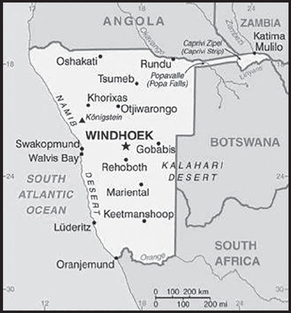
INTRODUCTION
Background: Various ethnic groups occupied southwestern Africa prior to Germany establishing a colony over most of the territory in 1884. South Africa occupied the colony, then known as German South West Africa, in 1915 during World War I and administered it as a mandate until after World War II, when it annexed the territory. In 1966, the Marxist South-West Africa People’s Organization (SWAPO) guerrilla group launched a war of independence for the area that became Namibia, but it was not until 1988 that South Africa agreed to end its administration in accordance with a UN peace plan for the entire region. Namibia gained independence in 1990 and has been governed by SWAPO since, though the party has dropped much of its Marxist ideology. President Hage GEINGOB was elected in 2014 in a landslide victory, replacing Hifikepunye POHAMBA who stepped down after serving two terms. SWAPO retained its parliamentary super majority in the 2014 elections. In 2019 elections, GEINGOB was reelected but by a substantially reduced majority and SWAPO narrowly lost its super majority in parliament.
GEOGRAPHY
Location: Southern Africa, bordering the South Atlantic Ocean, between Angola and South Africa
Geographic coordinates: 22 00 S, 17 00 E
Map references: Africa
Area: total: 824,292 sq km
land: 823,290 sq km
water: 1,002 sq km
comparison ranking: total 35
Area - comparative: almost seven times the size of Pennsylvania; slightly more than half the size of Alaska
Land boundaries: total: 4,220 km
border countries (4): Angola 1,427 km; Botswana 1,544 km; South Africa 1,005 km; Zambia 244 km
Coastline: 1,572 km
Maritime claims: territorial sea: 12 nm
contiguous zone: 24 nm
exclusive economic zone: 200 nm
Climate: desert; hot, dry; rainfall sparse and erratic
Terrain: mostly high plateau; Namib Desert along coast; Kalahari Desert in east
Elevation: highest point: Konigstein on Brandberg 2,573 m
lowest point: Atlantic Ocean 0 m
mean elevation: 1,141 m
Natural resources: diamonds, copper, uranium, gold, silver, lead, tin, lithium, cadmium, tungsten, zinc, salt, hydropower, fish; note - suspected deposits of oil, coal, and iron ore
Land use: agricultural land: 47.2% (2018 est.)
arable land: 1% (2018 est.)
permanent crops: 0% (2018 est.)
permanent pasture: 46.2% (2018 est.)
forest: 8.8% (2018 est.)
other: 44% (2018 est.)
Irrigated land: 80 sq km (2012)
Major rivers (by length in km): Zambezi (shared with Zambia [s]), Angola, Botswana, Zimbabwe, and Mozambique [m]) - 2,740 km; Orange river mouth (shared with Lesotho [s], and South Africa) - 2,092 km; Okavango (shared with Angola [s], and Botswana [m]) - 1,600 km
note – [s] after country name indicates river source; [m] after country name indicates river mouth
Major watersheds (area sq km): Atlantic Ocean drainage: Orange (941,351 sq km)
Indian Ocean drainage: Zambezi (1,332,412 sq km)
Internal (endorheic basin) drainage: Okavango Basin (863,866 sq km)
Major aquifers: Lower Kalahari-Stampriet Basin, Upper Kalahari-Cuvelai-Upper Zambezi Basin
Population distribution: population density is very low, with the largest clustering found in the extreme north-central area along the border with Angola as shown in this population distribution map
Natural hazards: prolonged periods of drought
Geography - note: the Namib Desert, after which the country is named, is considered to be the oldest desert in the world; Namibia is the first country in the world to incorporate the protection of the environment into its constitution; some 14% of the land is protected, including virtually the entire Namib Desert coastal strip; Namib-Naukluft National Park (49,768 sq km), is the largest game park in Africa and one of the largest in the world
PEOPLE AND SOCIETY
Population: 2,777,232 (2023 est.)
comparison ranking: 141
Nationality: noun: Namibian(s)
adjective: Namibian
Ethnic groups: Ovambo 50%, Kavangos 9%, Herero 7%, Damara 7%, mixed European and African ancestry 6.5%, European 6%, Nama 5%, Caprivian 4%, San 3%, Baster 2%, Tswana 0.5%
Languages: Oshiwambo languages 49.7%, Nama/Damara 11%, Kavango languages 10.4%, Afrikaans 9.4% (also a common language), Herero languages 9.2%, Zambezi languages 4.9%, English (official) 2.3%, other African languages 1.5%, other European languages 0.7%, other 1% (2016 est.)
note: Namibia has 13 recognized national languages, including 10 indigenous African languages and 3 European languages
Religions: Christian 97.5%, other 0.6% (includes Muslim, Baha’i, Jewish, Buddhist), unaffiliated 1.9% (2020 est.)
Demographic profile: Planning officials view Namibia’s reduced population growth rate as sustainable based on the country’s economic growth over the past decade. Prior to independence in 1990, Namibia’s relatively small population grew at about 3% annually, but declining fertility and the impact of HIV/AIDS slowed this growth to 1.4% by 2011, rebounding to close to 2% by 2016. Namibia’s fertility rate has fallen over the last two decades – from about 4.5 children per woman in 1996 to 3.4 in 2016 and to 3 in 2022 – due to increased contraceptive use, higher educational attainment among women, and greater female participation in the labor force. The average age at first birth has stayed fairly constant, but the age at first marriage continues to increase, indicating a rising incidence of premarital childbearing.
The majority of Namibians are rural dwellers (about 55%) and live in the better-watered north and northeast parts of the country. Migration, historically male-dominated, generally flows from northern communal areas – non-agricultural lands where blacks were sequestered under the apartheid system – to agricultural, mining, and manufacturing centers in the center and south. After independence from South Africa, restrictions on internal movement eased, and rural-urban migration increased, bolstering urban growth.
Some Namibians – usually persons who are better-educated, more affluent, and from urban areas – continue to legally migrate to South Africa temporarily to visit family and friends and, much less frequently, to pursue tertiary education or better economic opportunities. Namibians concentrated along the country’s other borders make unauthorized visits to Angola, Zambia, Zimbabwe, or Botswana, to visit family and to trade agricultural goods. Few Namibians express interest in permanently settling in other countries; they prefer the safety of their homeland, have a strong national identity, and enjoy a well-supplied retail sector. Although Namibia is receptive to foreign investment and cross-border trade, intolerance toward non-citizens is widespread.
Age structure: 0-14 years: 34.38% (male 482,432/female 472,474)
15-64 years: 61.68% (male 834,001/female 878,865)
65 years and over: 3.94% (2023 est.) (male 46,235/female 63,225)
Dependency ratios: total dependency ratio: 67.3
youth dependency ratio: 60.6
elderly dependency ratio: 6.7
potential support ratio: 14.8 (2021 est.)
Median age: total: 21.8 years (2020)
male: 21.1 years
female: 22.6 years
comparison ranking: total 182
Population growth rate: 1.8% (2023 est.)
comparison ranking: 49
Birth rate: 24.68 births/1,000 population (2023 est.)
comparison ranking: 45
Death rate: 6.64 deaths/1,000 population (2023 est.)
comparison ranking: 128
Net migration rate: 0 migrant(s)/1,000 population (2023 est.)
comparison ranking: 89
Population distribution: population density is very low, with the largest clustering found in the extreme north-central area along the border with Angola as shown in this population distribution map
Urbanization: urban population: 54.9% of total population (2023)
rate of urbanization: 3.64% annual rate of change (2020-25 est.)
Major urban areas - population: 477,000 WINDHOEK (capital) (2023)
Sex ratio: at birth: 1.03 male(s)/female
0-14 years: 1.02 male(s)/female
15-64 years: 0.95 male(s)/female
65 years and over: 0.73 male(s)/female
total population: 0.96 male(s)/female (2023 est.)
Mother’s mean age at first birth: 21.6 years (2013 est.)
note: data represents median age at first birth among women 25-49
Maternal mortality ratio: 215 deaths/100,000 live births (2020 est.)
comparison ranking: 44
Infant mortality rate: total: 28.49 deaths/1,000 live births (2023 est.)
male: 30.52 deaths/1,000 live births
female: 26.4 deaths/1,000 live births
comparison ranking: total 55
Life expectancy at birth: total population: 67.04 years (2023 est.)
male: 65 years
female: 69.14 years
comparison ranking: total population 196
Total fertility rate: 2.94 children born/woman (2023 est.)
comparison ranking: 47
Gross reproduction rate: 1.45 (2023 est.)
Contraceptive prevalence rate: 56.1% (2013)
Drinking water source: improved: urban: 98.9% of population
rural: 83.2% of population
total: 91.4% of population
unimproved: urban: 1.1% of population
rural: 16.8% of population
total: 8.6% of population (2020 est.)
Current health expenditure: 8.9% of GDP (2020)
Physicians density: 0.59 physicians/1,000 population (2018)
Hospital bed density: 2.7 beds/1,000 population
Sanitation facility access: improved: urban: 70.6% of population
rural: 23.6% of population
total: 48.1% of population
unimproved: urban: 29.4% of population
rural: 76.4% of population
total: 51.9% of population (2020 est.)
Major infectious diseases: degree of risk: high (2023)
food or waterborne diseases: bacterial diarrhea, hepatitis A, and typhoid fever
vectorborne diseases: malaria
water contact diseases: schistosomiasis
Obesity - adult prevalence rate: 17.2% (2016)
comparison ranking: 119
Alcohol consumption per capita: total: 2.38 liters of pure alcohol (2019 est.)
beer: 1.37 liters of pure alcohol (2019 est.)
wine: 0.16 liters of pure alcohol (2019 est.)
spirits: 0.53 liters of pure alcohol (2019 est.)
other alcohols: 0.32 liters of pure alcohol (2019 est.)
comparison ranking: total 126
Tobacco use: total: 15.1% (2020 est.)
male: 24.2% (2020 est.)
female: 6% (2020 est.)
comparison ranking: total 103
Children under the age of 5 years underweight: 13.2% (2013)
comparison ranking: 39
Currently married women (ages 15-49): 33.3% (2023 est.)
Education expenditures: 9.6% of GDP (2021 est.)
comparison ranking: 7
Literacy: definition: age 15 and over can read and write
total population: 92.3%
male: 90.6%
female: 92.3% (2021)
Youth unemployment rate (ages 15-24): total: 40.4% (2021 est.)
male: 39.4%
female: 41.7%
comparison ranking: total 13
ENVIRONMENT
Environment - current issues: depletion and degradation of water and aquatic resources; desertification; land degradation; loss of biodiversity and biotic resources; wildlife poaching
Environment - international agreements: party to: Antarctic-Marine Living Resources, Biodiversity, Climate Change, Climate Change-Kyoto Protocol, Climate Change-Paris Agreement, Comprehensive Nuclear Test Ban, Desertification, Endangered Species, Hazardous Wastes, Law of the Sea, Ozone Layer Protection, Ship Pollution, Wetlands
signed, but not ratified: none of the selected agreements
Climate: desert; hot, dry; rainfall sparse and erratic
Land use: agricultural land: 47.2% (2018 est.)
arable land: 1% (2018 est.)
permanent crops: 0% (2018 est.)
permanent pasture: 46.2% (2018 est.)
forest: 8.8% (2018 est.)
other: 44% (2018 est.)
Urbanization: urban population: 54.9% of total population (2023)
rate of urbanization: 3.64% annual rate of change (2020-25 est.)
Food insecurity: severe localized food insecurity: due to localized shortfalls in cereal production and rising food prices - cereal production increased in 2022 and this is expected to have a positive impact on food security, however, rising prices of basic foods is likely to limit a more substantial improvement (2022)
Revenue from forest resources: 0.47% of GDP (2018 est.)
comparison ranking: 68
Revenue from coal: 0% of GDP (2018 est.)
comparison ranking: 124
Air pollutants: particulate matter emissions: 11.81 micrograms per cubic meter (2019 est.)
carbon dioxide emissions: 4.23 megatons (2016 est.)
methane emissions: 10.4 megatons (2020 est.)
Waste and recycling: municipal solid waste generated annually: 256,729 tons (1993 est.)
municipal solid waste recycled annually: 11,553 tons (2005 est.)
percent of municipal solid waste recycled: 4.5% (2005 est.)
Major rivers (by length in km): Zambezi (shared with Zambia [s]), Angola, Botswana, Zimbabwe, and Mozambique [m]) - 2,740 km; Orange river mouth (shared with Lesotho [s], and South Africa) - 2,092 km; Okavango (shared with Angola [s], and Botswana [m]) - 1,600 km
note – [s] after country name indicates river source; [m] after country name indicates river mouth
Major watersheds (area sq km): Atlantic Ocean drainage: Orange (941,351 sq km)
Indian Ocean drainage: Zambezi (1,332,412 sq km)
Internal (endorheic basin) drainage: Okavango Basin (863,866 sq km)
Major aquifers: Lower Kalahari-Stampriet Basin, Upper Kalahari-Cuvelai-Upper Zambezi Basin
Total water withdrawal: municipal: 70 million cubic meters (2020 est.)
industrial: 10 million cubic meters (2020 est.)
agricultural: 201 million cubic meters (2020 est.)
Total renewable water resources: 39.91 billion cubic meters (2020 est.)
GOVERNMENT
Country name: conventional long form: Republic of Namibia
conventional short form: Namibia
local long form: Republic of Namibia
local short form: Namibia
former: German South-West Africa (Deutsch-Suedwestafrika), South-West Africa
etymology: named for the coastal Namib Desert; the name “namib” means “vast place” in the Nama/Damara language
Government type: presidential republic
Capital: name: Windhoek
geographic coordinates: 22 34 S, 17 05 E
time difference: UTC+1 (6 hours ahead of Washington, DC, during Standard Time)
daylight saving time: +1hr, begins first Sunday in September; ends first Sunday in April
etymology: may derive from the Afrikaans word “wind-hoek” meaning “windy corner”
Administrative divisions: 14 regions; Erongo, Hardap, //Karas, Kavango East, Kavango West, Khomas, Kunene, Ohangwena, Omaheke, Omusati, Oshana, Oshikoto, Otjozondjupa, Zambezi; note - the Karas Region was renamed //Karas in September 2013 to include the alveolar lateral click of the Khoekhoegowab language
Independence: 21 March 1990 (from South African mandate)
National holiday: Independence Day, 21 March (1990)
Constitution: history: adopted 9 February 1990, entered into force 21 March 1990
amendments: initiated by the Cabinet; passage requires two-thirds majority vote of the National Assembly membership and of the National Council of Parliament and assent of the president of the republic; if the National Council fails to pass an amendment, the president can call for a referendum; passage by referendum requires two-thirds majority of votes cast; amendments that detract from or repeal constitutional articles on fundamental rights and freedoms cannot be amended, and the requisite majorities needed by Parliament to amend the constitution cannot be changed; amended 1998, 2010, 2014
Legal system: mixed legal system of uncodified civil law based on Roman-Dutch law and customary law
International law organization participation: has not submitted an ICJ jurisdiction declaration; accepts ICCt jurisdiction
Citizenship: citizenship by birth: no
citizenship by descent only: at least one parent must be a citizen of Namibia
dual citizenship recognized: no
residency requirement for naturalization: 5 years
Suffrage: 18 years of age; universal
Executive branch: chief of state: President Hage GEINGOB (since 21 March 2015); Vice President Nangola MBUMBA (since 8 February 2018); note - the president is both chief of state and head of government
head of government: President Hage GEINGOB (since 21 March 2015); Vice President Nangola MBUMBA (since 8 February 2018); Prime Minister Saara KUUGONGELWA-AMADHILA (since 21 March 2015)
cabinet: Cabinet appointed by the president from among members of the National Assembly
elections/appointments: president directly elected by absolute majority popular vote in 2 rounds if needed for a 5-year term (eligible for a second term); election last held on 28 November 2019 (next to be held in 2024)
election results:
2019: Hage GEINGOB reelected president in the first round; percent of vote - Hage GEINGOB (SWAPO) 56.3%, Panduleni ITULA (independent) 29.4%, McHenry VENAANI (PDM) 5.3%, other 8.9%
2014: Hage GEINGOB elected president in the first round; percent of vote - Hage GEINGOB (SWAPO) 86.7%, McHenry VENAANI (DTA) 5%, Hidipo HAMUTENYA (RDP) 3.4%, Asser MBAI (NUDO)1.9%, Henk MUDGE (RP) 1%, other 2%
Legislative branch: description: bicameral Parliament consists of:
National Council (42 seats); members indirectly elected 3 each by the 14 regional councils to serve 5-year terms); note - the Council primarily reviews legislation passed and referred by the National Assembly
National Assembly (104 seats; 96 members directly elected in multi-seat constituencies by closed list, proportional representation vote to serve 5-year terms and 8 nonvoting members appointed by the president)
elections: National Council - elections for regional councils to determine members of the National Council held on 25 November 2020 (next to be held on 25 November 2025)
National Assembly - last held on 27 November 2019 (next to be held in 2024)
election results:
National Council - percent of vote by party - NA; seats by party - SWAPO 28, LPM 6, IPC 2, PDM 2, UDF 2, NUDO 1, independent 1; composition as of July 2022 - men 36, women 6, percent of women 14.3%
National Assembly - percent of vote by party - SWAPO 65.5%, PDM 16.6%, LPM 4.7%, NUDO 1.9%, APP 1.8%, UDF 1.8%, RP 1.8%, NEFF 1.7%, RDP 1.1%, CDV .7%, SWANU .6%, other 1.8%; seats by party - SWAPO 63, PDM 16, LPM 4, NUDO 2, APP 2, UDF 2, RP 2, NEFF 2, RDP 1, CDV 1, SWANU 1; composition as of July 2022 - men 58, women 46, percent of women 44.2%; note - overall percent of women in Parliament 35.6%
Judicial branch: highest court(s): Supreme Court (consists of the chief justice and at least 3 judges in quorum sessions)
judge selection and term of office: judges appointed by the president of Namibia upon the recommendation of the Judicial Service Commission; judges serve until age 65, but terms can be extended by the president until age 70
subordinate courts: High Court; Electoral Court, Labor Court; regional and district magistrates’ courts; community courts
Political parties and leaders: All People’s Party or APP (vacant)
Christian Democratic Voice or CDV [Gothard KANDUME]
Landless People’s Movement or LPM [Bernadus SWARTBOOI]
National Unity Democratic Organization or NUDO [Estes MUINJANGUE]
Namibian Economic Freedom Fighters or NEFF [Epafras MUKWIILONGO]
Popular Democratic Movement or PDM [McHenry VENAANI] (formerly Democratic Turnhalle Alliance or DTA)
Rally for Democracy and Progress or RDP [Mike KAVEKOTORA]
Republican Party or RP [Henk MUDGE]
South West Africa National Union or SWANU [Charles KATJIVIRUE]
South West Africa People’s Organization or SWAPO [Hage GEINGOB]
United Democratic Front or UDF [Apius AUCHAB]
United People’s Movement or UPM [Jan J. VAN WYK]
International organization participation: ACP, AfDB, AU, C, CD, CPLP (associate observer), FAO, G-77, IAEA, IBRD, ICAO, ICCt, ICRM, IDA, IFAD, IFC, IFRCS, ILO, IMF, IMO, Interpol, IOC, IOM, IPU, ISO, ITSO, ITU, ITUC (NGOs), MIGA, NAM, OPCW, SACU, SADC, UN, UNAMID, UNCTAD, UNESCO, UNHCR, UNHRC, UNIDO, UNISFA, UNMIL, UNMISS, UNOCI, UNWTO, UPU, WCO, WHO, WIPO, WMO, WTO
Diplomatic representation in the US: chief of mission: Ambassador Margaret Natalie MENSAH-WILLIAMS (since 18 January 2021)
chancery: 1605 New Hampshire Avenue NW, Washington, DC 20009
telephone: [1] (202) 986-0540
FAX: [1] (202) 986-0443
email address and website:
https://namibiaembassyusa.org/
Diplomatic representation from the US: chief of mission: Ambassador Randy William BERRY (since 9 February 2023)
embassy: 14 Lossen Street, Windhoek
mailing address: 2540 Windhoek Place, Washington DC 20521-2540
telephone: [264] (061) 295-8500
FAX: [264] (061) 295-8603
email address and website:
Flag description: a wide red stripe edged by narrow white stripes divides the flag diagonally from lower hoist corner to upper fly corner; the upper hoist-side triangle is blue and charged with a golden-yellow, 12-rayed sunburst; the lower fly-side triangle is green; red signifies the heroism of the people and their determination to build a future of equal opportunity for all; white stands for peace, unity, tranquility, and harmony; blue represents the Namibian sky and the Atlantic Ocean, the country’s precious water resources and rain; the golden-yellow sun denotes power and existence; green symbolizes vegetation and agricultural resources
National symbol(s): oryx (antelope); national colors: blue, red, green, white, yellow
National anthem: name: “Namibia, Land of the Brave”
lyrics/music: Axali DOESEB
note: adopted 1991
National heritage: total World Heritage Sites: 2 (1 cultural, 1 natural)
selected World Heritage Site locales: Twyfelfontein or /Ui-//aes (c); Namib Sand Sea (n)
ECONOMY
Economic overview: upper middle-income, export-driven Sub-Saharan economy; natural resource rich; Walvis Bay port expansion for trade; high potential for renewable power generation and energy independence; major nature-based tourist locale; natural resource rich; shortage of skilled labor
Real GDP (purchasing power parity): $23.12 billion (2021 est.)
$22.522 billion (2020 est.)
$24.49 billion (2019 est.)
note: data are in 2017 dollars
comparison ranking: 150
Real GDP growth rate: 2.66% (2021 est.)
-8.04% (2020 est.)
-0.84% (2019 est.)
comparison ranking: 150
Real GDP per capita: $9,100 (2021 est.)
$9,000 (2020 est.)
$10,000 (2019 est.)
note: data are in 2017 dollars
comparison ranking: 147
GDP (official exchange rate): $12.372 billion (2019 est.)
Inflation rate (consumer prices): 3.62% (2021 est.)
2.21% (2020 est.)
3.72% (2019 est.)
comparison ranking: 105
Credit ratings: Fitch rating: BB (2019)
Moody’s rating: Ba3 (2020)
note: The year refers to the year in which the current credit rating was first obtained.
GDP - composition, by sector of origin: agriculture: 6.7% (2016 est.)
industry: 26.3% (2016 est.)
services: 67% (2017 est.)
comparison rankings: services 87; industry 105; agriculture 114
GDP - composition, by end use: household consumption: 68.7% (2017 est.)
government consumption: 24.5% (2017 est.)
investment in fixed capital: 16% (2017 est.)
investment in inventories: 1.6% (2017 est.)
exports of goods and services: 36.7% (2017 est.)
imports of goods and services: -47.5% (2017 est.)
Agricultural products: beef, milk, grapes, millet, maize, mutton, pork, chickens, goats, wheat
Industries: mining, tourism, fishing, agriculture
Industrial production growth rate: 1.44% (2021 est.)
comparison ranking: 141
Labor force: 939,000 (2021 est.)
comparison ranking: 147
Labor force - by occupation: agriculture: 31%
industry: 14%
services: 54% (2013 est.)
note: about half of Namibia’s people are unemployed while about two-thirds live in rural areas; roughly two-thirds of rural dwellers rely on subsistence agriculture
Unemployment rate: 21.68% (2021 est.)
21.45% (2020 est.)
19.99% (2019 est.)
comparison ranking: 17
Youth unemployment rate (ages 15-24): total: 40.4% (2021 est.)
male: 39.4%
female: 41.7%
comparison ranking: total 13
Population below poverty line: 17.4% (2015 est.)
Gini Index coefficient - distribution of family income: 59.1 (2015 est.)
comparison ranking: 2
Household income or consumption by percentage share: lowest 10%: 2.4%
highest 10%: 42% (2010)
Budget: revenues: $4.004 billion (2019 est.)
expenditures: $4.693 billion (2019 est.)
Budget surplus (+) or deficit (-): -5.5% (of GDP) (2017 est.)
comparison ranking: 172
Public debt: 4.64% of GDP (2019 est.)
5.49% of GDP (2018 est.)
5.44% of GDP (2017 est.)
comparison ranking: 205
Taxes and other revenues: 31.17% (of GDP) (2020 est.)
comparison ranking: 28
Fiscal year: 1 April - 31 March
Current account balance: -$1.21 billion (2021 est.)
$270.277 million (2020 est.)
-$222.969 million (2019 est.)
comparison ranking: 140
Exports: $3.955 billion (2021 est.) note: data are in current year dollars
$3.565 billion (2020 est.) note: data are in current year dollars
$4.581 billion (2019 est.) note: data are in current year dollars
comparison ranking: 136
Exports - partners: China 29%, South Africa 20%, Botswana 8%, Belgium 6%, Zambia 4% (2020)
Exports - commodities: diamonds, uranium, copper, gold, fish products, aircraft, ships (2021)
Imports: $6.055 billion (2021 est.) note: data are in current year dollars
$4.614 billion (2020 est.) note: data are in current year dollars
$5.808 billion (2019 est.) note: data are in current year dollars
comparison ranking: 137
Imports - partners: South Africa 40%, Zambia 20%, Democratic Republic of the Congo 6%, China 5%, Bulgaria 3% (2020)
Imports - commodities: copper, refined petroleum, delivery trucks, cobalt, cars (2020)
Reserves of foreign exchange and gold: $2.764 billion (31 December 2021 est.)
$2.171 billion (31 December 2020 est.)
$2.049 billion (31 December 2019 est.)
comparison ranking: 121
Debt - external: $7.969 billion (31 December 2017 est.)
$6.904 billion (31 December 2016 est.)
comparison ranking: 122
Exchange rates: Namibian dollars (NAD) per US dollar -
Exchange rates: 14.779 (2021 est.)
16.463 (2020 est.)
14.449 (2019 est.)
13.234 (2018 est.)
13.313 (2017 est.)
ENERGY
Electricity access: population without electricity: 1 million (2020)
electrification - total population: 55.2% (2021)
electrification - urban areas: 74.7% (2021)
electrification - rural areas: 33.2% (2021)
Electricity: installed generating capacity: 640,000 kW (2020 est.)
consumption: 4,065,360,000 kWh (2019 est.)
exports: 119 million kWh (2019 est.)
imports: 3.417 billion kWh (2019 est.)
transmission/distribution losses: 270 million kWh (2019 est.)
comparison rankings: installed generating capacity 143; transmission/distribution losses 142; imports 47; exports 89;
Electricity generation sources: fossil fuels: 6.1% of total installed capacity (2020 est.)
solar: 4.7% of total installed capacity (2020 est.)
wind: 0.5% of total installed capacity (2020 est.)
hydroelectricity: 88.8% of total installed capacity (2020 est.)
Coal: production: 0 metric tons (2020 est.)
consumption: 38,000 metric tons (2020 est.)
exports: 0 metric tons (2020 est.)
imports: 59,000 metric tons (2020 est.)
proven reserves: 0 metric tons (2019 est.)
Petroleum: total petroleum production: 0 bbl/day (2021 est.)
refined petroleum consumption: 26,500 bbl/day (2019 est.)
Refined petroleum products - exports: 80 bbl/day (2015 est.)
comparison ranking: 120
Refined petroleum products - imports: 26,270 bbl/day (2015 est.)
comparison ranking: 105
Natural gas: proven reserves: 62.297 billion cubic meters (2021 est.)
Carbon dioxide emissions: 3.831 million metric tonnes of CO2 (2019 est.)
from coal and metallurgical coke: 66,000 metric tonnes of CO2 (2019 est.)
from petroleum and other liquids: 3.764 million metric tonnes of CO2 (2019 est.)
comparison ranking: total emissions 143
Energy consumption per capita: 29.811 million Btu/person (2019 est.)
comparison ranking: 121
COMMUNICATIONS
Telephones - fixed lines: total subscriptions: 91,869 (2021 est.)
subscriptions per 100 inhabitants: 4 (2021 est.)
comparison ranking: total subscriptions 139
Telephones - mobile cellular: total subscriptions: 2,915,307 (2021 est.)
subscriptions per 100 inhabitants: 115 (2021 est.)
comparison ranking: total subscriptions 141
Telecommunication systems: general assessment: the government’s Broadband Policy aims to provide 95% population coverage by 2024; mobile network coverage has increased sharply in recent years; by 2021, 3G infrastructure provided 89% population coverage while LTE infrastructure provided 79% coverage (compared to only 40% a year earlier); despite the relatively advanced nature of the market, progress towards 5G has been slow, partly due to unsubstantiated public concerns over health implications of the technology which caused the government to order an environmental assessment of 5G in mid-2020; the government has requested the regulator to speed up its 5G development strategy; Namibia’s internet and broadband sector is reasonably competitive, its development was for many years held back by high prices for international bandwidth caused by the lack of a direct connection to international submarine cables; this market situation improved after operators invested in diversifying terrestrial access routes to adjacent countries; by the end of 2022 Namibia is expected to be connected by a 1,050km branch line of cable running between Portugal and South Africa (2022)
domestic: fixed-line subscribership is 4 per 100 and mobile-cellular roughly 115 per 100 persons (2021)
international: country code - 264; landing points for the ACE and WACS fiber-optic submarine cable linking southern and western African countries to Europe; satellite earth stations - 4 Intelsat (2019)
Broadcast media: 1 private and 1 state-run TV station; satellite and cable TV service available; state-run radio service broadcasts in multiple languages; about a dozen private radio stations; transmissions of multiple international broadcasters available
Internet country code: .na
Internet users: total: 1.325 million (2021 est.)
percent of population: 53% (2021 est.)
comparison ranking: total 145
Broadband - fixed subscriptions: total: 71,063 (2020 est.)
subscriptions per 100 inhabitants: 3 (2020 est.)
comparison ranking: total 135
TRANSPORTATION
National air transport system: number of registered air carriers: 2 (2020)
inventory of registered aircraft operated by air carriers: 21
annual passenger traffic on registered air carriers: 602,893 (2018)
annual freight traffic on registered air carriers: 26.29 million (2018) mt-km
Civil aircraft registration country code prefix: V5
Airports: 112 (2021)
comparison ranking: total 51
Airports - with paved runways: 19
note: paved runways have a concrete or asphalt surface but not all have facilities for refueling, maintenance, or air traffic control; the length of a runway required for aircraft to safely operate depends on a number of factors including the type of aircraft, the takeoff weight (including passengers, cargo, and fuel), engine types, flap settings, landing speed, elevation of the airport, and average maximum daily air temperature; paved runways can reach a length of 5,000 m (16,000 ft.), but the “typical” length of a commercial airline runway is between 2,500-4,000 m (8,000-13,000 ft.)
Airports - with unpaved runways: 93
note: unpaved runways have a surface composition such as grass or packed earth and are most suited to the operation of light aircraft; unpaved runways are usually short, often less than 1,000 m (3,280 ft.) in length; airports with unpaved runways often lack facilities for refueling, maintenance, or air traffic control
Railways: total: 2,628 km (2014)
narrow gauge: 2,628 km (2014) 1.067-m gauge
comparison ranking: total 62
Roadways: total: 48,875 km (2018)
paved: 7,893 km (2018)
unpaved: 40,982 km (2018)
comparison ranking: total 82
Merchant marine: total: 15 (2022)
by type: general cargo 1, other 14
comparison ranking: total 151
Ports and terminals: major seaport(s): Luderitz, Walvis Bay
MILITARY AND SECURITY
Military and security forces: Namibian Defense Force (NDF): Army, Navy, Air Force (2023)
note: the Namibian Police Force is under the Ministry of Home Affairs, Immigration, Safety, and Security; it has a paramilitary Special Field Force responsible for protecting borders and government installations
Military expenditures: 3% of GDP (2022 est.)
3% of GDP (2021 est.)
3.4% of GDP (2020 est.)
3.3% of GDP (2019 est.)
3.4% of GDP (2018 est.)
comparison ranking: 28
Military and security service personnel strengths: information varies; approximately 12,500 personnel (11,000 Army; 1,000 Navy; 500 Air Force) (2023)
Military equipment inventories and acquisitions: the NDF’s inventory consists of a mix of Soviet-era and some more modern systems from a variety of countries, including Brazil, China, Germany, India, and South Africa; in recent years, China has been the leading supplier; Namibia has a small defense industry that produces items such as armored personnel carriers (2023)
Military service age and obligation: 18-25 years of age for men and women for voluntary military service; no conscription (2023)
note: as of 2018, women comprised more than 20% of the active duty military
Military - note: the NDF’s primary responsibility is external security; it has participated in UN and regional peacekeeping and security missions and provides assistance to civil authorities as needed; it is a small and professional force that participates in multinational training exercises; the Army fields a largely mobile force centered on 3 small motorized infantry brigades and a reconnaissance regiment; the Navy has a Chinese-built multipurpose offshore patrol ship equipped with a helicopter landing platform and supported by several coastal patrol vessels, while the Air Force has a small inventory of aircraft, including a few Chinese-made fighters and Soviet-era attack helicopters
the NDF was created in 1990, largely from demobilized former members of the People’s Liberation Army of Namibia (PLAN) and the South West Africa Territorial Force (SWATF); PLAN was the armed wing of the South West Africa People’s Organization (SWAPO), while SWATF was an auxiliary of the South African Defense Force and comprised the armed forces of the former South West Africa, 1977-1989; from 1990-1995, the British military assisted with the forming and training the NDF (2023)
TRANSNATIONAL ISSUES
Disputes - international: Namibia-Angola-Botswana: concerns from international experts and local populations over the Okavango Delta ecology in Botswana and human displacement scuttled Namibian plans to construct a hydroelectric dam on Popa Falls along the Angola-Namibia border
Namibia-Botswana-Zambia-Zimbabwe: Namibia has supported, and in 2004 Zimbabwe dropped objections to, plans between Botswana and Zambia to build a bridge over the Zambezi River, thereby de facto recognizing a short, but not clearly delimited, Botswana-Zambia boundary in the river; the Kazungula Bridge opened to traffic in May 2021
Namibia-South Africa: the governments of South Africa and Namibia have not signed or ratified the text of the 1994 Surveyor’s General agreement placing the boundary in the middle of the Orange River; Namibia claims a median line boundary, while South Africa supports the northern bank of the river
Refugees and internally displaced persons: refugees (country of origin): 6,247 (Democratic Republic of the Congo) (refugees and asylum seekers) (2023)
NAURU
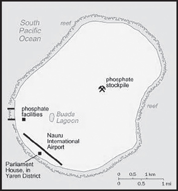
INTRODUCTION
Background: Nauru was inhabited by Micronesian and Polynesian settlers by around 1000 B.C., and the island was divided into 12 clans. Nauru developed in relative isolation because ocean currents made landfall on the island difficult. As a result, the Nauruan language does not clearly resemble any other in the Pacific region. In 1798, British sea captain John FEARN became the first European to spot the island. By 1830, European whalers used Nauru as a supply stop, trading firearms for food. In 1878, a civil war erupted on the island, reducing the population by more than a third. Germany forcibly annexed Nauru in 1888 by holding the 12 chiefs under house arrest until they consented to the annexation. Germany banned alcohol, confiscated weapons, instituted strict dress codes, and brought in Christian missionaries to convert the population. Phosphate was discovered in 1900 and heavily mined, although Nauru and Nauruans earned about one tenth of one percent of the profits from the phosphate deposits.
Australian forces captured Nauru from Germany during World War I, and in 1919, it was placed under a joint Australian-British-New Zealand mandate with Australian administration. Japan occupied Nauru during World War II and used its residents as forced labor elsewhere in the Pacific while destroying much of the infrastructure on the island. After the war, Nauru became a UN trust territory under Australian administration. Recognizing the phosphate stocks would eventually be depleted, in 1962, Australian Prime Minister Robert MENZIES offered to resettle all Nauruans on Curtis Island in Queensland, but Nauruans rejected that plan and opted for independence, which was achieved in 1968. In 1970, Nauru purchased the phosphate mining assets, and income from the mines made Nauruans among the richest people in the world. However, Nauru subsequently began a series of unwise investments in buildings, musical theater, and an airline. Nauru sued Australia in 1989 for the damage caused by mining when Australia administered the island. Widespread phosphate mining officially ceased in 2006.
Nauru went nearly bankrupt by 2000 and tried to rebrand itself as an offshore banking haven, although it ended that practice in 2005. In 2001, Australia set up the Nauru Regional Processing Center (NRPC), an offshore refugee detention facility, paying Nauru per person at the center. The NRPC was closed in 2008 but reopened in 2012. The number of refugees has steadily declined since 2014, and the remaining people were moved to a hotel in Brisbane, Australia, in 2020, effectively shuttering the NRPC. In a bid for Russian humanitarian aid, in 2008, Nauru recognized the breakaway Georgian republics of Abkhazia and South Ossetia.
GEOGRAPHY
Location: Oceania, island in the South Pacific Ocean, south of the Marshall Islands
Geographic coordinates: 0 32 S, 166 55 E
Map references: Oceania
Area: total: 21 sq km
land: 21 sq km
water: 0 sq km
comparison ranking: total 239
Area - comparative: about 0.1 times the size of Washington, DC
Land boundaries: total: 0 km
Coastline: 30 km
Maritime claims: territorial sea: 12 nm
contiguous zone: 24 nm
exclusive economic zone: 200 nm
Climate: tropical with a monsoonal pattern; rainy season (November to February)
Terrain: sandy beach rises to fertile ring around raised coral reefs with phosphate plateau in center
Elevation: highest point: Command Ridge 70 m
lowest point: Pacific Ocean 0 m
Natural resources: phosphates, fish
Land use: agricultural land: 20% (2018 est.)
arable land: 0% (2018 est.)
permanent crops: 20% (2018 est.)
permanent pasture: 0% (2018 est.)
forest: 0% (2018 est.)
other: 80% (2018 est.)
Irrigated land: 0 sq km (2022)
Population distribution: extensive phosphate mining made approximately 90% of the island unsuitable for farming; most people live in the fertile coastal areas, especially along the southwest coast
Natural hazards: periodic droughts
Geography - note: Nauru is the third-smallest country in the world behind the Holy See (Vatican City) and Monaco; it is the smallest country in the Pacific Ocean, the smallest country outside Europe, the world’s smallest island country, and the the world’s smallest independent republic; situated just 53 km south of the Equator, Nauru is one of the three great phosphate rock islands in the Pacific Ocean - the others are Banaba (Ocean Island) in Kiribati and Makatea in French Polynesia
PEOPLE AND SOCIETY
Population: 9,852 (2023 est.)
comparison ranking: 222
Nationality: noun: Nauruan(s)
adjective: Nauruan
Ethnic groups: Nauruan 94.6%, I-Kiribati 2.2%, Fijian 1.3%, other 1.9% (2021 est.)
Languages: Nauruan 93% (official, a distinct Pacific Island language), English 2% (widely understood, spoken, and used for most government and commercial purposes), other 5% (includes Gilbertese force is employed in phosphate 2% and Chinese 2%) (2011 est.)
note: data represent main language spoken at home; Nauruan is spoken by 95% of the population, English by 66%, and other languages by 12%
Religions: Protestant 60.4% (Nauruan Congregational 34.7%, Assemblies of God 11.6%, Pacific Light House 6.3%, Nauru Independent 3.6%, Baptist 1.5, Seventh Day Adventist 1.3%, other Protestant 1.4%), Roman Catholic 33.9%, other 4.2%, none 1.3%, no answer 0.3% (2021 est.)
Age structure: 0-14 years: 30.13% (male 1,513/female 1,455)
15-64 years: 65.65% (male 3,183/female 3,285)
65 years and over: 4.22% (2023 est.) (male 141/female 275)
Dependency ratios: total dependency ratio: 69.9
youth dependency ratio: 66
elderly dependency ratio: 3.9
potential support ratio: 25.8 (2021)
Median age: total: 27 years (2020)
male: 28.2 years
female: 25.9 years
comparison ranking: total 150
Population growth rate: 0.42% (2023 est.)
comparison ranking: 160
Birth rate: 20.71 births/1,000 population (2023 est.)
comparison ranking: 65
Death rate: 6.39 deaths/1,000 population (2023 est.)
comparison ranking: 140
Net migration rate: -10.15 migrant(s)/1,000 population (2023 est.)
comparison ranking: 222
Population distribution: extensive phosphate mining made approximately 90% of the island unsuitable for farming; most people live in the fertile coastal areas, especially along the southwest coast
Urbanization: urban population: 100% of total population (2023)
rate of urbanization: 0.18% annual rate of change (2020-25 est.)
Sex ratio: at birth: 1.04 male(s)/female
0-14 years: 1.04 male(s)/female
15-64 years: 0.97 male(s)/female
65 years and over: 0.51 male(s)/female
total population: 0.96 male(s)/female (2023 est.)
Infant mortality rate: total: 7.72 deaths/1,000 live births (2023 est.)
male: 9.94 deaths/1,000 live births
female: 5.41 deaths/1,000 live births
comparison ranking: total 152
Life expectancy at birth: total population: 68.25 years (2023 est.)
male: 64.69 years
female: 71.95 years
comparison ranking: total population 186
Total fertility rate: 2.58 children born/woman (2023 est.)
comparison ranking: 65
Gross reproduction rate: 1.27 (2023 est.)
Drinking water source: improved: total: 100% of population
unimproved: total: 0% of population (2020 est.)
Current health expenditure: 12% of GDP (2020)
Physicians density: 1.35 physicians/1,000 population (2015)
Sanitation facility access: improved: total: 96.3% of population
unimproved: total: 3.7% of population (2017 est.)
Obesity - adult prevalence rate: 61% (2016)
comparison ranking: 1
Alcohol consumption per capita: total: 2.44 liters of pure alcohol (2019 est.)
beer: 0.54 liters of pure alcohol (2019 est.)
wine: 0.09 liters of pure alcohol (2019 est.)
spirits: 1.81 liters of pure alcohol (2019 est.)
other alcohols: 0 liters of pure alcohol (2019 est.)
comparison ranking: total 125
Tobacco use: total: 48.5% (2020 est.)
male: 47.8% (2020 est.)
female: 49.1% (2020 est.)
comparison ranking: total 1
Currently married women (ages 15-49): 59.6% (2023 est.)
Education expenditures: 7.1% of GDP (2021)
comparison ranking: 20
Youth unemployment rate (ages 15-24): total: 26.6% (2013)
male: 20.9%
female: 37.5%
comparison ranking: total 53
ENVIRONMENT
Environment - current issues: limited natural freshwater resources, roof storage tanks that collect rainwater and desalination plants provide water; a century of intensive phosphate mining beginning in 1906 left the central 90% of Nauru a wasteland; cadmium residue, phosphate dust, and other contaminants have caused air and water pollution with negative impacts on health; climate change has brought on rising sea levels and inland water shortages
Environment - international agreements: party to: Biodiversity, Climate Change, Climate Change-Kyoto Protocol, Climate Change-Paris Agreement, Comprehensive Nuclear Test Ban, Desertification, Hazardous Wastes, Law of the Sea, Marine Dumping-London Convention, Ozone Layer Protection, Whaling
signed, but not ratified: none of the selected agreements
Climate: tropical with a monsoonal pattern; rainy season (November to February)
Land use: agricultural land: 20% (2018 est.)
arable land: 0% (2018 est.)
permanent crops: 20% (2018 est.)
permanent pasture: 0% (2018 est.)
forest: 0% (2018 est.)
other: 80% (2018 est.)
Urbanization: urban population: 100% of total population (2023)
rate of urbanization: 0.18% annual rate of change (2020-25 est.)
Revenue from forest resources: 0% of GDP (2018 est.)
comparison ranking: 172
Air pollutants: particulate matter emissions: 7.4 micrograms per cubic meter (2019 est.)
carbon dioxide emissions: 0.05 megatons (2016 est.)
methane emissions: 0.01 megatons (2020 est.)
Waste and recycling: municipal solid waste generated annually: 6,192 tons (2016 est.)
Total renewable water resources: 10 million cubic meters (2020 est.)
GOVERNMENT
Country name: conventional long form: Republic of Nauru
conventional short form: Nauru
local long form: Republic of Nauru
local short form: Nauru
former: Pleasant Island
etymology: the island name may derive from the Nauruan word “anaoero” meaning “I go to the beach”
Government type: parliamentary republic
Capital: name: no official capital; government offices in the Yaren District
time difference: UTC+12 (17 hours ahead of Washington, DC, during Standard Time)
Administrative divisions: 14 districts; Aiwo, Anabar, Anetan, Anibare, Baitsi, Boe, Buada, Denigomodu, Ewa, Ijuw, Meneng, Nibok, Uaboe, Yaren
Independence: 31 January 1968 (from the Australia-, NZ-, and UK-administered UN trusteeship)
National holiday: Independence Day, 31 January (1968)
Constitution: history: effective 29 January 1968
amendments: proposed by Parliament; passage requires two-thirds majority vote of Parliament; amendments to constitutional articles, such as the republican form of government, protection of fundamental rights and freedoms, the structure and authorities of the executive and legislative branches, also require two-thirds majority of votes in a referendum; amended several times, last in 2018
Legal system: mixed legal system of common law based on the English model and customary law
International law organization participation: has not submitted an ICJ jurisdiction declaration; accepts ICCt jurisdiction
Suffrage: 20 years of age; universal and compulsory
Executive branch: chief of state: President David ADEANG (since 30 October 2023); note - the president is both chief of state and head of government
head of government: President David ADEANG (since 30 October 2023)
cabinet: Cabinet appointed by the president from among members of Parliament
elections/appointments: president indirectly elected by Parliament for 3-year term (eligible for a second term); election last held on 30 October 2023 (next to be held in 2026)
election results: David ADEAGN elected president over Delvin THOMA, 10-8
Legislative branch: description: unicameral Parliament (19 seats; members directly elected in multi-seat constituencies by majority vote using the “Dowdall” counting system by which voters rank candidates on their ballots; members serve 3-year terms)
elections: last held on 24 September 2022 (next to be held in September 2025)
election results: percent of vote - NA; seats - independent 19; composition - men 17, women 2, percent of women 10.5%
Judicial branch: highest court(s): Supreme Court (consists of the chief justice and several justices); note - in late 2017, the Nauruan Government revoked the 1976 High Court Appeals Act, which had allowed appeals beyond the Nauruan Supreme Court, and in early 2018, the government formed its own appeals court
judge selection and term of office: judges appointed by the president to serve until age 65
subordinate courts: District Court, Family Court
Political parties and leaders: Nauru does not have formal political parties; alliances within the government are often formed based on extended family ties
International organization participation: ACP, ADB, AOSIS, C, FAO, G-77, ICAO, ICCt, IFAD, Interpol, IOC, IOM, ITU, OPCW, PIF, Sparteca, SPC, UN, UNCTAD, UNESCO, UPU, WHO
Diplomatic representation in the US: chief of mission: Ambassador Margo DEIYE (since 1 December 2021)
chancery: 800 2nd Avenue, Third Floor, New York, NY 10017
telephone: [1] (212) 937-0074
FAX: [1] (212) 937-0079
email address and website:
Diplomatic representation from the US: embassy: the US does not have an embassy in Nauru; the US Ambassador to Fiji is accredited to Nauru
Flag description: blue with a narrow, horizontal, gold stripe across the center and a large white 12-pointed star below the stripe on the hoist side; blue stands for the Pacific Ocean, the star indicates the country’s location in relation to the Equator (the gold stripe) and the 12 points symbolize the 12 original tribes of Nauru; the star’s white color represents phosphate, the basis of the island’s wealth
National symbol(s): frigatebird, calophyllum flower; national colors: blue, yellow, white
National anthem: name: “Nauru Bwiema” (Song of Nauru)
lyrics/music: Margaret HENDRIE/Laurence Henry HICKS
note: adopted 1968
ECONOMY
Economic overview: upper-middle-income Pacific island country; phosphate resource exhaustion made island interior uninhabitable; licenses fishing rights; houses Australia’s Regional Processing Centre; former tax haven; largely dependent on foreign subsidies
Real GDP (purchasing power parity): $149.474 million (2021 est.)
$147.265 million (2020 est.)
$145.591 million (2019 est.)
note: data are in 2017 dollars
comparison ranking: 224
Real GDP growth rate: 1.5% (2021 est.)
1.15% (2020 est.)
0% (2019 est.)
comparison ranking: 175
Real GDP per capita: $11,900 (2021 est.) note: data are in 2017 dollars
$12,000 (2020 est.) note: data are in 2017 dollars
$12,000 (2019 est.)
comparison ranking: 131
GDP (official exchange rate): $114 million (2017 est.)
Inflation rate (consumer prices): 5.1% (2017 est.)
8.2% (2016 est.)
comparison ranking: 65
GDP - composition, by sector of origin: agriculture: 6.1% (2009 est.)
industry: 33% (2009 est.)
services: 60.8% (2009 est.)
comparison rankings: services 118; industry 59; agriculture 120
GDP - composition, by end use: household consumption: 98% (2016 est.)
government consumption: 37.6% (2016 est.)
investment in fixed capital: 42.2% (2016 est.)
exports of goods and services: 11.2% (2016 est.)
imports of goods and services: -89.1% (2016 est.)
Agricultural products: coconuts, tropical fruit, vegetables, pork, eggs, pig offals, pig fat, poultry, papayas, cabbages
Industries: phosphate mining, offshore banking, coconut products
Labor force - by occupation: note: most of the labor force is employed in phosphate mining, public administration, education, and transportation
Unemployment rate: 23% (2011 est.)
90% (2004 est.)
comparison ranking: 15
Youth unemployment rate (ages 15-24): total: 26.6% (2013)
male: 20.9%
female: 37.5%
comparison ranking: total 53
Gini Index coefficient - distribution of family income: 34.8 (2012 est.)
comparison ranking: 105
Budget: revenues: $195 million (2020 est.)
expenditures: $158 million (2020 est.)
Budget surplus (+) or deficit (-): -9.2% (of GDP) (2017 est.)
comparison ranking: 206
Public debt: 62% of GDP (2017 est.)
65% of GDP (2016 est.)
comparison ranking: 80
Taxes and other revenues: 48.24% (of GDP) (2020 est.)
comparison ranking: 6
Fiscal year: 1 July - 30 June
Current account balance: $8.406 million (2018 est.)
$14.11 million (2017 est.)
$2.079 million (2016 est.)
comparison ranking: 74
Exports: $187 million (2021 est.)
$105 million (2020 est.)
$32.7 million (2019 est.)
note: data are in current year dollars
comparison ranking: 202
Exports - partners: Thailand 49%, Saudi Arabia 14%, Philippines 11%, South Korea 8%, India 7% (2021)
Exports - commodities: skipjack, calcium phosphates, tuna, cars, delivery trucks, low-voltage protection equipment (2021)
Imports: $94.2 million (2021 est.)
$103 million (2020 est.)
$88.2 million (2019 est.)
note: data are in current year dollars
comparison ranking: 217
Imports - partners: Australia 36%, Taiwan 16%, China 12%, Japan 12%, Nigeria 7% (2021)
Imports - commodities: refined petroleum, tugboats, cigarettes, cars, construction vehicles (2021)
Debt - external: $33.3 million (2004 est.)
comparison ranking: 199
Exchange rates: Australian dollars (AUD) per US dollar -
Exchange rates: 1.331 (2021 est.)
1.453 (2020 est.)
1.439 (2019 est.)
1.338 (2018 est.)
1.305 (2017 est.)
ENERGY
Electricity access: electrification - total population: 100% (2021)
Electricity: installed generating capacity: 15,000 kW (2020 est.)
consumption: 34.216 million kWh (2019 est.)
exports: 0 kWh (2020 est.)
imports: 0 kWh (2020 est.)
transmission/distribution losses: 0 kWh (2019 est.)
comparison rankings: imports 194; exports 191; installed generating capacity 206; transmission/distribution losses 212; consumption 204
Electricity generation sources: fossil fuels: 100% of total installed capacity (2020 est.)
Petroleum: total petroleum production: 0 bbl/day (2021 est.)
refined petroleum consumption: 400 bbl/day (2019 est.)
Refined petroleum products - imports: 449 bbl/day (2015 est.)
comparison ranking: 205
Carbon dioxide emissions: 66,000 metric tonnes of CO2 (2019 est.)
from petroleum and other liquids: 66,000 metric tonnes of CO2 (2019 est.)
comparison ranking: total emissions 211
Energy consumption per capita: 0 Btu/person (2019 est.)
comparison ranking: 201
COMMUNICATIONS
Telephones - fixed lines: total subscriptions: (2018 est.) 0
subscriptions per 100 inhabitants: (2018 est.) 0
Telephones - mobile cellular: total subscriptions: 10,000 (2021 est.)
subscriptions per 100 inhabitants: 80 (2021 est.)
comparison ranking: total subscriptions 219
Telecommunication systems: general assessment: relies on satellite as the primary Internet service provider and mobile operator; internet connectivity on the island is very limited and unstable due to the vulnerability of the network infrastructure to bad weather and limited network coverage, with several blind spots (2022)
domestic: fixed-line 0 per 100 and mobile-cellular subscribership approximately 80 per 100 (2021)
international: country code - 674; satellite earth station - 1 Intelsat (Pacific Ocean)
Broadcast media: 1 government-owned TV station broadcasting programs from New Zealand sent via satellite or on videotape; 1 government-owned radio station, broadcasting on AM and FM, utilizes Australian and British programs (2019)
Internet country code: .nr
Internet users: total: 10,920 (2021 est.)
percent of population: 84% (2021 est.)
comparison ranking: total 218
Broadband - fixed subscriptions: total: 950 (2010 est.)
subscriptions per 100 inhabitants: 10 (2010 est.)
comparison ranking: total 209
TRANSPORTATION
National air transport system: number of registered air carriers: 1 (2020)
inventory of registered aircraft operated by air carriers: 5
annual passenger traffic on registered air carriers: 45,457 (2018)
annual freight traffic on registered air carriers: 7.94 million (2018) mt-km
Civil aircraft registration country code prefix: C2
Airports: 1 (2021)
comparison ranking: total 229
Airports - with paved runways: 1
note: paved runways have a concrete or asphalt surface but not all have facilities for refueling, maintenance, or air traffic control; the length of a runway required for aircraft to safely operate depends on a number of factors including the type of aircraft, the takeoff weight (including passengers, cargo, and fuel), engine types, flap settings, landing speed, elevation of the airport, and average maximum daily air temperature; paved runways can reach a length of 5,000 m (16,000 ft.), but the “typical” length of a commercial airline runway is between 2,500-4,000 m (8,000-13,000 ft.)
Roadways: total: 30 km (2002)
paved: 24 km (2002)
unpaved: 6 km (2002)
comparison ranking: total 219
Merchant marine: total: 3 (2022)
by type: other 3
comparison ranking: total 171
Ports and terminals: major seaport(s): Nauru
MILITARY AND SECURITY
Military and security forces: no regular military forces; the police force, under the Minister for Police and Emergency Services, maintains internal security and, as necessary, external security (2023)
Military - note: Nauru maintains no defense forces; under an informal agreement, defense is the responsibility of Australia
Nauru has a “shiprider” agreement with the US, which allows local maritime law enforcement officers to embark on US Coast Guard (USCG) and US Navy (USN) vessels, including to board and search vessels suspected of violating laws or regulations within Nauru’s designated exclusive economic zone (EEZ) or on the high seas; “shiprider” agreements also enable USCG personnel and USN vessels with embarked USCG law enforcement personnel to work with host nations to protect critical regional resources (2023)
TRANSNATIONAL ISSUES
Disputes - international: none identified
Refugees and internally displaced persons: stateless persons: 140 (2022)
NAVASSA ISLAND
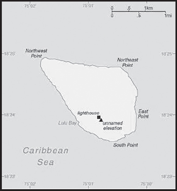
INTRODUCTION
Background: This uninhabited island was claimed by the US in 1857 for its guano. Mining took place between 1865 and 1898. The lighthouse, built in 1917, was shut down in 1996 and administration of Navassa Island transferred from the US Coast Guard to the Department of the Interior, Office of Insular Affairs. A 1998 scientific expedition to the island described it as a “unique preserve of Caribbean biodiversity.” The following year it became a National Wildlife Refuge and annual scientific expeditions have continued.
GEOGRAPHY
Location: Caribbean, island in the Caribbean Sea, 30 nm west of Tiburon Peninsula of Haiti
Geographic coordinates: 18 25 N, 75 02 W
Map references: Central America and the Caribbean
Area: total: 5 sq km
land: 5.4 sq km
water: 0 sq km
comparison ranking: total 249
Area - comparative: about nine times the size of the National Mall in Washington, DC
Land boundaries: total: 0 km
Coastline: 8 km
Maritime claims: territorial sea: 12 nm
exclusive economic zone: 200 nm
Climate: marine, tropical
Terrain: raised flat to undulating coral and limestone plateau; ringed by vertical white cliffs (9 to 15 m high)
Elevation: highest point: 200 m NNW of lighthouse 85 m
lowest point: Caribbean Sea 0 m
Natural resources: guano (mining discontinued in 1898)
Land use: other: 100% (2018 est.)
Natural hazards: hurricanes
Geography - note: strategic location 160 km south of the US Naval Base at Guantanamo Bay, Cuba; mostly exposed rock with numerous solution holes (limestone sinkholes) but with enough grassland to support goat herds; dense stands of fig trees, scattered cactus
PEOPLE AND SOCIETY
Population: uninhabited; transient Haitian fishermen and others camp on the island
ENVIRONMENT
Environment - current issues: some coral bleaching
Climate: marine, tropical
Land use: other: 100% (2018 est.)
GOVERNMENT
Country name: conventional long form: none
conventional short form: Navassa Island
etymology: the flat island was named “Navaza” by some of Christopher COLUMBUS’ sailors in 1504; the name derives from the Spanish term “nava” meaning “flat land, plain, or field”
Dependency status: unorganized, unincorporated territory of the US; administered by the Fish and Wildlife Service, US Department of the Interior from the Caribbean Islands National Wildlife Refuge in Boqueron, Puerto Rico; in September 1996, the Coast Guard ceased operations and maintenance of the Navassa Island Light, a 46-meter-tall lighthouse on the southern side of the island; Haiti has claimed the island since the 19th century
Legal system: the laws of the US apply where applicable
Diplomatic representation from the US: embassy: none (territory of the US)
Flag description: the flag of the US is used
TRANSPORTATION
Ports and terminals: none; offshore anchorage only
MILITARY AND SECURITY
Military - note: defense is the responsibility of the US
TRANSNATIONAL ISSUES
Disputes - international: Navassa Island (US)-Haiti: claimed by Haiti and is in Haiti’s constitution; the waters around Navassa island are a source of subsistence for Haitian fishermen
NEPAL
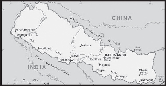
INTRODUCTION
Background: During the late 18th-early 19th centuries, the principality of Gorkha united many of the other principalities and states of the sub-Himalayan region into a Nepali Kingdom. Nepal retained its independence following the Anglo-Nepalese War of 1814-16 and the subsequent peace treaty laid the foundations for two centuries of amicable relations between Britain and Nepal. (The Brigade of Gurkhas continues to serve in the British Army to the present day.) In 1951, the Nepali monarch ended the century-old system of rule by hereditary premiers and instituted a cabinet system that brought political parties into the government. That arrangement lasted until 1960, when political parties were again banned, but was reinstated in 1990 with the establishment of a multiparty democracy within the framework of a constitutional monarchy.
An insurgency led by Maoists broke out in 1996. During the ensuing 10-year civil war between Maoist and government forces, the monarchy dissolved the cabinet and parliament and re-assumed absolute power in 2002, after the crown prince massacred the royal family in 2001. A peace accord in 2006 led to the promulgation of an interim constitution in 2007. Following a nationwide Constituent Assembly (CA) election in 2008, the newly formed CA declared Nepal a federal democratic republic, abolished the monarchy, and elected the country’s first president. After the CA failed to draft a constitution by a 2012 deadline set by the Supreme Court, then-Prime Minister Baburam BHATTARAI dissolved the CA. Months of negotiations ensued until 2013 when the major political parties agreed to create an interim government headed by then-Chief Justice Khil Raj REGMI with a mandate to hold elections for a new CA. Elections were held in 2013, in which the Nepali Congress (NC) won the largest share of seats in the CA and in 2014 formed a coalition government with the second-place Communist Party of Nepal-Unified Marxist-Leninist (UML) with NC President Sushil KOIRALA serving as prime minister. Nepal’s new constitution came into effect in 2015, at which point the CA became the Parliament. Khagda Prasad Sharma OLI served as the first post-constitution prime minister from 2015 to 2016. OLI resigned ahead of a no-confidence motion against him, and Parliament elected Communist Party of Nepal-Maoist (CPN-M) leader Pushpa Kamal DAHAL (aka “Prachanda”) prime minister. The constitution provided for a transitional period during which three sets of elections – local, provincial, and national – needed to take place. The first local elections in 20 years occurred in three phases between May and September 2017, and state and federal elections proceeded in two phases in November and December 2017. The parties headed by OLI and DAHAL ran in coalition and swept the parliamentary elections, and OLI, who led the larger of the two parties, was sworn in as prime minister in February 2018. In May 2018, OLI and DAHAL announced the merger of their parties - the UML and CPN-M - to establish the Nepal Communist Party (NCP), which headed the government for roughly two years before infighting led the party to split. OLI from late 2020 sought to dissolve parliament and hold elections. The supreme court in July 2021 declared OLI’s efforts unconstitutional and called for an appointment of the opposition-supported NC leader Sher Bahadur DEUBA as prime minister. DEUBA led Nepal with the support of his party and DAHAL’s Communist Party of Nepal-Maoist Centre (CPN-MC) until December 2022. The NC won a majority of seats in the parliamentary elections on November 2022, but in late December 2022, DAHAL broke with the ruling coalition and sought a partnership with OLI and the CPN-UML to become prime minister. DAHAL’s first post-election cabinet lasted approximately two months, until disagreements over ministerial assignments across the coalition caused OLI to withdraw his support. In March 2023, DAHAL survived a vote of confidence and formed a coalition with the NC to remain prime minister.
GEOGRAPHY
Location: Southern Asia, between China and India
Geographic coordinates: 28 00 N, 84 00 E
Map references: Asia
Area: total: 147,181 sq km
land: 143,351 sq km
water: 3,830 sq km
comparison ranking: total 95
Area - comparative: slightly larger than New York state
Land boundaries: total: 3,159 km
border countries (2): China 1,389 km; India 1,770 km
Coastline: 0 km (landlocked)
Maritime claims: none (landlocked)
Climate: varies from cool summers and severe winters in north to subtropical summers and mild winters in south
Terrain: Tarai or flat river plain of the Ganges in south; central hill region with rugged Himalayas in north
Elevation: highest point: Mount Everest (highest peak in Asia and highest point on earth above sea level) 8,849 m
lowest point: Kanchan Kalan 70 m
mean elevation: 2,565 m
Natural resources: quartz, water, timber, hydropower, scenic beauty, small deposits of lignite, copper, cobalt, iron ore
Land use: agricultural land: 28.8% (2018 est.)
arable land: 15.1% (2018 est.)
permanent crops: 1.2% (2018 est.)
permanent pasture: 12.5% (2018 est.)
forest: 25.4% (2018 est.)
other: 45.8% (2018 est.)
Irrigated land: 13,320 sq km (2012)
Major watersheds (area sq km): Indian Ocean drainage: Brahmaputra (651,335 sq km), Ganges (1,016,124 sq km), Indus (1,081,718 sq km)
Major aquifers: Indus-Ganges-Brahmaputra Basin
Population distribution: most of the population is divided nearly equally between a concentration in the southern-most plains of the Tarai region and the central hilly region; overall density is quite low
Natural hazards: severe thunderstorms; flooding; landslides; drought and famine depending on the timing, intensity, and duration of the summer monsoons
Geography - note: landlocked; strategic location between China and India; contains eight of world’s 10 highest peaks, including Mount Everest and Kanchenjunga - the world’s tallest and third tallest mountains - on the borders with China and India respectively
PEOPLE AND SOCIETY
Population: 30,899,443 (2023 est.)
comparison ranking: 49
Nationality: noun: Nepali (singular and plural)
adjective: Nepali
Ethnic groups: Chhettri 16.5%, Brahman-Hill 11.3%, Magar 6.9%, Tharu 6.2%, Tamang 5.6%, Bishwokarma 5%, Musalman 4.9%, Newar 4.6%, Yadav 4.2%, Rai 2.2%, Pariyar 1.9%, Gurung 1.9%, Thakuri 1.7%, Mijar 1.6%, Teli 1.5%, Yakthung/Limbu 1.4%, Chamar/Harijan/Ram 1.4%, Koiri/Kushwaha 1.2%, other 20% (2021 est.)
note: 141 caste/ethnic groups were reported in the 2021 national census
Languages: Nepali (official) 44.9%, Maithali 11.1%, Bhojpuri 6.2%, Tharu 5.9%, Tamang 4.9%, Bajjika 3.9%, Avadhi 3%, Nepalbhasha (Newari) 3%, Magar Dhut 2.8%, Doteli 1.7%, Urdu 1.4%, Yakthung/Limbu 1.2%, Gurung 1.1%, other 8.9%; note - 123 languages reported as mother tongue in 2021 national census; many in government and business also speak English (2021 est.)
major-language sample(s):

(Nepali)
Religions: Hindu 81.2%, Buddhist 8.2%, Muslim 5.1%, Kirat 3.2%, Christian 1.8%, other 0.5% (2021 est.)
Age structure: 0-14 years: 26.32% (male 4,175,742/female 3,956,153)
15-64 years: 67.52% (male 10,016,748/female 10,846,101)
65 years and over: 6.16% (2023 est.) (male 930,510/female 974,189)
Dependency ratios: total dependency ratio: 54.9
youth dependency ratio: 45.5
elderly dependency ratio: 9.4
potential support ratio: 10.7 (2021 est.)
Median age: total: 25.3 years (2020)
male: 23.9 years
female: 26.9 years
comparison ranking: total 160
Population growth rate: 0.74% (2023 est.)
comparison ranking: 121
Birth rate: 17.26 births/1,000 population (2023 est.)
comparison ranking: 88
Death rate: 5.59 deaths/1,000 population (2023 est.)
comparison ranking: 177
Net migration rate: -4.29 migrant(s)/1,000 population (2023 est.)
comparison ranking: 195
Population distribution: most of the population is divided nearly equally between a concentration in the southern-most plains of the Tarai region and the central hilly region; overall density is quite low
Urbanization: urban population: 21.9% of total population (2023)
rate of urbanization: 3.09% annual rate of change (2020-25 est.)
Major urban areas - population: 1.571 million KATHMANDU (capital) (2023)
Sex ratio: at birth: 1.06 male(s)/female
0-14 years: 1.06 male(s)/female
15-64 years: 0.92 male(s)/female
65 years and over: 0.96 male(s)/female
total population: 0.96 male(s)/female (2023 est.)
Mother’s mean age at first birth: 20.4 years (2016 est.)
note: data represents median age at first birth among women 25-49
Maternal mortality ratio: 174 deaths/100,000 live births (2020 est.)
comparison ranking: 51
Infant mortality rate: total: 24.55 deaths/1,000 live births (2023 est.)
male: 25.84 deaths/1,000 live births
female: 23.18 deaths/1,000 live births
comparison ranking: total 67
Life expectancy at birth: total population: 72.67 years (2023 est.)
male: 71.95 years
female: 73.44 years
comparison ranking: total population 158
Total fertility rate: 1.88 children born/woman (2023 est.)
comparison ranking: 132
Gross reproduction rate: 0.91 (2023 est.)
Contraceptive prevalence rate: 46.7% (2019)
Drinking water source: improved: urban: 92.7% of population
rural: 94.4% of population
total: 94.1% of population
unimproved: urban: 7.3% of population
rural: 5.6% of population
total: 5.9% of population (2020 est.)
Current health expenditure: 5.2% of GDP (2020)
Physicians density: 0.85 physicians/1,000 population (2020)
Hospital bed density: 0.3 beds/1,000 population (2012)
Sanitation facility access: improved: urban: 95.1% of population
rural: 85.7% of population
total: 87.7% of population
unimproved: urban: 4.9% of population
rural: 14.3% of population
total: 12.3% of population (2020 est.)
Major infectious diseases: degree of risk: high (2023)
food or waterborne diseases: bacterial diarrhea, hepatitis A and E, and typhoid fever
vectorborne diseases: Japanese encephalitis, malaria, and dengue fever
Obesity - adult prevalence rate: 4.1% (2016)
comparison ranking: 187
Alcohol consumption per capita: total: 0.36 liters of pure alcohol (2019 est.)
beer: 0.22 liters of pure alcohol (2019 est.)
wine: 0 liters of pure alcohol (2019 est.)
spirits: 0.13 liters of pure alcohol (2019 est.)
other alcohols: 0 liters of pure alcohol (2019 est.)
comparison ranking: total 167
Tobacco use: total: 30.4% (2020 est.)
male: 47.9% (2020 est.)
female: 12.8% (2020 est.)
comparison ranking: total 31
Children under the age of 5 years underweight: 18.7% (2022)
comparison ranking: 23
Currently married women (ages 15-49): 74.6% (2023 est.)
Child marriage: women married by age 15: 7.9%
women married by age 18: 32.8%
men married by age 18: 9% (2019 est.)
Education expenditures: 4.2% of GDP (2020 est.)
comparison ranking: 110
Literacy: definition: age 15 and over can read and write
total population: 71.2%
male: 81%
female: 63.3% (2021)
School life expectancy (primary to tertiary education): total: 13 years
male: 13 years
female: 13 years (2020)
Youth unemployment rate (ages 15-24): total: 9.5% (2021 est.)
male: 10.6%
female: 8.6%
comparison ranking: total 160
ENVIRONMENT
Environment - current issues: deforestation (overuse of wood for fuel and lack of alternatives); forest degradation; soil erosion; contaminated water (with human and animal wastes, agricultural runoff, and industrial effluents); unmanaged solid-waste; wildlife conservation; vehicular emissions
Environment - international agreements: party to: Biodiversity, Climate Change, Climate Change-Kyoto Protocol, Climate Change-Paris Agreement, Desertification, Endangered Species, Hazardous Wastes, Law of the Sea, Nuclear Test Ban, Ozone Layer Protection, Wetlands
signed, but not ratified: Comprehensive Nuclear Test Ban, Marine Life Conservation
Climate: varies from cool summers and severe winters in north to subtropical summers and mild winters in south
Land use: agricultural land: 28.8% (2018 est.)
arable land: 15.1% (2018 est.)
permanent crops: 1.2% (2018 est.)
permanent pasture: 12.5% (2018 est.)
forest: 25.4% (2018 est.)
other: 45.8% (2018 est.)
Urbanization: urban population: 21.9% of total population (2023)
rate of urbanization: 3.09% annual rate of change (2020-25 est.)
Revenue from forest resources: 0.45% of GDP (2018 est.)
comparison ranking: 69
Revenue from coal: 0% of GDP (2018 est.)
comparison ranking: 157
Air pollutants: particulate matter emissions: 36.43 micrograms per cubic meter (2019 est.)
carbon dioxide emissions: 9.11 megatons (2016 est.)
methane emissions: 41.15 megatons (2020 est.)
Waste and recycling: municipal solid waste generated annually: 1,768,977 tons (2016 est.)
Major watersheds (area sq km): Indian Ocean drainage: Brahmaputra (651,335 sq km), Ganges (1,016,124 sq km), Indus (1,081,718 sq km)
Major aquifers: Indus-Ganges-Brahmaputra Basin
Total water withdrawal: municipal: 150 million cubic meters (2020 est.)
industrial: 30 million cubic meters (2020 est.)
agricultural: 9.32 billion cubic meters (2020 est.)
Total renewable water resources: 210.2 billion cubic meters (2020 est.)
GOVERNMENT
Country name: conventional long form: none
conventional short form: Nepal
local long form: none
local short form: Nepal
etymology: the Newar people of the Kathmandu Valley and surrounding areas apparently gave their name to the country; the terms “Nepal,” “Newar,” “Nepar,” and “Newal” are phonetically different forms of the same word
Government type: federal parliamentary republic
Capital: name: Kathmandu
geographic coordinates: 27 43 N, 85 19 E
time difference: UTC+5.75 (10.75 hours ahead of Washington, DC, during Standard Time)
etymology: name derives from the Kasthamandap temple that stood in Durbar Square; in Sanskrit, kastha means “wood” and mandapa means “pavilion”; the three-story structure was made entirely of wood, without iron nails or supports, and dated to the late 16th century; it collapsed during a 2015 earthquake
Administrative divisions: 7 provinces (pradesh, singular - pradesh); Bagmati, Gandaki, Karnali, Koshi, Lumbini, Madhesh, Sudurpashchim
Independence: 1768 (unified by Prithvi Narayan SHAH)
National holiday: Constitution Day, 20 September (2015); note - marks the promulgation of Nepal’s constitution in 2015 and replaces the previous 28 May Republic Day as the official national day in Nepal; the Gregorian day fluctuates based on Nepal’s Hindu calendar
Constitution: history: several previous; latest approved by the Second Constituent Assembly 16 September 2015, signed by the president and effective 20 September 2015
amendments: proposed as a bill by either house of the Federal Parliament; bills affecting a state border or powers delegated to a state must be submitted to the affected state assembly; passage of such bills requires a majority vote of that state assembly membership; bills not requiring state assembly consent require at least two-thirds majority vote by the membership of both houses of the Federal Parliament; parts of the constitution on the sovereignty, territorial integrity, independence, and sovereignty vested in the people cannot be amended; amended 2016, 2020
Legal system: English common law and Hindu legal concepts; note - new criminal and civil codes came into effect on 17 August 2018
International law organization participation: has not submitted an ICJ jurisdiction declaration; non-party state to the ICCt
Citizenship: citizenship by birth: yes
citizenship by descent only: yes
dual citizenship recognized: no
residency requirement for naturalization: 15 years
Suffrage: 18 years of age; universal
Executive branch: chief of state: President Ram Chandra POUDEL (since 13 March 2023); Vice President Ram Sahaya Prasad YADAV (since 20 March 2023)
head of government: Prime Minister Pushpa Kamal DAHAL (since 26 December 2022); deputy prime ministers Narayan Kaji SHRESTHA (since 26 December 2022), Purna Bahadur KHADKA (since 31 March 2023) (an)
cabinet: Council of Ministers appointed by the prime minister; cabinet split between Nepali Congress, Communist Party of Nepal-Maoist Centre, and various coalition partners
elections/appointments: president indirectly elected by an electoral college of the Federal Parliament and of the state assemblies for a 5-year term (eligible for a second term); election last held on 9 March 2023 (next to be held in 2028); prime minister indirectly elected by the Federal Parliament
election results: Ram Chandra POUDEL elected president; electoral vote - Ram Chandra POUDEL (NC) 33,802, Subash Chandra NEMBANG (CPN-UML) 15,518
Legislative branch: description: bicameral Federal Parliament consists of:
National Assembly (59 seats; 56 members, including at least 3 women, 1 Dalit, 1 member with disabilities, or 1 minority indirectly elected by an electoral college of state and municipal government leaders, and 3 members, including 1 woman, nominated by the president of Nepal on the recommendation of the government; members serve 6-year terms with renewal of one-third of the membership every 2 years)
House of Representatives (275 seats; 165 members directly elected in single-seat constituencies by simple majority vote and 110 members directly elected in a single nationwide constituency by closed-list proportional representation vote, with a threshold of 3% overall valid vote to be allocated a seat; members serve 5-year terms); note - the House of Representatives was dissolved on 22 May 2021, but on 13 July, the Supreme Court directed its reinstatement
elections: National Assembly - last held on 26 January 2022 (next to be held in 2024)
House of Representatives - last held on 20 November 2022 (next to be held in November 2027)
election results:
National Assembly - percent of vote by party - NA; seats by party - CPN-UML 42, NC 13, FSFN 2, RJPN 2; composition - men 37, women 22, percent of women 37.3%
House of Representatives - percent of vote by party - NA; seats by party - NC 89, CPN-UML 78, CPN-MC 32, RSP 20, RPP 14, PSP-N 12, CPN (Unified Socialist) 10, Janamat Party 6, Loktantrik Samajwadi Party 4, other 10; composition - men 184, women 91, percent of women 33.1%
Judicial branch: highest court(s): Supreme Court (consists of the chief justice and up to 20 judges)
judge selection and term of office: Supreme Court chief justice appointed by the president upon the recommendation of the Constitutional Council, a 5-member, high-level advisory body headed by the prime minister; other judges appointed by the president upon the recommendation of the Judicial Council, a 5-member advisory body headed by the chief justice; the chief justice serves a 6-year term; judges serve until age 65
subordinate courts: High Court; district courts
Political parties and leaders: Federal Socialist Forum, Nepal or FSFN [Upendra YADAV]
Communist Party of Nepal (Maoist Centre) or CPN-MC [Pushpa Kamal DAHAL]
Communist Party of Nepal (Unified Marxist-Leninist) or CPN-UML [Khadga Prasad OLI]
Communist Party of Nepal (Unified Socialist) or CPN-US [Madhav Kumar NEPAL]
Janamat Party [Chandra Kant RAUT]
Loktantrik Samajwadi Party [Mahantha THAKUR]
Naya Shakti Party, Nepal [Baburam BHATTARAI]
Nepali Congress or NC [Sher Bahadur DEUBA]
Nepal Mazdoor Kisan Party (Nepal Workers’ and Peasants’ Party) or NWPP [Narayan Man BIJUKCHHE]
People’s Socialist Party [Upendra YAKAV]
Rastriya Janamorcha (National People’s Front) [Chitra Bahadur K.C.]
Rastriya Janata Party (National People’s Party, Nepal) or RJPN [Mahanta THAKUR]
Rastriya Prajatantra Party (National Democratic Party) or RPP [Rajendra Prasad LINGDEN]
Rastriya Swatantra Party or RSP [Rabi LAMICHHANE]
International organization participation: ADB, BIMSTEC, CD, CP, FAO, G-77, IAEA, IBRD, ICAO, ICC (NGOs), ICRM, IDA, IFAD, IFC, IFRCS, ILO, IMF, IMO, Interpol, IOC, IOM, IPU, ISO, ITSO, ITU, ITUC (NGOs), MIGA, MINURSO, MINUSMA, MINUSTAH, MONUSCO, NAM, OPCW, SAARC, SACEP, UN, UNAMID, UNCTAD, UNDOF, UNESCO, UNHRC, UNIDO, UNIFIL, UNISFA, UNMIL, UNMISS, UNOCI, UNSOM, UNTSO, UNWTO, UPU, WCO, WFTU (NGOs), WHO, WIPO, WMO, WTO
Diplomatic representation in the US: chief of mission: Ambassador Sridhar KHATRI (since 19 April 2022)
chancery: 2730 34th Place NW, Washington, DC 20007
telephone: [1] (202) 667-4550
FAX: [1] (202) 667-5534
email address and website:
https://us.nepalembassy.gov.np/
consulate(s) general: Chicago, New York
Diplomatic representation from the US: chief of mission: Ambassador Dean R. THOMPSON (since October 2022)
embassy: Maharajgunj, Kathmandu
mailing address: 6190 Kathmandu Place, Washington DC 20521-6190
telephone: [977] (1) 423-4000
FAX: [977] (1) 400-7272
email address and website:
Flag description: crimson red with a blue border around the unique shape of two overlapping right triangles; the smaller, upper triangle bears a white stylized moon and the larger, lower triangle displays a white 12-pointed sun; the color red represents the rhododendron (Nepal’s national flower) and is a sign of victory and bravery, the blue border signifies peace and harmony; the two right triangles are a combination of two single pennons (pennants) that originally symbolized the Himalaya Mountains while their charges represented the families of the king (upper) and the prime minister, but today they are understood to denote Hinduism and Buddhism, the country’s two main religions; the moon represents the serenity of the Nepalese people and the shade and cool weather in the Himalayas, while the sun depicts the heat and higher temperatures of the lower parts of Nepal; the moon and the sun are also said to express the hope that the nation will endure as long as these heavenly bodies
note: Nepal is the only country in the world whose flag is not rectangular or square
National symbol(s): rhododendron blossom; national color: red
National anthem: name: “Sayaun Thunga Phool Ka” (Hundreds of Flowers)
lyrics/music: Pradeep Kumar RAI/Ambar GURUNG
note: adopted 2007; after the abolition of the monarchy in 2006, a new anthem was required because of the previous anthem’s praise for the king
National heritage: total World Heritage Sites: 4 (2 cultural, 2 natural)
selected World Heritage Site locales: Kathmandu Valley (c); Sagarmatha National Park (n); Chitwan National Park (n); Lumbini, Buddha Birthplace (c)
ECONOMY
Economic overview: low-income South Asian economy; post-conflict fiscal federalism increasing stability; COVID-19 hurt trade and tourism; widening current account deficits; environmentally fragile economy from earthquakes; growing Chinese relations and investments
Real GDP (purchasing power parity): $115.093 billion (2021 est.)
$110.404 billion (2020 est.)
$113.083 billion (2019 est.)
note: data are in 2017 dollars
comparison ranking: 86
Real GDP growth rate: 4.25% (2021 est.)
-2.37% (2020 est.)
6.66% (2019 est.)
comparison ranking: 111
Real GDP per capita: $3,800 (2021 est.)
$3,800 (2020 est.)
$3,900 (2019 est.)
note: data are in 2017 dollars
comparison ranking: 187
GDP (official exchange rate): $24.88 billion (2017 est.)
Inflation rate (consumer prices): 4.09% (2021 est.)
5.05% (2020 est.)
5.57% (2019 est.)
comparison ranking: 89
GDP - composition, by sector of origin: agriculture: 27% (2017 est.)
industry: 13.5% (2017 est.)
services: 59.5% (2017 est.)
comparison rankings: services 131; industry 190; agriculture 25
GDP - composition, by end use: household consumption: 78% (2017 est.)
government consumption: 11.7% (2017 est.)
investment in fixed capital: 33.8% (2017 est.)
investment in inventories: 8.7% (2017 est.)
exports of goods and services: 9.8% (2017 est.)
imports of goods and services: -42% (2017 est.)
Agricultural products: rice, vegetables, sugar cane, potatoes, maize, wheat, buffalo milk, milk, fruit, mangoes/guavas
Industries: tourism, carpets, textiles; small rice, jute, sugar, and oilseed mills; cigarettes, cement and brick production
Industrial production growth rate: 4.51% (2021 est.)
comparison ranking: 98
Labor force: 16.884 million (2021 est.)
note: severe lack of skilled labor
comparison ranking: 38
Labor force - by occupation: agriculture: 69%
industry: 12%
services: 19% (2015 est.)
Unemployment rate: 5.05% (2021 est.)
4.72% (2020 est.)
3.1% (2019 est.)
comparison ranking: 151
Youth unemployment rate (ages 15-24): total: 9.5% (2021 est.)
male: 10.6%
female: 8.6%
comparison ranking: total 160
Population below poverty line: 25.2% (2011 est.)
Gini Index coefficient - distribution of family income: 32.8 (2010 est.)
comparison ranking: 129
Household income or consumption by percentage share: lowest 10%: 3.2%
highest 10%: 29.5% (2011)
Budget: revenues: $7.305 billion (2020 est.)
expenditures: $9.008 billion (2020 est.)
Budget surplus (+) or deficit (-): -0.1% (of GDP) (2017 est.)
comparison ranking: 49
Public debt: 39.05% of GDP (2020 est.)
31.78% of GDP (2019 est.)
comparison ranking: 139
Taxes and other revenues: 15.77% (of GDP) (2020 est.)
comparison ranking: 139
Fiscal year: 16 July - 15 July
Current account balance: -$5.363 billion (2021 est.)
-$84.137 million (2020 est.)
-$1.754 billion (2019 est.)
comparison ranking: 190
Exports: $2.52 billion (2021 est.) note: data are in current year dollars
$1.771 billion (2020 est.) note: data are in current year dollars
$2.726 billion (2019 est.) note: data are in current year dollars
comparison ranking: 151
Exports - partners: India 68%, United States 10% (2019)
Exports - commodities: soybean oil, palm oil, clothing and apparel, carpets, nutmeg (2021)
Imports: $16.993 billion (2021 est.) note: data are in current year dollars
$10.694 billion (2020 est.) note: data are in current year dollars
$13.836 billion (2019 est.) note: data are in current year dollars
comparison ranking: 96
Imports - partners: India 70%, China 15% (2019)
Imports - commodities: refined petroleum, iron, broadcasting equipment, natural gas, rice (2019)
Reserves of foreign exchange and gold: $9.661 billion (31 December 2021 est.)
$11.468 billion (31 December 2020 est.)
$8.713 billion (31 December 2019 est.)
comparison ranking: 82
Debt - external: $5.849 billion (31 December 2017 est.)
$4.321 billion (31 December 2016 est.)
comparison ranking: 129
Exchange rates: Nepalese rupees (NPR) per US dollar -
Exchange rates: 118.134 (2021 est.)
118.345 (2020 est.)
112.609 (2019 est.)
108.93 (2018 est.)
104.512 (2017 est.)
ENERGY
Electricity access: population without electricity: 1 million (2020)
electrification - total population: 89.9% (2021)
electrification - urban areas: 94.2% (2021)
electrification - rural areas: 97% (2020)
Electricity: installed generating capacity: 1.392 million kW (2020 est.)
consumption: 4.676 billion kWh (2019 est.)
exports: 107 million kWh (2019 est.)
imports: 1.729 billion kWh (2019 est.)
transmission/distribution losses: 1.183 billion kWh (2019 est.)
comparison rankings: installed generating capacity 128; transmission/distribution losses 107; imports 60; exports 91; consumption 128
Electricity generation sources: solar: 2.6% of total installed capacity (2020 est.)
wind: 0.2% of total installed capacity (2020 est.)
hydroelectricity: 97.2% of total installed capacity (2020 est.)
Coal: production: 28,000 metric tons (2020 est.)
consumption: 839,000 metric tons (2020 est.)
exports: 0 metric tons (2020 est.)
imports: 811,000 metric tons (2020 est.)
proven reserves: 1 million metric tons (2019 est.)
Petroleum: total petroleum production: 0 bbl/day (2021 est.)
refined petroleum consumption: 49,400 bbl/day (2019 est.)
Refined petroleum products - imports: 26,120 bbl/day (2015 est.)
comparison ranking: 106
Carbon dioxide emissions: 7.708 million metric tonnes of CO2 (2019 est.)
from coal and metallurgical coke: 1.051 million metric tonnes of CO2 (2019 est.)
from petroleum and other liquids: 6.657 million metric tonnes of CO2 (2019 est.)
comparison ranking: total emissions 120
Energy consumption per capita: 5.219 million Btu/person (2019 est.)
comparison ranking: 171
COMMUNICATIONS
Telephones - fixed lines: total subscriptions: 730,000 (2021 est.)
subscriptions per 100 inhabitants: 2 (2021 est.)
comparison ranking: total subscriptions 79
Telephones - mobile cellular: total subscriptions: 38 million (2021 est.)
subscriptions per 100 inhabitants: 130 (2021 est.)
comparison ranking: total subscriptions 41
Telecommunication systems: general assessment: in relation to its telecom sector, Nepal has several topographical and economic constraints which have impeded efforts to expand network infrastructure and improve the quality of service for end-users; the fixed line market remains underdeveloped, and as a result most traffic is channeled via mobile networks; fixed broadband penetration remains very low, though to address this the government has initiated several programs as part of the Digital Nepal Framework and the wider Optical Fiber Backbone Network Expansion Project, started in 2012; supported by the Rural Telecommunications Development Fund, the programs include building out fiber backbone infrastructure and using this to provide broadband to schools and community centers nationally; telcos have also invested in fiber networks, and competition in the market is intensifying; cheap fiber-based services launched in mid-2021 prompted responses from other ISPs to provide faster and more competitively priced offers; Nepal’s mobile market is relatively developed, with a focus on LTE; in 2021, the regulator considered a range of spectrum bands which could be used for 5G (2021)
domestic: fixed-line is 2 per 100 persons and mobile-cellular nearly 130 per 100 persons (2021)
international: country code - 977; Nepal, China and Tibet connected across borders with underground and all-dielectric self-supporting (ADSS) fiber-optic cables; radiotelephone communications; microwave and fiber landlines to India; satellite earth station - 1 Intelsat (Indian Ocean) (2019)
Broadcast media: state operates 3 TV stations, as well as national and regional radio stations; 117 television channels are licensed, among those 71 are cable television channels, three are distributed through Direct-To-Home (DTH) system, and four are digital terrestrial; 736 FM radio stations are licensed and at least 314 of those radio stations are community radio stations (2019)
Internet country code: .np
Internet users: total: 15.6 million (2021 est.)
percent of population: 52% (2021 est.)
comparison ranking: total 48
Broadband - fixed subscriptions: total: 1.27 million (2020 est.)
subscriptions per 100 inhabitants: 4 (2020 est.)
comparison ranking: total 69
TRANSPORTATION
National air transport system: number of registered air carriers: 6 (2020)
inventory of registered aircraft operated by air carriers: 39
annual passenger traffic on registered air carriers: 3,296,953 (2018)
annual freight traffic on registered air carriers: 4.66 million (2018) mt-km
Civil aircraft registration country code prefix: 9N
Airports: 47 (2021)
comparison ranking: total 93
Airports - with paved runways: 11
note: paved runways have a concrete or asphalt surface but not all have facilities for refueling, maintenance, or air traffic control; the length of a runway required for aircraft to safely operate depends on a number of factors including the type of aircraft, the takeoff weight (including passengers, cargo, and fuel), engine types, flap settings, landing speed, elevation of the airport, and average maximum daily air temperature; paved runways can reach a length of 5,000 m (16,000 ft.), but the “typical” length of a commercial airline runway is between 2,500-4,000 m (8,000-13,000 ft.)
Airports - with unpaved runways: 36
note: unpaved runways have a surface composition such as grass or packed earth and are most suited to the operation of light aircraft; unpaved runways are usually short, often less than 1,000 m (3,280 ft.) in length; airports with unpaved runways often lack facilities for refueling, maintenance, or air traffic control
Railways: total: 59 km (2018)
narrow gauge: 59 km (2018) 0.762-m gauge
comparison ranking: total 132
Roadways: total: 27,990 km (2016)
paved: 11,890 km (2016)
unpaved: 16,100 km (2016)
comparison ranking: total 99
MILITARY AND SECURITY
Military and security forces: Nepalese Armed Forces (Ministry of Defense): Nepali Army (includes Air Wing)
Ministry of Home Affairs: Nepal Police, Nepal Armed Police Force (2023)
note: the Nepal Police are responsible for enforcing law and order across the country; the Armed Police Force is responsible for combating terrorism, providing security during riots and public disturbances, assisting in natural disasters, and protecting vital infrastructure, public officials, and the borders; it also conducts counterinsurgency and counterterrorism operations and would assist the Army in the event of an external invasion
Military expenditures: 1.1% of GDP (2022 est.)
1.3% of GDP (2021 est.)
1.3% of GDP (2020 est.)
2.1% of GDP (2019)
2.3% of GDP (2018)
comparison ranking: 125
Military and security service personnel strengths: approximately 95,000 active troops (including a small air wing of about 500 personnel) (2023)
Military equipment inventories and acquisitions: the Army’s inventory includes a mix of mostly older equipment largely of British, Chinese, Indian, Russian, and South African origin; in recent years, Nepal has received limited amounts of newer hardware from several countries, including China, Italy, and Russia (2022)
Military service age and obligation: 18 years of age for voluntary military service (including women); no conscription (2023)
note: as of 2022, women comprised about 7% of the active duty military
Military deployments: 1225 Central African Republic (MINUSCA); 1,150 Democratic Republic of the Congo (MONUSCO); 400 Golan Heights (UNDOF); 875 Lebanon (UNIFIL); 225 Liberia (UNSMIL); 175 Mali (MINUSMA); 1,750 (plus about 220 police) South Sudan (UNMISS) (2023)
Military - note: the Nepali Army is a lightly equipped and professional force responsible for territorial defense, although it has some domestic duties such as disaster relief/humanitarian assistance and nature conservation efforts; during the 10-year civil war that ended in 2006, it conducted extensive counterinsurgency operations against Maoist guerrillas; the Army also has a long and distinguished history of supporting UN missions, having sent its first UN observers to Lebanon in 1958 and its first troop contingent to Egypt in 1974; as of 2023, nearly 150,000 Nepali military personnel had deployed on over 40 UN missions; the Army conducts training with foreign partners, including China, India, and the US; it has 8 geographically-based divisions, each comprised of light infantry brigades and support units; the Army also has independent special forces and security force (palace guard) brigades; the Air Wing has a small number of multi-role and transport helicopters
the British began to recruit Nepalese citizens (Gurkhas) into the East India Company Army during the Anglo-Nepalese War (1814-1816); the Gurkhas subsequently were brought into the British Indian Army and by 1914, there were 10 Gurkha regiments, collectively known as the Gurkha Brigade; following the partition of India in 1947, an agreement between Nepal, India, and Great Britain allowed for the transfer of the 10 regiments from the British Indian Army to the separate British and Indian armies; four regiments were transferred to the British Army, where they have since served continuously as the Brigade of Gurkhas; six Gurkha (aka Gorkha in India) regiments went to the new Indian Army; a seventh regiment was later added; Gurkhas are also recruited into the Singaporean Police and a special guard in the Sultanate of Brunei known as the Gurkha Reserve Unit (2023)
TERRORISM
Terrorist group(s): Terrorist group(s): Indian Mujahedeen
note: details about the history, aims, leadership, organization, areas of operation, tactics, targets, weapons, size, and sources of support of the group(s) appear(s) in Appendix-T
TRANSNATIONAL ISSUES
Disputes - international: Nepal-China: China may have constructed 11 buildings in Nepal’s Humla region in 2021
Nepal-India: joint border commission continues to work on contested sections of boundary with India, including the 400 sq km dispute over the source of the Kalapani River; the Kalapani issue resurfaced in November 2019 when India issued a new map showing the contested area within India’s borders and then built a new road in the region through Lipulekh pass, an area controlled by India but claimed by Nepal; Nepal countered by amending its constitution and issuing its own map showing the disputed area within its borders; the countries prime ministers briefly discussed the border dispute in April 2022; India has instituted a stricter border regime to restrict transit of illegal cross-border activities
Refugees and internally displaced persons: refugees (country of origin): 12,540 (Tibet/China), 6,365 (Bhutan) (mid-year 2022)
stateless persons: undetermined (mid-year 2021)
Illicit drugs: illicit producer of cannabis and hashish for the domestic and international drug markets; transit point for opiates from Southeast Asia to the West; destination country for Indian-produced heroin smuggled in for domestic consumption
NETHERLANDS
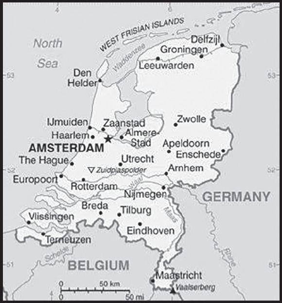
INTRODUCTION
Background: The Dutch United Provinces declared their independence from Spain in 1581; during the 17th century, they became a leading seafaring and commercial power, with settlements and colonies around the world. After 18 years of French domination, the Netherlands regained its independence in 1813. In 1830, Belgium seceded and formed a separate kingdom. The Netherlands remained neutral in World War I but suffered German invasion and occupation in World War II. A modern, industrialized nation, the Netherlands is also a large exporter of agricultural products. The country was a founding member of NATO and the EEC (now the EU) and participated in the introduction of the euro in 1999. In October 2010, the former Netherlands Antilles was dissolved and the three smallest islands - Bonaire, Sint Eustatius, and Saba - became special municipalities in the Netherlands administrative structure. The larger islands of Sint Maarten and Curacao joined the Netherlands and Aruba as constituent countries forming the Kingdom of the Netherlands.
In February 2018, the Sint Eustatius island council (governing body) was dissolved and replaced by a government commissioner to restore the integrity of public administration. According to the Dutch Government, the intervention will be as “short as possible and as long as needed.”
GEOGRAPHY
Location: Western Europe, bordering the North Sea, between Belgium and Germany
Geographic coordinates: 52 31 N, 5 46 E
Map references: Europe
Area: total: 41,543 sq km
land: 33,893 sq km
water: 7,650 sq km
comparison ranking: total 134
Area - comparative: slightly less than twice the size of New Jersey
Land boundaries: total: 1,053 km
border countries (2): Belgium 478 km; Germany 575 km
Coastline: 451 km
Maritime claims: territorial sea: 12 nm
contiguous zone: 24 nm
exclusive fishing zone: 200 nm
Climate: temperate; marine; cool summers and mild winters
Terrain: mostly coastal lowland and reclaimed land (polders); some hills in southeast
Elevation: highest point: Mount Scenery (on the island of Saba in the Caribbean, now considered an integral part of the Netherlands following the dissolution of the Netherlands Antilles) 862 m
lowest point: Zuidplaspolder -7 m
mean elevation: 30 m
note: the highest point on continental Netherlands is Vaalserberg at 322 m
Natural resources: natural gas, petroleum, peat, limestone, salt, sand and gravel, arable land
Land use: agricultural land: 55.1% (2018 est.)
arable land: 29.8% (2018 est.)
permanent crops: 1.1% (2018 est.)
permanent pasture: 24.2% (2018 est.)
forest: 10.8% (2018 est.)
other: 34.1% (2018 est.)
Irrigated land: 2,969 sq km (2019)
Major rivers (by length in km): Rijn (Rhine) river mouth (shared with Switzerland [s], Germany, and France) - 1,233 km
note – [s] after country name indicates river source; [m] after country name indicates river mouth
Major watersheds (area sq km): Atlantic Ocean drainage: Rhine-Maas (198,735 sq km)
Population distribution: an area known as the Randstad, anchored by the cities of Amsterdam, Rotterdam, the Hague, and Utrecht, is the most densely populated region; the north tends to be less dense, though sizeable communities can be found throughout the entire country
Natural hazards: flooding
volcanism: Mount Scenery (887 m), located on the island of Saba in the Caribbean, last erupted in 1640; Round Hill (601 m), a dormant volcano also known as The Quill, is located on the island of St. Eustatius in the Caribbean; these islands are at the northern end of the volcanic island arc of the Lesser Antilles that extends south to Grenada
Geography - note: located at mouths of three major European rivers (Rhine (Rijn), Meuse (Maas), and Scheldt (Schelde)); about a quarter of the country lies below sea level and only about half of the land exceeds one meter above sea level
PEOPLE AND SOCIETY
Population: 17,463,930 (2023 est.)
comparison ranking: 71
Nationality: noun: Dutchman(men), Dutchwoman(women)
adjective: Dutch
Ethnic groups: Dutch 75.4%, EU (excluding Dutch) 6.4%, Turkish 2.4%, Moroccan 2.4%, Surinamese 2.1%, Indonesian 2%, other 9.3% (2021 est.)
Languages: Dutch (official); note - Frisian is an official language in Fryslan province; Frisian, Low Saxon, Limburgish, Romani, and Yiddish have protected status under the European Charter for Regional or Minority Languages; Dutch is the official language of the three special municipalities of the Caribbean Netherlands; English is a recognized regional language on Sint Eustatius and Saba; Papiamento is a recognized regional language on Bonaire
major-language sample(s):
Het Wereld Feitenboek, een onmisbare bron van informatie. (Dutch)
Religions: Roman Catholic 20.1%, Protestant 14.8% (includes Dutch Reformed, Protestant Church of The Netherlands, Calvinist), Muslim 5%, other 5.9% (includes Hindu, Buddhist, Jewish), none 54.1% (2019 est.)
Age structure: 0-14 years: 16.06% (male 1,436,601/female 1,368,697)
15-64 years: 63.08% (male 5,532,490/female 5,483,034)
65 years and over: 20.86% (2023 est.) (male 1,658,652/female 1,984,456)
Dependency ratios: total dependency ratio: 54.9
youth dependency ratio: 24
elderly dependency ratio: 30.9
potential support ratio: 3.2 (2021 est.)
Median age: total: 42.8 years (2020)
male: 41.6 years
female: 44 years
comparison ranking: total 32
Population growth rate: 0.36% (2023 est.)
comparison ranking: 162
Birth rate: 10.98 births/1,000 population (2023 est.)
comparison ranking: 166
Death rate: 9.27 deaths/1,000 population (2023 est.)
comparison ranking: 49
Net migration rate: 1.89 migrant(s)/1,000 population (2023 est.)
comparison ranking: 50
Population distribution: an area known as the Randstad, anchored by the cities of Amsterdam, Rotterdam, the Hague, and Utrecht, is the most densely populated region; the north tends to be less dense, though sizeable communities can be found throughout the entire country
Urbanization: urban population: 93.2% of total population (2023)
rate of urbanization: 0.59% annual rate of change (2020-25 est.)
Major urban areas - population: 1.174 million AMSTERDAM (capital), 1.018 million Rotterdam (2023)
Sex ratio: at birth: 1.05 male(s)/female
0-14 years: 1.05 male(s)/female
15-64 years: 1.01 male(s)/female
65 years and over: 0.84 male(s)/female
total population: 0.98 male(s)/female (2023 est.)
Mother’s mean age at first birth: 30.2 years (2020 est.)
Maternal mortality ratio: 4 deaths/100,000 live births (2020 est.)
comparison ranking: 174
Infant mortality rate: total: 3.34 deaths/1,000 live births (2023 est.)
male: 3.7 deaths/1,000 live births
female: 2.97 deaths/1,000 live births
comparison ranking: total 201
Life expectancy at birth: total population: 82.36 years (2023 est.)
male: 80.15 years
female: 84.69 years
comparison ranking: total population 27
Total fertility rate: 1.77 children born/woman (2023 est.)
comparison ranking: 147
Gross reproduction rate: 0.86 (2023 est.)
Contraceptive prevalence rate: 73% (2013)
note: percent of women aged 18-45
Drinking water source: improved: total: 100% of population
unimproved: total: 0% of population (2020 est.)
Current health expenditure: 11.1% of GDP (2020)
Physicians density: 4.08 physicians/1,000 population (2020)
Hospital bed density: 3.2 beds/1,000 population (2018)
Sanitation facility access: improved: total: 100% of population
unimproved: total: 0% of population (2020 est.)
Obesity - adult prevalence rate: 20.4% (2016)
comparison ranking: 99
Alcohol consumption per capita: total: 8.23 liters of pure alcohol (2019 est.)
beer: 3.95 liters of pure alcohol (2019 est.)
wine: 2.92 liters of pure alcohol (2019 est.)
spirits: 1.36 liters of pure alcohol (2019 est.)
other alcohols: 0 liters of pure alcohol (2019 est.)
comparison ranking: total 40
Tobacco use: total: 22.2% (2020 est.)
male: 24.4% (2020 est.)
female: 19.9% (2020 est.)
comparison ranking: total 70
Currently married women (ages 15-49): 53.7% (2023 est.)
Education expenditures: 5.3% of GDP (2020 est.)
comparison ranking: 64
School life expectancy (primary to tertiary education): total: 19 years
male: 18 years
female: 19 years (2020)
Youth unemployment rate (ages 15-24): total: 9.6% (2021 est.)
male: 10%
female: 9.2%
comparison ranking: total 157
ENVIRONMENT
Environment - current issues: water and air pollution are significant environmental problems; pollution of the country’s rivers from industrial and agricultural chemicals, including heavy metals, organic compounds, nitrates, and phosphates; air pollution from vehicles and refining activities
Environment - international agreements: party to: Air Pollution, Air Pollution-Heavy Metals, Air Pollution-Multi-effect Protocol, Air Pollution-Nitrogen Oxides, Air Pollution-Persistent Organic Pollutants, Air Pollution-Sulphur 85, Air Pollution-Sulphur 94, Air Pollution-Volatile Organic Compounds, Antarctic-Environmental Protection, Antarctic-Marine Living Resources, Antarctic Treaty, Biodiversity, Climate Change, Climate Change-Kyoto Protocol, Climate Change-Paris Agreement, Comprehensive Nuclear Test Ban, Desertification, Endangered Species, Environmental Modification, Hazardous Wastes, Law of the Sea, Marine Dumping- London Convention, Marine Dumping-London Protocol, Marine Life Conservation, Nuclear Test Ban, Ozone Layer Protection, Ship Pollution, Tropical Timber 2006, Wetlands, Whaling
signed, but not ratified: none of the selected agreements
Climate: temperate; marine; cool summers and mild winters
Land use: agricultural land: 55.1% (2018 est.)
arable land: 29.8% (2018 est.)
permanent crops: 1.1% (2018 est.)
permanent pasture: 24.2% (2018 est.)
forest: 10.8% (2018 est.)
other: 34.1% (2018 est.)
Urbanization: urban population: 93.2% of total population (2023)
rate of urbanization: 0.59% annual rate of change (2020-25 est.)
Revenue from forest resources: 0.01% of GDP (2018 est.)
comparison ranking: 156
Revenue from coal: 0% of GDP (2018 est.)
comparison ranking: 160
Air pollutants: particulate matter emissions: 10.74 micrograms per cubic meter (2019 est.)
carbon dioxide emissions: 170.78 megatons (2016 est.)
methane emissions: 17.79 megatons (2020 est.)
Waste and recycling: municipal solid waste generated annually: 8.855 million tons (2015 est.)
municipal solid waste recycled annually: 2,179,216 tons (2015 est.)
percent of municipal solid waste recycled: 24.6% (2015 est.)
Major rivers (by length in km): Rijn (Rhine) river mouth (shared with Switzerland [s], Germany, and France) - 1,233 km
note – [s] after country name indicates river source; [m] after country name indicates river mouth
Major watersheds (area sq km): Atlantic Ocean drainage: Rhine-Maas (198,735 sq km)
Total water withdrawal: municipal: 2.05 billion cubic meters (2020 est.)
industrial: 5.94 billion cubic meters (2020 est.)
agricultural: 31 million cubic meters (2020 est.)
Total renewable water resources: 91 billion cubic meters (2020 est.)
GOVERNMENT
Country name: conventional long form: Kingdom of the Netherlands
conventional short form: Netherlands
local long form: Koninkrijk der Nederlanden
local short form: Nederland
abbreviation: NL
etymology: the country name literally means “the lowlands” and refers to the geographic features of the land being both flat and down river from higher areas (i.e., at the estuaries of the Scheldt, Meuse, and Rhine Rivers; only about half of the Netherlands is more than 1 meter above sea level)
Government type: parliamentary constitutional monarchy; part of the Kingdom of the Netherlands
Capital: name: Amsterdam; note - The Hague is the seat of government
geographic coordinates: 52 21 N, 4 55 E
time difference: UTC+1 (6 hours ahead of Washington, DC, during Standard Time)
daylight saving time: +1hr, begins last Sunday in March; ends last Sunday in October
time zone note: time descriptions apply to the continental Netherlands only, for the constituent countries in the Caribbean, the time difference is UTC-4
etymology: the original Dutch name, Amstellerdam, meaning “a dam on the Amstel River,” dates to the 13th century; over time the name simplified to Amsterdam
Administrative divisions: 12 provinces (provincies, singular - provincie), 3 public entities* (openbare lichamen, singular - openbaar lichaam (Dutch); entidatnan publiko, singular - entidat publiko (Papiamento)); Bonaire*, Drenthe, Flevoland, Fryslan (Friesland), Gelderland, Groningen, Limburg, Noord-Brabant (North Brabant), Noord-Holland (North Holland), Overijssel, Saba*, Sint Eustatius*, Utrecht, Zeeland (Zealand), Zuid-Holland (South Holland)
note 1: the Netherlands is one of four constituent countries of the Kingdom of the Netherlands; the other three, Aruba, Curacao, and Sint Maarten, are all islands in the Caribbean; while all four parts are considered equal partners, in practice, most of the Kingdom’s affairs are administered by the Netherlands, which makes up about 98% of the Kingdom’s total land area and population
note 2: although Bonaire, Saba, and Sint Eustatius are officially incorporated into the country of the Netherlands under the broad designation of “public entities,” Dutch Government sources regularly apply to them the more descriptive term of “special municipalities”; Bonaire, Saba, and Sint Eustatius are collectively referred to as the Caribbean Netherlands
Independence: 26 July 1581 (the northern provinces of the Low Countries formally declared their independence with an Act of Abjuration; however, it was not until 30 January 1648 and the Peace of Westphalia that Spain recognized this independence)
National holiday: King’s Day (birthday of King WILLEM-ALEXANDER), 27 April (1967); note - King’s or Queen’s Day is observed on the ruling monarch’s birthday; currently celebrated on 26 April if 27 April is a Sunday
Constitution: history: many previous to adoption of the “Basic Law of the Kingdom of the Netherlands” on 24 August 1815; revised 8 times, the latest in 1983
amendments: proposed as an Act of Parliament by or on behalf of the king or by the Second Chamber of the States General; the Second Chamber is dissolved after its first reading of the Act; passage requires a second reading by both the First Chamber and the newly elected Second Chamber, followed by at least two-thirds majority vote of both chambers, and ratification by the king; amended many times, last in 2018
Legal system: civil law system based on the French system; constitution does not permit judicial review of acts of the States General
International law organization participation: accepts compulsory ICJ jurisdiction with reservations; accepts ICCt jurisdiction
Citizenship: citizenship by birth: no
citizenship by descent only: at least one parent must be a citizen of the Netherlands
dual citizenship recognized: no
residency requirement for naturalization: 5 years
Suffrage: 18 years of age; universal
Executive branch: chief of state: King WILLEM-ALEXANDER (since 30 April 2013); Heir Apparent Princess CATHARINA-AMALIA (daughter of King WILLEM-ALEXANDER, born 7 December 2003)
head of government: Prime Minister Mark RUTTE (since 14 October 2010); Deputy Prime Ministers Sigrid KAAG and Wopke HOEKSTRA (since 10 January 2022), Carola SCHOUTEN (since 26 October 2017); note - Mark RUTTE’s ruling coalition collapsed on 8 July 2023; he is serving as prime minister in a caretaker status until new elections on 22 November 2023
cabinet: Council of Ministers appointed by the monarch
elections/appointments: the monarchy is hereditary; following Second Chamber elections, the leader of the majority party or majority coalition is usually appointed prime minister by the monarch; deputy prime ministers are appointed by the monarch
Legislative branch: description: bicameral States General or Staten Generaal consists of:
Senate or Eerste Kamer (75 seats; members indirectly elected by the country’s 12 provincial council members by proportional representation vote; members serve 4-year terms)
House of Representatives or Tweede Kamer (150 seats; members directly elected in multi-seat constituencies by openlist proportional representation vote to serve up to 4-year terms)
elections: Senate - last held on 30 May 2023 (next to be held in May 2027)
House of Representatives - last held on 22 November 2023 (next to be held on 30 November 2027)
election results:
Senate - percent of vote by party - BBB 21.3%, VVD 13.3%, GL 9.3%, PvdA 9.3%, CDA 8.0%, D66 6.7%, PVV 5.3%, SP 4.0%, CU 4.0%, PvdD 4.0%, JA21 4.0%, Volt 2.7%, SGP 2.7%, FvD 2.7%, other 2.6%; seats by party - BBB 16, VVD 10, GL 7, PvdA 7, CDA 6, D66 5, PVV 4, SP 3, CU 3, PvdD 3, JA21 3, Volt 2, SGP 2, FvD 2 other 2; composition (as of May 2023) - men 45, women 30, percent of women 40%
House of Representatives - percent of vote by party - PVV 23.6%, GL/PvdA 15.5%, VVD 15.2%, NSC 12.8%, D66 6.2%, BBB 4.7%, CDA 3.3%, SP 3.1%, Denk 2.4%, FvD 2.2%, PvdD 2.3%, CU 2.1%, SGP 2.2%, other 6.4%; seats by party - PVV 37, GL/PvdA 25, VVD 24, NSC 20, D66 9, BBB 7, CDA 5, SP 5, Denk 3, PvdD 3, CU 3, FvD 3, SGP 3, other 6; composition (as of September 2021) - men 89, women 61, percent of women 40.7%; note - total States General percent of women 37.3%
Judicial branch: highest court(s): Supreme Court or Hoge Raad (consists of 41 judges: the president, 6 vice presidents, 31 justices or raadsheren, and 3 justices in exceptional service, referred to as buitengewone dienst); the court is divided into criminal, civil, tax, and ombuds chambers
judge selection and term of office: justices appointed by the monarch from a list provided by the House of Representatives of the States General; justices appointed for life or until mandatory retirement at age 70
subordinate courts: courts of appeal; district courts, each with up to 5 subdistrict courts; Netherlands Commercial Court
Political parties and leaders: Christian Democratic Appeal or CDA [Henri BONTENBAI]
Christian Union or CU [Mirjam BIKKER]
Correct Answer 2021 or JA21 [Joost EEDERMANS]
Democrats 66 or D66 [Rob JETTEN]
Denk [Stephan van BAARLE]
Farmer-Citizen Movement or BBB [Caroline van der PLAS]
50Plus [Martin van ROOIJEN]
Forum for Democracy or FvD [Thierry BAUDET]
Green Left (GroenLinks) or GL [Jesse KLAVER]
Labor Party or PvdA [Attje KUIKEN]
New Social Contract or NSC [Pieter OMTZIGT]
Party for Freedom or PVV [Geert WILDERS]
Party for the Animals or PvdD [Esther OUWENHAND]
People’s Party for Freedom and Democracy or VVD [Dilan YESILGOZ]
Reformed Political Party or SGP [Chris STOFFER]
Socialist Party or SP [Lilian MARIJNISSEN]
Together or BIJ1 [Edson OLF]
Volt Netherlands or Volt [Laurens DASSEN]
International organization participation: ADB (nonregional member), AfDB (nonregional member), Arctic Council (observer), Australia Group, Benelux, BIS, CBSS (observer), CD, CE, CERN, EAPC, EBRD, ECB, EIB, EITI (implementing country), EMU, ESA, EU, FAO, FATF, G-10, IADB, IAEA, IBRD, ICAO, ICC (national committees), ICCt, ICRM, IDA, IEA, IFAD, IFC, IFRCS, IGAD (partners), IHO, ILO, IMF, IMO, IMSO, Interpol, IOC, IOM, IPU, ISO, ITSO, ITU, ITUC (NGOs), MIGA, MINUSMA, NATO, NEA, NSG, OAS (observer), OECD, OPCW, OSCE, Pacific Alliance (observer), Paris Club, PCA, Schengen Convention, SELEC (observer), UN, UNCTAD, UNESCO, UNHCR, UNHRC, UNIDO, UNMISS, UNOOSA, UNRWA, UN Security Council (temporary), UNTSO, UNWTO, UPU, Wassenaar Arrangement, WCO, WHO, WIPO, WMO, WTO, ZC
Diplomatic representation in the US: chief of mission: Ambassador Birgitta TAZELAAR (since 15 September 2023)
chancery: 4200 Linnean Avenue NW, Washington, DC 20008
telephone: [1] (202) 244-5300
FAX: [1] (202) 362-3430
email address and website:
https://www.netherlandsworldwide.nl/countries/united-states/about-us/embassy-in-washington-dc
consulate(s) general: Atlanta, Chicago, Miami, New York, San Francisco
Diplomatic representation from the US: chief of mission: Ambassador Shefali RAZDAN DUGGAL (since 19 October 2022)
embassy: John Adams Park 1, 2244 BZ Wassenaar
mailing address: 5780 Amsterdam Place, Washington DC 20521-5780
telephone: [31] (70) 310-2209
FAX: [31] (70) 310-2207
email address and website: AmsterdamUSC@state.gov
consulate(s) general: Amsterdam
Flag description: three equal horizontal bands of red (bright vermilion; top), white, and blue (cobalt); similar to the flag of Luxembourg, which uses a lighter blue and is longer; the colors were derived from those of WILLIAM I, Prince of Orange, who led the Dutch Revolt against Spanish sovereignty in the latter half of the 16th century; originally the upper band was orange, but because its dye tended to turn red over time, the red shade was eventually made the permanent color; the banner is perhaps the oldest tricolor in continuous use
National symbol(s): lion, tulip; national color: orange
National anthem: name: “Het Wilhelmus” (The William)
lyrics/music: Philips VAN MARNIX van Sint Aldegonde (presumed)/unknown
note: adopted 1932, in use since the 17th century, making it the oldest national anthem in the world; also known as “Wilhelmus van Nassouwe” (William of Nassau), it is in the form of an acrostic, where the first letter of each stanza spells the name of the leader of the Dutch Revolt
National heritage: total World Heritage Sites: 12 (11 cultural, 1 natural); note - includes one site in Curacao
selected World Heritage Site locales: Schokland and Surroundings (c); Dutch Water Defense Lines (c); Van Nellefabriek (c); Mill Network at Kinderdijk-Elshout (c); Droogmakerij de Beemster (Beemster Polder) (c); Rietveld Schröderhuis (Rietveld Schröder House) (c); Wadden Sea (n); Seventeenth Century Canal Ring Area of Amsterdam inside the Singelgracht (c); Colonies of Benevolence (c); Frontiers of the Roman Empire - The Lower German Limes (c)
ECONOMY
Economic overview: high-income European economy; core EU member; chemical, oil, and machinery exporter; some age-based income inequality; substantial amount of independent contractor employees; manageable public debt; key international aid funder.
Real GDP (purchasing power parity): $992.675 billion (2021 est.)
$946.637 billion (2020 est.)
$984.912 billion (2019 est.)
note: data are in 2017 dollars
comparison ranking: 28
Real GDP growth rate: 4.86% (2021 est.)
-3.89% (2020 est.)
1.96% (2019 est.)
comparison ranking: 93
Real GDP per capita: $56,600 (2021 est.)
$54,300 (2020 est.)
$56,800 (2019 est.)
note: data are in 2017 dollars
comparison ranking: 20
GDP (official exchange rate): $907.042 billion (2019 est.)
Inflation rate (consumer prices): 2.68% (2021 est.)
1.27% (2020 est.)
2.63% (2019 est.)
comparison ranking: 127
Credit ratings: Fitch rating: AAA (1994)
Moody’s rating: Aaa (1986)
Standard & Poors rating: AAA (2015)
note: The year refers to the year in which the current credit rating was first obtained.
GDP - composition, by sector of origin: agriculture: 1.6% (2017 est.)
industry: 17.9% (2017 est.)
services: 70.2% (2017 est.)
comparison rankings: services 67; industry 163; agriculture 185
GDP - composition, by end use: household consumption: 44.3% (2017 est.)
government consumption: 24.2% (2017 est.)
investment in fixed capital: 20.5% (2017 est.)
investment in inventories: 0.2% (2017 est.)
exports of goods and services: 83% (2017 est.)
imports of goods and services: -72.3% (2017 est.)
Agricultural products: milk, potatoes, sugar beets, pork, onions, wheat, poultry, tomatoes, carrots/turnips, beef
Industries: agroindustries, metal and engineering products, electrical machinery and equipment, chemicals, petroleum, construction, microelectronics, fishing
Industrial production growth rate: 4.93% (2021 est.)
comparison ranking: 92
Labor force: 9.902 million (2021 est.)
comparison ranking: 54
Labor force - by occupation: agriculture: 1.2%
industry: 17.2%
services: 81.6% (2015 est.)
Unemployment rate: 4.01% (2021 est.)
3.82% (2020 est.)
3.38% (2019 est.)
comparison ranking: 173
Youth unemployment rate (ages 15-24): total: 9.6% (2021 est.)
male: 10%
female: 9.2%
comparison ranking: total 157
Population below poverty line: 13.6% (2019 est.)
Gini Index coefficient - distribution of family income: 29.2 (2019 est.)
comparison ranking: 156
Average household expenditures: on food: 11.4% of household expenditures (2018 est.)
on alcohol and tobacco: 3.3% of household expenditures (2018 est.)
Household income or consumption by percentage share: lowest 10%: 2.3%
highest 10%: 24.9% (2014 est.)
Budget: revenues: $396.687 billion (2019 est.)
expenditures: $374.166 billion (2019 est.)
Budget surplus (+) or deficit (-): 1.1% (of GDP) (2017 est.)
comparison ranking: 32
Public debt: 56.5% of GDP (2017 est.)
61.3% of GDP (2016 est.)
note: data cover general government debt and include debt instruments issued (or owned) by government entities other than the treasury; the data include treasury debt held by foreign entities; the data include debt issued by subnational entities, as well as intragovernmental debt; intragovernmental debt consists of treasury borrowings from surpluses in the social funds, such as for retirement, medical care, and unemployment, debt instruments for the social funds are not sold at public auctions
comparison ranking: 88
Taxes and other revenues: 24.38% (of GDP) (2020 est.)
comparison ranking: 56
Fiscal year: calendar year
Current account balance: $73.138 billion (2021 est.)
$46.794 billion (2020 est.)
$62.998 billion (2019 est.)
comparison ranking: 6
Exports: $839.6 billion (2021 est.) note: data are in current year dollars
$712.3 billion (2020 est.) note: data are in current year dollars
$751.2 billion (2019 est.) note: data are in current year dollars
comparison ranking: 7
Exports - partners: Germany 20%, Belgium 12%, United Kingdom 9%, France 7%, United States 5% (2019)
Exports - commodities: refined petroleum, broadcasting equipment, packaged medicines, photography equipment, computers (2021)
Imports: $735.7 billion (2021 est.) note: data are in current year dollars
$620.5 billion (2020 est.) note: data are in current year dollars
$662 billion (2019 est.) note: data are in current year dollars
comparison ranking: 7
Imports - partners: Germany 15%, China 11%, Belgium 9%, United States 8%, Russia 7%, United Kingdom 5% (2019)
Imports - commodities: crude petroleum, refined petroleum, broadcasting equipment, computers, cars (2019)
Reserves of foreign exchange and gold: $64.469 billion (31 December 2021 est.)
$53.971 billion (31 December 2020 est.)
$43.32 billion (31 December 2019 est.)
comparison ranking: 36
Debt - external: $4,345,413,000,000 (2019 est.)
$4,625,016,000,000 (2018 est.)
comparison ranking: 5
Exchange rates: euros (EUR) per US dollar -
Exchange rates: 0.845 (2021 est.)
0.876 (2020 est.)
0.893 (2019 est.)
0.847 (2018 est.)
0.885 (2017 est.)
ENERGY
Electricity access: electrification - total population: 100% (2021)
Electricity: installed generating capacity: 43.409 million kW (2020 est.)
consumption: 109.796 billion kWh (2020 est.)
exports: 22.433 billion kWh (2020 est.)
imports: 19.773 billion kWh (2020 est.)
transmission/distribution losses: 5.059 billion kWh (2020 est.)
comparison rankings: transmission/distribution losses 46; imports 11; exports 11; consumption 32; installed generating capacity 29
Electricity generation sources: fossil fuels: 68.3% of total installed capacity (2020 est.)
nuclear: 3.3% of total installed capacity (2020 est.)
solar: 6.8% of total installed capacity (2020 est.)
wind: 13.1% of total installed capacity (2020 est.)
biomass and waste: 8.5% of total installed capacity (2020 est.)
Nuclear energy: Number of operational nuclear reactors: 1 (2023)
Number of nuclear reactors under construction: 0
Net capacity of operational nuclear reactors: 0.48GW (2023)
Percent of total electricity production: 3.1% (2021)
Percent of total energy produced: 3% (2021)
Number of nuclear reactors permanently shut down: 0
Coal: production: 1.879 million metric tons (2020 est.)
consumption: 8.241 million metric tons (2020 est.)
exports: 20.164 million metric tons (2020 est.)
imports: 21.552 million metric tons (2020 est.)
proven reserves: 497 million metric tons (2019 est.)
Petroleum: total petroleum production: 76,100 bbl/day (2021 est.)
refined petroleum consumption: 915,200 bbl/day (2019 est.)
crude oil and lease condensate exports: 8,800 bbl/day (2018 est.)
crude oil and lease condensate imports: 1,096,500 bbl/day (2018 est.)
crude oil estimated reserves: 137.7 million barrels (2021 est.)
Refined petroleum products - production: 1.282 million bbl/day (2017 est.)
comparison ranking: 17
Refined petroleum products - exports: 2.406 million bbl/day (2017 est.)
comparison ranking: 3
Refined petroleum products - imports: 2.148 million bbl/day (2017 est.)
comparison ranking: 3
Natural gas: production: 32.858 billion cubic meters (2019 est.)
consumption: 44.753 billion cubic meters (2019 est.)
exports: 42.827 billion cubic meters (2019 est.)
imports: 55.767 billion cubic meters (2019 est.)
proven reserves: 132.608 billion cubic meters (2021 est.)
Carbon dioxide emissions: 214.416 million metric tonnes of CO2 (2019 est.)
from coal and metallurgical coke: 23.15 million metric tonnes of CO2 (2019 est.)
from petroleum and other liquids: 116.24 million metric tonnes of CO2 (2019 est.)
from consumed natural gas: 75.027 million metric tonnes of CO2 (2019 est.)
comparison ranking: total emissions 30
Energy consumption per capita: 219.606 million Btu/person (2019 est.)
comparison ranking: 19
COMMUNICATIONS
Telephones - fixed lines: total subscriptions: 5.024 million (2021 est.)
subscriptions per 100 inhabitants: 29 (2021 est.)
comparison ranking: total subscriptions 28
Telephones - mobile cellular: total subscriptions: 21.888 million (2021 est.)
subscriptions per 100 inhabitants: 125 (2021 est.)
comparison ranking: total subscriptions 58
Telecommunication systems: general assessment: telecom infrastructure in the Netherlands continues to be upgraded as modernization schemes undertaken by telcos make steady progress; other fiber providers have been supported by regulatory measures which have encouraged municipal governments to intervene with telcos’ fiber builds, facilitating open access networks in a bid to make rollouts cheaper, and completed sooner; while the Mobile Network Operators (MNOs) are also closing down their Global System for Mobile Communication (MSM) and 3G networks and repurposing their spectrum and physical assets for LTE and 5G, the regulator has also encouraged GSM/3G roaming in the interim, thus safeguarding services such as machine to machine and other low data-use applications while individual MNOs disable their own GSM/3G networks; the country has one of the highest fixed broadband penetration rates in the world, with effective cross-platform competition between Digital Subscriber Line (DSL), Hybrid Fiber Coazial (HFC), and fiber networks; in the third quarter of 2020 the number of cable broadband connections fell for the first time, while the DSL segment has long been eclipsed by fiber; by the end of 2021, over a quarter of fixed broadband connections were on fiber infrastructure, while DSL accounted for only about 29%; almost 49% of fixed connections provided data above 100Mb/s, while an additional 43.7% provided data of at least 30Mb/s (2022)
domestic: fixed-line is 29 per 100 and mobile-cellular at 125 per 100 persons (2021)
international: country code - 31; landing points for Farland North, TAT-14, Circe North, Concerto, Ulysses 2, AC-1, UK-Netherlands 14, and COBRAcable submarine cables which provide links to the US and Europe; satellite earth stations - 5 (3 Intelsat - 1 Indian Ocean and 2 Atlantic Ocean, 1 Eutelsat, and 1 Inmarsat) (2019)
Broadcast media: more than 90% of households are connected to cable or satellite TV systems that provide a wide range of domestic and foreign channels; public service broadcast system includes multiple broadcasters, 3 with a national reach and the remainder operating in regional and local markets; 2 major nationwide commercial television companies, each with 3 or more stations, and many commercial TV stations in regional and local markets; nearly 600 radio stations with a mix of public and private stations providing national or regional coverage
Internet country code: .nl
Internet users: total: 16.56 million (2021 est.)
percent of population: 92% (2021 est.)
comparison ranking: total 46
Broadband - fixed subscriptions: total: 7,525,016 (2020 est.)
subscriptions per 100 inhabitants: 44 (2020 est.)
comparison ranking: total 29
TRANSPORTATION
National air transport system: number of registered air carriers: 8 (2020)
inventory of registered aircraft operated by air carriers: 238
annual passenger traffic on registered air carriers: 43,996,044 (2018)
annual freight traffic on registered air carriers: 5,886,510,000 (2018) mt-km
Civil aircraft registration country code prefix: PH
Airports: 29 (2021)
comparison ranking: total 118
Airports - with paved runways: 23
civil airports: 6
military airports: 5
joint use (civil-military) airports: 2
other airports: 10
note: paved runways have a concrete or asphalt surface but not all have facilities for refueling, maintenance, or air traffic control; the length of a runway required for aircraft to safely operate depends on a number of factors including the type of aircraft, the takeoff weight (including passengers, cargo, and fuel), engine types, flap settings, landing speed, elevation of the airport, and average maximum daily air temperature; paved runways can reach a length of 5,000 m (16,000 ft.), but the “typical” length of a commercial airline runway is between 2,500-4,000 m (8,000-13,000 ft.)
Airports - with unpaved runways: 6
note: unpaved runways have a surface composition such as grass or packed earth and are most suited to the operation of light aircraft; unpaved runways are usually short, often less than 1,000 m (3,280 ft.) in length; airports with unpaved runways often lack facilities for refueling, maintenance, or air traffic control
Heliports: 1 (2021)
Pipelines: 14,000 km gas, 2,500 km oil and refined products, 3,000 km chemicals (2017)
Railways: total: 3,055 km (2020) 2,310 km electrified
comparison ranking: total 58
Roadways: total: 139,124 km (2016) (includes 3,654 km of expressways)
comparison ranking: total 37
Waterways: 6,237 km (2012) (navigable by ships up to 50 tons)
comparison ranking: 23
Merchant marine: total: 1,175 (2022)
by type: bulk carrier 11, container ship 37, general cargo 543, oil tanker 26, other 558
comparison ranking: total 22
Ports and terminals: major seaport(s): IJmuiden, Vlissingen
container port(s) (TEUs): Rotterdam (15,300,000) (2021)
LNG terminal(s) (import): Gate (Rotterdam)
river port(s): Amsterdam (Nordsee Kanaal); Moerdijk (Hollands Diep River); Rotterdam (Rhine River); Terneuzen (Western Scheldt River)
MILITARY AND SECURITY
Military and security forces: Netherlands (Dutch) Armed Forces (Nederlandse Krijgsmacht): Royal Netherlands Army, Royal Netherlands Navy (includes Marine Corps), Royal Netherlands Air Force, Royal Netherlands Marechaussee (Military Constabulary) (2023)
note 1: the Netherlands Coast Guard and the Dutch Caribbean Coast Guard are civilian in nature but managed by the Royal Netherlands Navy
note 2: the national police maintain internal security in the Netherlands and report to the Ministry of Justice and Security, which oversees law enforcement organizations, as do the justice ministries in Aruba, Curaçao, and Sint Maarten
Military expenditures: 1.7% of GDP (2023 est.)
1.6% of GDP (2022 est.)
1.4% of GDP (2021)
1.4% of GDP (2020)
1.3% of GDP (2019)
comparison ranking: 79
Military and security service personnel strengths: approximately 48,000 active-duty personnel (20,000 Army; 9,000 Navy; 7,000 Air Force; 7,000 Constabulary; 5,000 other) (2023)
note: the total figures include about 6,000 reservists on active duty; the Navy has about 2,300 marines
Military equipment inventories and acquisitions: the military’s inventory consists of a mix of domestically produced and modern European- and US-sourced equipment; in recent years, the US has been the leading supplier of weapons systems; the Netherlands has an advanced domestic defense industry that focuses on armored vehicles, naval ships, and air defense systems; it also participates with the US and other European countries on joint development and production of advanced weapons systems (2023)
Military service age and obligation: 17 years of age for voluntary service for men and women; the military is an all-volunteer force; conscription remains in place, but the requirement to show up for compulsory military service was suspended in 1997; must be a citizen of the Netherlands (2023)
note: in 2023, women made up about 14% of the military’s full-time personnel
Military deployments: 350 Lithuania (NATO); 200 Romania (NATO) (2023)
note: in response to Russia’s 2022 invasion of Ukraine, some NATO countries, including the Netherlands, have sent additional troops and equipment to the battlegroups deployed in NATO territory in eastern Europe
Military - note: the Dutch military is charged with the three core tasks of defending the country’s national territory and that of its allies, enforcing the national and international rule of law, and providing assistance during disasters and other crises; it also has some domestic security duties, including in the Dutch Caribbean territories; the military operates globally but rarely carries out military operations independently and focuses on cooperating with the armed forces of other countries, particularly with Belgium, Denmark, Germany, and the UK to include combined military units
the Netherlands has been a member of NATO since its founding in 1949, and the Dutch military is heavily involved in NATO missions and operations with air, ground, and naval forces, including air policing missions over the Benelux countries and Eastern Europe, NATO’s Enhanced Forward Presence initiative in the Baltic States and Eastern Europe, and several NATO naval flotillas, as well as standby units for NATO’s rapid response force; the military has previously deployed forces to NATO-led operations in Afghanistan, Iraq, and Kosovo and also regularly contributes to EU- and UNled missions
the Dutch military is a professional force and conforms to NATO standards; the Army is experienced, equipped with modern weapons, and exercises regularly, including with allied partners; it has three brigades of mechanized, light, and air mobile infantry, plus artillery, air defense, and commando/special forces units; the Army cooperates closely with the German Army, including having its air mobile and mechanized brigades assigned to German divisional headquarters; in addition, the Army shares with the Germans command of a NATO high-readiness corps-level headquarters, which can be ready for deployment inside or outside NATO territory within 20 days; in 2020, Belgium, Denmark, and the Netherlands formed a joint composite special operations component command
founded in the late 1400s, the Royal Netherlands Navy is one of the oldest naval forces in the World and conducts a variety of missions worldwide; in addition to its close ties with NATO, the Navy cooperates closely with the Belgian Navy, including a joint staff known as the Admiralty Benelux; it has a command responsible for the activities of Dutch naval units in the Caribbean, which includes combating drug trafficking, environmental crime, and illegal fishing, as well as providing search and rescue and disaster relief capabilities; the Netherlands has naval bases on Curaçao and Aruba; the Navy’s principal warships are 10 frigates and ocean-going patrol ships and three attack submarines; the Marine Corps has two battalion-size combat groups and special operations forces; since 1973, it has worked closely with the British Royal Marines, including jointly in the UK-Netherlands amphibious landing force
the Air Force operates globally and is equipped with about 50 modern US-origin combat aircraft, including F-35 stealth multirole fighters; the Air Force has a helicopter command with attack and other combat-capable helicopters; Belgium, the Netherlands, and Luxembourg have an agreement to allow the Belgian and Dutch Air Forces to conduct air policing patrols over the three countries
the core missions of the Royal Netherlands Marechaussee’s (military police) are border security, security and surveillance, and international and military police tasks; it has 21 brigades based in eight Dutch provinces, plus Curaçao in the Caribbean, a special missions security brigade, and separate security platoons to guard and protect domestic sites that are most likely to be the targets of attacks, such as government buildings; Marechaussee detachments have been included in international police units deployed by NATO
the Dutch military is also part of the UK-led Joint Expeditionary Force, a defense framework of 10 Northern European nations designed to provide security to the High North, North Atlantic, and the Baltic Sea Region in response to a crisis (2023)
SPACE
Space agency/agencies: Netherlands Space Office (NSO; established 2009); Netherlands Institute for Space Research (SRON; advises NSO on scientific space research; established 1983) (2023)
Space program overview: has an active space program focused on the added value of space on science, the economy, and society, as well as the development of cutting edge space technologies and services based on satellite data; builds and operates satellites; researches and develops technologies related to astrophysics, telecommunications, remote sensing (RS), propulsion systems, atmospheric measuring instruments (such as spectrometers), planetary/exoplanetary research, and robotics; active member of the European Space Agency (ESA) and participates in the construction of ESA satellite launch vehicles (Arienne and VEGA) and in the ESA astronaut training program; participates in international space programs and with other foreign space agencies and industries, including those of Japan, the US, and members of the EU; has a robust commercial space sector tied in to the larger European space economy (2023)
note: further details about the key activities, programs, and milestones of the country’s space program, as well as government spending estimates on the space sector, appear in Appendix S
TERRORISM
Terrorist group(s): Terrorist group(s): Islamic State of Iraq and ash-Sham (ISIS)
note: details about the history, aims, leadership, organization, areas of operation, tactics, targets, weapons, size, and sources of support of the group(s) appear(s) in Appendix-T
TRANSNATIONAL ISSUES
Disputes - international: none identified
Refugees and internally displaced persons: refugees (country of origin): 53,496 (Syria), 19,204 (Eritrea), 7,106 (Turkey), 5,593 (Iran), 5,152 (Iraq) (mid-year 2022); 136,470 (Ukraine) (as of 30 September 2023)
stateless persons: 4,570 (2022)
Illicit drugs: a major transit hub for illicit substances, especially cocaine from South and Central America and methamphetamine from Mexico; homegrown synthetic drug makers and illegal chemical precursor manufacturers selling dangerous drugs, including synthetic opioids, via the internet to customers in the United States and worldwide
NEW CALEDONIA
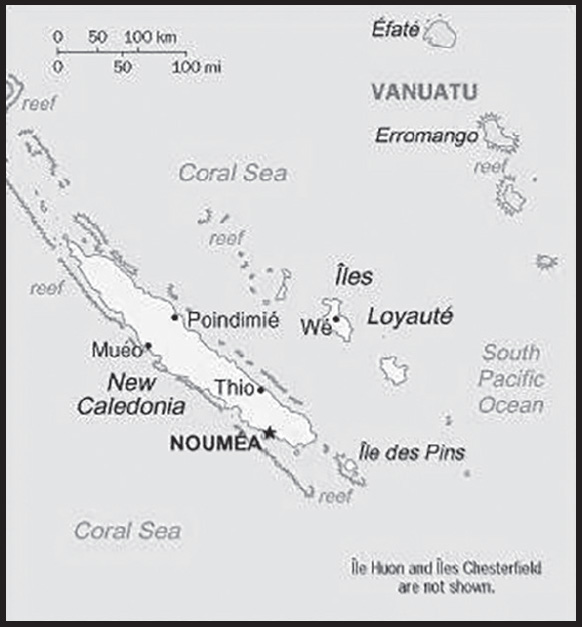
INTRODUCTION
Background: The first humans settled in New Caledonia around 1600 B.C. The Lapita were skilled navigators and evidence of their pottery around the Pacific has served as a guide for understanding human expansion in the region. Successive waves of migrants from other islands in Melanesia intermarried with the Lapita, giving rise to the Kanak ethnic group considered indigenous to New Caledonia. British explorer James COOK was the first European to visit New Caledonia in 1774, giving it the Latin name for Scotland. Missionaries first landed in New Caledonia in 1840. In 1853, France annexed New Caledonia to preclude any British attempt to claim the island. France declared it a penal colony in 1864 and sent more than 20,000 prisoners to New Caledonia in the ensuing three decades.
Nickel was discovered in 1864 and French prisoners were directed to mine it. France brought in indentured servants and enslaved labor from elsewhere in Southeast Asia to work the mines, blocking Kanaks from accessing the most profitable part of the local economy. In 1878, High Chief ATAI led a rebellion against French rule. The Kanaks were relegated to reservations, leading to periodic smaller uprisings and culminating in a large revolt in 1917 that was brutally suppressed by colonial authorities. During World War II, New Caledonia became an important base for Allied troops, and the US moved its South Pacific headquarters to the island in 1942. Following the war, France made New Caledonia an overseas territory and granted French citizenship to all inhabitants in 1953, thereby permitting the Kanaks to move off the reservations.
The Kanak nationalist movement began in the 1950s, but most voters chose to remain a territory in an independence referendum in 1958. The European population of New Caledonia boomed in the 1970s with a renewed focus on nickel mining, reigniting Kanak nationalism. Key Kanak leaders were assassinated in the early 1980s, leading to escalating violence and dozens of fatalities. The Matignon Accords of 1988 provided for a 10-year transition period. The Noumea Accord of 1998 transferred increasing governing responsibility from France to New Caledonia over a 20-year period and provided for three independence referenda. In the first held in 2018, voters rejected independence by 57% to 43%; in the second held in 2020, voters rejected independence 53% to 47%. In the third referendum held in December 2021, voters rejected independence 96% to 4%; however, a boycott by key Kanak groups spurred challenges about the legitimacy of the vote. In February 2021, pro-independence parties gained a majority in the New Caledonian Government for the first time. France and New Caledonia officials remain in talks about the status of the country.
GEOGRAPHY
Location: Oceania, islands in the South Pacific Ocean, east of Australia
Geographic coordinates: 21 30 S, 165 30 E
Map references: Oceania
Area: total: 18,575 sq km
land: 18,275 sq km
water: 300 sq km
comparison ranking: total 155
Area - comparative: slightly smaller than New Jersey
Land boundaries: total: 0 km
Coastline: 2,254 km
Maritime claims: territorial sea: 12 nm
exclusive economic zone: 200 nm
Climate: tropical; modified by southeast trade winds; hot, humid
Terrain: coastal plains with interior mountains
Elevation: highest point: Mont Panie 1,628 m
lowest point: Pacific Ocean 0 m
Natural resources: nickel, chrome, iron, cobalt, manganese, silver, gold, lead, copper
Land use: agricultural land: 10.4% (2018 est.)
arable land: 0.4% (2018 est.)
permanent crops: 0.2% (2018 est.)
permanent pasture: 9.8% (2018 est.)
forest: 45.9% (2018 est.)
other: 43.7% (2018 est.)
Irrigated land: 100 sq km (2012)
Population distribution: most of the populace lives in the southern part of the main island, in and around the capital of Noumea
Natural hazards: cyclones, most frequent from November to March
volcanism: Matthew and Hunter Islands are historically active
Geography - note: consists of the main island of New Caledonia (one of the largest in the Pacific Ocean), the archipelago of Iles Loyaute, and numerous small, sparsely populated islands and atolls
PEOPLE AND SOCIETY
Population: 300,682 (2023 est.)
comparison ranking: 182
Nationality: noun: New Caledonian(s)
adjective: New Caledonian
Ethnic groups: Kanak 39.1%, European 27.1%, Wallisian, Futunian 8.2%, Tahitian 2.1%, Indonesian 1.4%, Ni-Vanuatu 1%, Vietnamese 0.9%, other 17.7%, unspecified 2.5% (2014 est.)
Languages: French (official), 33 Melanesian-Polynesian dialects
major-language sample(s):
The World Factbook, une source indispensable d’informations de base. (French)
Religions: Christian 85.2%, Muslim 2.8%, other 1.6%, unaffiliated 10.4% (2020 est.)
Age structure: 0-14 years: 20.96% (male 32,199/female 30,825)
15-64 years: 68.45% (male 103,611/female 102,208)
65 years and over: 10.59% (2023 est.) (male 13,914/female 17,925)
Dependency ratios: total dependency ratio: 49.6
youth dependency ratio: 33.6
elderly dependency ratio: 16
potential support ratio: 6.3 (2021 est.)
Median age: total: 32.9 years (2020)
male: 32.1 years
female: 33.7 years
comparison ranking: total 102
Population growth rate: 1.17% (2023 est.)
comparison ranking: 78
Birth rate: 13.96 births/1,000 population (2023 est.)
comparison ranking: 124
Death rate: 5.92 deaths/1,000 population (2023 est.)
comparison ranking: 162
Net migration rate: 3.62 migrant(s)/1,000 population (2023 est.)
note: there has been steady emigration from Wallis and Futuna to New Caledonia
comparison ranking: 32
Population distribution: most of the populace lives in the southern part of the main island, in and around the capital of Noumea
Urbanization: urban population: 72.7% of total population (2023)
rate of urbanization: 1.72% annual rate of change (2020-25 est.)
Major urban areas - population: 198,000 NOUMEA (capital) (2018)
Sex ratio: at birth: 1.05 male(s)/female
0-14 years: 1.04 male(s)/female
15-64 years: 1.01 male(s)/female
65 years and over: 0.78 male(s)/female
total population: 0.99 male(s)/female (2023 est.)
Infant mortality rate: total: 4.92 deaths/1,000 live births (2023 est.)
male: 5.88 deaths/1,000 live births
female: 3.91 deaths/1,000 live births
comparison ranking: total 176
Life expectancy at birth: total population: 79.06 years (2023 est.)
male: 75.19 years
female: 83.13 years
comparison ranking: total population 66
Total fertility rate: 1.84 children born/woman (2023 est.)
comparison ranking: 137
Gross reproduction rate: 0.9 (2023 est.)
Drinking water source: improved: total: 99.3% of population
unimproved: total: 0.7% of population (2020 est.)
Sanitation facility access: improved: total: 100% of population
unimproved: total: 0% of population (2020 est.)
Currently married women (ages 15-49): 22.5% (2023 est.)
Literacy: definition: age 15 and over can read and write
total population: 96.9%
male: 97.3%
female: 96.5% (2015)
Youth unemployment rate (ages 15-24): total: 41% (2021 est.)
male: 39.2%
female: 43.2%
comparison ranking: total 11
ENVIRONMENT
Environment - current issues: preservation of coral reefs; prevention of invasive species; limiting erosion caused by nickel mining and forest fires
Climate: tropical; modified by southeast trade winds; hot, humid
Land use: agricultural land: 10.4% (2018 est.)
arable land: 0.4% (2018 est.)
permanent crops: 0.2% (2018 est.)
permanent pasture: 9.8% (2018 est.)
forest: 45.9% (2018 est.)
other: 43.7% (2018 est.)
Urbanization: urban population: 72.7% of total population (2023)
rate of urbanization: 1.72% annual rate of change (2020-25 est.)
Air pollutants: carbon dioxide emissions: 5.33 megatons (2016 est.)
Waste and recycling: municipal solid waste generated annually: 108,157 tons (2016 est.)
GOVERNMENT
Country name: conventional long form: Territory of New Caledonia and Dependencies
conventional short form: New Caledonia
local long form: Territoire des Nouvelle-Caledonie et Dependances
local short form: Nouvelle-Caledonie
etymology: British explorer Captain James COOK discovered and named New Caledonia in 1774; he used the appellation because the northeast of the island reminded him of Scotland (Caledonia is the Latin designation for Scotland)
Government type: parliamentary democracy (Territorial Congress); an overseas collectivity of France
Dependency status: special collectivity (or a sui generis collectivity) of France since 1998; note - independence referenda took place on 4 November 2018, 4 October 2020, and 12 December 2021 with a majority voting in each case to reject independence in favor of maintaining the status quo; an 18-month transition period is now in place (ending 30 June 2023), during which a referendum on the new status of New Caledonia within France will take place
Capital: name: Noumea
geographic coordinates: 22 16 S, 166 27 E
time difference: UTC+11 (16 hours ahead of Washington, DC, during Standard Time)
etymology: established in 1854 as Port-de-France, the settlement was renamed Noumea in 1866, in order to avoid any confusion with Fort-de-France in Martinique; the New Caledonian language of Ndrumbea (also spelled Ndumbea, Dubea, and Drubea) spoken in the area gave its name to the capital city, Noumea, as well as to the neighboring town (suburb) of Dumbea
Administrative divisions: 3 provinces; Province Iles (Islands Province), Province Nord (North Province), and Province Sud (South Province)
Independence: none (overseas collectivity of France); note - in three independence referenda, on 4 November 2018, 4 October 2020, and 12 December 2021, the majority voted to reject independence in favor of maintaining the status quo; an 18-month transition period is now in place (ending 30 June 2023), during which a referendum on the new status of New Caledonia within France will take place
National holiday: Fete de la Federation, 14 July (1790); note - the local holiday is New Caledonia Day, 24 September (1853)
Constitution: history: 4 October 1958 (French Constitution with changes as reflected in the Noumea Accord of 5 May 1998)
amendments: French constitution amendment procedures apply
Legal system: civil law system based on French civil law
Citizenship: see France
Suffrage: 18 years of age; universal
Executive branch: chief of state: President Emmanuel MACRON (since 14 May 2017); represented by High Commissioner Patrice FAURE (since 6 June 2021)
head of government: President of the Government Louis MAPOU (since 22 July 2021); Vice President Isabelle CHAMPMOREAU (since 22 July 2021)
cabinet: Cabinet elected from and by the Territorial Congress
elections/appointments: French president directly elected by absolute majority popular vote in 2 rounds if needed for a 5-year term (eligible for a second term); high commissioner appointed by the French president on the advice of the French Ministry of Interior; president of New Caledonia elected by Territorial Congress for a 5-year term (no term limits); election last held on 8 July 2021 (next to be held in 2026)
election results:
2021: Louis MAPOU (PALIKA) elected president by Territorial Congress with 6 of 11 votes
2019: Thieryy SANTA (The Republicans) elected president by Territorial Congress with 6 of 11 votes
Legislative branch: description: unicameral Territorial Congress or Congrès du Territoire (54 seats; members indirectly selected proportionally by the partisan makeup of the 3 Provincial Assemblies or Assemblés Provinciales; members of the 3 Provincial Assemblies directly elected by party-list proportional representation vote; members serve 5-year terms); note - the Customary Senate is the assembly of the various traditional councils of the Kanaks, the indigenous population, which rules on laws affecting the indigenous population
New Caledonia indirectly elects 2 members to the French Senate by an electoral colleges for a 6-year term with one seat renewed every 3 years and directly elects 2 members to the French National Assembly by absolute majority vote in 2 rounds if needed for a 5-year term
elections: Territorial Congress - last held on 12 May 2019 (next to be held in May 2024)
French Senate - election last held on 24 September 2023 (next to be held on 30 September 2026)
French National Assembly - election last held on 12 and 19 June 2022 (next to be held by June 2027)
election results:
Territorial Congress - percent of vote by party - N/A; seats by party - Future With Confidence 18, UNI 9, UC 9, CE 7, FLNKS 6, Oceanic Awakening 3, PT 1, LKS 1 (Anti-Independence 28, Pro-Independence 26);
French Senate - percent of vote by party - NA; seats by party - UMP 2
French National Assembly - percent of vote by party - NA; seats by party - CE 2
Judicial branch: highest court(s): Court of Appeal in Noumea or Cour d’Appel; organized into civil, commercial, social, and pre-trial investigation chambers; court bench normally includes the court president and 2 counselors); Administrative Court (number of judges NA); note - final appeals beyond the Court of Appeal are referred to the Court of Cassation or Cour de Cassation (in Paris); final appeals beyond the Administrative Court are referred to the Administrative Court of Appeal (in Paris)
judge selection and term of office: judge appointment and tenure based on France’s judicial system
subordinate courts: Courts of First Instance include: civil, juvenile, commercial, labor, police, criminal, assizes, and also a pre-trial investigation chamber; Joint Commerce Tribunal; administrative courts
Political parties and leaders: Caledonia Together or CE [Philippe GOMES]
Caledonian Union or UC [Daniel GOA]
Future With Confidence or AEC [Virginie RUFFENACH]
Kanak Socialist Front for National Liberation or FLNKS (alliance includes PALIKA, UNI, UC, and UPM) [Victor TUTUGORO]
Labor Party or PT [Louis Kotra UREGEI]
National Union for Independence or UNI [Louis MAPOU]
Oceanian Awakening [Milakulo TUKUMULI]
Party of Kanak Liberation or PALIKA [Paul NEAOUTYINE]
Socialist Kanak Liberation or LKS [Basile CITRE]
The Republicans (formerly The Rally or UMP) [Sonia BACKES]
International organization participation: ITUC (NGOs), PIF (associate member), SPC, UPU, WFTU (NGOs), WMO
Diplomatic representation in the US: none (overseas territory of France)
Diplomatic representation from the US: embassy: none (overseas territory of France)
Flag description: New Caledonia has two official flags; alongside the flag of France, the Kanak (indigenous Melanesian) flag has equal status; the latter consists of three equal horizontal bands of blue (top), red, and green; a large yellow disk - diameter two-thirds the height of the flag - shifted slightly to the hoist side is edged in black and displays a black fleche faitiere symbol, a native rooftop adornment
National symbol(s): fleche faitiere (native rooftop adornment), kagu bird; national colors: gray, red
National anthem: name: “Soyons unis, devenons freres” (Let Us Be United, Let Us Become Brothers)
lyrics/music: Chorale Melodia (a local choir)
note: adopted 2008; contains a mixture of lyrics in both French and Nengone (an indigenous language); as a self-governing territory of France, in addition to the local anthem, “La Marseillaise” is official (see France)
National heritage: total World Heritage Sites: 1 (natural); note - excerpted from the France entry
selected World Heritage Site locales: Lagoons of New Caledonia
ECONOMY
Economic overview: upper-middle-income French Pacific territorial economy; enormous nickel reserves; ongoing French independence negotiations; large Chinese nickel exporter; luxury eco-tourism destination; large French aid recipient; high cost-of-living; lingering wealth disparities
Real GDP (purchasing power parity): $10.266 billion (2021 est.)
$11.11 billion (2017 est.)
$10.89 billion (2016 est.)
note: data are in 2015 dollars
comparison ranking: 162
Real GDP growth rate: 2% (2017 est.)
1.1% (2016 est.)
3.2% (2015 est.)
comparison ranking: 164
Real GDP per capita: $35,700 (2021 est.)
$31,100 (2015 est.)
$32,100 (2014 est.)
comparison ranking: 56
GDP (official exchange rate): $9.77 billion (2017 est.)
Inflation rate (consumer prices): 1.4% (2017 est.)
0.6% (2016 est.)
comparison ranking: 185
GDP - composition, by sector of origin: agriculture: 1.4% (2017 est.)
industry: 26.4% (2017 est.)
services: 72.1% (2017 est.)
comparison rankings: services 61; industry 104; agriculture 189
GDP - composition, by end use: household consumption: 64.3% (2017 est.)
government consumption: 24% (2017 est.)
investment in fixed capital: 38.4% (2017 est.)
investment in inventories: 0% (2017 est.)
exports of goods and services: 18.7% (2017 est.)
imports of goods and services: -45.5% (2017 est.)
Agricultural products: coconuts, vegetables, maize, fruit, beef, pork, potatoes, bananas, eggs, yams
Industries: nickel mining and smelting
Industrial production growth rate: 3.5% (2017 est.)
comparison ranking: 110
Labor force: 132,200 (2021 est.)
comparison ranking: 181
Labor force - by occupation: agriculture: 2.7%
industry: 22.4%
services: 74.9% (2010)
Unemployment rate: 16.57% (2021 est.)
16.43% (2020 est.)
14.91% (2019 est.)
comparison ranking: 28
Youth unemployment rate (ages 15-24): total: 41% (2021 est.)
male: 39.2%
female: 43.2%
comparison ranking: total 11
Population below poverty line: 17% (2008)
Household income or consumption by percentage share: lowest 10%: NA
highest 10%: NA
Budget: revenues: $1.995 billion (2015 est.)
expenditures: $1.993 billion (2015 est.)
Budget surplus (+) or deficit (-): 0% (of GDP) (2015 est.)
comparison ranking: 47
Public debt: 6.5% of GDP (2015 est.)
6.5% of GDP (2014 est.)
comparison ranking: 202
Taxes and other revenues: 20.4% (of GDP) (2015 est.)
comparison ranking: 87
Fiscal year: calendar year
Current account balance: -$654.237 million (2016 est.)
-$1.861 billion (2013 est.)
comparison ranking: 126
Exports: $1.92 billion (2021 est.)
$1.8 billion (2020 est.)
$1.79 billion (2019 est.)
comparison ranking: 160
Exports - partners: China 55%, South Korea 16%, Japan 11%, Taiwan 4%, Spain 3% (2021)
Exports - commodities: iron alloys, nickel, essential oils, recreational boats, shrimp (2021)
Imports: $2.26 billion (2021 est.)
$2.1 billion (2020 est.)
$2.48 billion (2019 est.)
comparison ranking: 168
Imports - partners: France 39%, Australia 14%, Singapore 11%, New Zealand 7%, China 7% (2021)
Imports - commodities: refined petroleum, coal, cars, packaged medicines, delivery trucks (2021)
Debt - external: $112 million (31 December 2013 est.)
$79 million (31 December 1998 est.)
comparison ranking: 192
Exchange rates: Comptoirs Francais du Pacifique francs (XPF) per US dollar -
Exchange rates: 100.88 (2021 est.)
104.711 (2020 est.)
106.589 (2019 est.)
101.047 (2018 est.)
105.633 (2017 est.)
ENERGY
Electricity access: electrification - total population: 100% (2021)
Electricity: installed generating capacity: 1.071 million kW (2020 est.)
consumption: 2,940,707,000 kWh (2019 est.)
exports: 0 kWh (2020 est.)
imports: 0 kWh (2020 est.)
transmission/distribution losses: 64.293 million kWh (2019 est.)
comparison rankings: imports 139; exports 122; installed generating capacity 133; transmission/distribution losses 167; consumption 140
Electricity generation sources: fossil fuels: 91.2% of total installed capacity (2020 est.)
wind: 1.5% of total installed capacity (2020 est.)
hydroelectricity: 7.4% of total installed capacity (2020 est.)
Coal: production: 0 metric tons (2020 est.)
consumption: 1.151 million metric tons (2020 est.)
exports: 0 metric tons (2020 est.)
imports: 1.151 million metric tons (2020 est.)
proven reserves: 2 million metric tons (2019 est.)
Petroleum: total petroleum production: 0 bbl/day (2021 est.)
refined petroleum consumption: 19,300 bbl/day (2019 est.)
Refined petroleum products - imports: 19,100 bbl/day (2015 est.)
comparison ranking: 124
Carbon dioxide emissions: 5.886 million metric tonnes of CO2 (2019 est.)
from coal and metallurgical coke: 2.879 million metric tonnes of CO2 (2019 est.)
from petroleum and other liquids: 3.007 million metric tonnes of CO2 (2019 est.)
comparison ranking: total emissions 132
Energy consumption per capita: 0 Btu/person (2019 est.)
comparison ranking: 202
COMMUNICATIONS
Telephones - fixed lines: total subscriptions: 46,000 (2021 est.)
subscriptions per 100 inhabitants: 16 (2021 est.)
comparison ranking: total subscriptions 160
Telephones - mobile cellular: total subscriptions: 260,000 (2021 est.)
subscriptions per 100 inhabitants: 90 (2021 est.)
comparison ranking: total subscriptions 180
Telecommunication systems: general assessment: New Caledonia’s telecom sector provides fixed and mobile voice services, mobile internet, fixed broadband access, and wholesale services for other ISPs; the country is well serviced by extensive 3G and LTE networks, and is considered to have one of the highest smartphone adoption rates in the Pacific region; by 2025, smart phone penetration is expected to reach 71%; while DSL is still the dominant fixed broadband technology, and a nationwide FttP network; the South Pacific region has become a hub for submarine cable system developments in recent years, with further networks scheduled to come online later in 2021 and into 2022; these new cables are expected to increase competition in the region with regards to international capacity; in 2020, the government owned telco commissioned Alcatel Submarine Networks (ASN) to build the Gondwana-2 cable system to provide additional network capacity and complement the Gondwana-1 cable (2022)
domestic: fixed-line is 16 per 100 and mobile-cellular telephone subscribership 90 per 100 persons (2021)
international: country code - 687; landing points for the Gondwana-1 and Picot-1 providing connectivity via submarine cables around New Caledonia and to Australia; satellite earth station - 1 Intelsat (Pacific Ocean) (2019)
Broadcast media: the publicly owned French Overseas Network (RFO), which operates in France’s overseas departments and territories, broadcasts over the RFO Nouvelle-Calédonie TV and radio stations; a small number of privately owned radio stations also broadcast
Internet country code: .nc
Internet users: total: 237,800 (2021 est.)
percent of population: 82% (2021 est.)
comparison ranking: total 178
Broadband - fixed subscriptions: total: 55,000 (2020 est.)
subscriptions per 100 inhabitants: 19 (2020 est.)
comparison ranking: total 142
TRANSPORTATION
National air transport system: number of registered air carriers: 3 (2020) (registered in France)
inventory of registered aircraft operated by air carriers: 15 (registered in France)
Airports: 25 (2021)
comparison ranking: total 128
Airports - with paved runways: 12
note: paved runways have a concrete or asphalt surface but not all have facilities for refueling, maintenance, or air traffic control; the length of a runway required for aircraft to safely operate depends on a number of factors including the type of aircraft, the takeoff weight (including passengers, cargo, and fuel), engine types, flap settings, landing speed, elevation of the airport, and average maximum daily air temperature; paved runways can reach a length of 5,000 m (16,000 ft.), but the “typical” length of a commercial airline runway is between 2,500-4,000 m (8,000-13,000 ft.)
Airports - with unpaved runways: 13
note: unpaved runways have a surface composition such as grass or packed earth and are most suited to the operation of light aircraft; unpaved runways are usually short, often less than 1,000 m (3,280 ft.) in length; airports with unpaved runways often lack facilities for refueling, maintenance, or air traffic control
Heliports: 8 (2021)
Roadways: total: 5,622 km (2006)
comparison ranking: total 146
Merchant marine: total: 23 (2022)
by type: general cargo 5, oil tanker 1, other 17
comparison ranking: total 145
Ports and terminals: major seaport(s): Noumea
MILITARY AND SECURITY
Military and security forces: no regular military forces; France bases land, air, and naval forces on New Caledonia (Forces Armées de la Nouvelle-Calédonie, FANC)
Military - note: defense is the responsibility of France
TRANSNATIONAL ISSUES
Disputes - international: New Caledonia-France-Vanuatu: Matthew and Hunter Islands east of New Caledonia claimed by France and Vanuatu