S
SAINT BARTHELEMY
INTRODUCTION
Background: Discovered in 1493 by Christopher COLUMBUS who named it for his brother Bartolomeo, Saint Barthelemy was first settled by the French in 1648. In 1784, the French sold the island to Sweden, which renamed the largest town Gustavia, after the Swedish King GUSTAV III, and made it a free port; the island prospered as a trade and supply center during the colonial wars of the 18th century. France repurchased the island in 1877 and took control the following year. It was placed under the administration of Guadeloupe. Saint Barthelemy retained its free port status along with various Swedish appellations such as Swedish street and town names, and the three-crown symbol on the coat of arms. In 2003, the islanders voted to secede from Guadeloupe, and in 2007, the island became a French overseas collectivity. In 2012, it became an overseas territory of the EU, allowing it to exert local control over the permanent and temporary immigration of foreign workers including non-French European citizens. Hurricane Irma hit the island in September 2017 causing extensive damage, but Saint Barthelemy recovered by early 2018.
GEOGRAPHY
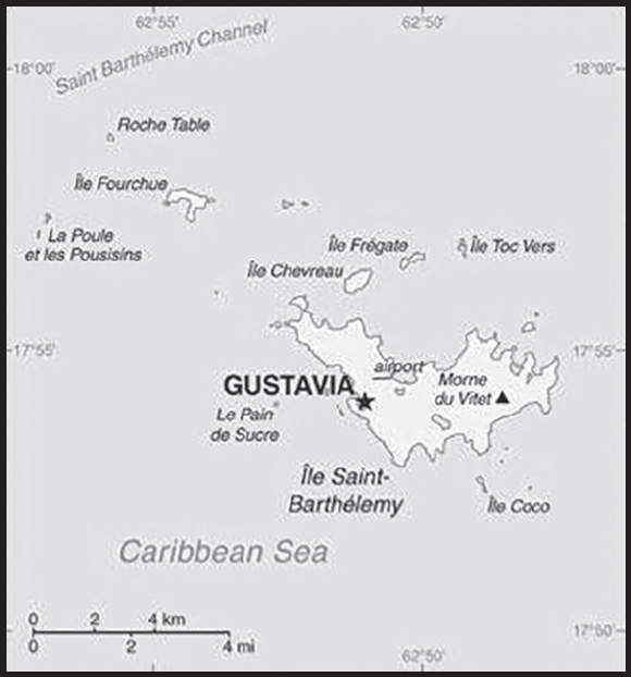
Location: Caribbean, island between the Caribbean Sea and the North Atlantic Ocean; located in the Leeward Islands (northern) group; Saint Barthelemy lies east of the US Virgin Islands
Geographic coordinates: 17 90 N, 62 85 W
Map references: Central America and the Caribbean
Area: total: 25 sq km
land: 25 sq km
water: negligible
comparison ranking: total 238
Area - comparative: less than one-eighth the size of Washington, DC
Land boundaries: total: 0 km
Climate: tropical, with practically no variation in temperature; has two seasons (dry and humid)
Terrain: hilly, almost completely surrounded by shallow-water reefs, with plentiful beaches
Elevation: highest point: Morne du Vitet 286 m
lowest point: Caribbean Ocean 0 m
Natural resources: few natural resources; beaches foster tourism
Population distribution: most of the populace concentrated in and around the capital of Gustavia, but scattered settlements exist around the island periphery
Geography - note: a 1,200-hectare marine nature reserve, the Reserve Naturelle, is made up of five zones around the island that form a network to protect the island’s coral reefs, seagrass, and endangered marine species
PEOPLE AND SOCIETY
Population: 7,093 (2023 est.)
comparison ranking: 225
Ethnic groups: French, Portuguese, Caribbean, Afro-Caribbean
Languages: French (primary), English
major-language sample(s):
The World Factbook, une source indispensable d’informations de base. (French)
Religions: Roman Catholic, Protestant, Jehovah’s Witnesses
Age structure: 0-14 years: 14.1% (male 515/female 485)
15-64 years: 63.8% (male 2,442/female 2,083)
65 years and over: 22.11% (2023 est.) (male 787/female 781)
Dependency ratios: total dependency ratio: 30.8
youth dependency ratio: 17.5
elderly dependency ratio: 13.3
potential support ratio: 7.5 (2021)
Median age: total: 47 years (2023 est.)
male: 46.7 years
female: 47.4 years
comparison ranking: total 6
Population growth rate: -0.11% (2023 est.)
comparison ranking: 204
Birth rate: 9.3 births/1,000 population (2023 est.)
comparison ranking: 196
Death rate: 9.2 deaths/1,000 population (2023 est.)
comparison ranking: 54
Net migration rate: -1.3 migrant(s)/1,000 population (2023 est.)
comparison ranking: 153
Population distribution: most of the populace concentrated in and around the capital of Gustavia, but scattered settlements exist around the island periphery
Sex ratio: at birth: 1.06 male(s)/female
0-14 years: 1.06 male(s)/female
15-64 years: 1.17 male(s)/female
65 years and over: 1.01 male(s)/female
total population: 1.12 male(s)/female (2023 est.)
Infant mortality rate: total: 6.6 deaths/1,000 live births (2023 est.)
male: 7.7 deaths/1,000 live births
female: 5.4 deaths/1,000 live births
comparison ranking: total 161
Life expectancy at birth: total population: 80.8 years (2023 est.)
male: 77.7 years
female: 84 years
comparison ranking: total population 47
Total fertility rate: 1.64 children born/woman (2023 est.)
comparison ranking: 173
Gross reproduction rate: 0.8 (2023 est.)
Drinking water source: improved:
total: 100% of population
unimproved: total: 0% of population (2020)
Sanitation facility access: improved:
total: 100% of population
unimproved: total: 0% of population (2020)
ENVIRONMENT
Environment - current issues: land-based pollution; urbanization; with no natural rivers or streams, fresh water is in short supply, especially in summer, and is provided by the desalination of sea water, the collection of rain water, or imported via water tanker; overfishing
Climate: tropical, with practically no variation in temperature; has two seasons (dry and humid)
GOVERNMENT
Country name: conventional long form: Overseas Collectivity of Saint Barthelemy
conventional short form: Saint Barthelemy
local long form: Collectivite d’outre mer de Saint-Barthelemy
local short form: Saint-Barthelemy
abbreviation: Saint-Barth (French)/ St. Barts or St. Barths (English)
etymology: explorer Christopher COLUMBUS named the island in honor of his brother Bartolomeo’s namesake saint in 1493
Government type: parliamentary democracy (Territorial Council); overseas collectivity of France
Dependency status: overseas collectivity of France
Capital: name: Gustavia
geographic coordinates: 17 53 N, 62 51 W
time difference: UTC-4 (1 hour ahead of Washington, DC, during Standard Time)
etymology: named in honor of King Gustav III (1746-1792) of Sweden during whose reign the island was obtained from France in 1784; the name was retained when in 1878 the island was sold back to France
Independence: none (overseas collectivity of France)
National holiday: Fete de la Federation, 14 July (1790); note - local holiday is St. Barthelemy Day, 24 August (1572)
Constitution: history: 4 October 1958 (French Constitution)
amendments: amendment procedures of France’s constitution apply
Legal system: French civil law
Citizenship: see France
Suffrage: 18 years of age, universal
Executive branch: chief of state: President Emmanuel MACRON (since 14 May 2017), represented by Prefect Vincent BERTON (since 28 March 2022)
head of government: President of Territorial Council Xavier LEDEE (since 3 April 2022)
cabinet: Executive Council elected by the Territorial Council; note - there is also an advisory, economic, social, and cultural council
elections/appointments: French president directly elected by absolute majority popular vote in 2 rounds if needed for a 5-year term (eligible for a second term); prefect appointed by the French president on the advice of French Ministry of Interior; president of Territorial Council indirectly elected by its members for a 5-year term; election last held on 27 March 2022 (next to be held in 2027)
election results:
2022: Xavier LEDEE (Saint Barth United) elected president; Territorial Council vote - 13 votes for, 6 blank votes
2017: Bruno MAGRAS (Saint Barth First) elected president; Territorial Council vote - 14 out of 19 votes
Legislative branch: description: unicameral Territorial Council (19 seats; members elected by absolute majority vote in the first-round vote and proportional representation vote in the second round; members serve 5-year terms); Saint Barthelemy indirectly elects 1 senator to the French Senate by an electoral college for a 6-year term and directly elects 1 deputy (shared with Saint Martin) to the French National Assembly
elections: Territorial Council - first round held on 20 March 2022 (next to be held in 2027); second round held on 27 March 2022
French Senate - election last held on 24 September 2023 (next to be held on 30 September 2026)
French National Assembly - election last held on 12 and 19 June 2022 (next to be held by June 2027)
election results: Territorial Council - percent of vote by party (first round) - SBA 46.2%, Saint Barth Action Equilibre 27.1%, Unis pour Saint Barthelemy 26.8%; percent of vote by party (second round) - Saint Barth Action Equilibre and Unis pour Saint Barthelemy 50.9%, SBA 49.2%, seats by party - Saint Barth Action Equilibre and Unis pour Saint Barthelemy 13, SBA 6; composition - men NA, women NA, percent of women NA
French Senate - percent of vote by party NA; seats by party UMP 1
French National Assembly - percent of vote by party NA; seats by party UMP 1
Political parties and leaders: All for Saint Barth (Tous pour Saint-Barth) [Bettina COINTRE]
Saint Barth Action Equilibre [Marie-Hélène BERNIER]
Saint Barth First! (Saint-Barth d’Abord!) or SBA [Romaric MAGRAS] (affiliated with France’s Republican party, Les Republicans)
Saint Barth United (Unis pour Saint-Barthelemy) [Xavier LEDEE]
International organization participation: UPU
Diplomatic representation in the US: none (overseas collectivity of France)
Diplomatic representation from the US: embassy:
none (overseas collectivity of France)
Flag description: the flag of France is used
National symbol(s): pelican
National anthem: name: “L’Hymne a St. Barthelemy” (Hymn to St. Barthelemy)
lyrics/music: Isabelle Massart DERAVIN/Michael VALENTI
note: local anthem in use since 1999; as a collectivity of France, “La Marseillaise” is official (see France)
ECONOMY
Economic overview: high-income French Caribbean territorial economy; duty-free luxury commerce and tourism industries; import-dependent for food, water, energy, and manufacturing; large Brazilian and Portuguese labor supply; environmentally fragile
Exports - partners: France 60%, Germany 27% (2019)
Exports - commodities: beauty products, broadcasting equipment, sunflower seed oil, plastics, cars (2019)
Imports - partners: France 78%, Switzerland 7%, Italy 7% (2019)
Imports - commodities: furniture, wine, refined petroleum, jewelry, food preparation materials (2019)
Exchange rates: 0.885 (2017 est.)
0.903 (2016 est.)
0.9214 (2015 est.)
0.885 (2014 est.)
ENERGY
Electricity access: electrification - total population: 100% (2021)
COMMUNICATIONS
Telecommunication systems: general assessment: fully integrated access; 4G and LTE services (2019)
domestic: direct dial capability with both fixed and wireless systems, 3 FM channels, no broadcasting (2018)
international: country code - 590; landing points for the SSCS and the Southern Caribbean Fiber submarine cables providing voice and data connectivity to numerous Caribbean Islands (2019)
Broadcast media: 2 local TV broadcasters; 5 FM radio channels (2021)
Internet country code: .bl; note - .gp, the Internet country code for Guadeloupe, and .fr, the Internet country code for France, might also be encountered
Internet users: total: 7,077 (2022 est.)
percent of population: 71.3% (2022 est.)
comparison ranking: total 220
TRANSPORTATION
Airports: 1 (2021)
comparison ranking: total 212
Airports - with paved runways: 1
note: paved runways have a concrete or asphalt surface but not all have facilities for refueling, maintenance, or air traffic control; the length of a runway required for aircraft to safely operate depends on a number of factors including the type of aircraft, the takeoff weight (including passengers, cargo, and fuel), engine types, flap settings, landing speed, elevation of the airport, and average maximum daily air temperature; paved runways can reach a length of 5,000 m (16,000 ft.), but the “typical” length of a commercial airline runway is between 2,500-4,000 m (8,000-13,000 ft.)
Roadways: total: 40 km
comparison ranking: total 218
Ports and terminals: major seaport(s): Gustavia
Transportation - note: nearest airport for international flights is Princess Juliana International Airport (SXM) located on Sint Maarten
MILITARY AND SECURITY
Military - note: defense is the responsibility of France
TRANSNATIONAL ISSUES
Disputes - international: none identified
SAINT HELENA, ASCENSION, AND TRISTAN DA CUNHA
INTRODUCTION
Background: Saint Helena is a British Overseas Territory consisting of Saint Helena and Ascension Islands, and the island group of Tristan da Cunha.
Saint Helena: Uninhabited when first discovered by the Portuguese in 1502, Saint Helena was garrisoned by the British during the 17th century. It acquired fame as the place of Napoleon BONAPARTE’s exile from 1815 until his death in 1821, but its importance as a port of call declined after the opening of the Suez Canal in 1869. During the Anglo-Boer War in South Africa, several thousand Boer prisoners were confined on the island between 1900 and 1903.
Saint Helena is one of the most remotely populated places in the world. The British Government committed to building an airport on Saint Helena in 2005. After more than a decade of delays and construction, a commercial air service to South Africa via Namibia was inaugurated in October of 2017. The weekly service to Saint Helena from Johannesburg via Windhoek in Namibia takes just over six hours (including the refueling stop in Windhoek) and replaces the mail ship that had made a five-day journey to the island every three weeks.
Ascension Island: This barren and uninhabited island was discovered and named by the Portuguese in 1503. The British garrisoned the island in 1815 to prevent a rescue of NAPOLEON from Saint Helena. It served as a provisioning station for the Royal Navy’s West Africa Squadron on anti-slavery patrol. The island remained under Admiralty control until 1922, when it became a dependency of Saint Helena. During World War II, the UK permitted the US to construct an airfield on Ascension in support of transatlantic flights to Africa and anti-submarine operations in the South Atlantic. In the 1960s the island became an important space tracking station for the US. In 1982, Ascension was an essential staging area for British forces during the Falklands War. It remains a critical refueling point in the air-bridge from the UK to the South Atlantic.
The island hosts one of four dedicated ground antennas that assist in the operation of the Global Positioning System (GPS) navigation system (the others are on Diego Garcia (British Indian Ocean Territory), Kwajalein (Marshall Islands), and at Cape Canaveral, Florida (US)). NASA and the US Air Force also operate a Meter-Class Autonomous Telescope (MCAT) on Ascension as part of the deep space surveillance system for tracking orbital debris, which can be a hazard to spacecraft and astronauts.
Tristan da Cunha: The island group consists of Tristan da Cunha, Nightingale, Inaccessible, and Gough Islands. Tristan da Cunha, named after its Portuguese discoverer (1506), was garrisoned by the British in 1816 to prevent any attempt to rescue NAPOLEON from Saint Helena. Gough and Inaccessible Islands have been designated World Heritage Sites. South Africa leases a site for a meteorological station on Gough Island.
GEOGRAPHY
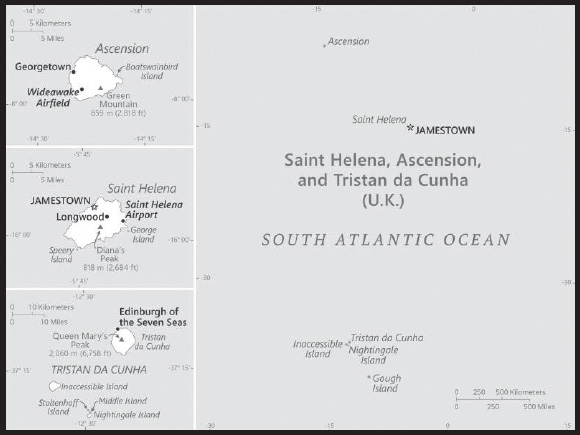
Location: islands in the South Atlantic Ocean, about midway between South America and Africa; Ascension Island lies 1,300 km (800 mi) northwest of Saint Helena; Tristan da Cunha lies 4,300 km (2,700 mi) southwest of Saint Helena
Geographic coordinates: Saint Helena: 15 57 S, 5 42 W;
Ascension Island: 7 57 S, 14 22 W;
Tristan da Cunha island group: 37 15 S, 12 30 W
Map references: Africa
Area: total: 394 sq km
land: 122 sq km Saint Helena Island
water: 0 sq km
88 sq km Ascension Island, 184 sq km Tristan da Cunha island group (includes Tristan (98 sq km), Inaccessible, Nightingale, and Gough islands)
comparison ranking: total 203
Area - comparative: slightly more than twice the size of Washington, DC
Land boundaries: total: 0 km
Coastline: Saint Helena: 60 km
Ascension Island: NA
Tristan da Cunha (island only): 34 km
Maritime claims: territorial sea: 12 nm
exclusive fishing zone: 200 nm
Climate: Saint Helena: tropical marine; mild, tempered by trade winds;
Ascension Island: tropical marine; mild, semi-arid;
Tristan da Cunha: temperate marine; mild, tempered by trade winds (tends to be cooler than Saint Helena)
Terrain: the islands of this group are of volcanic origin associated with the Atlantic Mid-Ocean Ridge
Saint Helena: rugged, volcanic; small scattered plateaus and plains;
Ascension: surface covered by lava flows and cinder cones of 44 dormant volcanoes; terrain rises to the east;
Tristan da Cunha: sheer cliffs line the coastline of the nearly circular island; the flanks of the central volcanic peak are deeply dissected; narrow coastal plain lies between The Peak and the coastal cliffs
Elevation: highest point: Queen Mary’s Peak on Tristan da Cunha 2,060 m; Green Mountain on Ascension Island 859 m; Diana’s Peak on Saint Helena Island 818 m
lowest point: Atlantic Ocean 0 m
Natural resources: fish, lobster
Land use: agricultural land: 30.8% (2018 est.)
arable land: 10.3% (2018 est.)
permanent crops: 0% (2018 est.)
permanent pasture: 20.5% (2018 est.)
forest: 5.1% (2018 est.)
other: 64.1% (2018 est.)
Irrigated land: 0 sq km (2022)
Population distribution: Saint Helena - population is concentrated in and around the capital Jamestown in the northwest, with another significant cluster in the interior Longwood area; Ascension - largest settlement, and location of most of the population, is Georgetown; Tristan da Cunha - most of the nearly 300 inhabitants live in the northern coastal town of Edinburgh of the Seven Seas
Natural hazards: active volcanism on Tristan da Cunha
volcanism: the island volcanoes of Tristan da Cunha (2,060 m) and Nightingale Island (365 m) experience volcanic activity; Tristan da Cunha erupted in 1962 and Nightingale in 2004
Geography - note: Saint Helena harbors at least 40 species of plants unknown elsewhere in the world; Ascension is a breeding ground for sea turtles and sooty terns; Queen Mary’s Peak on Tristan da Cunha is the highest island mountain in the South Atlantic and a prominent landmark on the sea lanes around southern Africa
PEOPLE AND SOCIETY
Population: 7,935 (2023 est.)
note: Saint Helena’s Statistical Office estimated the resident population to be 4,439 in 2021; only Saint Helena, Ascension, and Tristan da Cunha islands are inhabited, none of the other nearby islands/islets are
comparison ranking: 224
Nationality: noun: Saint Helenian(s)
adjective: Saint Helenian
note: referred to locally as “Saints”
Ethnic groups: African descent 50%, White 25%, Chinese 25%
Languages: English
Religions: Protestant 75.9% (includes Anglican 68.9, Baptist 2.1%, Seventh Day Adventist 1.8%, Salvation Army 1.7%, New Apostolic 1.4%), Jehovah’s Witness 4.1%, Roman Catholic 1.2%, other 2.5% (includes Baha’i), unspecified 0.8%, none 6.1%, no response 9.4% (2016 est.)
note: data represent Saint Helena only
Demographic profile: The vast majority of the population of Saint Helena, Ascension, and Tristan da Cunha live on Saint Helena. Ascension has no indigenous or permanent residents and is inhabited only by persons contracted to work on the island (mainly with the UK and US military or in the space and communications industries) or their dependents, while Tristan da Cunha – the main island in a small archipelago – has fewer than 300 residents. The population of Saint Helena consists of the descendants of 17th century British sailors and settlers from the East India Company, African slaves, and indentured servants and laborers from India, Indonesia, and China. Most of the population of Ascension are Saint Helenians, Britons, and Americans, while that of Tristan da Cunha descends from shipwrecked sailors and Saint Helenians.
Change in Saint Helena’s population size is driven by net outward migration. Since the 1980s, Saint Helena’s population steadily has shrunk and aged as the birth rate has decreased and many working-age residents left for better opportunities elsewhere. The restoration of British citizenship in 2002 accelerated family emigration; from 1998 to 2008 alone, population declined by about 20%.
In the 2010s, the population experienced some temporary growth, as foreigners and returning Saint Helenians, came to build an international airport, but numbers faded as the project reached completion and workers departed. With the airport fully operational, increased access to the remote island has the potential to boost tourism and fishing, provide more jobs for Saint Helenians domestically, and could encourage some ex-patriots to return home. In the meantime, however, Saint Helena, Ascension, and Tristan da Cunha have to contend with the needs of an aging population. The elderly population of the islands has risen from an estimated 9.4% in 1998 to 18% in 2022.
Age structure: 0-14 years: 14.48% (male 586/female 563)
15-64 years: 66.87% (male 2,640/female 2,666)
65 years and over: 18.65% (2023 est.) (male 753/female 727)
Dependency ratios: total dependency ratio: 68.6
youth dependency ratio: 23.6
elderly dependency ratio: 45.1
potential support ratio: 2.2 (2021)
Median age: total: 44.7 years (2023 est.)
male: 44.5 years
female: 44.9 years
comparison ranking: total 26
Population growth rate: 0.11% (2023 est.)
comparison ranking: 186
Birth rate: 9.3 births/1,000 population (2023 est.)
comparison ranking: 197
Death rate: 8.2 deaths/1,000 population (2023 est.)
comparison ranking: 83
Net migration rate: 0 migrant(s)/1,000 population (2023 est.)
comparison ranking: 91
Population distribution: Saint Helena - population is concentrated in and around the capital Jamestown in the northwest, with another significant cluster in the interior Longwood area; Ascension - largest settlement, and location of most of the population, is Georgetown; Tristan da Cunha - most of the nearly 300 inhabitants live in the northern coastal town of Edinburgh of the Seven Seas
Urbanization: urban population: 40.7% of total population (2023)
rate of urbanization: 0.98% annual rate of change (2020-25 est.)
Major urban areas - population: 1,000 JAMESTOWN (capital) (2018)
Sex ratio: at birth: 1.06 male(s)/female
0-14 years: 1.04 male(s)/female
15-64 years: 0.99 male(s)/female
65 years and over: 1.04 male(s)/female
total population: 1.01 male(s)/female (2023 est.)
Infant mortality rate: total: 18.6 deaths/1,000 live births (2023 est.)
male: 22.4 deaths/1,000 live births
female: 14.7 deaths/1,000 live births
comparison ranking: total 86
Life expectancy at birth: total population: 80.7 years (2023 est.)
male: 77.8 years
female: 83.7 years
comparison ranking: total population 50
Total fertility rate: 1.61 children born/woman (2023 est.)
comparison ranking: 181
Gross reproduction rate: 0.78 (2023 est.)
Drinking water source: improved:
total: 99.1% of population
unimproved: total: 0.9% of population (2020)
Sanitation facility access: improved:
total: 100% of population
unimproved: total: 0% of population (2020)
ENVIRONMENT
Environment - current issues: development threatens unique biota on Saint Helena
Climate: Saint Helena: tropical marine; mild, tempered by trade winds;
Ascension Island: tropical marine; mild, semi-arid;
Tristan da Cunha: temperate marine; mild, tempered by trade winds (tends to be cooler than Saint Helena)
Land use: agricultural land: 30.8% (2018 est.)
arable land: 10.3% (2018 est.)
permanent crops: 0% (2018 est.)
permanent pasture: 20.5% (2018 est.)
forest: 5.1% (2018 est.)
other: 64.1% (2018 est.)
Urbanization: urban population: 40.7% of total population (2023)
rate of urbanization: 0.98% annual rate of change (2020-25 est.)
GOVERNMENT
Country name: conventional long form: Saint Helena, Ascension, and Tristan da Cunha
conventional short form: none
etymology: Saint Helena was discovered in 1502 by Galician navigator Joao da NOVA, sailing in the service of the Kingdom of Portugal, who named it “Santa Helena”; Ascension was named in 1503 by Portuguese navigator Afonso de ALBUQUERQUE who sighted the island on the Feast Day of the Ascension; Tristan da Cunha was discovered in 1506 by Portuguese explorer Tristao da CUNHA who christened the main island after himself (the name was subsequently anglicized)
Government type: parliamentary democracy
Dependency status: overseas territory of the UK
Capital: name: Jamestown
geographic coordinates: 15 56 S, 5 43 W
time difference: UTC 0 (5 hours ahead of Washington, DC, during Standard Time)
etymology: founded in 1659 and named after James, Duke of York, who would become King JAMES II of England (r. 1785-1788)
Administrative divisions: 3 administrative areas; Ascension, Saint Helena, Tristan da Cunha
Independence: none (overseas territory of the UK)
National holiday: Official birthday of King Charles III, April or June as designated by the governor
Constitution: history: several previous; latest effective 1 September 2009 (St Helena, Ascension and Tristan da Cunha Constitution Order 2009)
Legal system: English common law and local statutes
Citizenship: see United Kingdom
Suffrage: 18 years of age
Executive branch: chief of state: King CHARLES III (since 8 September 2022)
head of government: Governor Nigel PHILLIPS (since 13 August 2022)
cabinet: Executive Council consists of the governor, 3 ex-officio officers, and 5 elected members of the Legislative Council
elections/appointments: none; the monarchy is hereditary; governor appointed by the monarch
note: the constitution order provides for an administrator for Ascension and Tristan da Cunha, appointed by the governor
Legislative branch: description: unicameral Legislative Council (17 seats including the speaker and deputy speaker; 12 members directly elected in a single countrywide constituency by simple majority vote and 3 ex-officio members - the chief secretary, financial secretary, and attorney general; members serve 4-year terms)
elections: last held on 13 October 2021 (next to be held in 2025)
election results: percent of vote - NA; seats by party - independent 12; composition - men 14, women 3, percent women 17.6%
note: the Constitution Order provides for separate Island Councils for both Ascension and Tristan da Cunha
Judicial branch: highest court(s): Court of Appeal (consists of the court president and 2 justices); Supreme Court (consists of the chief justice - a nonresident - and NA judges); note - appeals beyond the Court of Appeal are heard by the Judicial Committee of the Privy Council (in London)
judge selection and term of office: Court of Appeal and Supreme Court justices appointed by the governor acting upon the instructions from a secretary of state acting on behalf of King CHARLES III; justices of both courts serve until retirement at age 70, but terms can be extended
subordinate courts: Magistrates’ Court; Small Claims Court; Juvenile Court
Political parties and leaders: none
International organization participation: UPU
Diplomatic representation in the US: none (overseas territory of the UK)
Diplomatic representation from the US: embassy: none (overseas territory of the UK)
Flag description: blue with the flag of the UK in the upper hoist-side quadrant and the Saint Helenian shield centered on the outer half of the flag; the upper third of the shield depicts a white plover (wire bird) on a yellow field; the remainder of the shield depicts a rocky coastline on the left, offshore is a three-masted sailing ship with sails furled but flying an English flag
National symbol(s): Saint Helena plover (bird)
National anthem: note: as an overseas territory of the UK, “God Save the King” is official (see United Kingdom)
ECONOMY
Economic overview: upper middle-income, British Atlantic Ocean territorial economy; native (but pegged to British pound) currency user on 2 of 3 islands; significant UK financial support; unique land/farming commune structure; military-related economic activity; sport fishing locale
Real GDP (purchasing power parity): $31.1 million (2009 est.)
comparison ranking: 227
Real GDP per capita: $7,800 (FY09/10 est.)
comparison ranking: 157
GDP (official exchange rate): NA
Inflation rate (consumer prices): 4% (2012 est.)
comparison ranking: 93
Agricultural products: coffee, corn, potatoes, vegetables; fish, lobster; livestock; timber
Industries: construction, crafts (furniture, lacework, fancy woodwork), fishing, collectible postage stamps
Labor force: 2,486 (1998 est.)
comparison ranking: 226
Labor force - by occupation: agriculture: 6%
industry: 48%
services: 46% (1987 est.)
Unemployment rate: 14% (1998 est.)
comparison ranking: 43
Budget: revenues: $8.427 million (FY06/07 est.)
expenditures: $20.7 million (FY06/07 est.)
note: revenue data reflect only locally raised revenues; the budget deficit is resolved by grant aid from the UK
Fiscal year: 1 April - 31 March
Exports: $19 million (2004 est.)
comparison ranking: 216
Exports - partners: United States 47%, Japan 12%, South Korea 10%, France 9%, Australia 5% (2019)
Exports - commodities: crustaceans, fish, integrated circuits, air conditioners, clothing and apparel (2019)
Imports: $20.53 million (2010 est.)
comparison ranking: 222
Imports - partners: United Kingdom 65%, South Africa 21% (2019)
Imports - commodities: refined petroleum, cranes, communion wafers, iron sheeting, cars and vehicle parts (2019)
Exchange rates: Saint Helenian pounds (SHP) per US dollar -
Exchange rates: 0.7836 (2017 est.)
0.6542 (2016 est.)
0.6542 (2015)
0.607 (2014 est.)
0.6391 (2013 est.)
ENERGY
Electricity access: electrification - total population: 100% (2021)
Electricity: installed generating capacity: 8,000 kW (2020 est.)
consumption: 6.809 million kWh (2019 est.)
exports: 0 kWh (2020 est.)
imports: 0 kWh (2020 est.)
transmission/distribution losses: 1.688 million kWh (2019 est.)
comparison rankings: imports 207; exports 207; installed generating capacity 209; transmission/distribution losses 206; consumption 208
Electricity generation sources: fossil fuels: 100% of total installed capacity (2020 est.)
Petroleum: total petroleum production: 0 bbl/day (2021 est.)
refined petroleum consumption: 100 bbl/day (2019 est.)
Refined petroleum products - imports: 65 bbl/day (2015 est.)
comparison ranking: 209
Carbon dioxide emissions: 13,000 metric tonnes of CO2 (2019 est.)
from petroleum and other liquids: 13,000 metric tonnes of CO2 (2019 est.)
comparison ranking: total emissions 215
Energy consumption per capita: 0 Btu/person (2019 est.)
comparison ranking: 207
COMMUNICATIONS
Telephones - fixed lines: total subscriptions: 4,000 (2021 est.)
subscriptions per 100 inhabitants: 74 (2021 est.)
comparison ranking: total subscriptions 208
Telephones - mobile cellular: total subscriptions: 4,000 (2021 est.)
subscriptions per 100 inhabitants: 74 (2021 est.)
comparison ranking: total subscriptions 223
Telecommunication systems: general assessment: capability to communicate worldwide; ADSL- broadband service; LTE coverage of 95% of population, includes voice calls, text messages, mobile data as well as inbound and outbound roaming; Wi-Fi hotspots in Jamestown, 1 ISP, many services are not offered locally but made available for visitors; some sun outages due to the reliance of international telephone and Internet communication relying on single satellite link (2020)
domestic: automatic digital network; fixed-line is 74 per 100 and mobile-cellular is 74 per 100 persons (2021)
international: country code (Saint Helena) - 290, (Ascension Island) - 247; landing point for the SaEx1 submarine cable providing connectivity to South Africa, Brazil, Virginia Beach (US) and islands in Saint Helena, Ascension and Tristan de Cunha; international direct dialing; satellite voice and data communications; satellite earth stations - 5 (Ascension Island - 4, Saint Helena - 1) (2019)
Broadcast media: Saint Helena has no local TV station; 2 local radio stations, one of which is relayed to Ascension Island; satellite TV stations rebroadcast terrestrially; Ascension Island has no local TV station but has 1 local radio station and receives relays of broadcasts from 1 radio station on Saint Helena; broadcasts from the British Forces Broadcasting Service (BFBS) are available, as well as TV services for the US military; Tristan da Cunha has 1 local radio station and receives BFBS TV and radio broadcasts
Internet country code: .sh; note - Ascension Island assigned .ac
Internet users: total: 2,287 (2021 est.)
percent of population: 37.6% (2021 est.)
comparison ranking: total 227
Broadband - fixed subscriptions: total: 1,000 (2018 est.)
subscriptions per 100 inhabitants: 17 (2020 est.)
comparison ranking: total 205
Communications - note: Ascension Island hosts one of four dedicated ground antennas that assist in the operation of the Global Positioning System (GPS) navigation system (the others are on Diego Garcia (British Indian Ocean Territory), Kwajalein (Marshall Islands), and at Cape Canaveral, Florida (US)); South Africa maintains a meteorological station on Gough Island in the Tristan da Cunha archipelago
TRANSPORTATION
Civil aircraft registration country code prefix: VQ-H
Airports: 2 (2021)
comparison ranking: total 197
Airports - with paved runways: 2
note 1: paved runways have a concrete or asphalt surface but not all have facilities for refueling, maintenance, or air traffic control; the length of a runway required for aircraft to safely operate depends on a number of factors including the type of aircraft, the takeoff weight (including passengers, cargo, and fuel), engine types, flap settings, landing speed, elevation of the airport, and average maximum daily air temperature; paved runways can reach a length of 5,000 m (16,000 ft.), but the “typical” length of a commercial airline runway is between 2,500-4,000 m (8,000-13,000 ft.)
note 2: Ascension Island - Wideawake Field (ASI); Saint Helena (HLE)
Roadways: total: 198 km (2002) (Saint Helena 138 km, Ascension 40 km, Tristan da Cunha 20 km)
paved: 168 km (2002) (Saint Helena 118 km, Ascension 40 km, Tristan da Cunha 10 km)
unpaved: 30 km (2002) (Saint Helena 20 km, Tristan da Cunha 10 km)
comparison ranking: total 208
Ports and terminals: major seaport(s): Saint Helena
Saint Helena: Jamestown
Ascension Island: Georgetown
Tristan da Cunha: Calshot Harbor (Edinburgh)
Transportation - note: the new airport on Saint Helena opened for limited operations in July 2016, and the first commercial flight took place on 14 October 2017, marking the start of weekly air service between Saint Helena and South Africa via Namibia; the military airport on Ascension Island is closed to civilian traffic; there is no air connection to Tristan da Cunha and very limited sea connections making it one of the most isolated communities on the planet
MILITARY AND SECURITY
Military - note: defense is the responsibility of the UK
TRANSNATIONAL ISSUES
Disputes - international: none identified
SAINT KITTS AND NEVIS
INTRODUCTION
Background: Carib Indians occupied the islands of the West Indies for hundreds of years before the British and French began settlement in 1623. During the course of the 17th century, Saint Kitts became the premier base for English and French expansion into the Caribbean. The French ceded the territory to the UK in 1713. At the turn of the 18th century, Saint Kitts was the richest British Crown Colony per capita in the Caribbean, a result of the sugar trade. Although small in size and separated by only 3 km (2 mi) of water, Saint Kitts and Nevis were viewed and governed as different states until the late-19th century, when the British forcibly unified them along with the island of Anguilla. In 1967, the island territory of Saint Christopher-Nevis-Anguilla became an associated state of the UK with full internal autonomy. The island of Anguilla rebelled and was allowed to secede in 1971. The remaining islands achieved independence in 1983 as Saint Kitts and Nevis. In 1998, a referendum on Nevis to separate from Saint Kitts fell short of the two-thirds majority vote needed.
GEOGRAPHY
Location: Caribbean, islands in the Caribbean Sea, about one-third of the way from Puerto Rico to Trinidad and Tobago
Geographic coordinates: 17 20 N, 62 45 W
Map references: Central America and the Caribbean
Area: total: 261 sq km (Saint Kitts 168 sq km; Nevis 93 sq km)
land: 261 sq km
water: 0 sq km
comparison ranking: total 211
Area - comparative: 1.5 times the size of Washington, DC
Land boundaries: total: 0 km
Coastline: 135 km
Maritime claims: territorial sea: 12 nm
contiguous zone: 24 nm
exclusive economic zone: 200 nm
continental shelf: 200 nm or to the edge of the continental margin
Climate: tropical, tempered by constant sea breezes; little seasonal temperature variation; rainy season (May to November)
Terrain: volcanic with mountainous interiors
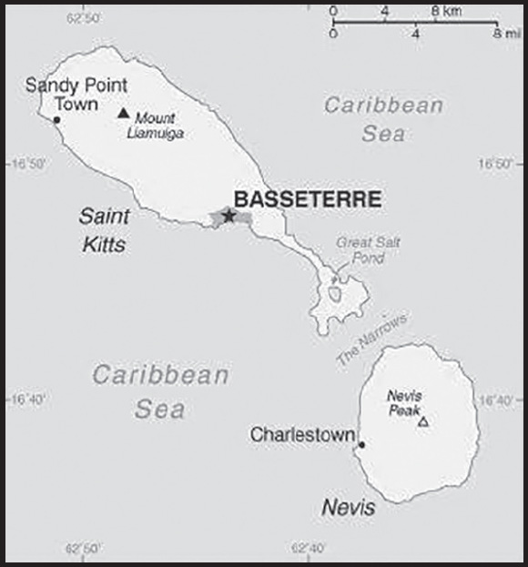
Elevation: highest point: Mount Liamuiga 1,156 m
lowest point: Caribbean Sea 0 m
Natural resources: arable land
Land use: agricultural land: 23.1% (2018 est.)
arable land: 19.2% (2018 est.)
permanent crops: 0.4% (2018 est.)
permanent pasture: 3.5% (2018 est.)
forest: 42.3% (2018 est.)
other: 34.6% (2018 est.)
Irrigated land: 8 sq km (2012)
Population distribution: population clusters are found in the small towns located on the periphery of both islands
Natural hazards: hurricanes (July to October)
volcanism: Mount Liamuiga (1,156 m) on Saint Kitts, and Nevis Peak (985 m) on Nevis, are both volcanoes that are part of the volcanic island arc of the Lesser Antilles, which extends from Saba in the north to Grenada in the south
Geography - note: smallest country in the Western Hemisphere both in terms of area and population; with coastlines in the shape of a baseball bat and ball, the two volcanic islands are separated by a 3-km-wide channel called The Narrows; on the southern tip of long, baseball bat-shaped Saint Kitts lies the Great Salt Pond; Nevis Peak sits in the center of its almost circular namesake island and its ball shape complements that of its sister island
PEOPLE AND SOCIETY
Population: 54,817 (2023 est.)
comparison ranking: 207
Nationality: noun: Kittitian(s), Nevisian(s)
adjective: Kittitian, Nevisian
Ethnic groups: African descent 92.5%, mixed 3%, White 2.1%, East Indian 1.5%, other 0.6%, unspecified 0.3% (2001 est.)
Languages: English (official)
Religions: Protestant 75.6% (includes Anglican 16.6%, Methodist 15.8%, Pentecostal 10.8%, Church of God 7.4%, Baptist 5.4%, Seventh Day Adventist 5.4%, Wesleyan Holiness 5.3%, Moravian 4.8%, Evangelical 2.1%, Brethren 1.7%, Presbyterian 0.3%), Roman Catholic 5.9%, Hindu 1.8%, Jehovah’s Witness 1.4%, Rastafarian 1.3%, other 5%, none 8.8%, unspecified 0.1% (2011 est.)
Age structure: 0-14 years: 19.4% (male 5,338/female 5,298)
15-64 years: 68.54% (male 18,958/female 18,615)
65 years and over: 12.05% (2023 est.) (male 3,146/female 3,462)
Dependency ratios: total dependency ratio: 41.7
youth dependency ratio: 28
elderly dependency ratio: 13.7
potential support ratio: 7.3 (2021)
Median age: total: 38.1 years (2023 est.)
male: 38.3 years
female: 37.8 years
comparison ranking: total 72
Population growth rate: 0.59% (2023 est.)
comparison ranking: 144
Birth rate: 12.1 births/1,000 population (2023 est.)
comparison ranking: 152
Death rate: 7.3 deaths/1,000 population (2023 est.)
comparison ranking: 114
Net migration rate: 1.2 migrant(s)/1,000 population (2023 est.)
comparison ranking: 66
Population distribution: population clusters are found in the small towns located on the periphery of both islands
Urbanization: urban population: 31.1% of total population (2023)
rate of urbanization: 1.06% annual rate of change (2020-25 est.)
Major urban areas - population: 14,000 BASSETERRE (capital) (2018)
Sex ratio: at birth: 1.02 male(s)/female
0-14 years: 1.01 male(s)/female
15-64 years: 1.02 male(s)/female
65 years and over: 0.91 male(s)/female
total population: 1 male(s)/female (2023 est.)
Infant mortality rate: total: 8.2 deaths/1,000 live births (2023 est.)
male: 5.6 deaths/1,000 live births
female: 10.8 deaths/1,000 live births
comparison ranking: total 145
Life expectancy at birth: total population: 77.3 years (2023 est.)
male: 74.9 years
female: 79.8 years
comparison ranking: total population 89
Total fertility rate: 1.76 children born/woman (2023 est.)
comparison ranking: 146
Gross reproduction rate: 0.87 (2023 est.)
Drinking water source: improved:
total: 98.3% of population
unimproved: total: 1.7% of population (2015 est.)
Current health expenditure: 5.4% of GDP (2020)
Physicians density: 2.77 physicians/1,000 population (2018)
Hospital bed density: 4.8 beds/1,000 population (2012)
Sanitation facility access: improved:
total: 87.3% of population
unimproved: total: 12.7% of population (2017 est.)
Obesity - adult prevalence rate: 22.9% (2016)
comparison ranking: 71
Alcohol consumption per capita: total: 8.84 liters of pure alcohol (2019 est.)
beer: 3.73 liters of pure alcohol (2019 est.)
wine: 1.02 liters of pure alcohol (2019 est.)
spirits: 3.89 liters of pure alcohol (2019 est.)
other alcohols: 0.21 liters of pure alcohol (2019 est.)
comparison ranking: total 36
Currently married women (ages 15-49): 57.2% (2023 est.)
Education expenditures: 2.5% of GDP (2021 est.)
comparison ranking: 176
School life expectancy (primary to tertiary education): total: 17 years
male: 16 years
female: 19 years (2015)
ENVIRONMENT
Environment - current issues: deforestation; soil erosion and silting affects marine life on coral reefs; water pollution from uncontrolled dumping of sewage
Environment - international agreements: party to: Biodiversity, Climate Change, Climate Change-Kyoto Protocol, Climate Change-Paris Agreement, Comprehensive Nuclear Test Ban, Desertification, Endangered Species, Hazardous Wastes, Law of the Sea, Marine Dumping-London Protocol, Ozone Layer Protection, Ship Pollution, Whaling
signed, but not ratified: none of the selected agreements
Climate: tropical, tempered by constant sea breezes; little seasonal temperature variation; rainy season (May to November)
Land use: agricultural land: 23.1% (2018 est.)
arable land: 19.2% (2018 est.)
permanent crops: 0.4% (2018 est.)
permanent pasture: 3.5% (2018 est.)
forest: 42.3% (2018 est.)
other: 34.6% (2018 est.)
Urbanization: urban population: 31.1% of total population (2023)
rate of urbanization: 1.06% annual rate of change (2020-25 est.)
Revenue from forest resources: 0% of GDP (2018 est.)
comparison ranking: 193
Revenue from coal: 0% of GDP (2018 est.)
comparison ranking: 111
Air pollutants: particulate matter emissions: 8.05 micrograms per cubic meter (2019 est.)
carbon dioxide emissions: 0.24 megatons (2016 est.)
methane emissions: 0.1 megatons (2020 est.)
Waste and recycling: municipal solid waste generated annually: 32,892 tons (2015 est.)
Total water withdrawal: municipal: 20 million cubic meters (2020 est.)
industrial: 0 cubic meters (2017 est.)
agricultural: 200,000 cubic meters (2017 est.)
Total renewable water resources: 20 million cubic meters (2020 est.)
GOVERNMENT
Country name: conventional long form: Federation of Saint Kitts and Nevis
conventional short form: Saint Kitts and Nevis
former: Federation of Saint Christopher and Nevis
etymology: Saint Kitts was, and still is, referred to as Saint Christopher and this name was well established by the 17th century (although who first applied the name is unclear); in the 17th century a common nickname for Christopher was Kit or Kitt, so the island began to be referred to as “Saint Kitt’s Island” or just “Saint Kitts”; Nevis is derived from the original Spanish name “Nuestra Senora de las Nieves” (Our Lady of the Snows) and refers to the white halo of clouds that generally wreathes Nevis Peak
note: Nevis is pronounced nee-vis
Government type: federal parliamentary democracy under a constitutional monarchy; a Commonwealth realm
Capital: name: Basseterre
geographic coordinates: 17 18 N, 62 43 W
time difference: UTC-4 (1 hour ahead of Washington, DC, during Standard Time)
etymology: the French name translates as “low land” in English; the reference is to the city’s low-lying location within a valley, as well as to the fact that the city is on the leeward (downwind) part of the island, and is thus a safe anchorage
Administrative divisions: 14 parishes; Christ Church Nichola Town, Saint Anne Sandy Point, Saint George Basseterre, Saint George Gingerland, Saint James Windward, Saint John Capesterre, Saint John Figtree, Saint Mary Cayon, Saint Paul Capesterre, Saint Paul Charlestown, Saint Peter Basseterre, Saint Thomas Lowland, Saint Thomas Middle Island, Trinity Palmetto Point
Independence: 19 September 1983 (from the UK)
National holiday: Independence Day, 19 September (1983)
Constitution: history: several previous (preindependence); latest presented 22 June 1983, effective 23 June 1983
amendments: proposed by the National Assembly; passage requires approval by at least two-thirds majority vote of the total Assembly membership and assent of the governor general; amendments to constitutional provisions such as the sovereignty of the federation, fundamental rights and freedoms, the judiciary, and the Nevis Island Assembly also require approval in a referendum by at least two thirds of the votes cast in Saint Kitts and in Nevis
Legal system: English common law
International law organization participation: has not submitted an ICJ jurisdiction declaration; accepts ICCt jurisdiction
Citizenship: citizenship by birth: yes
citizenship by descent only: yes
dual citizenship recognized: yes
residency requirement for naturalization: 14 years
Suffrage: 18 years of age; universal
Executive branch: chief of state: King CHARLES III (since 8 September 2022); represented by Governor General Marcella LIBURD (since 1 February 2023)
head of government: Prime Minister Dr. Terrance DREW (since 6 August 2022); Deputy Prime Minister Dr. Geoffrey HANLEY (since 13 August 2022)
cabinet: Cabinet appointed by governor general in consultation with prime minister
elections/appointments: the monarchy is hereditary; governor general appointed by the monarch; following legislative elections, the leader of the majority party or majority coalition usually appointed prime minister by governor general; deputy prime minister appointed by governor general
Legislative branch: description: unicameral National Assembly (14 or 15 seats, depending on inclusion of attorney general; 11 members directly elected in single-seat constituencies by simple majority vote and 3 appointed by the governor general - 2 on the advice of the prime minister and the third on the advice of the opposition leader; members serve 5-year terms)
elections: last held on 5 August 2022 (next to be held on 2027)
election results: percent of vote by party - SKNLP 44.4%, PLP 16.1%, PAM 16.2%, CCM 12.7%, other 10.6%; seats by party - SKNLP 6, CCM 3, PLP 1, CCM 1
Judicial branch: highest court(s): the Eastern Caribbean Supreme Court (ECSC) is the superior court of the Organization of Eastern Caribbean States; the ECSC - headquartered on St. Lucia - consists of the Court of Appeal - headed by the chief justice and 4 judges - and the High Court with 18 judges; the Court of Appeal is itinerant, traveling to member states on a schedule to hear appeals from the High Court and subordinate courts; High Court judges reside in the member states, with 2 assigned to Saint Kitts and Nevis; note - the ECSC in 2003 replaced the Judicial Committee of the Privy Council (in London) as the final court of appeal on Saint Kitts and Nevis; Saint Kitts and Nevis is also a member of the Caribbean Court of Justice
judge selection and term of office: chief justice of Eastern Caribbean Supreme Court appointed by His Majesty, King Charles III; other justices and judges appointed by the Judicial and Legal Services Commission, an independent body of judicial officials; Court of Appeal justices appointed for life with mandatory retirement at age 65; High Court judges appointed for life with mandatory retirement at age 62
subordinate courts: magistrates’ courts
Political parties and leaders: Concerned Citizens Movement or CCM [Mark BRANTLEY]
Nevis Reformation Party or NRP [Dr. Janice DANIEL-HODGE]
People’s Action Movement or PAM [Shawn K. RICHARDS]
People’s Labour Party or PLP [Dr. Timothy HARRIS]
Saint Kitts and Nevis Labor Party or SKNLP [Dr. Terrance DREW]
International organization participation: ACP, AOSIS, C, Caricom, CDB, CELAC, FAO, G-77, IBRD, ICAO, ICCt, ICRM, IDA, IFAD, IFC, IFRCS, ILO, IMF, IMO, Interpol, IOC, ITU, MIGA, OAS, OECS, OPANAL, OPCW, Petrocaribe, UN, UNCTAD, UNESCO, UNIDO, UPU, WHO, WIPO, WTO
Diplomatic representation in the US: chief of mission: Ambassador Jacinth HENRY-MARTIN (since 15 September 2023)
chancery: 1203 19th St. NW, 5th Floor, Washington, DC 20036
telephone: [1] (202) 686-2636
FAX: [1] (202) 686-5740
email address and website:
Embassy of St.Kitts and Nevis to the USA – and Permanent Mission to the OAS (embassydc.gov.kn)
consulate(s) general: Los Angeles, New York
Diplomatic representation from the US: embassy: the US does not have an embassy in Saint Kitts and Nevis; the US Ambassador to Barbados is accredited to Saint Kitts and Nevis
Flag description: divided diagonally from the lower hoist side by a broad black band bearing two white, five-pointed stars; the black band is edged in yellow; the upper triangle is green, the lower triangle is red; green signifies the island’s fertility, red symbolizes the struggles of the people from slavery, yellow denotes year-round sunshine, and black represents the African heritage of the people; the white stars stand for the islands of Saint Kitts and Nevis, but can also express hope and liberty, or independence and optimism
National symbol(s): brown pelican, royal poinciana (flamboyant) tree; national colors: green, yellow, red, black, white
National anthem: name: “Oh Land of Beauty!”
lyrics/music: Kenrick Anderson GEORGES
note: adopted 1983
National heritage: total World Heritage Sites: 1 (cultural)
selected World Heritage Site locales: Brimstone Hill Fortress National Park
ECONOMY
Economic overview: high-income, tourism-based Caribbean OECS economy; better debt balancing; CARICOM and ECCU member; growing offshore financial and telecommunications hub; environmentally fragile; unique citizenship-driven growth model
Real GDP (purchasing power parity): $1.261 billion (2021 est.)
$1.272 billion (2020 est.)
$1.488 billion (2019 est.)
note: data are in 2017 dollars
comparison ranking: 204
Real GDP growth rate: -0.88% (2021 est.)
-14.53% (2020 est.)
4.05% (2019 est.)
comparison ranking: 196
Real GDP per capita: $26,500 (2021 est.)
$26,700 (2020 est.)
$31,200 (2019 est.)
note: data are in 2017 dollars
comparison ranking: 76
GDP (official exchange rate): $964 million (2017 est.)
Inflation rate (consumer prices): 1.2% (2021 est.)
-1.17% (2020 est.)
-0.33% (2019 est.)
comparison ranking: 195
GDP - composition, by sector of origin: agriculture: 1.1% (2017 est.)
industry: 30% (2017 est.)
services: 68.9% (2017 est.)
comparison rankings: services 77; industry 77; agriculture 196
GDP - composition, by end use: household consumption: 41.4% (2017 est.)
government consumption: 25.9% (2017 est.)
investment in fixed capital: 30.8% (2017 est.)
investment in inventories: 0% (2017 est.)
exports of goods and services: 62.5% (2017 est.)
imports of goods and services: -60.4% (2017 est.)
Agricultural products: coconuts, tropical fruit, roots/tubers, vegetables, sweet potatoes, pulses, watermelons, carrots/turnips, eggs, tomatoes
Industries: tourism, cotton, salt, copra, clothing, footwear, beverages
Industrial production growth rate: 1.55% (2021 est.)
comparison ranking: 140
Labor force: 18,170 (June 1995 est.)
comparison ranking: 212
Unemployment rate: 4.5% (1997)
comparison ranking: 164
Budget: revenues: $286 million (2020 est.)
expenditures: $324 million (2020 est.)
Budget surplus (+) or deficit (-): 1.7% (of GDP) (2017 est.)
comparison ranking: 18
Public debt: 62.9% of GDP (2017 est.)
61.5% of GDP (2016 est.)
comparison ranking: 75
Taxes and other revenues: 15.03% (of GDP) (2020 est.)
comparison ranking: 143
Fiscal year: calendar year
Current account balance: -$61.009 million (2021 est.)
-$78.456 million (2020 est.)
-$25.045 million (2019 est.)
comparison ranking: 87
Exports: $408.471 million (2021 est.) note: data are in current year dollars
$383.152 million (2020 est.)
$598.343 million (2019 est.)
comparison ranking: 192
Exports - partners: United States 56%, Italy 19%, Canada 4%, Germany 3%, Saint Vincent and the Grenadines 3% (2021)
Exports - commodities: broadcasting equipment, recreational boats, electrical plugs and sockets, measuring instruments, electrical transformers (2021)
Imports: $441.192 million (2021 est.) note: data are in current year dollars
$432.584 million (2020 est.)
$602.385 million (2019 est.)
comparison ranking: 201
Imports - partners: United States 50%, Trinidad and Tobago 10%, China 5%, Jamaica 4%, Germany 4% (2021)
Imports - commodities: refined petroleum, ships, cars, poultry, valves, jewelry (2021)
Reserves of foreign exchange and gold: $337.533 million (31 December 2021 est.)
$373.502 million (31 December 2020 est.)
$362.798 million (31 December 2019 est.)
comparison ranking: 177
Debt - external: $201.8 million (31 December 2017 est.)
$187.9 million (31 December 2016 est.)
comparison ranking: 187
Exchange rates: East Caribbean dollars (XCD) per US dollar -
Exchange rates: 2.7 (2021 est.)
2.7 (2020 est.)
2.7 (2019 est.)
2.7 (2018 est.)
2.7 (2017 est.)
ENERGY
Electricity access: electrification - total population: 100% (2021)
Electricity: installed generating capacity: 71,000 kW (2020 est.)
consumption: 175.34 million kWh (2019 est.)
exports: 0 kWh (2020 est.)
imports: 0 kWh (2020 est.)
transmission/distribution losses: 40 million kWh (2019 est.)
comparison rankings: imports 208; exports 208; installed generating capacity 189; transmission/distribution losses 175; consumption 188
Electricity generation sources: fossil fuels: 96.3% of total installed capacity (2020 est.)
wind: 3.7% of total installed capacity (2020 est.)
Petroleum: total petroleum production: 0 bbl/day (2021 est.)
refined petroleum consumption: 1,800 bbl/day (2019 est.)
Refined petroleum products - imports: 1,743 bbl/day (2015 est.)
comparison ranking: 192
Carbon dioxide emissions: 268,000 metric tonnes of CO2 (2019 est.)
from petroleum and other liquids: 268,000 metric tonnes of CO2 (2019 est.)
comparison ranking: total emissions 199
Energy consumption per capita: 71.96 million Btu/person (2019 est.)
comparison ranking: 82
COMMUNICATIONS
Telephones - fixed lines: total subscriptions: 16,000 (2021 est.)
subscriptions per 100 inhabitants: 33 (2021 est.)
comparison ranking: total subscriptions 179
Telephones - mobile cellular: total subscriptions: 57,000 (2021 est.)
subscriptions per 100 inhabitants: 120 (2021 est.)
comparison ranking: total subscriptions 205
Telecommunication systems: general assessment: good interisland and international connections; broadband access; expanded FttP (Fiber to the Home) and LTE markets; regulatory development; telecom sector contributes greatly to the overall GDP; telecom sector is a growth area (2020)
domestic: fixed-line teledensity is 33 per 100 persons; mobile-cellular teledensity is 120 per 100 persons (2021)
international: country code - 1-869; landing points for the ECFS, Southern Caribbean Fiber and the SSCS submarine cables providing connectivity for numerous Caribbean Islands (2019)
Broadcast media: the government operates a national TV network that broadcasts on 2 channels; cable subscription services provide access to local and international channels; the government operates a national radio network; a mix of government-owned and privately owned broadcasters operate roughly 15 radio stations (2019)
Internet country code: .kn
Internet users: total: 37,920 (2021 est.)
percent of population: 79% (2021 est.)
comparison ranking: total 205
Broadband - fixed subscriptions: total: 30,000 (2020 est.)
subscriptions per 100 inhabitants: 56 (2020 est.)
comparison ranking: total 154
TRANSPORTATION
Civil aircraft registration country code prefix: V4
Airports: 2 (2021)
comparison ranking: total 204
Airports - with paved runways: 2
note: paved runways have a concrete or asphalt surface but not all have facilities for refueling, maintenance, or air traffic control; the length of a runway required for aircraft to safely operate depends on a number of factors including the type of aircraft, the takeoff weight (including passengers, cargo, and fuel), engine types, flap settings, landing speed, elevation of the airport, and average maximum daily air temperature; paved runways can reach a length of 5,000 m (16,000 ft.), but the “typical” length of a commercial airline runway is between 2,500-4,000 m (8,000-13,000 ft.)
Railways: total: 50 km (2008)
narrow gauge: 50 km (2008) 0.762-m gauge on Saint Kitts for tourists
comparison ranking: total 133
Roadways: total: 383 km (2002)
paved: 163 km (2002)
unpaved: 220 km (2002)
comparison ranking: total 200
Merchant marine: total: 282 (2022)
by type: bulk carrier 9, container ship 11, general cargo 64, oil tanker 46, other 152
comparison ranking: total 56
Ports and terminals: major seaport(s): Basseterre, Charlestown
MILITARY AND SECURITY
Military and security forces: Ministry of National Security: St. Kitts and Nevis Defense Force (SKNDF), St. Kitts and Nevis Coast Guard, the Royal St. Christopher and Nevis Police Force (2023)
note: the Nevis Police Force includes the paramilitary Special Services Unit
Military and security service personnel strengths: less than 500 active personnel (2023)
Military equipment inventories and acquisitions: the SKNDF is lightly armed with equipment from Belgium, the UK, and the US (2023)
Military service age and obligation: 18 years of age for voluntary military service for men and women (under 18 with written parental permission); no conscription (2023)
Military - note: St. Kitts joined the Caribbean Regional Security System (RSS) in 1984; RSS signatories (Antigua and Barbuda, Barbados, Dominica, Grenada, Saint Lucia, and Saint Vincent and the Grenadines) agreed to prepare contingency plans and assist one another, on request, in national emergencies, prevention of smuggling, search and rescue, immigration control, fishery protection, customs and excise control, maritime policing duties, protection of off-shore installations, pollution control, national and other disasters, and threats to national security
SKNDF’s missions included defense of the country’s territorial integrity and sovereignty, protecting natural resources, interdicting narcotics trafficking, and providing humanitarian relief as needed (2023)
TRANSNATIONAL ISSUES
Disputes - international: Saint Kitts and Nevis-Venezuela: joins other Caribbean states to counter Venezuela’s claim that Aves Island sustains human habitation, a criterion under UN Convention on the Law of the Sea, which permits Venezuela to extend its EEZ/continental shelf over a large portion of the eastern Caribbean Sea
Illicit drugs: a transit point for cocaine and marijuana destined for North America, Europe, and elsewhere in the Caribbean; some local demand for cocaine and some use of synthetic drugs
SAINT LUCIA
INTRODUCTION
Background: The island, with its fine natural harbor at Castries and burgeoning sugar industry, was contested by England and France throughout the 17th and early 18th centuries (changing possession 14 times); it was finally ceded to the UK in 1814 and became part of the British Windward Islands colony. Even after the abolition of slavery on its plantations in 1834, Saint Lucia remained an agricultural island, dedicated to producing tropical commodity crops. In the mid-20th century, Saint Lucia joined the West Indies Federation (1958–1962) and in 1967 became one of the six members of the West Indies Associated States, with internal self-government. In 1979, Saint Lucia gained full independence.
GEOGRAPHY
Location: Caribbean, island between the Caribbean Sea and North Atlantic Ocean, north of Trinidad and Tobago
Geographic coordinates: 13 53 N, 60 58 W
Map references: Central America and the Caribbean
Area: total: 616 sq km
land: 606 sq km
water: 10 sq km
comparison ranking: total 192
Area - comparative: three and a half times the size of Washington, DC
Land boundaries: total: 0 km
Coastline: 158 km
Maritime claims: territorial sea: 12 nm
contiguous zone: 24 nm
exclusive economic zone: 200 nm
continental shelf: 200 nm or to the edge of the continental margin
Climate: tropical, moderated by northeast trade winds; dry season January to April, rainy season May to August
Terrain: volcanic and mountainous with broad, fertile valleys
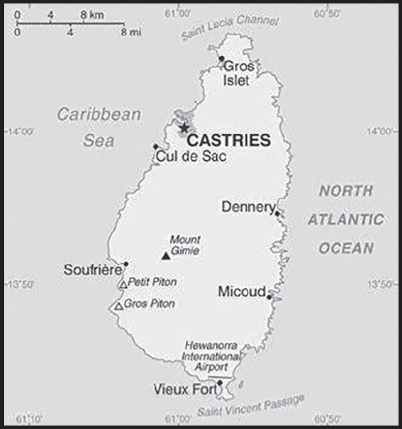
Elevation: highest point: Mount Gimie 948 m
lowest point: Caribbean Sea 0 m
Natural resources: forests, sandy beaches, minerals (pumice), mineral springs, geothermal potential
Land use: agricultural land: 17.4% (2018 est.)
arable land: 4.9% (2018 est.)
permanent crops: 11.5% (2018 est.)
permanent pasture: 1% (2018 est.)
forest: 77% (2018 est.)
other: 5.6% (2018 est.)
Irrigated land: 30 sq km (2012)
Population distribution: most of the population is found on the periphery of the island, with a larger concentration in the north around the capital of Castries
Natural hazards: hurricanes
volcanism: Mount Gimie (948 m), also known as Qualibou, is a caldera on the west of the island; the iconic twin pyramidal peaks of Gros Piton (771 m) and Petit Piton (743 m) are lava dome remnants associated with the Soufriere volcano; there have been no historical magmatic eruptions, but a minor steam eruption in 1766 spread a thin layer of ash over a wide area; Saint Lucia is part of the volcanic island arc of the Lesser Antilles that extends from Saba in the north to Grenada in the south
Geography - note: the twin Pitons (Gros Piton and Petit Piton), striking cone-shaped peaks south of Soufriere, are one of the scenic natural highlights of the Caribbean
PEOPLE AND SOCIETY
Population: 167,591 (2023 est.)
comparison ranking: 186
Nationality: noun: Saint Lucian(s)
adjective: Saint Lucian
Ethnic groups: Black/African descent 85.3%, mixed 10.9%, East Indian 2.2%, other 1.6%, unspecified 0.1% (2010 est.)
Languages: English (official), Saint Lucian Creole
Religions: Roman Catholic 61.5%, Protestant 25.5% (includes Seventh Day Adventist 10.4%, Pentecostal 8.9%, Baptist 2.2%, Anglican 1.6%, Church of God 1.5%, other Protestant 0.9%), other Christian 3.4% (includes Evangelical 2.3% and Jehovah’s Witness 1.1%), Rastafarian 1.9%, other 0.4%, none 5.9%, unspecified 1.4% (2010 est.)
Age structure: 0-14 years: 18.23% (male 15,734/female 14,820)
15-64 years: 66.97% (male 54,354/female 57,880)
65 years and over: 14.8% (2023 est.) (male 11,257/female 13,546)
Dependency ratios: total dependency ratio: 37.7
youth dependency ratio: 25.2
elderly dependency ratio: 12.5
potential support ratio: 8 (2021 est.)
Median age: total: 39 years (2023 est.)
male: 37.8 years
female: 40.2 years
comparison ranking: total 66
Population growth rate: 0.27% (2023 est.)
comparison ranking: 171
Birth rate: 11.7 births/1,000 population (2023 est.)
comparison ranking: 155
Death rate: 8.2 deaths/1,000 population (2023 est.)
comparison ranking: 81
Net migration rate: -0.8 migrant(s)/1,000 population (2023 est.)
comparison ranking: 138
Population distribution: most of the population is found on the periphery of the island, with a larger concentration in the north around the capital of Castries
Urbanization: urban population: 19.2% of total population (2023)
rate of urbanization: 0.98% annual rate of change (2020-25 est.)
Major urban areas - population: 22,000 CASTRIES (capital) (2018)
Sex ratio: at birth: 1.06 male(s)/female
0-14 years: 1.06 male(s)/female
15-64 years: 0.94 male(s)/female
65 years and over: 0.83 male(s)/female
total population: 0.94 male(s)/female (2023 est.)
Maternal mortality ratio: 73 deaths/100,000 live births (2020 est.)
comparison ranking: 82
Infant mortality rate: total: 11.8 deaths/1,000 live births (2023 est.)
male: 11 deaths/1,000 live births
female: 12.5 deaths/1,000 live births
comparison ranking: total 117
Life expectancy at birth: total population: 79.2 years (2023 est.)
male: 76.5 years
female: 82.1 years
comparison ranking: total population 64
Total fertility rate: 1.72 children born/woman (2023 est.)
comparison ranking: 158
Gross reproduction rate: 0.84 (2023 est.)
Contraceptive prevalence rate: 55.5% (2011/12)
Drinking water source: improved: urban: 99.4% of population
rural: 98.5% of population
total: 98.7% of population
unimproved: urban: 0.6% of population
rural: 1.5% of population
total: 1.3% of population (2020 est.)
Current health expenditure: 6.7% of GDP (2020)
Physicians density: 0.64 physicians/1,000 population (2017)
Hospital bed density: 1.3 beds/1,000 population (2017)
Sanitation facility access: improved: urban: 97.6% of population
rural: 92.9% of population
total: 93.8% of population
unimproved: urban: 2.4% of population
rural: 7.1% of population
total: 6.2% of population (2020 est.)
Obesity - adult prevalence rate: 19.7% (2016)
comparison ranking: 111
Alcohol consumption per capita: total: 9.3 liters of pure alcohol (2019 est.)
beer: 3.21 liters of pure alcohol (2019 est.)
wine: 0.4 liters of pure alcohol (2019 est.)
spirits: 5.1 liters of pure alcohol (2019 est.)
other alcohols: 0.6 liters of pure alcohol (2019 est.)
comparison ranking: total 31
Currently married women (ages 15-49): 53.6% (2023 est.)
Education expenditures: 3.6% of GDP (2020 est.)
comparison ranking: 138
School life expectancy (primary to tertiary education): total: 13 years
male: 12 years
female: 13 years (2020)
Youth unemployment rate (ages 15-24): total: 38.7% (2021 est.)
male: 41%
female: 36.2%
comparison ranking: total 17
ENVIRONMENT
Environment - current issues: deforestation; soil erosion, particularly in the northern region
Environment - international agreements: party to: Biodiversity, Climate Change, Climate Change-Kyoto Protocol, Climate Change-Paris Agreement, Comprehensive Nuclear Test Ban, Desertification, Endangered Species, Environmental Modification, Hazardous Wastes, Law of the Sea, Marine Dumping-London Convention, Ozone Layer Protection, Ship Pollution, Wetlands, Whaling
signed, but not ratified: none of the selected agreements
Climate: tropical, moderated by northeast trade winds; dry season January to April, rainy season May to August
Land use: agricultural land: 17.4% (2018 est.)
arable land: 4.9% (2018 est.)
permanent crops: 11.5% (2018 est.)
permanent pasture: 1% (2018 est.)
forest: 77% (2018 est.)
other: 5.6% (2018 est.)
Urbanization: urban population: 19.2% of total population (2023)
rate of urbanization: 0.98% annual rate of change (2020-25 est.)
Revenue from forest resources: 0.01% of GDP (2018 est.)
comparison ranking: 153
Revenue from coal: 0% of GDP (2018 est.)
comparison ranking: 66
Air pollutants: particulate matter emissions: 8.98 micrograms per cubic meter (2019 est.)
carbon dioxide emissions: 0.41 megatons (2016 est.)
methane emissions: 0.27 megatons (2020 est.)
Waste and recycling: municipal solid waste generated annually: 77,616 tons (2015 est.)
Total water withdrawal: municipal: 10 million cubic meters (2020 est.)
industrial: 0 cubic meters (2017 est.)
agricultural: 30 million cubic meters (2020 est.)
Total renewable water resources: 300 million cubic meters (2020 est.)
GOVERNMENT
Country name: conventional long form: none
conventional short form: Saint Lucia
etymology: named after Saint LUCY of Syracuse by French sailors who were shipwrecked on the island on 13 December 1502, the saint’s feast day; Saint Lucia is the only country named specifically after a woman
note: pronounced saynt-looshuh
Government type: parliamentary democracy under a constitutional monarchy; a Commonwealth realm
Capital: name: Castries
geographic coordinates: 14 00 N, 61 00 W
time difference: UTC-4 (1 hour ahead of Washington, DC, during Standard Time)
etymology: in 1785, the village of Carenage was renamed Castries, after Charles Eugene Gabriel de La Croix de CASTRIES (1727-1801), who was then the French Minister of the Navy and Colonies
Administrative divisions: 10 districts; Anse-la-Raye, Canaries, Castries, Choiseul, Dennery, Gros-Islet, Laborie, Micoud, Soufriere, Vieux-Fort
Independence: 22 February 1979 (from the UK)
National holiday: Independence Day, 22 February (1979)
Constitution: history: previous 1958, 1960 (preindependence); latest presented 20 December 1978, effective 22 February 1979
amendments: proposed by Parliament; passage requires at least two-thirds majority vote by the House of Assembly membership in the final reading and assent of the governor general; passage of amendments to various constitutional sections, such as those on fundamental rights and freedoms, government finances, the judiciary, and procedures for amending the constitution, require at least three-quarters majority vote by the House and assent of the governor general; passage of amendments approved by the House but rejected by the Senate require a majority of votes cast in a referendum; amended several times, last in 2008
Legal system: English common law
International law organization participation: has not submitted an ICJ jurisdiction declaration; accepts ICCt jurisdiction
Citizenship: citizenship by birth: yes
citizenship by descent only: at least one parent must be a citizen of Saint Lucia
dual citizenship recognized: yes
residency requirement for naturalization: 8 years
Suffrage: 18 years of age; universal
Executive branch: chief of state: King CHARLES III (since 8 September 2022); represented by Acting Governor General Errol CHARLES (since 11 November 2021)
head of government: Prime Minister Philip J. PIERRE (since 28 July 2021)
cabinet: Cabinet appointed by the governor general on the advice of the prime minister
elections/appointments: the monarchy is hereditary; governor general appointed by the monarch; following legislative elections, the leader of the majority party or majority coalition usually appointed prime minister by governor general; deputy prime minister appointed by governor general
Legislative branch: description: bicameral Houses of Parliament consists of:
Senate (11 seats; all members appointed by the governor general; 6 on the advice of the prime minister, 3 on the advice of the leader of the opposition, and 2 upon consultation with religious, economic, and social groups; members serve 5-year terms)
House of Assembly (18 seats; 17 members directly elected in single-seat constituencies by simple majority vote and the speaker, designated from outside the Parliament; members serve 5-year terms)
elections: Senate - last appointments on 17 August 2021 (next to be held in 2026)
House of Assembly - last held on 26 July 2021 (next to be held in 2026)
election results: Senate - percent of vote by party - NA; seats by party - NA; composition - men 6, women 5, percent of women 45.5%
House of Assembly - percent of vote by party - SLP 50.1%, UWP 42.9%, other o.3%, independent 6.6%; seats by party - SLP 13, UWP 2, independent 2; composition (including the speaker) - men 16, women 2, percent of women 11.1%; note - total Parliament percent of women 24.1%
Judicial branch: highest court(s): the Eastern Caribbean Supreme Court (ECSC) is the superior court of the Organization of Eastern Caribbean States; the ECSC - headquartered on St. Lucia - consists of the Court of Appeal - headed by the chief justice and 4 judges - and the High Court with 18 judges; the Court of Appeal is itinerant, traveling to member states on a schedule to hear appeals from the High Court and subordinate courts; High Court judges reside in the member states with 4 on Saint Lucia; Saint Lucia is a member of the Caribbean Court of Justice
judge selection and term of office: chief justice of Eastern Caribbean Supreme Court appointed by Her Majesty, Queen ELIZABETH II; other justices and judges appointed by the Judicial and Legal Services Commission, an independent body of judicial officials; Court of Appeal justices appointed for life with mandatory retirement at age 65; High Court judges appointed for life with mandatory retirement at age 62
subordinate courts: magistrate’s court
Political parties and leaders: Saint Lucia Labor Party or SLP [Philip J. PIERRE]
United Workers Party or UWP [Allen M. CHASTANET]
International organization participation: ACP, AOSIS, C, Caricom, CD, CDB, CELAC, FAO, G-77, IBRD, ICAO, ICCt, ICRM, IDA, IFAD, IFC, IFRCS, ILO, IMF, IMO, Interpol, IOC, ISO, ITU, ITUC (NGOs), MIGA, NAM, OAS, OECS, OIF, OPANAL, OPCW, Petrocaribe, UN, UNCTAD, UNESCO, UNIDO, UPU, WCO, WFTU (NGOs), WHO, WIPO, WMO, WTO
Diplomatic representation in the US: chief of mission: Ambassador Elizabeth DARIUS-CLARKE (since 7 June 2022)
chancery: 1629 K Street NW, Suite 1250, Washington, DC 20006
telephone: [1] (202) 364-6792
FAX: [1] (202) 364-6723
email address and website:
https://www.embassyofstlucia.org/
consulate(s) general: New York
Diplomatic representation from the US: embassy: the US does not have an embassy in Saint Lucia; the US Ambassador to Barbados is accredited to Saint Lucia
Flag description: cerulean blue with a gold isosceles triangle below a black arrowhead; the upper edges of the arrowhead have a white border; the blue color represents the sky and sea, gold stands for sunshine and prosperity, and white and black the racial composition of the island (with the latter being dominant); the two major triangles invoke the twin Pitons (Gros Piton and Petit Piton), cone-shaped volcanic plugs that are a symbol of the island
National symbol(s): twin pitons (volcanic peaks), Saint Lucia parrot; national colors: cerulean blue, gold, black, white
National anthem: name: “Sons and Daughters of St. Lucia”
lyrics/music: Charles JESSE/Leton Felix THOMAS
note: adopted 1967
National heritage: total World Heritage Sites: 1 (natural)
selected World Heritage Site locales:Pitons Management Area
ECONOMY
Economic overview: upper middle-income, tourism-based Caribbean island economy; environmentally fragile; energy import-dependent; major banana producer; well-educated labor force; key infrastructure, IT, and communications investments
Real GDP (purchasing power parity): $2.344 billion (2021 est.)
$2.088 billion (2020 est.)
$2.761 billion (2019 est.)
note: data are in 2017 dollars
comparison ranking: 195
Real GDP growth rate: 12.23% (2021 est.)
-24.36% (2020 est.)
-0.65% (2019 est.)
comparison ranking: 18
Real GDP per capita: $13,000 (2021 est.)
$11,700 (2020 est.)
$15,500 (2019 est.)
note: data are in 2017 dollars
comparison ranking: 125
GDP (official exchange rate): $1.686 billion (2017 est.)
Inflation rate (consumer prices): 2.41% (2021 est.)
-1.76% (2020 est.)
0.54% (2019 est.)
comparison ranking: 141
GDP - composition, by sector of origin: agriculture: 2.9% (2017 est.)
industry: 14.2% (2017 est.)
services: 82.8% (2017 est.)
comparison rankings: services 26; industry 185; agriculture 153
GDP - composition, by end use: household consumption: 66.1% (2017 est.)
government consumption: 11.2% (2017 est.)
investment in fixed capital: 16.9% (2017 est.)
investment in inventories: 0.1% (2017 est.)
exports of goods and services: 62.7% (2017 est.)
imports of goods and services: -56.9% (2017 est.)
Agricultural products: bananas, coconuts, fruit, tropical fruit, plantains, roots/tubers, cassava, poultry, vegetables, mangoes/guavas
Industries: tourism; clothing, assembly of electronic components, beverages, corrugated cardboard boxes, lime processing, coconut processing
Industrial production growth rate: 10.8% (2021 est.)
comparison ranking: 24
Labor force: 99,900 (2021 est.)
comparison ranking: 183
Labor force - by occupation: agriculture: 21.7%
industry: 24.7%
services: 53.6% (2002 est.)
Unemployment rate: 16.91% (2021 est.)
16.89% (2020 est.)
15.32% (2019 est.)
comparison ranking: 26
Youth unemployment rate (ages 15-24): total: 38.7% (2021 est.)
male: 41%
female: 36.2%
comparison ranking: total 17
Population below poverty line: 25% (2016 est.)
Gini Index coefficient - distribution of family income: 51.2 (2016 est.)
comparison ranking: 11
Budget: revenues: $350 million (2020 est.)
expenditures: $516 million (2020 est.)
Budget surplus (+) or deficit (-): 0.3% (of GDP) (2017 est.)
comparison ranking: 40
Public debt: 70.7% of GDP (2017 est.)
69.2% of GDP (2016 est.)
comparison ranking: 59
Taxes and other revenues: 18.24% (of GDP) (2017 est.)
comparison ranking: 109
Fiscal year: 1 April - 31 March
Current account balance: -$2.289 million (2021 est.)
-$237.61 million (2020 est.)
$119.6 million (2019 est.)
comparison ranking: 80
Exports: $890.724 million (2021 est.) note: data are in current year dollars
$445.965 million (2020 est.)
$1.209 billion (2019 est.)
comparison ranking: 180
Exports - partners: Brazil 98% (2021)
Exports - commodities: crude petroleum, fertilizers, refined petroleum, polymers, aluminum (2021)
Imports: $846.484 million (2021 est.) note: data are in current year dollars
$672.769 million (2020 est.)
$968.174 million (2019 est.)
comparison ranking: 193
Imports - partners: Brazil 64%, United States 14%, Russia 8%, Colombia 7%, Trinidad and Tobago 2% (2021)
Imports - commodities: crude petroleum, poultry, sugar, refined petroleum, soybeans, beef, corn, wheat (2021)
Reserves of foreign exchange and gold: $433.117 million (31 December 2021 est.)
$231.361 million (31 December 2020 est.)
$260.87 million (31 December 2019 est.)
comparison ranking: 168
Debt - external: $570.6 million (31 December 2017 est.)
$529 million (31 December 2015 est.)
comparison ranking: 176
Exchange rates: East Caribbean dollars (XCD) per US dollar -
Exchange rates: 2.7 (2021 est.)
2.7 (2020 est.)
2.7 (2019 est.)
2.7 (2018 est.)
2.7 (2017 est.)
ENERGY
Electricity access: electrification - total population: 100% (2021)
Electricity: installed generating capacity: 92,000 kW (2020 est.)
consumption: 322.506 million kWh (2019 est.)
exports: 0 kWh (2020 est.)
imports: 0 kWh (2020 est.)
transmission/distribution losses: 27.568 million kWh (2019 est.)
comparison rankings: imports 166; exports 155; installed generating capacity 184; transmission/distribution losses 179; consumption 179
Electricity generation sources: fossil fuels: 99.1% of total installed capacity (2020 est.)
solar: 1% of total installed capacity (2020 est.)
Petroleum: total petroleum production: 0 bbl/day (2021 est.)
refined petroleum consumption: 4,500 bbl/day (2019 est.)
Refined petroleum products - imports: 3,113 bbl/day (2015 est.)
comparison ranking: 184
Carbon dioxide emissions: 659,000 metric tonnes of CO2 (2019 est.)
from petroleum and other liquids: 659,000 metric tonnes of CO2 (2019 est.)
comparison ranking: total emissions 184
Energy consumption per capita: 50.872 million Btu/person (2019 est.)
comparison ranking: 100
COMMUNICATIONS
Telephones - fixed lines: total subscriptions: 14,000 (2021 est.)
subscriptions per 100 inhabitants: 8 (2021 est.)
comparison ranking: total subscriptions 183
Telephones - mobile cellular: total subscriptions: 170,000 (2021 est.)
subscriptions per 100 inhabitants: 96 (2021 est.)
comparison ranking: total subscriptions 186
Telecommunication systems: general assessment: an adequate system that is automatically switched; good interisland and international connections; broadband access; expanded FttP (Fiber to the Home) and LTE markets; regulatory development; telecom sector contributes to the overall GDP; telecom sector is a growth area (2020)
domestic: fixed-line teledensity is 8 per 100 persons and mobile-cellular teledensity is roughly 96 per 100 persons (2021)
international: country code - 1-758; landing points for the ECFS and Southern Caribbean Fiber submarine cables providing connectivity to numerous Caribbean islands; direct microwave radio relay link with Martinique and Saint Vincent and the Grenadines; tropospheric scatter to Barbados (2019)
Broadcast media: 3 privately owned TV stations; 1 public TV station operating on a cable network; multi-channel cable TV service available; a mix of state-owned and privately owned broadcasters operate nearly 25 radio stations including repeater transmission stations (2019)
Internet country code: .lc
Internet users: total: 140,400 (2021 est.)
percent of population: 78% (2021 est.)
comparison ranking: total 183
Broadband - fixed subscriptions: total: 33,000 (2020 est.)
subscriptions per 100 inhabitants: 18 (2020 est.)
comparison ranking: total 149
TRANSPORTATION
Civil aircraft registration country code prefix: J6
Airports: 2 (2021)
comparison ranking: total 203
Airports - with paved runways: 2
note: paved runways have a concrete or asphalt surface but not all have facilities for refueling, maintenance, or air traffic control; the length of a runway required for aircraft to safely operate depends on a number of factors including the type of aircraft, the takeoff weight (including passengers, cargo, and fuel), engine types, flap settings, landing speed, elevation of the airport, and average maximum daily air temperature; paved runways can reach a length of 5,000 m (16,000 ft.), but the “typical” length of a commercial airline runway is between 2,500-4,000 m (8,000-13,000 ft.)
Roadways: total: 1,210 km (2011)
paved: 847 km (2011)
unpaved: 363 km (2011)
comparison ranking: total 179
Ports and terminals: major seaport(s): Castries, Cul-de-Sac, Vieux-Fort
MILITARY AND SECURITY
Military and security forces: no regular military forces; Royal Saint Lucia Police Force (includes Special Service Unit, Marine Unit) (2023)
note: the RSLPF has responsibility for law enforcement and maintenance of order within the country; it is under the Ministry of Home Affairs, Justice, and National Security and includes a Special Service Unit and a Marine Unit
Military - note: Saint Lucia has been a member of the Caribbean Regional Security System (RSS) since its creation in 1982; RSS signatories (Antigua and Barbuda, Barbados, Dominica, Grenada, Saint Kitts, and Saint Vincent and the Grenadines) agreed to prepare contingency plans and assist one another, on request, in national emergencies, prevention of smuggling, search and rescue, immigration control, fishery protection, customs and excise control, maritime policing duties, protection of off-shore installations, pollution control, national and other disasters, and threats to national security (2023)
TRANSNATIONAL ISSUES
Disputes - international: Saint Lucia-Venezuela: joins other Caribbean states to counter Venezuela’s claim that Aves Island sustains human habitation, a criterion under UN Convention on the Law of the Sea, which permits Venezuela to extend its EEZ/continental shelf over a large portion of the eastern Caribbean Sea
Illicit drugs: a transit point for cocaine and marijuana destined for North America, Europe, and elsewhere in the Caribbean; some local demand for cocaine and some use of synthetic drugs
SAINT MARTIN
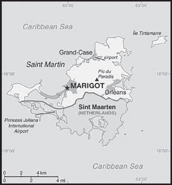
INTRODUCTION
Background: Although sighted by Christopher COLUMBUS in 1493 and claimed for Spain, it was the Dutch who occupied the island in 1631 to exploit its salt deposits. The Spanish retook the island in 1633 but continued to be harassed by the Dutch. The Spanish finally relinquished Saint Martin to the French and Dutch, who divided it between themselves in 1648. Friction between the two sides caused the border to frequently fluctuate over the next two centuries, with the French eventually holding the greater portion of the island (about 61%). The cultivation of sugarcane introduced African slavery to the island in the late 18th century; the practice was not abolished until 1848. The island became a free port in 1939; the tourism industry was dramatically expanded during the 1970s and 1980s. In 2003, the populace of Saint Martin voted to secede from Guadeloupe and in 2007, the northern portion of the island became a French overseas collectivity. In 2010, the southern Dutch portion of the island became the independent nation of Sint Maarten within the Kingdom of the Netherlands. On 6 September 2017, Hurricane Irma passed over the island of Saint Martin causing extensive damage to roads, communications, electrical power, and housing; the UN estimated that 90% of the buildings were damaged or destroyed.
GEOGRAPHY
Location: Caribbean, located in the Leeward Islands (northern) group; French part of the island of Saint Martin in the Caribbean Sea; Saint Martin lies east of the US Virgin Islands
Geographic coordinates: 18 05 N, 63 57 W
Map references: Central America and the Caribbean
Area: total: 50 sq km
land: 50 sq km
water: negligible
comparison ranking: total 231
Area - comparative: more than one-third the size of Washington, DC
Land boundaries: total: 16 km
border countries (1): Sint Maarten 16 km
Coastline: 58.9 km (for entire island)
Climate: temperature averages 27-29 degrees Celsius all year long; low humidity, gentle trade winds, brief, intense rain showers; hurricane season stretches from July to November
Elevation: highest point: Pic du Paradis 424 m
lowest point: Caribbean Ocean 0 m
Natural resources: salt
Population distribution: most of the population is found along the coast, with a largest concentrations around the capital Marigot, Orleans, and Grand-Case
Natural hazards: subject to hurricanes from July to November
Geography - note: note 1: the southern border is shared with Sint Maarten, a country within the Kingdom of the Netherlands; together, these two entities make up the smallest landmass in the world shared by two self-governing states
note 2: Simpson Bay Lagoon (aka as Simson Bay Lagoon or The Great Pond) is one of the largest inland lagoons in the West Indies; the border between the French and Dutch halves of the island of Saint Martin runs across the center of the lagoon, which is shared by both of the island’s entities
PEOPLE AND SOCIETY
Population: 32,897 (2023 est.)
comparison ranking: 215
Ethnic groups: Creole (Mulatto), Black, Guadeloupe Mestizo (French-East Asian), White, East Indian, other
Languages: French (official), Dutch, English, Guadeloupian Creole, Haitian Creole, Italian, Martiniquan Creole, Papiamento (dialect of Netherlands Antilles), Spanish
major-language sample(s):
The World Factbook, une source indispensable d’informations de base. (French)
Religions: Roman Catholic, Jehovah’s Witness, Protestant, Hindu
Age structure: 0-14 years: 24.9% (male 4,067/female 4,125)
15-64 years: 64.65% (male 10,205/female 11,063)
65 years and over: 10.45% (2023 est.) (male 1,484/female 1,953)
Dependency ratios: total dependency ratio: 49.1 N
youth dependency ratio: 33.5
elderly dependency ratio: 15.6
potential support ratio: 6.4 (2021)
Median age: total: 34 years (2023 est.)
male: 33.2 years
female: 34.8 years
comparison ranking: total 102
Population growth rate: 0.31% (2023 est.)
comparison ranking: 165
Birth rate: 14 births/1,000 population (2023 est.)
comparison ranking: 123
Death rate: 4.7 deaths/1,000 population (2023 est.)
comparison ranking: 206
Net migration rate: -6.2 migrant(s)/1,000 population (2023 est.)
comparison ranking: 212
Population distribution: most of the population is found along the coast, with a largest concentrations around the capital Marigot, Orleans, and Grand-Case
Sex ratio: at birth: 1.04 male(s)/female
0-14 years: 0.99 male(s)/female
15-64 years: 0.92 male(s)/female
65 years and over: 0.76 male(s)/female
total population: 0.92 male(s)/female (2023 est.)
Infant mortality rate: total: 6.6 deaths/1,000 live births (2023 est.)
male: 7.7 deaths/1,000 live births
female: 5.4 deaths/1,000 live births
comparison ranking: total 160
Life expectancy at birth: total population: 80.8 years (2023 est.)
male: 77.7 years
female: 84 years
comparison ranking: total population 46
Total fertility rate: 1.8 children born/woman (2023 est.)
comparison ranking: 141
Gross reproduction rate: 0.88 (2023 est.)
Drinking water source: improved:
total: 100% of population
unimproved: total: 0% of population (2020)
Sanitation facility access: improved:
total: 100% of population
unimproved: total: 0% of population (2020)
ENVIRONMENT
Environment - current issues: excessive population pressure (increasing settlement); waste management; salinity intrusions into the mainland of the island; fresh water supply is dependent on desalination of sea water; over-exploitation of marine resources (reef fisheries, coral and shell); indiscriminate anchoring of boats damages coral reefs, causing underwater pollution and sedimentation
Climate: temperature averages 27-29 degrees Celsius all year long; low humidity, gentle trade winds, brief, intense rain showers; hurricane season stretches from July to November
Waste and recycling: municipal solid waste generated annually: 15,480 tons (2012 est.)
GOVERNMENT
Country name: conventional long form: Overseas Collectivity of Saint Martin
conventional short form: Saint Martin
local long form: Collectivite d’outre mer de Saint-Martin
local short form: Saint-Martin
etymology: explorer Christopher COLUMBUS named the island after Saint MARTIN of Tours because the 11 November 1493 day of discovery was the saint’s feast day
Government type: parliamentary democracy (Territorial Council); overseas collectivity of France
Dependency status: overseas collectivity of France
note: the only French overseas collectivity that is part of the EU
Capital: name: Marigot
geographic coordinates: 18 04 N, 63 05 W
time difference: UTC-4 (1 hour ahead of Washington, DC, during Standard Time)
etymology: marigot is a French term referring to a body of water, a watercourse, a side-stream, or a tributary rivulet; the name likely refers to a stream at the site of the city’s original founding
Independence: none (overseas collectivity of France)
National holiday: Fete de la Federation, 14 July (1790); note - local holiday is Schoelcher Day (Slavery Abolition Day) 12 July (1848), as well as St. Martin’s Day, 11 November (1985), which commemorates the discovery of the island by COLUMBUS on Saint Martin’s Day, 11 November 1493; the latter holiday celebrated on both halves of the island
Constitution: history: 4 October 1958 (French Constitution)
amendments: amendment procedures of France’s constitution apply
Legal system: French civil law
Citizenship: see France
Suffrage: 18 years of age, universal
Executive branch: chief of state: President Emmanuel MACRON (since 14 May 2017); represented by Prefect Vincent BERTON (since 28 March 2022)
head of government: President of Territorial Council Louis MUSSINGTON (since 3 April 2022); First Vice President Alain RICHARDSON (since 3 April 2022)
cabinet: Executive Council; note - there is also an advisory economic, social, and cultural council
elections/appointments: French president directly elected by absolute majority popular vote in 2 rounds if needed for a 5-year term (eligible for a second term); prefect appointed by French president on the advice of French Ministry of Interior; president of Territorial Council elected by its members for a 5-year term; election last held on 3 April 2022 (next to be held in 2027)
election results:
2022: Louis MUSSINGTON (RSM) elected president; Territorial Council vote - unanimous
2017: Daniel Gibbs (UD) elected president: Territorial Council vote - 18 of 23 votes
Legislative branch: description: unicameral Territorial Council (23 seats; members directly elected by absolute majority vote in 2 rounds if needed to serve 5-year terms); Saint Martin elects 1 member to the French Senate and 1 member (shared with Saint Barthelemy) to the French National Assembly
elections:
Territorial Council - first round held on 20 March and second round held on 27 March 2022 (next to be held in March 2027)
election results:
Territorial Council - percent of vote by party (first round) - RSM 25.4%, UD 24.7%, HOPE 17.5%, Saint Martin with You 13.8%, Alternative 11.2%, Future Saint Martin 7.5%; percent of vote by party (second round) - RSM and Alternative 49.1%, UD 33.3%, HOPE, Saint Martin with You, and Future Saint Martin 17.6%; seats by party - RSM and Alternative 16, UD 5, HOPE, Saint Martin with You, and Future Saint Martin 2; composition - men 13, women 10, percent of women 43.5%
French Senate - last held on 27 September 2020 (next to be held not later than September 2023) French National Assembly - last held on 12 and 19 June 2022 (next to be held by June 2027) French Senate - 1 seat: UMP 1 French National Assembly - 1 seat: UMP 1
Political parties and leaders: Alternative [Valerie DAMASEAU]
Future Saint Martin (Avenir Saint Martin) [Yawo NYUIADZI]
Generation Hope or HOPE [Jules CHARVILLE]
Rassemblement Saint-Martinois or RSM [Louis MUSSINGTON] (formerly Movement for Justice and Prosperity or MJP)
Saint Martin with You [James HAMLET]
Union for Democracy or UD [Daniel GIBBS]
International organization participation: UPU
Diplomatic representation in the US: none (overseas collectivity of France)
Diplomatic representation from the US: embassy: none (overseas collectivity of France)
Flag description: the flag of France is used
National symbol(s): brown pelican
National anthem: name: “O Sweet Saint Martin’s Land”
lyrics/music: Gerard KEMPS
note: the song, written in 1958, is used as an unofficial anthem for the entire island (both French and Dutch sides); as a collectivity of France, in addition to the local anthem, “La Marseillaise” remains official on the French side (see France); as a constituent part of the Kingdom of the Netherlands, in addition to the local anthem, “Het Wilhelmus” remains official on the Dutch side (see Netherlands)
ECONOMY
Economic overview: high-income French Caribbean territorial economy; extremely reliant on tourism, with severe COVID-19 impacts; neartotal destruction from Hurricane Irma in 2017; some offshore banking; import-dependent; duty-free commerce; yachting destination
Real GDP (purchasing power parity): $561.5 million (2005 est.)
comparison ranking: 213
Real GDP per capita: $19,300 (2005 est.)
comparison ranking: 93
GDP (official exchange rate): $561.5 million (2005 est.)
GDP - composition, by sector of origin: agriculture: 1% (2000)
industry: 15% (2000)
services: 84% (2000)
comparison rankings: services 21; industry 181; agriculture 198
Industries: tourism, light industry and manufacturing, heavy industry
Labor force: 17,300 (2008 est.)
comparison ranking: 214
Labor force - by occupation: 85 directly or indirectly employed in tourist industry
Exports - partners: United States 35%, Netherlands 26%, Antigua and Barbuda 21%, France 10% (2019)
Exports - commodities: gold, special use vessels, furniture, scrap aluminum, rum (2019)
Imports - partners: United States 76%, Netherlands 7%, France 7% (2019)
Imports - commodities: jewelry, diamonds, pearls, recreational boats, cars (2019)
Exchange rates: euros (EUR) per US dollar -
Exchange rates: 0.885 (2017 est.)
0.903 (2016 est.)
0.9214 (2015 est.)
0.885 (2014 est.)
0.7634 (2013 est.)
ENERGY
Electricity access: electrification - total population: 100% (2021)
COMMUNICATIONS
Telephones - mobile cellular: total subscriptions: 68,840 (2012 est.)
subscriptions per 100 inhabitants: 196 (2012 est.)
comparison ranking: total subscriptions 198
Telecommunication systems: general assessment: fully integrated access; good interisland and international connections; broadband access; expanded FttP (Fiber to the Home) and LTE markets; regulatory development; telecom sector contributes greatly to the overall GDP; telecom sector is a growth area (2020)
domestic: direct dial capability with both fixed and wireless systems (2018)
international: country code - 590; landing points for the SMPR-1, Southern Caribbean Fiber and the Saba, Statia Cable System submarine cables providing connectivity to numerous Caribbean islands (2019)
Broadcast media: 1 local TV station; access to about 20 radio stations, including RFO Guadeloupe radio broadcasts via repeater
Internet country code: .mf; note - .gp, the Internet country code for Guadeloupe, and .fr, the Internet country code for France, might also be encountered
Internet users: total: 19,284 (2022 est.)
percent of population: 48.5% (2022 est.)
comparison ranking: total 212
TRANSPORTATION
Airports: 1 (2021)
comparison ranking: total 234
Airports - with paved runways: 1
note: paved runways have a concrete or asphalt surface but not all have facilities for refueling, maintenance, or air traffic control; the length of a runway required for aircraft to safely operate depends on a number of factors including the type of aircraft, the takeoff weight (including passengers, cargo, and fuel), engine types, flap settings, landing speed, elevation of the airport, and average maximum daily air temperature; paved runways can reach a length of 5,000 m (16,000 ft.), but the “typical” length of a commercial airline runway is between 2,500-4,000 m (8,000-13,000 ft.)
Transportation - note: nearest airport for international flights is Princess Juliana International Airport (SXM) located on Sint Maarten
MILITARY AND SECURITY
Military and security forces: no armed forces; Saint Martin Police Force (Korps Politie Sint Marteen)
Military - note: defense is the responsibility of France
TRANSNATIONAL ISSUES
Disputes - international: none identified
Illicit drugs: transshipment point for cocaine, heroin, and marijuana destined for Puerto Rico and the U.S. Virgin Islands as well as Europe.
SAINT PIERRE AND MIQUELON
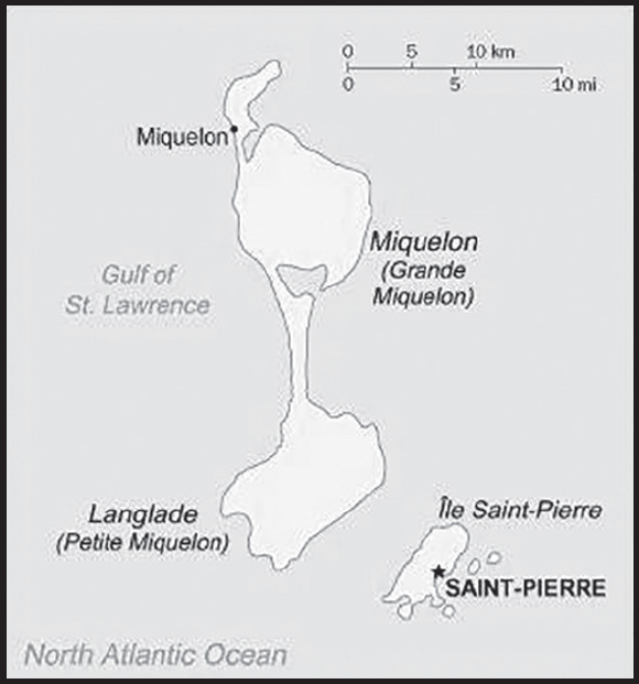
INTRODUCTION
Background: First settled by the French in the early 17th century, the islands represent the sole remaining vestige of France’s once vast North American possessions. They attained the status of an overseas collectivity in 2003.
GEOGRAPHY
Location: Northern North America, islands in the North Atlantic Ocean, south of Newfoundland (Canada)
Geographic coordinates: 46 50 N, 56 20 W
Map references: North America
Area: total: 242 sq km
land: 242 sq km
water: 0 sq km
note: includes eight small islands in the Saint Pierre and the Miquelon groups
comparison ranking: total 213
Area - comparative: one and half times the size of Washington, DC
Land boundaries: total: 0 km
Coastline: 120 km
Maritime claims: territorial sea: 12 nm
exclusive economic zone: 200 nm
Climate: cold and wet, with considerable mist and fog; spring and autumn are often windy
Terrain: mostly barren rock
Elevation: highest point: Morne de la Grande Montagne 240 m
lowest point: Atlantic Ocean 0 m
Natural resources: fish, deepwater ports
Land use: agricultural land: 8.7% (2018 est.)
arable land: 8.7% (2018 est.)
permanent crops: 0% (2018 est.)
permanent pasture: 0% (2018 est.)
forest: 12.5% (2018 est.)
other: 78.8% (2018 est.)
Irrigated land: 0 sq km (2022)
Population distribution: most of the population is found on Saint Pierre Island; a small settlement is located on the north end of Miquelon Island
Natural hazards: persistent fog throughout the year can be a maritime hazard
Geography - note: vegetation scanty; the islands are actually part of the northern Appalachians along with Newfoundland
PEOPLE AND SOCIETY
Population: 5,195 (2023 est.)
comparison ranking: 227
Nationality: noun: Frenchman(men), Frenchwoman(women)
adjective: French
Ethnic groups: Basques and Bretons (French fishermen)
Languages: French (official)
major-language sample(s):
The World Factbook, une source indispensable d’informations de base. (French)
Religions: Roman Catholic 99%, other 1%
Age structure: 0-14 years: 13.42% (male 358/female 339)
15-64 years: 61.98% (male 1,590/female 1,630)
65 years and over: 24.6% (2023 est.) (male 563/female 715)
Dependency ratios: total dependency ratio: 52
youth dependency ratio: 26.1
elderly dependency ratio: 25.9
potential support ratio: 3.9 (2021)
Median age: total: 50.6 years (2023 est.)
male: 49.9 years
female: 51.2 years
comparison ranking: total 2
Population growth rate: -1.19% (2023 est.)
comparison ranking: 233
Birth rate: 6.5 births/1,000 population (2023 est.)
comparison ranking: 227
Death rate: 11.4 deaths/1,000 population (2023 est.)
comparison ranking: 22
Net migration rate: -7.1 migrant(s)/1,000 population (2023 est.)
comparison ranking: 217
Population distribution: most of the population is found on Saint Pierre Island; a small settlement is located on the north end of Miquelon Island
Urbanization: urban population: 90.1% of total population (2023)
rate of urbanization: 0.75% annual rate of change (2020-25 est.)
Major urban areas - population: 6,000 SAINT-PIERRE (capital) (2018)
Sex ratio: at birth: 1.06 male(s)/female
0-14 years: 1.06 male(s)/female
15-64 years: 0.98 male(s)/female
65 years and over: 0.79 male(s)/female
total population: 0.94 male(s)/female (2023 est.)
Infant mortality rate: total: 8 deaths/1,000 live births (2023 est.)
male: 9.9 deaths/1,000 live births
female: 6 deaths/1,000 live births
comparison ranking: total 148
Life expectancy at birth: total population: 81.6 years (2023 est.)
male: 79.3 years
female: 84.1 years
comparison ranking: total population 41
Total fertility rate: 1.59 children born/woman (2023 est.)
comparison ranking: 185
Gross reproduction rate: 0.76 (2023 est.)
Drinking water source: improved:
total: 91.4% of population
unimproved: total: 8.6% of population (2017 est.)
Sanitation facility access: improved:
total: 100% of population
unimproved:
total: 0% of population (2020)
Currently married women (ages 15-49): 64.1% (2023 est.)
ENVIRONMENT
Environment - current issues: overfishing; recent test drilling for oil in waters around Saint Pierre and Miquelon may bring future development that would impact the environment
Climate: cold and wet, with considerable mist and fog; spring and autumn are often windy
Land use: agricultural land: 8.7% (2018 est.)
arable land: 8.7% (2018 est.)
permanent crops: 0% (2018 est.)
permanent pasture: 0% (2018 est.)
forest: 12.5% (2018 est.)
other: 78.8% (2018 est.)
Urbanization: urban population: 90.1% of total population (2023)
rate of urbanization: 0.75% annual rate of change (2020-25 est.)
GOVERNMENT
Country name: conventional long form: Territorial Collectivity of Saint Pierre and Miquelon
conventional short form: Saint Pierre and Miquelon
local long form: Departement de Saint-Pierre et Miquelon
local short form: Saint-Pierre et Miquelon
etymology: Saint-Pierre is named after Saint PETER, the patron saint of fishermen; Miquelon may be a corruption of the Basque name Mikelon
Government type: parliamentary democracy (Territorial Council); overseas collectivity of France
Dependency status: overseas collectivity of France
Capital: name: Saint-Pierre
geographic coordinates: 46 46 N, 56 11 W
time difference: UTC-3 (2 hours ahead of Washington, DC, during Standard Time)
daylight saving time: +1hr, begins second Sunday in March; ends first Sunday in November
etymology: named after Saint Peter, the patron saint of fisherman
Administrative divisions: none (territorial overseas collectivity of France); note - there are no first-order administrative divisions as defined by the US Government, but there are 2 communes at the second order - Saint Pierre, Miquelon
Independence: none (overseas collectivity collectivity of France; has been under French control since 1763)
National holiday: Fete de la Federation, 14 July (1790)
Constitution: history: 4 October 1958 (French Constitution)
amendments: amendment procedures of France’s constitution apply
Legal system: French civil law
Citizenship: see France
Suffrage: 18 years of age; universal
Executive branch: chief of state: President Emmanuel MACRON (since 14 May 2017); represented by Prefect Christian POUGET (since 6 January 2021)
head of government: President of Territorial Council Bernard BRIAND (since 13 October 2020)
cabinet: Le Cabinet du Prefet
elections/appointments: French president directly elected by absolute majority popular vote in 2 rounds if needed for a 5-year term (eligible for a second term); election last held on 10 April and 24 April 2022 (next to be held in 2027); prefect appointed by French president on the advice of French Ministry of Interior; Territorial Council president elected by Territorial Council councilors by absolute majority vote; term NA; election last held on 13 October 2020 (next election to held in NA)
election results:
2020: Bernard BRIAND elected President of Territorial Council; Territorial Council vote - 17 for, 2 abstentions
2017: Stephane LENORMAND elected President of Territorial Council vote - NA
Legislative branch: description: unicameral Territorial Council or Conseil Territorial (19 seats - Saint Pierre 15, Miquelon 4; members directly elected in single-seat constituencies by absolute majority vote in 2 rounds if needed to serve 6-year terms); Saint Pierre and Miquelon indirectly elects 1 senator to the French Senate by an electoral college to serve a 6-year term and directly elects 1 deputy to the French National Assembly by absolute majority vote to serve a 5-year term
elections: Territorial Council - first round held on 20 March and second round held on 27 March 2022 (next to be held in March 2028)
French Senate - last held on 27 September 2020 (next to be held no later than September 2025)
French National Assembly - last held on 12 and 19 June 2022 (next to be held by June 2027)
election results:
Territorial Council - percent of vote by party (first round) - AD 45.9%, Focus on the Future 37%, Together to Build 17.1%; percent of vote by party (second round) - AD 51.8%, Focus on the Future 38.1%, Together to Build 10.1%, seats by party - AD 15, Focus on the Future 4; composition - men NA, women NA, percent of women NA
French Senate - percent of vote by party - NA; seats by party - PS 1 (affiliated with UMP)
French National Assembly - percent of vote by party - NA; seats by party - AD 1
Judicial branch: highest court(s): Superior Tribunal of Appeals or Tribunal Superieur d’Appel (composition NA)
judge selection and term of office: judge selection and tenure NA
subordinate courts: NA
Political parties and leaders: Archipelago Tomorrow (Archipel Domain) or AD (affiliated with The Republicans)
Focus on the Future (Cap sur l’Avenir) [Annick GIRARDIN] (affiliated with Left Radical Party)
Together to Build (Ensemble pour Construire) [Karine CLAIREAUX]
International organization participation: UPU, WFTU (NGOs)
Diplomatic representation in the US: none (territorial overseas collectivity of France)
Diplomatic representation from the US: embassy: none (territorial overseas collectivity of France)
Flag description: a yellow three-masted sailing ship facing the hoist side rides on a blue background with scattered, white, wavy lines under the ship; a continuous black-over-white wavy line divides the ship from the white wavy lines; on the hoist side, a vertical band is divided into three parts: the top part (called ikkurina) is red with a green diagonal cross extending to the corners overlaid by a white cross dividing the rectangle into four sections; the middle part has a white background with an ermine pattern; the third part has a red background with two stylized yellow lions outlined in black, one above the other; these three heraldic arms represent settlement by colonists from the Basque Country (top), Brittany, and Normandy; the blue on the main portion of the flag symbolizes the Atlantic Ocean and the stylized ship represents the Grande Hermine in which Jacques Cartier “discovered” the islands in 1536
note: the flag of France used for official occasions
National symbol(s): 16th-century sailing ship
National anthem: note: as a collectivity of France, “La Marseillaise” is official (see France)
ECONOMY
Economic overview: high-income, French North American territorial economy; primarily fishing exports; substantial French Government support; highly seasonal labor force; euro user; increasing tourism and aquaculture investments
Real GDP (purchasing power parity): $261.3 million (2015 est.)
$215.3 million (2006 est.)
note: supplemented by annual payments from France of about $60 million
comparison ranking: 217
Real GDP per capita: $46,200 (2006 est.)
$34,900 (2005)
comparison ranking: 36
GDP (official exchange rate): $261.3 million (2015 est.)
Inflation rate (consumer prices): 1.5% (2015)
4.5% (2010)
comparison ranking: 180
GDP - composition, by sector of origin: agriculture: 2% (2006 est.)
industry: 15% (2006 est.)
services: 83% (2006 est.)
comparison rankings: services 25; industry 182; agriculture 176
Agricultural products: vegetables; poultry, cattle, sheep, pigs; fish
Industries: fish processing and supply base for fishing fleets; tourism
Labor force: 4,429 (2015)
comparison ranking: 224
Labor force - by occupation: agriculture: 18%
industry: 41%
services: 41% (1996 est.)
Unemployment rate: 8.7% (2015 est.)
9.9% (2008 est.)
comparison ranking: 84
Budget: revenues: $70 million (1996 est.)
expenditures: $60 million (1996 est.)
Budget surplus (+) or deficit (-): 3.8% (of GDP) (1996 est.)
comparison ranking: 10
Taxes and other revenues: 26.8% (of GDP) (1996 est.)
comparison ranking: 38
Fiscal year: calendar year
Exports: $6.641 million (2010 est.)
$5.5 million (2005 est.)
comparison ranking: 221
Exports - partners: Canada 79%, France 8%, Belgium 6% (2019)
Exports - commodities: crustaceans, fish, medical instruments, electrical parts, pasta (2019)
Imports: $95.35 million (2010 est.)
$68.2 million (2005 est.)
comparison ranking: 216
Imports - partners: France 69%, Canada 22% (2019)
Imports - commodities: food preparation, packaged medicines, low-voltage protection equipment, cars, computers, iron structures (2019)
Exchange rates: euros (EUR) per US dollar -
Exchange rates: 0.885 (2017 est.)
0.903 (2016 est.)
0.9214 (2015 est.)
0.885 (2014 est.)
0.7634 (2013 est.)
ENERGY
Electricity: installed generating capacity: 26,000 kW (2020 est.)
consumption: 47.267 million kWh (2019 est.)
exports: 0 kWh (2020 est.)
imports: 0 kWh (2020 est.)
transmission/distribution losses: 1.733 million kWh (2019 est.)
comparison rankings: imports 204; exports 204; installed generating capacity 204; transmission/distribution losses 205; consumption 202
Electricity generation sources: fossil fuels: 100% of total installed capacity (2020 est.)
Petroleum: total petroleum production: 0 bbl/day (2021 est.)
refined petroleum consumption: 600 bbl/day (2019 est.)
Refined petroleum products - imports: 650 bbl/day (2015 est.)
comparison ranking: 203
Carbon dioxide emissions: 84,000 metric tonnes of CO2 (2019 est.)
from petroleum and other liquids: 84,000 metric tonnes of CO2 (2019 est.)
comparison ranking: total emissions 209
Energy consumption per capita: 0 Btu/person (2019 est.)
comparison ranking: 205
COMMUNICATIONS
Telephones - fixed lines: total subscriptions: 4,800 (2015 est.)
subscriptions per 100 inhabitants: 76 (2015 est.)
comparison ranking: total subscriptions 207
Telecommunication systems: general assessment: adequate (2019)
domestic: fixed-line teledensity 76 per 100 persons (2019)
international: country code - 508; landing point for the St Pierre and Miquelon Cable connecting Saint Pierre & Miquelon and Canada; radiotelephone communication with most countries in the world; satellite earth station - 1 in French domestic satellite system (2019)
Broadcast media: 8 TV stations, all part of the French Overseas Network, and local cable provided by SPM Telecom; 3 of 4 radio stations on St. Pierre and on Miquelon are part of the French Overseas Network (2021)
Internet country code: .pm
Internet users: total: 5,099 (2022 est.)
percent of population: 88.7% (2022 est.)
comparison ranking: total 223
TRANSPORTATION
Airports: 2 (2021)
comparison ranking: total 202
Airports - with paved runways: 2
note: paved runways have a concrete or asphalt surface but not all have facilities for refueling, maintenance, or air traffic control; the length of a runway required for aircraft to safely operate depends on a number of factors including the type of aircraft, the takeoff weight (including passengers, cargo, and fuel), engine types, flap settings, landing speed, elevation of the airport, and average maximum daily air temperature; paved runways can reach a length of 5,000 m (16,000 ft.), but the “typical” length of a commercial airline runway is between 2,500-4,000 m (8,000-13,000 ft.)
Roadways: total: 117 km (2009)
paved: 80 km (2009)
unpaved: 37 km (2009)
comparison ranking: total 213
Ports and terminals: major seaport(s): Saint-Pierre
MILITARY AND SECURITY
Military - note: defense is the responsibility of France
TRANSNATIONAL ISSUES
Disputes - international: none identified
SAINT VINCENT AND THE GRENADINES
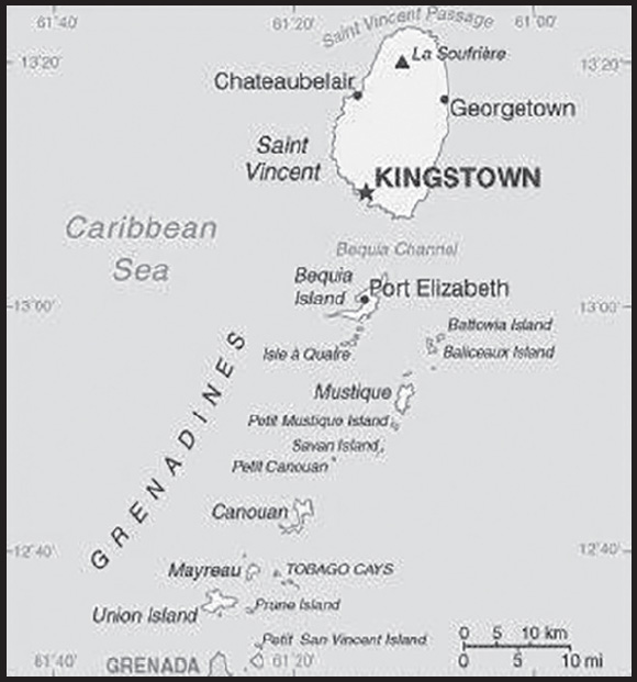
INTRODUCTION
Background: Resistance by native Caribs prevented colonization on Saint Vincent until 1719. Disputed by France and the UK for most of the 18th century, the island was ceded to Britain in 1783. The British prized Saint Vincent due to its fertile soil, which allowed for thriving slave-run plantations of sugar, coffee, indigo, tobacco, cotton, and cocoa. In 1834, the British abolished slavery. Immigration of indentured servants eased the ensuing labor shortage, as did subsequent Portuguese immigrants from Madeira and East Indian laborers. Conditions remained harsh for both former slaves and immigrant agricultural workers, however, as depressed world sugar prices kept the economy stagnant until the early 1900s. The economy then went into a period of decline with many landowners abandoning their estates and leaving the land to be cultivated by liberated slaves. Between 1960 and 1962, Saint Vincent and the Grenadines was a separate administrative unit of the Federation of the West Indies. Autonomy was granted in 1969 and independence in 1979. In April 2021, the explosive eruption of the La Soufrière volcano in the north of Saint Vincent destroyed much of Saint Vincent’s most productive agricultural lands. Unlike most of its tourism-dependent neighbors, the Vincentian economy is primarily agricultural. The US provided $4.7 million in humanitarian support after the eruption.
GEOGRAPHY
Location: Caribbean, islands between the Caribbean Sea and North Atlantic Ocean, north of Trinidad and Tobago
Geographic coordinates: 13 15 N, 61 12 W
Map references: Central America and the Caribbean
Area: total: 389 sq km (Saint Vincent 344 sq km)
land: 389 sq km
water: 0 sq km
comparison ranking: total 204
Area - comparative: twice the size of Washington, DC
Land boundaries: total: 0 km
Coastline: 84 km
Maritime claims: territorial sea: 12 nm
contiguous zone: 24 nm
exclusive economic zone: 200 nm
continental shelf: 200 nm
Climate: tropical; little seasonal temperature variation; rainy season (May to November)
Terrain: volcanic, mountainous
Elevation: highest point: La Soufriere 1,234 m
lowest point: Caribbean Sea 0 m
Natural resources: hydropower, arable land
Land use: agricultural land: 25.6% (2018 est.)
arable land: 12.8% (2018 est.)
permanent crops: 7.7% (2018 est.)
permanent pasture: 5.1% (2018 est.)
forest: 68.7% (2018 est.)
other: 5.7% (2018 est.)
Irrigated land: 10 sq km (2012)
Population distribution: most of the population is concentrated in and around the capital of Kingstown
Natural hazards: hurricanes; La Soufriere volcano on the island of Saint Vincent is a constant threat
volcanism: La Soufriere (1,234 m) on the island of Saint Vincent last erupted in 1979; the island of Saint Vincent is part of the volcanic island arc of the Lesser Antilles that extends from Saba in the north to Grenada in the south
Geography - note: the administration of the islands of the Grenadines group is divided between Saint Vincent and the Grenadines and Grenada; Saint Vincent and the Grenadines is comprised of 32 islands and cays
PEOPLE AND SOCIETY
Population: 100,804 (2023 est.)
comparison ranking: 195
Nationality: noun: Saint Vincentian(s) or Vincentian(s)
adjective: Saint Vincentian or Vincentian
Ethnic groups: African descent 71.2%, mixed 23%, Indigenous 3%, East Indian/Indian 1.1%, European 1.5%, other 0.2% (2012 est.)
Languages: English, Vincentian Creole English, French patois
Religions: Protestant 75% (Pentecostal 27.6%, Anglican 13.9%, Seventh Day Adventist 11.6%, Baptist 8.9%, Methodist 8.7%, Evangelical 3.8%, Salvation Army 0.3%, Presbyterian/Congregational 0.3%), Roman Catholic 6.3%, Rastafarian 1.1%, Jehovah’s Witness 0.8%, other 4.7%, none 7.5%, unspecified 4.7% (2012 est.)
Age structure: 0-14 years: 19.05% (male 9,687/female 9,515)
15-64 years: 68.55% (male 35,621/female 33,478)
65 years and over: 12.4% (2023 est.) (male 6,021/female 6,482)
Dependency ratios: total dependency ratio: 49
youth dependency ratio: 32.9
elderly dependency ratio: 16.1
potential support ratio: 6.2 (2021 est.)
Median age: total: 37 years (2023 est.)
male: 37.2 years
female: 36.9 years
comparison ranking: total 80
Population growth rate: -0.16% (2023 est.)
comparison ranking: 207
Birth rate: 12.1 births/1,000 population (2023 est.)
comparison ranking: 151
Death rate: 7.6 deaths/1,000 population (2023 est.)
comparison ranking: 102
Net migration rate: -6.1 migrant(s)/1,000 population (2023 est.)
comparison ranking: 209
Population distribution: most of the population is concentrated in and around the capital of Kingstown
Urbanization: urban population: 54.3% of total population (2023)
rate of urbanization: 0.94% annual rate of change (2020-25 est.)
Major urban areas - population: 27,000 KINGSTOWN (capital) (2018)
Sex ratio: at birth: 1.03 male(s)/female
0-14 years: 1.02 male(s)/female
15-64 years: 1.06 male(s)/female
65 years and over: 0.93 male(s)/female
total population: 1.04 male(s)/female (2023 est.)
Maternal mortality ratio: 62 deaths/100,000 live births (2020 est.)
comparison ranking: 91
Infant mortality rate: total: 12.6 deaths/1,000 live births (2023 est.)
male: 14.2 deaths/1,000 live births
female: 10.9 deaths/1,000 live births
comparison ranking: total 108
Life expectancy at birth: total population: 76.9 years (2023 est.)
male: 74.9 years
female: 79 years
comparison ranking: total population 95
Total fertility rate: 1.74 children born/woman (2023 est.)
comparison ranking: 154
Gross reproduction rate: 0.86 (2023 est.)
Drinking water source: improved: total: 95.1% of population
unimproved: total: 4.9% of population (2017 est.)
Current health expenditure: 4.8% of GDP (2020)
Physicians density: 0.66 physicians/1,000 population (2012)
Hospital bed density: 4.3 beds/1,000 population (2016)
Sanitation facility access: improved:
total: 90.2% of population
unimproved: total: 9.8% of population (2017 est.)
Obesity - adult prevalence rate: 23.7% (2016)
comparison ranking: 64
Alcohol consumption per capita: total: 7.48 liters of pure alcohol (2019 est.)
beer: 2.52 liters of pure alcohol (2019 est.)
wine: 0.24 liters of pure alcohol (2019 est.)
spirits: 4.48 liters of pure alcohol (2019 est.)
other alcohols: 0.23 liters of pure alcohol (2019 est.)
comparison ranking: total 52
Currently married women (ages 15-49): 53.3% (2023 est.)
Education expenditures: 5.7% of GDP (2018 est.)
comparison ranking: 52
School life expectancy (primary to tertiary education): total: 14 years
male: 14 years
female: 15 years (2015)
Youth unemployment rate (ages 15-24): total: 41.1% (2021 est.)
male: 39.7%
female: 43.9%
comparison ranking: total 10
ENVIRONMENT
Environment - current issues: pollution of coastal waters and shorelines from discharges by pleasure yachts and other effluents; in some areas, pollution is severe enough to make swimming prohibitive; poor land use planning; deforestation; watershed management and squatter settlement control
Environment - international agreements: party to: Biodiversity, Climate Change, Climate Change-Kyoto Protocol, Climate Change-Paris Agreement, Comprehensive Nuclear Test Ban, Desertification, Endangered Species, Environmental Modification, Hazardous Wastes, Law of the Sea, Marine Dumping-London Convention, Ozone Layer Protection, Ship Pollution, Whaling
signed, but not ratified: none of the selected agreements
Climate: tropical; little seasonal temperature variation; rainy season (May to November)
Land use: agricultural land: 25.6% (2018 est.)
arable land: 12.8% (2018 est.)
permanent crops: 7.7% (2018 est.)
permanent pasture: 5.1% (2018 est.)
forest: 68.7% (2018 est.)
other: 5.7% (2018 est.)
Urbanization: urban population: 54.3% of total population (2023)
rate of urbanization: 0.94% annual rate of change (2020-25 est.)
Revenue from forest resources: 0.02% of GDP (2018 est.)
comparison ranking: 145
Revenue from coal: 0% of GDP (2018 est.)
comparison ranking: 105
Air pollutants: particulate matter emissions: 9.41 micrograms per cubic meter (2019 est.)
carbon dioxide emissions: 0.22 megatons (2016 est.)
methane emissions: 0.09 megatons (2020 est.)
Waste and recycling: municipal solid waste generated annually: 31,561 tons (2015 est.)
Total water withdrawal: municipal: 10 million cubic meters (2020 est.)
industrial: 2,000 cubic meters (2017 est.)
agricultural: 0 cubic meters (2017 est.)
Total renewable water resources: 100 million cubic meters (2020 est.)
GOVERNMENT
Country name: conventional long form: none
conventional short form: Saint Vincent and the Grenadines
etymology: Saint Vincent was named by explorer Christopher COLUMBUS after Saint VINCENT of Saragossa because the 22 January 1498 day of discovery was the saint’s feast day
Government type: parliamentary democracy under a constitutional monarchy; a Commonwealth realm
Capital: name: Kingstown
geographic coordinates: 13 08 N, 61 13 W
time difference: UTC-4 (1 hour ahead of Washington, DC, during Standard Time)
etymology: an earlier French settlement was renamed Kingstown by the British in 1763 when they assumed control of the island; the king referred to in the name is GEORGE III (r. 1760-1820)
Administrative divisions: 6 parishes; Charlotte, Grenadines, Saint Andrew, Saint David, Saint George, Saint Patrick
Independence: 27 October 1979 (from the UK)
National holiday: Independence Day, 27 October (1979)
Constitution: history: previous 1969, 1975; latest drafted 26 July 1979, effective 27 October 1979 (The Saint Vincent Constitution Order 1979)
amendments: proposed by the House of Assembly; passage requires at least two-thirds majority vote of the Assembly membership and assent of the governor general; passage of amendments to constitutional sections on fundamental rights and freedoms, citizen protections, various government functions and authorities, and constitutional amendment procedures requires approval by the Assembly membership, approval in a referendum of at least two thirds of the votes cast, and assent of the governor general
Legal system: English common law
International law organization participation: has not submitted an ICJ jurisdiction declaration; accepts ICCt jurisdiction
Citizenship: citizenship by birth: yes
citizenship by descent only: at least one parent must be a citizen of Saint Vincent and the Grenadines
dual citizenship recognized: yes
residency requirement for naturalization: 7 years
Suffrage: 18 years of age; universal
Executive branch: chief of state: King CHARLES III (since 8 September 2022); represented by Governor General Susan DOUGAN (since 1 August 2019)
head of government: Prime Minister Ralph E. GONSALVES (since 29 March 2001)
cabinet: Cabinet appointed by the governor general on the advice of the prime minister
elections/appointments: the monarchy is hereditary; governor general appointed by the monarch; following legislative elections, the leader of the majority party usually appointed prime minister by the governor general; deputy prime minister appointed by the governor general on the advice of the prime minister
Legislative branch: description: unicameral House of Assembly (23 seats; 15 representatives directly elected in single-seat constituencies by simple majority vote, 6 senators appointed by the governor general, and 2 ex officio members - the speaker of the house and the attorney general; members serve 5-year terms)
elections: last held on 5 November 2020 (next to be held in 2025)
election results: percent of vote by party - ULP 49.58%, NDP 50.34%, other 0.8%; seats by party - ULP 9, NDP 6
Judicial branch: highest court(s): the Eastern Caribbean Supreme Court (ECSC) is the superior court of the Organization of Eastern Caribbean States; the ECSC - headquartered on St. Lucia - consists of the Court of Appeal - headed by the chief justice and 4 judges - and the High Court with 18 judges; the Court of Appeal is itinerant, traveling to member states on a schedule to hear appeals from the High Court and subordinate courts; High Court judges reside in the member states, with 2 assigned to Saint Vincent and the Grenadines; note - Saint Vincent and the Grenadines is also a member of the Caribbean Court of Justice
judge selection and term of office: chief justice of Eastern Caribbean Supreme Court appointed by Her Majesty, Queen ELIZABETH II; other justices and judges appointed by the Judicial and Legal Services Commission, an independent body of judicial officials; Court of Appeal justices appointed for life with mandatory retirement at age 65; High Court judges appointed for life with mandatory retirement at age 62
subordinate courts: magistrates’ courts
Political parties and leaders: New Democratic Party or NDP [Dr. Godwin L. FRIDAY]
SVG Green Party or SVGP [Ivan O’NEAL]
Unity Labor Party or ULP [Dr. Ralph GONSALVES] (formed in 1994 by the coalition of Saint Vincent Labor Party or SVLP and the Movement for National Unity or MNU)
International organization participation: ACP, AOSIS, C, Caricom, CDB, CELAC, FAO, G-77, IBRD, ICAO, ICCt, ICRM, IDA, IFAD, IFRCS, ILO, IMF, IMO, Interpol, IOC, IOM, ISO (subscriber), ITU, MIGA, NAM, OAS, OECS, OPANAL, OPCW, Petrocaribe, UN, UNCTAD, UNESCO, UNIDO, UPU, WFTU (NGOs), WHO, WIPO, WTO
Diplomatic representation in the US: chief of mission: Ambassador Lou-Anne Gaylene GILCHRIST (since 18 January 2017)
chancery: 1627 K Street, NW, Suite 704, Washington, DC 20006
telephone: [1] (202) 364-6730
FAX: [1] (202) 364-6736
email address and website:
http://wa.embassy.gov.vc/washington/
consulate(s) general: New York
Diplomatic representation from the US: embassy: the US does not have an embassy in Saint Vincent and the Grenadines; the US Ambassador to Barbados is accredited to Saint Vincent and the Grenadines
Flag description: three vertical bands of blue (hoist side), gold (double width), and green; the gold band bears three green diamonds arranged in a V pattern, which stands for Vincent; the diamonds recall the islands as “the Gems of the Antilles” and are set slightly lowered in the gold band to reflect the nation’s position in the Antilles; blue conveys the colors of a tropical sky and crystal waters, yellow signifies the golden Grenadine sands, and green represents lush vegetation
National symbol(s): Saint Vincent parrot; national colors: blue, gold, green
National anthem: name: “St. Vincent! Land So Beautiful!”
lyrics/music: Phyllis Joyce MCCLEAN PUNNETT/Joel Bertram MIGUEL
note: adopted 1967
ECONOMY
Economic overview: upper middle-income Caribbean island economy; key agriculture and tourism sectors; environmentally fragile; diversifying economy across services, science and knowledge, and creative industries; CARICOM member and US Caribbean Basin Initiative beneficiary
Real GDP (purchasing power parity): $1.429 billion (2021 est.)
$1.41 billion (2020 est.)
$1.489 billion (2019 est.)
note: data are in 2017 dollars
comparison ranking: 203
Real GDP growth rate: 1.35% (2021 est.)
-5.31% (2020 est.)
0.4% (2019 est.)
comparison ranking: 178
Real GDP per capita: $13,700 (2021 est.)
$13,500 (2020 est.)
$14,200 (2019 est.)
note: data are in 2017 dollars
comparison ranking: 122
GDP (official exchange rate): $785 million (2017 est.)
Inflation rate (consumer prices): 1.57% (2021 est.)
-0.63% (2020 est.)
0.91% (2019 est.)
comparison ranking: 174
Credit ratings:
Moody’s rating: B3 (2014)
note: The year refers to the year in which the current credit rating was first obtained.
GDP - composition, by sector of origin: agriculture: 7.1% (2017 est.)
industry: 17.4% (2017 est.)
services: 75.5% (2017 est.)
comparison rankings: services 45; industry 168; agriculture 108
GDP - composition, by end use: household consumption: 87.3% (2017 est.)
government consumption: 16.6% (2017 est.)
investment in fixed capital: 10.8% (2017 est.)
investment in inventories: -0.2% (2017 est.)
exports of goods and services: 37.1% (2017 est.)
imports of goods and services: -51.7% (2017 est.)
Agricultural products: bananas, sugar cane, roots/tubers, plantains, vegetables, fruit, coconuts, sweet potatoes, yams, mangoes/guavas
Industries: tourism; food processing, cement, furniture, clothing, starch
Industrial production growth rate: 5.7% (2021 est.)
comparison ranking: 76
Labor force: 51,700 (2021 est.)
comparison ranking: 192
Labor force - by occupation: agriculture: 26%
industry: 17%
services: 57% (1980 est.)
Unemployment rate: 21.62% (2021 est.)
21% (2020 est.)
19.28% (2019 est.)
comparison ranking: 18
Youth unemployment rate (ages 15-24): total: 41.1% (2021 est.)
male: 39.7%
female: 43.9%
comparison ranking: total 10
Budget: revenues: $243 million (2020 est.)
expenditures: $288 million (2020 est.)
Budget surplus (+) or deficit (-): -0.6% (of GDP) (2017 est.)
comparison ranking: 64
Public debt: 73.8% of GDP (2017 est.)
82.8% of GDP (2016 est.)
comparison ranking: 50
Taxes and other revenues: 23.7% (of GDP) (2017 est.)
comparison ranking: 59
Fiscal year: calendar year
Current account balance: -$211.643 million (2021 est.)
-$131.46 million (2020 est.)
-$27.903 million (2019 est.)
comparison ranking: 100
Exports: $125.777 million (2021 est.) note: data are in current year dollars
$188.834 million (2020 est.)
$327.51 million (2019 est.)
comparison ranking: 207
Exports - partners: Netherlands 45%, India 9%, United States 6%, Barbados 5%, Greece 5% (2021)
Exports - commodities: recreational boats, drilling platforms, cargo ships, wheat flours, animal food, collector’s items (2021)
Imports: $415.725 million (2021 est.) note: data are in current year dollars
$373.621 million (2020 est.)
$425.28 million (2019 est.)
comparison ranking: 204
Imports - partners: United States 29%, Netherlands 15%, Trinidad and Tobago 10%, China 8%, France 5% (2021)
Imports - commodities: dredger ships, refined petroleum, floating docks, aircraft, poultry, packaged medicines (2021)
Reserves of foreign exchange and gold: $311.903 million (31 December 2021 est.)
$205.195 million (31 December 2020 est.)
$193.357 million (31 December 2019 est.)
comparison ranking: 179
Debt - external: $362.2 million (31 December 2017 est.)
$330.8 million (31 December 2016 est.)
comparison ranking: 182
Exchange rates: East Caribbean dollars (XCD) per US dollar -
Exchange rates: 2.7 (2021 est.)
2.7 (2020 est.)
2.7 (2019 est.)
2.7 (2018 est.)
2.7 (2017 est.)
ENERGY
Electricity access: electrification - total population: 100% (2021)
Electricity: installed generating capacity: 49,000 kW (2020 est.)
consumption: 133.917 million kWh (2019 est.)
exports: 0 kWh (2020 est.)
imports: 0 kWh (2020 est.)
transmission/distribution losses: 11.083 million kWh (2019 est.)
comparison rankings: imports 179; exports 171; installed generating capacity 192; transmission/distribution losses 194;
Electricity generation sources: fossil fuels: 73.5% of total installed capacity (2020 est.)
solar: 0.7% of total installed capacity (2020 est.)
hydroelectricity: 25.8% of total installed capacity (2020 est.)
Petroleum: total petroleum production: 0 bbl/day (2021 est.)
refined petroleum consumption: 1,500 bbl/day (2019 est.)
Refined petroleum products - imports: 1,621 bbl/day (2015 est.)
comparison ranking: 193
Carbon dioxide emissions: 202,000 metric tonnes of CO2 (2019 est.)
from petroleum and other liquids: 202,000 metric tonnes of CO2 (2019 est.)
comparison ranking: total emissions 202
Energy consumption per capita: 27.821 million Btu/person (2019 est.)
comparison ranking: 123
COMMUNICATIONS
Telephones - fixed lines: total subscriptions: 11,385 (2021 est.)
subscriptions per 100 inhabitants: 11 (2021 est.)
comparison ranking: total subscriptions 188
Telephones - mobile cellular: total subscriptions: 114,892 (2021 est.)
subscriptions per 100 inhabitants: 110 (2021 est.)
comparison ranking: total subscriptions 190
Telecommunication systems: general assessment: adequate island-wide, fully automatic telephone system; broadband access; expanded FttP (Fiber to the Home) markets; LTE launches; regulatory development; telecom sector contributes greatly to the overall GDP; telecom sector is a growth area (2020)
domestic: fixed-line teledensity is 11 per 100 persons and mobile-cellular teledensity is 110 per 100 persons (2021)
international: country code - 1-784; landing points for the ECFS, CARCIP and Southern Caribbean Fiber submarine cables providing connectivity to US and Caribbean Islands; connectivity also provided by VHF/UHF radiotelephone from Saint Vincent to Barbados; SHF radiotelephone to Grenada and Saint Lucia; access to Intelsat earth station in Martinique through Saint Lucia (2019)
Broadcast media: St. Vincent and the Grenadines Broadcasting Corporation operates 1 TV station and 5 repeater stations that provide near total coverage to the multi-island state; multi-channel cable TV service available; a partially government-funded national radio service broadcasts on 1 station and has 2 repeater stations; about a dozen privately owned radio stations and repeater stations
Internet country code: .vc
Internet users: total: 85,000 (2021 est.)
percent of population: 85% (2021 est.)
comparison ranking: total 192
Broadband - fixed subscriptions: total: 24,733 (2020 est.)
subscriptions per 100 inhabitants: 22 (2020 est.)
comparison ranking: total 161
TRANSPORTATION
National air transport system: number of registered air carriers: 2 (2020)
inventory of registered aircraft operated by air carriers: 11
Civil aircraft registration country code prefix: J8
Airports: 6 (2021)
comparison ranking: total 175
Airports - with paved runways: 5
note: paved runways have a concrete or asphalt surface but not all have facilities for refueling, maintenance, or air traffic control; the length of a runway required for aircraft to safely operate depends on a number of factors including the type of aircraft, the takeoff weight (including passengers, cargo, and fuel), engine types, flap settings, landing speed, elevation of the airport, and average maximum daily air temperature; paved runways can reach a length of 5,000 m (16,000 ft.), but the “typical” length of a commercial airline runway is between 2,500-4,000 m (8,000-13,000 ft.)
Airports - with unpaved runways: 1
note: unpaved runways have a surface composition such as grass or packed earth and are most suited to the operation of light aircraft; unpaved runways are usually short, often less than 1,000 m (3,280 ft.) in length; airports with unpaved runways often lack facilities for refueling, maintenance, or air traffic control
Merchant marine: total: 832 (2022)
by type: bulk carrier 32, container ship 17, general cargo 148, oil tanker 14, other 621
comparison ranking: total 28
Ports and terminals: major seaport(s): Kingstown
MILITARY AND SECURITY
Military and security forces: no regular military forces; Royal Saint Vincent and the Grenadines Police Force (RSVPF; includes the Coast Guard, Special Services Unit, Rapid Response Unit, Drug Squad, and Anti-Trafficking Unit) (2023)
note: the RSVPF is the only security force in the country and is responsible for maintaining internal security; it reports to the Minister of National Security, a portfolio held by the prime minister
Military - note: the country has been a member of the Caribbean Regional Security System (RSS) since its creation in 1982; RSS signatories (Antigua and Barbuda, Barbados, Dominica, Grenada, Saint Kitts, and Saint Lucia) agreed to prepare contingency plans and assist one another, on request, in national emergencies, prevention of smuggling, search and rescue, immigration control, fishery protection, customs and excise control, maritime policing duties, protection of offshore installations, pollution control, national and other disasters, and threats to national security (2023)
TRANSNATIONAL ISSUES
Disputes - international: Saint Vincent and the Grenadines-Venezuela: joins other Caribbean states to counter Venezuela’s claim that Aves Island sustains human habitation, a criterion under UN Convention on the Law of the Sea, which permits Venezuela to extend its EEZ/continental shelf over a large portion of the eastern Caribbean Sea
Illicit drugs: a transit point for cocaine and marijuana destined for North America, Europe, and elsewhere in the Caribbean; some local demand for cocaine and some use of synthetic drugs
SAMOA
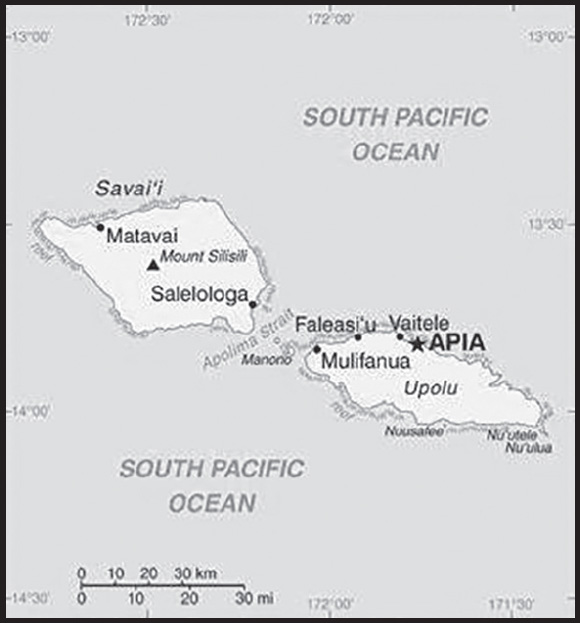
INTRODUCTION
Background: The first Austronesian settlers arrived in Samoa around 1000 B.C., and early Samoans traded and intermarried with Fijian and Tongan nobility. The fa’amatai system of titles and nobility developed, which dominates Samoan politics to this day; all but two seats in the legislature are reserved for matai, or heads of families. Dutch explorer Jacob ROGGEVEEN was the first European to spot the islands in 1722. Christian missionaries arrived in the 1830s, converting most of the population. In the 1850s, Apia became a center for Pacific trading and hosted an American commercial agent and British and German consuls. In 1892, American traders convinced the Samoan king to align his country’s date with the US, moving to the east of the International Date Line.
Following the death of the Samoan king in 1841, rival families competed for his titles, devolving into civil war in 1886 with factions getting support from either Germany, the UK, or the US. All three countries sent warships to Apia in 1889, presaging a larger war, but a cyclone destroyed the ships and Malietoa LAUPEPA was installed as king. Upon LAUPEPA’s death in 1898, a second civil war over succession broke out. The war ended in 1899 and the Western powers abolished the monarchy, giving the western Samoan islands to Germany and the eastern Samoan islands to the US. The UK abandoned claims in Samoa and received former German territory in the Solomon Islands.
The Mau, a non-violent popular movement to advocate for Samoan independence, formed in 1908. New Zealand annexed Samoa in 1914 after the outbreak of World War I. Opposition to New Zealand’s rule quickly grew. In 1918, a New Zealand ship introduced the Spanish flu, infecting 90% of the population and killing more than 20%. In 1929, New Zealand police shot into a crowd of peaceful protestors, killing 11, in an event known as Black Sunday. In 1962, Samoa became the first Polynesian nation to reestablish its independence as Western Samoa but dropped the “Western” from its name in 1997. The Human Rights Protection Party dominated politics from 1982 until current Prime Minister FIAME Naomi Mata’afa’s Fa’atuatua i le Atua Samoa ua Tasi or FAST party gained a majority in elections in 2021.
In the late 2000s, Samoa began making efforts to align more closely with Australia and New Zealand. In 2009, Samoa changed its driving orientation to the left side of the road, in line with other Commonwealth countries. In 2011, Samoa jumped forward one day - skipping December 30 - by moving to the west side of the International Date Line so that it was one hour ahead of New Zealand and three hours ahead of the east coast of Australia, rather than 23 and 21 hours behind, respectively.
GEOGRAPHY
Location: Oceania, group of islands in the South Pacific Ocean, about halfway between Hawaii and New Zealand
Geographic coordinates: 13 35 S, 172 20 W
Map references: Oceania
Area: total: 2,831 sq km
land: 2,821 sq km
water: 10 sq km
comparison ranking: total 177
Area - comparative: slightly smaller than Rhode Island
Land boundaries: total: 0 km
Coastline: 403 km
Maritime claims: territorial sea: 12 nm
contiguous zone: 24 nm
exclusive economic zone: 200 nm
Climate: tropical; rainy season (November to April), dry season (May to October)
Terrain: two main islands (Savaii, Upolu) and several smaller islands and uninhabited islets; narrow coastal plain with volcanic, rugged mountains in interior
Elevation: highest point: Mount Silisili 1,857 m
lowest point: Pacific Ocean 0 m
Natural resources: hardwood forests, fish, hydropower
Land use: agricultural land: 12.4% (2018 est.)
arable land: 2.8% (2018 est.)
permanent crops: 7.8% (2018 est.)
permanent pasture: 1.8% (2018 est.)
forest: 60.4% (2018 est.)
other: 27.2% (2018 est.)
Irrigated land: 0 sq km (2022)
Population distribution: about three-quarters of the population lives on the island of Upolu
Natural hazards: occasional cyclones; active volcanism
volcanism: Savai’I Island (1,858 m), which last erupted in 1911, is historically active
Geography - note: occupies an almost central position within Polynesia
PEOPLE AND SOCIETY
Population: 207,501 (2023 est.)
comparison ranking: 184
Nationality: noun: Samoan(s)
adjective: Samoan
Ethnic groups: Samoan 96%, Samoan/New Zealander 2%, other 1.9% (2011 est.)
note: data represent the population by country of citizenship
Languages: Samoan (Polynesian) (official) 91.1%, Samoan/English 6.7%, English (official) 0.5%, other 0.2%, unspecified 1.6% (2006 est.)
Religions: Protestant 54.9% (Congregationalist 29%, Methodist 12.4%, Assembly of God 6.8%, Seventh Day Adventist 4.4%, other Protestant 2.3%), Roman Catholic 18.8%, Church of Jesus Christ 16.9%, Worship Centre 2.8%, other Christian 3.6%, other 2.9% (includes Baha’i, Muslim), none 0.2% (2016 est.)
Age structure: 0-14 years: 27.33% (male 29,259/female 27,452)
15-64 years: 65.72% (male 69,635/female 66,745)
65 years and over: 6.94% (2023 est.) (male 6,415/female 7,995)
Dependency ratios: total dependency ratio: 74.9
youth dependency ratio: 66
elderly dependency ratio: 8.9
potential support ratio: 11.2 (2020 est.)
Median age: total: 26.9 years (2023 est.)
male: 26.5 years
female: 27.3 years
comparison ranking: total 158
Population growth rate: 0.65% (2023 est.)
comparison ranking: 132
Birth rate: 19 births/1,000 population (2023 est.)
comparison ranking: 76
Death rate: 5.4 deaths/1,000 population (2023 est.)
comparison ranking: 187
Net migration rate: -7.2 migrant(s)/1,000 population (2023 est.)
comparison ranking: 218
Population distribution: about three-quarters of the population lives on the island of Upolu
Urbanization: urban population: 17.5% of total population (2023)
rate of urbanization: -0.03% annual rate of change (2020-25 est.)
Major urban areas - population: 36,000 APIA (capital) (2018)
Sex ratio: at birth: 1.05 male(s)/female
0-14 years: 1.07 male(s)/female
15-64 years: 1.04 male(s)/female
65 years and over: 0.8 male(s)/female
total population: 1.03 male(s)/female (2023 est.)
Maternal mortality ratio: 59 deaths/100,000 live births (2020 est.)
comparison ranking: 93
Infant mortality rate: total: 17.8 deaths/1,000 live births (2023 est.)
male: 21.3 deaths/1,000 live births
female: 14.1 deaths/1,000 live births
comparison ranking: total 87
Life expectancy at birth: total population: 75.5 years (2023 est.)
male: 72.6 years
female: 78.5 years
comparison ranking: total population 121
Total fertility rate: 2.37 children born/woman (2023 est.)
comparison ranking: 77
Gross reproduction rate: 1.16 (2023 est.)
Contraceptive prevalence rate: 16.6% (2019/20)
Drinking water source: improved: urban: 100% of population
rural: 98% of population
total: 98.4% of population
unimproved: urban: 0% of population
rural: 2% of population
total: 1.6% of population (2020 est.)
Current health expenditure: 5.3% of GDP (2020)
Physicians density: 0.6 physicians/1,000 population (2020)
Sanitation facility access: improved: urban: 99.5% of population
rural: 99.5% of population
total: 99.5% of population
unimproved: urban: 0.5% of population
rural: 0.5% of population
total: 0.5% of population (2020 est.)
Obesity - adult prevalence rate: 47.3% (2016)
comparison ranking: 8
Alcohol consumption per capita: total: 2.18 liters of pure alcohol (2019 est.)
beer: 2.01 liters of pure alcohol (2019 est.)
wine: 0 liters of pure alcohol (2019 est.)
spirits: 0.17 liters of pure alcohol (2019 est.)
other alcohols: 0 liters of pure alcohol (2019 est.)
comparison ranking: total 127
Tobacco use: total: 25.3% (2020 est.)
male: 36.1% (2020 est.)
female: 14.5% (2020 est.)
comparison ranking: total 49
Children under the age of 5 years underweight: 3.4% (2019/20)
comparison ranking: 84
Currently married women (ages 15-49): 61.7% (2023 est.)
Child marriage: women married by age 15: 0.9%
women married by age 18: 7.4%
men married by age 18: 2% (2020 est.)
Education expenditures: 4.8% of GDP (2020 est.)
comparison ranking: 85
Literacy: definition: age 15 and over can read and write
total population: 99.1%
male: 99%
female: 99.3% (2021)
Youth unemployment rate (ages 15-24): total: 19.7% (2021 est.)
male: 16.7%
female: 24.5%
comparison ranking: total 83
ENVIRONMENT
Environment - current issues: soil erosion, deforestation, invasive species, overfishing
Environment - international agreements: party to: Biodiversity, Climate Change, Climate Change-Kyoto Protocol, Climate Change-Paris Agreement, Comprehensive Nuclear Test Ban, Desertification, Endangered Species, Hazardous Wastes, Law of the Sea, Nuclear Test Ban, Ozone Layer Protection, Ship Pollution, Wetlands
signed, but not ratified: none of the selected agreements
Climate: tropical; rainy season (November to April), dry season (May to October)
Land use: agricultural land: 12.4% (2018 est.)
arable land: 2.8% (2018 est.)
permanent crops: 7.8% (2018 est.)
permanent pasture: 1.8% (2018 est.)
forest: 60.4% (2018 est.)
other: 27.2% (2018 est.)
Urbanization: urban population: 17.5% of total population (2023)
rate of urbanization: -0.03% annual rate of change (2020-25 est.)
Revenue from forest resources: 0.27% of GDP (2018 est.)
comparison ranking: 84
Revenue from coal: 0% of GDP (2018 est.)
comparison ranking: 180
Air pollutants: particulate matter emissions: 7.78 micrograms per cubic meter (2019 est.)
carbon dioxide emissions: 0.25 megatons (2016 est.)
methane emissions: 0.27 megatons (2020 est.)
Waste and recycling: municipal solid waste generated annually: 27,399 tons (2011 est.)
municipal solid waste recycled annually: 9,864 tons (2013 est.)
percent of municipal solid waste recycled: 36% (2013 est.)
Total renewable water resources: 0 cubic meters (2017 est.)
GOVERNMENT
Country name: conventional long form: Independent State of Samoa
conventional short form: Samoa
local long form: Malo Sa’oloto Tuto’atasi o Samoa
local short form: Samoa
former: Western Samoa
etymology: the meaning of Samoa is disputed; some modern explanations are that the “sa” connotes “sacred” and “moa” indicates “center,” so the name can mean “Holy Center”; alternatively, some assertions state that it can mean “place of the sacred moa bird” of Polynesian mythology; the name, however, may go back to Proto-Polynesian (PPn) times (before 1000 B.C.); a plausible PPn reconstruction has the first syllable as “sa’a” meaning “tribe or people” and “moa” meaning “deep sea or ocean” to convey the meaning “people of the deep sea”
Government type: parliamentary republic
Capital: name: Apia
geographic coordinates: 13 49 S, 171 46 W
time difference: UTC+13 (18 hours ahead of Washington, DC, during Standard Time)
etymology: name derives from the native village around which the capital was constructed in the 1850s; the village still exists within the larger modern capital
Administrative divisions: 11 districts; A’ana, Aiga-i-le-Tai, Atua, Fa’asaleleaga, Gaga’emauga, Gagaifomauga, Palauli, Satupa’itea, Tuamasaga, Va’a-o-Fonoti, Vaisigano
Independence: 1 January 1962 (from New Zealand-administered UN trusteeship)
National holiday: Independence Day Celebration, 1 June (1962); note - 1 January 1962 is the date of independence from the New Zealand-administered UN trusteeship, but it is observed in June
Constitution: history: several previous (preindependence); latest 1 January 1962
amendments: proposed as an act by the Legislative Assembly; passage requires at least two-thirds majority vote by the Assembly membership in the third reading - provided at least 90 days have elapsed since the second reading, and assent of the chief of state; passage of amendments affecting constitutional articles on customary land or constitutional amendment procedures also requires at least two-thirds majority approval in a referendum; amended several times, last in 2020
Legal system: mixed legal system of English common law and customary law; judicial review of legislative acts with respect to fundamental rights of the citizen
International law organization participation: has not submitted an ICJ jurisdiction declaration; accepts ICCt jurisdiction
Citizenship: citizenship by birth: no
citizenship by descent only: at least one parent must be a citizen of Samoa
dual citizenship recognized: no
residency requirement for naturalization: 5 years
Suffrage: 21 years of age; universal
Executive branch: chief of state: TUIMALEALI’IFANO Va’aletoa Sualauvi II (since 21 July 2017)
head of government: Prime Minister FIAME Naomi Mata’afa (since 24 May 2021)
cabinet: Cabinet appointed by the chief of state on the advice of the prime minister
elections/appointments: chief of state indirectly elected by the Legislative Assembly to serve a 5-year term (2-term limit); election last held on 23 August 2022 (next to be held in 2027); following legislative elections, the leader of the majority party is usually appointed prime minister by the chief of state, approved by the Legislative Assembly
election results: TUIMALEALI’IFANO Va’aletoa Sualauvi II (independent) unanimously reelected by the Legislative Assembly
Legislative branch: description: unicameral Legislative Assembly or Fono (53 seats for 2021-2026 term); members from 51 single-seat constituencies directly elected by simple majority vote, with a minimum 10% representation of women in the Assembly required; members serve 5-year terms)
elections: election last held on 9 April 2021 (next election to be held in 2026)
election results: percent of vote by party - HRPP 55%, FAST 37%, TSP 3%, independents 5%; seats by party – FAST 30, HRPP 22, independents 1; composition - men 47, women 6, percent of women 11.3%
note: on 29 November 2021, the Election Commissioner added two women seats to parliament, bringing the HRPP’s total from 20 to 22 seats
Judicial branch: highest court(s): Court of Appeal (consists of the chief justice and 2 Supreme Court judges and meets once or twice a year); Supreme Court (consists of the chief justice and several judges)
judge selection and term of office: chief justice appointed by the chief of state upon the advice of the prime minister; other Supreme Court judges appointed by the Judicial Service Commission, a 3-member body chaired by the chief justice and includes the attorney general and an appointee of the Minister of Justice; judges normally serve until retirement at age 68
subordinate courts: District Court; Magistrates’ Courts; Land and Titles Courts; village fono or village chief councils
Political parties and leaders: Fa’atuatua i le Atua Samoa ua Tasi or FAST [FIAME Naomi Mata’afa]
Human Rights Protection Party or HRPP [TUILA’EPA Sailele Malielegaoi]
Tautua Samoa Party or TSP [Afualo Wood Uti SALELE]
International organization participation: ACP, ADB, AOSIS, C, FAO, G-77, IBRD, ICAO, ICCt, ICRM, IDA, IFAD, IFC, IFRCS, ILO, IMF, IMO, Interpol, IOC, IPU, ITU, ITUC (NGOs), MIGA, OPCW, PIF, Sparteca, SPC, UN, UNCTAD, UNESCO, UNIDO, UPU, WCO, WHO, WIPO, WMO, WTO
Diplomatic representation in the US: chief of mission: Ambassador Pa’olelei LUTERU (since 7 July 2021)
chancery: 685 Third Avenue, 44th Street, 11th Floor, Suite 1102, New York, NY 10017
telephone: [1] (212) 599-6196
FAX: [1] (212) 599-0797
email address and website:
https://www.un.int/samoa/samoa/embassy-independent-state-samoa-united-states-america
consulate(s) general: Pago Pago (American Samoa)
Diplomatic representation from the US: chief of mission: the US Ambassador to New Zealand is accredited to Samoa
embassy: 5th Floor, Accident Corporation Building, Matafele Apia
mailing address: 4400 Apia Place, Washington DC 20521-4400
telephone: [685] 21-436
FAX: [685] 22-030
email address and website:
Flag description: red with a blue rectangle in the upper hoist-side quadrant bearing five white, five-pointed stars representing the Southern Cross constellation; red stands for courage, blue represents freedom, and white signifies purity
note: similar to the flag of Taiwan
National symbol(s): Southern Cross constellation (five, five-pointed stars); national colors: red, white, blue
National anthem: name: “O le Fu’a o le Sa’olotoga o Samoa” (The Banner of Freedom)
lyrics/music: Sauni Liga KURESA
note: adopted 1962; also known as “Samoa Tula’i” (Samoa Arise)
ECONOMY
Economic overview: ower middle-income Pacific island economy; enormous fishing and agriculture industries; significant remittances; growing offshore financial hub; recently hosted Pacific Games to drive tourism and infrastructure growth
Real GDP (purchasing power parity): $1.211 billion (2021 est.)
$1.303 billion (2020 est.)
$1.345 billion (2019 est.)
note: data are in 2017 dollars
comparison ranking: 206
Real GDP growth rate: -7.08% (2021 est.)
-3.11% (2020 est.)
4.45% (2019 est.)
comparison ranking: 217
Real GDP per capita: $5,500 (2021 est.)
$6,100 (2020 est.)
$6,300 (2019 est.)
note: data are in 2017 dollars
comparison ranking: 171
GDP (official exchange rate): $841 million (2017 est.)
Inflation rate (consumer prices): 3.13% (2021 est.)
-1.57% (2020 est.)
0.98% (2019 est.)
comparison ranking: 120
GDP - composition, by sector of origin: agriculture: 10.4% (2017 est.)
industry: 23.6% (2017 est.)
services: 66% (2017 est.)
comparison rankings: services 90; industry 120; agriculture 87
GDP - composition, by end use: exports of goods and services: 27.2% (2015 est.)
imports of goods and services: -50.5% (2015 est.)
Agricultural products: coconuts, taro, bananas, yams, tropical fruit, pineapples, mangoes/guavas, papayas, roots/tubers, pork
Industries: food processing, building materials, auto parts
Industrial production growth rate: -9.65% (2021 est.)
comparison ranking: 199
Labor force: 58,400 (2021 est.)
comparison ranking: 189
Labor force - by occupation: agriculture: 65%
industry: 6%
services: 29% (2015 est.)
Unemployment rate: 9.84% (2021 est.)
9.15% (2020 est.)
8.41% (2019 est.)
comparison ranking: 72
Youth unemployment rate (ages 15-24): total: 19.7% (2021 est.)
male: 16.7%
female: 24.5%
comparison ranking: total 83
Population below poverty line: 20.3% (2013 est.)
Gini Index coefficient - distribution of family income: 38.7 (2013 est.)
comparison ranking: 65
Budget: revenues: $313 million (2020 est.)
expenditures: $263 million (2020 est.)
Budget surplus (+) or deficit (-): -4.7% (of GDP) (2017 est.)
comparison ranking: 165
Public debt: 49.1% of GDP (2017 est.)
52.6% of GDP (2016 est.)
comparison ranking: 108
Taxes and other revenues: 24.42% (of GDP) (2020 est.)
comparison ranking: 55
Fiscal year: June 1 - May 31
Current account balance: -$118.081 million (2021 est.)
-$79.68 million (2020 est.)
$34.073 million (2019 est.)
comparison ranking: 93
Exports: $97.774 million (2021 est.) note: data are in current year dollars
$116.519 million (2020 est.)
$336.782 million (2019 est.)
comparison ranking: 210
Exports - partners: US 20%, New Zealand 16%, American Samoa 11%, Brazil 8%, Australia 7% (2021)
Exports - commodities: coconut oil, insulated wiring, refined petroleum, integrated circuits, sardines, air pumps, tuna, lemons, beer (2021)
Imports: $430.011 million (2021 est.) note: data are in current year dollars
$376.791 million (2020 est.)
$456.707 million (2019 est.)
comparison ranking: 203
Imports - partners: New Zealand 24%, China 19%, Singapore 11%, United States 8%, Australia 7% (2021)
Imports - commodities: refined petroleum, poultry meats, iron, lumber, processed fish, cars (2021)
Reserves of foreign exchange and gold: $294.682 million (31 December 2021 est.)
$277.056 million (31 December 2020 est.)
$177.244 million (31 December 2019 est.)
comparison ranking: 181
Debt - external: $447.2 million (31 December 2013 est.)
comparison ranking: 180
Exchange rates: tala (SAT) per US dollar -
Exchange rates: 2.556 (2021 est.)
2.665 (2020 est.)
2.649 (2019 est.)
2.587 (2018 est.)
2.554 (2017 est.)
ENERGY
Electricity access: electrification - total population: 98.3% (2021)
electrification - urban areas: 100% (2021)
electrification - rural areas: 97.9% (2021)
Electricity: installed generating capacity: 50,000 kW (2020 est.)
consumption: 120.13 million kWh (2019 est.)
exports: 0 kWh (2020 est.)
imports: 0 kWh (2020 est.)
transmission/distribution losses: 15 million kWh (2019 est.)
comparison rankings: imports 182; exports 175; installed generating capacity 191; transmission/distribution losses 189; consumption 193
Electricity generation sources: fossil fuels: 72.7% of total installed capacity (2020 est.)
wind: 0.1% of total installed capacity (2020 est.)
hydroelectricity: 27.2% of total installed capacity (2020 est.)
Petroleum: total petroleum production: 0 bbl/day (2021 est.)
refined petroleum consumption: 2,500 bbl/day (2019 est.)
Refined petroleum products - imports: 2,363 bbl/day (2015 est.)
comparison ranking: 187
Carbon dioxide emissions: 355,000 metric tonnes of CO2 (2019 est.)
from petroleum and other liquids: 355,000 metric tonnes of CO2 (2019 est.)
comparison ranking: total emissions 191
Energy consumption per capita: 27.111 million Btu/person (2019 est.)
comparison ranking: 125
COMMUNICATIONS
Telephones - fixed lines: total subscriptions: 6,000 (2021 est.)
subscriptions per 100 inhabitants: 3 (2021 est.)
comparison ranking: total subscriptions 202
Telephones - mobile cellular: total subscriptions: 69,000 (2021 est.)
subscriptions per 100 inhabitants: 32 (2021 est.)
comparison ranking: total subscriptions 197
Telecommunication systems: general assessment: Samoa was one of the first Pacific Island countries to establish a regulatory infrastructure and to liberalize its telecom market; the advent of competition in the mobile market saw prices fall by around 50% and network coverage increase to more than 90% of the population; Samoa also boasts one of the highest rates of mobile phone coverage in the Pacific region; the growth of fixed-line internet has been impeded by factors including the high costs for bandwidth, under investment in fixed-line infrastructure; Samoa’s telecoms sector has been inhibited by a lack of international connectivity; Samoa has had access to the Samoa-America-Samoa (SAS) cable laid in 2009, this cable has insufficient capacity to meet the country’s future bandwidth needs; this issue was addressed with two new submarine cables that became available in 2018 and 2019; combined with the Samoa National Broadband Highway (SNBH), have improved internet data rates and reliability, and have helped to reduce the high costs previously associated with internet access in Samoa; in April 2022, the Samoan government announced its decision to take over control of the Samoa Submarine Cable Company, looking to the cable to generate additional revenue for the state (2022)
domestic: fixed-line is 3 per 100 and mobile-cellular teledensity 32 telephones per 100 persons (2021)
international: country code - 685; landing points for the Tui-Samo, Manatua, SAS, and Southern Cross NEXT submarine cables providing connectivity to Samoa, Fiji, Wallis & Futuna, Cook Islands, Niue, French Polynesia, American Samoa, Australia, New Zealand, Kiribati, Los Angeles (US), and Tokelau; satellite earth station - 1 Intelsat (Pacific Ocean) (2019)
Broadcast media: state-owned TV station privatized in 2008; 4 privately owned television broadcast stations; about a half-dozen privately owned radio stations and one state-owned radio station; TV and radio broadcasts of several stations from American Samoa are available (2019)
Internet country code: .ws
Internet users: total: 171,600 (2021 est.)
percent of population: 78% (2021 est.)
comparison ranking: total 182
Broadband - fixed subscriptions: total: 1,692 (2020 est.)
subscriptions per 100 inhabitants: 1 (2020 est.)
comparison ranking: total 199
TRANSPORTATION
National air transport system: number of registered air carriers: 1 (2020)
inventory of registered aircraft operated by air carriers: 4
annual passenger traffic on registered air carriers: 137,770 (2018)
Civil aircraft registration country code prefix: 5W
Airports: 4 (2021)
comparison ranking: total 183
Airports - with paved runways: 1
note: paved runways have a concrete or asphalt surface but not all have facilities for refueling, maintenance, or air traffic control; the length of a runway required for aircraft to safely operate depends on a number of factors including the type of aircraft, the takeoff weight (including passengers, cargo, and fuel), engine types, flap settings, landing speed, elevation of the airport, and average maximum daily air temperature; paved runways can reach a length of 5,000 m (16,000 ft.), but the “typical” length of a commercial airline runway is between 2,500-4,000 m (8,000-13,000 ft.)
Airports - with unpaved runways: 3
note: unpaved runways have a surface composition such as grass or packed earth and are most suited to the operation of light aircraft; unpaved runways are usually short, often less than 1,000 m (3,280 ft.) in length; airports with unpaved runways often lack facilities for refueling, maintenance, or air traffic control
Roadways: total: 1,150 km (2018)
comparison ranking: total 181
Merchant marine: total: 15 (2022)
by type: general cargo 3, oil tanker 5, other 7
comparison ranking: total 152
Ports and terminals: major seaport(s): Apia
MILITARY AND SECURITY
Military and security forces: no regular military forces; Samoa Police Force (Ministry of Police, Prisons, and Correction Services) (2023)
Military - note: informal defense ties exist with New Zealand, which is required to consider any Samoan request for assistance under the 1962 Treaty of Friendship
Samoa has a “shiprider” agreement with the US, which allows local maritime law enforcement officers to embark on US Coast Guard (USCG) and US Navy (USN) vessels, including to board and search vessels suspected of violating laws or regulations within Somoa’s designated exclusive economic zone (EEZ) or on the high seas; “shiprider” agreements also enable USCG personnel and USN vessels with embarked USCG law enforcement personnel to work with host nations to protect critical regional resources (2023)
TRANSNATIONAL ISSUES
Disputes - international: none identified